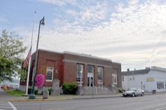
Block
From the record
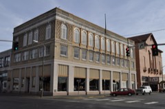
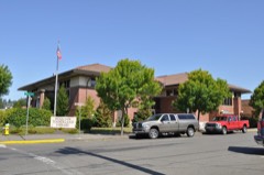
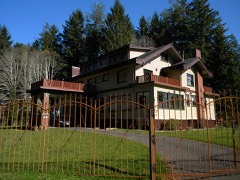
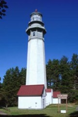
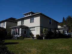
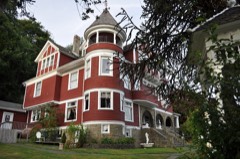
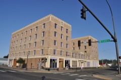
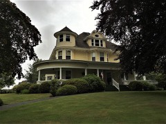
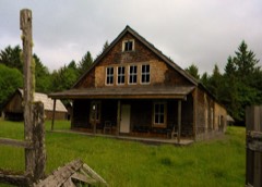
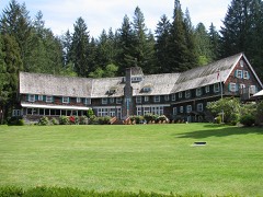
22 National Register listings published here.
Sources: the National Register database, National Park Service
119 topographic sheets cover 88 settlements here, and 22 properties are on the National Register of Historic Places.
22 National Register listings published here.
Sources: the National Register database, National Park Service
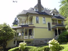
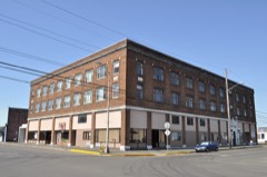
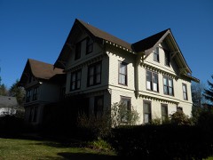
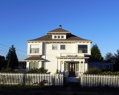
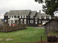
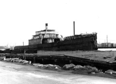
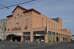
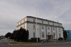
Every property in this county listed on the National Register of Historic Places, with the year it was listed and the federal nomination document.
Every wildfire the federal occurrence database records inside this county: 662 of them, burning about 1,123 acres. 23 started naturally and 34 were recorded as arson. Each settlement page carries the fires within five miles of it.
| Reported cause | Fires |
|---|---|
| Recreation and ceremony | 163 |
| Debris and open burning | 156 |
| Missing data/not specified/undetermined | 110 |
| Fireworks | 62 |
| Equipment and vehicle use | 47 |
| Arson/incendiarism | 34 |
| Smoking | 28 |
| Natural | 23 |
| Other causes | 13 |
| Misuse of fire by a minor | 11 |
| Power generation/transmission/distribution | 8 |
| Railroad operations and maintenance | 7 |
The five largest, by the area the report gives. One of them was set deliberately.
| Date | Cause | Size | Reported by | Name on the report |
|---|---|---|---|---|
| 5 May 2013 | Recreation and ceremony | 82 acres | Washington State Department of Natural Resources Headquarters | C-LINE FIRE |
| 20 August 2013 | Missing data/not specified/undetermined | 55 acres | Washington State Department of Natural Resources Headquarters | MARINE VIEW 2 |
| 18 May 2006 | Arson/incendiarism | 48 acres | Washington State Department of Natural Resources Headquarters | not named |
| 1 July 2000 | Equipment and vehicle use | 38 acres | Washington State Department of Natural Resources Headquarters | not named |
| 9 October 1993 | Debris and open burning | 36 acres | Washington State Department of Natural Resources Headquarters | not named |
| 16 May 1992 | Debris and open burning | 32 acres | Washington State Department of Natural Resources Headquarters | not named |
| 17 May 2012 | Debris and open burning | 25 acres | Washington State Department of Natural Resources Headquarters | BOG FIRE |
| 21 June 2003 | Recreation and ceremony | 24 acres | Washington State Department of Natural Resources Headquarters | not named |
Every settlement page carries the fires within five miles of it - see the settlement index below.
The NOAA Storm Events Database holds 31 reports for this county, causing 3 deaths, no injuries and about $11,809,000 in recorded property damage. Each settlement page carries the reports that name it.
| Kind of event | Reports |
|---|---|
| Heavy Rain | 13 |
| Flood | 6 |
| Thunderstorm Wind | 4 |
| Tornado | 3 |
| Storm Surge/Tide | 3 |
| Hail | 1 |
| Debris Flow | 1 |
The most serious of them, by death, then injury, then recorded damage. The accounts are quoted exactly as the forecast office filed them.
| When | Event | Place named | Harm | What the report says |
|---|---|---|---|---|
| January 2022 | Flood | Independence | 2 killed, $3,390,000 | Heavy rainfall of 6 to 10 inches, along with melting of remaining snow at lower elevations, lead to river flooding, significant urban and small stream flooding, and landslides. The peak of the rainfall was January 5 through January 7. Major flooding occurred on the Chehalis River and moderate flooding on the Satsop River. A motorist was stranded trying to cross a flooded road along the Chehalis River and was swept away when he left his vehicle. He was missing and presumed dead. Another man fatality occurred when an man tried to move his car out of flood danger and the car was swept away by flooding on the North River. Damages are reported and estimated; not all damages have been identified. Crop damages are unknown. |
| December 1996 | Flood | Cosmopolis | 1 killed | no account filed |
| January 2006 | Heavy Rain | Countywide | $2,900,000 | no account filed |
| January 2009 | Flood | Aberdeen | $1,200,000 | Nearly 50 roads were closed in the county. The closed roads caused many school districts to cancel classes. Several businesses also closed. Near Copalis Crossing, the Humptulips River flooded several homes. A few homes near Elma were also flooded. |
| March 1997 | Heavy Rain | Montesano | $1,200,000 | no account filed |
| March 1999 | Storm Surge/Tide | Ocean Shrs | $1,000,000 | Tidal overflow due to high winds and heavy surf (to 35 feet) flooded some homes and damaged roads and city utilities. |
| November 2006 | Flood | (Hqm)Bowerman Fld Ho | $760,000 | Record flooding occurred on the Cowlitz, Nooksack, Puyallup, Nisqually, |Skykomish, Stillaguamish, Carbon, Snoqualmie, and Bogachiel. Major flooding occurred on the Tolt, Snohomish, Skokomish, Skagit, and White rivers. Other rivers flooding were the Satsop, Cedar, Wynoochee, Elwha, Deschutes, Dungeness, Skookumchuck, and Chehalis. |
| November 2008 | Heavy Rain | Cosmopolis | $500,000 | Softened ground from heavy rain combined with strong winds blew down several trees, and their dislodged root balls collapsed an earthen section of the Mill Creek dam near Cosmopolis. A footbridge was knocked out and some nearby residential areas were flooded. |
| January 2015 | Debris Flow | (Hqm)Bowerman Fld Ho | $300,000 | A slide on the bluff has blocked all 4 lanes in and out of Aberdeen on US 12. Aberdeen school district schools and Grays Harbor College are closed. Record rainfall was seen throughout Grays Harbor, with 10.2 near Lake Quinault and 5.5 at Bowerman Field in Hoquiam. A few homes were damaged by mudslides in Hoquiam. |
| December 1998 | Heavy Rain | Elma | $200,000 | no account filed |
| December 2005 | Heavy Rain | Cosmopolis | $100,000 | Heavy rain caused part of Highway 107 between Montesano and Cosmopolis to buckle and split, making the road impassable. |
| October 2003 | Heavy Rain | Countywide | $100,000 | no account filed |
| January 2021 | Flood | Satsop | $60,000 | The Satsop River hit flood stage on the 2nd and Moderate flood stage on the 3rd. Flooding on the Chehalis River at Porter started on the 5th, cresting above Moderate flood before falling below flood on the 11th. Urban and small stream flooding occurred as well. |
| January 2021 | Flood | Brady | $59,000 | The Satsop River near Satsop and Chehalis River at Porter exceeded flood stage. Urban and small stream flooding also occurred. |
| December 1999 | Heavy Rain | Aberdeen | $20,000 | no account filed |
| November 2012 | Heavy Rain | Cosmopolis | $15,000 | A hole about six foot, by six foot, opened up in the roadway. An SUV plunged front first into the hole and about 4 feet of mud. No one was injured. There was some minor building flooding in Aberdeen. |
| November 2002 | Storm Surge/Tide | Westport | $5,000 | no account filed |
| February 2025 | Heavy Rain | Quinault | - | Heavy rainfall of 6.76 inches was reported at Quinault in Olympic National Park.|Heavy rainfall of 4.61 inches was reported in Ocean Shores, WA. |
| July 2024 | Heavy Rain | (Hqm)Bowerman Fld Ho | - | A record rainfall of 0.69 inches was set at Hoquiam Airport on July 24th, breaking the old record of 0.23 inches set in 1991. |
| December 2023 | Heavy Rain | (Hqm)Bowerman Fld Ho | - | A record rainfall of 2.93 inches at the Hoquiam Airport broke the previous daily record of 2.30 inches set in 1990. |
| October 2020 | Tornado (EF1) | Neilton | - | A Quinault Indian Nation Fire official reported that at approximately 5:20 AM he came upon 10 downed trees (1-2.5 feet in diameter) across Moclips Highway (S-26) at approximately mile marker 18. Photographs were provided of the downed trees. Subsequent reports and imagery from a trained spotter identified additional damage approximately 0.5 miles to the northeast across a forest service road. No injuries or other impacts were reported.||An evaluation of the photographic evidence from local officials and the trained spotter combined with radar signatures from the event are consistent with a brief tornado. Based on the location and path length the tornado most likely touched down at 4:40am and lasted for less than 2 minutes, traveling 0.50 miles with a maximum width of 30 yards. The degree of tree damage is consistent with peak winds of approximately 90 MPH, rating it as an EF-1 tornado on the Enhanced Fujita scale. |
| March 2002 | Storm Surge/Tide | Ocean Shrs | - | 25 foot seas combined with high tides cause minor coastal flooding near the north jetty of Grays Harbor |
| August 1997 | Tornado (F0) | Elma | - | State patrol reported a weak tornado that caused minor tree damage. |
| December 2010 | Thunderstorm Wind | (Hqm)Bowerman Fld Ho | - | no account filed |
| August 2001 | Heavy Rain | Countywide | - | no account filed |
| November 2001 | Heavy Rain | Countywide | - | no account filed |
| December 1997 | Tornado (F0) | Westport | - | no account filed |
| December 1975 | Thunderstorm Wind | not stated | - | no account filed |
| December 1975 | Thunderstorm Wind | not stated | - | no account filed |
| December 1970 | Thunderstorm Wind | not stated | - | no account filed |
| December 1969 | Hail | not stated | - | no account filed |
The Survey's mineral resources record lists 219 workings inside this county. 1 still produces and 218 are closed or unrecorded. Each settlement page carries the workings within five miles of it.
| Commodity | Workings |
|---|---|
| Sand and Gravel, Construction | 99 |
| Manganese | 73 |
| Stone, Crushed/Broken | 17 |
| Stone | 8 |
| Iron | 6 |
| Gold | 5 |
| Silica | 4 |
| Limestone, General | 3 |
| REE | 2 |
| Titanium | 2 |
| Titanium, Metal, Zirconium, Iron, Gold, Platinum | 1 |
| Gold, Platinum | 1 |
| Titanium, Metal | 1 |
| Iron, Titanium, Metal | 1 |
The least common of them first, because a county's hundredth gravel pit says nothing its first ten did not.
| Where | Site | Commodity | Status | Recorded |
|---|---|---|---|---|
| Chamberlain Quarry | Cesium | Past Producer | ||
| Elma | Iron, Titanium, Metal | Past Producer | Fossil Placer | |
| Elma | Iron, Titanium, Metal | Occurrence | Fossil Placer | |
| Hoquiam | Gold, Platinum | Occurrence | Beach Placer | |
| Moclips Placer | Chromium, REE, Thorium, Platinum, Silver, Gold, Titanium, Metal, Zirconium, Iron | Occurrence | Beach Placer | |
| Moclips Placer | REE, Platinum, Gold, Chromium, Vanadium | Occurrence | ||
| Point Brown | Titanium, Metal, Zirconium, Iron, Gold, Platinum | Occurrence | Beach Placer | |
| Elma | Iron, Titanium | Prospect | ||
| Grays Harbor Area Illmenite Deposit | Titanium | Occurrence | ||
| Schouweiler Road Pit and Plant | REE | Past Producer | ||
| Copper Creek Deposit | Limestone, General | Occurrence | ||
| Humptulips East Fork Deposit No. 1 | Limestone, General | Occurrence | ||
| Schofield Creek Deposit | Limestone, General | Occurrence | ||
| C.W. Miller | Silica | Occurrence | ||
| East Aberdeen | Silica | Past Producer | ||
| Montesano | Silica | Past Producer | ||
| West Aberdeen | Silica | Past Producer | ||
| Cow Point Placer | Gold | Occurrence | ||
| Moclips River Placer | Gold | Occurrence | ||
| Oyhut Placer | Gold | Occurrence | ||
| Oyhut Placer | Gold | Occurrence | ||
| Point Brown Placer | Gold | Occurrence | ||
| Burnt Peak Mine | Manganese, Iron | Past Producer | Bementite, Hausmannite | |
| Egge Claims | Manganese, Iron | Past Producer | Bementite | |
| Lizard Claim | Manganese, Iron | Past Producer | 1916 | |
| Skunk Creek No. 19 Claim | Manganese, Iron | Past Producer | Bementite, Goethite, Hematite, Limonite, Pyrolusite, Rhodonite | |
| 5250 Deep Creek Quarry | Stone | Past Producer | ||
| A & M Pit | Stone | Past Producer | ||
| Chamberlain Quarry | Stone | Past Producer | ||
| Gravel Pit | Stone | Past Producer | ||
| Minot Quarry | Stone | Past Producer | ||
| Newskah Quarry | Stone | Past Producer | ||
| Oakville Pit | Stone | Past Producer | ||
| Quarry 5204.84 | Stone | Past Producer | ||
| Arctic Quarry | Stone, Crushed/Broken | Past Producer | ||
| Borrow Pit | Stone, Crushed/Broken | Past Producer | ||
| Brown Rock Pit 5200-5216 | Stone, Crushed/Broken | Past Producer | ||
| Gate Quarry | Stone, Crushed/Broken | Past Producer | ||
| Hoquiam Quarry | Stone, Crushed/Broken | Past Producer | ||
| Lund 15 Quarry | Stone, Crushed/Broken | Past Producer | ||
| Mayr Newskah Quarry | Stone, Crushed/Broken | Past Producer | ||
| Mccleary # 2 Quarry | Stone, Crushed/Broken | Past Producer | ||
| Newshak Lower 5.11 | Stone, Crushed/Broken | Past Producer | ||
| Newskah Quarry | Stone, Crushed/Broken | Past Producer | ||
| Newskah Quarry | Stone, Crushed/Broken | Past Producer | ||
| Porter Creek Quarry | Stone, Crushed/Broken | Past Producer | ||
| Unnamed Quarry | Stone, Crushed/Broken | Past Producer | ||
| Unnamed Quarry | Stone, Crushed/Broken | Past Producer | ||
| Unnamed Quarry | Stone, Crushed/Broken | Past Producer | ||
| Upper Newskah Quarry | Stone, Crushed/Broken | Past Producer | ||
| Wishkah Pit | Stone, Crushed/Broken | Past Producer | ||
| A.E. Graham | Manganese | Unknown | 1956 | |
| A.E. Graham Claim | Manganese | Occurrence | ||
| Antlers | Manganese | Prospect | 1941 | |
| Antlers Claim | Manganese | Occurrence | Replacement | |
| Black Gold | Manganese | Occurrence | ||
| Black Wonder | Manganese | Past Producer | 1936 | |
| Black Wonder Claim | Manganese | Past Producer | 1936 | |
| Burnt Hill Mine | Manganese | Past Producer | 1958 | |
| Burnt Peak | Manganese | Occurrence | Bementite, Hausmannite | |
| Comstock Claim | Manganese | Occurrence | ||
| Cook Creek | Manganese | Occurrence | Replacement | |
| Cook Creek | Manganese | Prospect | 1954 | |
| East Cook Creek | Manganese | Occurrence | Replacement | |
| East Cook Creek | Manganese | Prospect | 1956 | |
| Egge | Manganese | Occurrence | Bementite | |
| Esther-Irene | Manganese | Past Producer | Bementite, Manganite, Psilomelane | |
| Esther-Irene | Manganese | Occurrence | Bementite, Manganite, Psilomelane | |
| Esther-Irene | Manganese | Prospect | ||
| Excelsior | Manganese | Unknown | 1956 | |
| Excelsior Claim | Manganese | Occurrence | Replacement | |
| Fishel Claim | Manganese | Occurrence | Replacement | |
| Fosberg Claim | Manganese | Occurrence | ||
| Fossburg | Manganese | Unknown | 1956 | |
| Gideon Claim | Manganese | Prospect | ||
| Grays Harbor Title | Manganese | Occurrence | ||
| Grays Harbor Title | Manganese | Unknown | 1956 | |
| Hydman Claim | Manganese | Occurrence | ||
| Hyndman | Manganese | Unknown | 1956 | |
| Knowles | Manganese | Occurrence | 1956 | |
| Lady Bird | Manganese | Occurrence | ||
| Lady Martha Claim | Manganese | Occurrence | ||
| Lizard | Manganese | Past Producer | 1916 | |
| Olympic Peninsula Mn - 0530310200 | Manganese | Occurrence | ||
| Paramont | Manganese | Prospect | 1956 | |
| Paramount Claim | Manganese | Occurrence | ||
| Pioneer | Manganese | Prospect | 1941 | |
| Pioneer Claim | Manganese | Occurrence | Replacement | |
| Polson | Manganese | Unknown | 1956 | |
| Polson Claim | Manganese | Occurrence | ||
| Ralfson | Manganese | Unknown | 1956 | |
| Ralfson Claim | Manganese | Occurrence | ||
| Richards | Manganese | Unknown | 1956 | |
| Richards Claim | Manganese | Occurrence | ||
| Robinson | Manganese | Unknown | 1956 | |
| Robinson Claim | Manganese | Occurrence | ||
| Skunk Creek No. 19 | Manganese | Occurrence | Bementite, Pyrolusite, Rhodonite | |
| Skunk Creek No. 19 Mine | Manganese | Past Producer | 1952 | |
| Skunk Creek No. 35. | Manganese | Prospect | 1958 | |
| Skunk-Cook Creek Divide Claim | Manganese | Occurrence | Replacement | |
| Star | Manganese | Occurrence | 1956 | |
| Star Claim | Manganese | Occurrence | Replacement | |
| Stevens Creek No. 1 Claim | Manganese | Past Producer | 1941, 1952 | |
| Stevens Creek No. 1 Claim | Manganese | Prospect | 1956 | |
| Stevens Creek No. 2 Claim | Manganese | Occurrence | Replacement | |
| Stevens Creek No. 2 Claim | Manganese | Prospect | 1954 | |
| Stevens Creek No. 6 Claim | Manganese | Occurrence | Replacement | |
| Stevens Creek No. 6 Claim | Manganese | Prospect | ||
| Stevens Creek, North Fork | Manganese | Prospect | ||
| Superior | Manganese | Unknown | 1956 | |
| Superior Claim | Manganese | Occurrence | ||
| Supreme | Manganese | Unknown | 1956 | |
| Supreme Claim | Manganese | Occurrence | ||
| Surprise | Manganese | Occurrence | ||
| Thomas Svendsen | Manganese | Unknown | 1956 | |
| Thomas Svendsen Claim | Manganese | Occurrence | ||
| W. H. Hopkinson Claim | Manganese | Occurrence | ||
| W.H. Hopkinson | Manganese | Unknown | 1956 | |
| Wynoochee | Manganese | Occurrence | Replacement | |
| Wynoochee | Manganese | Occurrence | 1951 | |
| Ames Pit | Sand and Gravel, Construction | Past Producer | ||
| Badger Pit | Sand and Gravel, Construction | Past Producer | ||
| Bayview Pit | Sand and Gravel, Construction | Past Producer | ||
| Bert Sutton Pit | Sand and Gravel, Construction | Past Producer | ||
| Borrow Pit | Sand and Gravel, Construction | Past Producer | ||
| Borrow Pit | Sand and Gravel, Construction | Past Producer | ||
| Borrow Pit | Sand and Gravel, Construction | Past Producer | ||
| Borrow Pit | Sand and Gravel, Construction | Past Producer | ||
| Borrow Pit | Sand and Gravel, Construction | Past Producer | ||
| Borrow Pit | Sand and Gravel, Construction | Past Producer | ||
| Borrow Pit | Sand and Gravel, Construction | Past Producer | ||
| Borrow Pit | Sand and Gravel, Construction | Past Producer | ||
| Borrow Pit | Sand and Gravel, Construction | Past Producer | ||
| Borrow Pit | Sand and Gravel, Construction | Past Producer | ||
| Borrow Pit | Sand and Gravel, Construction | Past Producer | ||
| Borrow Pit | Sand and Gravel, Construction | Past Producer | ||
| Brady Pit | Sand and Gravel, Construction | Past Producer | ||
| Carter Pit | Sand and Gravel, Construction | Past Producer | ||
| Central Park Pit | Sand and Gravel, Construction | Past Producer | ||
| Charmin Pit | Sand and Gravel, Construction | Past Producer | ||
| Chehalis River Pit | Sand and Gravel, Construction | Past Producer | ||
| Cloquallum Creek Pit | Sand and Gravel, Construction | Past Producer | ||
| Diamond Lake Pit | Sand and Gravel, Construction | Past Producer | ||
| Elma Pit | Sand and Gravel, Construction | Past Producer | ||
| Fishel Pit | Sand and Gravel, Construction | Past Producer | ||
| Gravel Pit | Sand and Gravel, Construction | Past Producer | ||
| Gravel Pit | Sand and Gravel, Construction | Past Producer | ||
| Gravel Pit | Sand and Gravel, Construction | Past Producer | ||
| Gravel Pit | Sand and Gravel, Construction | Past Producer | ||
| Gravel Pit | Sand and Gravel, Construction | Past Producer | ||
| Gravel Pit | Sand and Gravel, Construction | Past Producer | ||
| Gravel Pit | Sand and Gravel, Construction | Past Producer | ||
| Hagara Pit | Sand and Gravel, Construction | Past Producer | ||
| Hathaway Pit | Sand and Gravel, Construction | Past Producer | ||
| Humptulips Pit | Sand and Gravel, Construction | Past Producer | ||
| Johnson Pit | Sand and Gravel, Construction | Past Producer | ||
| Junction City Pit | Sand and Gravel, Construction | Past Producer | ||
| Landberg Pit | Sand and Gravel, Construction | Past Producer | ||
| Maris Pit | Sand and Gravel, Construction | Past Producer | ||
| Melbourne Dredge & Plant | Sand and Gravel, Construction | Past Producer | ||
| Northwest Rock Pit | Sand and Gravel, Construction | Past Producer | ||
| Oakville It | Sand and Gravel, Construction | Past Producer | ||
| Quinault Lake Pit | Sand and Gravel, Construction | Past Producer | ||
| Sand Pit | Sand and Gravel, Construction | Past Producer | ||
| Schoch Pit | Sand and Gravel, Construction | Past Producer | ||
| Smiley Pit | Sand and Gravel, Construction | Past Producer | ||
| Stafford Creek Pit | Sand and Gravel, Construction | Past Producer | ||
| State Pit Ps-H-128 | Sand and Gravel, Construction | Past Producer | ||
| Strand Pit | Sand and Gravel, Construction | Past Producer | ||
| Stuck Pit | Sand and Gravel, Construction | Past Producer | ||
| Swano Pit | Sand and Gravel, Construction | Past Producer | ||
| Unnamed Pit | Sand and Gravel, Construction | Past Producer | ||
| Unnamed Pit | Sand and Gravel, Construction | Past Producer | ||
| Unnamed Pit | Sand and Gravel, Construction | Past Producer | ||
| Unnamed Pit | Sand and Gravel, Construction | Past Producer | ||
| Unnamed Pit | Sand and Gravel, Construction | Past Producer | ||
| Unnamed Pit | Sand and Gravel, Construction | Past Producer | ||
| Unnamed Pit | Sand and Gravel, Construction | Past Producer | ||
| Unnamed Pit | Sand and Gravel, Construction | Past Producer | ||
| Unnamed Pit | Sand and Gravel, Construction | Past Producer | ||
| Unnamed Pit | Sand and Gravel, Construction | Past Producer | ||
| Unnamed Pit | Sand and Gravel, Construction | Past Producer | ||
| Unnamed Pit | Sand and Gravel, Construction | Past Producer | ||
| Unnamed Pit | Sand and Gravel, Construction | Past Producer | ||
| Unnamed Pit | Sand and Gravel, Construction | Past Producer | ||
| Unnamed Pit | Sand and Gravel, Construction | Past Producer | ||
| Unnamed Pit | Sand and Gravel, Construction | Past Producer | ||
| Unnamed Pit | Sand and Gravel, Construction | Past Producer | ||
| Unnamed Pit | Sand and Gravel, Construction | Past Producer | ||
| Unnamed Pit | Sand and Gravel, Construction | Past Producer | ||
| Unnamed Pit | Sand and Gravel, Construction | Past Producer | ||
| Unnamed Pit | Sand and Gravel, Construction | Past Producer | ||
| Unnamed Pit | Sand and Gravel, Construction | Past Producer | ||
| Unnamed Pit | Sand and Gravel, Construction | Past Producer | ||
| Unnamed Pit | Sand and Gravel, Construction | Past Producer | ||
| Unnamed Pit | Sand and Gravel, Construction | Past Producer | ||
| Unnamed Pit | Sand and Gravel, Construction | Past Producer | ||
| Unnamed Pit | Sand and Gravel, Construction | Past Producer | ||
| Unnamed Pit | Sand and Gravel, Construction | Past Producer | ||
| Unnamed Pit | Sand and Gravel, Construction | Past Producer | ||
| Unnamed Pit | Sand and Gravel, Construction | Past Producer | ||
| Unnamed Pit | Sand and Gravel, Construction | Past Producer | ||
| Unnamed Pit | Sand and Gravel, Construction | Past Producer | ||
| Unnamed Pit | Sand and Gravel, Construction | Past Producer | ||
| Unnamed Pit | Sand and Gravel, Construction | Past Producer | ||
| Unnamed Pit | Sand and Gravel, Construction | Past Producer | ||
| Unnamed Pit | Sand and Gravel, Construction | Past Producer | ||
| Unnamed Pit | Sand and Gravel, Construction | Past Producer | ||
| Unnamed Pit | Sand and Gravel, Construction | Past Producer | ||
| Unnamed Pit | Sand and Gravel, Construction | Past Producer | ||
| Unnamed Pit | Sand and Gravel, Construction | Past Producer | ||
| Unnamed Pit | Sand and Gravel, Construction | Past Producer | ||
| Unnamed Pit | Sand and Gravel, Construction | Past Producer | ||
| Unnamed Pit | Sand and Gravel, Construction | Past Producer | ||
| Unnamed Pit | Sand and Gravel, Construction | Past Producer | ||
| Unnamed Pit | Sand and Gravel, Construction | Past Producer | ||
| Unnamed Pit | Sand and Gravel, Construction | Past Producer | ||
| Wynoochee Pit and Plant | Sand and Gravel, Construction | Producer | ||
| Wynoochee River Pit | Sand and Gravel, Construction | Past Producer |
Named settlements recorded in the Geographic Names Information System, each with the topographic sheets covering it. Villages, hamlets and abandoned places alike. Each is shown with the nearest named watercourse or landform and the survey quadrangle it falls on.
Aberdeen-Hoquiam census division · 98520 · On Wishkah River · Aberdeen quadrangle
9 sheets, 1953 to 1992
Wishkah census division · 98520 · On East Fork Wishkah River · Aberdeen Gardens quadrangle
10 sheets, 1943 to 1990
Aberdeen-Hoquiam census division · 98520 · On Van Winkle Creek · Aberdeen quadrangle
9 sheets, 1953 to 1992
Aberdeen-Hoquiam census division · 98563 · Near Wynoochee Valley · Central Park quadrangle
14 sheets, 1940 to 1992
Ocean Shores census division · 98536 · On Beaver Creek · Moclips quadrangle
13 sheets, 1938 to 1980
Quinault Reservation census division · 98526 · On Higley Creek · Lake Quinault West quadrangle
11 sheets, 1921 to 1995
North River census division · 98537 · On Little North River · Central Park quadrangle
14 sheets, 1940 to 1992
Humptulips census division · 98550 · On Axford Prairie · Humptulips quadrangle
10 sheets, 1943 to 1990
Oakville census division · 98568 · On Garrard Creek · Oakville quadrangle
14 sheets, 1941 to 1992
Westport census division · 98520 · On Beardslee Slough · Grayland quadrangle
11 sheets, 1941 to 1989
Aberdeen-Hoquiam census division · 98520 · On Stewart Creek · Aberdeen quadrangle
9 sheets, 1953 to 1992
Montesano census division · 98563 · On Henson Creek · Montesano quadrangle
14 sheets, 1940 to 1992
Aberdeen-Hoquiam census division · 98520 · On Stewart Creek · Aberdeen quadrangle
9 sheets, 1953 to 1992
Humptulips census division · 98550 · On Burg Slough · Copalis Crossing quadrangle
13 sheets, 1938 to 1980
Oakville census division · 98568 · On Rock Creek · Cedarville quadrangle
15 sheets, 1941 to 1992
Aberdeen-Hoquiam census division · 98520 · On Higgins Slough · Central Park quadrangle
14 sheets, 1940 to 1992
Westport census division · 98595 · Near Grass Island · Grayland quadrangle
11 sheets, 1941 to 1989
Westport census division · 98595 · Near Grass Island · Grayland quadrangle
11 sheets, 1941 to 1989
Ocean Shores census division · 98535 · On Cedar Creek · Copalis Beach quadrangle
14 sheets, 1938 to 1980
Ocean Shores census division · 98550 · Copalis Crossing quadrangle
13 sheets, 1938 to 1980
Aberdeen-Hoquiam census division · 98537 · On Mill Creek · Aberdeen quadrangle
9 sheets, 1953 to 1992
Aberdeen-Hoquiam census division · 98520 · On Wilson Creek · Aberdeen quadrangle
9 sheets, 1953 to 1992
Aberdeen-Hoquiam census division · 98550 · On Hoquiam River · Aberdeen quadrangle
9 sheets, 1953 to 1992
Malone-Porter census division · 98541 · On Fuller Creek · South Elma quadrangle
15 sheets, 1941 to 1992
McCleary census division · 98557 · On East Fork Wildcat Creek · McCleary quadrangle
9 sheets, 1943 to 1988
Humptulips census division · 98550 · On Grass Creek · Copalis Crossing quadrangle
13 sheets, 1938 to 1980
Aberdeen-Hoquiam census division · 98550 · On Blazer Creek · Hoquiam quadrangle
12 sheets, 1953 to 1992
Malone-Porter census division · 98541 · On Delezene Creek · Malone quadrangle
15 sheets, 1941 to 1992
Montesano census division · 98563 · On Anderson Creek · Grisdale quadrangle
11 sheets, 1921 to 1990
Aberdeen-Hoquiam census division · 98520 · On Stewart Creek · Aberdeen quadrangle
9 sheets, 1953 to 1992
Ocean Shores census division · 98571 · On Joe Creek · Moclips quadrangle
13 sheets, 1938 to 1980
McCleary census division · 98557 · Near Mohneys Prairie · McCleary quadrangle
9 sheets, 1943 to 1988
Aberdeen-Hoquiam census division · 98550 · On Hoquiam River · Hoquiam quadrangle
12 sheets, 1953 to 1992
Humptulips census division · 98552 · On Stevens Creek · Humptulips quadrangle
10 sheets, 1943 to 1990
Ocean Shores census division · 98535 · On Boone Creek · Moclips quadrangle
13 sheets, 1938 to 1980
Aberdeen-Hoquiam census division · 98520 · On Elliott Slough · Aberdeen quadrangle
9 sheets, 1953 to 1992
Westport census division · 98520 · Near Laidlaw Island · Grayland quadrangle
11 sheets, 1941 to 1989
Malone-Porter census division · 98568 · Near Ford Prairie · Malone quadrangle
15 sheets, 1941 to 1992
Malone-Porter census division · 98541 · On Porter Creek · Malone quadrangle
15 sheets, 1941 to 1992
Westport census division · 98520 · Near Traitors Islet · Hoquiam quadrangle
12 sheets, 1953 to 1992
McCleary census division · 98557 · Near Mohneys Prairie · McCleary quadrangle
9 sheets, 1943 to 1988
North River census division · 98563 · On Wynoochee River · Montesano quadrangle
14 sheets, 1940 to 1992
Ocean Shores census division · 98562 · On Moclips River · Moclips quadrangle
13 sheets, 1938 to 1980
Montesano census division · 98563 · On Sylvia Creek · Montesano quadrangle
14 sheets, 1940 to 1992
Neilton census division · 98566 · On South Fork Boulder Creek · Lake Quinault West quadrangle
11 sheets, 1921 to 1995
Wishkah census division · 98550 · On Polson Creek · New London quadrangle
10 sheets, 1943 to 1990
Humptulips census division · 98550 · On Burg Slough · Copalis Crossing quadrangle
13 sheets, 1938 to 1980
Aberdeen-Hoquiam census division · 98520 · On Stewart Creek · Aberdeen quadrangle
9 sheets, 1953 to 1992
Neilton census division · 98575 · On Haas Creek · Lake Quinault East quadrangle
10 sheets, 1921 to 1990
Oakville census division · 98568 · On Harris Creek · Oakville quadrangle
14 sheets, 1941 to 1992
Ocean Shores census division · 98569 · On Cranberry Creek · Copalis Beach quadrangle
14 sheets, 1938 to 1980
Ocean Shores census division · 98571 · By Yellow Bluff · Moclips quadrangle
13 sheets, 1938 to 1980
Westport census division · 98520 · On Redman Slough · Westport quadrangle
12 sheets, 1941 to 1989
Ocean Shores census division · 98571 · On Joe Creek · Moclips quadrangle
13 sheets, 1938 to 1980
Aberdeen-Hoquiam census division · 98520 · On Stewart Creek · Aberdeen quadrangle
9 sheets, 1953 to 1992
Malone-Porter census division · 98541 · On Porter Creek · Malone quadrangle
15 sheets, 1941 to 1992
Neilton census division · 98575 · On Falls Creek · Lake Quinault East quadrangle
10 sheets, 1921 to 1990
McCleary census division · 98557 · On East Fork Wildcat Creek · McCleary quadrangle
9 sheets, 1943 to 1988
Malone-Porter census division · 98541 · On Eaton Creek · Malone quadrangle
15 sheets, 1941 to 1992
Malone-Porter census division · 98541 · On Delezene Creek · South Elma quadrangle
15 sheets, 1941 to 1992
Aberdeen-Hoquiam census division · 98520 · On Wishkah River · Aberdeen quadrangle
9 sheets, 1953 to 1992
Westport census division · 98520 · By Stearns Bluff · Hoquiam quadrangle
12 sheets, 1953 to 1992
Malone-Porter census division · 98541 · On Cloquallum Creek · South Elma quadrangle
15 sheets, 1941 to 1992
Ocean Shores census division · On Joe Creek · Moclips quadrangle
13 sheets, 1938 to 1980
Quinault Reservation census division · 98587 · On Quinault River · Taholah quadrangle
11 sheets, 1943 to 1982
Humptulips census division · 98550 · On Burg Slough · Copalis Crossing quadrangle
13 sheets, 1938 to 1980
North River census division · 98537 · On Vesta Creek · Brooklyn quadrangle
14 sheets, 1940 to 1992
Neilton census division · 98563 · On Harris Creek · Larsen Creek quadrangle
11 sheets, 1921 to 1990
Westport census division · 98595 · Near Grass Island · Westport quadrangle
12 sheets, 1941 to 1989
Wishkah census division · 98520 · On West Fork Wishkah River · Aberdeen Gardens quadrangle
10 sheets, 1943 to 1990
Aberdeen-Hoquiam census division · 98550 · On East Fork Hoquiam River · New London quadrangle
10 sheets, 1943 to 1990