Block
From the record
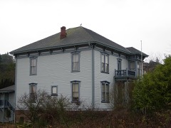
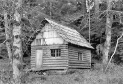
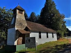
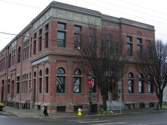
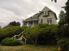
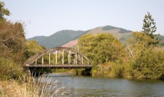
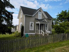
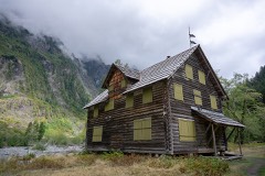
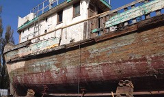
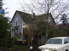
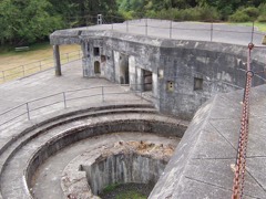
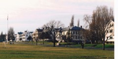
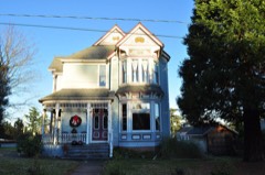
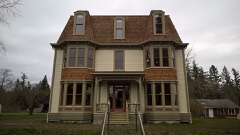
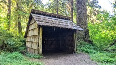
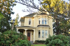
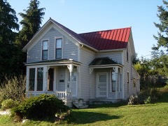
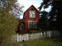
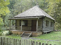
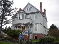
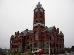
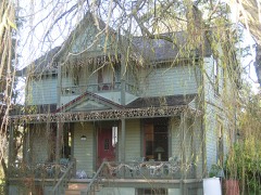
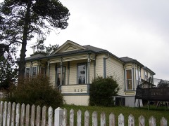
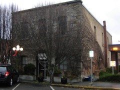
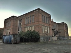
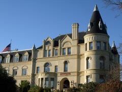
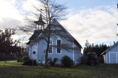
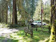
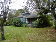
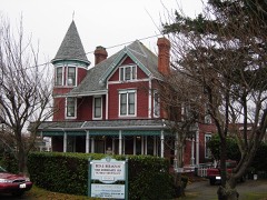
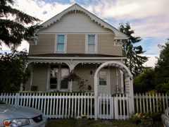
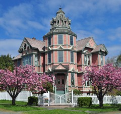
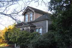
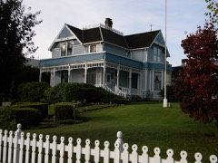
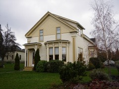
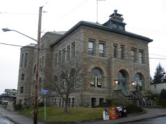
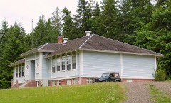
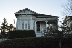
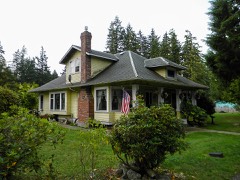
75 National Register listings published here, 2 of them National Historic Landmarks.
Sources: the National Register database, National Park Service
94 topographic sheets cover 44 settlements here, and 75 properties are on the National Register of Historic Places.
75 National Register listings published here, 2 of them National Historic Landmarks.
Sources: the National Register database, National Park Service
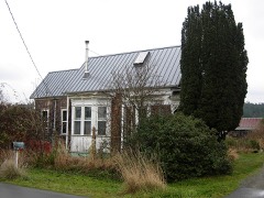
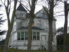
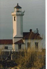
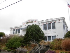
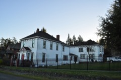
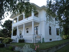
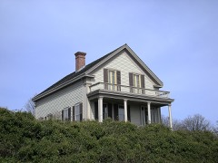
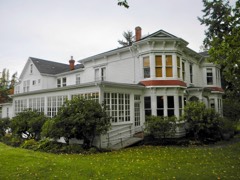
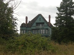
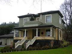
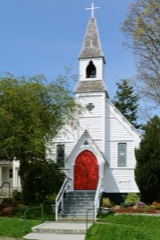
Every property in this county listed on the National Register of Historic Places, with the year it was listed and the federal nomination document.
Every wildfire the federal occurrence database records inside this county: 578 of them, burning about 10,519 acres. 114 started naturally and 27 were recorded as arson. Each settlement page carries the fires within five miles of it.
| Reported cause | Fires |
|---|---|
| Recreation and ceremony | 225 |
| Natural | 114 |
| Debris and open burning | 84 |
| Missing data/not specified/undetermined | 53 |
| Arson/incendiarism | 27 |
| Equipment and vehicle use | 20 |
| Fireworks | 17 |
| Other causes | 12 |
| Misuse of fire by a minor | 12 |
| Smoking | 11 |
| Power generation/transmission/distribution | 3 |
The five largest, by the area the report gives. None of them was recorded as arson.
| Date | Cause | Size | Reported by | Name on the report |
|---|---|---|---|---|
| 15 June 2015 | Natural | 2,815 acres | Olympic National Park | PARADISE |
| 26 July 2016 | Natural | 2,475 acres | Olympic National Park | HAYES FIRE |
| 1 September 2011 | Missing data/not specified/undetermined | 1,243 acres | Olympic National Forest | BIG HUMP |
| 25 July 2016 | Natural | 825 acres | Olympic National Park | GODKIN FIRE |
| 23 June 2009 | Natural | 817 acres | Olympic National Park | 10 MILE |
| 11 July 2009 | Natural | 443 acres | Olympic National Park | CONSTANCE |
| 6 August 2010 | Natural | 385 acres | Olympic National Park | HOPPER |
| 29 July 2009 | Natural | 299 acres | Olympic National Park | BUCKINGHORSE |
Every settlement page carries the fires within five miles of it - see the settlement index below.
The NOAA Storm Events Database holds 16 reports for this county, causing 1 death, no injuries and about $11,453,500 in recorded property damage. Each settlement page carries the reports that name it.
| Kind of event | Reports |
|---|---|
| Heavy Rain | 8 |
| Flood | 4 |
| Lightning | 3 |
| Debris Flow | 1 |
The most serious of them, by death, then injury, then recorded damage. The accounts are quoted exactly as the forecast office filed them.
| When | Event | Place named | Harm | What the report says |
|---|---|---|---|---|
| August 2001 | Heavy Rain | Countywide | 1 killed | no account filed |
| November 2006 | Heavy Rain | Hoh | $5,500,000 | Olympic National Park received about 36 inches of rain from Nov 2nd through the 11th. That rainfall, plus help from some strong winds, caused damage to roads, bridges and trails. A 75 foot section of road, 25 feet deep, was washed away along with adjacent power lines. |
| December 2007 | Heavy Rain | Brinnon | $3,000,000 | A house was knocked off its foundation by flood waters. |
| October 2003 | Heavy Rain | Countywide | $800,000 | no account filed |
| January 2006 | Heavy Rain | Countywide | $700,000 | no account filed |
| January 2021 | Flood | Hoh | $554,000 | Heavy rain caused surface runoff, landslides, and urban and small stream flooding. One to three inches of rain fell during the day. |
| December 2014 | Flood | Brinnon | $300,000 | Fire District 4 suffered major flood damage to Station 42, near the Duckabush River. The station is reported to be a total loss (at one point fire personnel measured more than 5 feet of water in the station with fire apparatus still inside) The loss of the station and equipment is estimated at nearly $200,000. About 6 homes in the area suffered damage. |
| November 2015 | Flood | Hoh | $200,000 | Flooding from the Hoh river damaged Oil City road. |
| December 1999 | Heavy Rain | Countywide | $170,000 | no account filed |
| February 2015 | Debris Flow | Brinnon | $150,000 | A mudslide was reported near Shorewood Road and Kelly Road in Brinnon, off Duckabush Road. The slide reportedly blocked the road and damaged five or six homes. |
| February 2015 | Flood | Brinnon | $50,000 | A National Weather Service spotter reported that 4.43 inches of rain fell in the area between 4 p.m. Thursday and 7:30 a.m. Friday. |
| August 1999 | Lightning | Port Townsend | $15,500 | A house was struck by lightning, causing structural and electrical damage. |
| July 2012 | Lightning | Port Ludlow | $9,000 | Lightning strike cause minor damage to computers that are used to operate the Hood Canal Bridge. |
| August 2004 | Lightning | Nordland | $5,000 | A lightning strike destroyed 3 trees and started a fire which burning a storage shed to the ground. |
| February 2025 | Heavy Rain | Quilcene | - | Heavy rainfall of 3.21 inches was reported in Quilcene, WA. |
| November 2001 | Heavy Rain | Countywide | - | no account filed |
The Survey's mineral resources record lists 106 workings inside this county. 2 still produce and 104 are closed or unrecorded. Each settlement page carries the workings within five miles of it.
| Commodity | Workings |
|---|---|
| Sand and Gravel, Construction | 60 |
| Manganese | 21 |
| Stone, Crushed/Broken | 12 |
| Iron | 6 |
| Gold | 4 |
| Manganese, Iron | 2 |
| Copper | 2 |
| Silver | 1 |
| Travertine | 1 |
| Iron, Manganese | 1 |
| Manganese, Copper | 1 |
| Diatomite | 1 |
| Quartz | 1 |
The least common of them first, because a county's hundredth gravel pit says nothing its first ten did not.
| Where | Site | Commodity | Status | Recorded |
|---|---|---|---|---|
| Dosewallips | Travertine | Occurrence | ||
| Irondale | Diatomite | Occurrence | ||
| Mount Anderson | Quartz | Occurrence | ||
| Mount Claywood | Iron, Manganese | Occurrence | 1956 | |
| Triple Ore Copper Prospect | Copper, Silver | Prospect | ||
| Tubal Cain Property | Manganese, Copper | Prospect | 1941 | |
| Elkhorn | Manganese, Iron | Occurrence | Bementite | |
| North Pole Quartz | Manganese, Iron | Occurrence | 1956 | |
| Tubal Cain Property | Manganese, Copper | Occurrence | Replacement | |
| Ruby Beach Placer | Gold | Occurrence | Beach Placer | |
| Ruby Beach Placer | Gold | Occurrence | ||
| Rustler Creek | Gold | Prospect | ||
| Rustler Creek Claim | Gold | Occurrence | Gold | |
| Black Hump | Iron, Manganese | Occurrence | Hematite | |
| Black Hump | Manganese, Iron | Occurrence | ||
| Chimacum Valley | Iron | Prospect | ||
| Elkhorn Group | Manganese, Iron | Past Producer | 1945 | |
| Mount Claywood | Manganese, Iron | Occurrence | Replacement | |
| North Pole Quartz Claim | Manganese, Iron | Occurrence | Replacement | |
| 246-3.6 Quarry Prairie Creek North | Stone, Crushed/Broken | Past Producer | ||
| Mats Mats Quarry and Plant | Stone, Crushed/Broken | Past Producer | ||
| Pit 2926-3.8 | Stone, Crushed/Broken | Past Producer | ||
| Quarry 2849-1.6 | Stone, Crushed/Broken | Producer | ||
| Quarry 2849-4.1 | Stone, Crushed/Broken | Past Producer | ||
| Quarry 2907-10.4 | Stone, Crushed/Broken | Past Producer | ||
| Quarry 2909-4.8 | Stone, Crushed/Broken | Past Producer | ||
| Quarry 2926-6.7 | Stone, Crushed/Broken | Past Producer | ||
| Quarry- 2927-1.3 | Stone, Crushed/Broken | Past Producer | ||
| Quarry-2927-1.0 | Stone, Crushed/Broken | Past Producer | ||
| Quilcene Quarry | Stone, Crushed/Broken | Past Producer | ||
| Tower Creek Pit | Stone, Crushed/Broken | Past Producer | ||
| Albino Rodriguez | Manganese | Occurrence | 1956 | |
| Albino Rodriquez | Manganese | Occurrence | Replacement | |
| Duckabush River | Manganese | Occurrence | ||
| Duckabush River | Manganese | Occurrence | ||
| Elkhorn | Manganese | Prospect | ||
| Karnes Deposits | Manganese | Prospect | ||
| Lower East Ledge | Manganese | Prospect | 1951 | |
| Lower Middle Ledge | Manganese | Past Producer | 1951 | |
| Lower West Ledge | Manganese | Prospect | ||
| Lucky Creek Claim | Manganese | Occurrence | Replacement | |
| Lucky Creek Claim | Manganese | Prospect | 1958 | |
| Olympic Peninsula Mn Project # 301 | Manganese | Prospect | ||
| Tull City | Manganese | Occurrence | Replacement | |
| Tull City | Manganese | Occurrence | ||
| Upper West Ledge | Manganese | Prospect | 1951 | |
| 240.2-0.7 Park Pit #2 | Sand and Gravel, Construction | Past Producer | ||
| Bucks Gravel Pit | Sand and Gravel, Construction | Past Producer | ||
| Calkins Pit | Sand and Gravel, Construction | Past Producer | ||
| Cape George Pit | Sand and Gravel, Construction | Past Producer | ||
| Chimacum Pit | Sand and Gravel, Construction | Past Producer | ||
| Crown Zellerbach Hadlock Pit | Sand and Gravel, Construction | Past Producer | ||
| Currier Pit | Sand and Gravel, Construction | Past Producer | ||
| Davies Pit | Sand and Gravel, Construction | Past Producer | ||
| Dry Creek Pit | Sand and Gravel, Construction | Past Producer | ||
| East Quilcene Pit | Sand and Gravel, Construction | Past Producer | ||
| Elkins Pit | Sand and Gravel, Construction | Past Producer | ||
| Gravel Pit | Sand and Gravel, Construction | Past Producer | ||
| Gravel Pit | Sand and Gravel, Construction | Past Producer | ||
| Gravel Pit | Sand and Gravel, Construction | Past Producer | ||
| Hadlock Pit | Sand and Gravel, Construction | Past Producer | ||
| Hastings Pit | Sand and Gravel, Construction | Past Producer | ||
| Hoh Pit | Sand and Gravel, Construction | Past Producer | ||
| Hoh Pit | Sand and Gravel, Construction | Past Producer | ||
| Hunt Pit | Sand and Gravel, Construction | Past Producer | ||
| Irondale Pit | Sand and Gravel, Construction | Past Producer | ||
| Kofoed Pit | Sand and Gravel, Construction | Past Producer | ||
| Lindseys New Pit | Sand and Gravel, Construction | Past Producer | ||
| Newsted Pit | Sand and Gravel, Construction | Past Producer | ||
| Phelan Creek Pit | Sand and Gravel, Construction | Past Producer | ||
| Pierce Pit | Sand and Gravel, Construction | Past Producer | ||
| Puget Sound Surfacers Pit | Sand and Gravel, Construction | Past Producer | ||
| Queets Pit | Sand and Gravel, Construction | Past Producer | ||
| Queets Pit | Sand and Gravel, Construction | Past Producer | ||
| Queets River Pit | Sand and Gravel, Construction | Past Producer | ||
| Quilcene Pit | Sand and Gravel, Construction | Past Producer | ||
| Roberts Pit | Sand and Gravel, Construction | Past Producer | ||
| Shine Pit | Sand and Gravel, Construction | Producer | ||
| Shine Pit | Sand and Gravel, Construction | Past Producer | ||
| Thomas Pit | Sand and Gravel, Construction | Past Producer | ||
| Uncas Pit | Sand and Gravel, Construction | Past Producer | ||
| Unnamed Pit | Sand and Gravel, Construction | Past Producer | ||
| Unnamed Pit | Sand and Gravel, Construction | Past Producer | ||
| Unnamed Pit | Sand and Gravel, Construction | Past Producer | ||
| Unnamed Pit | Sand and Gravel, Construction | Past Producer | ||
| Unnamed Pit | Sand and Gravel, Construction | Past Producer | ||
| Unnamed Pit | Sand and Gravel, Construction | Past Producer | ||
| Unnamed Pit | Sand and Gravel, Construction | Past Producer | ||
| Unnamed Pit | Sand and Gravel, Construction | Past Producer | ||
| Unnamed Pit | Sand and Gravel, Construction | Past Producer | ||
| Unnamed Pit | Sand and Gravel, Construction | Past Producer | ||
| Unnamed Pit | Sand and Gravel, Construction | Past Producer | ||
| Unnamed Pit | Sand and Gravel, Construction | Past Producer | ||
| Unnamed Pit | Sand and Gravel, Construction | Past Producer | ||
| Unnamed Pit | Sand and Gravel, Construction | Past Producer | ||
| Unnamed Pit | Sand and Gravel, Construction | Past Producer | ||
| Unnamed Pit | Sand and Gravel, Construction | Past Producer | ||
| Unnamed Pit | Sand and Gravel, Construction | Past Producer | ||
| Unnamed Pit | Sand and Gravel, Construction | Past Producer | ||
| Unnamed Pit | Sand and Gravel, Construction | Past Producer | ||
| Unnamed Pit | Sand and Gravel, Construction | Past Producer | ||
| Unnamed Pit | Sand and Gravel, Construction | Past Producer | ||
| Unnamed Pit | Sand and Gravel, Construction | Past Producer | ||
| Unnamed Quarry | Sand and Gravel, Construction | Past Producer | ||
| Winfield Pit North | Sand and Gravel, Construction | Past Producer | ||
| Zellerbach | Sand and Gravel, Construction | Past Producer |
Named settlements recorded in the Geographic Names Information System, each with the topographic sheets covering it. Villages, hamlets and abandoned places alike. Each is shown with the nearest named watercourse or landform and the survey quadrangle it falls on.
Discovery Bay-Port Townsend census division · 98368 · Port Townsend South quadrangle
11 sheets, 1939 to 1993
Oak Bay-Port Ludlow census division · 98365 · Port Ludlow quadrangle
12 sheets, 1937 to 1992
Quilcene Bay-Brinnon census division · 98320 · On Spencer Creek · Quilcene quadrangle
12 sheets, 1940 to 1992
Quilcene Bay-Brinnon census division · 98320 · On Walkers Creek · Brinnon quadrangle
17 sheets, 1936 to 1999
Quilcene Bay-Brinnon census division · 98376 · Quilcene quadrangle
12 sheets, 1940 to 1992
Oak Bay-Port Ludlow census division · 98339 · Near West Valley · Port Townsend South quadrangle
11 sheets, 1939 to 1993
West End census division · 98331 · On Hurst Creek · Queets quadrangle
9 sheets, 1943 to 1988
Quilcene Bay-Brinnon census division · 98376 · On Tarboo Creek · Quilcene quadrangle
12 sheets, 1940 to 1992
Discovery Bay-Port Townsend census division · 98368 · On Salmon Creek · Uncas quadrangle
13 sheets, 1940 to 1995
Discovery Bay-Port Townsend census division · 98368 · On Salmon Creek · Center quadrangle
12 sheets, 1940 to 1997
Quilcene Bay-Brinnon census division · 98320 · On Duckabush River · Brinnon quadrangle
17 sheets, 1936 to 1999
Discovery Bay-Port Townsend census division · 98368 · Center quadrangle
12 sheets, 1940 to 1997
Quilcene Bay-Brinnon census division · 98376 · On Donovan Creek · Quilcene quadrangle
12 sheets, 1940 to 1992
Discovery Bay-Port Townsend census division · 98368 · On Salmon Creek · Center quadrangle
12 sheets, 1940 to 1997
Oak Bay-Port Ludlow census division · 98358 · Near Craven Rock · Nordland quadrangle
12 sheets, 1939 to 1998
Discovery Bay-Port Townsend census division · 98368 · Port Townsend South quadrangle
11 sheets, 1939 to 1993
Discovery Bay-Port Townsend census division · 98382 · Gardiner quadrangle
12 sheets, 1939 to 1993
Discovery Bay-Port Townsend census division · 98368 · Port Townsend South quadrangle
11 sheets, 1939 to 1993
West End census division · 98331 · On Fossil Creek · Destruction Island quadrangle
9 sheets, 1943 to 1988
Oak Bay-Port Ludlow census division · 98339 · On Chimacum Creek · Port Townsend South quadrangle
11 sheets, 1939 to 1993
West End census division · 98331 · On Kalaloch Creek · Queets quadrangle
9 sheets, 1943 to 1988
Quilcene Bay-Brinnon census division · 98320 · On Duckabush River · Brinnon quadrangle
17 sheets, 1936 to 1999
Oak Bay-Port Ludlow census division · 98358 · On Marrowstone Island · Nordland quadrangle
12 sheets, 1939 to 1998
Oak Bay-Port Ludlow census division · 98365 · Port Ludlow quadrangle
12 sheets, 1937 to 1992
Discovery Bay-Port Townsend census division · 98368 · On Salmon Creek · Uncas quadrangle
13 sheets, 1940 to 1995
Discovery Bay-Port Townsend census division · 98368 · Port Townsend South quadrangle
11 sheets, 1939 to 1993
No longer a settlement
Oak Bay-Port Ludlow census division · 98358 · Near Marrowstone Island · Nordland quadrangle
12 sheets, 1939 to 1998
West End census division · 98331 · On Hoh River · Hoh Head quadrangle
12 sheets, 1939 to 1988
Discovery Bay-Port Townsend census division · 98368 · Port Townsend South quadrangle
11 sheets, 1939 to 1993
Oak Bay-Port Ludlow census division · 98339 · Near Skunk Island · Port Townsend South quadrangle
11 sheets, 1939 to 1993
Oak Bay-Port Ludlow census division · 98365 · Near The Twins · Port Ludlow quadrangle
12 sheets, 1937 to 1992
Discovery Bay-Port Townsend census division · 98368 · Near Morgan Hill · Port Townsend South quadrangle
11 sheets, 1939 to 1993
West End census division · 98331 · On Queets River · Queets quadrangle
9 sheets, 1943 to 1988
Quilcene Bay-Brinnon census division · 98376 · On Big Quilcene River · Mount Walker quadrangle
13 sheets, 1940 to 1995
Quilcene Bay-Brinnon census division · On Turner Creek · Brinnon quadrangle
17 sheets, 1936 to 1999
Oak Bay-Port Ludlow census division · 98365 · On Criss Creek · Lofall quadrangle
14 sheets, 1937 to 1992
West End census division · 98331 · On Tshletshy Creek · Kloochman Rock quadrangle
9 sheets, 1956 to 1990
Oak Bay-Port Ludlow census division · 98365 · Near The Twins · Port Ludlow quadrangle
12 sheets, 1937 to 1992
Discovery Bay-Port Townsend census division · 98368 · Port Townsend South quadrangle
11 sheets, 1939 to 1993
Discovery Bay-Port Townsend census division · 98368 · On Salmon Creek · Uncas quadrangle
13 sheets, 1940 to 1995
Discovery Bay-Port Townsend census division · 98368 · Port Townsend South quadrangle
11 sheets, 1939 to 1993
The vanished settlements of Jefferson County: the places named above that are no longer on the map.