 Block
From the record
9 National Register listings published here.
Sources: the National Register database, National Park Service
130 topographic sheets cover 49 settlements here, and 9 properties are on the National Register of Historic Places.
9 National Register listings published here.
Sources: the National Register database, National Park Service
Every property in this county listed on the National Register of Historic Places, with the year it was listed and the federal nomination document.
| Photograph | Property | Type | Listed | Reference |
|---|---|---|---|---|
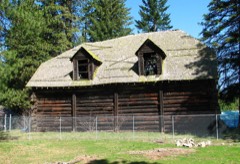 | Appleton Log Hall | building | 1992 | 92001294 |
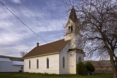 | First Day Advent Christian Church | building | 1991 | 91001439 |
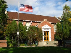 | Goldendale Free Public Library | building | 1982 | 82004259 |
| Klickitat County Courthouse | building | 2014 | 14000613 | |
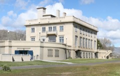 | Maryhill | building | 1974 | 74001966 |
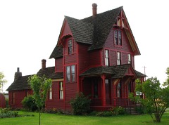 | Charles Newell House | building | 1977 | 77001344 |
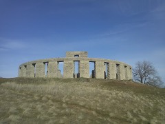 | Stonehenge Memorial | structure | 2021 | 100006703 |
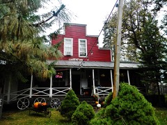 | Trout Lake Tourist Club | building | 2005 | 05001063 |
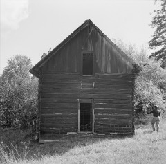 | Whitcomb Cabin | building | 1975 | 75001860 |
Every wildfire the federal occurrence database records inside this county: 1,597 of them, burning about 226,295 acres. 284 started naturally and 60 were recorded as arson. Each settlement page carries the fires within five miles of it.
| Reported cause | Fires |
|---|---|
| Debris and open burning | 301 |
| Missing data/not specified/undetermined | 294 |
| Natural | 284 |
| Recreation and ceremony | 243 |
| Equipment and vehicle use | 144 |
| Arson/incendiarism | 60 |
| Smoking | 56 |
| Fireworks | 56 |
| Other causes | 46 |
| Railroad operations and maintenance | 45 |
| Misuse of fire by a minor | 38 |
| Power generation/transmission/distribution | 30 |
The five largest, by the area the report gives. One of them was set deliberately.
| Date | Cause | Size | Reported by | Name on the report |
|---|---|---|---|---|
| 4 August 2015 | Missing data/not specified/undetermined | 33,103 acres | Spokane District | HIGHWAY 8 |
| 24 July 2013 | Missing data/not specified/undetermined | 26,093 acres | Yakama Agency | MM 28 |
| 13 July 2007 | Natural | 20,947 acres | Spokane District | SIX PRONG |
| 27 July 1998 | Natural | 18,500 acres | Spokane District | CLEVELAND |
| 18 August 2001 | Railroad operations and maintenance | 11,526 acres | Spokane District | GOODNOE |
| 10 August 2000 | Natural | 11,300 acres | Washington State Fire Marshal's Office | SIXPRONG COMPLEX |
| 29 August 2011 | Power generation/transmission/distribution | 11,008 acres | Columbia River Gorge National Scenic Area | WISHRAM 2 |
| 31 July 2018 | Arson/incendiarism | 10,232 acres | Columbia River Gorge National Scenic Area | MILEPOST 90 |
Every settlement page carries the fires within five miles of it - see the settlement index below.
The NOAA Storm Events Database holds 28 reports for this county, causing no deaths, 1 injury and about $21,000 in recorded property damage. Each settlement page carries the reports that name it.
| Kind of event | Reports |
|---|---|
| Hail | 12 |
| Thunderstorm Wind | 5 |
| Lightning | 3 |
| Flood | 3 |
| Wildfire | 2 |
| Heavy Rain | 2 |
| Funnel Cloud | 1 |
The most serious of them, by death, then injury, then recorded damage. The accounts are quoted exactly as the forecast office filed them.
| When | Event | Place named | Harm | What the report says |
|---|---|---|---|---|
| November 1999 | Heavy Rain | Dallesport | 1 hurt, $10,000 | A rock slide caused by heavy rains briefly closed Washington State Highway 14 on the north side of the Columbia River. A motorist was slightly injured when a rock struck a vehicle. |
| August 2004 | Lightning | Goldendale | $10,000 | no account filed |
| July 2002 | Thunderstorm Wind | Lyle | $1,000 | Strong winds from a thunderstorm caused a suspension bridge to collapse across the Klickitat River between Lyle and Pitt. |
| July 2024 | Thunderstorm Wind | Cliffs | - | A member of the public sent videos of strong outflow winds impacting their home, with photos showing damage to a sturdy shed detached from the house. They also reported that their neighbors large trees had been uprooted. |
| August 2024 | Hail | Husum | - | A Washington fire weather employee and a member of the public on Facebook both reported hail size of around 1 inch near the town of Trout Lake. |
| August 2024 | Thunderstorm Wind | Lyle | - | Mesonet stations along the Columbia River in Klickitat County recorded outflow winds as high as 61 mph. |
| July 2022 | Hail | Bickleton | - | A member of the public reported quarter to golf ball size hail stones from a thunderstorm that was nearly stationary over the Bickleton area. |
| June 2019 | Hail | Brooks Mem St Pk | - | Nickel size hail was reported at Brooks Memorial Park. |
| August 2019 | Hail | Goldendale | - | Heavy rainfall accompanied the hail with totals of 2.5 to 3 inches in the same location. |
| August 2019 | Hail | Blockhouse | - | Social media report showed quarter sized hail. |
| September 2019 | Hail | Trout Lake | - | Hail ranged in size from dimes to quarters. Time estimated from radar. |
| March 2017 | Flood | Pitt | - | The Klickitat river near Pitt (flood stage 9.0) crested at 9.3 feet at 0445 on March 16th. |
| March 2012 | Flood | Pitt | - | Law enforcement reported flood waters covering highway 142 5 miles southeast of Appleton. The Klickitat River near Pitt was above flood stage from 7 am March 30 to 11:45 pm March 31. It peaked at 11.12 feet pm March 30 at 4:45 pm. |
| January 2011 | Flood | Glenwood | - | Only minor flooding observed. The Klickitat River gauge at Pitt crested at 10.26, which was 1.26 feet above normal. |
| March 2008 | Funnel Cloud | Bickleton | - | Brief cold core funnel cloud observed. |
| July 2006 | Lightning | B Z Corner | - | Two lightning strikes about 15 minutes apart hit two red fir trees outside of a house. The lightning destroyed two telephones and started a small fire in one of the trees. |
| November 2006 | Heavy Rain | Trout Lake | - | The Cooperative Observer at the Mount Adams Ranger station reported a record 24 hour amount of 6.20 inches. |
| August 2000 | Lightning | Bickleton | - | Lightning started several blazes that became known as the Sixprong Complex. Together, they consumed over 3500 acres and threatened several dozen structures in the Alderdale, Bickleton and Sixprong areas. |
| July 1999 | Hail | Goldendale | - | A farmer located 4 miles south of Satus Pass reported crop damage due to hail as well as some erosion from heavy rain. Lightning also damaged a sprinkler pump. |
| September 1998 | Wildfire | Dallesport | - | A fire burned about 1,400 acres of grassland east of Dallesport. About 80 volunteer firefighters battled the blaze that was pushed by the wind and jumped roads several times. The fire caused the closure of Highway 14 for a while. No structure damage or injuries were reported. |
| July 1998 | Wildfire | Cleveland | - | A lightning caused wild fire burned more than 18,500 acres of grassland and forest in Klickitat County. At least 17 outbuildings, including five homes, were destroyed. The entire town of Cleveland was evacuated. In all over 900 people helped fight the fire with no injuries reported. However, nearly 150 head of cattle died as a result of the fire. Heavy rain helped bring the fire under control. |
| June 1998 | Hail | Glenwood | - | A thunderstorm in Glenwood produced 3/4 inch hail and heavy rain. |
| May 2020 | Thunderstorm Wind | Goodnoe Hills | - | no account filed |
| May 2020 | Thunderstorm Wind | Mc Credie | - | no account filed |
| August 2014 | Hail | Bickleton | - | no account filed |
| August 2013 | Hail | Wahkiacus | - | no account filed |
| June 2004 | Hail | Alderdale | - | no account filed |
| April 2003 | Hail | Bickleton | - | no account filed |
The Survey's mineral resources record lists 93 workings inside this county. 8 still produce and 85 are closed or unrecorded. Each settlement page carries the workings within five miles of it.
| Commodity | Workings |
|---|---|
| Sand and Gravel, Construction | 42 |
| Stone, Crushed/Broken | 32 |
| Stone, Dimension | 3 |
| Pumice | 2 |
| Stone | 2 |
| Diatomite | 2 |
| Silica | 2 |
| Geothermal | 2 |
| Clay | 2 |
| Volcanic Materials | 1 |
| Aluminum, Contained or Metal | 1 |
| Gemstone | 1 |
| Perlite | 1 |
| Magnesite | 1 |
The least common of them first, because a county's hundredth gravel pit says nothing its first ten did not.
| Where | Site | Commodity | Status | Recorded |
|---|---|---|---|---|
| (Facility) Goldendale Aluminum Smelter | Aluminum, Contained or Metal | Plant | ||
| Laurel | Pumice, Volcanic Materials | Past Producer | ||
| Roosevelt | Gemstone | Occurrence | ||
| Satus Creek | Perlite | Occurrence | ||
| Twin Buttes | Magnesite | Occurrence | ||
| White Salmon | Clay, Aluminum | Prospect | ||
| Blockhouse Mineral Springs | Geothermal | Producer | ||
| Chapman Creek | Diatomite | Occurrence | ||
| Goldendale | Clay | Past Producer | ||
| Goodnoe Hills | Silica | Occurrence | ||
| Quigley Butte Cinders | Pumice | Past Producer | ||
| Riley Pit | Stone | Past Producer | ||
| Satus Pass | Diatomite | Occurrence | ||
| Sundale | Silica | Past Producer | ||
| Trout Lake Pit | Stone | Past Producer | ||
| Unnamed Hot Spring | Geothermal | Producer | ||
| Blockhouse Quarry | Stone, Dimension | Producer | ||
| Klickitat Co. Pits | Stone, Dimension | Past Producer | ||
| Red Rock Quarry | Stone, Dimension | Producer | ||
| Alderdale Pit | Stone, Crushed/Broken | Past Producer | ||
| Appleton Quarry | Stone, Crushed/Broken | Past Producer | ||
| Borrow Pit | Stone, Crushed/Broken | Past Producer | ||
| Bryant Quarry | Stone, Crushed/Broken | Past Producer | ||
| Cleveland Quarry | Stone, Crushed/Broken | Past Producer | ||
| Cuff Quarry | Stone, Crushed/Broken | Past Producer | ||
| Dean Quarry | Stone, Crushed/Broken | Past Producer | ||
| Gorge Rock Pit | Stone, Crushed/Broken | Past Producer | ||
| Ingram Quarry | Stone, Crushed/Broken | Past Producer | ||
| Mahone Quarry | Stone, Crushed/Broken | Past Producer | ||
| Mary Hill Pit | Stone, Crushed/Broken | Past Producer | ||
| Matsen Quarry | Stone, Crushed/Broken | Past Producer | ||
| Reither Quarry | Stone, Crushed/Broken | Past Producer | ||
| Stultz Quarry | Stone, Crushed/Broken | Past Producer | ||
| Thompson Quarry | Stone, Crushed/Broken | Producer | ||
| Thompson Quarry | Stone, Crushed/Broken | Past Producer | ||
| Unnamed Quarrry | Stone, Crushed/Broken | Past Producer | ||
| Unnamed Quarry | Stone, Crushed/Broken | Past Producer | ||
| Unnamed Quarry | Stone, Crushed/Broken | Past Producer | ||
| Unnamed Quarry | Stone, Crushed/Broken | Past Producer | ||
| Unnamed Quarry | Stone, Crushed/Broken | Past Producer | ||
| Unnamed Quarry | Stone, Crushed/Broken | Past Producer | ||
| Unnamed Quarry | Stone, Crushed/Broken | Past Producer | ||
| Unnamed Quarry | Stone, Crushed/Broken | Past Producer | ||
| Unnamed Quarry | Stone, Crushed/Broken | Past Producer | ||
| Unnamed Quarry | Stone, Crushed/Broken | Past Producer | ||
| Unnamed Quarry | Stone, Crushed/Broken | Past Producer | ||
| Unnamed Quarry | Stone, Crushed/Broken | Past Producer | ||
| Unnamed Quarry | Stone, Crushed/Broken | Past Producer | ||
| Unnamed Quarry | Stone, Crushed/Broken | Past Producer | ||
| Unnamed Quarry Rry | Stone, Crushed/Broken | Past Producer | ||
| Unnamed Quarry Quarry | Stone, Crushed/Broken | Past Producer | ||
| Borrow Pit | Sand and Gravel, Construction | Past Producer | ||
| Borrow Pit | Sand and Gravel, Construction | Past Producer | ||
| Borrow Pit | Sand and Gravel, Construction | Past Producer | ||
| Circle T Ranch Pit | Sand and Gravel, Construction | Producer | ||
| Cunningham Pit | Sand and Gravel, Construction | Past Producer | ||
| Dickey Farm Sand Pit | Sand and Gravel, Construction | Past Producer | ||
| Gravel Pit | Sand and Gravel, Construction | Past Producer | ||
| Gravel Pit | Sand and Gravel, Construction | Past Producer | ||
| Gravel Pit | Sand and Gravel, Construction | Past Producer | ||
| Gravel Pit | Sand and Gravel, Construction | Past Producer | ||
| Gravel Pit | Sand and Gravel, Construction | Past Producer | ||
| Gravel Pit | Sand and Gravel, Construction | Past Producer | ||
| Gravel Pit | Sand and Gravel, Construction | Past Producer | ||
| Gravel Pits | Sand and Gravel, Construction | Past Producer | ||
| Gregory Source Pit | Sand and Gravel, Construction | Past Producer | ||
| Hunsaker Pit | Sand and Gravel, Construction | Past Producer | ||
| Hunsaker Sand and Gravel Pit | Sand and Gravel, Construction | Past Producer | ||
| Jewett Creek Pit | Sand and Gravel, Construction | Past Producer | ||
| Layman No3 Pit | Sand and Gravel, Construction | Past Producer | ||
| Lyle Pit | Sand and Gravel, Construction | Past Producer | ||
| Lyle Pit | Sand and Gravel, Construction | Past Producer | ||
| Pacific Northwest Aggregates Pit | Sand and Gravel, Construction | Producer | ||
| Pipeline Road Pit | Sand and Gravel, Construction | Past Producer | ||
| Starr Pit | Sand and Gravel, Construction | Past Producer | ||
| Unnamed Pit | Sand and Gravel, Construction | Past Producer | ||
| Unnamed Pit | Sand and Gravel, Construction | Past Producer | ||
| Unnamed Pit | Sand and Gravel, Construction | Past Producer | ||
| Unnamed Pit | Sand and Gravel, Construction | Past Producer | ||
| Unnamed Pit | Sand and Gravel, Construction | Past Producer | ||
| Unnamed Pit | Sand and Gravel, Construction | Past Producer | ||
| Unnamed Pit | Sand and Gravel, Construction | Past Producer | ||
| Unnamed Pit | Sand and Gravel, Construction | Past Producer | ||
| Unnamed Pit | Sand and Gravel, Construction | Past Producer | ||
| Unnamed Pit | Sand and Gravel, Construction | Unknown | ||
| Unnamed Pit | Sand and Gravel, Construction | Past Producer | ||
| Unnamed Pit | Sand and Gravel, Construction | Past Producer | ||
| Unnamed Pit | Sand and Gravel, Construction | Past Producer | ||
| Unnamed Pit | Sand and Gravel, Construction | Past Producer | ||
| Unnamed Pit | Sand and Gravel, Construction | Past Producer | ||
| Unnamed Pit | Sand and Gravel, Construction | Past Producer | ||
| Unnamed Pit I | Sand and Gravel, Construction | Past Producer | ||
| Unnamed Quarry | Sand and Gravel, Construction | Past Producer |
Named settlements recorded in the Geographic Names Information System, each with the topographic sheets covering it. Villages, hamlets and abandoned places alike. Each is shown with the nearest named watercourse or landform and the survey quadrangle it falls on.
Horse Heaven Hills Plateau census division · 99322 · On Alder Creek · Golgotha Butte quadrangle
16 sheets, 1906 to 1993
White Salmon census division · 98672 · On Gilmer Creek · Penny Ridge quadrangle
15 sheets, 1926 to 1994
Horse Heaven Hills Plateau census division · 99356 · Sundale NW quadrangle
12 sheets, 1916 to 1980
Horse Heaven Hills Plateau census division · 99322 · Bickleton quadrangle
11 sheets, 1916 to 1980
White Salmon census division · 98605 · On Dry Creek · White Salmon quadrangle
15 sheets, 1934 to 1994
Goldendale census division · 98620 · On Blockhouse Butte · Centerville quadrangle
9 sheets, 1953 to 1983
Dallesport-Klickitat census division · 98613 · Centerville quadrangle
9 sheets, 1953 to 1983
Horse Heaven Hills Plateau census division · 99356 · Bickleton quadrangle
11 sheets, 1916 to 1980
Dallesport-Klickitat census division · 98617 · The Dalles South quadrangle
17 sheets, 1934 to 1994
Goldendale census division · 98620 · Near Devils Canyon · White Pine Buttes quadrangle
9 sheets, 1953 to 1983
White Salmon census division · 98672 · On Kline Creek · Husum quadrangle
15 sheets, 1934 to 1994
Yakama Nation Reservation census division · 98619 · Glenwood quadrangle
13 sheets, 1904 to 1970
Goldendale census division · 98620 · On Bloodgood Creek · Goldendale quadrangle
9 sheets, 1953 to 1983
Horse Heaven Hills Plateau census division · 99356 · Near Sand Spring Canyon · Quinton quadrangle
10 sheets, 1953 to 1980
Horse Heaven Hills Plateau census division · 99356 · Goodnoe Hills quadrangle
11 sheets, 1916 to 1980
Dallesport-Klickitat census division · 98613 · Stacker Butte quadrangle
16 sheets, 1934 to 1994
White Salmon census division · 98650 · On Cave Creek · Guler Mountain quadrangle
15 sheets, 1926 to 1998
White Salmon census division · 98623 · On Rattlesnake Creek · Husum quadrangle
15 sheets, 1934 to 1994
Dallesport-Klickitat census division · 98628 · Near Snyder Canyon · Klickitat quadrangle
14 sheets, 1934 to 2000
Dallesport-Klickitat census division · 98635 · Appleton quadrangle
15 sheets, 1934 to 1994
Dallesport-Klickitat census division · 98628 · Near Wahkiaous Canyon · Wahkiacus quadrangle
13 sheets, 1934 to 1983
Yakama Nation Reservation census division · 98619 · Quigley Butte quadrangle
14 sheets, 1934 to 1983
White Salmon census division · 98672 · Near Tracy Hill · Husum quadrangle
15 sheets, 1934 to 1994
Dallesport-Klickitat census division · 98635 · On Klickitat River · Lyle quadrangle
16 sheets, 1934 to 1994
Horse Heaven Hills Plateau census division · 99356 · On Cottonwood Creek · Golgotha Butte quadrangle
16 sheets, 1906 to 1993
Horse Heaven Hills Plateau census division · 99356 · On Pine Creek · Heppner Junction quadrangle
13 sheets, 1916 to 1980
Dallesport-Klickitat census division · 98635 · Near Sq’wanana · The Dalles North quadrangle
17 sheets, 1934 to 1994
Dallesport-Klickitat census division · 98635 · Near Wheeler Canyon · Klickitat quadrangle
14 sheets, 1934 to 2000
Horse Heaven Hills Plateau census division · 99356 · Near Wood Gulch · Arlington quadrangle
12 sheets, 1916 to 1980
Horse Heaven Hills Plateau census division · 99322 · Heppner Junction quadrangle
13 sheets, 1916 to 1980
Dallesport-Klickitat census division · 98617 · Near Stanley Canyon · The Dalles North quadrangle
17 sheets, 1934 to 1994
White Salmon census division · 98605 · White Salmon quadrangle
15 sheets, 1934 to 1994
Horse Heaven Hills Plateau census division · 99356 · On Chapman Creek · Sundale quadrangle
12 sheets, 1916 to 1980
White Salmon census division · 98650 · On Cave Creek · Guler Mountain quadrangle
15 sheets, 1926 to 1998
Dallesport-Klickitat census division · 98628 · Near Swale Canyon · Wahkiacus quadrangle
13 sheets, 1934 to 1983
Dallesport-Klickitat census division · 98613 · Near Centerville Valley · Wishram quadrangle
10 sheets, 1953 to 1994
White Salmon census division · 98672 · On Jewett Creek · White Salmon quadrangle
15 sheets, 1934 to 1994
Dallesport-Klickitat census division · 98673 · Wishram quadrangle
10 sheets, 1953 to 1994
Dallesport-Klickitat census division · 98670 · Near Long Butte · Klickitat quadrangle
14 sheets, 1934 to 2000