Block
From the record
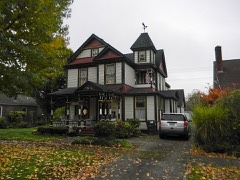
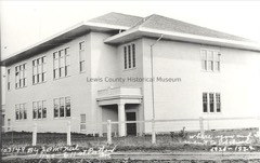
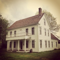
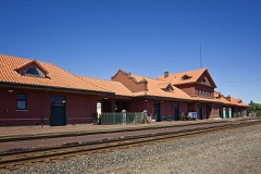
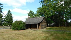
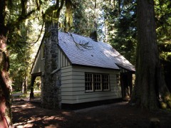
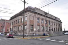
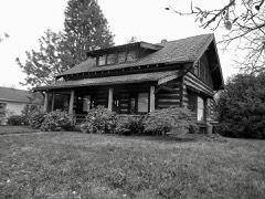
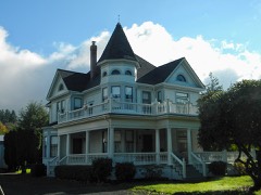
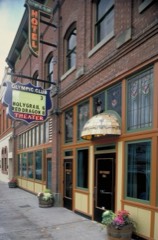
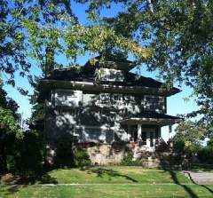
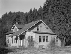
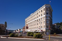
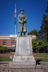
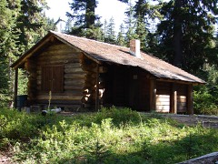
33 National Register listings published here.
Sources: the National Register database, National Park Service
146 topographic sheets cover 74 settlements here, and 33 properties are on the National Register of Historic Places.
33 National Register listings published here.
Sources: the National Register database, National Park Service
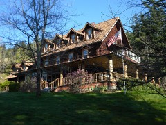
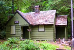
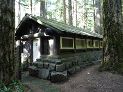
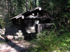
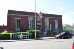
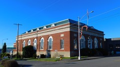
Every property in this county listed on the National Register of Historic Places, with the year it was listed and the federal nomination document.
Every wildfire the federal occurrence database records inside this county: 1,033 of them, burning about 3,748 acres. 166 started naturally and 34 were recorded as arson. Each settlement page carries the fires within five miles of it.
| Reported cause | Fires |
|---|---|
| Debris and open burning | 289 |
| Recreation and ceremony | 216 |
| Natural | 166 |
| Missing data/not specified/undetermined | 147 |
| Smoking | 52 |
| Equipment and vehicle use | 46 |
| Arson/incendiarism | 34 |
| Fireworks | 25 |
| Misuse of fire by a minor | 22 |
| Other causes | 22 |
| Railroad operations and maintenance | 7 |
| Power generation/transmission/distribution | 7 |
The five largest, by the area the report gives. None of them was recorded as arson.
| Date | Cause | Size | Reported by | Name on the report |
|---|---|---|---|---|
| 19 September 2012 | Natural | 523 acres | Gifford Pinchot National Forest | SOUTH POINT |
| 11 August 2015 | Natural | 359 acres | Gifford Pinchot National Forest | ALDER LAKE |
| 24 August 2003 | Natural | 321 acres | Gifford Pinchot National Forest | LOST LAKE |
| 29 July 1998 | Natural | 232 acres | Gifford Pinchot National Forest | WHITE PASS |
| 19 August 2015 | Missing data/not specified/undetermined | 175 acres | Washington State Department of Natural Resources Headquarters | GORE ROAD |
| 8 August 2018 | Natural | 133 acres | Gifford Pinchot National Forest | CLEAR FORK |
| 19 March 2019 | Debris and open burning | 103 acres | Washington State Department of Natural Resources Headquarters | SWOFFORD |
| 9 August 2015 | Missing data/not specified/undetermined | 103 acres | Washington State Department of Natural Resources Headquarters | GISH |
Every settlement page carries the fires within five miles of it - see the settlement index below.
The NOAA Storm Events Database holds 19 reports for this county, causing 3 deaths, 2 injuries and about $71,014,000 in recorded property damage. Each settlement page carries the reports that name it.
| Kind of event | Reports |
|---|---|
| Flood | 8 |
| Heavy Rain | 5 |
| Tornado | 3 |
| Lightning | 3 |
The most serious of them, by death, then injury, then recorded damage. The accounts are quoted exactly as the forecast office filed them.
| When | Event | Place named | Harm | What the report says |
|---|---|---|---|---|
| November 2006 | Flood | Packwood | 2 killed, $8,800,000 | Record flooding occurred on the Cowlitz, Nooksack, Puyallup, Nisqually, |Skykomish, Stillaguamish, Carbon, Snoqualmie, and Bogachiel. Major flooding occurred on the Tolt, Snohomish, Skokomish, Skagit, and White rivers. Other rivers flooding were the Satsop, Cedar, Wynoochee, Elwha, Deschutes, Dungeness, Skookumchuck, and Chehalis. |
| December 2007 | Flood | Doty | 1 killed, $50,000,000 | The Chehalis river at Centralia reached a record flood stage of 74.78 feet. An 81-year old man disappeared along a stream near Winlock. More than 450 homes were damaged outside of the cities of Chehalis and Centralia. About 65 homes were destroyed, while just over 200 had major damage. Over 1800 farm animals died. A 20 mile stretch of Interstate-5 was closed for 3 days as parts of the interstate were under as much as 10 feet of water as well as the major north-south rail line. In Centralia about 350 homes were damaged or destroyed. About 1100 people used shelters. Many schools were closed for a week. Some communities had no fresh water. More than 20 square blocks near downtown Centralia were under water. |
| September 2013 | Lightning | Chehalis | 1 hurt | A 59 year old motorcycle driver was injured when he was struck by lightning while driving on Interstate-5. |
| May 2004 | Lightning | Toledo | 1 hurt | A man was seriously injured after being struck by lightning while working on a roof. His co-workers said there was just one lightning bolt, none before or after the one that struck the man. |
| January 2009 | Flood | Chehalis River At Centralia | $8,400,000 | There was some damage in the town of Randle, mostly businesses that need to replace carpets. Interstate 5 was closed for about 2 days, causing losses of nearly 10 million. Dozens of homes flooded and many people had to be evacuated. More than 50 miles of road surfaces, as well as a water treatment plant, were damaged. |
| January 2021 | Flood | Chehalis River At Centralia | $1,450,000 | The Cowlitz River at Randle and Newaukum River near Chehalis exceeded flood stage. Urban and small stream flooding occurred also. |
| January 2021 | Flood | Doty | $1,450,000 | The Chehalis River near Doty, Newaukum River near Centralia rose above flood stage Jan 3. Urban and small stream flooding occurred as well. |
| November 2021 | Flood | Silver Brook | $526,000 | Heavy rain drove a several rivers and streams above flood stage. Major flooding occurred on the Cowlitz River and moderate flooding on the Newaukum River. |
| November 2015 | Flood | Mineral | $200,000 | Flooding on Mineral Creek damaged a segment of the Mount Rainier Scenic Railroad. |
| December 2015 | Flood | Silver Brook | $100,000 | There was some flooding of the Cispus and Cowlitz rivers. Forest Service Road 23 suffered extensive washouts at mileposts 12.5 and 24. As a result the popular road is currently closed at mileposts 11 and 25. There was additional flood-related closures on Forest Service roads in Lewis county. |
| January 2006 | Heavy Rain | Countywide | $50,000 | no account filed |
| November 1965 | Tornado (F2) | not stated | $25,000 | no account filed |
| May 2011 | Tornado (EF0) | Napavine | $10,000 | Tornado with a peak wind speed estimated near 75 mph. Light to moderate damage to metal roofs on out buildings. Light damage to two houses - missing shingles and siding damage. Large branches snapped off several trees. Tornado estimated on the ground for less than 2 minutes. |
| August 2002 | Lightning | Toledo | $2,000 | Four cattle were killed when struck by lightning. |
| October 2010 | Tornado (EF0) | (Tdo)Toledo-Winlock | $1,000 | A weak EF0 tornado touched down in a field behind a home with two eyewitnesses. Path length was 110 yards, width 5 yards. Damage limited to branches of up to 3 inches in diameter ripped off several trees and some deck plastic. |
| January 2003 | Heavy Rain | Countywide | - | no account filed |
| March 2003 | Heavy Rain | Countywide | - | no account filed |
| August 2001 | Heavy Rain | Countywide | - | no account filed |
| August 2001 | Heavy Rain | Countywide | - | no account filed |
The Survey's mineral resources record lists 217 workings inside this county. 8 still produce and 209 are closed or unrecorded. Each settlement page carries the workings within five miles of it.
| Commodity | Workings |
|---|---|
| Sand and Gravel, Construction | 87 |
| Stone, Crushed/Broken | 29 |
| Pumice | 27 |
| Mercury | 19 |
| Copper | 9 |
| Silica | 7 |
| Clay | 5 |
| Antimony | 4 |
| Gemstone | 4 |
| Geothermal | 3 |
| Stone, Dimension | 3 |
| Manganese | 2 |
| Arsenic | 2 |
| Nickel | 2 |
The least common of them first, because a county's hundredth gravel pit says nothing its first ten did not.
| Where | Site | Commodity | Status | Recorded |
|---|---|---|---|---|
| Eagle Peak | Tungsten, Gold, Silver, Cobalt, Uranium, Copper | Occurrence | Bornite, Chalcopyrite, Linnaeite, Molybdenite, Scheelite, Sphalerite | |
| Eagle Peak | Copper, Uranium, Silver, Gold, Cobalt | Past Producer | ||
| Eagle Peak Mine | Copper, Cobalt, Silver, Gold, Tungsten, Zinc, Molybdenum, Uranium, Arsenic | Past Producer | Bornite, Chalcopyrite, Covellite, Linnaeite, Molybdenite, Pyrite, Scheelite, Sphalerite | |
| J.E. Brown/Weyerhaeuser Co. Prop. | Aluminum | Occurrence | ||
| Mineral Creek | Arsenic, Lead, Silver, Zinc | Occurrence | Galena, Realgar, Sphalerite | |
| Mineral Creek | Zinc, Silver, Lead, Arsenic | Past Producer | 1904 | |
| Mineral Creek Mine | Arsenic, Zinc, Lead, Silver | Past Producer | Galena, Realgar, Sphalerite | |
| Rocky Point Group | Gold, Copper | Past Producer | Gold | |
| Winlock Placer | Titanium | Occurrence | ||
| Winlock Placer Prospect | Titanium, Metal | Occurrence | Placer | |
| Adna Pit No. 2 | Stone | Past Producer | ||
| Buswell | Fire Clay (Refractory) | Occurrence | ||
| Chehalis River | Manganese | Prospect | 1952 | |
| Chehalis River Prospect | Manganese | Occurrence | ||
| Jug Lake Prospect | Antimony, Silver | Occurrence | Stibnite | |
| Mineral Creek | Limestone, General | Occurrence | ||
| Morton | Diatomite | Occurrence | ||
| Newaukum | Limestone, General | Occurrence | ||
| Paradise Prospect | Copper, Arsenic | Past Producer | Bornite, Chalcopyrite, Pyrite | |
| Salkum Pit | Silver | Past Producer | ||
| Salmon Creek | Fire Clay (Refractory) | Occurrence | ||
| Summit Creek | Nickel | Occurrence | ||
| Summit Creek Prospect | Nickel | Occurrence | ||
| Tilton River | Diatomite | Occurrence | ||
| Unnamed Quarry | Stone | Past Producer | ||
| Ohanapecosh Hot Springs | Geothermal | Producer | ||
| Out-Of Gas Group | Stone, Dimension | Occurrence | ||
| Packwood Spring | Geothermal | Producer | ||
| Quality Rock Quarry | Stone, Dimension | Past Producer | ||
| Summit Creek Springs | Geothermal | Producer | ||
| Wild Rose Claim | Stone, Dimension | Occurrence | ||
| Centralia | Gemstone | Occurrence | ||
| Chehalis Valley | Gemstone | Occurrence | ||
| Doty | Gemstone | Occurrence | ||
| Fall Creek | Gemstone | Occurrence | ||
| Jug Lake | Antimony | Occurrence | ||
| Reeves | Antimony | Prospect | ||
| Reeves Prospect | Antimony | Occurrence | Stibiconite, Stibnite | |
| Brown | Clay | Past Producer | ||
| Cowlitz River | Clay | Occurrence | ||
| Ladd Mine | Clay | Occurrence | ||
| Unnamed Pit | Clay | Past Producer | ||
| Vader | Clay | Past Producer | ||
| Campbell Road | Silica | Occurrence | ||
| Centralia | Silica | Occurrence | ||
| Lund | Silica | Occurrence | ||
| Mendota | Silica | Occurrence | ||
| Morton | Silica | Occurrence | ||
| Morton A and B | Silica | Occurrence | ||
| Stillwater Creek | Silica | Occurrence | ||
| Big Falls | Copper | Unknown | ||
| Big Falls Group | Copper | Occurrence | ||
| Green River | Copper | Unknown | ||
| Paradise | Copper | Past Producer | ||
| Rocky Point | Copper | Unknown | ||
| Apex | Mercury | Past Producer | Cinnabar | |
| Barnum-McDonnell | Mercury | Past Producer | 1913 | |
| Chapman | Mercury | Occurrence | Cinnabar | |
| Chestnut | Mercury | Occurrence | ||
| Eight-Seventeen | Mercury | Occurrence | Cinnabar | |
| Fisher Lease | Mercury | Occurrence | Cinnabar | |
| Ladd | Mercury | Occurrence | Cinnabar | |
| Lytle-Lynch | Mercury | Past Producer | Cinnabar | |
| N.P. Prospect | Mercury | Occurrence | ||
| Nineteen Creek | Mercury | Occurrence | ||
| Parmenter | Mercury | Past Producer | Cinnabar | |
| Roy | Mercury | Past Producer | 1928 | |
| Roy No. 5 | Mercury | Occurrence | Cinnabar | |
| Section One | Mercury | Occurrence | Cinnabar | |
| Section Thirty-Six | Mercury | Occurrence | Cinnabar | |
| Seipman | Mercury | Occurrence | ||
| Spencer | Mercury | Past Producer | Cinnabar, Pyrite | |
| Tilton River, East Fork | Mercury | Occurrence | Placer | |
| Tilton River, West Fork | Mercury | Occurrence | Placer | |
| Cispus | Pumice | Occurrence | ||
| Cispus River A Deposit | Pumice | Occurrence | ||
| Cispus River B | Pumice | Occurrence | ||
| Cispus River C | Pumice | Occurrence | ||
| Cispus River D | Pumice | Occurrence | ||
| Cispus River E | Pumice | Occurrence | ||
| Cispus River F | Pumice | Occurrence | ||
| Cispus River G | Pumice | Occurrence | ||
| Cispus River H | Pumice | Occurrence | ||
| Cowlitz River | Pumice | Occurrence | ||
| Cowlitz Valley B | Pumice | Prospect | ||
| Cowlitz Valley C | Pumice | Occurrence | ||
| Cowlitz Valley E | Pumice | Occurrence | ||
| Glenoma | Pumice | Occurrence | ||
| Hunt & Gaines Pit | Pumice | Past Producer | ||
| Kiona Creek A | Pumice | Occurrence | ||
| Kiona Creek B | Pumice | Occurrence | ||
| Kiona Creek C | Pumice | Occurrence | ||
| Kiona Creek D | Pumice | Occurrence | ||
| Kiona Valley | Pumice | Occurrence | ||
| Mill Creek | Pumice | Occurrence | ||
| Popcorn Pit | Pumice | Past Producer | ||
| Rainy Creek A | Pumice | Occurrence | ||
| Rainy Creek B | Pumice | Occurrence | ||
| Rainy Creek C | Pumice | Occurrence | ||
| Rainy Valley | Pumice | Prospect | ||
| Tom Dalton A | Pumice | Occurrence | ||
| 35 Road Pit Weyerhaeuser Company | Stone, Crushed/Broken | Past Producer | ||
| Alois Rakoz | Stone, Crushed/Broken | Past Producer | ||
| Alpha Quarry | Stone, Crushed/Broken | Past Producer | ||
| Ames Quarry | Stone, Crushed/Broken | Past Producer | ||
| Borrow Pit | Stone, Crushed/Broken | Past Producer | ||
| Breen Quarry | Stone, Crushed/Broken | Past Producer | ||
| Bunker Quarry | Stone, Crushed/Broken | Producer | ||
| Coleman Quarry | Stone, Crushed/Broken | Past Producer | ||
| Curtis Hill Quarry | Stone, Crushed/Broken | Past Producer | ||
| Dean Quarry | Stone, Crushed/Broken | Past Producer | ||
| Doty Quarry | Stone, Crushed/Broken | Past Producer | ||
| Dry Pass Quarry | Stone, Crushed/Broken | Past Producer | ||
| Eveline Quarry | Stone, Crushed/Broken | Past Producer | ||
| Gillingham Pit | Stone, Crushed/Broken | Past Producer | ||
| Hale Quarry | Stone, Crushed/Broken | Past Producer | ||
| Harv Breen Quarry | Stone, Crushed/Broken | Producer | ||
| Hugo Lake Quarry | Stone, Crushed/Broken | Past Producer | ||
| Meskill Quarry | Stone, Crushed/Broken | Past Producer | ||
| Mullaney Quarry | Stone, Crushed/Broken | Past Producer | ||
| Road Pit No. 35 | Stone, Crushed/Broken | Past Producer | ||
| Sandman Quarry | Stone, Crushed/Broken | Past Producer | ||
| Sliwa Quarry | Stone, Crushed/Broken | Past Producer | ||
| Thrash Creek Pit | Stone, Crushed/Broken | Past Producer | ||
| Unnamed Pit | Stone, Crushed/Broken | Past Producer | ||
| Unnamed Quarry | Stone, Crushed/Broken | Past Producer | ||
| Unnamed Quarry | Stone, Crushed/Broken | Past Producer | ||
| Unnamed Quarry | Stone, Crushed/Broken | Past Producer | ||
| Unnamed Quarry | Stone, Crushed/Broken | Past Producer | ||
| Weyerhaeuser Quarry | Stone, Crushed/Broken | Past Producer | ||
| Askin Pit | Sand and Gravel, Construction | Producer | ||
| Bernobich Pit | Sand and Gravel, Construction | Past Producer | ||
| Centralia Pit & Plant No. 64 | Sand and Gravel, Construction | Producer | ||
| Chesser Pit | Sand and Gravel, Construction | Past Producer | ||
| Fairhurst Pit | Sand and Gravel, Construction | Past Producer | ||
| Fate Pit | Sand and Gravel, Construction | Past Producer | ||
| Foron Road Pit | Sand and Gravel, Construction | Producer | ||
| Gravel Pit | Sand and Gravel, Construction | Past Producer | ||
| Hanaford Pit | Sand and Gravel, Construction | Past Producer | ||
| Harmony Pit | Sand and Gravel, Construction | Past Producer | ||
| Huntting Pit | Sand and Gravel, Construction | Past Producer | ||
| Independence Pit | Sand and Gravel, Construction | Past Producer | ||
| Jody Quarry | Sand and Gravel, Construction | Past Producer | ||
| Keating Pit | Sand and Gravel, Construction | Past Producer | ||
| Keller-Petra-Keller Pit | Sand and Gravel, Construction | Past Producer | ||
| Kelly Pit | Sand and Gravel, Construction | Past Producer | ||
| Kiona Pit | Sand and Gravel, Construction | Past Producer | ||
| Kuper Pit | Sand and Gravel, Construction | Past Producer | ||
| Lindberg Pit | Sand and Gravel, Construction | Past Producer | ||
| Mcquiggs Pit | Sand and Gravel, Construction | Past Producer | ||
| Miller Bar | Sand and Gravel, Construction | Past Producer | ||
| Mineral Pit | Sand and Gravel, Construction | Past Producer | ||
| Moore-Davis Pit | Sand and Gravel, Construction | Past Producer | ||
| Mossyrock Pit | Sand and Gravel, Construction | Past Producer | ||
| Mulford Pit | Sand and Gravel, Construction | Past Producer | ||
| Olequah Pit | Sand and Gravel, Construction | Past Producer | ||
| Onalaska Pit | Sand and Gravel, Construction | Past Producer | ||
| Packwood Pit | Sand and Gravel, Construction | Past Producer | ||
| Packwood Pit No. 96 | Sand and Gravel, Construction | Past Producer | ||
| Riverside Sand & Gravel Pit | Sand and Gravel, Construction | Past Producer | ||
| Road Pit No. 3 | Sand and Gravel, Construction | Past Producer | ||
| Roundtree Pit | Sand and Gravel, Construction | Past Producer | ||
| Rushpit | Sand and Gravel, Construction | Past Producer | ||
| Shorey Pit | Sand and Gravel, Construction | Past Producer | ||
| Smathers Pit | Sand and Gravel, Construction | Past Producer | ||
| Smith Pit | Sand and Gravel, Construction | Past Producer | ||
| Squatter Quarry | Sand and Gravel, Construction | Past Producer | ||
| Sunbird Pit | Sand and Gravel, Construction | Past Producer | ||
| Thompson Pit | Sand and Gravel, Construction | Past Producer | ||
| Toledo Pit | Sand and Gravel, Construction | Past Producer | ||
| Union Pit | Sand and Gravel, Construction | Past Producer | ||
| Unnamed Pit | Sand and Gravel, Construction | Past Producer | ||
| Unnamed Pit | Sand and Gravel, Construction | Past Producer | ||
| Unnamed Pit | Sand and Gravel, Construction | Past Producer | ||
| Unnamed Pit | Sand and Gravel, Construction | Past Producer | ||
| Unnamed Pit | Sand and Gravel, Construction | Past Producer | ||
| Unnamed Pit | Sand and Gravel, Construction | Past Producer | ||
| Unnamed Pit | Sand and Gravel, Construction | Past Producer | ||
| Unnamed Pit | Sand and Gravel, Construction | Past Producer | ||
| Unnamed Pit | Sand and Gravel, Construction | Past Producer | ||
| Unnamed Pit | Sand and Gravel, Construction | Past Producer | ||
| Unnamed Pit | Sand and Gravel, Construction | Past Producer | ||
| Unnamed Pit | Sand and Gravel, Construction | Past Producer | ||
| Unnamed Pit | Sand and Gravel, Construction | Past Producer | ||
| Unnamed Pit | Sand and Gravel, Construction | Past Producer | ||
| Unnamed Pit | Sand and Gravel, Construction | Past Producer | ||
| Unnamed Pit | Sand and Gravel, Construction | Past Producer | ||
| Unnamed Pit | Sand and Gravel, Construction | Past Producer | ||
| Unnamed Pit | Sand and Gravel, Construction | Past Producer | ||
| Unnamed Pit | Sand and Gravel, Construction | Past Producer | ||
| Unnamed Pit | Sand and Gravel, Construction | Past Producer | ||
| Unnamed Pit | Sand and Gravel, Construction | Past Producer | ||
| Unnamed Pit | Sand and Gravel, Construction | Past Producer | ||
| Unnamed Pit | Sand and Gravel, Construction | Past Producer | ||
| Unnamed Pit | Sand and Gravel, Construction | Past Producer | ||
| Unnamed Pit | Sand and Gravel, Construction | Past Producer | ||
| Unnamed Pit | Sand and Gravel, Construction | Past Producer | ||
| Unnamed Pit | Sand and Gravel, Construction | Past Producer | ||
| Unnamed Pit | Sand and Gravel, Construction | Past Producer | ||
| Unnamed Pit | Sand and Gravel, Construction | Past Producer | ||
| Unnamed Pit | Sand and Gravel, Construction | Past Producer | ||
| Unnamed Pit | Sand and Gravel, Construction | Past Producer | ||
| Unnamed Pit | Sand and Gravel, Construction | Past Producer | ||
| Unnamed Pit | Sand and Gravel, Construction | Past Producer | ||
| Unnamed Pit | Sand and Gravel, Construction | Past Producer | ||
| Unnamed Pit | Sand and Gravel, Construction | Past Producer | ||
| Unnamed Pit | Sand and Gravel, Construction | Past Producer | ||
| Unnamed Pit | Sand and Gravel, Construction | Past Producer | ||
| Unnamed Pit | Sand and Gravel, Construction | Past Producer | ||
| Unnamed Pit | Sand and Gravel, Construction | Past Producer | ||
| Unnamed Pit | Sand and Gravel, Construction | Past Producer | ||
| Unnamed Quarry | Sand and Gravel, Construction | Past Producer | ||
| Wallace Pit | Sand and Gravel, Construction | Past Producer | ||
| Warnke Pit | Sand and Gravel, Construction | Past Producer | ||
| Waunch Prairie Pit | Sand and Gravel, Construction | Past Producer | ||
| Weyerhaeuser Quarry | Sand and Gravel, Construction | Past Producer | ||
| Wilder Pit | Sand and Gravel, Construction | Past Producer |
Named settlements recorded in the Geographic Names Information System, each with the topographic sheets covering it. Villages, hamlets and abandoned places alike. Each is shown with the nearest named watercourse or landform and the survey quadrangle it falls on.
Mossyrock census division · 98564 · On Sulphur Creek · Mossyrock quadrangle
16 sheets, 1937 to 1998
Mineral census division · 98570 · On Stowell Creek · Mayfield Lake quadrangle
17 sheets, 1916 to 1984
Mossyrock census division · 98564 · Near Swofford Valley · Winters Mountain quadrangle
14 sheets, 1919 to 1983
Centralia-Chehalis census division · 98531 · Near Davis Hill · Centralia quadrangle
17 sheets, 1916 to 1985
Winlock-Pe Ell census division · 98532 · On Boistfort Prairie · Boistfort quadrangle
15 sheets, 1941 to 1992
Mineral census division · 98355 · On Coal Creek · Mineral quadrangle
16 sheets, 1937 to 1998
Centralia-Chehalis census division · 98531 · Near Seminary Hill · Centralia quadrangle
17 sheets, 1916 to 1985
Centralia-Chehalis census division · 98532 · On Coal Creek · Centralia quadrangle
17 sheets, 1916 to 1985
Newaukum Prairie census division · 98532 · On Mill Creek · Adna quadrangle
15 sheets, 1941 to 1992
Big Bottom census division · 98377 · On Garrett Creek · Purcell Mountain quadrangle
23 sheets, 1924 to 1994
Napavine census division · 98591 · On Bill Creek · Toledo quadrangle
11 sheets, 1941 to 1984
Winlock-Pe Ell census division · 98532 · Curtis quadrangle
15 sheets, 1941 to 1992
No longer a settlement
Winlock-Pe Ell census division · 98532 · On Lake Creek · Curtis quadrangle
15 sheets, 1941 to 1992
Winlock-Pe Ell census division · 98532 · On Elk Creek · Doty quadrangle
14 sheets, 1941 to 1992
Centralia-Chehalis census division · 98531 · On Skookumchuck River · Centralia quadrangle
17 sheets, 1916 to 1985
Logan Hill census division · 98532 · On North Fork Newaukum River · Jackson Prairie quadrangle
15 sheets, 1916 to 1985
Centralia-Chehalis census division · 98531 · Near Lincoln Creek Valley · Adna quadrangle
15 sheets, 1941 to 1992
Morton census division · 98336 · Near Rainey Valley · Glenoma quadrangle
16 sheets, 1937 to 1998
Mossyrock census division · 98585 · Near Dunn Canyon · Mossyrock quadrangle
16 sheets, 1937 to 1998
Winlock-Pe Ell census division · 98538 · On Beaver Creek · Boistfort quadrangle
15 sheets, 1941 to 1992
Morton census division · 98356 · On Steffen Creek · Vanson Peak quadrangle
15 sheets, 1919 to 1998
No longer a settlement
Ethel census division · 98532 · Near Jackson Prairie · Jackson Prairie quadrangle
15 sheets, 1916 to 1985
Mossyrock census division · 98564 · On Winston Creek · Mayfield Lake quadrangle
17 sheets, 1916 to 1984
Bunker census division · 98532 · On Garret Creek · Rainbow Falls quadrangle
15 sheets, 1941 to 1992
No longer a settlement
Winlock-Pe Ell census division · 98572 · On McCormick Creek · Pe Ell quadrangle
14 sheets, 1941 to 1992
Bunker census division · 98532 · On Garret Creek · Rainbow Falls quadrangle
15 sheets, 1941 to 1992
Mineral census division · 98355 · On Roundtop Creek · Mineral quadrangle
16 sheets, 1937 to 1998
Morton census division · 98356 · On Connelly Creek · Morton quadrangle
16 sheets, 1937 to 1998
Mossyrock census division · 98564 · Near Klickitat Prairie · Mossyrock quadrangle
16 sheets, 1937 to 1998
Mossyrock census division · 98564 · Near Steel Canyon · Winters Mountain quadrangle
14 sheets, 1919 to 1983
Centralia-Chehalis census division · 98532 · On Berwick Creek · Centralia quadrangle
17 sheets, 1916 to 1985
Mineral census division · 98570 · On Lost Creek · Onalaska quadrangle
17 sheets, 1916 to 1984
Big Bottom census division · 98361 · On Jonathan Creek · Packwood quadrangle
22 sheets, 1924 to 1994
Winlock-Pe Ell census division · 98572 · On Stowe Creek · Pe Ell quadrangle
14 sheets, 1941 to 1992
Big Bottom census division · 98377 · On Hampton Creek · Randle quadrangle
23 sheets, 1924 to 1994
Winlock-Pe Ell census division · 98572 · On McCormick Creek · Pe Ell quadrangle
14 sheets, 1941 to 1992
No longer a settlement
Mossyrock census division · 98564 · On Simmons Creek · Morton quadrangle
16 sheets, 1937 to 1998
No longer a settlement
Winlock-Pe Ell census division · 98532 · On South Fork Chehalis River · Curtis quadrangle
15 sheets, 1941 to 1992
Ethel census division · 98582 · On Mill Creek · Mayfield Lake quadrangle
17 sheets, 1916 to 1984
Big Bottom census division · 98377 · On Spears Creek · Randle quadrangle
23 sheets, 1924 to 1994
Big Bottom census division · 98377 · On Surrey Creek · Randle quadrangle
23 sheets, 1924 to 1994
Mineral census division · 98585 · On Silver Creek · Mayfield Lake quadrangle
17 sheets, 1916 to 1984
Mossyrock census division · 98564 · In Swofford Valley · Mossyrock quadrangle
16 sheets, 1937 to 1998
Toledo-Vader census division · 98591 · On Bill Creek · Toledo quadrangle
11 sheets, 1941 to 1984
Toledo-Vader census division · 98593 · On McMurphy Creek · Winlock quadrangle
11 sheets, 1941 to 1985
Big Bottom census division · 98377 · On Spears Creek · Randle quadrangle
23 sheets, 1924 to 1994
Centralia-Chehalis census division · 98531 · Near Hanaford Valley · Centralia quadrangle
17 sheets, 1916 to 1985
Winlock-Pe Ell census division · 98572 · On McCormick Creek · Pe Ell quadrangle
14 sheets, 1941 to 1992
Toledo-Vader census division · 98538 · On Sep Creek · Wildwood quadrangle
13 sheets, 1953 to 1986
Mossyrock census division · 98564 · On Hopkey Creek · Hatchet Mountain quadrangle
12 sheets, 1942 to 1984
Winlock-Pe Ell census division · 98596 · On King Creek · Winlock quadrangle
11 sheets, 1941 to 1985
Mossyrock census division · 98564 · On South Fork Winston Creek · Hatchet Mountain quadrangle
12 sheets, 1942 to 1984
The vanished settlements of Lewis County: the places named above that are no longer on the map.