 Block
From the record
8 National Register listings published here.
Sources: the National Register database, National Park Service
74 topographic sheets cover 38 settlements here, and 8 properties are on the National Register of Historic Places.
8 National Register listings published here.
Sources: the National Register database, National Park Service
Every property in this county listed on the National Register of Historic Places, with the year it was listed and the federal nomination document.
| Photograph | Property | Type | Listed | Reference |
|---|---|---|---|---|
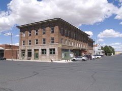 | Almira Hotel | building | 2006 | 06000137 |
| Atlas E Missile Site 9 | site | 2009 | 09000579 | |
| Fort Spokane Military Reserve | district | 1988 | 88002621 | |
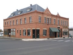 | Harrington Bank Block and Opera House | building | 1992 | 92001288 |
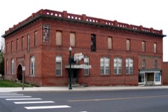 | Lincoln Hotel | building | 2010 | 10001044 |
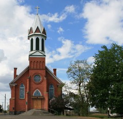 | Mary Queen of Heaven Roman Catholic Church | building | 1990 | 90000675 |
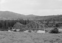 | Spokane River Bridge at Fort Spokane | structure | 1995 | 95000261 |
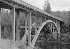 | Spokane River Bridge at Long Lake Dam | structure | 1995 | 95000628 |
Every wildfire the federal occurrence database records inside this county: 383 of them, burning about 270,095 acres. 116 started naturally and 8 were recorded as arson. Each settlement page carries the fires within five miles of it.
| Reported cause | Fires |
|---|---|
| Natural | 116 |
| Missing data/not specified/undetermined | 73 |
| Recreation and ceremony | 49 |
| Debris and open burning | 46 |
| Equipment and vehicle use | 21 |
| Railroad operations and maintenance | 15 |
| Firearms and explosives use | 15 |
| Fireworks | 13 |
| Power generation/transmission/distribution | 12 |
| Arson/incendiarism | 8 |
| Misuse of fire by a minor | 7 |
| Other causes | 5 |
| Smoking | 3 |
The five largest, by the area the report gives. None of them was recorded as arson.
| Date | Cause | Size | Reported by | Name on the report |
|---|---|---|---|---|
| 7 September 2020 | Power generation/transmission/distribution | 127,430 acres | Northeast Region-Department of Natural Resources | WHITNEY |
| 9 September 2012 | Natural | 23,324 acres | Spokane District | APACHE PASS |
| 30 August 1996 | Debris and open burning | 20,080 acres | Spokane District | LINCOLN |
| 18 August 2008 | Missing data/not specified/undetermined | 19,090 acres | Spokane District | SWANSON LAKES |
| 29 July 1998 | Railroad operations and maintenance | 18,120 acres | Spokane District | TOKIO |
| 19 July 2014 | Firearms and explosives use | 10,552 acres | Spokane District | WATERMELON HILL |
| 27 July 2003 | Equipment and vehicle use | 7,209 acres | Spokane District | HATTEN RD |
| 27 July 2005 | Recreation and ceremony | 5,178 acres | Spokane District | WALL LAKE |
Every settlement page carries the fires within five miles of it - see the settlement index below.
The NOAA Storm Events Database holds 81 reports for this county, causing no deaths, 1 injury and about $3,323,830 in recorded property damage. Each settlement page carries the reports that name it.
| Kind of event | Reports |
|---|---|
| Thunderstorm Wind | 27 |
| Tornado | 12 |
| Hail | 11 |
| Flood | 8 |
| Funnel Cloud | 7 |
| Flash Flood | 7 |
| Lightning | 3 |
| Heavy Rain | 3 |
| Wildfire | 2 |
| Debris Flow | 1 |
The most serious of them, by death, then injury, then recorded damage. The accounts are quoted exactly as the forecast office filed them.
| When | Event | Place named | Harm | What the report says |
|---|---|---|---|---|
| April 1972 | Tornado (F3) | not stated | 1 hurt, $250,000 | no account filed |
| March 2017 | Flood | Wells | $800,000 | Lincoln County experienced flooding issues from periodic heavy rain and low elevation snow melt through much of March. The county was included in a State of Emergency declaration due to this flooding. The town of Sprague experienced widespread flooding when Negro Creek overflowed it's banks with most homes and structures in the town experiencing basement, yard and minor first floor flooding. The road into town was cut off by flooding. The National Guard was mobilized to help sandbag. ||The town of Creston also experienced extensive field, basement, road and parking lot flooding. In Edwall a grain elevator collapsed due to saturated soil conditions. |
| April 2017 | Debris Flow | Miles | $800,000 | On April 2nd a hillside along the Porcupine Bay Road near the Porcupine Bay recreation area gave way and cut the road, cutting off access to the campground. Three days later the hillside was still moving. Extensive debris was washed into Lake Roosevelt during this slide. The road remained closed into the month of May and may be closed indefinitely with repair work not able to commence until soil conditions stabilize and careful analysis of further landslide hazard is complete. |
| February 2014 | Flood | Crescent | $600,000 | Numerous areas across Lincoln County dealt with flooding between the 12th and 14th. Some sections of highways that were flooded include SR 23 between mileposts 57 and 60 south of Harrington, SR 231 between mileposts 36 and 42 near Reardon, SR 231 between mileposts 18 and 19 near Edwall, SR 25 between Davenport and Lake Roosevelt, and SR 21 between mileposts 57 and 60 near Harrington. A creek that runs through the middle of the Edwall flooded the Post Office and adjacent businesses with one to two feet of water. Edwall-Reardon school district was forced to delay school openings because buses were struggling to navigate muddy dirt roads. A tech company located on SR 231 reported 30 inches of water flooded its manufacturing facility. Fortunately, the staff was able to get all valuable equipment off the floor before the flood waters entered. |
| May 1997 | Tornado (F1) | Wilbur | $300,000 | top of barn blown off and several outbuildings destroyed in wilbur. tree and irrigation system damage and major damage to large horse barn in creston |
| March 2014 | Flood | Lincoln | $200,000 | Numerous county roads damaged and culverts washed out. State Route 231 was closed from Reardan to the Stevens County line due to flooding over the roadway. State Route 223 was closed from milepost 44 to 66 due to water and mud over the road. A four foot section of a driveway was washed out due to a culvert being overrun by flood waters. Flood waters inundated a culvert resulting in damage to portions of Hawk Creek Ranch Road. Pooling of water was reported in Edwall due to culverts being overwhelmed by flood waters. Damage costs for the event were estimated. |
| May 2020 | Thunderstorm Wind | Mohler | $90,000 | The local fire department responded to approximately 30 power poles down which closed numerous roads and power outages in Mohler, Washington. There was no known damage other than downed power poles. The time of incident is estimated by radar. |
| August 2013 | Thunderstorm Wind | Downs | $80,000 | In the town of Harrington, two large trees were split. One tree was located on the golf course and second on 5th and Sherlock. No damage was noted to the property. Widespread two to four inch branches were scattered on ground around town. The Odessa Agrimet Sensor clocked a peak wind gust of 57 miles per hour. Several trees were downed in Davenport but no property damage was reported. One tree did land on a powerline leading to 29 power outages. A large tree was blown down at the Sherman Cemetary. A greenhouse was destroyed on a property located seven miles north of Reardan. The Spring Canyon RAWS located three miles southeast of Coulee Dam clocked a wind gust of 65 miles per hour. The storm also knocked down multiple trees at the Lakeview Terrace mobile home park. Two mobile homes were damaged. |
| August 2004 | Thunderstorm Wind | Davenport Arpt | $40,000 | no account filed |
| May 2009 | Tornado (EF1) | Davenport | $30,000 | A short-lived tornado from a thunderstorm touched down and caused damage to two structures. It also uprooted and snapped numerous coniferous trees, many with trunk diameters greater than 15 inches. |
| February 1999 | Flash Flood | Wilbur | $20,000 | Snowmelt and heavy rain caused high water levels on many small stream across northern Lincoln County, including Goose Creek. Portions of Highwy 2 were closed and several business were flooded in downtown Creston. |
| July 1998 | Flash Flood | Wilbur | $20,000 | heavy rain lead to flooding in downtown Wilbur with flood drainages full and streets running with water. One inch diameter hail also occurred. |
| June 2009 | Flash Flood | Reardan | $15,000 | no account filed |
| May 2020 | Thunderstorm Wind | Rocklyn | $10,000 | The strong thunderstorm winds in Davenport damaged one home and over 40 poplar trees were uprooted. There were no known injuries. |
| July 1998 | Flash Flood | Reardan | $10,000 | flooding on Highway 231 |
| July 1998 | Thunderstorm Wind | Sprague | $10,000 | power lines down in RV park |
| August 1998 | Wildfire | Davenport | $7,000 | Lightning sparked a small fire on a grassy hillside south of Davenport. Over 70 acres of grass and timber were burned. |
| April 2000 | Thunderstorm Wind | Wilbur | $5,000 | Tree blew down from wind. |
| July 2010 | Heavy Rain | Harrington | $5,000 | no account filed |
| May 2003 | Thunderstorm Wind | Miles | $5,000 | no account filed |
| July 2023 | Thunderstorm Wind | Almira | $3,000 | Multiple reports of crop damage from wind hail and flooding between Hartline and Almira. Hail size varied between half an inch to three quarters an inch. |
| May 2000 | Thunderstorm Wind | Davenport | $3,000 | Thunderstorm winds blew down several power lines near Davenport. |
| May 2006 | Lightning | Davenport | $3,000 | no account filed |
| August 2005 | Thunderstorm Wind | Reardan | $3,000 | no account filed |
| August 1978 | Tornado | not stated | $2,500 | no account filed |
| June 2023 | Thunderstorm Wind | Omans | $2,000 | Outflow gusts from thunderstorms downed power lines south of Davenport. |
| August 2014 | Thunderstorm Wind | Downs | $2,000 | Sustained winds of 30 to 45 mph with gusts to 60 mph knocked down trees in Harrington and produced a wall of dust across Lincoln County. Visibility was reduced below a mile along sections of Highway 2 as the storm moved through. A sensor at the Sevens Bay Marina clocked a wind gust of 59 mph. |
| August 2014 | Thunderstorm Wind | Creston | $2,000 | Trained spotter three miles southwest of Miles estimated winds between fifty and sixty miles per hour. A secondary thunderstorm cell that developed along the gust front produced hail to the size of quarters briefly three miles southwest of Miles. |
| June 2001 | Thunderstorm Wind | Davenport | $2,000 | Trees were blown onto power lines. |
| August 1998 | Wildfire | Davenport | $2,000 | Dry and windy conditions helped fan a wild fire in wheat field. A truck sparked the fire which burned over 1000 acres of farm land and timber. |
| August 2000 | Thunderstorm Wind | Wilbur | $1,000 | An apparent dry microburst descended on a small area south of Wilbur, causing damage in an area about 60 feet wide. An anemometer measured a wind gust to 60 mph and the temperature briefly rose to 84 degrees at 330 AM PDT. A barbecue with its five-gallon propane tank was blown across a yard, and a six-inch tree limb was broken from a tree. |
| March 2019 | Flood | Davenport | $800 | Snow melt caused a portion of State Route 25 to close due to water and blocks of unmelted snow transported by the flooding over the roadway. |
| February 2025 | Flood | Edwall | $500 | Heavy rain and rapid snow melt led to the closing of State Route 231 closed from Interstate 90 to Highway 2 due to flooding. 0.58 inches of rain was reported by a hydromet station in Davenport. |
| May 1957 | Tornado (F0) | not stated | $30 | no account filed |
| February 2025 | Flood | Davenport | - | Water over roadway on SR 25 both directions at milepost 3.5 reported. |
| February 2025 | Flood | Wilbur | - | Local news reported Highway 21 closed north of Wilbur due to flooding. |
| March 2024 | Tornado (EF0) | Rocklyn | - | Spotter confirmed visual evidence of condensation funnel connected to cloud base 2 miles Northwest of Davenport. Radar confirmed an outflow boundary in the area. No damage reported over open wheat country. Time and location estimated. |
| June 2024 | Hail | Wilbur Piper Arpt | - | State crop report recorded penny to quarter size hail damaged crops in the area. Crop damage cost is estimated. |
| July 2023 | Tornado (EF0) | Wilbur | - | Public reported landspout near Wilbur Airport. No damage reported. |
| June 2022 | Funnel Cloud | Rocklyn | - | Cold air funnel cloud reported near Davenport with no damage. |
| May 2019 | Funnel Cloud | Edwall | - | A member of the public photographed a small funnel cloud north of Interstate 90 over uninhabited land in Lincoln County near the border with Spokane County. |
| May 2017 | Funnel Cloud | Sprague | - | A funnel cloud was reported appending from a weak thunderstorm just west of Sprague. |
| June 2015 | Thunderstorm Wind | Reardan | - | Law enforcement reported trees and power lines down on state route 231 between mile post 42 and 45. |
| July 2015 | Heavy Rain | Davenport | - | A CoCoRaHS reported 1.34 inches of rain 15 miles north of Davenport, WA due to numerous showers and thunderstorms. |
| August 2014 | Hail | Rocklyn | - | One inch hail reported by trained spotter in Davenport, WA. |
| August 2014 | Heavy Rain | Rocklyn | - | A small debris flow was observed over Rocklyn Road six miles southwest of Davenport, WA. Rainfall amounts were near one inch. |
| August 2014 | Flash Flood | Creston | - | Water was flowing over the roadway half a mile east of Creston on Miles Creston Road. |
| September 2013 | Thunderstorm Wind | Miles | - | Numerous trees either toppled over or tops snapped off at the Fort Spokane Campground. |
| September 2013 | Thunderstorm Wind | Almira | - | Large tree limb estimated at ten to twelve inches in diameter snapped off. Numerous other three to four inch diameter limbs down across the area. A metal roof was blown off of an enclosure. |
| September 2013 | Thunderstorm Wind | Downs | - | A roof was blown off of a barn approximately eight miles southeast of Harrington. |
| April 2011 | Funnel Cloud | Reardan | - | A brief funnel cloud was observed on the base of a strengthening thunderstorm west of the Spokane WFO. The funnel cloud coincided with the timing of two merging cells. |
| June 2010 | Thunderstorm Wind | Wilbur | - | Several farmers in the area reported wind gusting to approximately 60 miles per hour. |
| June 2009 | Tornado (EF0) | Creston | - | An EF0 tornado formed two miles south of Highway 2 between Wilbur and Creston. This tornado tracked west before dissipating. This was one of four tornadoes that occurred within a 25 minute period in the area. |
| June 2009 | Tornado (EF0) | Creston | - | An EF0 tornado formed two miles south of Highway 2 between Creston and Wilbur. This tornado tracked to the west-southwest before dissipating. This was one of four tornadoes that occurred within a 25 minute period. |
| June 2009 | Tornado (EF0) | Creston | - | An EF0 tornado was observed two miles south of Highway 2 between Creston and Wilbur. This was one of four tornadoes that occurred within a 25 minute period. This tornado tracked west-northwest and stayed just south of Ramsey Road. |
| June 2009 | Tornado (EF0) | Creston | - | An EF0 tornado formed two miles south of Highway 2 between Creston and Wilbur, then tracked northwest before dissipating less than a mile from Highway 2. This tornado was one of four tornadoes observed in a 25 minute period in the area. |
| June 2001 | Flood | Harrington | - | A culvert was washed out on Rodgers Road. |
| July 1998 | Funnel Cloud | Wilbur | - | funnel cloud sighted on the south side of Wilbur. |
| May 1997 | Hail | Wilbur | - | 3/4 inch hail |
| May 1997 | Hail | Davenport | - | 3/4 inch hail |
The Survey's mineral resources record lists 163 workings inside this county. 5 still produce and 158 are closed or unrecorded. Each settlement page carries the workings within five miles of it.
| Commodity | Workings |
|---|---|
| Sand and Gravel, Construction | 95 |
| Stone, Crushed/Broken | 26 |
| Gold | 13 |
| Lead | 7 |
| Copper | 4 |
| Molybdenum | 3 |
| Silver | 3 |
| Molybdenum, Gold, Silver | 2 |
| Uranium | 2 |
| Talc-Soapstone | 2 |
| Aluminum | 2 |
| Molybdenum, Silver | 1 |
| Zinc, Lead, Copper | 1 |
| Silver, Lead | 1 |
The least common of them first, because a county's hundredth gravel pit says nothing its first ten did not.
| Where | Site | Commodity | Status | Recorded |
|---|---|---|---|---|
| Alt Prospect | Tungsten | Prospect | ||
| Crystal City Mining Co | Lead, Copper, Tungsten, Silver | Past Producer | ||
| Crystal Mine | Silver, Lead, Copper, Zinc, Tungsten | Occurrence | 1895 | |
| Egypt | Silica | Occurrence | ||
| Fouress | Silver, Zinc, Lead, Gold, Copper | Past Producer | ||
| Fouress Mine | Molybdenum, Silver, Zinc, Lead, Copper, Uranium | Past Producer | 1902, 1941 | |
| Jurgenson Quarry | Stone, Dimension | Past Producer | ||
| Mondovi | Semiprecious Gemstone | Occurrence | ||
| Old Fort Spokane | Clay | Occurrence | ||
| Old Fort Spokane Area | Dolomite | Prospect | ||
| Silver Queen | Silver, Lead, Copper | Prospect | ||
| Spokane Molybdenum Mine | Molybdenum, Gold, Silver | Past Producer | ||
| State Pit Ps-T-158 | Stone | Past Producer | ||
| Valley View | Zinc, Lead | Past Producer | ||
| C.W. Capps | Talc-Soapstone | Occurrence | ||
| Creston Clay | Aluminum | Occurrence | ||
| Pershell Clay | Aluminum | Unknown | ||
| Spokane | Molybdenum, Gold, Silver | Producer | Molybdenite | |
| Spokane Molybdenum | Molybdenum, Gold, Silver | Occurrence | Vein | |
| Spokane Molybdenum | Molybdenum, Uranium | Occurrence | ||
| Travis Farm | Talc-Soapstone | Occurrence | ||
| Spokane Moly-Spokane River | Molybdenum | Occurrence | ||
| United Workman | Silver, Gold | Prospect | ||
| Heart | Copper | Prospect | ||
| Iron Crown | Gold, Copper | Prospect | ||
| Joseph Matherly | Copper | Unknown | ||
| Lincoln | Copper, Lead | Occurrence | ||
| Egypt | Lead | Prospect | ||
| Elkhorn | Lead | Prospect | ||
| John L. | Lead | Prospect | ||
| Matherly Lead Prospect | Lead | Prospect | ||
| Barnell Placer | Gold | Occurrence | Placer | |
| China Bar Placer | Gold | Occurrence | Placer | |
| China Bar Placer | Gold | Past Producer | ||
| Clark Placer | Gold | Occurrence | Placer | |
| Creston Ferry Placer | Gold | Past Producer | ||
| Davenport Placer | Gold | Occurrence | ||
| Keller Ferry Placer | Gold | Occurrence | Placer | |
| Keller Ferry Placer | Gold | Past Producer | ||
| Latta and Phillips Placer | Gold | Prospect | ||
| Peach Bar Placer | Gold | Prospect | ||
| Winkelman Bar Placer | Gold | Prospect | ||
| Alm Quarry | Stone, Crushed/Broken | Past Producer | ||
| Beib Quarry | Stone, Crushed/Broken | Past Producer | ||
| Bonthius Quarry | Stone, Crushed/Broken | Past Producer | ||
| Brown Quarry | Stone, Crushed/Broken | Past Producer | ||
| Gale Quarry | Stone, Crushed/Broken | Past Producer | ||
| Gravel Pit | Stone, Crushed/Broken | Past Producer | ||
| Gravel Pit | Stone, Crushed/Broken | Producer | ||
| Kramer Quarry | Stone, Crushed/Broken | Past Producer | ||
| Lauritzen Quarry | Stone, Crushed/Broken | Past Producer | ||
| Llewellyn Quarry | Stone, Crushed/Broken | Past Producer | ||
| Mangis Quarry | Stone, Crushed/Broken | Past Producer | ||
| Mcdade Quarry | Stone, Crushed/Broken | Past Producer | ||
| Miller Quarry | Stone, Crushed/Broken | Past Producer | ||
| Pebles Quarry | Stone, Crushed/Broken | Past Producer | ||
| Pit No. Qst-174 | Stone, Crushed/Broken | Producer | ||
| Pit Site No. Ps-T-98 | Stone, Crushed/Broken | Past Producer | ||
| Rockstool Quarry | Stone, Crushed/Broken | Past Producer | ||
| Roth Rock Quarry | Stone, Crushed/Broken | Past Producer | ||
| Unnamed Quarry | Stone, Crushed/Broken | Past Producer | ||
| Unnamed Quarry | Stone, Crushed/Broken | Past Producer | ||
| Unnamed Quarry | Stone, Crushed/Broken | Past Producer | ||
| Unnamed Quarry | Stone, Crushed/Broken | Past Producer | ||
| Unnamed Quarry | Stone, Crushed/Broken | Past Producer | ||
| Unnamed Quarry | Stone, Crushed/Broken | Past Producer | ||
| Unnnamed Quarry | Stone, Crushed/Broken | Past Producer | ||
| Wilson Quarry | Stone, Crushed/Broken | Past Producer | ||
| Almira Pit | Sand and Gravel, Construction | Past Producer | ||
| Anderson Pit | Sand and Gravel, Construction | Past Producer | ||
| Borrow Pit | Sand and Gravel, Construction | Past Producer | ||
| Burke Pit | Sand and Gravel, Construction | Past Producer | ||
| Campbell Pit | Sand and Gravel, Construction | Past Producer | ||
| Davenport Pit | Sand and Gravel, Construction | Past Producer | ||
| Dept of Highways | Sand and Gravel, Construction | Past Producer | ||
| Doggett Pitt | Sand and Gravel, Construction | Past Producer | ||
| Govan Pit | Sand and Gravel, Construction | Past Producer | ||
| Gravel Pit | Sand and Gravel, Construction | Past Producer | ||
| Gravel Pit | Sand and Gravel, Construction | Past Producer | ||
| Gravel Pit | Sand and Gravel, Construction | Past Producer | ||
| Gravel Pit | Sand and Gravel, Construction | Past Producer | ||
| Gravel Pit | Sand and Gravel, Construction | Past Producer | ||
| Gravel Pit | Sand and Gravel, Construction | Past Producer | ||
| Gravel Pit Tment | Sand and Gravel, Construction | Past Producer | ||
| Hall Pit | Sand and Gravel, Construction | Past Producer | ||
| Hallapeter Pit | Sand and Gravel, Construction | Past Producer | ||
| Hammersmith Pit | Sand and Gravel, Construction | Past Producer | ||
| Harrington Quarry | Sand and Gravel, Construction | Producer | ||
| L. Campbell Pit | Sand and Gravel, Construction | Past Producer | ||
| Lawton Pit | Sand and Gravel, Construction | Past Producer | ||
| Loughbon Pit | Sand and Gravel, Construction | Past Producer | ||
| Miller Pit | Sand and Gravel, Construction | Past Producer | ||
| Minard Pit | Sand and Gravel, Construction | Past Producer | ||
| Nichols Pit | Sand and Gravel, Construction | Past Producer | ||
| Phillips Pit | Sand and Gravel, Construction | Past Producer | ||
| Ramm Pit | Sand and Gravel, Construction | Past Producer | ||
| Riddle Pit | Sand and Gravel, Construction | Past Producer | ||
| Roby Pit | Sand and Gravel, Construction | Past Producer | ||
| Rocklyn Pit | Sand and Gravel, Construction | Past Producer | ||
| Rothrock Pit | Sand and Gravel, Construction | Past Producer | ||
| Sand Pit | Sand and Gravel, Construction | Past Producer | ||
| Scheiber Pit | Sand and Gravel, Construction | Past Producer | ||
| Smith Pit | Sand and Gravel, Construction | Past Producer | ||
| Smith Pit | Sand and Gravel, Construction | Past Producer | ||
| Sprague Pit | Sand and Gravel, Construction | Past Producer | ||
| State Pit Lco-Gp-292 | Sand and Gravel, Construction | Past Producer | ||
| State Pit Ps-T-214 | Sand and Gravel, Construction | Producer | ||
| State Pit Qs-T-196 | Sand and Gravel, Construction | Past Producer | ||
| Underwood Pit | Sand and Gravel, Construction | Past Producer | ||
| Unnamed Pit | Sand and Gravel, Construction | Past Producer | ||
| Unnamed Pit | Sand and Gravel, Construction | Past Producer | ||
| Unnamed Pit | Sand and Gravel, Construction | Past Producer | ||
| Unnamed Pit | Sand and Gravel, Construction | Past Producer | ||
| Unnamed Pit | Sand and Gravel, Construction | Past Producer | ||
| Unnamed Pit | Sand and Gravel, Construction | Past Producer | ||
| Unnamed Pit | Sand and Gravel, Construction | Past Producer | ||
| Unnamed Pit | Sand and Gravel, Construction | Past Producer | ||
| Unnamed Pit | Sand and Gravel, Construction | Past Producer | ||
| Unnamed Pit | Sand and Gravel, Construction | Past Producer | ||
| Unnamed Pit | Sand and Gravel, Construction | Past Producer | ||
| Unnamed Pit | Sand and Gravel, Construction | Past Producer | ||
| Unnamed Pit | Sand and Gravel, Construction | Past Producer | ||
| Unnamed Pit | Sand and Gravel, Construction | Past Producer | ||
| Unnamed Pit | Sand and Gravel, Construction | Past Producer | ||
| Unnamed Pit | Sand and Gravel, Construction | Past Producer | ||
| Unnamed Pit | Sand and Gravel, Construction | Past Producer | ||
| Unnamed Pit | Sand and Gravel, Construction | Past Producer | ||
| Unnamed Pit | Sand and Gravel, Construction | Past Producer | ||
| Unnamed Pit | Sand and Gravel, Construction | Past Producer | ||
| Unnamed Pit | Sand and Gravel, Construction | Past Producer | ||
| Unnamed Pit | Sand and Gravel, Construction | Past Producer | ||
| Unnamed Pit | Sand and Gravel, Construction | Past Producer | ||
| Unnamed Pit | Sand and Gravel, Construction | Past Producer | ||
| Unnamed Pit | Sand and Gravel, Construction | Past Producer | ||
| Unnamed Pit | Sand and Gravel, Construction | Past Producer | ||
| Unnamed Pit | Sand and Gravel, Construction | Past Producer | ||
| Unnamed Pit | Sand and Gravel, Construction | Past Producer | ||
| Unnamed Pit | Sand and Gravel, Construction | Past Producer | ||
| Unnamed Pit | Sand and Gravel, Construction | Past Producer | ||
| Unnamed Pit | Sand and Gravel, Construction | Past Producer | ||
| Unnamed Pit | Sand and Gravel, Construction | Past Producer | ||
| Unnamed Pit | Sand and Gravel, Construction | Past Producer | ||
| Unnamed Pit | Sand and Gravel, Construction | Past Producer | ||
| Unnamed Pit | Sand and Gravel, Construction | Past Producer | ||
| Unnamed Pit | Sand and Gravel, Construction | Past Producer | ||
| Unnamed Pit | Sand and Gravel, Construction | Past Producer | ||
| Unnamed Pit | Sand and Gravel, Construction | Past Producer | ||
| Unnamed Pit | Sand and Gravel, Construction | Past Producer | ||
| Unnamed Pit | Sand and Gravel, Construction | Past Producer | ||
| Unnamed Pit | Sand and Gravel, Construction | Past Producer | ||
| Unnamed Pit | Sand and Gravel, Construction | Past Producer | ||
| Unnamed Pit | Sand and Gravel, Construction | Past Producer | ||
| Unnamed Pit | Sand and Gravel, Construction | Past Producer | ||
| Unnamed Pit | Sand and Gravel, Construction | Past Producer | ||
| Unnamed Pit | Sand and Gravel, Construction | Past Producer | ||
| Unnamed Pit | Sand and Gravel, Construction | Past Producer | ||
| Unnamed Pit | Sand and Gravel, Construction | Past Producer | ||
| Unnamed Pit | Sand and Gravel, Construction | Past Producer | ||
| Unnamed Pit | Sand and Gravel, Construction | Past Producer | ||
| Unnamed Pit L | Sand and Gravel, Construction | Past Producer | ||
| Unnamed Pit El | Sand and Gravel, Construction | Past Producer | ||
| Unnamed Pit Ravel | Sand and Gravel, Construction | Past Producer | ||
| Wilbur Pit | Sand and Gravel, Construction | Past Producer |
Named settlements recorded in the Geographic Names Information System, each with the topographic sheets covering it. Villages, hamlets and abandoned places alike. Each is shown with the nearest named watercourse or landform and the survey quadrangle it falls on.
Wilbur census division · 99103 · Jack Woods Butte quadrangle
16 sheets, 1948 to 1989
Odessa census division · 99008 · On Bluestem Creek · Sprague Lake NE quadrangle
7 sheets, 1953 to 1982
Wilbur census division · 99117 · On Creston Butte · Creston quadrangle
11 sheets, 1948 to 1989
Davenport census division · 99008 · Near Hanning Butte · Edwall quadrangle
9 sheets, 1945 to 1987
Davenport census division · 99122 · On Spokane River · Fort Spokane quadrangle
12 sheets, 1948 to 1985
Wilbur census division · 99147 · On Welsh Creek · Lincoln quadrangle
12 sheets, 1948 to 1985
Davenport census division · 99013 · On Spring Creek · Little Falls quadrangle
10 sheets, 1944 to 1987
Wilbur census division · 99185 · Near Sage Hen Draw · Creston quadrangle
11 sheets, 1948 to 1989
Odessa census division · 99122 · Near Pleasant Valley · Edwall quadrangle
9 sheets, 1945 to 1987