 Block
From the record
16 National Register listings published here.
Sources: the National Register database, National Park Service
90 topographic sheets cover 44 settlements here, and 16 properties are on the National Register of Historic Places.
16 National Register listings published here.
Sources: the National Register database, National Park Service
Every property in this county listed on the National Register of Historic Places, with the year it was listed and the federal nomination document.
| Photograph | Property | Type | Listed | Reference |
|---|---|---|---|---|
| Cushman Hydroelectric Project Historic District | district | 2015 | 14001244 | |
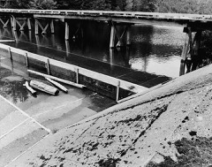 | Cushman No. 1 Hydroelectric Power Plant | district | 1988 | 88002759 |
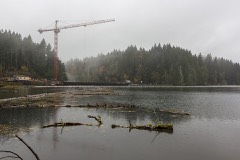 | Cushman No. 2 Hydroelectric Power Plant | district | 1988 | 88002757 |
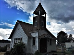 | Ebenezer Congregational Church | building | 2018 | 100002940 |
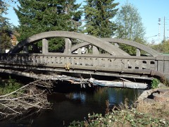 | Goldsborough Creek Bridge | structure | 1982 | 82004264 |
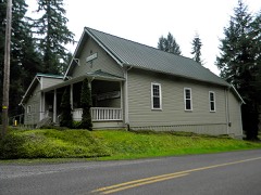 | Harstine Island Community Hall | building | 1989 | 89000212 |
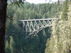 | High Steel Bridge | structure | 1982 | 82004265 |
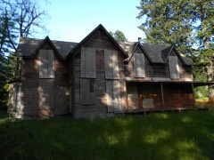 | Malaney-O'Neill House | building | 2013 | 12001222 |
 | Mason County Courthouse | building | 2013 | 12001160 |
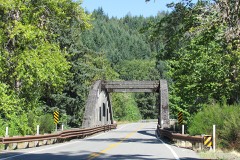 | North Hamma Hamma River Bridge | structure | 1982 | 82004262 |
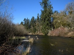 | Schafer State Park | district | 2010 | 10000255 |
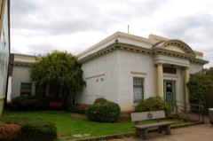 | Shelton Public Library and Town Hall | building | 1983 | 83003348 |
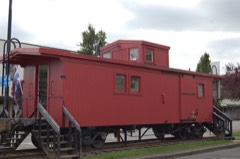 | Simpson Logging Company Locomotive No. 7 and Peninsular Railway Caboose No. 700 | structure | 1984 | 84003532 |
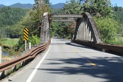 | South Hamma Hamma River Bridge | structure | 1982 | 82004263 |
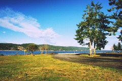 | Twanoh State Park | district | 2014 | 14000614 |
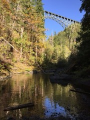 | Vance Creek Bridge | structure | 1982 | 82004266 |
Every wildfire the federal occurrence database records inside this county: 1,035 of them, burning about 7,154 acres. 55 started naturally and 87 were recorded as arson. Each settlement page carries the fires within five miles of it.
| Reported cause | Fires |
|---|---|
| Missing data/not specified/undetermined | 318 |
| Debris and open burning | 196 |
| Recreation and ceremony | 169 |
| Arson/incendiarism | 87 |
| Fireworks | 62 |
| Natural | 55 |
| Smoking | 40 |
| Equipment and vehicle use | 38 |
| Misuse of fire by a minor | 37 |
| Power generation/transmission/distribution | 18 |
| Other causes | 12 |
| Railroad operations and maintenance | 3 |
The five largest, by the area the report gives. One of them was set deliberately.
| Date | Cause | Size | Reported by | Name on the report |
|---|---|---|---|---|
| 4 August 2018 | Equipment and vehicle use | 3,312 acres | Olympic National Forest | MAPLE |
| 25 July 2006 | Fireworks | 1,100 acres | Olympic National Forest | BEAR GULCH II |
| 19 May 1997 | Debris and open burning | 594 acres | Washington State Department of Natural Resources Headquarters | not named |
| 4 October 2012 | Arson/incendiarism | 229 acres | Washington State Department of Natural Resources Headquarters | POWERLINE #2 |
| 11 August 2014 | Missing data/not specified/undetermined | 185 acres | Washington State Department of Natural Resources Headquarters | HAVEN LAKE |
| 31 July 2015 | Missing data/not specified/undetermined | 107 acres | Washington State Department of Natural Resources Headquarters | DECKERVILLE |
| 26 September 1993 | Equipment and vehicle use | 104 acres | Washington State Department of Natural Resources Headquarters | not named |
| 15 August 2010 | Missing data/not specified/undetermined | 84 acres | Washington State Department of Natural Resources Headquarters | RICHERT RD |
Every settlement page carries the fires within five miles of it - see the settlement index below.
The NOAA Storm Events Database holds 17 reports for this county, causing 1 death, 1 injury and about $18,047,600 in recorded property damage. Each settlement page carries the reports that name it.
| Kind of event | Reports |
|---|---|
| Heavy Rain | 8 |
| Flood | 5 |
| Lightning | 2 |
| Hail | 1 |
| Tornado | 1 |
The most serious of them, by death, then injury, then recorded damage. The accounts are quoted exactly as the forecast office filed them.
| When | Event | Place named | Harm | What the report says |
|---|---|---|---|---|
| December 2007 | Flood | Potlatch | 1 killed, $12,000 | The Skokomish at Potlatch reach a record flood stage of 18.12 feet. Two bridges were washed away, one over the Tahuya River and one over Finch creek. All schools in the county were closed monday. Several roads were closed and a few people were evacuated from their homes. A man was swept away in the Tahuya river. |
| September 2013 | Lightning | (Shn)Sanderson Fld S | 1 hurt, $2,000 | A man was struck by lightning near Shelton. Another bolt struck a tree that then spread into a nearby apartment. |
| March 1999 | Heavy Rain | Lilliwaup | $10,200,000 | no account filed |
| March 1999 | Heavy Rain | Hoodsport | $5,000,000 | no account filed |
| January 2009 | Flood | Shelton | $900,000 | There was flooding along the Skokomish River. Several homes in Shelton flooded, most from local creeks. Several roads in the area were also flooded, including SR 106 and 108. |
| December 2010 | Flood | Skokomish River Near Potlatch | $700,000 | All of highway 106 in Mason county was closed due to flooding and mudslides. A foot bridge in the Tahuya State Forest was closed after floods washed out the concrete entry. Several homes were reported flooded in Mason county. |
| January 2006 | Heavy Rain | Countywide | $700,000 | no account filed |
| October 2003 | Heavy Rain | Countywide | $300,000 | no account filed |
| October 2019 | Tornado (EF1) | Bay Shr | $150,000 | Between approximately 6:02 - 6:07 PM on the evening of October 18, a tornado touched down near Shelton in Mason County, Washington and traveled approximately 0.68 miles before moving over the water of Pickering Passage and dissipating as a waterspout. The first video evidence and reports from area fire officials prompted the NWS to send a damage survey team to the area during the afternoon of October 19, 2019. Preliminary evaluation of the damage by the team concluded that the tornado reached an EF-1 rating. The damage path was up to 90 yards in width and the tornado was estimated to be on the ground for approximately 5 minutes.||Fortunately, no injuries were reported with this tornado. Most of the damage was in the form of uprooted or snapped soft wood fir and cedar trees. Falling trees did impact at least two houses along the damage path, including one house that had two trees fall on the roof. |
| July 1997 | Lightning | Belfair | $70,000 | Lightning started a fire which destroyed a garage. |
| January 2021 | Flood | Skokomish River Near Potlatch | $8,160 | The Skokomish River went above flood stage December 31st, 2020 and stayed above flood stage until January 7, closing roads and cutting off access to the valley. I was above moderate flood at times everyday from January 2nd and the 6th. Urban and small stream flooding occurred as well. |
| January 2021 | Flood | Matlock | $5,440 | The Skokomish River exceeded moderate flood stage. Urban and small stream flooding occurred as well. |
| February 2025 | Heavy Rain | Lilliwaup | - | Heavy rainfall of 4.68 inches was recorded at Jefferson Creek, WA. |
| August 2001 | Heavy Rain | Countywide | - | no account filed |
| November 2001 | Heavy Rain | Countywide | - | no account filed |
| April 1996 | Heavy Rain | Hoodsport | - | no account filed |
| October 1985 | Hail | not stated | - | no account filed |
The Survey's mineral resources record lists 105 workings inside this county. 6 still produce and 99 are closed or unrecorded. Each settlement page carries the workings within five miles of it.
| Commodity | Workings |
|---|---|
| Sand and Gravel, Construction | 58 |
| Manganese | 31 |
| Stone, Crushed/Broken | 7 |
| Iron | 6 |
| Copper | 4 |
| Phosphorus-Phosphates | 2 |
| Limestone, General | 2 |
| Manganese, Copper | 1 |
| Zinc, Magnesite, Cobalt, Nickel, Silver | 1 |
| Manganese, Silver, Nickel, Magnesite, Copper | 1 |
| Manganese, Iron | 1 |
| Silica, Manganese, Iron, Calcium | 1 |
| Magnesite | 1 |
| Manganese, Silver, Nickel, Copper | 1 |
The least common of them first, because a county's hundredth gravel pit says nothing its first ten did not.
| Where | Site | Commodity | Status | Recorded |
|---|---|---|---|---|
| Apex Prospect | Silica, Manganese, Iron, Calcium | Prospect | 1940 | |
| Black and White | Manganese, Silver, Nickel, Magnesite, Copper | Occurrence | Bementite, Chalcocite, Copper, Cuprite, Malachite, Rhodochrosite, Rhodonite | |
| Black and White Mine | Manganese, Copper, Zinc, Magnesite, Cobalt, Nickel, Silver | Past Producer | Bementite, Chalcocite, Copper, Cuprite, Malachite, Rhodochrosite, Rhodonite | |
| Black and White Mine | Manganese, Silver, Nickel, Copper | Past Producer | 1918 | |
| Discovery Prospect | Magnesite, Copper | Prospect | ||
| Maple Creek Prospect | Barium-Barite, Manganese | Occurrence | ||
| Triple Trip | Manganese, Iron | Occurrence | Bementite | |
| India Claim | Manganese, Iron, Phosphorus-Phosphates | Occurrence | Replacement | |
| Lake Cushman Limestone Deposit | Limestone, General | Occurrence | ||
| Russian No. 1 Claim | Manganese, Iron, Phosphorus-Phosphates | Occurrence | Replacement | |
| Staircase Deposit | Limestone, General | Occurrence | ||
| Arkansas Traveler | Manganese, Copper | Occurrence | Bementite | |
| Black Tail | Copper | Occurrence | Chalcopyrite | |
| Black Tail | Copper | Unknown | ||
| Apex | Manganese, Iron | Occurrence | Bementite, Rhodochrosite | |
| Bosnia Claim | Manganese, Iron | Occurrence | Replacement | |
| McKean Claim | Manganese, Iron | Past Producer | 1918 | |
| Triple Trip Prospect | Manganese, Iron | Past Producer | 1910, 1918 | |
| Cdc Rock Quarry | Stone, Crushed/Broken | Past Producer | ||
| One Two Five Zero Road Quarry | Stone, Crushed/Broken | Past Producer | ||
| Panhandle Lake Quarry | Stone, Crushed/Broken | Past Producer | ||
| Quarry 249-7.0 | Stone, Crushed/Broken | Past Producer | ||
| Tuff Quarry | Stone, Crushed/Broken, Sand and Gravel, Construction | Past Producer | ||
| Unnamed Quarry | Stone, Crushed/Broken | Past Producer | ||
| Unnamed Quarry | Stone, Crushed/Broken | Past Producer | ||
| Arkansas Traveler | Manganese | Unknown | ||
| Black Hump | Manganese | Occurrence | Bementite | |
| Black Hump | Manganese | Past Producer | 1924 | |
| Black Hump Claim | Manganese | Past Producer | 1924 | |
| Black Queen | Manganese | Prospect | 1942 | |
| Black Queen Claims | Manganese | Occurrence | Replacement | |
| Brown Mule Prospect | Manganese | Past Producer | 1916 | |
| Hi Hope | Manganese | Prospect | 1942 | |
| Hi Hope Claims | Manganese | Occurrence | Replacement | |
| Jolly Jack | Manganese | Prospect | 1951 | |
| Jolly Jack Group | Manganese | Occurrence | Replacement | |
| Lucky Jack | Manganese | Unknown | ||
| McKean | Manganese | Past Producer | ||
| Old Crow | Manganese | Unknown | 1951 | |
| Old Crow Claim | Manganese | Occurrence | Replacement | |
| Rose Aster | Manganese | Prospect | ||
| Rose Aster Claim | Manganese | Occurrence | Replacement | |
| Russian No. 1 | Manganese | Unknown | 1956 | |
| Smith | Manganese | Unknown | 1956 | |
| Smith Claim | Manganese | Occurrence | Replacement | |
| Steel Creek Prospect | Manganese | Prospect | 1956 | |
| Widow | Manganese | Unknown | 1951 | |
| Widow Claim | Manganese | Occurrence | Replacement | |
| Bay Shore Pit | Sand and Gravel, Construction | Producer | ||
| Bear Creek Pit | Sand and Gravel, Construction | Producer | ||
| Beekman Pit | Sand and Gravel, Construction | Past Producer | ||
| Belair North Shore Pit | Sand and Gravel, Construction | Past Producer | ||
| Borrow Pit | Sand and Gravel, Construction | Past Producer | ||
| Borrow Pit | Sand and Gravel, Construction | Past Producer | ||
| Borrow Pit | Sand and Gravel, Construction | Past Producer | ||
| Borrow Pit | Sand and Gravel, Construction | Past Producer | ||
| Canal Premix Pit and Plant | Sand and Gravel, Construction | Producer | ||
| Cascade Tracts | Sand and Gravel, Construction | Past Producer | ||
| Central Shop Pit | Sand and Gravel, Construction | Past Producer | ||
| Evergreen Materials | Sand and Gravel, Construction | Producer | ||
| Gravel Pit | Sand and Gravel, Construction | Past Producer | ||
| Gravel Pit | Sand and Gravel, Construction | Past Producer | ||
| Gravel Pit | Sand and Gravel, Construction | Past Producer | ||
| Gravel Pit | Sand and Gravel, Construction | Past Producer | ||
| Gravel Pit | Sand and Gravel, Construction | Past Producer | ||
| Graves Pit | Sand and Gravel, Construction | Past Producer | ||
| Institution Pit | Sand and Gravel, Construction | Past Producer | ||
| Lake Isabella Pit | Sand and Gravel, Construction | Past Producer | ||
| Lost Lake Pit | Sand and Gravel, Construction | Past Producer | ||
| Mason County Landfill Pit | Sand and Gravel, Construction | Past Producer | ||
| Mason Pit | Sand and Gravel, Construction | Producer | ||
| Matlock Area Silica Sand | Sand and Gravel, Construction | Occurrence | ||
| Matlock Area Silica Sand | Sand and Gravel, Construction | Occurrence | ||
| Miller Pit | Sand and Gravel, Construction | Past Producer | ||
| Overton Pit | Sand and Gravel, Construction | Past Producer | ||
| Palmer Pit | Sand and Gravel, Construction | Past Producer | ||
| Pit 245-7.5 | Sand and Gravel, Construction | Producer | ||
| Pope & Talbot Pit | Sand and Gravel, Construction | Past Producer | ||
| Stewart | Sand and Gravel, Construction | Past Producer | ||
| Unnamed Pit | Sand and Gravel, Construction | Past Producer | ||
| Unnamed Pit | Sand and Gravel, Construction | Past Producer | ||
| Unnamed Pit | Sand and Gravel, Construction | Past Producer | ||
| Unnamed Pit | Sand and Gravel, Construction | Past Producer | ||
| Unnamed Pit | Sand and Gravel, Construction | Past Producer | ||
| Unnamed Pit | Sand and Gravel, Construction | Past Producer | ||
| Unnamed Pit | Sand and Gravel, Construction | Past Producer | ||
| Unnamed Pit | Sand and Gravel, Construction | Past Producer | ||
| Unnamed Pit | Sand and Gravel, Construction | Past Producer | ||
| Unnamed Pit | Sand and Gravel, Construction | Past Producer | ||
| Unnamed Pit | Sand and Gravel, Construction | Past Producer | ||
| Unnamed Pit | Sand and Gravel, Construction | Past Producer | ||
| Unnamed Pit | Sand and Gravel, Construction | Past Producer | ||
| Unnamed Pit | Sand and Gravel, Construction | Past Producer | ||
| Unnamed Pit | Sand and Gravel, Construction | Past Producer | ||
| Unnamed Pit | Sand and Gravel, Construction | Past Producer | ||
| Unnamed Pit | Sand and Gravel, Construction | Past Producer | ||
| Unnamed Pit | Sand and Gravel, Construction | Past Producer | ||
| Unnamed Pit | Sand and Gravel, Construction | Past Producer | ||
| Unnamed Pit | Sand and Gravel, Construction | Past Producer | ||
| Unnamed Pit | Sand and Gravel, Construction | Past Producer | ||
| Unnamed Pit | Sand and Gravel, Construction | Past Producer | ||
| Unnamed Pit | Sand and Gravel, Construction | Past Producer | ||
| Unnamed Pit | Sand and Gravel, Construction | Past Producer | ||
| Unnamed Quarry | Sand and Gravel, Construction | Past Producer | ||
| Will Pit | Sand and Gravel, Construction | Past Producer |
Named settlements recorded in the Geographic Names Information System, each with the topographic sheets covering it. Villages, hamlets and abandoned places alike. Each is shown with the nearest named watercourse or landform and the survey quadrangle it falls on.
Timber Lake-Harstine Island census division · 98584 · On Campbell Creek · Shelton quadrangle
10 sheets, 1939 to 1988
Union-Grapeview census division · 98524 · On Sherwood Creek · Belfair quadrangle
13 sheets, 1938 to 1999
Shelton census division · 98584 · Near Hope Island · Squaxin Island quadrangle
16 sheets, 1937 to 1997
West Mason census division · 98555 · On Jorsted Creek · Eldon quadrangle
15 sheets, 1938 to 1988
Timber Lake-Harstine Island census division · 98584 · Near McMicken Island · Longbranch quadrangle
15 sheets, 1937 to 1997
Shelton census division · 98584 · On Johns Creek · Shelton quadrangle
10 sheets, 1939 to 1988
Belfair-Tahuya census division · 98528 · On Irene Creek · Belfair quadrangle
13 sheets, 1938 to 1999
Union-Grapeview census division · 98584 · Skokomish Valley quadrangle
11 sheets, 1943 to 1988
Shelton census division · 98584 · On Goldsborough Creek · Shelton quadrangle
10 sheets, 1939 to 1988
West Mason census division · 98584 · Near Little Egypt Valley · Shelton Valley quadrangle
8 sheets, 1939 to 1988
Union-Grapeview census division · 98524 · Near Reach Island · Vaughn quadrangle
13 sheets, 1938 to 1991
No longer a settlement
Belfair-Tahuya census division · 98588 · On Dewatto River · Lilliwaup quadrangle
10 sheets, 1943 to 1988
West Mason census division · 98555 · On Hamma Hamma River · Eldon quadrangle
15 sheets, 1938 to 1988
Union-Grapeview census division · 98524 · Near Reach Island · Vaughn quadrangle
13 sheets, 1938 to 1991
Kamilche census division · 98584 · Near Little Skookum Valley · Kamilche Valley quadrangle
9 sheets, 1939 to 1988
Union-Grapeview census division · 98528 · Lake Wooten quadrangle
14 sheets, 1938 to 1999
West Mason census division · 98541 · On Rabbit Creek · Matlock quadrangle
9 sheets, 1943 to 1988
Timber Lake-Harstine Island census division · 98584 · On Jones Creek · Squaxin Island quadrangle
16 sheets, 1937 to 1997
Timber Lake-Harstine Island census division · 98584 · On Jones Creek · Mason Lake quadrangle
14 sheets, 1938 to 1997
Union-Grapeview census division · 98546 · Near Stretch Island · Vaughn quadrangle
13 sheets, 1938 to 1991
West Mason census division · 98555 · On Jorsted Creek · Eldon quadrangle
15 sheets, 1938 to 1988
Timber Lake-Harstine Island census division · 98584 · On Jarrell Creek · Mason Lake quadrangle
14 sheets, 1938 to 1997
West Mason census division · 98548 · On Finch Creek · Hoodsport quadrangle
10 sheets, 1943 to 1988
Kamilche census division · 98584 · On Little Skookum Creek · Shelton quadrangle
10 sheets, 1939 to 1988
West Mason census division · 98555 · On Lilliwaup Creek · Lilliwaup quadrangle
10 sheets, 1943 to 1988
Union-Grapeview census division · 98546 · On Schumacher Creek · Mason Lake quadrangle
14 sheets, 1938 to 1997
Kamilche census division · 98584 · Near Little Skookum Valley · Kamilche Valley quadrangle
9 sheets, 1939 to 1988
West Mason census division · 98541 · On Dry Creek · Matlock quadrangle
9 sheets, 1943 to 1988
West Mason census division · 98584 · On North Fork Skokomish River · Skokomish Valley quadrangle
11 sheets, 1943 to 1988
Kamilche census division · 98584 · On Kennedy Creek · Summit Lake quadrangle
10 sheets, 1939 to 1988
Shelton census division · 98584 · Near Johns Prairie · Shelton quadrangle
10 sheets, 1939 to 1988
West Mason census division · 98584 · On No Name Creek · Hoodsport quadrangle
10 sheets, 1943 to 1988
Union-Grapeview census division · 98528 · On Little Mission Creek · Belfair quadrangle
13 sheets, 1938 to 1999
Shelton census division · 98584 · On Shelton Creek · Shelton quadrangle
10 sheets, 1939 to 1988
Skokomish Reservation census division · 98584 · In Skokomish Valley · Skokomish Valley quadrangle
11 sheets, 1943 to 1988
Belfair-Tahuya census division · 98528 · On Stimson Creek · Lake Wooten quadrangle
14 sheets, 1938 to 1999
Union-Grapeview census division · 98528 · On Stimson Creek · Lake Wooten quadrangle
14 sheets, 1938 to 1999
Belfair-Tahuya census division · 98588 · On Tahuya River · Union quadrangle
10 sheets, 1943 to 1988
Union-Grapeview census division · 98592 · Near Skokomish Flats · Union quadrangle
10 sheets, 1943 to 1988
Union-Grapeview census division · 98528 · On Sherwood Creek · Belfair quadrangle
13 sheets, 1938 to 1999
Timber Lake-Harstine Island census division · 98546 · On Hiawata Creek · Mason Lake quadrangle
14 sheets, 1938 to 1997
The vanished settlements of Mason County: the places named above that are no longer on the map.