 Block
From the record
20 National Register listings published here, 1 of them a National Historic Landmark.
Sources: the National Register database, National Park Service
117 topographic sheets cover 60 settlements here, and 20 properties are on the National Register of Historic Places.
20 National Register listings published here, 1 of them a National Historic Landmark.
Sources: the National Register database, National Park Service
Every property in this county listed on the National Register of Historic Places, with the year it was listed and the federal nomination document.
| Photograph | Property | Type | Listed | Reference |
|---|---|---|---|---|
| Cape Disappointment Historic District | district | 1975 | 75001864 | |
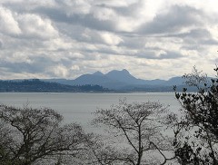 | Chinook Point | site | 1966 | 66000747 |
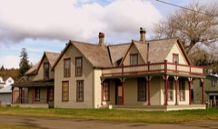 | Colbert House | building | 1977 | 77001347 |
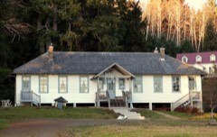 | Columbia River Quarantine Station | building | 1980 | 80004007 |
| Fort Columbia | district | 2025 | 100011981 | |
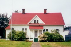 | Klipsan Beach Life Saving Station | building | 1979 | 79002546 |
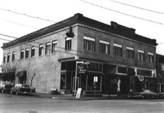 | Lumber Exchange Building | building | 1988 | 88000604 |
| Oysterville Historic District | district | 1976 | 76001898 | |
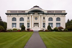 | Pacific County Courthouse | building | 1977 | 77001348 |
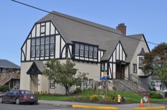 | Raymond Public Library | building | 1979 | 79002548 |
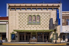 | Raymond Theater | building | 1991 | 91000540 |
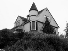 | Russell House | building | 1977 | 77001349 |
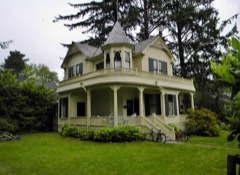 | Peter Schulderman House | building | 1988 | 88000597 |
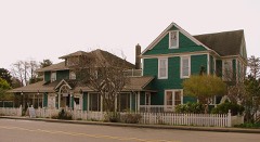 | Shelburne Hotel | building | 1978 | 78002765 |
| Shogren Cottage | building | 2019 | 100002409 | |
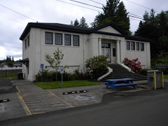 | South Bend Carnegie Public Library | building | 1982 | 82004269 |
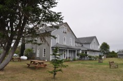 | Tokeland Hotel | building | 1978 | 78002766 |
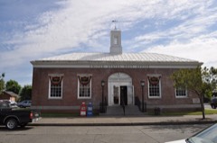 | US Post Office-Raymond Main | building | 1991 | 91000654 |
| Willapa Bay Boathouse | building | 1986 | 86000358 | |
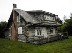 | Wreckage, The | building | 1979 | 79002547 |
Every wildfire the federal occurrence database records inside this county: 317 of them, burning about 1,372 acres. 16 started naturally and 23 were recorded as arson. Each settlement page carries the fires within five miles of it.
| Reported cause | Fires |
|---|---|
| Debris and open burning | 92 |
| Recreation and ceremony | 55 |
| Missing data/not specified/undetermined | 53 |
| Fireworks | 35 |
| Arson/incendiarism | 23 |
| Smoking | 16 |
| Natural | 16 |
| Equipment and vehicle use | 16 |
| Misuse of fire by a minor | 10 |
| Power generation/transmission/distribution | 1 |
The five largest, by the area the report gives. None of them was recorded as arson.
| Date | Cause | Size | Reported by | Name on the report |
|---|---|---|---|---|
| 11 September 2014 | Missing data/not specified/undetermined | 127 acres | Washington State Department of Natural Resources Headquarters | FORK PEAK |
| 23 November 2013 | Missing data/not specified/undetermined | 119 acres | Pacific Cascade Region-DNR | CHINOOK VALLEY |
| 4 July 2013 | Fireworks | 110 acres | Washington State Department of Natural Resources Headquarters | INDEPENDENCE |
| 20 October 1998 | Debris and open burning | 102 acres | Washington State Department of Natural Resources Headquarters | not named |
| 27 November 2015 | Missing data/not specified/undetermined | 100 acres | Pacific Cascade Region-DNR | COHO |
| 22 June 1992 | Equipment and vehicle use | 98 acres | Washington State Department of Natural Resources Headquarters | not named |
| 12 November 2014 | Debris and open burning | 85 acres | Washington State Department of Natural Resources Headquarters | BEAR RIVER |
| 8 July 2006 | Natural | 51 acres | Willapa National Wildlife Refuge Complex | GRASS ISLAND |
Every settlement page carries the fires within five miles of it - see the settlement index below.
The NOAA Storm Events Database holds 27 reports for this county, causing no deaths, no injuries and about $11,017,000 in recorded property damage. Each settlement page carries the reports that name it.
| Kind of event | Reports |
|---|---|
| Flood | 12 |
| Heavy Rain | 6 |
| Tornado | 3 |
| Thunderstorm Wind | 3 |
| Funnel Cloud | 1 |
| Wildfire | 1 |
| Hail | 1 |
The most serious of them, by death, then injury, then recorded damage. The accounts are quoted exactly as the forecast office filed them.
| When | Event | Place named | Harm | What the report says |
|---|---|---|---|---|
| December 2007 | Flood | Willapa | $10,000,000 | The Willapa River flooded near Willapa, reaching major flood levels. Downtown Raymond had a depth of 2 feet of flood water due to a combination of coastal flooding and flooding of the Willapa. Residents in the Willapa valley stated they had never seen the Willapa river as high as it was. Also, minor flooding of the Naselle river sent some water over Hwy. 401. NOTE: Damage estimates are for the entire Pacific county. |
| January 2022 | Flood | Lebam | $990,000 | The gauge on the Willapa River near Willapa rose above flood stage of 21.0 feet at 1620PST, crested at 23.3 feet on the 7th at 0345PST (major flood stage is 24.0 feet), then dropped below flood stage on the 7th at 1750PST. As a result, 33 homes have significant damage (combined river and coastal flooding.) Two people were sheltered. Also landslides preventing road entries into the county including five slides on SR 105. |
| December 1990 | Tornado (F0) | not stated | $25,000 | no account filed |
| September 1997 | Funnel Cloud | Oysterville | $2,000 | A funnel cloud moved across Oysterville but did not touch down. However, it damaged a mobile home as it passed overhead. |
| December 2023 | Flood | Willapa | - | The Willapa River at Willapa rose reached minor flood stage during a period of 1 and half hours, cresting at 21.03 feet at 315 pm on December 5th. |
| January 2022 | Flood | Naselle | - | The gauge on the Naselle River near Naselle rose above flood stage of 15.0 feet on the 6th, crested at 18.3 feet at 2000PST. This is above major flood stage of 17.0 feet. The river then dropped below flood stage on the 7th at 1130PST. |
| January 2021 | Flood | Willapa | - | The Willapa River at Willapa (WILW1) reached flood stage at 0345PST, crested at 21.2 feet then dropped below flood stage at 0800PST on January 3rd. Flood stage is 21.0 feet. |
| March 2021 | Tornado (EF0) | Ilwaco Arpt | - | A tornado occurred in Ilwaco, Washington just north of the Port of Ilwaco Airport. The tornado began near the intersection of Redwing Way and Captain Gray Drive around 1904PST, tracked northeast across a housing subdivision, crossed the Wallacut River before dissipating near the intersection of Chinook Valley Road and U.S. Highway 101 around 1908PST. The tornado track was about one-third of a mile long and 60 yards wide. There was minor damage to trees, fences, windows, shingles, and other unsecured attachments to structures along the path (DI 2, DOD 2). |
| September 2020 | Heavy Rain | Oceanside | - | Over 1.25 inches of rainfall. |
| January 2018 | Thunderstorm Wind | Ilwaco | - | Weather station on Cape Disappointment recorded wind gusts up to 67 mph. |
| October 2016 | Thunderstorm Wind | Ilwaco | - | Thunderstorms produced strong winds on and off through the morning, with the strongest gust of 63 mph at Cape Disappointment. |
| January 2015 | Flood | Naselle | - | The Naselle River near Naselle reached flood stage of 15.5 feet at 410 AM on January 5th. The river crested at the major flood stage of 17 feet around 745 AM before dropping below flood stage at 1150 AM. |
| November 2015 | Flood | Willapa | - | Five day rainfall totals ending in the morning of Nov 17th in the Willapa Hills were 8 to 12 inches. This rain resulted in the Willapa River to exceed flood stage around 11 pm on the 17th. The River crested at 21.12 feet which is 1.1 feet above flood stage. |
| November 2014 | Hail | Naselle | - | A Pacific County Sheriff officer took photos of very large hail that fell near the Naselle-Grays River School District Office. The size of the hail was estimated to have a 1.25 inch diameter. |
| November 2012 | Flood | Raymond | - | Heavy rain caused the Willapa River near Willapa to overflow its banks and flood low lying areas. The Willapa River crested at 23.9 feet on November 19th at 9 pm PST, 2.9 feet above flood stage. |
| December 2010 | Thunderstorm Wind | Long Beach | - | Gusty winds were reported at Long Beach, Washington with a peak gust of 55 kts. |
| January 2009 | Heavy Rain | Raymond | - | Heavy rain resulted the closure of highway 6 outside of Raymond due to high water. |
| January 2009 | Flood | Naselle | - | Heavy rain caused the Naselle River to overflow its banks and cause significant flooding. The Naselle River crested at a flood of record of 20.8 ft. |
| January 2009 | Flood | Willapa | - | Heavy rain combined with snowmelt runoff caused the Willapa River to overflow its banks. |
| January 2009 | Heavy Rain | Naselle | - | Heavy rain caused localized flooding in the community of Naselle. Several structures were flooded and many people forced to evacuate thier homes and businesses. |
| October 1998 | Wildfire | Naselle | - | A slash fire near Naselle Washington got out of control and burned 100 acres before fire crews and cooler weather checked the fire. The 100 acre Bear Fire was west of Washington Highway 401 about 6 miles from Naselle. The glow of the fire was visible at night as far away as Astoria, Oregon. |
| January 2006 | Flood | Willapa | - | no account filed |
| January 2006 | Flood | Willapa | - | no account filed |
| January 2003 | Heavy Rain | Countywide | - | no account filed |
| March 2003 | Heavy Rain | Countywide | - | no account filed |
| August 2001 | Heavy Rain | Countywide | - | no account filed |
| June 1991 | Tornado (F0) | not stated | - | no account filed |
The Survey's mineral resources record lists 76 workings inside this county. 4 still produce and 72 are closed or unrecorded. Each settlement page carries the workings within five miles of it.
| Commodity | Workings |
|---|---|
| Stone, Crushed/Broken | 29 |
| Sand and Gravel, Construction | 25 |
| Limestone, General | 4 |
| Gold | 3 |
| Stone | 3 |
| Iron | 3 |
| Titanium, Iron | 2 |
| Clay | 2 |
| Gold, Chromium, Zirconium, Titanium, Metal, Iron, Platinum | 1 |
| Platinum, Gold, Iron, Titanium, Metal, Zirconium | 1 |
| Platinum, Iron, Zirconium, Titanium, Metal | 1 |
| Iron, Platinum, Titanium, Metal, Zirconium | 1 |
| Lead | 1 |
| Gemstone | 1 |
The least common of them first, because a county's hundredth gravel pit says nothing its first ten did not.
| Where | Site | Commodity | Status | Recorded |
|---|---|---|---|---|
| Bear River | Gemstone | Occurrence | ||
| Beards Hollow Placer | Iron, Platinum, Titanium, Metal, Zirconium | Occurrence | Beach Placer | |
| Beards Hollow Placer | Platinum, Zirconium, Titanium, Iron | Occurrence | ||
| Chinook Black Sands | Titanium, Iron | Occurrence | ||
| Fort Canby | Gold, Platinum, Iron, Zirconium, Titanium, Metal | Occurrence | Beach Placer | |
| Leadbetter Point | Gold, Chromium, Zirconium, Titanium, Metal, Iron, Platinum | Occurrence | Beach Placer | |
| Mc Gowan Placer | Iron, Titanium, Zirconium | Prospect | ||
| Mc Gowan Querry | Flagstone | Past Producer | ||
| Nahcotta | Platinum, Gold, Iron, Titanium, Metal, Zirconium | Occurrence | Beach Placer | |
| Naselle | Lead | Occurrence | ||
| Fort Canby Placer | Gold, Titanium, Iron | Prospect | ||
| Ocean Park Placer | Gold, Titanium, Iron | Occurrence | ||
| South Bend | Clay | Past Producer | ||
| Willapa No. 2 | Clay | Occurrence | ||
| Chetlo Harbor | Iron | Occurrence | ||
| D-4 Quarry | Stone | Past Producer | ||
| Gravel Pit | Stone | Past Producer | ||
| Salmon Creek Pit | Stone | Past Producer | ||
| Bear River | Limestone, General | Past Producer | ||
| Bear River | Limestone, General | Past Producer | ||
| Knappton | Limestone, General | Past Producer | ||
| Menlo | Limestone, General | Occurrence | ||
| Fender | Sand and Gravel, Construction | Occurrence | ||
| Holcomb Pit | Sand and Gravel, Construction | Past Producer | ||
| Londalen Pit | Sand and Gravel, Construction | Past Producer | ||
| Long Beach | Sand and Gravel, Construction | Occurrence | ||
| Megler | Sand and Gravel, Construction | Occurrence | ||
| Nahcotta Pit | Sand and Gravel, Construction | Past Producer | ||
| Naselle River | Sand and Gravel, Construction | Occurrence | ||
| Newart Pit | Sand and Gravel, Construction | Past Producer | ||
| Palix River Pit | Sand and Gravel, Construction | Past Producer | ||
| Unnamed Pit | Sand and Gravel, Construction | Past Producer | ||
| Unnamed Pit | Sand and Gravel, Construction | Past Producer | ||
| Unnamed Pit | Sand and Gravel, Construction | Past Producer | ||
| Unnamed Pit | Sand and Gravel, Construction | Past Producer | ||
| Unnamed Pit | Sand and Gravel, Construction | Past Producer | ||
| Unnamed Pit | Sand and Gravel, Construction | Past Producer | ||
| Unnamed Pit | Sand and Gravel, Construction | Past Producer | ||
| Unnamed Pit | Sand and Gravel, Construction | Past Producer | ||
| Unnamed Pit | Sand and Gravel, Construction | Past Producer | ||
| Unnamed Pit | Sand and Gravel, Construction | Past Producer | ||
| Unnamed Pit | Sand and Gravel, Construction | Past Producer | ||
| Unnamed Pit | Sand and Gravel, Construction | Past Producer | ||
| Unnamed Pit | Sand and Gravel, Construction | Past Producer | ||
| Unnamed Pit Ands | Sand and Gravel, Construction | Past Producer | ||
| Unnamed Pit Ing Co | Sand and Gravel, Construction | Past Producer | ||
| Willapa Harbor | Sand and Gravel, Construction | Occurrence | ||
| Bear River Quarry No. 1 | Stone, Crushed/Broken | Past Producer | ||
| Bear River Quarry No. 2 | Stone, Crushed/Broken | Past Producer | ||
| Chinook Quarry | Stone, Crushed/Broken | Producer | ||
| City of South Bend Quarry | Stone, Crushed/Broken | Producer | ||
| Falls Creek Quarry | Stone, Crushed/Broken | Past Producer | ||
| Grays River 7000 Pit | Stone, Crushed/Broken | Past Producer | ||
| Half Moon Creek Quarry | Stone, Crushed/Broken | Past Producer | ||
| Johnson Quarry | Stone, Crushed/Broken | Producer | ||
| Lane Creek Quarry | Stone, Crushed/Broken | Past Producer | ||
| N. Willapa River Quarry | Stone, Crushed/Broken | Past Producer | ||
| Nallpee Quarry | Stone, Crushed/Broken | Past Producer | ||
| Naselle River Quarry | Stone, Crushed/Broken | Past Producer | ||
| O'Conner Creek Quarry | Stone, Crushed/Broken | Past Producer | ||
| O'Meara Quarry | Stone, Crushed/Broken | Past Producer | ||
| Pluvius Quarry | Stone, Crushed/Broken | Past Producer | ||
| Provo Quarry | Stone, Crushed/Broken | Past Producer | ||
| South Bend Quarry | Stone, Crushed/Broken | Past Producer | ||
| Templin Quarry | Stone, Crushed/Broken | Past Producer | ||
| Templin Quarry | Stone, Crushed/Broken | Producer | ||
| Twin Harbors Lumber Co Quarry | Stone, Crushed/Broken | Past Producer | ||
| Unnamed Quarry | Stone, Crushed/Broken | Past Producer | ||
| Unnamed Quarry | Stone, Crushed/Broken | Past Producer | ||
| Unnamed Quarry | Stone, Crushed/Broken | Past Producer | ||
| Unnamed Quarry | Stone, Crushed/Broken | Past Producer | ||
| Unnamed Quarry | Stone, Crushed/Broken | Past Producer | ||
| Unnamed Quarry | Stone, Crushed/Broken | Past Producer | ||
| Unnamed Quarry | Stone, Crushed/Broken | Past Producer | ||
| Unnamed Quarry | Stone, Crushed/Broken | Past Producer | ||
| Unnamed Quarry | Stone, Crushed/Broken | Past Producer |
Named settlements recorded in the Geographic Names Information System, each with the topographic sheets covering it. Villages, hamlets and abandoned places alike. Each is shown with the nearest named watercourse or landform and the survey quadrangle it falls on.
Raymond census division · 98527 · On Palix River · Bay Center quadrangle
14 sheets, 1938 to 1992
Raymond census division · 98527 · On South Fork Palix River · Nemah quadrangle
15 sheets, 1938 to 1992
Willapa Valley census division · 98577 · On Brush Creek · Dean Creek quadrangle
14 sheets, 1941 to 1992
Long Beach-North Beach Peninsula census division · 98631 · Cape Disappointment quadrangle
11 sheets, 1938 to 1980
Raymond census division · 98537 · On Fall River · Brooklyn quadrangle
14 sheets, 1940 to 1992
Raymond census division · 98586 · On Hansen Creek · Bay Center quadrangle
14 sheets, 1938 to 1992
Willapa Valley census division · 98577 · On Brush Creek · Dean Creek quadrangle
14 sheets, 1941 to 1992
Willapa Valley census division · 98577 · On Fourth Creek · Dean Creek quadrangle
14 sheets, 1941 to 1992
Raymond census division · 98590 · On Kindred Slough · North Cove quadrangle
12 sheets, 1938 to 1989
Raymond census division · 98577 · Near Willapa Valley · Raymond quadrangle
13 sheets, 1953 to 1992
Willapa Valley census division · 98577 · On Little Elk Creek · Dean Creek quadrangle
14 sheets, 1941 to 1992
Long Beach-North Beach Peninsula census division · 98624 · Near Ruby Island · Cape Disappointment quadrangle
11 sheets, 1938 to 1980
Willapa Valley census division · 98577 · Near Elk Prairie · Lebam quadrangle
13 sheets, 1953 to 1992
Naselle census division · 98638 · On Frank Born Creek · Knappton quadrangle
17 sheets, 1938 to 1981
Willapa Valley census division · 98577 · On Penny Creek · Lebam quadrangle
13 sheets, 1953 to 1992
Raymond census division · 98547 · On Seastrand Creek · Grayland quadrangle
11 sheets, 1941 to 1989
Long Beach-North Beach Peninsula census division · 98640 · On Stackpole Slough · Oysterville quadrangle
11 sheets, 1938 to 1989
Willapa Valley census division · 98577 · On Oxbow Creek · Lebam quadrangle
13 sheets, 1953 to 1992
Long Beach-North Beach Peninsula census division · 98644 · Cape Disappointment quadrangle
11 sheets, 1938 to 1980
Long Beach-North Beach Peninsula census division · 98624 · On Wallacut River · Cape Disappointment quadrangle
11 sheets, 1938 to 1980
Long Beach-North Beach Peninsula census division · 98640 · Ocean Park quadrangle
10 sheets, 1938 to 1980
Long Beach-North Beach Peninsula census division · 98640 · Ocean Park quadrangle
10 sheets, 1938 to 1980
Naselle census division · 98638 · Near Bear Mountain · Knappton quadrangle
17 sheets, 1938 to 1981
Willapa Valley census division · 98577 · On Half Moon Creek · Lebam quadrangle
13 sheets, 1953 to 1992
Long Beach-North Beach Peninsula census division · 98631 · Cape Disappointment quadrangle
11 sheets, 1938 to 1980
Long Beach-North Beach Peninsula census division · 98631 · Ocean Park quadrangle
10 sheets, 1938 to 1980
Naselle census division · 98614 · Near Scarboro Hill · Warrenton quadrangle
18 sheets, 1919 to 1996
Willapa Valley census division · 98577 · On West Fork Rue Creek · Menlo quadrangle
12 sheets, 1953 to 1992
Naselle census division · 98586 · On Middle Nemah River · Long Island quadrangle
15 sheets, 1938 to 1981
Long Beach-North Beach Peninsula census division · 98631 · Cape Disappointment quadrangle
11 sheets, 1938 to 1980
Long Beach-North Beach Peninsula census division · 98640 · On Pauls Slough · Ocean Park quadrangle
10 sheets, 1938 to 1980
Willapa Valley census division · 98577 · On Trap Creek · Lebam quadrangle
13 sheets, 1953 to 1992
Naselle census division · 98638 · On South Naselle River · Knappton quadrangle
17 sheets, 1938 to 1981
Naselle census division · 98586 · On North Nemah River · Nemah quadrangle
15 sheets, 1938 to 1992
Raymond census division · 98586 · Near Nemah Flats · Nemah quadrangle
15 sheets, 1938 to 1992
Naselle census division · 98586 · On Williams Creek · North Nemah quadrangle
15 sheets, 1938 to 1992
Long Beach-North Beach Peninsula census division · 98640 · On Pauls Slough · Ocean Park quadrangle
10 sheets, 1938 to 1980
Long Beach-North Beach Peninsula census division · 98631 · Ocean Park quadrangle
10 sheets, 1938 to 1980
Long Beach-North Beach Peninsula census division · 98644 · Cape Disappointment quadrangle
11 sheets, 1938 to 1980
Long Beach-North Beach Peninsula census division · 98640 · Oysterville quadrangle
11 sheets, 1938 to 1989
Long Beach-North Beach Peninsula census division · 98624 · Near Ruby Island · Cape Disappointment quadrangle
11 sheets, 1938 to 1980
No longer a settlement
Willapa Valley census division · 98577 · On Pluvius Hill · Pluvius quadrangle
14 sheets, 1941 to 1992
Raymond census division · 98577 · On South Fork Willapa River · Raymond quadrangle
13 sheets, 1953 to 1992
Raymond census division · 98586 · On Potter Slough · South Bend quadrangle
15 sheets, 1938 to 1992
No longer a settlement
Raymond census division · 98586 · Nemah quadrangle
15 sheets, 1938 to 1992
No longer a settlement
Long Beach-North Beach Peninsula census division · 98644 · Cape Disappointment quadrangle
11 sheets, 1938 to 1980
Naselle census division · 98624 · On Chinook River · Chinook quadrangle
17 sheets, 1938 to 1984
Willapa Valley census division · 98577 · On Brown Creek · East of Raymond quadrangle
13 sheets, 1953 to 1994
Willapa Valley census division · 98577 · On Swem Creek · Dean Creek quadrangle
14 sheets, 1941 to 1992
Raymond census division · 98590 · On Kindred Slough · Bay Center quadrangle
14 sheets, 1938 to 1992
Raymond census division · 98547 · On Norris Slough · Bay Center quadrangle
14 sheets, 1938 to 1992
Willapa Valley census division · 98577 · On Ward Creek · Raymond quadrangle
13 sheets, 1953 to 1992
The vanished settlements of Pacific County: the places named above that are no longer on the map.