 Block
From the record
21 National Register listings published here, 1 of them a National Historic Landmark.
Sources: the National Register database, National Park Service
49 topographic sheets cover 27 settlements here, and 21 properties are on the National Register of Historic Places.
21 National Register listings published here, 1 of them a National Historic Landmark.
Sources: the National Register database, National Park Service
Every property in this county listed on the National Register of Historic Places, with the year it was listed and the federal nomination document.
| Photograph | Property | Type | Listed | Reference |
|---|---|---|---|---|
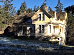 | Alderbrook Farmhouse | building | 1985 | 85002919 |
| American and English Camps, San Juan Island | district | 1966 | 09000465 | |
| Center School | building | 2022 | 100007711 | |
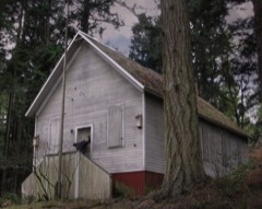 | Crow Valley School | building | 1987 | 87001457 |
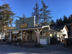 | Doe Bay General Store and Post Office | building | 1986 | 86001017 |
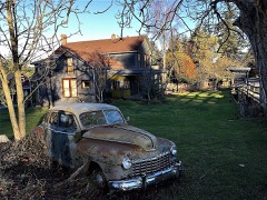 | Michael and Myra Donohue House | building | 2013 | 12001161 |
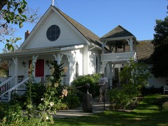 | Emmanuel Episcopal Church | building | 1994 | 94001431 |
| Krumdiack Homestead | district | 1993 | 93000367 | |
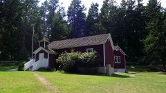 | Little Red Schoolhouse | building | 1973 | 73001886 |
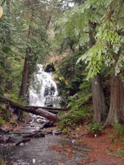 | Moran State Park | district | 2013 | 12001140 |
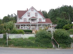 | Orcas Hotel | building | 1982 | 82004284 |
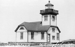 | Patos Island Light Station | structure | 1977 | 77001355 |
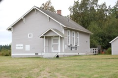 | Port Stanley School | building | 1994 | 94001437 |
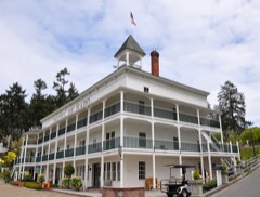 | Roche Harbor | district | 1977 | 77001356 |
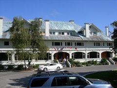 | Rosario | building | 1978 | 78002772 |
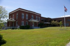 | San Juan County Courthouse | building | 1984 | 84003603 |
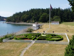 | San Juan Island National Historic Site | district | 1966 | 66000369 |
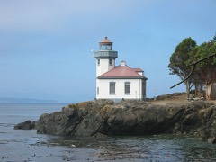 | San Juan Island, Lime Kiln Light Station | site | 1978 | 78002771 |
| San Juan Lime Company-Cowell's | district | 2007 | 07000136 | |
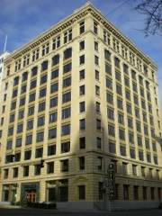 | Tacoma Building | building | 2001 | 01001162 |
| Tharald Homestead | district | 2002 | 01001473 |
Every wildfire the federal occurrence database records inside this county: 192 of them, burning about 104 acres. 7 started naturally and none was recorded as arson. Each settlement page carries the fires within five miles of it.
| Reported cause | Fires |
|---|---|
| Recreation and ceremony | 65 |
| Debris and open burning | 42 |
| Missing data/not specified/undetermined | 23 |
| Fireworks | 21 |
| Smoking | 12 |
| Equipment and vehicle use | 11 |
| Natural | 7 |
| Misuse of fire by a minor | 7 |
| Other causes | 2 |
| Firearms and explosives use | 1 |
| Power generation/transmission/distribution | 1 |
The five largest, by the area the report gives. None of them was recorded as arson.
| Date | Cause | Size | Reported by | Name on the report |
|---|---|---|---|---|
| 7 October 2002 | Debris and open burning | 10 acres | Olympic National Park | SAJH AMERI |
| 15 July 2018 | Firearms and explosives use | 6.7 acres | San Juan Island National Historical Park | AMERICAN CAMP |
| 25 July 2010 | Missing data/not specified/undetermined | 5.2 acres | Washington State Department of Natural Resources Headquarters | BAKERS BLUFF - STELLITE IS |
| 7 August 1998 | Equipment and vehicle use | 4.0 acres | Washington State Department of Natural Resources Headquarters | not named |
| 11 August 1997 | Debris and open burning | 3.5 acres | Washington State Department of Natural Resources Headquarters | not named |
| 3 August 1998 | Recreation and ceremony | 3.5 acres | Washington State Department of Natural Resources Headquarters | not named |
| 10 June 2009 | Debris and open burning | 3.5 acres | Washington State Department of Natural Resources Headquarters | BOBBY ANNE |
| 19 August 2002 | Equipment and vehicle use | 2.5 acres | Washington State Department of Natural Resources Headquarters | not named |
Every settlement page carries the fires within five miles of it - see the settlement index below.
The NOAA Storm Events Database holds 5 reports for this county, causing no deaths, no injuries and about $510,000 in recorded property damage. Each settlement page carries the reports that name it.
| Kind of event | Reports |
|---|---|
| Heavy Rain | 2 |
| Thunderstorm Wind | 1 |
| Funnel Cloud | 1 |
| Flood | 1 |
The most serious of them, by death, then injury, then recorded damage. The accounts are quoted exactly as the forecast office filed them.
| When | Event | Place named | Harm | What the report says |
|---|---|---|---|---|
| November 2021 | Flood | Deer Harbor | $475,000 | Heavy rain cause urban and small stream flooding, washing out some roads. |
| June 2004 | Thunderstorm Wind | Orcas | $25,000 | Thunderstorm winds blew a tree into a cabin, knocking down a wall and damaging parts of the interior. |
| September 2015 | Heavy Rain | Friday Harbor | $10,000 | The rain culminated in a rushing torrent of water down the sidewalks and pooling on First Street. Cars were up to their bumpers in water, and about five inches of rain water pooled in Kings Market, which had to close temporarily in order to remove the water. |
| December 2012 | Funnel Cloud | Friday Harbor | - | An unconfirmed funnel cloud lasting less than a minute was spotted on the west side of San Juan Island. |
| August 2001 | Heavy Rain | Countywide | - | no account filed |
The Survey's mineral resources record lists 77 workings inside this county. 1 still produces and 76 are closed or unrecorded. Each settlement page carries the workings within five miles of it.
| Commodity | Workings |
|---|---|
| Limestone, General | 53 |
| Sand and Gravel, Construction | 14 |
| Stone, Crushed/Broken | 4 |
| Flagstone | 3 |
| Feldspar | 1 |
| Limestone, General, Stone, Crushed/Broken | 1 |
| Clay | 1 |
| Kyanite | 1 |
| Limestone, Dimension | 1 |
The least common of them first, because a county's hundredth gravel pit says nothing its first ten did not.
| Where | Site | Commodity | Status | Recorded |
|---|---|---|---|---|
| Blakely Island | Kyanite | Occurrence | ||
| Deer Harbor Feldspar Deposit | Feldspar | Occurrence | ||
| Mcgraw-Kittinger Deposit | Limestone, General, Stone, Crushed/Broken | Past Producer | ||
| Orcas Island | Clay | Past Producer | ||
| Roche Harbor Quarries | Stone, Crushed/Broken, Limestone, Dimension | Past Producer | ||
| Alaska Barge Co. Quarry | Flagstone, Stone, Crushed/Broken | Past Producer | ||
| Reid Harbor Quarries | Flagstone | Past Producer | ||
| Sucia Island Quarries | Flagstone | Past Producer | ||
| Humphrey Head Quarry | Stone, Crushed/Broken | Past Producer | ||
| North Beach Quarry | Stone, Crushed/Broken | Prospect | ||
| Erismann Pit | Sand and Gravel, Construction | Past Producer | ||
| Friday Harbor Pit | Sand and Gravel, Construction | Past Producer | ||
| Lopez Redi-Mix Pit and Plant | Sand and Gravel, Construction | Past Producer | ||
| Lopez Sand and Gravel Pit | Sand and Gravel, Construction | Past Producer | ||
| Lopez Sand and Gravel Pit | Sand and Gravel, Construction | Past Producer | ||
| Sea Island Pit | Sand and Gravel, Construction | Producer | ||
| Shoal Bay Pit No. 2 | Sand and Gravel, Construction | Past Producer | ||
| Unnamed Pit | Sand and Gravel, Construction | Past Producer | ||
| Unnamed Pit | Sand and Gravel, Construction | Past Producer | ||
| Unnamed Pit | Sand and Gravel, Construction | Past Producer | ||
| Unnamed Pit | Sand and Gravel, Construction | Past Producer | ||
| Unnamed Pit | Sand and Gravel, Construction | Past Producer | ||
| Unnamed Quarry | Sand and Gravel, Construction | Past Producer | ||
| Unnamed [Ot | Sand and Gravel, Construction | Past Producer | ||
| Biendle Deposit | Limestone, General | Occurrence | ||
| Buck Mountain Deposit No. 1 | Limestone, General | Past Producer | ||
| Caldwell Point Deposit | Limestone, General | Occurrence | ||
| Camp Indralaya Deposit | Limestone, General | Occurrence | ||
| Chuckanut Lime Co. Quarry | Limestone, General | Past Producer | ||
| Cliff Island Deposit | Limestone, General | Past Producer | ||
| Cowell Quarry | Limestone, General | Past Producer | ||
| Crane Island Deposit | Limestone, General | Occurrence | ||
| Davison Head Deposit | Limestone, General | Occurrence | ||
| Deadman Bay Deposits | Limestone, General | Occurrence | ||
| Double Hill Deposit No. 1 | Limestone, General | Occurrence | ||
| Englehartson Deposit | Limestone, General | Occurrence | ||
| English Camp Deposit | Limestone, General | Prospect | ||
| Entrance Mountain Deposit | Limestone, General | Occurrence | ||
| Eureka Deposit | Limestone, General | Past Producer | ||
| Flaherty Deposit No. 1 | Limestone, General | Occurrence | ||
| Four Winds Deposit | Limestone, General | Occurrence | ||
| Fowler Deposit No. 1 | Limestone, General | Occurrence | ||
| Hannah Area Outcrop A | Limestone, General | Occurrence | ||
| Hannah Area Outcrop B | Limestone, General | Occurrence | ||
| Henry Island Deposit No. 1 | Limestone, General | Past Producer | ||
| Imperial Lime Co. Quarry | Limestone, General | Past Producer | ||
| Johnson Quarries | Limestone, General | Past Producer | ||
| Jones Island Depsoit No. 1 | Limestone, General | Occurrence | ||
| Judd Cove Deposit | Limestone, General | Occurrence | ||
| Kellett Bluff Deposit | Limestone, General | Occurrence | ||
| Krumdick | Limestone, General | Past Producer | ||
| Langdon Deposit South Part | Limestone, General | Past Producer | ||
| Langell Deposit | Limestone, General | Occurrence | ||
| Lawson Cave Deposit | Limestone, General | Occurrence | ||
| Limestone Point Quarry | Limestone, General | Past Producer | ||
| Mitchell Bay Quarry | Limestone, General | Past Producer | ||
| Moran State Park Deposit | Limestone, General | Occurrence | ||
| Mount Dallas Deposits | Limestone, General | Occurrence | ||
| Newhall | Limestone, General | Occurrence | ||
| O'Neal Island | Limestone, General | Occurrence | ||
| Olga Deposit | Limestone, General | Occurrence | ||
| Open Bay Deposit | Limestone, General | Occurrence | ||
| Payton | Limestone, General | Past Producer | ||
| Pineo Deposits No. 1 and 2 | Limestone, General | Past Producer | ||
| Raccoon Point Deposit | Limestone, General | Occurrence | ||
| Red Cross Quarry | Limestone, General | Past Producer | ||
| Rosario Deposit | Limestone, General | Occurrence | ||
| Rouleau | Limestone, General | Occurrence | ||
| Rulo | Limestone, General | Occurrence | ||
| Rusch Deposit No. 1 | Limestone, General | Occurrence | ||
| Soderberg Quarries | Limestone, General | Past Producer | ||
| Welch Deposit | Limestone, General | Occurrence | ||
| West Sound Quarries | Limestone, General | Past Producer | ||
| Wilson Quarry | Limestone, General | Past Producer | ||
| Wright Deposit | Limestone, General | Occurrence | ||
| Yansen Deposit | Limestone, General | Occurrence | ||
| Young Hill East Deposit | Limestone, General | Occurrence |
Named settlements recorded in the Geographic Names Information System, each with the topographic sheets covering it. Villages, hamlets and abandoned places alike. Each is shown with the nearest named watercourse or landform and the survey quadrangle it falls on.
San Juan Island census division · 98250 · Near Dinner Island · Friday Harbor quadrangle
10 sheets, 1954 to 1981
Orcas census division · 98245 · Near Freeman Island · Eastsound quadrangle
12 sheets, 1943 to 1997
Orcas census division · 98245 · Near Buck Mountain · Mount Constitution quadrangle
12 sheets, 1943 to 1978
Orcas census division · 98245 · Near Freeman Island · Eastsound quadrangle
12 sheets, 1943 to 1997
Lopez census division · 98221 · On Decatur Island · Blakely Island quadrangle
13 sheets, 1943 to 1997
Orcas census division · 98243 · Near Fawn Island · Shaw Island quadrangle
11 sheets, 1943 to 1975
Orcas census division · 98279 · Near Doe Island · Mount Constitution quadrangle
12 sheets, 1943 to 1978
Orcas census division · 98245 · Near Mount Woolard · Eastsound quadrangle
12 sheets, 1943 to 1997
Orcas census division · 98245 · Near Double Hill · Eastsound quadrangle
12 sheets, 1943 to 1997
San Juan Island census division · 98250 · Near Brown Island · Friday Harbor quadrangle
10 sheets, 1954 to 1981
Lopez census division · 98261 · Near Crab Island · Lopez Pass quadrangle
12 sheets, 1943 to 1998
Orcas census division · 98279 · On Cascade Creek · Blakely Island quadrangle
13 sheets, 1943 to 1997
Orcas census division · 98280 · Near Oak Island · Shaw Island quadrangle
11 sheets, 1943 to 1975
Lopez census division · 98261 · Near Flower Island · Blakely Island quadrangle
13 sheets, 1943 to 1997
San Juan Island census division · 98250 · Near Lofgren Mountain · Stuart Island quadrangle
8 sheets, 1953 to 1981
Lopez census division · 98261 · On Richardson Rock · Richardson quadrangle
12 sheets, 1943 to 1998
San Juan Island census division · 98250 · Near Pearl Island · Roche Harbor quadrangle
10 sheets, 1954 to 1981
Orcas census division · 98245 · On Rosario Hill · Mount Constitution quadrangle
12 sheets, 1943 to 1997
Orcas census division · 98279 · Near North Peapod · Mount Constitution quadrangle
12 sheets, 1943 to 1978
Lopez census division · 98286 · Near Blind Island · Shaw Island quadrangle
11 sheets, 1943 to 1975
Lopez census division · 98222 · By Bald Bluff · Blakely Island quadrangle
13 sheets, 1943 to 1997
Orcas census division · 98297 · Near Disney Mountain · Waldron Island quadrangle
11 sheets, 1954 to 1997
Orcas census division · 98245 · Near Freeman Island · Eastsound quadrangle
12 sheets, 1943 to 1997
Orcas census division · 98245 · Near Crow Valley · Eastsound quadrangle
12 sheets, 1943 to 1997
San Juan Island census division · 98250 · Near Guss Island · Roche Harbor quadrangle
10 sheets, 1954 to 1981