 Block
Okanogan, Washington
12 topographic sheets cover this place, the earliest surveyed in 1905 and the latest in 1983. It stands in the Okanogan census division. It lies in ZIP code area 98840. It stands on Salmon Creek. The Survey maps it on the Okanogan quadrangle. 2,379 people lived here at the 2020 count. It stands 840 feet above sea level.
On record in Okanogan
Buildings and businesses the archive holds for this place. Each opens its own page, with the source record it came from.
On the National Register 2 records
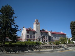 Okanogan County Courthouselisted 1995
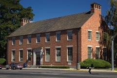 US Post Office-Okanogan Mainlisted 1991
Population over time
2 figuresOkanogan fell from 2,552 to 2,379 between 2010 and 2020. These are the recorded population figures Wikidata holds for this place, reached through the Geographic Names Information System number this page is keyed on rather than by name, so they belong to this place and not to another of the same name. Most are census counts, but not all are: an early figure may be a founding or settlement estimate, and an estimate published within five years of a census is left out. The change column is computed, and is left blank where more than 20 years separate a figure from the one before it, because a gap that long is not a change between two counts.
| Year | People | Change |
|---|---|---|
| 2010 | 2,552 | |
| 2020 | 2,379 | -173 (-7%) |
Topographic sheets covering this place
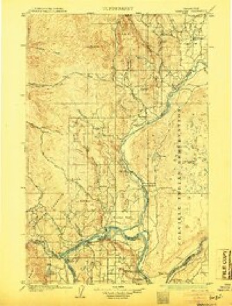
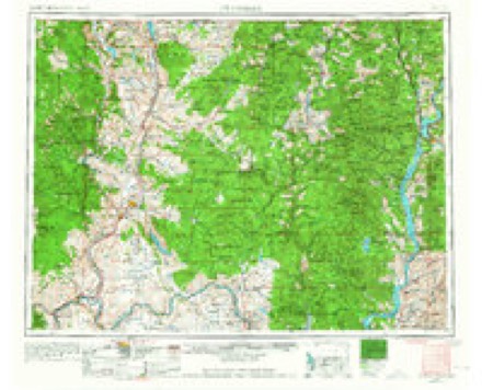
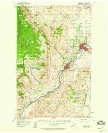
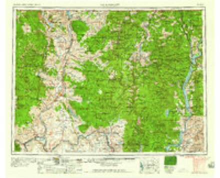
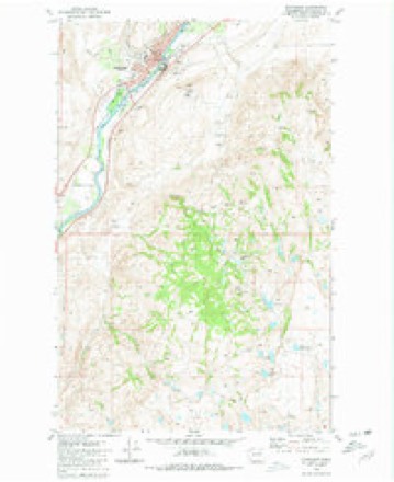
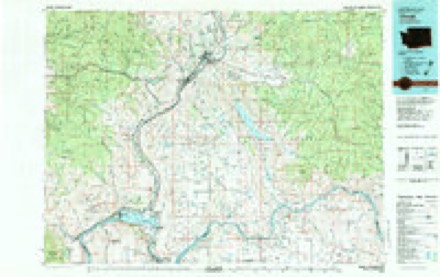
6 surveys from 12 printed sheetsMatched by testing this settlement's coordinate against the published boundary of every sheet in the United States Geological Survey's historical collection. Each opens the scanned sheet at the Survey.
- 1905 USGS Okanogan quadrangle1:125000, 3 printings
- 1954 USGS Okanogan quadrangle1:250000, 2 printings
- 1957 USGS Okanogan quadrangle1:62500, 2 printings
- 1958 USGS Okanogan quadrangle1:250000
- 1980 USGS Okanogan quadrangle1:24000, 2 printings
- 1983 USGS Omak quadrangle1:100000, 2 printings
Fires near this place
128 since 1992Regional context, not property-specific evidence. The federal wildfire occurrence database lists 128 fires within 5 miles of Okanogan between 1992 and 2020, burning about 198,837 acres in total. 25 started naturally. 11 were recorded as arson. Distance is straight-line from the map coordinates, so a fire counted here may appear on a neighbouring settlement's page as well.
| Reported cause | Fires |
|---|---|
| Missing data/not specified/undetermined | 30 |
| Debris and open burning | 26 |
| Natural | 25 |
| Equipment and vehicle use | 13 |
| Arson/incendiarism | 11 |
| Recreation and ceremony | 9 |
| Fireworks | 7 |
| Power generation/transmission/distribution | 3 |
| Other causes | 2 |
| Smoking | 1 |
| Misuse of fire by a minor | 1 |
The most recent of them, most recent first, with the day each was reported and the service that recorded it.
| Date | Cause | Size | Reported by | Name on the report |
|---|---|---|---|---|
| 8 September 2009 | Natural | 7.0 acres | Colville Agency | CAMERON LAKE LOOP RD |
| 6 September 2020 | Missing data/not specified/undetermined | 189,923 acres | Colville Agency | COLD SPRINGS |
| 4 September 2013 | Natural | 2.2 acres | Colville Agency | COYOTE |
| 4 September 2008 | Missing data/not specified/undetermined | under an acre | Washington State Department of Natural Resources Headquarters | SPRING COULEE CAR WRECK |
| 4 September 2004 | Recreation and ceremony | under an acre | Colville Agency | STEEL HOUS |
| 30 September 2009 | Arson/incendiarism | under an acre | Colville Agency | OMAK LAKE CAMERON LA |
| 27 September 1998 | Missing data/not specified/undetermined | 27 acres | Colville Agency | CAMERON LO |
| 2 September 2018 | Missing data/not specified/undetermined | under an acre | Washington State Department of Natural Resources Headquarters | LEADER SURPRISE |
Settlements close enough to share some of these fires:
Mines and quarries near this place
10 of 19 shownRegional context, not property-specific evidence. The federal mineral resources record lists 19 workings within 5 miles of Okanogan: 9 occurrences, 5 unknowns, 3 past producers, 2 producers. 2 still produce. What was taken out: Sand and Gravel, Construction, Stone, Crushed/Broken, Copper, Tungsten, Garnet. Distance is straight-line from the map coordinates, so a quarry counted here may appear on a neighbouring settlement's page as well.
| Where | Site | Commodity | Status | Recorded |
|---|---|---|---|---|
| Buzzard Lake | Peat | Occurrence | Sedimentary | |
| Cameron Lake | Bromine | Occurrence | ||
| Cameron Lake | Salt | Occurrence | ||
| Cooper Antimony | Antimony, Zinc, Lead | Unknown | ||
| Geo Thompson Farm | Graphite | Occurrence | ||
| Monse | Tungsten, Garnet | Occurrence | Garnet, Scheelite | |
| Okanogan | Chromium, Platinum | Occurrence | Unknown | |
| Okanogan | Limestone, General | Occurrence | Limestone | |
| Sherman | Lead, Zinc, Silver, Gold | Unknown | ||
| Sherman Claims | Lead, Zinc, Silver, Gold, Copper | Occurrence | Replacement |
Storms near this place
13 since 2000Regional context, not property-specific evidence. The National Weather Service names Okanogan in 13 storm reports between 2000 and 2023: 5 thunderstorm wind, 4 flood, 2 wildfire, 2 hail. The reports record 2 injuries. Each account below is quoted exactly as the forecast office filed it, from the NOAA Storm Events Database, and each date opens the federal record of that event.
| When | Event | Place named | Harm | What the report says |
|---|---|---|---|---|
| August 2001 | Wildfire | Okanogan | 2 hurt, $900,000 | A weather disturbance moved across eastern Washington early on the morning of August 12, producing hundreds of cloud-to-ground lightning strikes across the region. The "Virginia Lake Complex" of fires resulted and quickly spread out of control. During the first day of the fire, nine structures burned, and two firefighters had to deploy emergency shelters. This complex of fires burned for the rest of August and was contained on September 2 after burning 74,109 acres of land. |
| July 2003 | Wildfire | Okanogan | $1,000,000 | A human caused fire on the north edge of the town of Okanogan during very dry summer conditions was fanned by estimated 35 mph wind gusts. The fire quickly spread to 300 acres in size and engulfed a residential subdivision. Six houses were destroyed and several others damaged. The blaze was finally brought under control by 125 firefighters, 45 engines and tenders as well as an airborne tanker and two helicopters. |
| June 2023 | Thunderstorm Wind | Okanogan | $375,000 | Gust front caused roof to blow off of airplane hangar, destroyed a vintage airplane, took out power, and started a small power line fire. Other reports in the county included a carport roof blown off in Oroville, two foot diameter tree blown down, and downed power lines. |
| May 2001 | Thunderstorm Wind | Okanogan | $125,000 | A mainly dry thunderstorm moved northeast through Okanogan County. As the storm reached the Omak/Okanogan area, the storm caused a 67 mph wind gust at a location 7 miles northwest of Okanogan at 740 PM PDT. The storm then brought a 77 mph wind gust 4 miles southeast of Omak at 745 PM PDT. The ASOS at the Omak Airport measured a peak wind gust to 53 mph, reducing the visibility to 1 3/4 miles in blowing dust for a time. In Omak, numerous large trees were blown onto roads, blocking traffic in spots. Five trees were blown into power lines. One tree branch that fell into a power line on Johnson Creek Road sent out sparks and touched off a blaze that destroyed a house and garage. At a gas station on Omak Avenue, the wind peeled off the roof and picked up an air conditioning unit. Three trees fell on a single home on Middle Lane Road. One-third of a triple-wide home being set up on Spring Coulee Road was flipped over. A fence was blown over in Okanogan. Seven 40-50 foot pine trees were blown down. Several orchards in the area also suffered damage. |
| June 2012 | Thunderstorm Wind | Okanogan | $25,000 | Strong winds associated with outflow from a cluster of thunderstorms was thought to be responsible for damaging a roof on a resident house. The roof was picked up on the east side of the house and completely flipped over to the west side of the property, damaging two cars parked next to the home. The roof was actually a second roof on top of an old one. Showers the following week resulted in damage to the ceiling, drywall, and the carpet. |
| May 2018 | Flood | Okanogan | $3,000 | On May 8th Conconully Lake reached the spillway level on the Conconully Dam due to heavy Spring runoff from the upper reaches of the Salmon River. The increased flow caused flooding along the river below the dam and resulted in the flooding and subsequent closure of Salmon Creek Road between Spring Coulee Road and Danker Cutoff Road. |
| June 2011 | Flood | Okanogan | $2,000 | A combination of a log jam on the Oak Street bridge and washout of a dike at Pine Street in the city of Okanogan resulted in seepage of the Okanogan River into a few basements of homes along Second Avenue. Damage costs were estimated. |
| July 2016 | Thunderstorm Wind | Okanogan | $500 | A spotter reported a few trees were blown down due to thunderstorm winds. Measured wind gusts of 38 mph were reported. The reported observer location was 8 miles northwest of Okanogan, WA. |
| May 2015 | Hail | Okanogan | - | A trained spotter reported 0.75 inch hail eight miles northwest of Okanogan, WA. |
| May 2011 | Flood | Okanogan | - | On May 22nd, Salmon Creek Road was closed between Spring Coulee Road and Danker Cut-Off Road due to water and debris flowing over the roadway from Salmon Creek. A combination of high spring runoff and log jams in the creek was responsible for the flooding. The road was later reopened but closed on and off for the next few weeks. |
| June 2011 | Flood | Okanogan | - | Salmon Creek Road was closed June 1st between Spring Coulee and Danker Cutoff roads due to flooding of the Salmon Creek. |
| July 2000 | Thunderstorm Wind | Okanogan | - | Half-inch diameter hail. |
| July 2010 | Hail | Okanogan | - | no account filed |
Nearest settlements
The eight closest, with where each one stands in the county. Distances are straight-line, computed from the Geographic Names Information System coordinates.
| Map | Place | Distance | Sheets |
|---|---|---|---|
| Epley (historical) | 4.4 miles | 12 | |
| Omak | 4.5 miles | 12 | |
| Chillowist | 4.9 miles | 12 | |
| Brown Lake | 8.2 miles | 11 | |
| Malott | 8.5 miles | 12 | |
| Cherokee | 8.7 miles | 9 | |
| Loop Loop (historical) | 9.3 miles | 11 | |
| North Omak | 9.4 miles | 9 |
Elsewhere
Matched on this settlement's Geographic Names Information System number rather than its name, so it cannot be a different place of the same name in another state.
| Wikipedia article on Okanogan | An encyclopaedic summary. Its text is share-alike, so it is linked here rather than copied. |
| Wikidata item Q1511988 | The structured record the population and elevation above come from. Public domain (CC0). |
Provenance
This settlement is recorded in the Geographic Names Information System as feature 1531489. The sheet list is computed by point-in-boundary test against the United States Geological Survey's historical topographic inventory. Both are works of the United States government and carry no copyright under 17 U.S.C. 105.
Wildfire. Short, Karen C. 2022. Spatial wildfire occurrence data for the United States, 1992-2020 [FPA_FOD_20221014]. 6th Edition. Fort Collins, CO: Forest Service Research Data Archive. https://doi.org/10.2737/RDS-2013-0009.6 Collected with United States Government funding and usable without additional permissions or fees.
Mines and quarries. USGS Mineral Resources Data System (MRDS) https://mrdata.usgs.gov/mrds/ A work of the United States government, no copyright under 17 U.S.C. 105.
Storms. NOAA National Centers for Environmental Information, Storm Events Database https://www.ncei.noaa.gov/stormevents/ A work of the United States government, no copyright under 17 U.S.C. 105. Narratives are quoted verbatim from the National Weather Service report and are not edited or summarised.