 Block
From the record
One of 19 National Register listings published here for Stevens County · listed in 1995 · category: District.
Sources: the case file at the National Archives · the National Register database, National Park Service
Listed on the National Register of Historic Places in 1995.
One of 19 National Register listings published here for Stevens County · listed in 1995 · category: District.
Sources: the case file at the National Archives · the National Register database, National Park Service
Regional context, not property-specific evidence. The federal wildfire occurrence database lists 271 fires within 5 miles of Meyers Falls Power Plant Historic District between 1992 and 2020, burning about 6,187 acres in total. 42 started naturally. 8 were recorded as arson. Distance is straight-line from the map coordinates, so a fire counted here may appear on a neighbouring settlement's page as well.
| Reported cause | Fires |
|---|---|
| Missing data/not specified/undetermined | 57 |
| Debris and open burning | 48 |
| Recreation and ceremony | 46 |
| Natural | 42 |
| Fireworks | 15 |
| Railroad operations and maintenance | 15 |
| Power generation/transmission/distribution | 12 |
| Equipment and vehicle use | 10 |
| Misuse of fire by a minor | 9 |
| Arson/incendiarism | 8 |
| Other causes | 5 |
| Smoking | 4 |
The most recent of them, most recent first, with the day each was reported and the service that recorded it.
| Date | Cause | Size | Reported by | Name on the report |
|---|---|---|---|---|
| 9 September 2006 | Missing data/not specified/undetermined | 484 acres | Colville National Forest | BISBEE MOUNTAIN |
| 8 September 1999 | Debris and open burning | under an acre | Washington State Department of Natural Resources Headquarters | not named |
| 7 September 2020 | Missing data/not specified/undetermined | 2.8 acres | Washington State Department of Natural Resources Headquarters | KIFER ROAD |
| 7 September 2009 | Natural | under an acre | Washington State Department of Natural Resources Headquarters | POTTERS KNOB |
| 7 September 1994 | Other causes | 1.0 acres | Washington State Department of Natural Resources Headquarters | not named |
| 5 September 1992 | Recreation and ceremony | under an acre | Lake Roosevelt National Recreation Area | CAMPFIRE41 |
| 5 September 1992 | Recreation and ceremony | under an acre | Lake Roosevelt National Recreation Area | CAMPFIRE42 |
| 4 September 2019 | Railroad operations and maintenance | 13 acres | Washington State Department of Natural Resources Headquarters | PEACH CREST |
Regional context, not property-specific evidence. The federal mineral resources record lists 71 workings within 5 miles of Meyers Falls Power Plant Historic District: 30 occurrences, 17 prospects, 13 past producers, 8 unknowns. 3 still produce. What was taken out: Gold, Silver, Sand and Gravel, Construction, Copper. Distance is straight-line from the map coordinates, so a quarry counted here may appear on a neighbouring settlement's page as well.
| Where | Site | Commodity | Status | Recorded |
|---|---|---|---|---|
| Ark | Copper, Lead, Silver, Zinc, Gold | Past Producer | Vein | |
| Ark | Silver, Zinc, Copper, Lead, Gold | Past Producer | ||
| Ark Silver Queen | Silver, Gold, Lead, Zinc, Copper, Antimony | Producer | Chalcopyrite, Galena, Pyrite, Sphalerite, Tetrahedrite | |
| Blue Grouse | Silver, Lead | Occurrence | Vein | |
| Bluegrouse | Silver, Iron | Prospect | ||
| City View | Gold, Lead, Silver, Copper | Occurrence | Vein | |
| City View | Gold, Copper, Lead, Silver | Prospect | ||
| Columbia, Coyote, Gray Eagle | Molybdenum, Copper, Gold, Silver | Occurrence | Vein | |
| Cornet | Copper, Gold, Lead, Silver | Prospect | ||
| Emc | Lead, Copper, Silver | Occurrence | Vein |
Regional context, not property-specific evidence. The National Weather Service names Kettle Falls, the town this property stands in, in 9 storm reports between 1997 and 2024: 3 hail, 2 tornado, 1 lightning, 1 flash flood. No death or injury is recorded in these reports. Each account below is quoted exactly as the forecast office filed it, from the NOAA Storm Events Database, and each date opens the federal record of that event.
| When | Event | Place named | Harm | What the report says |
|---|---|---|---|---|
| July 1997 | Tornado (F1) | Kettle Falls | $20,000 | NWS Storm survey confirmed second tornado in Kettle Falls |
| July 1997 | Tornado (F1) | Kettle Falls | $20,000 | NWS Storm survey confirmed tornado in Kettle Falls. Path was not continuous |
| July 2014 | Hail | Kettle Falls | $14,000 | Hail ranging between quarters and hen eggs fell across eastern reaches of Kettle Falls, WA. Seven vehicles were damaged at Pingston Creek Road and Highway 395. The vehicles were dented in spots and some windows were cracked. The hail also left dents on metal roofs of shop buildings with one resident stating that it was the worst storm he witnessed in 72 years. A resident two miles south southeast of Kettle Falls stated the hail destroyed the vinyl siding on the south and western portions of his home. The storm continued to produce severe hail as it tracked northeast toward the Canadian Border. Hail to the size of half dollars was reported by the public four miles east southeast of Northport, WA. Winds estimated around 50 mph also accompanied the storm leading to some tree damage eight miles southeast of Northport, WA. |
| July 2022 | Flash Flood | Kettle Falls | $2,000 | At least six inches of sand, mud, and debris on route 25 north of rice from flash flooding. There were two public reports of 2 of rain near Kettle Falls north of the flooded roadway. |
| April 2023 | Flood | Kettle Falls | $1,000 | Mingo Mtn Road has washout and debris from culvert on road. |
| September 2024 | Thunderstorm Wind | Kettle Falls | $500 | A small metal roof ripped off a structure. A wind gust of 42 was recorded in Kettle Falls. |
| July 1997 | Lightning | Kettle Falls | - | Lightning damage to a power transformer. All power to town is out |
| June 1997 | Hail | Kettle Falls | - | 1 inch hail |
| July 2009 | Hail | Kettle Falls | - | no account filed |
No historic map-sheet match is published for this property yet. That does not mean no map exists. This record needs a coordinate-quality review before it can be joined to a sheet boundary. Browse the county's mapped places while that work is pending.
Other National Register properties close enough to walk or drive between, ordered by distance from this one. Both positions come from the same geocoding pass that matched these properties to their map sheets.
| Photograph | Property | Distance | Listed |
|---|---|---|---|
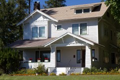 | Keller House | 7.5 miles | 1979 |
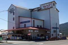 | Colville Flour Mill | 7.5 miles | 1995 |
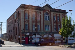 | Opera House and I. O. O. F. Lodge | 7.8 miles | 1997 |
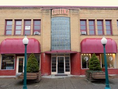 | Collins Building | 7.8 miles | 1998 |
| H. M. McCauley House | 7.8 miles | 1979 | |
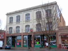 | Rickey Block | 7.8 miles | 1995 |
| National Archives record | The nomination case file for reference 95000808 in Record Group 79. |
| Stevens County | All 19 listed properties in this county. |