Block
From the record
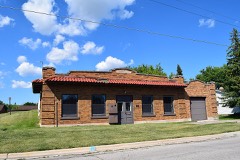
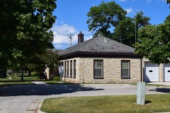
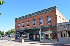
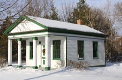
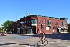
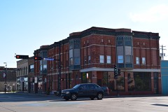
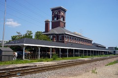
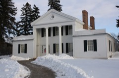
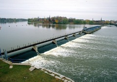
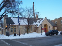
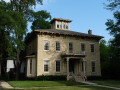
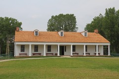
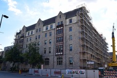
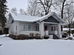
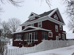
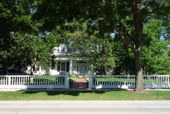
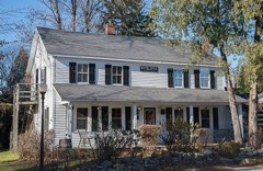
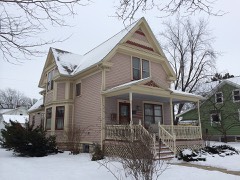
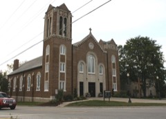
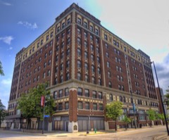
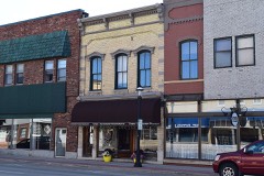
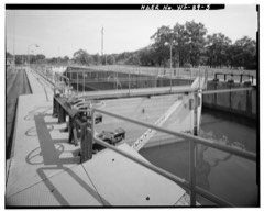
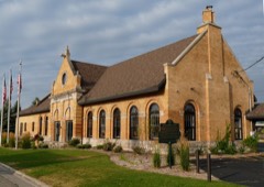
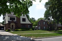
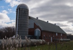
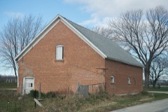
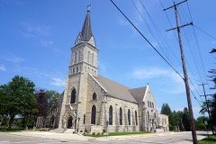
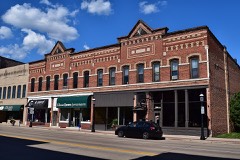
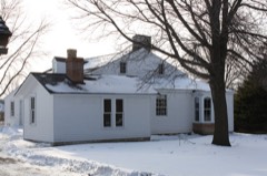
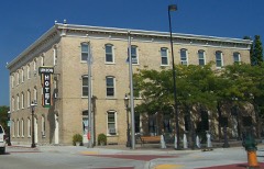
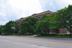
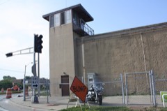
65 National Register listings published here.
Sources: the county history on the Internet Archive · the National Register database, National Park Service
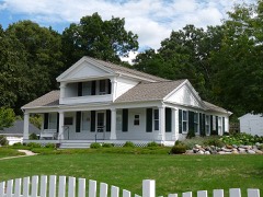
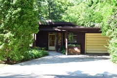
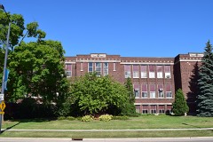
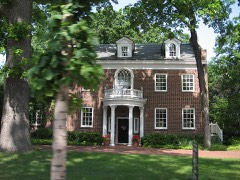
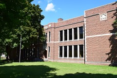
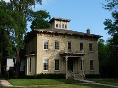
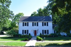
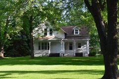
58 topographic sheets cover 55 settlements here, and 65 properties are on the National Register of Historic Places.
65 National Register listings published here.
Sources: the county history on the Internet Archive · the National Register database, National Park Service
Every property in this county listed on the National Register of Historic Places, with the year it was listed and the federal nomination document.
Every wildfire the federal occurrence database records inside this county: 104 of them, burning about 137 acres. None started naturally and 3 were recorded as arson. Each settlement page carries the fires within five miles of it.
| Reported cause | Fires |
|---|---|
| Missing data/not specified/undetermined | 65 |
| Debris and open burning | 20 |
| Equipment and vehicle use | 9 |
| Arson/incendiarism | 3 |
| Misuse of fire by a minor | 2 |
| Smoking | 2 |
| Recreation and ceremony | 2 |
| Power generation/transmission/distribution | 1 |
The five largest, by the area the report gives. None of them was recorded as arson.
| Date | Cause | Size | Reported by | Name on the report |
|---|---|---|---|---|
| 27 March 2012 | Missing data/not specified/undetermined | 35 acres | Wisconsin Department of Natural Resources | not named |
| 18 July 2018 | Equipment and vehicle use | 15 acres | Wisconsin Department of Natural Resources | 1836311 |
| 18 July 2018 | Equipment and vehicle use | 15 acres | Wisconsin Department of Natural Resources | 18057 |
| 11 May 1996 | Recreation and ceremony | 15 acres | Wisconsin Department of Natural Resources | not named |
| 16 April 2020 | Debris and open burning | 5.0 acres | Wisconsin Department of Natural Resources | 2024 |
| 29 July 2018 | Equipment and vehicle use | 5.0 acres | Wisconsin Department of Natural Resources | 18062 |
| 3 November 2020 | Missing data/not specified/undetermined | 3.0 acres | Wisconsin Department of Natural Resources | 20116 |
| 6 April 2020 | Debris and open burning | 3.0 acres | Wisconsin Department of Natural Resources | 150 |
Every settlement page carries the fires within five miles of it - see the settlement index below.
The NOAA Storm Events Database holds 392 reports for this county, causing 1 death, 8 injuries and about $10,181,100 in recorded property damage. Each settlement page carries the reports that name it.
| Kind of event | Reports |
|---|---|
| Thunderstorm Wind | 189 |
| Hail | 121 |
| Tornado | 30 |
| Lightning | 16 |
| Flash Flood | 14 |
| Flood | 9 |
| Funnel Cloud | 6 |
| Heavy Rain | 6 |
| Dust Devil | 1 |
The most serious of them, by death, then injury, then recorded damage. The accounts are quoted exactly as the forecast office filed them.
| When | Event | Place named | Harm | What the report says |
|---|---|---|---|---|
| June 2025 | Thunderstorm Wind | Cormier | 1 killed | Thunderstorm winds downed a tree onto a 9-year-old child on the west side of Green Bay. The person was taken to the hospital and passed away from the injuries. The time of this report is an estimate based on radar data. |
| May 1959 | Tornado (F2) | not stated | 3 hurt, $2,500,000 | no account filed |
| April 1970 | Tornado (F2) | not stated | 2 hurt, $250,000 | no account filed |
| April 1970 | Tornado (F2) | not stated | 1 hurt, $250,000 | no account filed |
| August 1968 | Tornado (F2) | not stated | 1 hurt, $25,000 | no account filed |
| August 1996 | Thunderstorm Wind | Suamico | 1 hurt, $10,000 | no account filed |
| August 2013 | Tornado (EF0) | Wrightstown | $2,000,000 | The tornado that developed 2.7 miles east-northeast of Mackville in Outagamie County at 12:40 am CDT moved into Brown County, entering near Highway 41, 1.8 miles northwest of Wrightstown, at 12:48 am CDT. The tornado first hit the Apple Creek Campground, snapping 50 trees and knocking over two camping trailers. As the tornado moved across the southern part of the county, at least 70 homes sustained at least minor damage, many from fallen trees (DI 27, DOD 3 and 4; DI 28, DOD 3 and 4). A large, free-standing garage was heavily damaged when the tornadic winds blew in two garage doors, causing the roof to be ripped off (DI 1, DOD 5). The tornado entered Manitowoc County 4.1 miles northwest of Rosecrans at 1:01 am CDT. Average path width of the tornado in Brown County was 175 yards. |
| March 2019 | Flood | Suamico | $1,120,000 | Runoff from rainfall and snow melt combined with clogged storm drains and ice jams to cause flooding on rivers, streams, roads and low-lying areas throughout Brown County. The hardest hit area in Green Bay was along the East River, where first responders evacuated about 80 to 100 residents from their homes. Residents near Duck Creek in Howard were also evacuated due to flooding. The county EOC moved assets away from its site in Allouez on the evening of March 15th due to flooding in the vicinity. Some roads were damaged by the flooding and required repairs after flood waters receded. Twelve homes sustained major flood damage and twenty-four suffered minor damage. Pamperin Park in Howard remained closed for a month due to damage caused by the flooding. A county-wide state of emergency was declared on March 15th, and the City of Green Bay, Town of Ledgeview, and Village of Suamico also declared a states of emergency that same day. The Village of Bellevue declared a state of emergency on March 14th. |
| September 2018 | Flash Flood | Green Bay | $500,000 | Thunderstorms brought a period of torrential rainfall to eastern Brown County, causing flash flooding on the east side of Green Bay and in Bellevue. About 50 people had to be rescued from cars that became trapped in flooded intersections. Employees and customers of some businesses had to shelter in place due to high water in their parking lots and surrounding streets. The ground floor of some buildings flooded, including a Green Bay Metro Fire Department station.||More than 100 people were evacuated from seven buildings, including residents of a 48-unit apartment building that housed mostly elderly people. The basement of the building flooded, leaving electrical services underwater. More than 70 people were left homeless for the night and stayed overnight at a local church. |
| August 2013 | Tornado (EF1) | Wrightstown | $500,000 | The tornado that formed in Outagamie County near Mackville at 12:38 am CDT entered Brown County about two miles southwest of Wrightstown at 12:48 am CDT. The tornado snapped or uprooted dozens of trees as it moved east, just south of Greenleaf. A house lost an attached garage when winds blew in the garage door and caused a large portion of the garage roof to lift off (DI 2, DOD 4). The walls of a nearby outbuilding collapsed (DI 1, DOD 6). The tornado dissipated about 3 miles west of Morrison. The average path width of the tornado in Brown County was 125 yards. |
| July 1994 | Thunderstorm Wind | Bellevue | $500,000 | no account filed |
| May 1992 | Tornado (F1) | not stated | $250,000 | no account filed |
| August 1979 | Tornado (F1) | not stated | $250,000 | no account filed |
| July 1977 | Tornado (F1) | not stated | $250,000 | no account filed |
| April 1970 | Tornado (F1) | not stated | $250,000 | no account filed |
| July 2007 | Thunderstorm Wind | Green Bay | $237,000 | High winds from thunderstorms downed numerous trees on the northeast side of Green Bay. Some of the trees landed on roofs in the 1800 block of East Shore Drive, damaging at least 6 houses. |
| July 2010 | Heavy Rain | Green Bay | $150,000 | In 18 minutes 1.06 inches of rain fell at the National Weather Service Office in Green Bay, 0.61 inch of that fell in just 6 minutes. The torrential rain flooded streets, dislodged manhole covers and caused water to backup into basements. The west side of Green Bay and Ashwaubenon had the most extensive street and basement flooding. Many homes on the west side of Green Bay had up to 6 inches of water in their basements, resulting in substantial costs to homeowners. |
| August 2010 | Tornado (EF1) | Greenleaf | $100,000 | The tornado touched down 2 miles southeast of Greenleaf, where several trees were snapped and uprooted. The tornado then destroyed a relatively new barn constructed of metal wall panels and roof (DI 1, DOD 5,6). Pieces of the wall and roof panels were strewn over 100 yards from the site. About 50 to 100 yards on either side of the damaged barn small outbuildings and trees were untouched. The tornado continued east-northeast to another farm and heavily damaged a metal building which contained hay bales. Large parts of the metal roof were thrown over 200 yards. Numerous trees along the path were snapped or uprooted. Estimated maximum winds were 90 mph.||The tornado dissipated just north of the Holland State Wildlife Area. |
| June 1999 | Lightning | Green Bay | $100,000 | no account filed |
| June 2016 | Thunderstorm Wind | Ashwaubenon | $75,000 | Thunderstorm winds downed one huge tree and several large branches at the intersection of Morris and Marlee. The downed tree and branches damaged the roof of a building and caused severe damage to three vehicles. |
| August 2023 | Thunderstorm Wind | Wrightstown | $50,000 | Thunderstorm winds downed trees, power lines, and heavily damaged a golf clubhouse in Wrightstown. The time of this report is an estimate based on radar data. |
| August 2019 | Tornado (EF0) | Green Bay | $50,000 | A tornado quickly formed southeast of the city of Green Bay and moved southeast into the town of Bellevue. Three power poles sustained damage and a business sign was heavily damaged in Green Bay. The tornado continued southeast and damaged at least 100 trees along the path (DI 27 and 28, DOD 1-3). A poorly constructed carport lost part of its metal roof at an apartment building and a nearby house lost a couple shingles (DI 2, DOD 2). |
| September 2019 | Flash Flood | Green Bay | $50,000 | Heavy rainfall caused street flooding across much of the east side of Green Bay and De Pere. There were multiple reports of streets closed, businesses evacuated, vehicles stranded and rescues from the high water. Businesses were evacuated on Mason Street on the east side of Green Bay between Main Street and Lime Kiln Road, Monroe Road in Bellevue was closed from WI-172 to Dickinson Road, there was 3 to 4 feet of water on Red Maple Road in De Pere under the railroad underpass, Ledgeview Road in De Pere was closed between Winding Waters Way and Creamery Road, Bellevue Street in Bellevue was closed from Debra Lane to Allouez Avenue, Wrightstown Road in De Pere was closed between River Oaks Drive and Greenleaf Road, and Huron Road in Bellevue was closed from Easton Road to Yeager Drive due to flash flooding. |
| August 2013 | Thunderstorm Wind | Cormier | $50,000 | Thunderstorm winds, estimated at 80 mph, took down several trees, numerous large limbs and blew off pieces of siding and shingles of several houses on the west side of Green Bay. |
| September 2005 | Thunderstorm Wind | Green Bay | $50,000 | no account filed |
| September 2005 | Thunderstorm Wind | Ashwaubenon | $50,000 | no account filed |
| April 1994 | Thunderstorm Wind | Green Bay | $50,000 | no account filed |
| April 1994 | Thunderstorm Wind | Green Bay | $50,000 | no account filed |
| June 2025 | Lightning | De Pere | $40,000 | Lightning struck an apartment building in De Pere causing electrical damage and a hole in the roof where the lightning hit the building. The lightning produced around $40,000 in damage and displaced 24 residents. |
| July 1999 | Lightning | Green Bay | $40,000 | no account filed |
| September 2005 | Thunderstorm Wind | De Pere | $30,000 | no account filed |
| August 2015 | Lightning | Suamico | $25,000 | A lightning strike caused a house fire in Suamico. |
| December 2015 | Heavy Rain | Ashwaubenon | $25,000 | Two to four inches of rain fell across the Green Bay area. Approximately 20 homes in the village of Allouez had some water in basements. Several streets were closed around Green Bay for short periods. |
| July 2012 | Hail | Cormier | $25,000 | Hail reached the size of tennis balls west of Green Bay in the village of Howard. Several homes and cars sustained minor damage from the large hail. |
| June 1997 | Lightning | Green Bay | $20,000 | no account filed |
| July 1996 | Lightning | Green Bay | $20,000 | no account filed |
| July 2021 | Lightning | Green Bay | $15,000 | Lightning struck a pole on South Oakland Street in Green Bay and fell on two garages causing damage. |
| September 2014 | Lightning | Allouez | $15,000 | Lightning struck a building on the east side of Green Bay, damaging its roof and facade. The time of this event is estimated. |
| April 2011 | Tornado (EF1) | Askeaton | $15,000 | A brief tornado touched down about a mile and a half south of Greenleaf. The tornado damaged the tops of two silos then ripped the roof off a barn (DI 1, DOD 5). Average path width was 75 yards. |
| June 2019 | Thunderstorm Wind | Green Bay | $10,000 | Thunderstorm winds uprooted a large tree on the west side of Green Bay. The tree fell onto a car, damaging the vehicle. |
| July 2018 | Thunderstorm Wind | Green Bay | $10,000 | Thunderstorm winds split a tree in half. The tree then fell on a house. |
| June 2017 | Thunderstorm Wind | De Pere | $10,000 | Thunderstorm winds downed trees that caused damage to several homes on the south side of De Pere. |
| July 2011 | Thunderstorm Wind | Green Bay | $10,000 | The public reported several power lines were knocked down on the south side of Green Bay and in De Pere. A tree fell on to a house in the village of Ashwaubenon, causing some damage to the roof. |
| September 2011 | Thunderstorm Wind | Wrightstown | $10,000 | Thunderstorm winds, gusting to 78 mph, overturned a semi-trailer near Wrightstown, on CR-U and US-41, and damaged dugouts at a baseball field. |
| July 2010 | Flood | Wrightstown | $10,000 | Heavy rainfall caused Apple Creek to rise about 2.5 feet above flood stage at the Apple Creek Campground. Brown County officials had to evacuate 28 people from the campground where water was up to 5 feet deep. |
| August 2005 | Tornado (F1) | Wrightstown | $10,000 | no account filed |
| June 1998 | Thunderstorm Wind | Suamico | $10,000 | no account filed |
| September 1997 | Lightning | Green Bay | $10,000 | no account filed |
| August 2010 | Flash Flood | Green Bay | $8,000 | Thunderstorms produced torrential rains in Green Bay. Lombardi Avenue was closed between Oneida Street and Holmgren Way due to 3 feet of water and stalled cars on the road. Storm and isolated sanitary sewer backups occurred in this area, causing some damage to basements. In just 10 minutes 0.88 inch of rain fell at Austin Straubel Airport, 0.54 inch of that fell in just 4 minutes. |
| August 2015 | Thunderstorm Wind | Cormier | $7,000 | Thunderstorm winds downed trees and power lines on the west side of Green Bay. |
| August 2015 | Thunderstorm Wind | Ashwaubenon | $6,500 | Thunderstorm winds downed power lines and a few large trees at the corner of West Point Road and Packerland Drive. |
| August 2015 | Thunderstorm Wind | Green Bay | $6,500 | Thunderstorm winds downed power lines and a few large trees in Green Bay. |
| August 2021 | Thunderstorm Wind | Green Bay | $5,000 | Thunderstorm winds caused a tree to fall on a house on the northeast side of Green Bay. The time of this event is an estimate based on radar data. |
| August 2018 | Thunderstorm Wind | De Pere | $5,000 | Thunderstorm winds downed large tree branches. One of the branches crushed the roof of a car. |
| September 2018 | Thunderstorm Wind | Bellevue | $5,000 | Thunderstorm winds caused a building that was under construction to collapse. |
| August 2018 | Flood | Green Bay | $5,000 | Heavy rainfall from thunderstorms caused urban flooding in and around Green Bay. The most extensive flooding was in low-lying and poor drainage areas where a few vehicles became stranded. |
| August 2015 | Thunderstorm Wind | Suamico | $5,000 | Thunderstorm winds tore shingles from a roof in Suamico. |
| July 2012 | Lightning | Little Rapids | $5,000 | Five residents of a house had to be evacuated when it filled with smoke after being struck by lightning. |
| September 2005 | Tornado (F0) | De Pere | $5,000 | no account filed |
| September 1998 | Flash Flood | Howard | $5,000 | no account filed |
The Survey's mineral resources record lists 33 workings inside this county. 18 still produce and 15 are closed or unrecorded. Each settlement page carries the workings within five miles of it.
| Commodity | Workings |
|---|---|
| Stone, Crushed/Broken | 18 |
| Sand and Gravel, Construction | 10 |
| Stone | 3 |
| Limestone, General, Bentonite | 1 |
| Calcium | 1 |
The least common of them first, because a county's hundredth gravel pit says nothing its first ten did not.
| Where | Site | Commodity | Status | Recorded |
|---|---|---|---|---|
| Green Bay Lime Kiln | Calcium | Plant | ||
| Hurlbut Calcium & Chemical Company | Limestone, General, Bentonite | Plant | ||
| Butnick Quarry #4 | Stone | Unknown | ||
| Gibson Quarry | Stone | Unknown | ||
| Own Crews | Stone | Unknown | ||
| De Jardin Mill | Sand and Gravel, Construction | Past Producer | ||
| De Jardin Pit | Sand and Gravel, Construction | Past Producer | ||
| De Pere Pit | Sand and Gravel, Construction | Past Producer | ||
| Decleen Pit | Sand and Gravel, Construction | Past Producer | ||
| Denmark Pit | Sand and Gravel, Construction | Producer | ||
| Katers Pit | Sand and Gravel, Construction | Past Producer | ||
| Kraszewski Pit | Sand and Gravel, Construction | Producer | ||
| Mertens 1 Pit | Sand and Gravel, Construction | Past Producer | ||
| Peters Trucking Corporation Pit | Sand and Gravel, Construction | Producer | ||
| Peters Trucking Sand & Gravel Pit | Sand and Gravel, Construction | Unknown | ||
| Bay Settlement Quarry | Stone, Crushed/Broken | Producer | ||
| Boulanger Mill | Stone, Crushed/Broken | Producer | ||
| Boulanger Quarry | Stone, Crushed/Broken | Producer | ||
| Butnick Quarry Ulmen #4 | Stone, Crushed/Broken | Past Producer | ||
| Daanen and Janssen | Stone, Crushed/Broken | Producer | ||
| Daanen and Janssen Howard Quarry | Stone, Crushed/Broken | Producer | ||
| Ebben Quarry | Stone, Crushed/Broken | Producer | ||
| Ira Nickel Limestone Quarry | Stone, Crushed/Broken | Past Producer | ||
| Keuken Quarry | Stone, Crushed/Broken | Past Producer | ||
| Leo Scray Mill | Stone, Crushed/Broken | Producer | ||
| Leo Scray Quarry | Stone, Crushed/Broken | Producer | ||
| McKeefry & Sons,Inc | Stone, Crushed/Broken | Producer | ||
| Mill No. 8 | Stone, Crushed/Broken | Producer | ||
| Number 3 Quarry | Stone, Crushed/Broken | Producer | ||
| Quarry No 2 Van Schyndel | Stone, Crushed/Broken | Past Producer | ||
| Quarry No. 8 and Mill | Stone, Crushed/Broken | Producer | ||
| Skalecki Dolomite Deposit | Stone, Crushed/Broken | Past Producer | ||
| Township of Scott Quarry | Stone, Crushed/Broken | Producer |
One book written about this county, cut here where the book itself is cut, at its printed chapters: 1 chapter in all. Every chapter is public domain, machine-read from the scan and reproduced complete. A chapter already given under one of the county's towns is not repeated in this list.
| Chapter | Length |
|---|---|
| The whole text | 212,393 words in 14 parts |
Named settlements recorded in the Geographic Names Information System, each with the topographic sheets covering it. Villages, hamlets and abandoned places alike. Each is shown with the nearest named watercourse or landform and the survey quadrangle it falls on.
Ashwaubenon village · 54304 · On Ashwaubenon Creek · De Pere quadrangle
10 sheets, 1954 to 1992
Howard village · 54313 · On Beaver Dam Creek · Green Bay West quadrangle
9 sheets, 1954 to 1992
Howard village · 54303 · On Beaver Dam Creek · Green Bay West quadrangle
9 sheets, 1954 to 1992
Howard village · 54313 · Near Platten Hill · Green Bay West quadrangle
9 sheets, 1954 to 1992
Suamico village · 54313 · On North Branch Suamico River · Suamico quadrangle
6 sheets, 1954 to 1984
Green Bay city · 54302 · On Baird Creek · Green Bay East quadrangle
11 sheets, 1954 to 1992
Howard village · 54303 · Near Platten Hill · Green Bay West quadrangle
9 sheets, 1954 to 1992
Pittsfield town · 54313 · On West Branch Suamico River · Oneida North quadrangle
7 sheets, 1954 to 1992
Wrightstown village · 54180 · On Plum Creek · Wrightstown quadrangle
8 sheets, 1954 to 1992