 Block
From the record
9 National Register listings published here.
Sources: the National Register database, National Park Service
69 topographic sheets cover 24 settlements here, and 9 properties are on the National Register of Historic Places.
9 National Register listings published here.
Sources: the National Register database, National Park Service
Every property in this county listed on the National Register of Historic Places, with the year it was listed and the federal nomination document.
| Photograph | Property | Type | Listed | Reference |
|---|---|---|---|---|
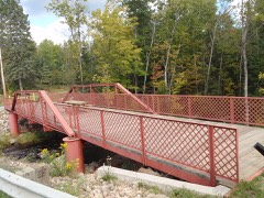 | Armstrong Creek Bridge | structure | 2011 | 11000841 |
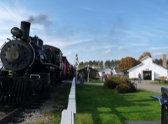 | Camp Five Farmstead | building | 1996 | 95001506 |
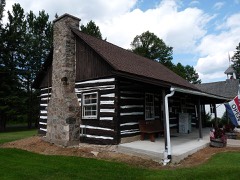 | Chicago and North-Western Land Office | building | 1993 | 93001446 |
| Connor Lumber and Land Company Store | building | 2019 | 100004667 | |
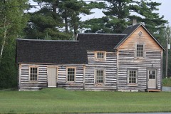 | Dinesen-Motzfeldt-Hettinger Log House | building | 2005 | 04001486 |
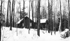 | Franklin Lake Campground | district | 1988 | 88001573 |
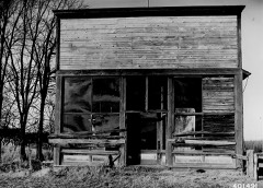 | Minertown-Oneva | site | 2010 | 09001315 |
| Otter Spring House | building | 1999 | 99000684 | |
| John and Anna Wywialowski Farmstead | building | 2016 | 16000766 |
Every wildfire the federal occurrence database records inside this county: 430 of them, burning about 428 acres. 20 started naturally and 47 were recorded as arson. Each settlement page carries the fires within five miles of it.
| Reported cause | Fires |
|---|---|
| Debris and open burning | 132 |
| Missing data/not specified/undetermined | 63 |
| Arson/incendiarism | 47 |
| Recreation and ceremony | 41 |
| Equipment and vehicle use | 39 |
| Power generation/transmission/distribution | 23 |
| Natural | 20 |
| Smoking | 19 |
| Fireworks | 15 |
| Misuse of fire by a minor | 14 |
| Other causes | 13 |
| Railroad operations and maintenance | 4 |
The five largest, by the area the report gives. None of them was recorded as arson.
| Date | Cause | Size | Reported by | Name on the report |
|---|---|---|---|---|
| 9 April 1998 | Debris and open burning | 26 acres | Wisconsin Department of Natural Resources | not named |
| 4 March 2000 | Debris and open burning | 23 acres | Wisconsin Department of Natural Resources | not named |
| 21 April 2006 | Natural | 19 acres | Wisconsin Department of Natural Resources | not named |
| 12 April 1998 | Missing data/not specified/undetermined | 18 acres | Chequamegon-Nicolet National Forest | WABENO BALL FIELD |
| 27 November 1998 | Missing data/not specified/undetermined | 17 acres | Chequamegon-Nicolet National Forest | HONEY CREEK |
| 3 May 2000 | Other causes | 14 acres | Wisconsin Department of Natural Resources | not named |
| 24 April 2007 | Debris and open burning | 12 acres | Chequamegon-Nicolet National Forest | OLD GRADE |
| 16 September 1998 | Debris and open burning | 12 acres | Chequamegon-Nicolet National Forest | HWY O |
Every settlement page carries the fires within five miles of it - see the settlement index below.
The NOAA Storm Events Database holds 165 reports for this county, causing no deaths, 3 injuries and about $5,966,550 in recorded property damage. Each settlement page carries the reports that name it.
| Kind of event | Reports |
|---|---|
| Thunderstorm Wind | 88 |
| Hail | 61 |
| Tornado | 7 |
| Funnel Cloud | 5 |
| Flash Flood | 3 |
| Lightning | 1 |
The most serious of them, by death, then injury, then recorded damage. The accounts are quoted exactly as the forecast office filed them.
| When | Event | Place named | Harm | What the report says |
|---|---|---|---|---|
| May 1994 | Tornado (F2) | Crandon to | 3 hurt, $5,000,000 | Severe thunderstorms raked west-central and northern Wisconsin with violent damaging winds up to 61 mph, hail up to tennis ball-size, and two tornadoes. A tornado set down just east of Woodville in St Croix County damaging eight farm dwellings and structures along its one-mile path causing $55,000 damage. Another tornado cut a 12-mile path from just southwest of Crandon to just north of Laona in Forest County causing $1 million damage. It destroyed three mobile homes, damaged or destroyed 25 homes and leveled 600 acres of timber. Three people were injured in a mobile home that was destroyed by the tornado. Widespread hail up to tennis ball-size fell over the Rhinelander area damaging hundreds of vehicles as well as roofs and windows. A severe thunderstorm with damaging winds knocked down about 3,000 trees and damaged several homes and cabins seven miles southeast of Seeley, Sawyer County. |
| September 1972 | Tornado (F2) | not stated | $250,000 | no account filed |
| April 2011 | Tornado (EF2) | Argonne | $200,000 | A tornado developed about 3.5 miles southeast of Argonne and moved northeast into Florence County. The storm uprooted and snapped hundreds of trees, some of which fell on vacation cabins along the storm's path. The hardest hit area was several miles east of Argonne shortly after the tornado developed. A large part of the roof of a house was removed (DI 2, DOD 6). The tornado continued northeast into Florence County at 7:46 pm CDT (1846 CST). The average width of the tornado was 250 yards. |
| July 2000 | Flash Flood | South Portion | $153,550 | no account filed |
| June 2010 | Thunderstorm Wind | Mole Lake | $100,000 | Thunderstorms winds downed numerous trees and several miles of power lines blocking most of the roads in the southern Forest County town of Nashville. At least ten houses and two out buildings sustained at least minor damage from the fallen trees. |
| June 2005 | Hail | Laona | $100,000 | no account filed |
| April 2011 | Tornado (EF1) | Armstrong Creek | $50,000 | A second tornado formed in Forest County about four miles west of Armstrong Creek at 8:03 pm CDT (1903 CST). The tornado snapped and uprooted trees and damaged two houses. One of the houses sustained significant roof damage (DI 2, DOD 4) as the tornado moved across the area. The average width was 125 yards. |
| June 1968 | Tornado (F2) | not stated | $25,000 | no account filed |
| September 1963 | Tornado (F1) | not stated | $25,000 | no account filed |
| June 1998 | Thunderstorm Wind | Crandon | $20,000 | no account filed |
| May 2012 | Thunderstorm Wind | Wabeno | $10,000 | Thunderstorm winds downed trees and power lines and destroyed a band stand in downtown Wabeno. The landmark band stand was in the community for more than 50 years. |
| June 2010 | Thunderstorm Wind | Lake Metonga | $10,000 | Thunderstorms downed numerous trees and power lines. One of the fallen trees damaged a house. |
| August 2007 | Thunderstorm Wind | Crandon | $10,000 | Strong winds from thunderstorms tipped over a mobile home and downed many trees across the southwest part of Forest County. |
| August 1996 | Thunderstorm Wind | Crandon | $5,000 | no account filed |
| June 2018 | Thunderstorm Wind | Argonne | $2,500 | Thunderstorm winds destroyed bird pens as the storms passed north of Argonne. The time of this report is an estimate based on radar data. |
| July 1998 | Thunderstorm Wind | Crandon | $2,000 | no account filed |
| August 1996 | Thunderstorm Wind | Alvin | $2,000 | no account filed |
| September 1997 | Thunderstorm Wind | Nelma | $1,000 | no account filed |
| May 1994 | Hail | Crandon | $500 | Severe thunderstorms raked west-central and northern Wisconsin with violent damaging winds up to 61 mph, hail up to tennis ball-size, and two tornadoes. A tornado set down just east of Woodville in St Croix County damaging eight farm dwellings and structures along its one-mile path causing $55,000 damage. Another tornado cut a 12-mile path from just southwest of Crandon to just north of Laona in Forest County causing $1 million damage. It destroyed three mobile homes, damaged or destroyed 25 homes and leveled 600 acres of timber. Three people were injured in a mobile home that was destroyed by the tornado. Widespread hail up to tennis ball-size fell over the Rhinelander area damaging hundreds of vehicles as well as roofs and windows. A severe thunderstorm with damaging winds knocked down about 3,000 trees and damaged several homes and cabins seven miles southeast of Seeley, Sawyer County. |
| June 2024 | Thunderstorm Wind | Crandon | - | Thunderstorm winds downed trees west of Crandon. The time of this report is an estimate based on radar data. |
| May 2022 | Hail | Laona | - | Penny size hail fell in Laona. |
| May 2022 | Hail | Mole Lake | - | Golf ball size hail fell near Mole Lake. |
| May 2022 | Hail | Nelma | - | Penny size hail fell in Alvin. The time of this event is an estimate based on radar data. |
| May 2022 | Hail | Crandon | - | Nickel size hail fell north of Crandon. |
| May 2022 | Hail | Crandon | - | Quarter size hail fell in Crandon. The time of this event is an estimate based on radar data. |
| May 2022 | Hail | Laona | - | Ping pong size hail fell in Laona. The time of this event is an estimate based on radar data. |
| August 2022 | Hail | Crandon Muni Arpt | - | Nickel size hail fell near Mole Lake. |
| June 2022 | Thunderstorm Wind | Nelma | - | Thunderstorm winds downed trees and power lines in Alvin. The time of this event is an estimate based on radar data. |
| June 2021 | Thunderstorm Wind | Crandon | - | Thunderstorm winds downed trees in Crandon. The time of this report is an estimate based on radar data. |
| July 2021 | Thunderstorm Wind | Nelma | - | Thunderstorm winds downed numerous trees and power lines in Alvin. The time of this event is an estimate based on radar data. |
| July 2021 | Thunderstorm Wind | Hiles | - | Thunderstorm winds downed numerous trees and power lines in Hiles. The time of this event is an estimate based on radar data. |
| August 2020 | Tornado (EF1) | Nelma | - | A tornado formed at 9:12 PM CDT in a remote forested area in extreme northeast Forest County, east of the town of Alvin. The tornado moved northeast to about 0.3 miles north of Ransdell Lake, then turned east, reaching maximum width before crossing Huff Creek Road. The tornado produced a path of tree damage (DI 27,28, DOD 3,4) before entering Florence County at 9:18 PM CDT. Peak winds were estimated at 105 mph. |
| August 2019 | Thunderstorm Wind | Argonne | - | Thunderstorm winds downed a few trees near Argonne. |
| August 2019 | Hail | Crandon | - | Penny size hail fell east of Crandon. |
| August 2019 | Thunderstorm Wind | Padus | - | Thunderstorm winds downed trees near Laona. |
| April 2017 | Thunderstorm Wind | Hiles | - | Thunderstorm winds downed several trees and power lines northeast of Hiles. |
| June 2017 | Thunderstorm Wind | Laona | - | Thunderstorm winds downed trees and power lines across Forest County. The time of this event is an estimate based on radar data. |
| June 2017 | Thunderstorm Wind | Wabeno | - | Thunderstorm winds downed trees near County Road W. |
| October 2016 | Hail | Newald | - | Penny to nickel size hail fell as a thunderstorm passed through Newald. |
| June 2016 | Thunderstorm Wind | Lake Metonga | - | Thunderstorm winds downed trees near Metonga Lake, south of Crandon. |
| August 2016 | Hail | Nelma | - | Quarter size hail fell at Franklin Lake as thunderstorms passed. |
| July 2016 | Thunderstorm Wind | Wabeno | - | Thunderstorm winds downed numerous trees and power lines in the far south and southwest parts of Forest County, west of Carter and about 2 miles north of the Pickerel area. |
| July 2016 | Thunderstorm Wind | Nelma | - | Thunderstorm winds downed power lines in the Alvin area. The time of this event was estimated based on radar data. |
| May 2015 | Hail | Crandon | - | Thunderstorms dropped penny size hail as they moved through the Crandon area. |
| August 2014 | Hail | Argonne | - | Quarter size hail fell at the COOP observing site near Argonne. |
| September 2014 | Thunderstorm Wind | Argonne | - | Thunderstorm winds downed numerous trees in the Argonne area. The time of this report is estimated. |
| July 2013 | Thunderstorm Wind | Crandon Muni Arpt | - | A wet microburst, with winds estimated at 75 mph, snapped about 30 trees near County Highway W and Bradley Lake Road, southeast of Crandon. The trees were snapped off several feet above the ground. The time of this event was estimated based on radar data. |
| July 2013 | Hail | Crandon Muni Arpt | - | A wet microburst, with winds estimated at 75 mph that snapped dozens of trees, also dropped penny size hail southeast of Crandon. The time of this event was estimated based on radar data. |
| May 2013 | Thunderstorm Wind | Crandon | - | Thunderstorm winds downed trees and knocked out power in Crandon. |
| August 2013 | Hail | Argonne | - | A trained spotter reported 1.00 inch diameter hail near the town of Argonne. The report was received via local television station WSAW-TV. |
| May 2012 | Hail | Wabeno | - | Quarter size hail fell at Wabeno. |
| May 2012 | Hail | Wabeno | - | Quarter size hail fell near Wabeno. |
| July 2012 | Hail | Crandon | - | Thunderstorms produced quarter size hail and wind gusts of 40 to 45 mph in Crandon. |
| July 2012 | Thunderstorm Wind | Wabeno | - | Thunderstorm winds downed trees near the intersection of STH 52 and CTH W. |
| July 2012 | Funnel Cloud | Crandon Muni Arpt | - | A funnel cloud was spotted southeast of Crandon, near Hemlock Lake. |
| July 2012 | Hail | Crandon | - | Thunderstorms produced golf ball size hail as they passed through Crandon. |
| July 2012 | Funnel Cloud | Argonne | - | Three small funnel clouds were spotted near the intersection of State Highway 32/55 and County Road N, between Argonne and Crandon. |
| September 2012 | Funnel Cloud | Wabeno | - | Thunderstorms produced a funnel cloud over Wabeno. |
| July 2012 | Thunderstorm Wind | Laona | - | Thunderstorms produced strong wind gusts that knocked down dozens of trees around Laona. |
| April 2011 | Hail | Argonne | - | Thunderstorms produced half dollar size hail that fell north of Argonne. |
The Survey's mineral resources record lists 118 workings inside this county. 7 still produce and 111 are closed or unrecorded. Each settlement page carries the workings within five miles of it.
| Commodity | Workings |
|---|---|
| Sand and Gravel, Construction | 115 |
| Copper, Zinc | 2 |
| Silver, Gold | 2 |
| Zinc, Lead, Copper | 1 |
| Lead | 1 |
| Gold, Silver | 1 |
The least common of them first, because a county's hundredth gravel pit says nothing its first ten did not.
| Where | Site | Commodity | Status | Recorded |
|---|---|---|---|---|
| Crandon Zn - Cu Deposit | Copper, Zinc, Lead, Gold, Silver | Prospect | 1975 | |
| Mole Lake Prospect | Zinc, Lead, Copper, Silver, Gold | Unknown | ||
| Catwillow | Copper, Zinc, Silver, Gold | Unknown | ||
| Allen Creek Gravel Deposit | Sand and Gravel, Construction | Occurrence | ||
| Armstrong Creek Gravel Deposit | Sand and Gravel, Construction | Occurrence | ||
| Big Bend Gravel Deposit | Sand and Gravel, Construction | Occurrence | ||
| Bills Creek Gravel Deposit | Sand and Gravel, Construction | Occurrence | ||
| Birch Lake Gravel Deposit | Sand and Gravel, Construction | Occurrence | ||
| C.J. Marshall Pit | Sand and Gravel, Construction | Past Producer | ||
| Camel Hump Gravel Pit | Sand and Gravel, Construction | Past Producer | ||
| Camp Twenty Creek Gravel Deposit | Sand and Gravel, Construction | Occurrence | ||
| Camp Twenty Creek Gravel Pit | Sand and Gravel, Construction | Past Producer | ||
| Carter Gravel Pit | Sand and Gravel, Construction | Past Producer | ||
| Cemetery Gravel Pit | Sand and Gravel, Construction | Past Producer | ||
| Circle O Gravel Deposit | Sand and Gravel, Construction | Occurrence | ||
| Clear Lake Sand Deposit | Sand and Gravel, Construction | Occurrence | ||
| County Line Gravel Pit | Sand and Gravel, Construction | Past Producer | ||
| Crandon Gravel Pit | Sand and Gravel, Construction | Past Producer | ||
| Crandon Sand Pit | Sand and Gravel, Construction | Past Producer | ||
| Creek View Gravel Deposit | Sand and Gravel, Construction | Occurrence | ||
| Crossroads Gravel Deposit | Sand and Gravel, Construction | Occurrence | ||
| Devils Foot Gravel Deposit | Sand and Gravel, Construction | Occurrence | ||
| Dogleg Gravel Pit | Sand and Gravel, Construction | Past Producer | ||
| Drake Creek Gravel Deposit | Sand and Gravel, Construction | Occurrence | ||
| Duffek Sand & Gravel Pit | Sand and Gravel, Construction | Producer | ||
| Eugene Lake Gravel Pit | Sand and Gravel, Construction | Past Producer | ||
| Fiddle Top Gravel Deposit | Sand and Gravel, Construction | Occurrence | ||
| Finger Ridge Gravel Deposit | Sand and Gravel, Construction | Occurrence | ||
| Forest Cnty Pits Townsend Pit | Sand and Gravel, Construction | Producer | ||
| Forest Cnty. Hwy. Dept. | Sand and Gravel, Construction | Unknown | ||
| Forest County Highway Dept Pit | Sand and Gravel, Construction | Producer | ||
| Forest County Pits | Sand and Gravel, Construction | Producer | ||
| Foxhead Gravel Deposit | Sand and Gravel, Construction | Occurrence | ||
| Geiter Pit | Sand and Gravel, Construction | Producer | ||
| Gruman Creek Gravel Deposit | Sand and Gravel, Construction | Occurrence | ||
| Half Lake Gravel Deposit | Sand and Gravel, Construction | Occurrence | ||
| Haymeadow Creek Gravel Deposit | Sand and Gravel, Construction | Occurrence | ||
| Highline Gravel Deposit | Sand and Gravel, Construction | Occurrence | ||
| Highline Gravel Pit | Sand and Gravel, Construction | Past Producer | ||
| Hillside Gravel Deposit | Sand and Gravel, Construction | Occurrence | ||
| Hogan Enterprises Inc. Pits | Sand and Gravel, Construction | Producer | ||
| Horseshoe Gravel Pit | Sand and Gravel, Construction | Past Producer | ||
| Indian Lake Gravel Pit | Sand and Gravel, Construction | Past Producer | ||
| Isolation Gravel Pit | Sand and Gravel, Construction | Past Producer | ||
| Kokots Creek Gravel Pit | Sand and Gravel, Construction | Past Producer | ||
| Lake Lucerne Gravel Deposit #1 | Sand and Gravel, Construction | Occurrence | ||
| Lake Lucerne Gravel Deposit #2 | Sand and Gravel, Construction | Occurrence | ||
| Lake Lucerne Gravel Pit #1 | Sand and Gravel, Construction | Prospect | ||
| Lake Lucerne Gravel Pit #2 | Sand and Gravel, Construction | Past Producer | ||
| Lake Metonga Gravel Deposit #1 | Sand and Gravel, Construction | Occurrence | ||
| Lake Metonga Gravel Deposit #2 | Sand and Gravel, Construction | Occurrence | ||
| Lake Metonga Gravel Pit | Sand and Gravel, Construction | Past Producer | ||
| Lakeside Gravel Deposit | Sand and Gravel, Construction | Occurrence | ||
| Little Birch Lake Gravel Deposit | Sand and Gravel, Construction | Occurrence | ||
| Little Popple River Gravel Pit | Sand and Gravel, Construction | Past Producer | ||
| Lost River Gravel Pit | Sand and Gravel, Construction | Past Producer | ||
| Low Bank Gravel Deposit | Sand and Gravel, Construction | Occurrence | ||
| May Lake Gravel Deposit | Sand and Gravel, Construction | Occurrence | ||
| Mid River Gravel Deposit | Sand and Gravel, Construction | Occurrence | ||
| N Br Peshtigo River Gravel Pit | Sand and Gravel, Construction | Past Producer | ||
| Newald Gravel Pit | Sand and Gravel, Construction | Past Producer | ||
| Ninemile Creek Gravel Deposit | Sand and Gravel, Construction | Occurrence | ||
| Oldtime Gravel Pit | Sand and Gravel, Construction | Past Producer | ||
| Onimish Lake Gravel Pit | Sand and Gravel, Construction | Past Producer | ||
| Otter Creek Gravel Pit | Sand and Gravel, Construction | Past Producer | ||
| Outskirts Gravel Deposit | Sand and Gravel, Construction | Occurrence | ||
| Peshtigo Lake Gravel Deposit | Sand and Gravel, Construction | Occurrence | ||
| Peshtigo Lake Sand Pit | Sand and Gravel, Construction | Past Producer | ||
| Pine Creek Gravel Deposit | Sand and Gravel, Construction | Occurrence | ||
| Pine Creek Gravel Pit #1 | Sand and Gravel, Construction | Past Producer | ||
| Pine Creek Gravel Pit #2 | Sand and Gravel, Construction | Past Producer | ||
| Pine Lake Gravel Deposit | Sand and Gravel, Construction | Occurrence | ||
| Pine River Gravel Deposit | Sand and Gravel, Construction | Occurrence | ||
| Popple River Gravel Deposit | Sand and Gravel, Construction | Occurrence | ||
| Popple River Gravel Pit | Sand and Gravel, Construction | Past Producer | ||
| Rail Line Gravel Pit | Sand and Gravel, Construction | Past Producer | ||
| Railbed Gravel Deposit | Sand and Gravel, Construction | Occurrence | ||
| Range Line Lake Gravel Pit | Sand and Gravel, Construction | Past Producer | ||
| Rat River Gravel Deposit #1 | Sand and Gravel, Construction | Occurrence | ||
| Rat River Gravel Deposit #2 | Sand and Gravel, Construction | Occurrence | ||
| Riley Lake Gravel Deposit | Sand and Gravel, Construction | Occurrence | ||
| Roadside Gravel Pit | Sand and Gravel, Construction | Past Producer | ||
| Roadstar Gravel Deposit | Sand and Gravel, Construction | Occurrence | ||
| Ross Lake Gravel Pit | Sand and Gravel, Construction | Past Producer | ||
| Ross Lake Road Gravel Deposit | Sand and Gravel, Construction | Occurrence | ||
| Round Creek Sand Pit | Sand and Gravel, Construction | Past Producer | ||
| Round Lake Gravel Deposit | Sand and Gravel, Construction | Occurrence | ||
| S Br Popple River Gravel Deposit #1 | Sand and Gravel, Construction | Occurrence | ||
| Scattered Rice Lake Gravel Pit | Sand and Gravel, Construction | Past Producer | ||
| Shephard Pit | Sand and Gravel, Construction | Past Producer | ||
| Snake Eye Gravel Deposit | Sand and Gravel, Construction | Occurrence | ||
| Soo Line Gravel Deposit | Sand and Gravel, Construction | Occurrence | ||
| Steephill Gravel Deposit | Sand and Gravel, Construction | Occurrence | ||
| Stevens Lake Gravel Deposit | Sand and Gravel, Construction | Occurrence | ||
| Sugarbush Hill Gravel Pit | Sand and Gravel, Construction | Past Producer | ||
| Swanson Creek Gravel Deposit | Sand and Gravel, Construction | Occurrence | ||
| Swanson Creek Gravel Pit | Sand and Gravel, Construction | Past Producer | ||
| Swanson Creek Ridge Gravel Deposit | Sand and Gravel, Construction | Occurrence | ||
| Swollen Point Gravel Pit | Sand and Gravel, Construction | Past Producer | ||
| Torpee Creek Gravel Deposit #1 | Sand and Gravel, Construction | Occurrence | ||
| Torpee Creek Gravel Deposit #2 | Sand and Gravel, Construction | Occurrence | ||
| Torpee Creek Gravel Deposit #3 | Sand and Gravel, Construction | Occurrence | ||
| Torpee Creek Gravel Pit | Sand and Gravel, Construction | Past Producer | ||
| Town of Alvin Pit | Sand and Gravel, Construction | Producer | ||
| Townhall Gravel Deposit | Sand and Gravel, Construction | Occurrence | ||
| Treetrunk Gravel Pit | Sand and Gravel, Construction | Past Producer | ||
| Trump Lake Gravel Pit | Sand and Gravel, Construction | Past Producer | ||
| Turn Point Gravel Deposit #1 | Sand and Gravel, Construction | Occurrence | ||
| Turn Point Gravel Deposit #2 | Sand and Gravel, Construction | Occurrence | ||
| Twin Waters Sand Deposit | Sand and Gravel, Construction | Occurrence | ||
| Valley Ridge Gravel Deposit | Sand and Gravel, Construction | Occurrence | ||
| Van Zile Lake Gravel Deposit | Sand and Gravel, Construction | Occurrence | ||
| Vanishing Creek Gravel Deposit | Sand and Gravel, Construction | Occurrence | ||
| Wabikon Lake Gravel Deposit #1 | Sand and Gravel, Construction | Occurrence | ||
| Wabikon Lake Gravel Deposit #2 | Sand and Gravel, Construction | Occurrence | ||
| Wabikon Lake Gravel Pit | Sand and Gravel, Construction | Past Producer | ||
| Wall Gravel Deposit | Sand and Gravel, Construction | Occurrence | ||
| Whiting Creek Gravel Pit | Sand and Gravel, Construction | Past Producer |
Named settlements recorded in the Geographic Names Information System, each with the topographic sheets covering it. Villages, hamlets and abandoned places alike. Each is shown with the nearest named watercourse or landform and the survey quadrangle it falls on.
Argonne town · 54511 · On West Branch Peshtigo River · Argonne quadrangle
11 sheets, 1939 to 1991
Blackwell town · 54541 · On Kokots Creek · Laona quadrangle
9 sheets, 1939 to 1991
Lincoln town · 54520 · On Hemlock Creek · Crandon quadrangle
11 sheets, 1939 to 1991
No longer a settlement
Popple River town · 54511 · On Little Popple River · Long Lake quadrangle
10 sheets, 1939 to 1991
Argonne town · 54511 · On West Branch Peshtigo River · Argonne quadrangle
11 sheets, 1939 to 1991
The vanished settlements of Forest County: the places named above that are no longer on the map.