 Block
From the record
13 National Register listings published here.
Sources: the National Register database, National Park Service
28 topographic sheets cover 33 settlements here, and 13 properties are on the National Register of Historic Places.
13 National Register listings published here.
Sources: the National Register database, National Park Service
Every property in this county listed on the National Register of Historic Places, with the year it was listed and the federal nomination document.
| Photograph | Property | Type | Listed | Reference |
|---|---|---|---|---|
| AMERICA (canaller) Shipwreck | site | 2013 | 13000467 | |
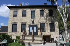 | Ahnapee Brewery | building | 1994 | 94000597 |
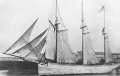 | DANIEL LYONS (Shipwreck) | site | 2007 | 07001048 |
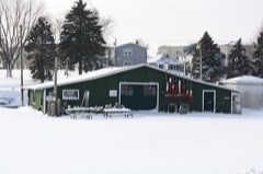 | Art Dettman Fishing Shanty | building | 1993 | 93001428 |
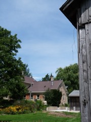 | George Halada Farmstead | building | 1993 | 93000026 |
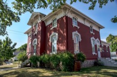 | Kewaunee County Sheriff's Residence and Jail | building | 1996 | 96000728 |
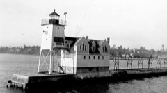 | Kewaunee Pierhead Lighthouse | building | 2022 | 100007998 |
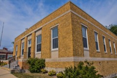 | Kewaunee Post Office | building | 2000 | 00001247 |
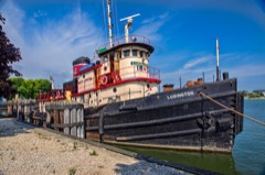 | MAJOR WILBUR FR. BROWDER (tugboat) | structure | 2002 | 02000284 |
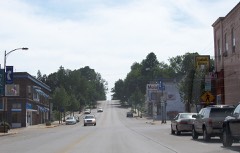 | Marquette Historic District | district | 1993 | 93001167 |
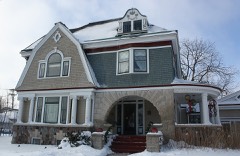 | Melvin W. and Mary Perry House | building | 2008 | 07001461 |
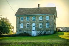 | Pilgrim Family Farmstead | building | 1979 | 79000091 |
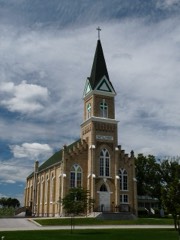 | St. Lawrence Catholic Church | district | 1989 | 89000056 |
Every wildfire the federal occurrence database records inside this county: 15 of them, burning about 11 acres. None started naturally and 1 was recorded as arson. Each settlement page carries the fires within five miles of it.
| Reported cause | Fires |
|---|---|
| Debris and open burning | 7 |
| Missing data/not specified/undetermined | 5 |
| Equipment and vehicle use | 1 |
| Arson/incendiarism | 1 |
| Smoking | 1 |
The five largest, by the area the report gives. None of them was recorded as arson.
| Date | Cause | Size | Reported by | Name on the report |
|---|---|---|---|---|
| 7 September 2020 | Debris and open burning | 3.0 acres | Wisconsin Department of Natural Resources | 45 |
| 13 June 2018 | Debris and open burning | 2.0 acres | Wisconsin Department of Natural Resources | 115418 |
| 17 March 2020 | Missing data/not specified/undetermined | 2.0 acres | Wisconsin Department of Natural Resources | F200044 |
| 8 May 2018 | Debris and open burning | 2.0 acres | Wisconsin Department of Natural Resources | 15 |
| 7 August 1994 | Missing data/not specified/undetermined | 1.0 acres | Wisconsin Department of Natural Resources | not named |
| 1 May 1993 | Smoking | under an acre | Wisconsin Department of Natural Resources | not named |
| 12 June 2018 | Missing data/not specified/undetermined | under an acre | Wisconsin Department of Natural Resources | 16 |
| 29 April 2018 | Debris and open burning | under an acre | Wisconsin Department of Natural Resources | 14 |
Every settlement page carries the fires within five miles of it - see the settlement index below.
The NOAA Storm Events Database holds 152 reports for this county, causing no deaths, 4 injuries and about $1,447,500 in recorded property damage. Each settlement page carries the reports that name it.
| Kind of event | Reports |
|---|---|
| Thunderstorm Wind | 71 |
| Hail | 50 |
| Flood | 16 |
| Tornado | 9 |
| Lightning | 3 |
| Funnel Cloud | 1 |
| Heavy Rain | 1 |
| Flash Flood | 1 |
The most serious of them, by death, then injury, then recorded damage. The accounts are quoted exactly as the forecast office filed them.
| When | Event | Place named | Harm | What the report says |
|---|---|---|---|---|
| July 2000 | Hail | Alaska | 2 hurt | no account filed |
| April 1970 | Tornado (F2) | not stated | 1 hurt, $250,000 | no account filed |
| September 2019 | Lightning | Kewaunee | 1 hurt | A 30 year old male was struck by lightning in the city of Kewaunee. Kewaunee Police say the man was working for a company that was contracted to do some work in the area and had been holding an uncharged power line in the performance of his job when lightning struck. He was transported to the hospital and his condition is unknown. |
| July 1994 | Thunderstorm Wind | Algoma | $500,000 | Lightning started a fire which extensively damaged a restaurant in Nekoosa (Wood County). A severe thunderstorm with winds to 60 mph caused $150,000 damage around Algoma (Kewaunee County). Damage occurred to roofs, porches and windows as well as trees and power lines. |
| April 1970 | Tornado (F2) | not stated | $250,000 | no account filed |
| August 2025 | Lightning | Rosiere | $125,000 | A house was struck by lightning and started on fire. The fire produced around $125,000 worth of damage. |
| March 2019 | Flood | Algoma | $121,000 | Runoff from rainfall and melting snow, along with clogged storm drains and ice jams, caused numerous roads, ditches, rivers and streams to flood throughout Kewaunee County. Some of the roads were damaged by the flooding and remained closed even after the water receded. One home sustained minor flood damage. The Kewaunee River reached moderate flood stage just west of Kewaunee. A county-wide state of emergency was declared on March 15th. |
| August 2013 | Tornado (EF1) | Pilsen | $50,000 | The tornado that formed in Brown County at 12:59 am CDT continued east-southeast into Kewaunee County, crossing the county line 2.9 miles southwest of Pilsen at 1:06 am CDT. The tornado caused the walls and roof of a barn to collapse (DI 1, DOD 6) and damaged the tops of two silos. In addition, the tornado damaged and uprooted several dozen trees along its path. Average path width in Kewaunee County was 75 yards. |
| June 1999 | Thunderstorm Wind | Alaska | $50,000 | no account filed |
| August 2016 | Tornado (EF0) | Kewaunee | $25,000 | A tornado formed and moved northeast on the west side of the city of Kewaunee. About 100 trees sustained some damage (DI 27,28 DOD 1,2) and several were uprooted in wet soil. Several homes had shingle or siding damage (DI 2, DOD 1,2). A baseball dugout at a school was blown down. Average path width was about 75 yards. |
| July 1972 | Tornado (F1) | not stated | $25,000 | no account filed |
| July 1969 | Tornado (F1) | not stated | $25,000 | no account filed |
| June 1999 | Thunderstorm Wind | Algoma | $15,000 | no account filed |
| August 1995 | Thunderstorm Wind | Algoma | $5,000 | no account filed |
| August 1996 | Thunderstorm Wind | Kewaunee | $2,000 | no account filed |
| September 2005 | Hail | Algoma | $1,000 | no account filed |
| June 1998 | Thunderstorm Wind | Casco | $1,000 | no account filed |
| June 1997 | Thunderstorm Wind | Kewaunee | $1,000 | no account filed |
| August 2019 | Flood | Algoma | $500 | Heavy rainfall caused flooding of several roads in and around Algoma. |
| July 1994 | Thunderstorm Wind | Ellisville | $500 | no account filed |
| July 1994 | Thunderstorm Wind | Stagelville | $500 | no account filed |
| April 2026 | Flash Flood | Luxemburg | - | Rainfall amounts of 1 to 2 inches in a short period of time caused closed roadways due to flash flooding in Kewaunee and near Luxemburg. |
| July 2025 | Thunderstorm Wind | Kewaunee | - | Thunderstorm winds downed trees in Kewaunee. The time of this report is an estimate based on radar data. |
| August 2025 | Thunderstorm Wind | Algoma | - | Thunderstorm winds downed trees and power lines in the Algoma area. The time of this report is an estimate based on radar data. |
| August 2024 | Thunderstorm Wind | Pilsen | - | Thunderstorm winds downed trees in Montpelier. The time of this report is an estimate based on radar data. |
| August 2024 | Thunderstorm Wind | Kewaunee | - | Thunderstorm winds downed trees in Kewaunee. The time of this report is an estimate based on radar data. |
| August 2024 | Thunderstorm Wind | Kewaunee | - | Thunderstorms produced a wind gust to 67 mph at a Mesonet site in Kewaunee. |
| June 2024 | Hail | Kewaunee | - | Penny size hail fell in Kewaunee. |
| April 2022 | Hail | Kewaunee | - | Quarter size hail fell in Kewaunee. The time of this event is an estimate based on radar data. |
| May 2022 | Hail | Pilsen | - | Nickel size hail fell near Pilsen. The time of this event is an estimate based on radar data. |
| July 2022 | Thunderstorm Wind | Krok | - | Thunderstorm winds downed trees near Ellisville. The time of this report is an estimate based on radar data. |
| September 2021 | Hail | Tisch Mills | - | Golf ball size hail fell northwest of Two Creeks. The time of this event is an estimate based on radar data. |
| July 2021 | Thunderstorm Wind | Algoma | - | Thunderstorm winds downed trees in Algoma. |
| August 2021 | Thunderstorm Wind | Algoma | - | Thunderstorm winds downed trees in Algoma. The time of this event is an estimate based on radar data. |
| August 2021 | Thunderstorm Wind | Thirty Daems | - | Thunderstorm winds downed multiple trees near County roads AB and K. The time of this event is an estimate based on radar data. |
| July 2021 | Thunderstorm Wind | Rosiere | - | Thunderstorm winds downed trees and power lines down in Rosiere, and across the northern half of Kewaunee County. The time of this event is an estimate based on radar data. |
| March 2020 | Flood | Kewaunee | - | Areas around the Kewaunee Marina were often under water due to record high lake levels. |
| May 2020 | Flood | Kewaunee | - | Areas around the Kewaunee Marina were often under water due to record high lake levels. |
| April 2020 | Flood | Kewaunee | - | Areas around the Kewaunee Marina were often under water due to record high lake levels. |
| January 2020 | Flood | Kewaunee | - | Areas around the Kewaunee Marina were often under water due to high lake levels. |
| February 2020 | Flood | Kewaunee | - | Areas around the Kewaunee Marina were often under water due to record high lake levels. |
| July 2020 | Flood | Kewaunee | - | Areas around the Kewaunee Marina were often under water due to record high lake levels. |
| August 2020 | Flood | Kewaunee | - | Areas around the Kewaunee Marina were often under water due to record high lake levels. |
| September 2020 | Flood | Kewaunee | - | Areas around the Kewaunee Marina were often under water due to high lake levels. |
| June 2020 | Flood | Kewaunee | - | Areas around the Kewaunee Marina were often under water due to record high lake levels. |
| October 2019 | Flood | Kewaunee | - | Areas around the Kewaunee Marina were often under water due to high lake levels. |
| July 2019 | Thunderstorm Wind | Luxemburg | - | Thunderstorm winds downed several trees around Luxemburg. |
| July 2019 | Thunderstorm Wind | Kewaunee | - | Thunderstorm winds downed several trees in and around Kewaunee. |
| July 2019 | Thunderstorm Wind | Stangelville | - | Thunderstorm winds downed trees in Stangelville. The time of this event is an estimate based on radar data. |
| July 2019 | Thunderstorm Wind | Norman | - | Thunderstorm winds downed trees in Norman. The time of this event is an estimate based on radar data. |
| July 2019 | Thunderstorm Wind | Kewaunee | - | Thunderstorm winds downed trees near Kewaunee. The time of this event is an estimate based on radar data. |
| August 2019 | Thunderstorm Wind | Walhain | - | Thunderstorm winds downed a couple of small trees and some branches at Highway 54 and County Highway H. The time of this report is an estimate based on radar data. |
| September 2019 | Flood | Kewaunee | - | Areas around the Kewaunee Marina were often under water due to high lake levels. |
| December 2019 | Flood | Kewaunee | - | Areas around the Kewaunee Marina were often under water due to high lake levels. |
| November 2019 | Flood | Kewaunee | - | Areas around the Kewaunee Marina were often under water due to high lake levels. |
| August 2018 | Thunderstorm Wind | Kewaunee | - | Thunderstorm winds downed several trees and branches from Kewaunee to Algoma. |
| April 2017 | Hail | Rostok | - | Quarter size hail fell north of Kewaunee. |
| June 2017 | Thunderstorm Wind | Dyckesville | - | Thunderstorm winds snapped a large tree in Dyckesville near the intersection of County Road DK and Debaker Lane. |
| August 2017 | Hail | Stangelville | - | Quarter size hail fell in Stangelville. |
| August 2017 | Hail | Kewaunee | - | Quarter size hail fell in Kewaunee. |
The Survey's mineral resources record lists 103 workings inside this county. 9 still produce and 94 are closed or unrecorded. Each settlement page carries the workings within five miles of it.
| Commodity | Workings |
|---|---|
| Sand and Gravel, Construction | 102 |
| Stone, Crushed/Broken | 1 |
The least common of them first, because a county's hundredth gravel pit says nothing its first ten did not.
| Where | Site | Commodity | Status | Recorded |
|---|---|---|---|---|
| Luxemburg Limestone Quarry | Stone, Crushed/Broken | Past Producer | ||
| Alaska Gravel Deposit | Sand and Gravel, Construction | Occurrence | ||
| Algoma Gravel Deposit #1 | Sand and Gravel, Construction | Occurrence | ||
| Algoma Gravel Pit #1 | Sand and Gravel, Construction | Past Producer | ||
| Algoma Gravel Pit #2 | Sand and Gravel, Construction | Past Producer | ||
| Algoma Gravel Pit #3 | Sand and Gravel, Construction | Past Producer | ||
| Algoma Gravel Pit #4 | Sand and Gravel, Construction | Past Producer | ||
| B Wilke Gravel Pit | Sand and Gravel, Construction | Past Producer | ||
| Blahnik Gravel Pit | Sand and Gravel, Construction | Past Producer | ||
| Boulanger Construction Co. Pit | Sand and Gravel, Construction | Past Producer | ||
| C Alexander Gravel Deposit | Sand and Gravel, Construction | Occurrence | ||
| C Lohney Gravel Pit | Sand and Gravel, Construction | Past Producer | ||
| C Novak Gravel Pit | Sand and Gravel, Construction | Past Producer | ||
| Casco Gravel Deposit | Sand and Gravel, Construction | Occurrence | ||
| Casco Gravel Pit #1 | Sand and Gravel, Construction | Past Producer | ||
| Casco Gravel Pit #2 | Sand and Gravel, Construction | Past Producer | ||
| Cherneyville Road Gravel Pit | Sand and Gravel, Construction | Past Producer | ||
| Collegiate Road Gravel Deposit | Sand and Gravel, Construction | Occurrence | ||
| D Cherney Gravel Deposit | Sand and Gravel, Construction | Occurrence | ||
| D Thielbar Gravel Pit | Sand and Gravel, Construction | Past Producer | ||
| Delleman Gravel Pit | Sand and Gravel, Construction | Past Producer | ||
| Dettman Gravel Deposit | Sand and Gravel, Construction | Occurrence | ||
| Duescher Gravel Pit | Sand and Gravel, Construction | Past Producer | ||
| E Brusky Gravel Deposit | Sand and Gravel, Construction | Occurrence | ||
| E Kroening Gravel Pit | Sand and Gravel, Construction | Past Producer | ||
| E Larsen Gravel Pit | Sand and Gravel, Construction | Past Producer | ||
| E Larson Gravel Pit #1 | Sand and Gravel, Construction | Past Producer | ||
| E Larson Gravel Pit #2 | Sand and Gravel, Construction | Past Producer | ||
| E Seidl Gravel Deposit | Sand and Gravel, Construction | Occurrence | ||
| East Krok Gravel Deposit #1 | Sand and Gravel, Construction | Occurrence | ||
| East Krok Gravel Deposit #2 | Sand and Gravel, Construction | Occurrence | ||
| F Shestock Gravel Pit | Sand and Gravel, Construction | Past Producer | ||
| Gunnlaugsson Gravel Pit | Sand and Gravel, Construction | Past Producer | ||
| H Arendt Gravel Pit | Sand and Gravel, Construction | Past Producer | ||
| H Jacobs Gravel Pit | Sand and Gravel, Construction | Past Producer | ||
| H Lemens Gravel Pit | Sand and Gravel, Construction | Past Producer | ||
| H Neuzil Gravel Pit | Sand and Gravel, Construction | Past Producer | ||
| Hillside Road Gravel Deposit #1 | Sand and Gravel, Construction | Occurrence | ||
| Hillside Road Gravel Deposit #2 | Sand and Gravel, Construction | Occurrence | ||
| J Hrabik Gravel Deposit | Sand and Gravel, Construction | Occurrence | ||
| J Kudick Gravel Pit | Sand and Gravel, Construction | Past Producer | ||
| J Wessely Gravel Pit #1 | Sand and Gravel, Construction | Past Producer | ||
| J Wessely Gravel Pit #2 | Sand and Gravel, Construction | Past Producer | ||
| Jacob Huber Gravel Deposit #1 | Sand and Gravel, Construction | Occurrence | ||
| Jacob Huber Gravel Deposit #2 | Sand and Gravel, Construction | Occurrence | ||
| Jas Dufek Gravel Pit | Sand and Gravel, Construction | Past Producer | ||
| John Theys Gravel Deposit | Sand and Gravel, Construction | Occurrence | ||
| K Koss Gravel Deposit | Sand and Gravel, Construction | Occurrence | ||
| Kassner Gravel Pit | Sand and Gravel, Construction | Past Producer | ||
| Kewaunee Cnty. Pit | Sand and Gravel, Construction | Unknown | ||
| Kewaunee County Pits | Sand and Gravel, Construction | Producer | ||
| Kewaunee Gravel Pit #1 | Sand and Gravel, Construction | Past Producer | ||
| Kewaunee Gravel Pit #2 | Sand and Gravel, Construction | Past Producer | ||
| Kirthman Pit | Sand and Gravel, Construction | Past Producer | ||
| Kraynik Gravel Pit | Sand and Gravel, Construction | Past Producer | ||
| Krok Creek Gravel Pit | Sand and Gravel, Construction | Past Producer | ||
| Kromns Lake Gravel Deposit | Sand and Gravel, Construction | Occurrence | ||
| L Schlies Gravel Pit | Sand and Gravel, Construction | Past Producer | ||
| Lautscher Gravel Pit | Sand and Gravel, Construction | Past Producer | ||
| Legois Pit | Sand and Gravel, Construction | Past Producer | ||
| Lester Huber Gravel Deposit | Sand and Gravel, Construction | Occurrence | ||
| Luxemburg Township Pit | Sand and Gravel, Construction | Past Producer | ||
| Mashek Creek Gravel Deposit | Sand and Gravel, Construction | Occurrence | ||
| Matzke Gravel Pit | Sand and Gravel, Construction | Past Producer | ||
| Milo Sidwell Gravel Pit | Sand and Gravel, Construction | Past Producer | ||
| Nuclear Road Gravel Pit #1 | Sand and Gravel, Construction | Past Producer | ||
| Nuclear Road Gravel Pit #2 | Sand and Gravel, Construction | Past Producer | ||
| O Born Gravel Pit | Sand and Gravel, Construction | Past Producer | ||
| Patek Pit and Mill | Sand and Gravel, Construction | Producer | ||
| Peter Knipp Gravel Pit | Sand and Gravel, Construction | Past Producer | ||
| Pit #1 | Sand and Gravel, Construction | Producer | ||
| Pribek Gravel Pit | Sand and Gravel, Construction | Past Producer | ||
| R Eckola Gravel Deposit | Sand and Gravel, Construction | Occurrence | ||
| R Graf Gravel Deposit | Sand and Gravel, Construction | Occurrence | ||
| Rankin Gravel Pit | Sand and Gravel, Construction | Past Producer | ||
| Rankin Pit | Sand and Gravel, Construction | Producer | ||
| Red River Pit | Sand and Gravel, Construction | Producer | ||
| Rio Creek Gravel Pit #1 | Sand and Gravel, Construction | Past Producer | ||
| River Road Gravel Pit #1 | Sand and Gravel, Construction | Past Producer | ||
| River Road Gravel Pit #2 | Sand and Gravel, Construction | Past Producer | ||
| S Blahnik Gravel Pit | Sand and Gravel, Construction | Past Producer | ||
| Sandy Bay Gravel Deposit | Sand and Gravel, Construction | Occurrence | ||
| Sandy Bay Road Gravel Pit | Sand and Gravel, Construction | Past Producer | ||
| Scarboro Creek Gravel Pit #1 | Sand and Gravel, Construction | Past Producer | ||
| Scarboro Creek Gravel Pit #2 | Sand and Gravel, Construction | Past Producer | ||
| Scarboro Creek Gravel Pit #3 | Sand and Gravel, Construction | Past Producer | ||
| Schuster Sand and Gravel Casco Pit | Sand and Gravel, Construction | Producer | ||
| Shimanek Gravel Pit | Sand and Gravel, Construction | Past Producer | ||
| Slovan Gravel Pit | Sand and Gravel, Construction | Past Producer | ||
| Stoller Pit | Sand and Gravel, Construction | Producer | ||
| Street Gravel Pit | Sand and Gravel, Construction | Past Producer | ||
| Swampside Gravel Pit | Sand and Gravel, Construction | Past Producer | ||
| Tebon Sand and Gravel Pit | Sand and Gravel, Construction | Producer | ||
| Theys Pit | Sand and Gravel, Construction | Producer | ||
| Three Corners Gravel Pit | Sand and Gravel, Construction | Past Producer | ||
| Tisch Mills Creek Gravel Deposit | Sand and Gravel, Construction | Occurrence | ||
| Tisch Mills Gravel Pit | Sand and Gravel, Construction | Past Producer | ||
| Valley Road Gravel Pit #1 | Sand and Gravel, Construction | Past Producer | ||
| Valley Road Gravel Pit #2 | Sand and Gravel, Construction | Past Producer | ||
| W Harmon Gravel Deposit | Sand and Gravel, Construction | Occurrence | ||
| W Junid Gravel Pit | Sand and Gravel, Construction | Past Producer | ||
| W Luedtke Gravel Pit | Sand and Gravel, Construction | Past Producer | ||
| Wierichs Gravel Pit | Sand and Gravel, Construction | Past Producer |
Named settlements recorded in the Geographic Names Information System, each with the topographic sheets covering it. Villages, hamlets and abandoned places alike. Each is shown with the nearest named watercourse or landform and the survey quadrangle it falls on.
Luxemburg town · 54217 · On Rogers Creek · Luxemburg quadrangle
8 sheets, 1952 to 1984
Montpelier town · 54217 · On Cherneyville Hill · Stangelville quadrangle
8 sheets, 1954 to 1984
Montpelier town · 54217 · Near Montpelier Hills · Stangelville quadrangle
8 sheets, 1954 to 1984
Casco town · 54216 · On Little Scarboro Creek · Casco quadrangle
8 sheets, 1952 to 1984