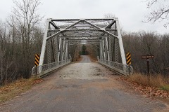
Block
From the record
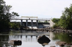
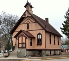
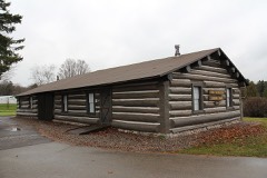
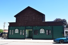
23 National Register listings published here, 1 of them a National Historic Landmark.
Sources: the National Register database, National Park Service
52 topographic sheets cover 35 settlements here, and 23 properties are on the National Register of Historic Places.
23 National Register listings published here, 1 of them a National Historic Landmark.
Sources: the National Register database, National Park Service
Every property in this county listed on the National Register of Historic Places, with the year it was listed and the federal nomination document.
Every wildfire the federal occurrence database records inside this county: 1,482 of them, burning about 2,171 acres. 25 started naturally and 115 were recorded as arson. Each settlement page carries the fires within five miles of it.
| Reported cause | Fires |
|---|---|
| Debris and open burning | 494 |
| Equipment and vehicle use | 321 |
| Missing data/not specified/undetermined | 230 |
| Arson/incendiarism | 115 |
| Recreation and ceremony | 103 |
| Smoking | 50 |
| Fireworks | 45 |
| Power generation/transmission/distribution | 38 |
| Other causes | 26 |
| Misuse of fire by a minor | 25 |
| Natural | 25 |
| Railroad operations and maintenance | 10 |
The five largest, by the area the report gives. Two of them were set deliberately.
| Date | Cause | Size | Reported by | Name on the report |
|---|---|---|---|---|
| 2 May 2004 | Debris and open burning | 215 acres | Wisconsin Department of Natural Resources | not named |
| 26 May 2014 | Natural | 110 acres | Wisconsin Department of Natural Resources | SNOW FALLS FIRE |
| 25 October 1999 | Missing data/not specified/undetermined | 65 acres | Chequamegon-Nicolet National Forest | ISLAND LAKE |
| 21 April 2007 | Arson/incendiarism | 42 acres | Wisconsin Department of Natural Resources | not named |
| 8 January 2003 | Arson/incendiarism | 37 acres | Wisconsin Department of Natural Resources | not named |
| 31 July 2012 | Debris and open burning | 35 acres | Wisconsin Department of Natural Resources | not named |
| 19 August 2002 | Equipment and vehicle use | 29 acres | Wisconsin Department of Natural Resources | not named |
| 23 April 1994 | Equipment and vehicle use | 28 acres | Wisconsin Department of Natural Resources | not named |
Every settlement page carries the fires within five miles of it - see the settlement index below.
The NOAA Storm Events Database holds 245 reports for this county, causing 2 deaths, 10 injuries and about $15,694,700 in recorded property damage. Each settlement page carries the reports that name it.
| Kind of event | Reports |
|---|---|
| Thunderstorm Wind | 115 |
| Hail | 85 |
| Flood | 18 |
| Tornado | 15 |
| Lightning | 5 |
| Flash Flood | 2 |
| Funnel Cloud | 2 |
| Heavy Rain | 2 |
| Dust Devil | 1 |
The most serious of them, by death, then injury, then recorded damage. The accounts are quoted exactly as the forecast office filed them.
| When | Event | Place named | Harm | What the report says |
|---|---|---|---|---|
| August 2014 | Lightning | Morgan | 2 killed | Lightning from a thunderstorm that quickly developed west of Abrams killed two men working on a tree house at a home on County Road E in the Town of Morgan. The men were struck by lightning from the storm as it passed about two miles to their south. One of the men, a 27-year-old, was killed instantly. The other, a 31-year-old, was taken to a Green Bay hospital and died of his injuries on August 6th. |
| September 1971 | Tornado (F3) | not stated | 4 hurt, $250,000 | no account filed |
| June 2007 | Tornado (EF2) | Mountain | 2 hurt, $10,500,000 | The long-track tornado moved from Langlade Co. into Oconto Co. about 8 miles west of Mountain at 4:58 PM CDT. The tornado reached a width of three-quarters of a mile wide as it flattened over 7000 acres of trees in the Chequamegon-Nicolet National Forest (DI 27, DOD4). The tornado destroyed or heavily damaged 12 homes (DI 4, DOD 11), with 14 others sustaining damage of varying degrees. Nearly all of the damaged homes were either manufactured homes or vacation cottages. Two people sustained minor injuries as they sought shelter in a bedroom of their home. The tornado dissipated about 10 miles east-northeast of Lakewood, near the Marinette County line, at 5:18 PM CDT. The tornado was rated EF2 in Langlade Co., with estimated winds of 125 to 135 mph, and an average path length of 1000 yards. |
| September 1994 | Thunderstorm Wind | Brazeau | 2 hurt, $200,000 | no account filed |
| March 1998 | Hail | Oconto | 1 hurt | no account filed |
| August 1987 | Thunderstorm Wind | not stated | 1 hurt | no account filed |
| July 2006 | Hail | Hayes | $2,250,000 | no account filed |
| December 2019 | Flood | Oconto | $384,000 | An ice jam and high river stages produced flooding in the city of Oconto. The high water mainly affected Pecor, McDonald, Water, Turner, Ontario, Bridge, First and Second streets. The mobile home park on Farnsworth Avenue also Flooded. Washington Street by the Oconto County Courthouse also flooded as storm sewers overflowed. |
| July 2019 | Thunderstorm Wind | Klondike | $350,000 | Thunderstorm winds downed trees along Highway 64 between Pound and Mountain. |
| May 2022 | Flash Flood | Klondike | $335,000 | Several rounds of thunderstorms dumped upwards of 7 inches of rain over central Oconto County during the late afternoon and evening hours. This caused damage to area roads, bridges, culverts, and parks across the central part of the county as well as several area roads to be washed out. The hardest hit areas were in or near the city of Spruce and north of Gillett. |
| July 2019 | Thunderstorm Wind | Mountain | $300,000 | Thunderstorm winds downed numerous trees in and around Mountain. |
| May 1980 | Tornado (F1) | not stated | $250,000 | no account filed |
| June 1979 | Tornado (F2) | not stated | $250,000 | no account filed |
| January 2020 | Flood | Oconto | $96,000 | An ice jam and high river stages produced flooding in the city of Oconto. The high water mainly affected Pecor, McDonald, Water, Turner, Ontario, Bridge, First and Second streets. The mobile home park on Farnsworth Avenue also Flooded. Washington Street by the Oconto County Courthouse also flooded as storm sewers overflowed. |
| July 2020 | Lightning | Townsend | $75,000 | A lightning strike caused a home to become engulfed in flames on Dencur Lane in Townsend. |
| July 2002 | Thunderstorm Wind | Suring | $75,000 | no account filed |
| July 2021 | Thunderstorm Wind | Flintville | $50,000 | Thunderstorm winds downed a tree and heavily damaged a roof in Sobieski. |
| June 1998 | Lightning | Klondike | $50,000 | no account filed |
| September 2014 | Thunderstorm Wind | Townsend | $42,000 | Thunderstorm winds, estimated at 75 mph, downed at least 30 trees in the Townsend area. A dozen homes sustained roof minor roof damage from fallen trees. |
| June 2017 | Thunderstorm Wind | Lena | $30,000 | Thunderstorm winds caused a barn to collapse and tore the roof from another. |
| July 2017 | Thunderstorm Wind | Chase | $25,000 | A farm building was heavily damaged and several trees were snapped or uprooted on property about two miles south of Chase. The damage was caused by thunderstorm winds estimated at least 70 mph in a wet microburst. |
| July 2013 | Tornado (EF0) | Oconto | $25,000 | A tornado touched down just east of Highway 41 near Swede Town Road and County Road A in Oconto County and moved along an eastward path toward the bay. The tornado was observed by an eyewitness. Dozens of trees were snapped and uprooted along the path of the tornado (DI 27, DOD 3-4 and DI 28, DOD 3-4). The tornado also blew over a recreational vehicle trailer. Average path width of the tornado was 75 yards. |
| June 1976 | Tornado (F1) | not stated | $25,000 | no account filed |
| June 1966 | Tornado (F2) | not stated | $25,000 | no account filed |
| June 1966 | Tornado (F2) | not stated | $25,000 | no account filed |
| June 1966 | Tornado (F2) | not stated | $25,000 | no account filed |
| June 2024 | Lightning | Chase | $20,000 | A barn was destroyed by a fire started by lightning in the town of Chase. |
| August 2015 | Hail | Brookside | $5,000 | Softball size hail fell near Abrams, causing isolated vehicle damage. |
| July 2015 | Tornado (EF1) | Gillett | $5,000 | Another tornado formed and produced mainly light damage along its two mile path. The tornado uprooted or snapped at least 20 trees (DI 27 and 28, DOD 3 and 4) and caused minor damage to a house (DI 2, DOD 2). |
| May 1996 | Thunderstorm Wind | Oconto Falls | $5,000 | no account filed |
| June 2017 | Thunderstorm Wind | Breed | $3,500 | Thunderstorm winds heavily damaged the roof of a cottage and downed several trees near Breed. |
| July 1995 | Thunderstorm Wind | Kelly Lake | $3,000 | Scattered severe thunderstrorms rolled through northern Wisconsin during the morning hours. Powerful winds toppled large trees near New Auburn (Chippewa County); and in St. Germania and Phelps (Vilas County). A few homes and vehicles sustained minor damaged in Kelly Lake. |
| June 1974 | Tornado (F1) | not stated | $2,500 | no account filed |
| June 1998 | Thunderstorm Wind | Oconto | $2,000 | no account filed |
| August 1996 | Thunderstorm Wind | Oconto | $2,000 | no account filed |
| August 1996 | Thunderstorm Wind | Chase | $2,000 | no account filed |
| May 1998 | Lightning | Oconto | $1,000 | no account filed |
| June 1998 | Thunderstorm Wind | Oconto Falls | $1,000 | no account filed |
| June 1998 | Thunderstorm Wind | Gillett | $1,000 | no account filed |
| June 1998 | Thunderstorm Wind | Oconto Falls | $1,000 | no account filed |
| July 1997 | Thunderstorm Wind | Pensaukee | $1,000 | no account filed |
| July 1997 | Thunderstorm Wind | Gillett | $1,000 | no account filed |
| April 1996 | Tornado (F0) | Pensaukee | $1,000 | no account filed |
| April 2010 | Dust Devil | Stiles | $500 | At around 3 pm CDT, a dust devil formed near the Machickanee Flowage on the southern branch of the Oconto River near Stiles. The whirlwind moved onto the water for a brief time, lifting the back of a pontoon boat and sucking the life jackets into the air. It then lifted several sections of the end of the dock 40 feet into the air, spinning the debris around, finally depositing everything into the water. |
| June 2014 | Thunderstorm Wind | Sobieski | $200 | Thunderstorm winds snapped 2 pine trees and a flag pole near Sobieski. |
| May 2025 | Thunderstorm Wind | Lena | - | Thunderstorm winds knocked over part of a tall fence and caused the roof of a barn to collapse near Lena. The time of this report is an estimate based on radar data. |
| April 2025 | Thunderstorm Wind | Klondike | - | Thunderstorm winds produced wind damage to a barn near White Potato Lake. The time of this report is an estimate based on radar data. |
| July 2025 | Hail | Suring | - | Quarter size hail fell near Suring. |
| July 2025 | Tornado (EF1) | Gillett | - | A tornado touched down in Gillett at 5:37 PM CDT. The tornado tracked east and tore the roof of a metal building, uplifted and damaged the roof of a nearby building, and snapped and uprooted several trees before dissipating east of Gillett at 5:40 PM CDT. Total path length is estimated to be 2.33 miles long, with a width of 65 yards. Peak wind estimated to be around 95 mph. |
| July 2025 | Tornado (EF0) | Oconto | - | A tornado touched down west of Oconto at 6:00 PM CDT. The tornado tracked northeast and snapped and uprooted several trees before dissipating just north of Oconto at 6:04 PM CDT. The tornado uprooted several trees at a local golf course northwest of Oconto. Total path length is estimated to be 2.37 miles long, with a width of 65 yards. Peak wind estimated to be around 77 mph. |
| June 2024 | Tornado (EF1) | Underhill | - | The tornado that developed near Highway 55 northwest of Keshena at 2:25 AM CDT crossed the county line at 2:33 AM CDT. The tornado tracked east-southeast across Berry Lake before lifting at 2:34 AM CDT. The tornado downed multiple power lines, snapped and uprooted trees, and flipped several campers at a campground along the path. Total path length is estimated to be 8.96 miles long, with a width of 83 yards. Peak wind estimated to be around 98 mph. |
| June 2024 | Hail | Underhill | - | Ping pong size hail fell near Berry Lake. The time of this report is an estimate based on radar data. |
| July 2023 | Thunderstorm Wind | Hickory Corners | - | Thunderstorm winds downed several trees and blew off several sections of a storage shed in and around Kelly Lake. The time of this report is an estimate based on radar data. |
| July 2023 | Hail | Mountain | - | Ping pong size hail fell near Mountain. The time of this event is an estimate based on radar data. |
| July 2023 | Thunderstorm Wind | Hickory Corners | - | Thunderstorm winds downed trees in Hickory Corners. The time of this event is an estimate based on radar data. |
| July 2023 | Thunderstorm Wind | Stiles | - | Thunderstorm winds downed multiple trees in Stiles. The time of this report is an estimate based on radar data. |
| October 2023 | Hail | Oconto Falls | - | Quarter size hail fell in Oconto Falls. |
| October 2023 | Hail | Stiles | - | Penny size hail fell in Stiles. |
| May 2022 | Hail | Mountain | - | Ping pong size hail fell in Mountain. |
| May 2022 | Hail | Mountain | - | Penny size hail fell in Crooked Lake. |
The Survey's mineral resources record lists 26 workings inside this county. 14 still produce and 12 are closed or unrecorded. Each settlement page carries the workings within five miles of it.
| Commodity | Workings |
|---|---|
| Sand and Gravel, Construction | 18 |
| Stone, Crushed/Broken | 8 |
The least common of them first, because a county's hundredth gravel pit says nothing its first ten did not.
| Where | Site | Commodity | Status | Recorded |
|---|---|---|---|---|
| Green Lake Diorite Quarry | Stone, Crushed/Broken | Past Producer | ||
| Jackie Foster Incorporated Quarries | Stone, Crushed/Broken | Producer | ||
| Military Road Dolomite Quarry | Stone, Crushed/Broken | Past Producer | ||
| Montevideo Quarry | Stone, Crushed/Broken | Past Producer | ||
| Oconto County Limestone Quarry | Stone, Crushed/Broken | Past Producer | ||
| Peters Quarry | Stone, Crushed/Broken | Producer | ||
| Snyder Limestone Quarry | Stone, Crushed/Broken | Past Producer | ||
| Valley Line Road Ls Quarry | Stone, Crushed/Broken | Past Producer | ||
| Bake Pit | Sand and Gravel, Construction | Producer | ||
| Elmer Hubbard Sand and Gravel | Sand and Gravel, Construction | Past Producer | ||
| Elmer Hubbard Sand and Gravel Pit | Sand and Gravel, Construction | Producer | ||
| Gene Sager Pit | Sand and Gravel, Construction | Past Producer | ||
| Gillett Pit | Sand and Gravel, Construction | Producer | ||
| Hubbard Pit | Sand and Gravel, Construction | Producer | ||
| Klatt Pit | Sand and Gravel, Construction | Producer | ||
| Kraczwski Pit | Sand and Gravel, Construction | Past Producer | ||
| Oconto County Highway Dept. Pits | Sand and Gravel, Construction | Producer | ||
| Paitz Pit | Sand and Gravel, Construction | Producer | ||
| Peters Trucking Co,Incperrets Pit | Sand and Gravel, Construction | Producer | ||
| Pierett Pit | Sand and Gravel, Construction | Past Producer | ||
| Robiacke Pit | Sand and Gravel, Construction | Producer | ||
| Sampson Pit | Sand and Gravel, Construction | Producer | ||
| Shuch Pit | Sand and Gravel, Construction | Producer | ||
| Spruce Township Pit | Sand and Gravel, Construction | Past Producer | ||
| Tri-County Pit | Sand and Gravel, Construction | Unknown | ||
| Zimmerman Pit | Sand and Gravel, Construction | Producer |
Named settlements recorded in the Geographic Names Information System, each with the topographic sheets covering it. Villages, hamlets and abandoned places alike. Each is shown with the nearest named watercourse or landform and the survey quadrangle it falls on.
Spruce town · 54139 · On Daly Creek · Oconto Falls North quadrangle
8 sheets, 1955 to 1984
Little Suamico town · 54141 · On Tibbet Creek · Suamico quadrangle
6 sheets, 1954 to 1984
Oconto Falls city · 54154 · On Coopman Creek · Oconto Falls South quadrangle
8 sheets, 1955 to 1984