 Block
From the record
20 National Register listings published here.
Sources: the National Register database, National Park Service
64 topographic sheets cover 27 settlements here, and 20 properties are on the National Register of Historic Places.
20 National Register listings published here.
Sources: the National Register database, National Park Service
Every property in this county listed on the National Register of Historic Places, with the year it was listed and the federal nomination document.
| Photograph | Property | Type | Listed | Reference |
|---|---|---|---|---|
| Ella M. Boesel Boathouse | building | 1997 | 97000889 | |
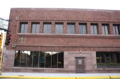 | First National Bank | building | 1973 | 73000091 |
| Hans J. Hagge Boathouse | building | 2005 | 05001493 | |
| Indianapolis Outing Club | building | 2004 | 04000156 | |
| Jollywood | building | 2003 | 03000166 | |
| George P. Mayer Boathouse | building | 2011 | 11000115 | |
 | Mecikalski General Store, Saloon, and Boardinghouse | building | 1984 | 84003751 |
| Marshall D. Miller Boathouse | building | 2008 | 08000747 | |
 | Oneida County Courthouse | building | 1981 | 81000052 |
| Phillip Orth Boathouse | building | 2005 | 05001492 | |
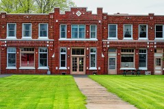 | Pelican Lake Hotel | building | 2013 | 12001188 |
| Reay Boathouse | building | 2004 | 04000730 | |
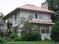 | Solon and Mathilda Sutliff House | building | 2009 | 09000821 |
| Texaco Service Station | building | 2023 | 100009186 | |
| Three Lakes Rod and Gun Club | district | 2013 | 13000808 | |
| Tomahawk Lake Camp Historic District | district | 1992 | 91001987 | |
| Joseph and Augusta Trunck Boathouse | building | 2008 | 08000750 | |
| Luther and Anna Walter Boathouse | building | 2005 | 05001494 | |
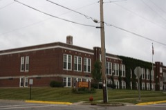 | West Side School | building | 2009 | 09000124 |
| William H. Yawkey Boathouse | building | 2009 | 09001198 |
Every wildfire the federal occurrence database records inside this county: 1,164 of them, burning about 1,095 acres. 15 started naturally and 100 were recorded as arson. Each settlement page carries the fires within five miles of it.
| Reported cause | Fires |
|---|---|
| Debris and open burning | 321 |
| Missing data/not specified/undetermined | 262 |
| Equipment and vehicle use | 133 |
| Arson/incendiarism | 100 |
| Recreation and ceremony | 89 |
| Power generation/transmission/distribution | 87 |
| Smoking | 43 |
| Railroad operations and maintenance | 37 |
| Misuse of fire by a minor | 29 |
| Other causes | 28 |
| Fireworks | 20 |
| Natural | 15 |
The five largest, by the area the report gives. Two of them were set deliberately.
| Date | Cause | Size | Reported by | Name on the report |
|---|---|---|---|---|
| 3 May 2000 | Debris and open burning | 98 acres | Wisconsin Department of Natural Resources | not named |
| 26 July 1992 | Missing data/not specified/undetermined | 77 acres | Wisconsin Department of Natural Resources | not named |
| 26 July 1992 | Missing data/not specified/undetermined | 68 acres | Wisconsin Department of Natural Resources | not named |
| 21 July 1998 | Fireworks | 48 acres | Wisconsin Department of Natural Resources | not named |
| 11 September 1998 | Equipment and vehicle use | 46 acres | Wisconsin Department of Natural Resources | not named |
| 28 May 1994 | Equipment and vehicle use | 43 acres | Wisconsin Department of Natural Resources | not named |
| 14 May 2019 | Arson/incendiarism | 39 acres | Wisconsin Department of Natural Resources | HAHN |
| 29 October 2005 | Arson/incendiarism | 36 acres | Wisconsin Department of Natural Resources | not named |
Every settlement page carries the fires within five miles of it - see the settlement index below.
The NOAA Storm Events Database holds 357 reports for this county, causing 6 deaths, 40 injuries and about $55,252,230 in recorded property damage. Each settlement page carries the reports that name it.
| Kind of event | Reports |
|---|---|
| Thunderstorm Wind | 168 |
| Hail | 142 |
| Tornado | 22 |
| Lightning | 9 |
| Heavy Rain | 6 |
| Flood | 6 |
| Flash Flood | 3 |
| Funnel Cloud | 1 |
The most serious of them, by death, then injury, then recorded damage. The accounts are quoted exactly as the forecast office filed them.
| When | Event | Place named | Harm | What the report says |
|---|---|---|---|---|
| June 1985 | Tornado (F3) | not stated | 2 killed, 16 hurt, $25,000,000 | no account filed |
| June 1950 | Tornado (F4) | not stated | 2 killed, 12 hurt, $250,000 | no account filed |
| April 1984 | Tornado (F3) | not stated | 1 killed, 5 hurt, $25,000,000 | no account filed |
| September 2016 | Lightning | Minocqua | 1 killed | A 66-year-old man was struck by lightning outside his residence on Tanglewood Court in Minocqua. He was first taken to Howard Young Medical Center, then transported to St. Claire's Hospital in Weston. From there, he was taken to a burn center in Madison where he died from his injuries. |
| June 1980 | Tornado (F1) | not stated | 3 hurt, $25,000 | no account filed |
| July 1997 | Thunderstorm Wind | Rhinelander | 2 hurt, $2,000 | no account filed |
| June 2002 | Lightning | Rhinelander | 2 hurt | no account filed |
| July 2001 | Lightning | Rhinelander | $750,000 | no account filed |
| July 1999 | Thunderstorm Wind | Lake Tomahawk | $500,000 | no account filed |
| July 2019 | Tornado (EF0) | Lake George | $400,000 | A tornado produced a path of scattered tree damage (DI 28, DOD 2,3) west of Pelican Lake. Peak winds were estimated around 80 mph. |
| July 2020 | Lightning | Minocqua Woodruff Ar | $306,000 | Lightning struck a house on Nixon Road in Minocqua during the early morning hours, causing it to burn to the ground. |
| July 1997 | Hail | Minocqua | $300,000 | no account filed |
| July 1999 | Thunderstorm Wind | Hazelhurst | $250,000 | no account filed |
| July 1999 | Thunderstorm Wind | Woodruff | $250,000 | no account filed |
| August 1996 | Thunderstorm Wind | Three Lakes | $250,000 | no account filed |
| June 1991 | Tornado (F2) | not stated | $250,000 | no account filed |
| July 1986 | Tornado (F2) | not stated | $250,000 | no account filed |
| June 1981 | Tornado (F2) | not stated | $250,000 | no account filed |
| June 2010 | Heavy Rain | (Rhi)Rhinelander Arp | $200,000 | Rainfall runoff from the thunderstorms overwhelmed sewers in the City of Rhinelander where at least 98 homes and businesses experienced damage due to raw sewage infiltration. The hardest hit area had sewage backups in excess of 5 feet deep. The damage amount is estimated. |
| July 2000 | Flash Flood | East Portion | $179,500 | no account filed |
| July 2019 | Thunderstorm Wind | Pelican Lake | $100,000 | Thunderstorm winds downed several six to eight inch diameter trees at Pelican Lake. |
| July 2019 | Thunderstorm Wind | Rhinelander | $100,000 | Thunderstorm winds downed trees south of Rhinelander. The time of this report is an estimate based on radar data. |
| July 2008 | Thunderstorm Wind | Minocqua Woodruff Ar | $85,000 | Thunderstorm winds downed a large number of trees and a number of power lines in the Town of Minocqua. Downed trees made roads impassable and caused thousands of customers in the Minocqua and Rhinelander areas to lose electrical service. Some homes sustained damage, mainly to their roofs, when trees fell onto them. The high winds also flipped or damaged a number of boats. |
| June 2010 | Thunderstorm Wind | Enterprise | $75,000 | High winds from thunderstorms downed trees and power lines. Fallen trees significantly damaged a house and blocked two roads along the southwest shore of Pelican Lake. |
| September 2001 | Tornado (F0) | Pelican Lake | $65,500 | no account filed |
| July 2019 | Hail | Pelican Lake | $50,000 | Half dollar size hail fell at Pelican Lake. |
| June 2013 | Hail | (Rhi)Rhinelander Arp | $50,000 | Thunderstorms produced hail as large as golf ball size as they passed north of Rhinelander, causing damage to numerous vehicles. |
| August 2000 | Thunderstorm Wind | Three Lakes | $30,000 | no account filed |
| August 1996 | Thunderstorm Wind | Pelican Lake | $25,000 | no account filed |
| August 1996 | Thunderstorm Wind | Monico | $25,000 | no account filed |
| June 1981 | Tornado (F1) | not stated | $25,000 | no account filed |
| June 1981 | Tornado (F1) | not stated | $25,000 | no account filed |
| June 1953 | Tornado (F1) | not stated | $25,000 | no account filed |
| April 2002 | Flood | Central Portion | $16,200 | no account filed |
| May 2001 | Tornado (F1) | Minocqua | $15,000 | no account filed |
| September 2012 | Thunderstorm Wind | Rhinelander | $13,000 | Thunderstorms produced wind near 60 mph on the northeast side of Rhinelander. The storms knocked trees down on three properties in the same neighborhood, causing minor damage to two homes, a car, and a fence. In addition, the top of a petroleum asphalt tank was partially ripped off at a nearby business. |
| July 2008 | Thunderstorm Wind | Hazelhurst | $12,000 | Thunderstorm winds downed trees in Hazelhurst. One of the trees crushed a car. |
| June 2016 | Thunderstorm Wind | Minocqua | $10,000 | Thunderstorm winds downed large trees in the Minocqua area. Some of the trees landed on buildings. The time of this event was estimated based on radar data. |
| July 2007 | Thunderstorm Wind | Woodboro | $10,000 | Straight-line thunderstorm winds downed trees on CR-L near the Lincoln County line and damaged a store in the township of Woodboro. Time of event is approximate. |
| September 1996 | Thunderstorm Wind | Lake Tomahawk | $10,000 | no account filed |
| July 2010 | Thunderstorm Wind | Three Lakes | $7,500 | Thunderstorm winds downed trees near Three Lakes. One of the trees fell onto a cabin. |
| August 1996 | Thunderstorm Wind | Minocqua | $5,000 | no account filed |
| May 1994 | Hail | Rhinelander | $5,000 | no account filed |
| May 1994 | Hail | Minocqua | $5,000 | no account filed |
| May 1994 | Hail | Rhinelander | $5,000 | no account filed |
| May 1994 | Hail | Hazelhurst | $5,000 | no account filed |
| May 1994 | Hail | Monico | $5,000 | no account filed |
| May 1994 | Hail | Minocqua | $5,000 | no account filed |
| May 1994 | Hail | Rhinelander | $5,000 | no account filed |
| July 1998 | Thunderstorm Wind | Rhinelander | $4,000 | no account filed |
| July 1998 | Thunderstorm Wind | Rhinelander | $3,000 | no account filed |
| August 2013 | Heavy Rain | Rhinelander | $2,000 | The public reported an estimated 4 inches of rain in the Rhinelander area. There was standing water in a basement in the town of Pelican, on the east side of Rhinelander. |
| July 1998 | Thunderstorm Wind | Clearwater Lake | $2,000 | no account filed |
| June 1997 | Hail | Minocqua | $2,000 | no account filed |
| September 1997 | Thunderstorm Wind | Hazelhurst | $2,000 | no account filed |
| May 1996 | Thunderstorm Wind | Rhinelander | $2,000 | no account filed |
| June 1996 | Thunderstorm Wind | Minocqua | $2,000 | no account filed |
| June 1999 | Hail | Three Lakes | $1,500 | no account filed |
| June 1998 | Thunderstorm Wind | Woodboro | $1,000 | no account filed |
| May 1998 | Thunderstorm Wind | Lake Tomahawk | $1,000 | no account filed |
The Survey's mineral resources record lists 142 workings inside this county. 7 still produce and 135 are closed or unrecorded. Each settlement page carries the workings within five miles of it.
| Commodity | Workings |
|---|---|
| Sand and Gravel, Construction | 136 |
| Copper, Zinc | 2 |
| Zinc, Lead, Copper | 1 |
| Silver | 1 |
| Gold | 1 |
| Zinc, Copper | 1 |
| Clay | 1 |
| Zinc | 1 |
| Copper, Gold, Lead, Silver | 1 |
The least common of them first, because a county's hundredth gravel pit says nothing its first ten did not.
| Where | Site | Commodity | Status | Recorded |
|---|---|---|---|---|
| Lynne | Zinc, Copper, Gold, Lead, Silver | Prospect | 1990 | |
| Lynne Deposit | Zinc, Lead, Copper, Silver, Gold | Past Producer | 1990 | |
| Perry Lake Clay Deposit | Clay | Occurrence | ||
| Wolf River Prospect | Zinc, Copper | Unknown | ||
| Pelican River | Copper, Zinc | Prospect | 1974 | |
| Pelican River Zn - Cu Deposit | Copper, Zinc | Prospect | 1975 | |
| Allens Lake Gravel Deposit | Sand and Gravel, Construction | Occurrence | ||
| Axelelson Road Gravel Pit | Sand and Gravel, Construction | Past Producer | ||
| Beaver Lake Sand Deposit | Sand and Gravel, Construction | Occurrence | ||
| Black Lake Road Gravel Deposit | Sand and Gravel, Construction | Occurrence | ||
| Blue Lake Gravel Deposit | Sand and Gravel, Construction | Occurrence | ||
| Bolger Lake Gravel Deposit #1 | Sand and Gravel, Construction | Occurrence | ||
| Bolger Lake Gravel Deposit #2 | Sand and Gravel, Construction | Occurrence | ||
| Bolger Lake Gravel Deposit #3 | Sand and Gravel, Construction | Occurrence | ||
| Bonack Pit | Sand and Gravel, Construction | Past Producer | ||
| Carrol Lake Gravel Pit | Sand and Gravel, Construction | Past Producer | ||
| Cassian Pit | Sand and Gravel, Construction | Producer | ||
| Clawson Lake Gravel Pit | Sand and Gravel, Construction | Past Producer | ||
| Corky Lake Gravel Deposit | Sand and Gravel, Construction | Occurrence | ||
| County Pit | Sand and Gravel, Construction | Unknown | ||
| Cross Road Sand Deposit | Sand and Gravel, Construction | Occurrence | ||
| Currie Lake Gravel Deposit | Sand and Gravel, Construction | Occurrence | ||
| Curtis Lake Gravel Pit | Sand and Gravel, Construction | Past Producer | ||
| Dead End Road Gravel Deposit | Sand and Gravel, Construction | Occurrence | ||
| Echo Lake Sand Pit | Sand and Gravel, Construction | Past Producer | ||
| Elton Gensler Pit | Sand and Gravel, Construction | Unknown | ||
| Faust Lake Gravel Deposit | Sand and Gravel, Construction | Occurrence | ||
| Fawn Lake Road Sand Pit | Sand and Gravel, Construction | Past Producer | ||
| Foss Lake Road Gravel Deposit | Sand and Gravel, Construction | Occurrence | ||
| Four Mile Creek Gravel Deposit | Sand and Gravel, Construction | Occurrence | ||
| Four Mile Creek Sand Deposit #1 | Sand and Gravel, Construction | Occurrence | ||
| Four Mile Creek Sand Deposit #2 | Sand and Gravel, Construction | Occurrence | ||
| Four Mile Creek Sand Pit #1 | Sand and Gravel, Construction | Past Producer | ||
| Four Mile Creek Sand Pit #2 | Sand and Gravel, Construction | Past Producer | ||
| Fox Ranch Road Gravel Pit | Sand and Gravel, Construction | Past Producer | ||
| Gagen Gravel Pit #1 | Sand and Gravel, Construction | Past Producer | ||
| Gagen Gravel Pit #2 | Sand and Gravel, Construction | Past Producer | ||
| George Lake Gravel Pit | Sand and Gravel, Construction | Past Producer | ||
| Gilmore Lake Gravel Pit | Sand and Gravel, Construction | Past Producer | ||
| Ginty Lake Gravel Pit | Sand and Gravel, Construction | Past Producer | ||
| Goodnow Gravel Deposit | Sand and Gravel, Construction | Occurrence | ||
| Guths Bay Gravel Pit | Sand and Gravel, Construction | Past Producer | ||
| Harshaw Gravel Deposit | Sand and Gravel, Construction | Occurrence | ||
| Harshaw Road Gravel Deposit | Sand and Gravel, Construction | Occurrence | ||
| Hat Rapids Flowage Gravel Deposit | Sand and Gravel, Construction | Occurrence | ||
| Hat Rapids Road Sand Deposit | Sand and Gravel, Construction | Occurrence | ||
| Hazelhurst Gravel Pit | Sand and Gravel, Construction | Past Producer | ||
| Heal Lake Gravel Pit | Sand and Gravel, Construction | Past Producer | ||
| Heiress Lake Gravel Deposit | Sand and Gravel, Construction | Occurrence | ||
| Hiles Junction Road Gravel Pit | Sand and Gravel, Construction | Past Producer | ||
| Hixon Lake Sand Deposit | Sand and Gravel, Construction | Occurrence | ||
| Javen Road Gravel Pit | Sand and Gravel, Construction | Past Producer | ||
| Jennie Webber Lake Sand Pit #1 | Sand and Gravel, Construction | Past Producer | ||
| Jennie Webber Lake Sand Pit #2 | Sand and Gravel, Construction | Past Producer | ||
| Johnson Road Gravel Pit | Sand and Gravel, Construction | Past Producer | ||
| Kathan Creek Gravel Pit | Sand and Gravel, Construction | Past Producer | ||
| Katherine Lake Gravel Pit | Sand and Gravel, Construction | Past Producer | ||
| Lake Julia Gravel Pit #1 | Sand and Gravel, Construction | Past Producer | ||
| Lake Julia Gravel Pit #2 | Sand and Gravel, Construction | Past Producer | ||
| Lake Julia Gravel Pit #3 | Sand and Gravel, Construction | Past Producer | ||
| Lake Julia Sand Pit | Sand and Gravel, Construction | Past Producer | ||
| Lassig Pit | Sand and Gravel, Construction | Producer | ||
| Little Moccasin Lake Gravel Pit | Sand and Gravel, Construction | Past Producer | ||
| Little Rice River Gravel Deposit | Sand and Gravel, Construction | Occurrence | ||
| Little Somo River Gravel Deposit #1 | Sand and Gravel, Construction | Occurrence | ||
| Little Somo River Gravel Deposit #2 | Sand and Gravel, Construction | Occurrence | ||
| Maple Lake Gravel Pit | Sand and Gravel, Construction | Past Producer | ||
| Margaret Lake Gravel Deposit | Sand and Gravel, Construction | Occurrence | ||
| Mars Lake Gravel Pit #1 | Sand and Gravel, Construction | Past Producer | ||
| Mars Lake Gravel Pit #2 | Sand and Gravel, Construction | Past Producer | ||
| Mccord Gravel Deposit | Sand and Gravel, Construction | Occurrence | ||
| Mercer Lake Road Gravel Deposit | Sand and Gravel, Construction | Occurrence | ||
| Minocqua Township Sand Pit | Sand and Gravel, Construction | Past Producer | ||
| Monico Creek Sand Pit | Sand and Gravel, Construction | Past Producer | ||
| Monico Gravel Pit #1 | Sand and Gravel, Construction | Past Producer | ||
| Monico Gravel Pit #2 | Sand and Gravel, Construction | Past Producer | ||
| Monico Sand Pit | Sand and Gravel, Construction | Past Producer | ||
| Mud Creek Sand Pit | Sand and Gravel, Construction | Past Producer | ||
| Musson Brothers Sand and Gravel Qy | Sand and Gravel, Construction | Producer | ||
| Neptune Creek Gravel Pit | Sand and Gravel, Construction | Past Producer | ||
| Newbold Creek Gravel Pit | Sand and Gravel, Construction | Past Producer | ||
| Newbold Creek Sand Deposit | Sand and Gravel, Construction | Occurrence | ||
| Newbold Spring Creek Gravel Pit | Sand and Gravel, Construction | Past Producer | ||
| Noisy Creek Sand Deposit | Sand and Gravel, Construction | Occurrence | ||
| North River Road Sand Pit | Sand and Gravel, Construction | Past Producer | ||
| Oneida County Operations | Sand and Gravel, Construction | Unknown | ||
| Oneida County Pits | Sand and Gravel, Construction | Producer | ||
| Oxbow Road Gravel Pit | Sand and Gravel, Construction | Past Producer | ||
| Pelican Lake Gravel Deposit #1 | Sand and Gravel, Construction | Occurrence | ||
| Pelican Lake Gravel Deposit #2 | Sand and Gravel, Construction | Occurrence | ||
| Pelican Lake Gravel Pit | Sand and Gravel, Construction | Past Producer | ||
| Pelican Lake Sand Deposit | Sand and Gravel, Construction | Occurrence | ||
| Pelican Lake Sand Pit | Sand and Gravel, Construction | Past Producer | ||
| Pergande Road Gravel Pit #1 | Sand and Gravel, Construction | Past Producer | ||
| Pergande Road Gravel Pit #2 | Sand and Gravel, Construction | Past Producer | ||
| Pier Lake Sand Pit | Sand and Gravel, Construction | Past Producer | ||
| Pine Lake Gravel Pit | Sand and Gravel, Construction | Past Producer | ||
| Pine Lake Road Gravel Pit | Sand and Gravel, Construction | Past Producer | ||
| Pitlick & Wick Inc.Pits | Sand and Gravel, Construction | Producer | ||
| Pratt Junction Gravel Deposit | Sand and Gravel, Construction | Occurrence | ||
| Pratt Junction Gravel Pit | Sand and Gravel, Construction | Past Producer | ||
| Pratt Junction Road Gravel Deposit | Sand and Gravel, Construction | Occurrence | ||
| Railway Lane Gravel Deposit | Sand and Gravel, Construction | Occurrence | ||
| Rainbow Flowage Gravel Pit #1 | Sand and Gravel, Construction | Past Producer | ||
| Rainbow Flowage Gravel Pit #2 | Sand and Gravel, Construction | Past Producer | ||
| Rhinelander Gravel Deposit | Sand and Gravel, Construction | Occurrence | ||
| Richardson Pit | Sand and Gravel, Construction | Past Producer | ||
| Rocky Run Road Gravel Deposit #1 | Sand and Gravel, Construction | Occurrence | ||
| Rocky Run Road Gravel Deposit #2 | Sand and Gravel, Construction | Occurrence | ||
| Sand & Gravel | Sand and Gravel, Construction | Unknown | ||
| Sand Lake Sand Deposit #1 | Sand and Gravel, Construction | Occurrence | ||
| Sand Lake Sand Deposit #2 | Sand and Gravel, Construction | Occurrence | ||
| Scott Creek Gravel Deposit #1 | Sand and Gravel, Construction | Occurrence | ||
| Scott Creek Gravel Deposit #2 | Sand and Gravel, Construction | Occurrence | ||
| Scott Creek Gravel Pit | Sand and Gravel, Construction | Past Producer | ||
| Silver Lake Sand Pit | Sand and Gravel, Construction | Past Producer | ||
| Silverbass Lake Sand Deposit | Sand and Gravel, Construction | Occurrence | ||
| South Big Lake Loop Gravel Deposit | Sand and Gravel, Construction | Occurrence | ||
| South Big Lake Loop Gravel Pit | Sand and Gravel, Construction | Past Producer | ||
| Spirit Lake Gravel Pit | Sand and Gravel, Construction | Past Producer | ||
| Spur Lake Gravel Deposit | Sand and Gravel, Construction | Occurrence | ||
| Spur Lake Sand Pit | Sand and Gravel, Construction | Past Producer | ||
| Sugar Camp Lake Gravel Pit | Sand and Gravel, Construction | Past Producer | ||
| Sureshot Lake Gravel Deposit | Sand and Gravel, Construction | Occurrence | ||
| Sutton Road Gravel Deposit | Sand and Gravel, Construction | Occurrence | ||
| Thunder Lake Gravel Pit | Sand and Gravel, Construction | Past Producer | ||
| Townline Lake Sand Pit | Sand and Gravel, Construction | Past Producer | ||
| Twin Lakes Creek Gravel Deposit #1 | Sand and Gravel, Construction | Occurrence | ||
| Twin Lakes Creek Gravel Deposit #2 | Sand and Gravel, Construction | Occurrence | ||
| Twin Lakes Creek Gravel Deposit #3 | Sand and Gravel, Construction | Occurrence | ||
| Two Sisters Lake Gravel Deposit | Sand and Gravel, Construction | Occurrence | ||
| Two Sisters Lake Gravel Pit | Sand and Gravel, Construction | Past Producer | ||
| Velvet Lake Gravel Pit | Sand and Gravel, Construction | Past Producer | ||
| Wilbert Storm Pits Musson Pit | Sand and Gravel, Construction | Producer | ||
| Wildwood Lake Sand Deposit | Sand and Gravel, Construction | Occurrence | ||
| Winger Pit | Sand and Gravel, Construction | Producer | ||
| Wolf River Gravel Pit #1 | Sand and Gravel, Construction | Past Producer | ||
| Woodruff Drive Sand Pit | Sand and Gravel, Construction | Past Producer | ||
| Woodruff Gravel Deposit | Sand and Gravel, Construction | Occurrence | ||
| Yawkey Lake Gravel Deposit | Sand and Gravel, Construction | Occurrence | ||
| Yawkey Lake Gravel Pit #1 | Sand and Gravel, Construction | Past Producer | ||
| Yawkey Lake Gravel Pit #2 | Sand and Gravel, Construction | Past Producer |
Named settlements recorded in the Geographic Names Information System, each with the topographic sheets covering it. Villages, hamlets and abandoned places alike. Each is shown with the nearest named watercourse or landform and the survey quadrangle it falls on.
Enterprise town · 54463 · On Pine Needle Creek · Enterprise quadrangle
10 sheets, 1940 to 1990
Woodboro town · 54487 · On Manson Creek · Heafford Junction quadrangle
12 sheets, 1939 to 1989
No longer a settlement
Rhinelander city · 54501 · On Pelican River · Rhinelander quadrangle
9 sheets, 1940 to 1989
Pine Lake town · 54501 · On Shepard Lake Creek · Moen Lake quadrangle
9 sheets, 1940 to 1989
Lake Tomahawk town · 54539 · Near Dead Island · Hazelhurst quadrangle
12 sheets, 1938 to 1989
Three Lakes town · 54562 · On Townline Creek · Three Lakes quadrangle
13 sheets, 1928 to 1989
The vanished settlements of Oneida County: the places named above that are no longer on the map.