 Block
From the record
13 National Register listings published here.
Sources: the National Register database, National Park Service
70 topographic sheets cover 36 settlements here, and 13 properties are on the National Register of Historic Places.
13 National Register listings published here.
Sources: the National Register database, National Park Service
Every property in this county listed on the National Register of Historic Places, with the year it was listed and the federal nomination document.
| Photograph | Property | Type | Listed | Reference |
|---|---|---|---|---|
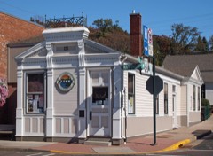 | Cushing Land Agency Building | building | 2005 | 05000955 |
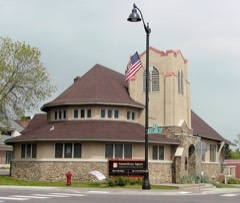 | First Baptist Church | building | 2008 | 08000201 |
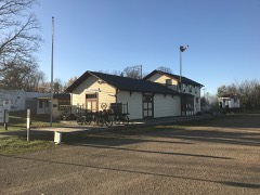 | Frederic Depot | building | 2003 | 03000133 |
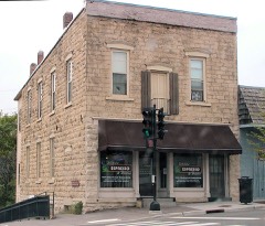 | Geiger Building-Old Polk County Courthouse | building | 1985 | 85003030 |
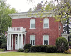 | Alvah A. Heald House | building | 1985 | 85003097 |
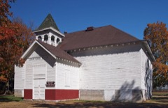 | Lamar Community Center | building | 1982 | 82001860 |
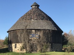 | John Lindstrom Round Barn | building | 2016 | 16000741 |
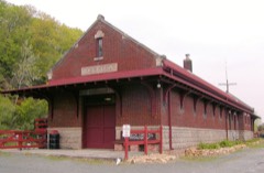 | Minneapolis, St. Paul and Sault Saint Marie Railway Depot | building | 2000 | 00001535 |
| Osceola Commercial Historic District | district | 2000 | 00001533 | |
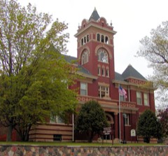 | Polk County Courthouse | building | 1982 | 82000697 |
| Seven Pines Lodge | building | 1978 | 78000125 | |
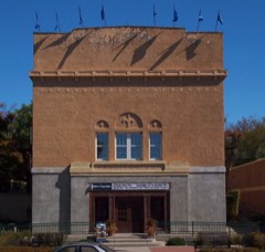 | St. Croix Falls Auditorium | building | 2007 | 07000711 |
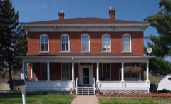 | Thomas Henry Thompson House | building | 1984 | 84003777 |
Every wildfire the federal occurrence database records inside this county: 304 of them, burning about 813 acres. 5 started naturally and 11 were recorded as arson. Each settlement page carries the fires within five miles of it.
| Reported cause | Fires |
|---|---|
| Debris and open burning | 92 |
| Missing data/not specified/undetermined | 87 |
| Equipment and vehicle use | 62 |
| Smoking | 14 |
| Recreation and ceremony | 14 |
| Arson/incendiarism | 11 |
| Other causes | 7 |
| Power generation/transmission/distribution | 6 |
| Natural | 5 |
| Fireworks | 3 |
| Misuse of fire by a minor | 2 |
| Railroad operations and maintenance | 1 |
The five largest, by the area the report gives. One of them was set deliberately.
| Date | Cause | Size | Reported by | Name on the report |
|---|---|---|---|---|
| 30 March 2010 | Equipment and vehicle use | 153 acres | Wisconsin Department of Natural Resources | SERLING FIRE |
| 20 April 2002 | Arson/incendiarism | 40 acres | Wisconsin Department of Natural Resources | not named |
| 2 April 2012 | Equipment and vehicle use | 40 acres | Wisconsin Department of Natural Resources | JOEL MARSH |
| 20 April 2002 | Missing data/not specified/undetermined | 36 acres | St. Croix Wetland Management District | FLATERS |
| 18 May 1994 | Recreation and ceremony | 33 acres | Wisconsin Department of Natural Resources | not named |
| 13 March 2015 | Debris and open burning | 30 acres | Wisconsin Department of Natural Resources | COUGHLIN |
| 8 April 2017 | Equipment and vehicle use | 28 acres | Wisconsin Department of Natural Resources | MCKINLEY |
| 20 April 2005 | Equipment and vehicle use | 25 acres | Wisconsin Department of Natural Resources | not named |
Every settlement page carries the fires within five miles of it - see the settlement index below.
The NOAA Storm Events Database holds 367 reports for this county, causing 4 deaths, 18 injuries and about $16,130,000 in recorded property damage. Each settlement page carries the reports that name it.
| Kind of event | Reports |
|---|---|
| Thunderstorm Wind | 207 |
| Hail | 109 |
| Tornado | 34 |
| Flash Flood | 7 |
| Funnel Cloud | 7 |
| Heavy Rain | 2 |
| Flood | 1 |
The most serious of them, by death, then injury, then recorded damage. The accounts are quoted exactly as the forecast office filed them.
| When | Event | Place named | Harm | What the report says |
|---|---|---|---|---|
| May 1953 | Tornado (F2) | not stated | 2 killed, 9 hurt, $2,500,000 | no account filed |
| June 1952 | Tornado (F3) | not stated | 2 killed, 6 hurt, $2,500,000 | no account filed |
| July 1966 | Tornado (F2) | not stated | 2 hurt, $250,000 | no account filed |
| August 2010 | Tornado (EF0) | Luck | 1 hurt, $100,000 | A National Weather Service Storm Damage Survey determined that an EF-0 touched down two miles west of Bone Lake, to about one mile south of Bone Lake, Wisconsin. Damage was extensive to hundreds of large trees that included several two foot diameter Pine Trees. Structural damage included shingles blown off a home, car and home windows blown out, and a wooden trailer tossed into a tree. |
| September 2005 | Thunderstorm Wind | Amery | $4,120,000 | Straight line winds estimated around 85 MPH produced significant damage on the south and east side of Amery. Emergency management reported minor damage to 26 residential and 3 business structures, major damage to 1 residential and 12 business structures, and the destruction of 7 business structures in town. Six hangars at the Amery airport including the airplanes and supplies inside were destroyed. Four other hangars received moderate damage. Debris from the airport was found up to 2 miles away. A nearby feed mill and warehouse at the local farmers co-op was a complete loss. Highway 46 South was closed for several hours due to debris in the roadway. Dozens of trees in the damage path were snapped 20 to 30 feet above the ground. |
| July 1977 | Tornado (F3) | not stated | $2,500,000 | no account filed |
| June 2001 | Thunderstorm Wind | Milltown | $800,000 | Numerous trees down, some on houses and vehicles, in a wide swath across the county. One tree fell through a trailer in Balsam Lake. Pole barn collapsed on western edge of Balsam Lake. Tree fell through apartment building in Balsam Lake. Building under construction in Centuria was taken down. |
| May 2017 | Hail | Clayton | $500,000 | There was a swath of very large hail, up to baseball size, that fell from southwest of Amery, northeast to Clayton. Numerous photos from social media provided how large the hail became. |
| July 2011 | Thunderstorm Wind | Range | $500,000 | A large swath of damage occurred from the northwestern edge of Pipe Lake on 220th Avenue, south and east along Pipe Lake, then southeast to the southeast side of Long Lake. The winds caused damage to boat lifts, boat docks, and buildings near Pipe Lake and around Johnstown Township. At least 100 large trees were downed, with some falling on homes, vehicles, and outbuildings. This wind damage was associated with the rear flank downdraft portion of a tornadic thunderstorm. |
| September 2002 | Flash Flood | Osceola | $400,000 | More than five inches of rain fell within a few hours, causing Osceola Creek to rise. Approximately 75 feet of the Upper Millpond Dam was breached, and a significantly greater flow of water headed toward State Highway 35. It overtopped the highway and flooded Falls Trailer Park, where 12 mobile homes had to be evacuated. One mobile home was permanently damaged and a cabin was destroyed. Most damage was to roads and other infrastructure. |
| April 1984 | Tornado (F1) | not stated | $250,000 | no account filed |
| August 1973 | Tornado (F1) | not stated | $250,000 | no account filed |
| July 1968 | Tornado (F1) | not stated | $250,000 | no account filed |
| June 2017 | Thunderstorm Wind | Osceola Muni Arpt | $100,000 | There were multiple reports of downed trees, power lines and vehicles blown off the road across portions of southern and central Polk County. This includes the towns of Osceola, Amery, Alden, Farmington, St. Croix Falls, Garfield, Clam Falls, Johnstown, Lincoln and Milltown. |
| July 2017 | Thunderstorm Wind | St Croix Falls | $100,000 | Numerous trees were blown down east of St. Croix Falls, to Balsam Lake. A home was also blown off its foundation, and a wall from a Menards store was blown down. |
| July 2016 | Thunderstorm Wind | Clear Lake | $100,000 | Sporadic tree damage occurred across the county. However, the most concentrated area was at Clear Lake County Park, where a local microburst caused considerable damage. Numerous trees were blown down in the park and campground, which is northwest of the town of Clear Lake. The park had to close temporarily due to widespread damage. |
| May 2012 | Flash Flood | Lewis | $100,000 | Very heavy rainfall occurred across a large area of northern Polk County and caused road closures, road damage and washouts from the communities of Luck, Eureka, Laketown, West Sweden, Clam Falls, Frederic and Lewis. Based on road damage alone in the 7 towns, up to $100,000 in expected in damages. |
| July 2010 | Tornado (EF0) | Balsam Lake | $100,000 | A tornado traveled from west to east across the northern edge of the village of Balsam Lake. A small grove of large trees was completely uprooted just north of downtown Balsam Lake. There were 2 garages which has all sides blown in. Other large trees were snapped or uprooted, with a few ending up on houses. A shed was blown over. |
| July 2010 | Tornado (EF1) | Turtle Lake | $100,000 | A tornado traveled east-southeast, just north of the village of Turtle Lake. It touched down in extreme eastern Polk County and moved into Barron County. In Polk County, a large outbuilding was completely destroyed 1.5 miles north-northwest of Turtle Lake, with debris scattered downstream for hundreds of yards. Scattered large trees were snapped or uprooted. |
| May 1996 | Hail | Luck | $99,000 | no account filed |
| July 2010 | Thunderstorm Wind | Cushing | $80,000 | Downburst damage was observed along a seven mile long path, oriented from northwest to southeast, in northwestern Polk County. The maximum width of the damage area was about 400 yards. The most intense damage consisted of numerous large trees being snapped and uprooted, with substantial branch loss on the north side of Little Mirror Lake to near the intersection of County Road N and 195th St. A few trees fell on garages and homes. One barn was heavily damaged. Silo roofs were blown off. |
| July 2011 | Thunderstorm Wind | Osceola Muni Arpt | $50,000 | Numerous reports of downed power lines and trees occurred across Polk County from near Osceola, north and east to Dresser, Wanderoos, Balsam Lake, Milltown, Luck and Clam Falls, Wisconsin. A spotter measured a wind gust near Wanderoos at 59 knots. |
| May 1994 | Thunderstorm Wind | St. Croix Falls | $50,000 | no account filed |
| July 2021 | Thunderstorm Wind | Horse Creek | $25,000 | An area of significant downed trees was noted between Deer Creek, east-southeast toward Highway 65. The area is rural and not overly populated so damage was confined to cleanup on county roads. |
| September 2010 | Thunderstorm Wind | Bunyan | $25,000 | Numerous large trees and power lines were blown down from west of the City of Balsam Lake near Long Lake, northeast to County Road I or east of Bone Lake, Wisconsin. Large hail was also reported during the same time period, but no measurements were made on hail size. A corn field was also flattened north of County Road G, and east of Half Moon Lake due to the severe winds. |
| August 1981 | Tornado (F0) | not stated | $25,000 | no account filed |
| August 1981 | Tornado (F0) | not stated | $25,000 | no account filed |
| October 1973 | Tornado (F1) | not stated | $25,000 | no account filed |
| July 1969 | Tornado (F1) | not stated | $25,000 | no account filed |
| June 1967 | Tornado (F2) | not stated | $25,000 | no account filed |
| May 2012 | Thunderstorm Wind | Frederic | $20,000 | Several thunderstorms moved across northern Polk County between Frederic and Clam Falls and caused a few trees to be uprooted, along with several power poles blown down. In addition, one tree landed on a home, with others blocking county and state roads. |
| August 2011 | Thunderstorm Wind | Osceola | $20,000 | One-third of a greenhouse roof was removed, along with numerous trees uprooted at the Philadelphia Community Farm, southwest of Osceola. |
| July 2001 | Hail | Clear Lake | $20,000 | Hail damaged a number of vehicles. |
| March 2019 | Flood | East Farmington | $18,000 | Spring snow melt and recent heavy rainfall, led to flood waters affecting the Village of Clear Lake, as a breach in a sewer line over-burdened the system causing raw sewage to back up in approximately eight homes. 82nd Avenue in the Town of Osceola was partially closed due to flooding. Residents in the area of the road closure also had water in their homes. |
| July 2011 | Thunderstorm Wind | Frederic | $15,000 | A 40 foot diameter tree was blown down near Frederic. The city lost power due to power lines blown down. |
| July 2010 | Thunderstorm Wind | Balsam Lake | $15,000 | Downburst wind damage was evident in central Balsam Lake, south of the EF-0 tornado that moved east to west along West Main Street (Highway 46). The downburst caused several signs and trees to be blown down. A garage was also damaged. |
| June 2012 | Thunderstorm Wind | Osceola Muni Arpt | $10,000 | Several power poles were blown down around Osceola. |
| August 2010 | Thunderstorm Wind | Dresser | $10,000 | Several trees and power lines were blown down near Dresser, Wisconsin. |
| July 2001 | Thunderstorm Wind | Osceola | $10,000 | Numerous trees down, including a few on houses and vehicles. |
| July 2015 | Thunderstorm Wind | Milltown | $5,000 | A two foot diameter tree was blown down in Milltown and landed on a house. |
| May 2012 | Thunderstorm Wind | Luck | $4,000 | A couple trees blew down on power lines in Luck, Wisconsin. |
| August 2011 | Thunderstorm Wind | Dresser | $2,500 | A large tree was blown down near Dresser. |
| May 1980 | Tornado (F0) | not stated | $2,500 | no account filed |
| May 2012 | Thunderstorm Wind | St Croix Falls | $2,000 | A tree blew down on a power line in St. Croix Falls, Wisconsin. |
| May 2022 | Thunderstorm Wind | Clayton | $500 | A large tree blew down and blocked a highway. |
| May 2022 | Thunderstorm Wind | Frederic | $500 | A large tree blew down and landed on County Road L. |
| May 2022 | Thunderstorm Wind | Amery | $500 | A large tree was blown down near Amery. |
| August 2016 | Thunderstorm Wind | Milltown | $500 | A large tree fell on a home near Main Street and State Highway 35. The tree damaged a electrical panel. |
| May 2025 | Thunderstorm Wind | Luck | - | Tree down along 105th St in Amery. |
| May 2025 | Thunderstorm Wind | Milltown | - | A tree was reported down near the intersection of 150th St and 220th Ave, east of the village of Milltown. |
| May 2025 | Thunderstorm Wind | Frederic | - | Report of trees down in the village of Frederic. |
| May 2025 | Thunderstorm Wind | Luck | - | A tree was reported down near the intersection of 120th St and 220th Ave in the village of Luck. |
| May 2024 | Hail | Cushing | - | Reported via mPing. |
| August 2024 | Thunderstorm Wind | Little Falls | - | A tree was snapped. |
| August 2024 | Heavy Rain | Deronda | - | County Dispatch reported 4-5 inches of standing water in the village of Amery. |
| August 2024 | Thunderstorm Wind | Balsam Lake | - | County Dispatch reported trees down in the village of Balsam Lake. |
| July 2024 | Hail | Little Falls | - | The hail damaged crops. |
| July 2024 | Hail | Clear Lake | - | Photos were provided with the hail shown next to a quarter. |
| June 2024 | Thunderstorm Wind | Centuria | - | About one dozen trees were tipped over or large branches broken. |
| June 2024 | Thunderstorm Wind | Centuria | - | Several trees were uprooted. The door of a barn was blown off track. |
The Survey's mineral resources record lists 180 workings inside this county. 18 still produce and 162 are closed or unrecorded. Each settlement page carries the workings within five miles of it.
| Commodity | Workings |
|---|---|
| Sand and Gravel, Construction | 145 |
| Copper | 30 |
| Stone, Crushed/Broken | 5 |
The least common of them first, because a county's hundredth gravel pit says nothing its first ten did not.
| Where | Site | Commodity | Status | Recorded |
|---|---|---|---|---|
| Bryan Rock Products Inc Dresser Jct | Stone, Crushed/Broken | Producer | ||
| Horse Creek Limestone Deposit #1 | Stone, Crushed/Broken | Occurrence | ||
| Horse Creek Limestone Deposit #2 | Stone, Crushed/Broken | Occurrence | ||
| Neumann Limestone Deposit | Stone, Crushed/Broken | Occurrence | ||
| Polk County Lime Quarry | Stone, Crushed/Broken | Producer | ||
| Nd Unnamed Prospect Near Clam Fa | Copper | Occurrence | ||
| Nd Unnamed Prospect Near Lewis | Copper | Occurrence | ||
| Nd Unnamed Prospect Near Milltow | Copper | Occurrence | ||
| Unnamed Prospect Near Clam Fa | Copper | Occurrence | ||
| Unnamed Prospect Near Clam Falls | Copper | Occurrence | ||
| Unnamed Prospect Near Clam Falls | Copper | Occurrence | ||
| Unnamed Prospect Near Clam River | Copper | Occurrence | ||
| Unnamed Prospect Near Clam River | Copper | Occurrence | ||
| Unnamed Prospect Near Forsythe La | Copper | Occurrence | ||
| Unnamed Prospect Near Forsythe La | Copper | Occurrence | ||
| Unnamed Prospect Near Lewis | Copper | Occurrence | ||
| Unnamed Prospect Near Lewis | Copper | Occurrence | ||
| Unnamed Prospect Near Lewis | Copper | Occurrence | ||
| Unnamed Prospect Near Milltow | Copper | Occurrence | ||
| Unnamed Prospect Near Milltown | Copper | Occurrence | ||
| Unnamed Prospect Near Milltown | Copper | Occurrence | ||
| Unnamed Prospect Near Osceola | Copper | Occurrence | ||
| Unnamed Prospect Near Osceola | Copper | Occurrence | ||
| Unnamed Prospect Near Rice Lake | Copper | Occurrence | ||
| Unnamed Prospect Near Rice Lake | Copper | Occurrence | ||
| Unnamed Prospect Near Somers Cree | Copper | Occurrence | ||
| Unnamed Prospect Near Somers Cree | Copper | Occurrence | ||
| Unnamed Prospect Near Somers Lake | Copper | Occurrence | ||
| Unnamed Prospect Near Somers Lake | Copper | Occurrence | ||
| Unnamed Prospect Near St Croix Fa | Copper | Occurrence | ||
| Unnamed Prospect Near St Croix Fa | Copper | Occurrence | ||
| Unnamed Prospect Near Weiss Lake | Copper | Occurrence | ||
| Unnamed Prospect Near Weiss Lake | Copper | Occurrence | ||
| Unnamed Prospect Near Young Lake | Copper | Occurrence | ||
| Unnamed Prospect Near Young Lake | Copper | Occurrence | ||
| Alden Pit | Sand and Gravel, Construction | Producer | ||
| Amery Gravel Pit | Sand and Gravel, Construction | Past Producer | ||
| Amery Pit | Sand and Gravel, Construction | Past Producer | ||
| Apple River Cemetery Gravel Deposit | Sand and Gravel, Construction | Occurrence | ||
| Apple River Gravel Pit | Sand and Gravel, Construction | Past Producer | ||
| Apple River Sand Deposit #1 | Sand and Gravel, Construction | Occurrence | ||
| Apple River Sand Deposit #2 | Sand and Gravel, Construction | Occurrence | ||
| Atlas Sand Pit | Sand and Gravel, Construction | Past Producer | ||
| Atlas Sand and Gravel Pit | Sand and Gravel, Construction | Past Producer | ||
| Badger Lake Gravel Pit | Sand and Gravel, Construction | Past Producer | ||
| Balsam Branch Gravel Deposit | Sand and Gravel, Construction | Occurrence | ||
| Balsam Lake Gravel Deposit | Sand and Gravel, Construction | Occurrence | ||
| Bass Lake Gravel Deposit | Sand and Gravel, Construction | Occurrence | ||
| Bass Lake Gravel Pit #1 | Sand and Gravel, Construction | Past Producer | ||
| Bass Lake Gravel Pit #2 | Sand and Gravel, Construction | Past Producer | ||
| Bear Lake Gravel Pit | Sand and Gravel, Construction | Past Producer | ||
| Bear Lake Sand Pit | Sand and Gravel, Construction | Past Producer | ||
| Beede Lake Trail Sand Pit | Sand and Gravel, Construction | Past Producer | ||
| Benjamin Boe Gravel Pit | Sand and Gravel, Construction | Past Producer | ||
| Benson Road Gravel Deposit | Sand and Gravel, Construction | Occurrence | ||
| Big Butternut Lake Gravel Pit | Sand and Gravel, Construction | Past Producer | ||
| Bohn Pit | Sand and Gravel, Construction | Producer | ||
| Bohn Pit | Sand and Gravel, Construction | Producer | ||
| Bosak Pit | Sand and Gravel, Construction | Past Producer | ||
| Bull Brook Gravel Pit | Sand and Gravel, Construction | Past Producer | ||
| Butternut Creek Gravel Deposit | Sand and Gravel, Construction | Occurrence | ||
| Carl Forrest Gravel Deposit | Sand and Gravel, Construction | Occurrence | ||
| Centuria Gravel Deposit | Sand and Gravel, Construction | Occurrence | ||
| Centuria Gravel Pit #1 | Sand and Gravel, Construction | Past Producer | ||
| Centuria Gravel Pit #2 | Sand and Gravel, Construction | Past Producer | ||
| Centuria Pit | Sand and Gravel, Construction | Producer | ||
| Church Road Sand Pit | Sand and Gravel, Construction | Past Producer | ||
| Clam River Sand Deposit | Sand and Gravel, Construction | Occurrence | ||
| Clam River Sand Pit | Sand and Gravel, Construction | Past Producer | ||
| Clear Lake Gravel Pits | Sand and Gravel, Construction | Past Producer | ||
| Deer Lake Gravel Pit | Sand and Gravel, Construction | Past Producer | ||
| Dresser Gravel Pit #1 | Sand and Gravel, Construction | Past Producer | ||
| Dresser Gravel Pit #2 | Sand and Gravel, Construction | Past Producer | ||
| Dwight Parmeter Sand Deposit | Sand and Gravel, Construction | Occurrence | ||
| Edward G McKenzie Sand Pit | Sand and Gravel, Construction | Past Producer | ||
| Emery Chouinard Pit | Sand and Gravel, Construction | Producer | ||
| Eng Pit | Sand and Gravel, Construction | Producer | ||
| Eureka Center Gravel Pit | Sand and Gravel, Construction | Past Producer | ||
| Frank Svoboda Pit | Sand and Gravel, Construction | Producer | ||
| Fred Wittstock Gravel Pit | Sand and Gravel, Construction | Past Producer | ||
| Frederic Sand Pit | Sand and Gravel, Construction | Past Producer | ||
| Freedom Creek Sand Pit | Sand and Gravel, Construction | Past Producer | ||
| Friday Creek Gravel Pit | Sand and Gravel, Construction | Past Producer | ||
| Gibson Lake Gravel Deposit #1 | Sand and Gravel, Construction | Occurrence | ||
| Gibson Lake Gravel Deposit #2 | Sand and Gravel, Construction | Occurrence | ||
| Greenquist Lake Sand Deposit | Sand and Gravel, Construction | Occurrence | ||
| Hardinbergh Gravel Deposit | Sand and Gravel, Construction | Occurrence | ||
| Hatchet Lake Gravel Deposit #1 | Sand and Gravel, Construction | Occurrence | ||
| Hatchet Lake Gravel Deposit #2 | Sand and Gravel, Construction | Occurrence | ||
| Hochstetler Pit | Sand and Gravel, Construction | Producer | ||
| Horseshoe Lake Sand Pit | Sand and Gravel, Construction | Past Producer | ||
| J. Nelson Mill | Sand and Gravel, Construction | Plant | ||
| J. Nelson Pit | Sand and Gravel, Construction | Producer | ||
| Jacobson Pit | Sand and Gravel, Construction | Producer | ||
| James D Gray Gravel Pit | Sand and Gravel, Construction | Past Producer | ||
| James Wickstrom Sand Pit | Sand and Gravel, Construction | Past Producer | ||
| John Gomulak Gravel Pit | Sand and Gravel, Construction | Past Producer | ||
| John Northquist Sand Pit | Sand and Gravel, Construction | Past Producer | ||
| Johnson Lake Gravel Pit | Sand and Gravel, Construction | Past Producer | ||
| Jorgenson Pit | Sand and Gravel, Construction | Unknown | ||
| Knapp Creek Gravel Deposit #1 | Sand and Gravel, Construction | Occurrence | ||
| Knapp Creek Gravel Deposit #2 | Sand and Gravel, Construction | Occurrence | ||
| Knapp Creek Gravel Pit | Sand and Gravel, Construction | Past Producer | ||
| L E Rasmussen Gravel Deposit | Sand and Gravel, Construction | Occurrence | ||
| Land Lake Gravel Deposit | Sand and Gravel, Construction | Occurrence | ||
| Legoo Lake Sand Deposit | Sand and Gravel, Construction | Occurrence | ||
| Leroy Markee Gravel Deposit | Sand and Gravel, Construction | Occurrence | ||
| Lewis Gravel Deposit | Sand and Gravel, Construction | Occurrence | ||
| Lincoln Lake Gravel Pits | Sand and Gravel, Construction | Past Producer | ||
| Little Pine Lake Gravel Deposit | Sand and Gravel, Construction | Occurrence | ||
| Little Round Lake Gravel Deposit | Sand and Gravel, Construction | Occurrence | ||
| Long Lake Snd Deposit #2 | Sand and Gravel, Construction | Occurrence | ||
| Long Lkae Sand Deposit #1 | Sand and Gravel, Construction | Occurrence | ||
| Loraine Gravel Pit | Sand and Gravel, Construction | Past Producer | ||
| Loraine Sand Pit | Sand and Gravel, Construction | Past Producer | ||
| Mabel Christensen Gravel Pit | Sand and Gravel, Construction | Past Producer | ||
| Mains Crossing Ave Gravel Deposit#1 | Sand and Gravel, Construction | Occurrence | ||
| Mains Crossing Ave Gravel Deposit#2 | Sand and Gravel, Construction | Occurrence | ||
| Manitou Lake Gravel Deposit | Sand and Gravel, Construction | Occurrence | ||
| Melvin McKenzie Pit | Sand and Gravel, Construction | Past Producer | ||
| Merle G Jacobson Gravel Deposit | Sand and Gravel, Construction | Occurrence | ||
| Miller Pit | Sand and Gravel, Construction | Producer | ||
| Milo Measner Gravel Pit | Sand and Gravel, Construction | Past Producer | ||
| Nevers Dam Gravel Pit | Sand and Gravel, Construction | Past Producer | ||
| Nevers Dam Road Sand & Gravel Pits | Sand and Gravel, Construction | Past Producer | ||
| Osceola Creek Gravel Pit | Sand and Gravel, Construction | Past Producer | ||
| Osceola Gravel Deposit | Sand and Gravel, Construction | Prospect | ||
| Osceola Gravel Pit | Sand and Gravel, Construction | Past Producer | ||
| Osceola Plant | Sand and Gravel, Construction | Plant | ||
| Otter Lake Gravel Pit | Sand and Gravel, Construction | Past Producer | ||
| Parker Creek Gravel Deposit | Sand and Gravel, Construction | Occurrence | ||
| Paul R Miller Gravel Deposit | Sand and Gravel, Construction | Occurrence | ||
| Pickerel Lake Gravel Deposit | Sand and Gravel, Construction | Occurrence | ||
| Pickerel Lake Gravel Pit | Sand and Gravel, Construction | Past Producer | ||
| Pike Lake Gravel Deposit | Sand and Gravel, Construction | Occurrence | ||
| Pike Lake Gravel Pit | Sand and Gravel, Construction | Past Producer | ||
| Rex D Johnson Gravel Pit | Sand and Gravel, Construction | Past Producer | ||
| Rhinstad Lake Gravel Deposit | Sand and Gravel, Construction | Occurrence | ||
| Rice Lake Gravel Deposit | Sand and Gravel, Construction | Occurrence | ||
| Rice Lake Gravel Pit | Sand and Gravel, Construction | Past Producer | ||
| Ridge Road Gravel Deposit | Sand and Gravel, Construction | Prospect | ||
| River Rd Gravel Deposit #1 | Sand and Gravel, Construction | Occurrence | ||
| River Rd Gravel Deposit #2 | Sand and Gravel, Construction | Prospect | ||
| Robert D Fenton Gravel Pit | Sand and Gravel, Construction | Past Producer | ||
| Silver Lake Gravel Deposit #1 | Sand and Gravel, Construction | Occurrence | ||
| Silver Lake Gravel Deposit #2 | Sand and Gravel, Construction | Occurrence | ||
| Simonson Pit | Sand and Gravel, Construction | Producer | ||
| Simpson Lake Sand Pit | Sand and Gravel, Construction | Past Producer | ||
| Skidmore Pit | Sand and Gravel, Construction | Producer | ||
| Snowshoe Lake Gravel Deposit | Sand and Gravel, Construction | Occurrence | ||
| St Croix Falls Gravel Deposit | Sand and Gravel, Construction | Occurrence | ||
| St Croix Falls Gravel Pits | Sand and Gravel, Construction | Past Producer | ||
| St Croix Falls Sand Deposit | Sand and Gravel, Construction | Occurrence | ||
| St Croix River Gravel Deposit | Sand and Gravel, Construction | Prospect | ||
| Sth 87 Sand Deposit | Sand and Gravel, Construction | Occurrence | ||
| Theo E Boettcher Gravel Deposit | Sand and Gravel, Construction | Occurrence | ||
| Toby Creek Gravel Deposit | Sand and Gravel, Construction | Occurrence | ||
| Trade River Gravel Pit #1 | Sand and Gravel, Construction | Past Producer | ||
| Trade River Gravel Pit #2 | Sand and Gravel, Construction | Past Producer | ||
| Trade River Gravel Pit #3 | Sand and Gravel, Construction | Occurrence | ||
| Trade River Sand Pit #1 | Sand and Gravel, Construction | Past Producer | ||
| Trade River Sand Pit #1 | Sand and Gravel, Construction | Occurrence | ||
| Turtle Lake Pit | Sand and Gravel, Construction | Past Producer | ||
| Twin Lake Gravel Deposit #1 | Sand and Gravel, Construction | Occurrence | ||
| Twin Lakes Gravel Deposit #2 | Sand and Gravel, Construction | Occurrence | ||
| Wanderoos Sand Deposit | Sand and Gravel, Construction | Occurrence | ||
| Wapogasset Branch Gravel Pit #1 | Sand and Gravel, Construction | Past Producer | ||
| Wapogasset Branch Gravel Pit #2 | Sand and Gravel, Construction | Past Producer | ||
| West Sweden Gravel Pit | Sand and Gravel, Construction | Past Producer | ||
| Wild Goose Lake Gravel Pit | Sand and Gravel, Construction | Past Producer | ||
| Wittenbreer Pit | Sand and Gravel, Construction | Producer | ||
| Wolf Creek Gravel Deposit | Sand and Gravel, Construction | Occurrence | ||
| Wood River Gravel Deposit #1 | Sand and Gravel, Construction | Occurrence | ||
| Wood River Gravel Deposit #2 | Sand and Gravel, Construction | Occurrence | ||
| Wood River Gravel Pit #1 | Sand and Gravel, Construction | Past Producer | ||
| Wood River Gravel Pit #2 | Sand and Gravel, Construction | Past Producer | ||
| Wood River Sand Pit #1 | Sand and Gravel, Construction | Past Producer | ||
| Wood River Sand Pit #2 | Sand and Gravel, Construction | Past Producer | ||
| Young Lake Gravel Deposit | Sand and Gravel, Construction | Occurrence | ||
| Young Lake Gravel Pit | Sand and Gravel, Construction | Past Producer |
Named settlements recorded in the Geographic Names Information System, each with the topographic sheets covering it. Villages, hamlets and abandoned places alike. Each is shown with the nearest named watercourse or landform and the survey quadrangle it falls on.
Balsam Lake village · 54810 · Near First Island · Balsam Lake quadrangle
14 sheets, 1950 to 1985
Clam Falls town · 54837 · On McKenzie Creek · Clam Falls quadrangle
13 sheets, 1951 to 1985
Alden town · 54001 · On Parker Creek · Wapogasset Lake quadrangle
13 sheets, 1950 to 1985
St. Croix Falls city · 54024 · Saint Croix Dalles quadrangle
23 sheets, 1900 to 1985