 Block
From the record
9 National Register listings published here.
Sources: the National Register database, National Park Service
54 topographic sheets cover 45 settlements here, and 9 properties are on the National Register of Historic Places.
9 National Register listings published here.
Sources: the National Register database, National Park Service
Every property in this county listed on the National Register of Historic Places, with the year it was listed and the federal nomination document.
| Photograph | Property | Type | Listed | Reference |
|---|---|---|---|---|
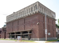 | A. D. German Warehouse | building | 1974 | 74000122 |
| Bloyer Mound Group | site | 2006 | 06000873 | |
 | Julia B. and Fred P. Bowen House | building | 1996 | 96000729 |
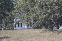 | John Coumbe Farmstead | building | 1992 | 92000827 |
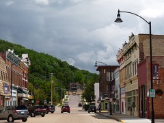 | Court Street Commercial Historic District | district | 1989 | 89001955 |
| Cunningham Lane Bridge | structure | 1996 | 96000731 | |
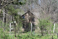 | Henry Fiedler House | building | 1986 | 86003515 |
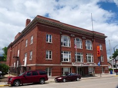 | Richland Center City Auditorium | building | 1980 | 80000182 |
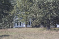 | Tippesaukee Farm Rural Historic District (Boundary Increase) | district | 1996 | 95001491 |
Every wildfire the federal occurrence database records inside this county: 520 of them, burning about 1,273 acres. 13 started naturally and 28 were recorded as arson. Each settlement page carries the fires within five miles of it.
| Reported cause | Fires |
|---|---|
| Debris and open burning | 249 |
| Equipment and vehicle use | 113 |
| Missing data/not specified/undetermined | 55 |
| Arson/incendiarism | 28 |
| Smoking | 15 |
| Natural | 13 |
| Power generation/transmission/distribution | 12 |
| Recreation and ceremony | 11 |
| Other causes | 10 |
| Misuse of fire by a minor | 8 |
| Fireworks | 5 |
| Railroad operations and maintenance | 1 |
The five largest, by the area the report gives. None of them was recorded as arson.
| Date | Cause | Size | Reported by | Name on the report |
|---|---|---|---|---|
| 12 April 2003 | Debris and open burning | 104 acres | Wisconsin Department of Natural Resources | not named |
| 9 April 1994 | Equipment and vehicle use | 64 acres | Wisconsin Department of Natural Resources | not named |
| 11 April 1996 | Equipment and vehicle use | 53 acres | Wisconsin Department of Natural Resources | not named |
| 10 April 1996 | Equipment and vehicle use | 50 acres | Wisconsin Department of Natural Resources | not named |
| 6 March 2000 | Debris and open burning | 34 acres | Wisconsin Department of Natural Resources | not named |
| 22 April 1996 | Missing data/not specified/undetermined | 33 acres | Wisconsin Department of Natural Resources | not named |
| 12 March 1994 | Equipment and vehicle use | 31 acres | Wisconsin Department of Natural Resources | not named |
| 11 March 1996 | Debris and open burning | 30 acres | Wisconsin Department of Natural Resources | not named |
Every settlement page carries the fires within five miles of it - see the settlement index below.
The NOAA Storm Events Database holds 268 reports for this county, causing 1 death, 9 injuries and about $24,960,850 in recorded property damage. Each settlement page carries the reports that name it.
| Kind of event | Reports |
|---|---|
| Thunderstorm Wind | 117 |
| Hail | 88 |
| Flash Flood | 26 |
| Flood | 17 |
| Tornado | 13 |
| Heavy Rain | 5 |
| Funnel Cloud | 2 |
The most serious of them, by death, then injury, then recorded damage. The accounts are quoted exactly as the forecast office filed them.
| When | Event | Place named | Harm | What the report says |
|---|---|---|---|---|
| August 2007 | Flash Flood | Richland Center | 1 killed, $8,800,000 | Numerous state highways and county roads were closed and impassable due to flood waters. An estimated 75 percent of the county roads were affected including Highway 80 that was impassable with bridges buckled. Highways 56 and 58 were also impacted. At least a dozen boat rescues were needed from homes and cars. The town of Rockbridge was basically underwater. A 51-year old was swept off a bridge on Highway 60 near the intersection of Highway 80 on his way to Muscoda from Mill Creek. |
| September 1964 | Tornado (F3) | not stated | 4 hurt, $250,000 | no account filed |
| August 2005 | Tornado (F2) | Viola | 3 hurt, $2,500,000 | no account filed |
| May 1964 | Tornado (F2) | not stated | 2 hurt, $250,000 | no account filed |
| September 2016 | Flash Flood | Viola | $2,400,000 | Flooding along a branch of Camp Creek sent three feet of water into a house east of Viola. Flooding along Fancy and Marshall Creeks caused roads to be closed near Gillingham. State Highway 56 was closed east of Viola due to flooding along Camp Creek and County Highway C was closed near Yuba because of flooding along the Pine River. A total of 3 homes were destroyed by the flooding with another 72 damaged. |
| June 2008 | Flood | Sand Prairie | $2,400,000 | Travel across Richland County was very difficult due to ongoing flooding. Numerous roads were closed, including Highways 131, 56 and 80, as well as County Roads C, F, Q, E, and U. |
| June 2008 | Flood | Viola | $2,200,000 | The Kickapoo river at Viola reached a record crest of 21.25 feet around 5 a.m. on June 9. The previous record crest of 21.0 feet occurred on July 1, 1978. Flood stage is 14.0 feet. Water was over bridge railings on the bridges. |
| June 2008 | Flash Flood | Cazenovia | $1,100,000 | Water was reported over several roads, including County Road I and Highway 58. |
| August 2007 | Flash Flood | Yuba | $750,000 | The fire department building was under water and Highway 80 buckled north of Century Farm Road. |
| August 2018 | Flood | Viola | $610,000 | Flooding along the Kickapoo River prompted some water rescues in Viola. Water was 12 to 18 inches deep in the fire station and was flowing over the upper rail of the State Highway 131 bridge. |
| June 2000 | Flash Flood | Countywide | $400,000 | no account filed |
| September 2018 | Flash Flood | Cazenovia | $336,000 | Runoff from heavy rains caused numerous streams across Richland County to go out of their banks. The flooding caused several roads to be closed including U.S. Highway 14, State Highways 56, 58, 80 and 131 along with numerous county and township roads. |
| June 2013 | Flash Flood | Lone Rock | $291,000 | Heavy rain produced flash flooding across the southwest half of Richland County. Numerous streams were forced out of their banks with water reported over County Highway JJ between Gotham and Lone Rock, State Highway 56 near Gillingham and the intersection of County Highways O and OO near Richland Center. Mud slides closed County Highway O northwest of Gotham. State Highway 60 between Gotham and the Crawford County line southwest of Westport was closed by a mudslide with other damage reducing the road to one lane at times. |
| June 1996 | Flash Flood | Rockbridge | $250,000 | no account filed |
| May 1988 | Tornado (F2) | not stated | $250,000 | no account filed |
| July 2017 | Flood | Viola | $211,000 | After the initial flash flooding across Richland County, the flooding continued to cause problems through July 20th into the 21st. The flooding along the Pine River prompted an apartment complex to be evacuated and a shelter to be opened in Richland Center. Over a dozen roads were closed across the county because of the flooding. Nine homes sustained minor damage during the flooding. |
| July 2017 | Flash Flood | Viola | $186,000 | Heavy rains, with totals of 6 to 8 inches, produced flash flooding across the central and eastern sections of Richland County. The heavy rains caused the Pine River to go out of its banks which prompted sandbagging to occur in Yuba, closed State Highway 80 at County Road D and caused flooding to occur in Richland Center. |
| August 2007 | Flood | Viola | $150,000 | The Kickapoo River at Viola established the second highest all-time crest of record when it reached 18.20 feet on August 19. Flood stage is 14 feet. |
| April 2025 | Hail | Richland Center | $135,000 | The public reported golf ball sized hail 1 mile east of Richland Center. |
| July 2023 | Thunderstorm Wind | (Lnr)Tri Co Arpt Lon | $100,000 | Extensive damage reported to barns with downed trees. Nearby automated weather observation recorded 77 mph wind gust. |
| August 2007 | Flood | Richland Center | $100,000 | Flooding continued along many creeks, streams and rivers. Law enforcement officials reported numerous roads and bridges were either washed out or still under water. |
| August 2005 | Tornado (F0) | Orion | $100,000 | no account filed |
| August 2018 | Flood | Yuba | $85,000 | Runoff from heavy rains caused flooding to occur along the Pine River from Yuba downstream to Rockbridge. |
| July 2015 | Thunderstorm Wind | Lone Rock | $80,000 | Numerous trees and powerlines were blown down in Lone Rock. Seven homes sustained roof damage from the high winds. |
| May 2004 | Flash Flood | Countywide | $75,000 | no account filed |
| July 2015 | Thunderstorm Wind | Richland Center | $60,000 | Numerous trees and powerlines were blown down across Richland Center. Two houses were damaged when trees fell on them. |
| May 2000 | Flash Flood | Countywide | $45,000 | no account filed |
| July 2023 | Hail | Bear Vly | $40,000 | Public reported golf ball sized hail near Sextonville. |
| June 2015 | Tornado (EF0) | Westport | $30,000 | The tornado traveled across rural portions of southwest Richland County north of Westport and Port Andrews. A few homes along County Roads W and M were damaged along with numerous trees. |
| May 2004 | Flash Flood | Countywide | $30,000 | no account filed |
| July 2000 | Flash Flood | North Portion | $30,000 | no account filed |
| June 1998 | Thunderstorm Wind | Richland Center | $30,000 | no account filed |
| June 2008 | Flash Flood | Sand Prairie | $28,000 | Flash flooding led to water over sections of Highway 48 about 4 miles from the intersection with Highway 14, as well as sections of County Roads O and OO. High water also caused problems from the Gotham area to Lone Rock. |
| June 1999 | Flash Flood | Southeast Portion | $25,000 | no account filed |
| September 1997 | Thunderstorm Wind | Richland Center | $25,000 | no account filed |
| June 1972 | Tornado (F1) | not stated | $25,000 | no account filed |
| August 1972 | Tornado (F1) | not stated | $25,000 | no account filed |
| August 1967 | Tornado (F1) | not stated | $25,000 | no account filed |
| July 1951 | Tornado (F2) | not stated | $25,000 | no account filed |
| August 2016 | Flash Flood | Excelsior | $20,000 | Runoff from heavy rain caused several streams to go out of their banks across western Richland County. The resulting flood waters caused some roads to be closed including State Highways 56 and 171 along with County Highway F near Excelsior and County Highways E and Q near Boaz. |
| May 2011 | Thunderstorm Wind | Basswood | $20,000 | Farm outbuildings were blown down over a road. |
| August 2010 | Thunderstorm Wind | Loyd | $20,000 | Damage occurred to the roof of a home, as well as to a shed at a homestead along County Road NN. Also, trees and power lines were blown down between Ithaca and Cazenovia. |
| August 2006 | Hail | Cazenovia | $20,000 | no account filed |
| May 1999 | Thunderstorm Wind | Richland Center | $20,000 | no account filed |
| June 1998 | Thunderstorm Wind | Yuba | $20,000 | no account filed |
| June 1997 | Thunderstorm Wind | Bear Valley | $20,000 | no account filed |
| July 2024 | Thunderstorm Wind | Cazenovia | $15,000 | Emergency management reported three trees blown down onto County Highway V in Cazenovia. There was also a report of a power line blown down. |
| April 2018 | Hail | Richland Center | $15,000 | Up to golf ball sized hail was reported in Richland Center. |
| July 2016 | Thunderstorm Wind | Lone Rock | $15,000 | Numerous trees were blown down in Lone Rock damaging some cars and homes. |
| July 2015 | Thunderstorm Wind | Richland Center | $15,000 | A tree was blown down onto a house just outside of Richland Center. |
| August 2010 | Thunderstorm Wind | Basswood | $15,000 | Thunderstorm winds blew the roof off of a shed, as well as damaging trees along Town Hall Road, which is just east of the town of Basswood. |
| October 2006 | Hail | Richland Center | $15,000 | no account filed |
| May 2000 | Hail | Hub City | $15,000 | no account filed |
| June 1998 | Thunderstorm Wind | Bloom City | $15,000 | no account filed |
| June 1998 | Flash Flood | Richland Center | $15,000 | no account filed |
| July 1998 | Thunderstorm Wind | Richland Center | $12,000 | no account filed |
| June 2022 | Thunderstorm Wind | Twin Bluffs | $10,000 | Several small sheds and outbuildings were damaged northwest of Sextonville. |
| September 2021 | Thunderstorm Wind | Viola | $10,000 | A roof was blown off a shed west of Bloom City. |
| May 2018 | Flood | Yuba | $10,000 | Runoff from heavy rains pushed the Pine River out of its banks across northern Richland County. Several roads were closed because of the flood waters. |
| June 2015 | Thunderstorm Wind | Byrds Creek | $10,000 | Trees were blown down and a barn was damaged by wind gusts north of Port Andrew. |
The Survey's mineral resources record lists 38 workings inside this county. 8 still produce and 30 are closed or unrecorded. Each settlement page carries the workings within five miles of it.
| Commodity | Workings |
|---|---|
| Stone, Crushed/Broken | 33 |
| Stone | 3 |
| Sand and Gravel, Construction | 2 |
The least common of them first, because a county's hundredth gravel pit says nothing its first ten did not.
| Where | Site | Commodity | Status | Recorded |
|---|---|---|---|---|
| Adams Gravel Pit | Sand and Gravel, Construction | Producer | ||
| County Pit | Sand and Gravel, Construction | Unknown | ||
| Mcglynn Quarry | Stone | Unknown | ||
| Own Crews | Stone | Unknown | ||
| Own Crews | Stone | Unknown | ||
| Akan Township Quarry | Stone, Crushed/Broken | Producer | ||
| Benson Quarry | Stone, Crushed/Broken | Past Producer | ||
| Bert Ray Quarry | Stone, Crushed/Broken | Past Producer | ||
| Bethke Quarry | Stone, Crushed/Broken | Producer | ||
| Bosstown Quarry | Stone, Crushed/Broken | Producer | ||
| Brown Quarry | Stone, Crushed/Broken | Past Producer | ||
| Bunker Hill Quarry | Stone, Crushed/Broken | Producer | ||
| Coumbs Quarry | Stone, Crushed/Broken | Past Producer | ||
| Dooley Quarry | Stone, Crushed/Broken | Past Producer | ||
| Dosch Quarry | Stone, Crushed/Broken | Past Producer | ||
| Ewing Quarry | Stone, Crushed/Broken | Past Producer | ||
| Excelsior Quarry | Stone, Crushed/Broken | Past Producer | ||
| Haney Quarry | Stone, Crushed/Broken | Past Producer | ||
| Hogskin Quarry | Stone, Crushed/Broken | Past Producer | ||
| Househoulder Quarry | Stone, Crushed/Broken | Producer | ||
| Huth Quarry | Stone, Crushed/Broken | Past Producer | ||
| Jake Miller Quarry | Stone, Crushed/Broken | Past Producer | ||
| Jo Templin Quarry | Stone, Crushed/Broken | Past Producer | ||
| Johnson Quarry | Stone, Crushed/Broken | Past Producer | ||
| Jones Quarry | Stone, Crushed/Broken | Past Producer | ||
| Joseph Quarry | Stone, Crushed/Broken | Past Producer | ||
| Joyce Quarry | Stone, Crushed/Broken | Past Producer | ||
| Keyesville Quarry | Stone, Crushed/Broken | Past Producer | ||
| Lawton Quarry | Stone, Crushed/Broken | Past Producer | ||
| Motts Quarry | Stone, Crushed/Broken | Producer | ||
| Muldowney Quarry | Stone, Crushed/Broken | Past Producer | ||
| Mullendorf Quarry | Stone, Crushed/Broken | Past Producer | ||
| Rego Quarry | Stone, Crushed/Broken | Past Producer | ||
| Shannon Quarry | Stone, Crushed/Broken | Producer | ||
| Snyder Quarry | Stone, Crushed/Broken | Past Producer | ||
| Spangler Quarry | Stone, Crushed/Broken | Past Producer | ||
| Thompson Quarry | Stone, Crushed/Broken | Past Producer | ||
| Tubbs Quarry | Stone, Crushed/Broken | Past Producer |
Named settlements recorded in the Geographic Names Information System, each with the topographic sheets covering it. Villages, hamlets and abandoned places alike. Each is shown with the nearest named watercourse or landform and the survey quadrangle it falls on.
Dayton town · 53581 · On Pier Spring Creek · Richland Center quadrangle
12 sheets, 1905 to 1985
No longer a settlement
Eagle town · 53573 · On John Hill Creek · Richland Center quadrangle
12 sheets, 1905 to 1985
Ithaca town · 53937 · Near Four Springs Hollow · Bear Valley quadrangle
11 sheets, 1905 to 1985
Rockbridge town · 53581 · On South Buck Creek · Rockbridge quadrangle
12 sheets, 1905 to 1985
Westford town · 53924 · Near Harrison Ridge · Rockbridge quadrangle
12 sheets, 1905 to 1985
Richwood town · 53518 · Near Brimstone Hollow · Blue River quadrangle
10 sheets, 1933 to 1985
Cazenovia village · 53924 · On McGlynn Creek · La Valle quadrangle
11 sheets, 1956 to 1985
Westford town · 53924 · On Corwin Ridge · Valton quadrangle
11 sheets, 1927 to 1985
No longer a settlement
Richwood town · 53518 · Near McKinney Hollow · Mount Zion quadrangle
10 sheets, 1933 to 1985
Marshall town · 53581 · On Marshall Creek · Gillingham quadrangle
12 sheets, 1905 to 1985
Henrietta town · 54634 · Near Norman Valley · Yuba quadrangle
11 sheets, 1927 to 1985
No longer a settlement
Ithaca town · 53581 · On Keyesville Ridge · Bear Valley quadrangle
11 sheets, 1905 to 1985
Marshall town · 53581 · Near English Ridge · Gillingham quadrangle
12 sheets, 1905 to 1985
No longer a settlement
Marshall town · 53581 · Near Laque Hollow · Sabin quadrangle
10 sheets, 1933 to 1985
No longer a settlement
Richland Center city · 53581 · On Center Creek · Richland Center quadrangle
12 sheets, 1905 to 1985
Rockbridge town · 53581 · On West Branch Pine River · Rockbridge quadrangle
12 sheets, 1905 to 1985
Richwood town · 53518 · On Sand Prairie · Blue River quadrangle
10 sheets, 1933 to 1985
Buena Vista town · 53556 · Near Post Hollow · Sextonville quadrangle
12 sheets, 1905 to 1985
The vanished settlements of Richland County: the places named above that are no longer on the map.