 Block
From the record
3 National Register listings published here.
Sources: the National Register database, National Park Service
39 topographic sheets cover 16 settlements here, and 3 properties are on the National Register of Historic Places.
3 National Register listings published here.
Sources: the National Register database, National Park Service
Every property in this county listed on the National Register of Historic Places, with the year it was listed and the federal nomination document.
| Photograph | Property | Type | Listed | Reference |
|---|---|---|---|---|
| Bishop Stanislaus Vincent Bona Cabin | building | 2020 | 100005753 | |
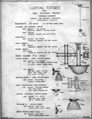 | Mrs. Richard Polson House | building | 1984 | 84003798 |
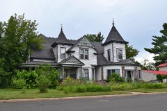 | George V. Siegner House | building | 1982 | 82000716 |
Every wildfire the federal occurrence database records inside this county: 853 of them, burning about 1,053 acres. 24 started naturally and 49 were recorded as arson. Each settlement page carries the fires within five miles of it.
| Reported cause | Fires |
|---|---|
| Debris and open burning | 231 |
| Missing data/not specified/undetermined | 168 |
| Equipment and vehicle use | 149 |
| Railroad operations and maintenance | 66 |
| Arson/incendiarism | 49 |
| Recreation and ceremony | 39 |
| Power generation/transmission/distribution | 33 |
| Smoking | 27 |
| Other causes | 26 |
| Fireworks | 25 |
| Natural | 24 |
| Misuse of fire by a minor | 16 |
The five largest, by the area the report gives. None of them was recorded as arson.
| Date | Cause | Size | Reported by | Name on the report |
|---|---|---|---|---|
| 12 April 1998 | Power generation/transmission/distribution | 120 acres | Wisconsin Department of Natural Resources | not named |
| 12 April 2006 | Misuse of fire by a minor | 75 acres | Wisconsin Department of Natural Resources | not named |
| 28 April 1996 | Debris and open burning | 69 acres | Wisconsin Department of Natural Resources | not named |
| 16 April 2019 | Debris and open burning | 44 acres | Wisconsin Department of Natural Resources | PERCH LAKE FIRE |
| 7 May 2019 | Missing data/not specified/undetermined | 22 acres | Wisconsin Department of Natural Resources | WALTER ROAD FIRE |
| 14 April 1995 | Equipment and vehicle use | 15 acres | Wisconsin Department of Natural Resources | not named |
| 22 April 2007 | Railroad operations and maintenance | 13 acres | Wisconsin Department of Natural Resources | not named |
| 13 April 2005 | Equipment and vehicle use | 13 acres | Wisconsin Department of Natural Resources | not named |
Every settlement page carries the fires within five miles of it - see the settlement index below.
The NOAA Storm Events Database holds 261 reports for this county, causing 1 death, no injuries and about $3,458,750 in recorded property damage. Each settlement page carries the reports that name it.
| Kind of event | Reports |
|---|---|
| Hail | 124 |
| Thunderstorm Wind | 117 |
| Flash Flood | 9 |
| Tornado | 8 |
| Flood | 2 |
| Lightning | 1 |
The most serious of them, by death, then injury, then recorded damage. The accounts are quoted exactly as the forecast office filed them.
| When | Event | Place named | Harm | What the report says |
|---|---|---|---|---|
| July 2002 | Lightning | Minong | 1 killed | no account filed |
| May 1953 | Tornado (F2) | not stated | $2,500,000 | no account filed |
| May 1965 | Tornado (F2) | not stated | $250,000 | no account filed |
| July 2025 | Flash Flood | Shell Lake | $200,000 | A video was received County Highway B partially washed out leaving only a thin layer of pavement on one half of the road where it passed over a culvert. Other washouts and closures were reported nearby in multiple locations by the Shell Lake Fire Department. |
| July 2025 | Flash Flood | Shell Lake | $100,000 | Hector Dam Road was was completely washed out at one of the culverts for the Dahlstrom Branch of the Yellow River. Work did not start to replace the road until July 14 with work completed on the 17th. |
| July 2025 | Flash Flood | Shell Lake Arpt | $100,000 | The intersection of Cadle Road and Sunset Drive was washed out by the North Fork of the Clam River. Work to repair the washed out culvert was not completed until after July 21st. |
| July 2025 | Flash Flood | Shell Lake | $100,000 | County Highway B was completely washout out just east of Old Highway B. This damage was repaired with the road reopened on July 15th. |
| April 2023 | Flood | Chittamo | $30,000 | Warm temperatures early in April led to rapid snowmelt of a well above normal snowpack across the region. Additionally, heavy rainfall on top of the snowpack led to additional high runoff across the county as well. Roads began to be impacted on the 12th with water overtopping low spots leading to washouts, failed culverts and numerous closed roads. Temperatures cooled during the middle of the month along with a heavy rain/snow event the 16th into the 17th. This allowed the runoff to slow and water levels to drop. Multiple communities issued disaster declarations due to the extent of washed out roads with the worst of the flooding abating by the 20th. |
| July 2011 | Thunderstorm Wind | Spring Brook | $30,000 | The intense winds brought down hundreds of trees. A barn was destroyed, a new recreational vehicle camper was destroyed, a home had major roof damage and a beef cow was killed. |
| June 1969 | Tornado (F1) | not stated | $25,000 | no account filed |
| August 2024 | Flash Flood | Schultz Spooner Arpt | $20,000 | Several gravel roads in the town of Casey were washed out by the heavy rainfall. |
| April 2022 | Flood | Shell Lake Arpt | $20,000 | A spring storm coupled with frost leaving the ground led to excessive runoff that resulted in damage to two culverts. Pictures show culverts being pushed upward. Protection on the road was necessary due to sinkholes that opened up above the culverts. Both culverts will need replacing. Each culvert is 84 inches by 70 feet with preliminary estimated costs of $20,000 to replace culverts and make repairs to the road along with time and equipment. The Town of Baronett requested an emergency declaration to help cover the costs. |
| July 2010 | Thunderstorm Wind | Birchwood | $15,000 | A large pine tree was blown down on a cabin, causing a large hole in the roof. |
| July 2025 | Thunderstorm Wind | Shell Lake | $10,000 | An approximately three foot in circumference tree was blown down causing damage to a fence and garage. In another area on the property there was an approximately 1.5 inch diameter branch impaled in the ground like a thrown spear. |
| July 2023 | Hail | Shell Lake Arpt | $10,000 | The hail caused severe damage to a garden and trees along with damage to cars and a roof. |
| July 2011 | Hail | Spring Brook | $10,000 | The hail shredded 100 acres of corn. |
| July 2010 | Thunderstorm Wind | Trego | $10,000 | Many trees were blown down across the county, especially in the Trego area and north side of Spooner. |
| July 2010 | Thunderstorm Wind | Minong | $10,000 | Widespread damage to trees either snapped or uprooted centered around the Minong and Chicog areas. |
| August 2024 | Thunderstorm Wind | Long Lake | $5,000 | Washburn County dispatch reported a downed power line. |
| May 2011 | Hail | Spooner | $4,000 | no account filed |
| July 1995 | Hail | Sarona | $3,000 | Hail from one inch up to 2.75 inches in diameter damaged cars. |
| July 1971 | Tornado (F1) | not stated | $2,500 | no account filed |
| June 1971 | Tornado (F1) | not stated | $2,500 | no account filed |
| August 2010 | Thunderstorm Wind | Minong | $1,000 | Trees were blown down. |
| July 2010 | Thunderstorm Wind | Spooner | $500 | A large tree limb was blown down on a cabin. |
| June 1985 | Tornado (F1) | not stated | $250 | no account filed |
| April 2026 | Thunderstorm Wind | Minong Sutherland Ar | - | A gust of 68 mph was recorded by the Minong RAWS station MRZW3. |
| April 2026 | Thunderstorm Wind | Earl | - | Photos were received of trees snapped around six feet above the ground between Earl and Springbrook. |
| May 2025 | Thunderstorm Wind | Long Lake | - | Numerous trees were down at the spotter's location along with the power being out. |
| May 2025 | Thunderstorm Wind | Sarona | - | Four trees were down at the reporter's location. One large poplar was uprooted, one was snapped at the base and one snapped midway up. The other was a medium maple tree. The neighbors had a medium white pine tree snapped four to six feet off the ground along with a birch tree snapped four to six feet up as well. |
| May 2025 | Thunderstorm Wind | Long Lake | - | Multiple birch and aspen trees were damaged. The trees were approximately 18 inches in diameter with some uprooted while others were snapped. |
| May 2025 | Thunderstorm Wind | Sarona | - | A photo was received showing several trees snapped near the trunk or uprooted. |
| May 2025 | Thunderstorm Wind | Trego | - | A few trees were knocked down in the storm along with lawn furniture being tossed and damaged. |
| July 2025 | Thunderstorm Wind | Shell Lake | - | Trees and tree limbs were down at the reporter's location. |
| July 2025 | Flash Flood | Shell Lake | - | Dispatch reported an estimated six to twelve inches of water on US Hwy 63 and 6th Ave intersection. |
| July 2025 | Thunderstorm Wind | Twin Oaks | - | A tree was down on a power line and on fire. |
| July 2025 | Thunderstorm Wind | Spooner | - | An 18 inch diameter pine tree was snapped six feet off the ground based on a photo. |
| July 2025 | Thunderstorm Wind | Lampson | - | Trees were down along County Highway F between County Highway K and Highway 53. |
| July 2025 | Thunderstorm Wind | Spooner | - | Multiple trees were down in Spooner. It is unknown if they were snapped or uprooted as most of the images show that fallen trees had already begun to be cut up. However, one image appears to show a tree that was snapped close to the base. |
| July 2025 | Thunderstorm Wind | Earl | - | A tree was down across the railroad tracks about 2 miles from Springbrook. |
| July 2025 | Thunderstorm Wind | Spooner | - | Photos were received of maple, oak, ash, and aspen trees that were down due to strong thunderstorm winds. Trees were snapped off or tipped. A large super canopy white pine had snapped off. It may have been more than a couple dozen trees that came down though it was difficult to tell since most trees were in the woods. There was also one tree that blocked Beaverbrook Avenue. |
| August 2025 | Thunderstorm Wind | Shell Lake Arpt | - | Photos were received showing trees down with one uprooted and down over the road near the southeast end of the Shell Lake airport. |
| August 2024 | Thunderstorm Wind | Sarona | - | Pictures were received of several small softwood trees with diameters ranging from 2 to 4 inches that were blown over and snapped. |
| August 2024 | Thunderstorm Wind | Shell Lake | - | Washburn County dispatch reported a downed tree. |
| July 2023 | Thunderstorm Wind | Shell Lake | - | Trees were reported down in several areas in Shell Lake across roadways. |
| July 2023 | Thunderstorm Wind | Shell Lake Arpt | - | Several trees were reported snapped with some near the base and others near the top. One of the trees snapped near the base had an estimated diameter of 10 inches. |
| August 2023 | Thunderstorm Wind | Earl | - | A tree was down blocking three quarters of the road on County Highway E near Earl. |
| May 2022 | Thunderstorm Wind | Spooner | - | A few trees were reported down in the Spooner area. |
| May 2022 | Thunderstorm Wind | Shell Lake | - | A few trees were reported down in the Shell Lake area. |
| May 2022 | Thunderstorm Wind | Spooner | - | A few tree limbs around 3 inches in diameter were broken by the storm. |
| August 2022 | Thunderstorm Wind | Spring Brook | - | A 20-inch diameter limb off a white pine tree was down along with several other smaller limbs and power outages in the area. |
| August 2022 | Thunderstorm Wind | Twin Oaks | - | A poplar tree was downed across a driveway. |
| August 2022 | Thunderstorm Wind | Stanberry | - | Several reports were received from across the county of smaller trees and branches down due to the winds. |
| July 2021 | Thunderstorm Wind | Spooner | - | An aspen tree was downed across Perch Lake Road near the intersection with Dock Lake Road near Spooner. |
| July 2021 | Thunderstorm Wind | Spooner | - | A large oak tree was downed across County Highway A near Dock Lake Road outside of Spooner. |
| July 2021 | Thunderstorm Wind | Shell Lake | - | Several 8 inch diameter maple and popple trees were snapped off at a farm. Some of the trees were in sheltered locations. |
| July 2021 | Thunderstorm Wind | Earl | - | Photos were received showing a large white pine tree and a large oak tree that were broken during the storm. |
| September 2021 | Flash Flood | Spooner | - | Flash flooding was occurring on US Highway 63 in front of a gas station with the water up to the grills on cars. |
| September 2021 | Flash Flood | Sarona | - | Washburn County dispatch reported a creek overflowing in the same location as an mPING report of flash flooding. |
| September 2021 | Thunderstorm Wind | Chittamo | - | A tree was blown over near Minong by the storms. |
The Survey's mineral resources record lists 110 workings inside this county. 6 still produce and 104 are closed or unrecorded. Each settlement page carries the workings within five miles of it.
| Commodity | Workings |
|---|---|
| Sand and Gravel, Construction | 108 |
| Copper | 1 |
| Clay, Sand and Gravel, Construction | 1 |
The least common of them first, because a county's hundredth gravel pit says nothing its first ten did not.
| Where | Site | Commodity | Status | Recorded |
|---|---|---|---|---|
| Eric Hinkfuss Clay Deposit | Clay, Sand and Gravel, Construction | Occurrence | ||
| Mudge | Copper | Unknown | Copper | |
| A. A. Pinter Gravel Deposit | Sand and Gravel, Construction | Occurrence | ||
| Carl & June Clark Gravel Deposit | Sand and Gravel, Construction | Occurrence | ||
| Carl Benson Gravel Deposit | Sand and Gravel, Construction | Occurrence | ||
| Chauncey Jacobsen Gravel Deposit #1 | Sand and Gravel, Construction | Occurrence | ||
| Chauncey Jacobsen Gravel Deposit #2 | Sand and Gravel, Construction | Occurrence | ||
| Chittamo Gravel Deposit | Sand and Gravel, Construction | Occurrence | ||
| Chittamo Gravel Pit | Sand and Gravel, Construction | Past Producer | ||
| Clark's Pit | Sand and Gravel, Construction | Producer | ||
| County Trunk M Pit | Sand and Gravel, Construction | Producer | ||
| Crystall Lake Gravel Pit | Sand and Gravel, Construction | Past Producer | ||
| Dock Lake Gravel Pit | Sand and Gravel, Construction | Past Producer | ||
| Don. & Lois Masterjohn Sand Deposit | Sand and Gravel, Construction | Occurrence | ||
| Dorothy Ryland Gravel Deposit | Sand and Gravel, Construction | Occurrence | ||
| Douglas M. Strunk Gravel Deposit | Sand and Gravel, Construction | Occurrence | ||
| Edward Stueckler Gravel Deposit | Sand and Gravel, Construction | Occurrence | ||
| Elmer Weideman Gravel Deposit | Sand and Gravel, Construction | Occurrence | ||
| Ernest Zieroth Jr. Gravel Deposit | Sand and Gravel, Construction | Occurrence | ||
| Eugene & Ann Wentzel Gravel Deposit | Sand and Gravel, Construction | Occurrence | ||
| Eugene & Ann Wentzel Gravel Pit | Sand and Gravel, Construction | Past Producer | ||
| Eugene R. Kasten Gravel Deposit | Sand and Gravel, Construction | Occurrence | ||
| Frank Gruenhagen Gravel Pit | Sand and Gravel, Construction | Past Producer | ||
| Fred & Lucille Bohne Gravel Deposit | Sand and Gravel, Construction | Occurrence | ||
| Frog Creek Sand Deposit | Sand and Gravel, Construction | Occurrence | ||
| G. M. Thompson Gravel Deposit | Sand and Gravel, Construction | Occurrence | ||
| Genard Amundson Sand Deposit #1 | Sand and Gravel, Construction | Occurrence | ||
| Genard Amundson Sand Deposit #2 | Sand and Gravel, Construction | Occurrence | ||
| George V. Greenfield Gravel Pit | Sand and Gravel, Construction | Past Producer | ||
| Gerald Campbell Gravel Deposit | Sand and Gravel, Construction | Occurrence | ||
| Gordon Krantz Sand Deposit | Sand and Gravel, Construction | Occurrence | ||
| Hannah Doyne Gravel Deposit | Sand and Gravel, Construction | Occurrence | ||
| Harry & Gladys Dawn Gravel Deposit | Sand and Gravel, Construction | Occurrence | ||
| Helen Schenk Gravel Pit | Sand and Gravel, Construction | Past Producer | ||
| Johana C. Davis Gravel Deposit | Sand and Gravel, Construction | Occurrence | ||
| John Furchtenicht Gravel Deposit | Sand and Gravel, Construction | Occurrence | ||
| John Gurrner Gravel Pit | Sand and Gravel, Construction | Past Producer | ||
| Joseph Andrea Gravel Deposit | Sand and Gravel, Construction | Occurrence | ||
| Joseph J. Lalich Gravel Deposit | Sand and Gravel, Construction | Occurrence | ||
| Karl Lemke Gravel Pit | Sand and Gravel, Construction | Past Producer | ||
| Krumviede Pit | Sand and Gravel, Construction | Producer | ||
| Larry Nelson Sand Deposit | Sand and Gravel, Construction | Occurrence | ||
| Lavern Graham Gravel Deposit | Sand and Gravel, Construction | Occurrence | ||
| Leroy Bassett Sand Deposit | Sand and Gravel, Construction | Occurrence | ||
| Little Stone Lake Gravel Deposit | Sand and Gravel, Construction | Occurrence | ||
| Marguerite Frey Gravel Deposit | Sand and Gravel, Construction | Occurrence | ||
| Martinson Pit | Sand and Gravel, Construction | Producer | ||
| Minong Depot Gravel Pit #1 | Sand and Gravel, Construction | Past Producer | ||
| Minong Gravel Pit #2 | Sand and Gravel, Construction | Past Producer | ||
| Morales & Londry Gravel Deposit | Sand and Gravel, Construction | Occurrence | ||
| Morris & V. Anderson Gravel Deposit | Sand and Gravel, Construction | Occurrence | ||
| Mud Lake Gravel Deposit | Sand and Gravel, Construction | Occurrence | ||
| Namekagon River Gravel Deposit | Sand and Gravel, Construction | Occurrence | ||
| Namekagon River Gravel Deposit | Sand and Gravel, Construction | Occurrence | ||
| Nekoosa Edwards Gravel Deposit | Sand and Gravel, Construction | Occurrence | ||
| Norman & Mary Skille Gravel Deposit | Sand and Gravel, Construction | Occurrence | ||
| Norman Schnagl Gravel Deposit | Sand and Gravel, Construction | Occurrence | ||
| Orville Crotteau Gravel Deposit | Sand and Gravel, Construction | Occurrence | ||
| Osterman Gravel Deposit | Sand and Gravel, Construction | Occurrence | ||
| P. & R. Clark Gravel Deposit | Sand and Gravel, Construction | Occurrence | ||
| Paffell Pit | Sand and Gravel, Construction | Past Producer | ||
| Potato Lake Inv. Co. Gravel Deposit | Sand and Gravel, Construction | Occurrence | ||
| Ralph Mortier Gravel Deposit | Sand and Gravel, Construction | Occurrence | ||
| Robert Link Gravel Pit | Sand and Gravel, Construction | Past Producer | ||
| Roberta Kending Gravel Deposit | Sand and Gravel, Construction | Occurrence | ||
| S. Lombard Gravel Deposit | Sand and Gravel, Construction | Occurrence | ||
| Severson Lake Gravel Deposit | Sand and Gravel, Construction | Occurrence | ||
| Shallow Lake Sand Deposit | Sand and Gravel, Construction | Occurrence | ||
| Shell Lake Gravel Pit | Sand and Gravel, Construction | Past Producer | ||
| Shell Lake Sand Pit #1 | Sand and Gravel, Construction | Past Producer | ||
| Shell Lake Sand Pit #2 | Sand and Gravel, Construction | Past Producer | ||
| Spooner Lake Gravel Pit | Sand and Gravel, Construction | Past Producer | ||
| Spooner Pit | Sand and Gravel, Construction | Past Producer | ||
| Spooner Pit | Sand and Gravel, Construction | Producer | ||
| State of Wisconsin Sand Pit | Sand and Gravel, Construction | Occurrence | ||
| Sugar Bush Lake Gravel Deposit | Sand and Gravel, Construction | Occurrence | ||
| T. W. Smith Gravel Pit | Sand and Gravel, Construction | Past Producer | ||
| Tony Roeser Sand Deposit | Sand and Gravel, Construction | Occurrence | ||
| Veronica Drost Sand Deposit | Sand and Gravel, Construction | Occurrence | ||
| Waggoner Brothers Gravel Pit | Sand and Gravel, Construction | Past Producer | ||
| Washburn County Gravel Deposit #1 | Sand and Gravel, Construction | Occurrence | ||
| Washburn County Gravel Deposit #2 | Sand and Gravel, Construction | Occurrence | ||
| Washburn County Gravel Deposit #3 | Sand and Gravel, Construction | Occurrence | ||
| Washburn County Gravel Deposit #4 | Sand and Gravel, Construction | Occurrence | ||
| Washburn County Gravel Deposit #5 | Sand and Gravel, Construction | Occurrence | ||
| Washburn County Gravel Deposit #6 | Sand and Gravel, Construction | Occurrence | ||
| Washburn County Gravel Deposit #7 | Sand and Gravel, Construction | Occurrence | ||
| Washburn County Gravel Deposit #8 | Sand and Gravel, Construction | Occurrence | ||
| Washburn County Gravel Pit #1 | Sand and Gravel, Construction | Past Producer | ||
| Washburn County Gravel Pit #2 | Sand and Gravel, Construction | Past Producer | ||
| Washburn County Gravel Pit #3 | Sand and Gravel, Construction | Past Producer | ||
| Washburn County Gravel Pit #4 | Sand and Gravel, Construction | Past Producer | ||
| Washburn County Gravel Pit #5 | Sand and Gravel, Construction | Past Producer | ||
| Washburn County Gravel Pit #6 | Sand and Gravel, Construction | Past Producer | ||
| Washburn County Gravel Pit #7 | Sand and Gravel, Construction | Past Producer | ||
| Washburn County Sand Deposit #1 | Sand and Gravel, Construction | Occurrence | ||
| Washburn County Sand Deposit #2 | Sand and Gravel, Construction | Occurrence | ||
| Washburn County Sand Deposit #3 | Sand and Gravel, Construction | Occurrence | ||
| Washburn County Sand and Gravel Pit | Sand and Gravel, Construction | Producer | ||
| Wesenberg Spring Gravel Deposit | Sand and Gravel, Construction | Occurrence | ||
| Wesenberg Spring Gravel Pit | Sand and Gravel, Construction | Past Producer | ||
| Whalen Lake Gravel Deposit #1 | Sand and Gravel, Construction | Occurrence | ||
| Whalen Lake Gravel Deposit #2 | Sand and Gravel, Construction | Occurrence | ||
| Wilbur Mattson Gravel Deposit #1 | Sand and Gravel, Construction | Occurrence | ||
| Wilbur Mattson Gravel Deposit #2 | Sand and Gravel, Construction | Occurrence | ||
| Wilfred Link Gravel Deposit #1 | Sand and Gravel, Construction | Occurrence | ||
| Wilfred Link Gravel Deposit #2 | Sand and Gravel, Construction | Occurrence | ||
| Wiliam Nehls Sand Deposit | Sand and Gravel, Construction | Occurrence | ||
| Wisconsin State Gravel Deposit #1 | Sand and Gravel, Construction | Occurrence | ||
| Wisconsin State Gravel Deposit #2 | Sand and Gravel, Construction | Occurrence |
Named settlements recorded in the Geographic Names Information System, each with the topographic sheets covering it. Villages, hamlets and abandoned places alike. Each is shown with the nearest named watercourse or landform and the survey quadrangle it falls on.
Beaver Brook town · 54801 · On Beaver Brook · Spooner quadrangle
8 sheets, 1948 to 1982
Stinnett town · 54875 · Stanberry West quadrangle
9 sheets, 1947 to 1980
No longer a settlement
Shell Lake city · 54871 · Near Scout Island · Shell Lake quadrangle
8 sheets, 1951 to 1982
Springbrook town · 54875 · On Spring Brook · Springbrook quadrangle
8 sheets, 1948 to 1980
Stinnett town · 54875 · On Maggie Creek · Stanberry West quadrangle
9 sheets, 1947 to 1980
The vanished settlements of Washburn County: the places named above that are no longer on the map.