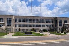
Block
From the record
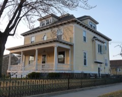
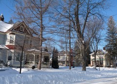
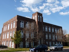
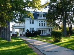
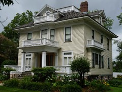
21 National Register listings published here.
Sources: the National Register database, National Park Service
41 topographic sheets cover 27 settlements here, and 21 properties are on the National Register of Historic Places.
21 National Register listings published here.
Sources: the National Register database, National Park Service
Every property in this county listed on the National Register of Historic Places, with the year it was listed and the federal nomination document.
Every wildfire the federal occurrence database records inside this county: 580 of them, burning about 1,034 acres. 13 started naturally and 37 were recorded as arson. Each settlement page carries the fires within five miles of it.
| Reported cause | Fires |
|---|---|
| Missing data/not specified/undetermined | 157 |
| Debris and open burning | 144 |
| Equipment and vehicle use | 86 |
| Recreation and ceremony | 39 |
| Arson/incendiarism | 37 |
| Power generation/transmission/distribution | 20 |
| Misuse of fire by a minor | 19 |
| Other causes | 18 |
| Smoking | 17 |
| Railroad operations and maintenance | 17 |
| Natural | 13 |
| Fireworks | 13 |
The five largest, by the area the report gives. Three of them were set deliberately.
| Date | Cause | Size | Reported by | Name on the report |
|---|---|---|---|---|
| 6 May 2000 | Missing data/not specified/undetermined | 170 acres | Wisconsin Department of Natural Resources | BLUE RIDGE FIRE |
| 1 August 2012 | Missing data/not specified/undetermined | 102 acres | Wisconsin Department of Natural Resources | SIGEL FIRE |
| 6 May 2000 | Arson/incendiarism | 91 acres | Wisconsin Department of Natural Resources | not named |
| 14 April 1997 | Debris and open burning | 59 acres | Wisconsin Department of Natural Resources | not named |
| 3 April 1995 | Debris and open burning | 42 acres | Wisconsin Department of Natural Resources | not named |
| 15 April 2009 | Debris and open burning | 36 acres | Wisconsin Department of Natural Resources | not named |
| 19 April 2014 | Arson/incendiarism | 34 acres | Wisconsin Department of Natural Resources | PINE RIDGE |
| 26 April 1997 | Arson/incendiarism | 31 acres | Wisconsin Department of Natural Resources | not named |
Every settlement page carries the fires within five miles of it - see the settlement index below.
The NOAA Storm Events Database holds 354 reports for this county, causing no deaths, 32 injuries and about $76,287,030 in recorded property damage. Each settlement page carries the reports that name it.
| Kind of event | Reports |
|---|---|
| Thunderstorm Wind | 166 |
| Hail | 136 |
| Tornado | 19 |
| Flash Flood | 13 |
| Heavy Rain | 6 |
| Flood | 5 |
| Lightning | 5 |
| Funnel Cloud | 4 |
The most serious of them, by death, then injury, then recorded damage. The accounts are quoted exactly as the forecast office filed them.
| When | Event | Place named | Harm | What the report says |
|---|---|---|---|---|
| August 1985 | Tornado (F2) | not stated | 14 hurt, $25,000,000 | no account filed |
| May 1964 | Tornado (F2) | not stated | 14 hurt, $250,000 | no account filed |
| July 1967 | Tornado (F2) | not stated | 2 hurt, $250,000 | no account filed |
| May 2011 | Tornado (EF1) | Cranmoor | 1 hurt, $1,020,000 | The tornado moved out of Juneau County at 6:03 pm CDT (1703 CST) and moved east-northeast across southern Wood County. The storm hit a campground on the east shore of the Wisconsin River about three miles south of Nekoosa. Over 100 pine trees were snapped and uprooted on the campground, some two feet in diameter (DI 28 DOD 4). Several camper vehicles were damaged by fallen trees. The tornado was seen by campground visitors just before 6:15 pm. The tornado continued east-northeast and snapped or uprooted hundreds of additional trees south of Wisconsin Rapids. The storm damaged at least six homes and several other outbuildings about six miles south-southeast of Wisconsin Rapids. One of the houses lost the entire roof of a garage (DI 2, DOD 4). A woman in the garage at the time sustained injuries when the garage fell on the truck that she was taking shelter in. This area experienced high-end EF1 damage with winds at least 95 to 105 mph. The tornado entered Portage County at 6:20 PM CDT (1720 CST). |
| June 2004 | Thunderstorm Wind | Vesper | 1 hurt | no account filed |
| June 2007 | Hail | Port Edwards | $45,000,000 | A supercell thunderstorm produced baseball and softball size hail in Port Edwards and Wisconsin Rapids. A 5.5 inch diameter hailstone that fell at Port Edwards was the second largest hailstone ever measured in Wisconsin. (The record largest hailstone in Wisconsin is 5.7 inches in diameter, which fell in Wausau on May 22, 1921.) Approximately 6,000 house and business roofs sustained at least minor damage. Over 500 vehicles were also damaged. Nine schools in the area sustained damage of $6.9 million alone. Total property damage was estimated at $45 million. |
| September 2010 | Flash Flood | Kellner | $1,500,000 | Heavy rain fell across Wood County, causing rivers and streams to overflow their banks, washing out roads and damaging homes and businesses. Much of the county received at least 4 inches of rain. The heaviest recorded total was 5.95 inches at Pittsville. Sandbagging was necessary along the Yellow River in southwest Wood County. The flooding caused minor damage to 79 homes and 10 businesses, major damage to 1 home and substantial damage to public infrastructure. As many as 35 roads across the county were closed at some point due to the flooding. |
| June 2002 | Flash Flood | Countywide | $1,000,000 | no account filed |
| May 2021 | Lightning | Wisconsin Rapids | $300,000 | Lightning struck the Verso Paper Mill at 7:30 pm CDT, producing $300,000 worth of damage. |
| July 2019 | Thunderstorm Wind | Wisconsin Rapids | $250,000 | Thunderstorm winds downed trees, large branches, and power lines in Wisconsin Rapids. Downed branches, as big as 5 inches in diameter and 10 feet long, blocked at least one road. |
| April 1992 | Tornado (F1) | not stated | $250,000 | no account filed |
| April 1984 | Tornado (F0) | not stated | $250,000 | no account filed |
| March 1982 | Tornado (F1) | not stated | $250,000 | no account filed |
| March 1967 | Tornado (F2) | not stated | $250,000 | no account filed |
| July 2019 | Thunderstorm Wind | Port Edwards | $100,000 | Thunderstorm winds downed trees and power lines along Highway 54 in Port Edwards. |
| September 2016 | Flash Flood | Bakerville | $64,000 | Runoff from heavy rainfall caused flooded roads, and caused damage to roads and bridges, especially across the western part of the county. |
| August 2021 | Flash Flood | Bakerville | $61,500 | Thunderstorms dumped 3 to 5 inches of rain over northern Wood County during the evening hours. This caused several roads to be closed due to flash flooding with several reports of cars stalled out. |
| July 2019 | Thunderstorm Wind | Babcock | $50,000 | Thunderstorm winds downed trees in Babcock. |
| February 2017 | Flood | Pittsville | $50,000 | An ice jam on the Yellow River caused flooding of basements and the ground floors of homes near the river, mainly from Pittsville to Dexterville. Property damage totals included in this report are only a rough estimate. |
| July 2014 | Hail | Wisconsin Rapids | $50,000 | A thunderstorm produced hail up to 2.25 inches in diameter as it passed through Wisconsin Rapids. Hail covered the ground and damaged at least 10 vehicles, denting them and breaking windshields. |
| June 1998 | Thunderstorm Wind | Rudolph | $50,000 | no account filed |
| May 1996 | Thunderstorm Wind | Wisconsin Rapids | $50,000 | no account filed |
| August 1996 | Thunderstorm Wind | Marshfield | $50,000 | no account filed |
| April 1997 | Thunderstorm Wind | Pittsville | $40,000 | no account filed |
| July 2011 | Thunderstorm Wind | Wisconsin Rapids | $25,000 | Law enforcement reported trees were knocked down in the city of Wisconsin Rapids. One tree fell onto a house, damaging the roof and kitchen ceiling. Scattered power outages were also reported in Marshfield. |
| May 2008 | Lightning | Amelia | $20,000 | Lightning stuck a tree and traveled through a coaxial cable that went into an adjacent house causing a fire in the house. The fire burned inside walls and in the attic of the house. Fire damage was confined to one of the bedrooms and smoke damage to the home was minimal. There was some water and roof damage that occurred during process of extinguishing the fire. |
| June 1999 | Thunderstorm Wind | Marshfield | $20,000 | no account filed |
| June 1996 | Thunderstorm Wind | Wisconsin Rapids | $10,000 | no account filed |
| May 1996 | Thunderstorm Wind | Marshfield | $10,000 | no account filed |
| August 2014 | Thunderstorm Wind | Alexander Southwd Ar | $6,000 | Thunderstorm winds uprooted at least a dozen trees in saturated soil on the southeast side of Wisconsin Rapids. Two houses were damaged by the fallen trees. |
| May 2017 | Thunderstorm Wind | Marshfield | $5,000 | Thunderstorm winds snapped power poles and caused some damage to nearby businesses in Marshfield. |
| June 2003 | Tornado (F0) | Marshfield Muni Arpt | $5,000 | no account filed |
| May 1998 | Thunderstorm Wind | Nekoosa | $5,000 | no account filed |
| May 1998 | Thunderstorm Wind | Blenker | $5,000 | no account filed |
| May 1998 | Thunderstorm Wind | Milladore | $5,000 | no account filed |
| June 1998 | Thunderstorm Wind | Nekoosa | $5,000 | no account filed |
| September 1997 | Heavy Rain | Marshfield | $5,000 | no account filed |
| July 1997 | Thunderstorm Wind | Marshfield | $3,000 | no account filed |
| July 2016 | Thunderstorm Wind | Kellner | $2,500 | Thunderstorm winds damaged tents for a water ski show on Lake Wazeecha. |
| June 1976 | Tornado (F1) | not stated | $2,500 | no account filed |
| December 1970 | Tornado (F2) | not stated | $2,500 | no account filed |
| July 2014 | Thunderstorm Wind | Arpin | $2,000 | Thunderstorm winds damaged trees and flipped a storage shed upside down, landing it next to another shed. The damage occurred near Arpin, at Highway 186 and CTH-K. |
| June 1999 | Thunderstorm Wind | Vesper | $2,000 | no account filed |
| June 1998 | Thunderstorm Wind | Port Edwards | $2,000 | no account filed |
| June 1998 | Thunderstorm Wind | Rudolph | $2,000 | no account filed |
| June 2017 | Flood | Nekoosa | $1,000 | Heavy rainfall from thunderstorms caused minor street flooding in Nekoosa. |
| June 1998 | Thunderstorm Wind | Nekoosa | $1,000 | no account filed |
| August 1997 | Lightning | Marshfield | $1,000 | no account filed |
| June 1997 | Thunderstorm Wind | Dexterville | $1,000 | no account filed |
| June 1997 | Thunderstorm Wind | Marshfield | $1,000 | no account filed |
| June 1997 | Thunderstorm Wind | Pittsville | $1,000 | no account filed |
| June 1997 | Thunderstorm Wind | Wisconsin Rapids | $1,000 | no account filed |
| July 1983 | Tornado (F0) | not stated | $30 | no account filed |
| April 2026 | Flash Flood | Marshfield | - | Rainfall amounts of 2 to 3 inches in a short time caused cars to get stuck in water on several streets in Marshfield due to flash flooding. |
| April 2026 | Hail | Vesper | - | Quarter size hail fell in Vesper. |
| April 2026 | Hail | Marshfield | - | Quarter size hail fell in Marshfield. |
| April 2026 | Flash Flood | Auburndale | - | Rainfall amounts of around 2 inches in a short time caused several roads to close in the Marshfield area due to flash flooding. The time of this report is an estimate based on radar data. |
| March 2025 | Hail | Bakerville | - | Penny size hail fell near Marshfield. |
| June 2025 | Thunderstorm Wind | Scranton | - | Thunderstorms produced a wind gust to 59 mph. |
| June 2025 | Thunderstorm Wind | Alexander Southwd Ar | - | Thunderstorms produced a wind gust to 69 mph at the Wisconsin Rapids Airport. |
The Survey's mineral resources record lists 7 workings inside this county. 3 still produce and 4 are closed or unrecorded. Each settlement page carries the workings within five miles of it.
| Commodity | Workings |
|---|---|
| Stone, Crushed/Broken | 5 |
| Sand and Gravel, Construction | 1 |
| Marble, Dimension | 1 |
The least common of them first, because a county's hundredth gravel pit says nothing its first ten did not.
| Where | Site | Commodity | Status | Recorded |
|---|---|---|---|---|
| Plantz Brothers Sand and Gravel Pit | Sand and Gravel, Construction | Past Producer | ||
| Something Mine | Marble, Dimension | Producer | ||
| Ellis Corp. | Stone, Crushed/Broken | Past Producer | ||
| Grange Quarry | Stone, Crushed/Broken | Past Producer | ||
| Rudolph Quarry | Stone, Crushed/Broken | Past Producer | ||
| Smith Quarry | Stone, Crushed/Broken | Producer | ||
| Wood County Operations | Stone, Crushed/Broken | Producer |
Named settlements recorded in the Geographic Names Information System, each with the topographic sheets covering it. Villages, hamlets and abandoned places alike. Each is shown with the nearest named watercourse or landform and the survey quadrangle it falls on.
Lincoln town · 54449 · On South Branch Yellow River · Marshfield quadrangle
11 sheets, 1953 to 1984
Biron village · 54494 · On Mosquito Creek · Wisconsin Rapids North quadrangle
8 sheets, 1955 to 1985
Port Edwards village · 54457 · On Moccasin Creek · Nekoosa quadrangle
8 sheets, 1955 to 1985
Port Edwards village · 54469 · On Twomile Creek · Wisconsin Rapids South quadrangle
8 sheets, 1955 to 1985
Vesper village · 54489 · On East Fork Hemlock Creek · Vesper quadrangle
8 sheets, 1955 to 1985
Wisconsin Rapids city · 54494 · Near Belle Island · Wisconsin Rapids North quadrangle
8 sheets, 1955 to 1985