 Block
Eagle, Wisconsin
23 topographic sheets cover this place, the earliest surveyed in 1892 and the latest in 1980. It stands in Eagle Village. It lies in ZIP code area 53119. The Survey maps it on the Eagle quadrangle. 2,071 people lived here at the 2020 count. It stands 902 feet above sea level.
On record in Eagle
Buildings and businesses the archive holds for this place. Each opens its own page, with the source record it came from.
On the National Register 4 records
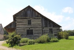 Christian Turck Houselisted 1973
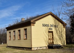 Ward District No. 3 Schoolhouselisted 1981
- Ahira R. Hinkley Houselisted 1974
- Koepsel Houselisted 1973
Population over time
2 figuresEagle grew from 1,950 to 2,071 between 2010 and 2020. These are the recorded population figures Wikidata holds for this place, reached through the Geographic Names Information System number this page is keyed on rather than by name, so they belong to this place and not to another of the same name. Most are census counts, but not all are: an early figure may be a founding or settlement estimate, and an estimate published within five years of a census is left out. The change column is computed, and is left blank where more than 20 years separate a figure from the one before it, because a gap that long is not a change between two counts.
| Year | People | Change |
|---|---|---|
| 2010 | 1,950 | |
| 2020 | 2,071 | +121 (+6%) |
Topographic sheets covering this place
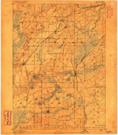
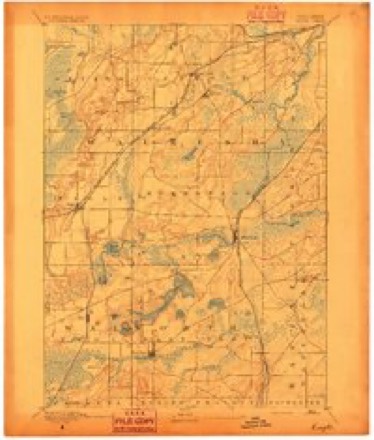
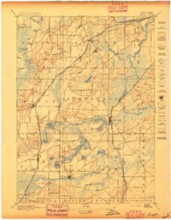
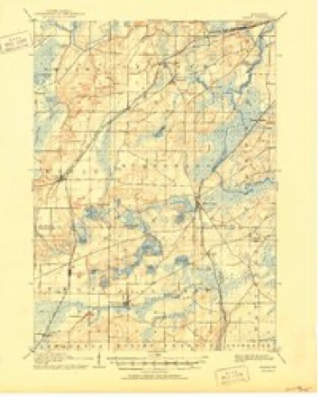
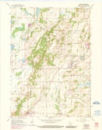
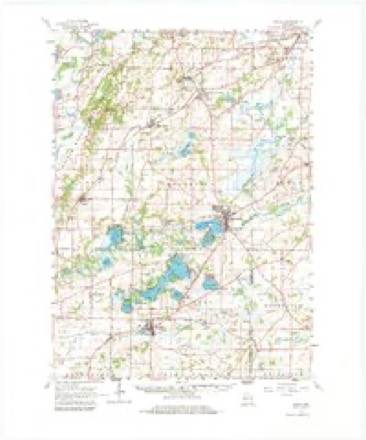
11 surveys from 23 printed sheetsMatched by testing this settlement's coordinate against the published boundary of every sheet in the United States Geological Survey's historical collection. Each opens the scanned sheet at the Survey.
- 1892 USGS Eagle quadrangle1:62500
- 1894 USGS Eagle quadrangle1:62500
- 1897 USGS Eagle quadrangle1:62500
- 1906 USGS Eagle quadrangle1:62500, 6 printings
- 1954 USGS Rockford quadrangle1:250000
- 1955 USGS Rockford quadrangle1:250000
- 1958 USGS Rockford quadrangle1:250000, 4 printings
- 1960 USGS Eagle quadrangle1:24000, 3 printings
- 1960 USGS Eagle quadrangle1:62500, 3 printings
- 1963 USGS Rockford quadrangle1:250000
- 1980 USGS Lake Geneva quadrangle1:100000





Fires near this place
15 since 2010Regional context, not property-specific evidence. The federal wildfire occurrence database lists 15 fires within 5 miles of Eagle between 2010 and 2020, burning about 87 acres in total. None started naturally. None was recorded as arson. Distance is straight-line from the map coordinates, so a fire counted here may appear on a neighbouring settlement's page as well.
| Reported cause | Fires |
|---|---|
| Missing data/not specified/undetermined | 14 |
| Debris and open burning | 1 |
The most recent of them, most recent first, with the day each was reported and the service that recorded it.
| Date | Cause | Size | Reported by | Name on the report |
|---|---|---|---|---|
| 11 August 2016 | Missing data/not specified/undetermined | under an acre | Wisconsin Department of Natural Resources | MCMILLER RANGE FIRE |
| 26 July 2018 | Missing data/not specified/undetermined | under an acre | Wisconsin Department of Natural Resources | 73 |
| 27 June 2020 | Missing data/not specified/undetermined | under an acre | Wisconsin Department of Natural Resources | 2002498 |
| 3 May 2020 | Missing data/not specified/undetermined | 15 acres | Wisconsin Department of Natural Resources | 20089 |
| 7 April 2012 | Missing data/not specified/undetermined | 4.6 acres | Wisconsin Department of Natural Resources | MCMILLER RANGE |
| 4 April 2015 | Missing data/not specified/undetermined | 13 acres | Wisconsin Department of Natural Resources | CARLIN TRAIL |
| 30 April 2018 | Missing data/not specified/undetermined | under an acre | Wisconsin Department of Natural Resources | 2018024 |
| 30 April 2018 | Missing data/not specified/undetermined | under an acre | Wisconsin Department of Natural Resources | 2018025 |
Settlements close enough to share some of these fires:
Mines and quarries near this place
1 within 5 milesRegional context, not property-specific evidence. The federal mineral resources record lists 1 working within 5 miles of Eagle: 1 past producer. None of them still produces. What was taken out: Sand and Gravel, Construction. Distance is straight-line from the map coordinates, so a quarry counted here may appear on a neighbouring settlement's page as well.
| Where | Site | Commodity | Status | Recorded |
|---|---|---|---|---|
| Pett Construction Co Burton Pit | Sand and Gravel, Construction | Past Producer |
Storms near this place
42 since 1995Regional context, not property-specific evidence. The National Weather Service names Eagle in 42 storm reports between 1995 and 2026: 21 thunderstorm wind, 14 hail, 4 tornado, 1 heavy rain. The reports record 17 injuries. Each account below is quoted exactly as the forecast office filed it, from the NOAA Storm Events Database, and each date opens the federal record of that event.
| When | Event | Place named | Harm | What the report says |
|---|---|---|---|---|
| June 2010 | Tornado (EF2) | Eagle | 15 hurt, $20,600,000 | An EF2 tornado developed about 1.9 miles west-southwest of the Village of Eagle, roughly 1/2 mile south-southeast of the intersection of STH 59 and CTH S, just west of CTH S and west of a horse-riding ranch, and moved east-northeast through the Eagle and then moved due east and then east-southeast before dissipating about 1.94 miles southeast of Jericho, just within Mukwonago County Park, 1000 feet east of Genevieve Drive. Fifteen people sustained minor injuries. One hundred thirty-four homes received minor damage, 67 homes had major damage, and 8 homes were destroyed, mainly in the southern part of the village. Another 75 homes were minimally affected. One business received major damage, while 18 businesses had minor damage. The business that received major damage was a commercial horse-riding ranch/western town at the beginning of the tornado path. Damage was inflicted upon all of the fencing, two trolleys, and 18 tables. One of the biggest buildings on the site was twisted and turned. A donkey was killed, four hayride wagons were lost, and 25 acres of trees were damaged. The owner of the riding ranch saw the tornado and said it looked like the Fourth of July fireworks finale - there were thousands of lightning streaks in the cone. All together, this tornado uprooted or damaged thousands of trees, and at least three dozen vehicles were damaged or totaled. At Old World Wisconsin, an outdoor museum operated by the Wisconsin Historical Society near Eagle, about 2500 tress were damaged at this site alone, and a few buildings sustained minor damage. Overall, Emergency Management officials estimated that residential damage reached $20,577,500, with business damage around $311,500, bringing total private sector damage to about $20,889,000. A few agricultural buildings were damaged, but loss estimates were not available. Public sector structural damage totaled only about $600, while public sector service costs (non-damage) such as debris clean-up, security and public protection, road protective measures, and other miscellaneous expenses were estimated at $101,965. The starting point location was Lat. 42.86785 Lon.-88.50307. The end point location was Lat.42.87100 Lon. -88.40003. The EF-rating was based on DI 2 (FR12) DOD 6 which suggests wind speeds between 125 to 130 mph. On the WSR-88D Doppler radar at the nearby WFO Milwaukee (MKX), a debris-ball appeared near Eagle within a classic hook echo as the parent thunderstorm moved east. |
| June 2011 | Thunderstorm Wind | Eagle | 1 hurt, $276,000 | A 2-mile wide swath of damage was caused by a microburst associated with a bowing line of severe thunderstorms that tracked from southwest to northeast across a large portion of Waukesha County. Wind gusts estimated up to between 100 to 110 mph (87 to 96 knots) dropped thousands of trees, damaged homes and barns and blew down power lines that left 10,000 customers without power in Waukesha County. One person was injured by airborne tree debris near the Pewaukee and Delafield town borders. A semi-trailer truck was blown over on Interstate-94 in Waukesha County, while two other high-profile vehicles were nearly blown over by the strong winds, but concrete construction barriers saved the vehicles from being completely blown over. |
| July 2013 | Lightning | Eagle | 1 hurt | Lightning struck the ground near a group of horse riders in the Kettle Moraine Forest near Eagle. The lightning traveled through the wet ground and passed through two of the horses and one of the riders. The second rider was injured when thrown from her horse after it was struck. |
| October 2002 | Thunderstorm Wind | Eagle | $50,000 | no account filed |
| July 2015 | Thunderstorm Wind | Eagle | $25,000 | Numerous branches and trees down across the county, most concentrated from Genesee to Mukwonago. In addition, a few 2 foot diameter trees downed and shingles blown off a home on North Island on Eagle Spring Lake. Power lines downed in Eagle, Ottawa, and Sussex. A tree fell on a van. |
| May 2024 | Thunderstorm Wind | Eagle | $15,000 | A swath of scattered tree damage and power lines down. |
| November 2022 | Thunderstorm Wind | Eagle | $15,000 | Scattered trees and branches down throughout the county, including power lines. Power outages were reported in Brookfield, New Berlin, and Vernon. |
| July 2015 | Thunderstorm Wind | Eagle | $10,000 | Several branches and trees down across the county. |
| July 2008 | Thunderstorm Wind | Eagle | $10,000 | Powerful thunderstorm wind gusts toppled several large trees and broke branches that brought down some power-lines. |
| June 2024 | Thunderstorm Wind | Eagle | $7,000 | A couple trees uprooted and snapped. A tree down on a car. |
| July 2023 | Thunderstorm Wind | Eagle | $6,000 | About a dozen tree tops from trees with diameter up to 16 inches were snapped off. A ten inch diameter Apple Tree was blown down. |
| June 2024 | Thunderstorm Wind | Eagle | $5,000 | A couple trees uprooted and snapped. A tree down a car. |
| July 2003 | Thunderstorm Wind | Eagle | $5,000 | no account filed |
| September 2012 | Thunderstorm Wind | Eagle | $3,000 | The Waukesha County 911 Center received reports of trees blown down by damaging thunderstorm wind gusts estimated at 56 knots (65 mph) from 5 miles northwest of Eagle to Eagle. |
| June 2014 | Thunderstorm Wind | Eagle | $1,000 | Large tree down. |
| May 1998 | Thunderstorm Wind | Eagle | $1,000 | no account filed |
| May 2025 | Hail | Eagle | - | Pictures provided. |
| April 2025 | Hail | Eagle | - | Picture provided. |
| March 2023 | Tornado (EF1) | Eagle | - | Very short lived tornado with substantial damage to under-construction property and many healthy trees snapped. Heavy debris lofted several hundred yards. Path continued northward and hit a house and bent over a stop sign. |
| July 2023 | Tornado (EF1) | Eagle | - | NWS damage survey found tree damage in a convergent path east of Palmyra. |
| July 2013 | Hail | Eagle | - | A trained spotter reported hail up to 3/4 of an inch in diameter in the Village of Eagle. |
| May 2011 | Hail | Eagle | - | A severe thunderstorm produced hail up to 1.75 inches in diameter in a 4-mile wide swath from the southwest corner of Waukesha County northeast to North Prairie. |
| August 2009 | Thunderstorm Wind | Eagle | - | Police reported trees down in the village of Eagle with estimated wind gusts of 56 knots (65 mph). |
| June 2008 | Thunderstorm Wind | Eagle | - | Powerful thunderstorm winds knocked down a few large trees in the vicinity of CTH Z and N. |
| June 2008 | Tornado (EF0) | Eagle | - | A brief tornado lasting less than a minute was spotted by the Eagle Police Department and Fire Department. Damage was restricted to broken tree branches. The starting and ending locations, with respect to lat/long pairs of numbers, were 42.85852/-88.47545 and 42.85973/-88.47364, respectively. DI #28 (TS), DOD2. Maximum wind speed about 75 mph. |
| July 2006 | Thunderstorm Wind | Eagle | - | Trees down on County Road ZZ. |
| April 2026 | Hail | Eagle | - | no account filed |
| April 2026 | Hail | Eagle | - | no account filed |
| April 2014 | Hail | Eagle | - | no account filed |
| April 2014 | Hail | Eagle | - | no account filed |
| June 2011 | Thunderstorm Wind | Eagle | - | no account filed |
| June 2010 | Hail | Eagle | - | no account filed |
| July 2010 | Funnel Cloud | Eagle | - | no account filed |
| October 2006 | Hail | Eagle | - | no account filed |
| June 2005 | Thunderstorm Wind | Eagle | - | no account filed |
| June 2004 | Thunderstorm Wind | Eagle | - | no account filed |
| July 2003 | Hail | Eagle | - | no account filed |
| May 2001 | Hail | Eagle | - | no account filed |
| September 2001 | Heavy Rain | Eagle | - | no account filed |
| March 2000 | Hail | Eagle | - | no account filed |
| May 1997 | Hail | Eagle | - | no account filed |
| August 1995 | Thunderstorm Wind | Eagle | - | no account filed |
Nearest settlements
The eight closest, with where each one stands in the county. Distances are straight-line, computed from the Geographic Names Information System coordinates.
| Map | Place | Distance | Sheets |
|---|---|---|---|
| Jericho | 2.7 miles | 23 | |
| Eagleville | 2.8 miles | 24 | |
| North Prairie | 5.3 miles | 23 | |
| Ottawa | 6.8 miles | 23 | |
| Oak Knoll | 7.3 miles | 24 | |
| Mukwonago | 7.5 miles | 24 | |
| Genesee | 7.9 miles | 23 | |
| Genesee Depot | 8.1 miles | 23 |
Elsewhere
Matched on this settlement's Geographic Names Information System number rather than its name, so it cannot be a different place of the same name in another state.
| Wikipedia article on Eagle | An encyclopaedic summary. Its text is share-alike, so it is linked here rather than copied. |
| Wikidata item Q2671381 | The structured record the population and elevation above come from. Public domain (CC0). |
Provenance
This settlement is recorded in the Geographic Names Information System as feature 1564231. The sheet list is computed by point-in-boundary test against the United States Geological Survey's historical topographic inventory. Both are works of the United States government and carry no copyright under 17 U.S.C. 105.
Wildfire. Short, Karen C. 2022. Spatial wildfire occurrence data for the United States, 1992-2020 [FPA_FOD_20221014]. 6th Edition. Fort Collins, CO: Forest Service Research Data Archive. https://doi.org/10.2737/RDS-2013-0009.6 Collected with United States Government funding and usable without additional permissions or fees.
Mines and quarries. USGS Mineral Resources Data System (MRDS) https://mrdata.usgs.gov/mrds/ A work of the United States government, no copyright under 17 U.S.C. 105.
Storms. NOAA National Centers for Environmental Information, Storm Events Database https://www.ncei.noaa.gov/stormevents/ A work of the United States government, no copyright under 17 U.S.C. 105. Narratives are quoted verbatim from the National Weather Service report and are not edited or summarised.