 Block
Hammond, Wisconsin
11 topographic sheets cover this place, the earliest surveyed in 1949 and the latest in 1990. It stands in Hammond Village. It lies in ZIP code area 54015. The Survey maps it on the Baldwin West quadrangle. 1,873 people lived here at the 2020 count. It stands 1,089 feet above sea level.
Population over time
2 figuresHammond fell from 1,922 to 1,873 between 2010 and 2020. These are the recorded population figures Wikidata holds for this place, reached through the Geographic Names Information System number this page is keyed on rather than by name, so they belong to this place and not to another of the same name. Most are census counts, but not all are: an early figure may be a founding or settlement estimate, and an estimate published within five years of a census is left out. The change column is computed, and is left blank where more than 20 years separate a figure from the one before it, because a gap that long is not a change between two counts.
| Year | People | Change |
|---|---|---|
| 2010 | 1,922 | |
| 2020 | 1,873 | -49 (-3%) |
Topographic sheets covering this place
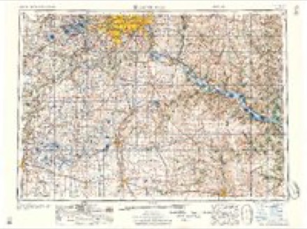
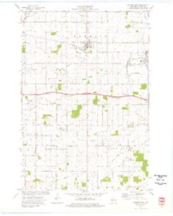
8 surveys from 11 printed sheetsMatched by testing this settlement's coordinate against the published boundary of every sheet in the United States Geological Survey's historical collection. Each opens the scanned sheet at the Survey.
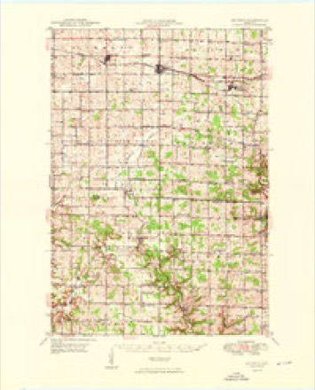
- 1949 USGS Baldwin quadrangle1:62500, 2 printings
- 1953 USGS Saint Paul quadrangle1:250000, 3 printings
- 1953 USGS St. Paul quadrangle1:250000
- 1959 USGS Saint Paul quadrangle1:250000
- 1959 USGS St. Paul quadrangle1:250000
- 1974 USGS Baldwin West quadrangle1:24000
- 1985 USGS Hastings quadrangle1:100000
- 1990 USGS Hastings quadrangle1:100000
Fires near this place
17 since 1994Regional context, not property-specific evidence. The federal wildfire occurrence database lists 17 fires within 5 miles of Hammond between 1994 and 2020, burning about 7 acres in total. None started naturally. None was recorded as arson. Distance is straight-line from the map coordinates, so a fire counted here may appear on a neighbouring settlement's page as well.
| Reported cause | Fires |
|---|---|
| Missing data/not specified/undetermined | 10 |
| Debris and open burning | 4 |
| Equipment and vehicle use | 1 |
| Power generation/transmission/distribution | 1 |
| Recreation and ceremony | 1 |
The most recent of them, most recent first, with the day each was reported and the service that recorded it.
| Date | Cause | Size | Reported by | Name on the report |
|---|---|---|---|---|
| 7 September 2019 | Debris and open burning | under an acre | Wisconsin Department of Natural Resources | 19-5587 |
| 20 September 2018 | Power generation/transmission/distribution | under an acre | Wisconsin Department of Natural Resources | 18-5761 |
| 12 August 2018 | Missing data/not specified/undetermined | under an acre | Wisconsin Department of Natural Resources | 18-4859 |
| 7 July 2018 | Missing data/not specified/undetermined | under an acre | Wisconsin Department of Natural Resources | 18-3958 |
| 13 July 2020 | Missing data/not specified/undetermined | 1.0 acres | Wisconsin Department of Natural Resources | 20-4331 |
| 9 June 2020 | Missing data/not specified/undetermined | 1.0 acres | Wisconsin Department of Natural Resources | 20-3417 |
| 8 June 2018 | Missing data/not specified/undetermined | under an acre | Wisconsin Department of Natural Resources | 1832178 |
| 8 June 2018 | Debris and open burning | under an acre | Wisconsin Department of Natural Resources | 18-3217 |
Settlements close enough to share some of these fires:
Mines and quarries near this place
10 of 23 shownRegional context, not property-specific evidence. The federal mineral resources record lists 23 workings within 5 miles of Hammond: 16 past producers, 3 occurrences, 2 producers, 1 prospect. 2 still produce. What was taken out: Sand and Gravel, Construction, Stone, Crushed/Broken. Distance is straight-line from the map coordinates, so a quarry counted here may appear on a neighbouring settlement's page as well.
| Where | Site | Commodity | Status | Recorded |
|---|---|---|---|---|
| Kinnickinnic River Dolomite Deposit | Stone, Crushed/Broken | Prospect | ||
| Russ & Bobbie Ihrke Dolomite Quarry | Stone, Crushed/Broken | Past Producer | ||
| Baldwin Gravel Deposit #1 | Sand and Gravel, Construction | Occurrence | ||
| Baldwin Gravel Deposit #2 | Sand and Gravel, Construction | Occurrence | ||
| Baldwin Gravel Pit #1 | Sand and Gravel, Construction | Past Producer | ||
| Baldwin Gravel Pit #2 | Sand and Gravel, Construction | Past Producer | ||
| County Pit | Sand and Gravel, Construction | Unknown | ||
| Deneen Pit | Sand and Gravel, Construction | Producer | ||
| H L Olsen Gravel Pit | Sand and Gravel, Construction | Past Producer | ||
| Hammond Gravel Pit | Sand and Gravel, Construction | Past Producer |
Storms near this place
29 since 1996Regional context, not property-specific evidence. The National Weather Service names Hammond in 29 storm reports between 1996 and 2025: 16 hail, 7 thunderstorm wind, 4 tornado, 1 funnel cloud. No death or injury is recorded in these reports. Each account below is quoted exactly as the forecast office filed it, from the NOAA Storm Events Database, and each date opens the federal record of that event.
| When | Event | Place named | Harm | What the report says |
|---|---|---|---|---|
| June 2005 | Tornado (F1) | Hammond | $3,600,000 | A tornado that was on the ground for 8 miles first touched down near Oak Drive in Section 24 of Kinnickinnic Township about 7 miles southwest of Hammond. A couple trying to outrun the storm in their car said that the funnel suddenly surrounded their vehicle. The car began to shake and the back end started to lift off the ground while at the same time branches were flying by the car. At a property nearby the tornado sheared off a garage roof, twisted a swing set up "like a pretzel", broke windows, and downed trees. The tornado pushed northeast and crossed Interstate 94 where it was witnessed by several motorists. Next the twister damaged a farmstead near the intersection of County Highway J and 170th Street about 4 miles southwest of Hammond. A number of horses were picked up and injured by flying debris. One horse had to be put down because of a severe leg injury. Three sheds (42x80 feet, 27x14 feet, and 150 feet long) were downed. After striking the farmstead the tornado destroyed two barns, a few sheds, and snapped or uprooted many trees before reaching Hammond. The tornado was at its strongest when it moved into the northwest corner of Hammond where it damaged 24 homes, mainly in the Meadows subdivision. A row of 5 townhouses sustained significant roof and garage damage and one building had to be demolished. The tornado caused grills, lawn furniture, and building debris to be thrown into the exterior walls and windows of homes. Several neighborhood residents took shelter in ground floor bathrooms and closets (the homes did not have basements) and incredibly no one was injured. Twenty seven families had to be sheltered by the Red Cross until the damage to their homes could be repaired. Hammond Golf Course lost 47 mature fairway trees between the 9th and 6th tee box. Three golfers caught outside when the tornado crossed the course had to hang onto trees to survive the forceful winds that threw trees up to 25 feet from where they were ripped from the ground. Just north of town along 90th Avenue the tornado threw a picnic table through the front of a home. The home itself was slightly moved off its foundation and the back wall of the home was ripped off. Two sheds on the property were picked up and dropped back down. This tornado was widely photographed and videotaped. |
| July 2010 | Tornado (EF1) | Hammond | $500,000 | Thirty homes sustained damage, including one with major damage. Dozens of trees were broken or snapped. |
| July 2021 | Thunderstorm Wind | Hammond | $100,000 | There was a barn and garage that was damaged, with corn flattened at County Road E and 160th Street. |
| August 2009 | Tornado (EF0) | Hammond | $100,000 | A damage survey determined that an EF-0 touched down approximately three miles north-northwest of Hammond, Wisconsin, and tracked eastward for approximately one-half mile before lifting. Several garage doors were blown in. A portion of a roof was blown off a house. Numerous soffets were blown off, and corn in the area was blown down. The damage occurred in the area of 167th Street. |
| May 2025 | Tornado (EF2) | Hammond | - | A tornado touched down near a property along 110th Ave, uprooting multiple trees. The tornado tracked north toward County Road E, snapping tree trunks along the way. It then started to track more to the northeast, destroying a farm outbuilding along with multiple uprooted trees at a property along 160th Street. The debris from this outbuilding was found along the rest of the tornado track. The most substantial damage occurred at a property along 165th Street, where multiple trees were snapped and a silo sustained significant damage. The silo was shifted, had one side caved in, and had its top removed. After this, the tornado tracked north of 140th Avenue before roping out and dissipating before reaching County Road G. |
| July 2023 | Hail | Hammond | - | Corn stripped from the hail. |
| July 2023 | Thunderstorm Wind | Hammond | - | Many ten to twelve inch diameter trees blown down. Corn was also stripped from hail. |
| May 2023 | Hail | Hammond | - | Trained Spotter measured nickel sized hail in Hammond, WI. |
| July 2023 | Heavy Rain | Hammond | - | A measured report of 2.13 inches of rain fell in one hour. |
| July 2016 | Hail | Hammond | - | Hail was photographed. |
| May 2015 | Thunderstorm Wind | Hammond | - | A home lost some shingles on their roof from damaging thunderstorm winds. |
| June 2010 | Hail | Hammond | - | A wall cloud was also observed near Hammond, Wisconsin. |
| June 2008 | Thunderstorm Wind | Hammond | - | Large tree and power line downed. |
| July 2008 | Hail | Hammond | - | Hail occurred 0.5 miles West of intersection of County Road N and T. |
| August 2007 | Hail | Hammond | - | In addition, measured 47 mph winds at 840 pm. |
| May 2007 | Thunderstorm Wind | Hammond | - | Three to five inch branches down. |
| June 2005 | Hail | Hammond | - | Dime to nickel sized hail fell 13 miles east of the Minnesota border on Interstate 94. |
| October 2004 | Thunderstorm Wind | Hammond | - | Near the intersection of Highway 12 and 160th Street 2 miles northwest of Hammond a pole barn was damaged. Pieces of the barn's corrugated steel roofing were found up to one quarter mile away. A playhouse made out of timbers was destroyed. A car was damaged by flying debris. A second barn lost a portion of its roof. |
| October 2004 | Thunderstorm Wind | Hammond | - | A tractor trailer was blown over on Interstate 94 at mile post 13. |
| June 2001 | Hail | Hammond | - | Ground turned white. |
| May 2022 | Hail | Hammond | - | no account filed |
| May 2021 | Hail | Hammond | - | no account filed |
| June 2017 | Hail | Hammond | - | no account filed |
| September 2016 | Hail | Hammond | - | no account filed |
| October 2016 | Hail | Hammond | - | no account filed |
| July 2010 | Hail | Hammond | - | no account filed |
| July 2010 | Funnel Cloud | Hammond | - | no account filed |
| June 2007 | Hail | Hammond | - | no account filed |
| October 1996 | Hail | Hammond | - | no account filed |
Nearest settlements
The eight closest, with where each one stands in the county. Distances are straight-line, computed from the Geographic Names Information System coordinates.
| Map | Place | Distance | Sheets |
|---|---|---|---|
| Baldwin | 3.4 miles | 11 | |
| Palmer | 5.5 miles | 11 | |
| Dahl | 6.3 miles | 11 | |
| Roberts | 6.4 miles | 12 | |
| Erin Corner | 6.9 miles | 12 | |
| Centerville | 7.8 miles | 11 | |
| Woodville | 7.9 miles | 11 | |
| Wildwood | 9.4 miles | 11 |
Elsewhere
Matched on this settlement's Geographic Names Information System number rather than its name, so it cannot be a different place of the same name in another state.
| Wikipedia article on Hammond | An encyclopaedic summary. Its text is share-alike, so it is linked here rather than copied. |
| Wikidata item Q2134988 | The structured record the population and elevation above come from. Public domain (CC0). |
Provenance
This settlement is recorded in the Geographic Names Information System as feature 1581640. The sheet list is computed by point-in-boundary test against the United States Geological Survey's historical topographic inventory. Both are works of the United States government and carry no copyright under 17 U.S.C. 105.
Wildfire. Short, Karen C. 2022. Spatial wildfire occurrence data for the United States, 1992-2020 [FPA_FOD_20221014]. 6th Edition. Fort Collins, CO: Forest Service Research Data Archive. https://doi.org/10.2737/RDS-2013-0009.6 Collected with United States Government funding and usable without additional permissions or fees.
Mines and quarries. USGS Mineral Resources Data System (MRDS) https://mrdata.usgs.gov/mrds/ A work of the United States government, no copyright under 17 U.S.C. 105.
Storms. NOAA National Centers for Environmental Information, Storm Events Database https://www.ncei.noaa.gov/stormevents/ A work of the United States government, no copyright under 17 U.S.C. 105. Narratives are quoted verbatim from the National Weather Service report and are not edited or summarised.