 Block
Ontario, Wisconsin
12 topographic sheets cover this place, the earliest surveyed in 1926 and the latest in 1985. It stands in Ontario Village. It lies in ZIP code area 54651. It lies near Bee Hollow. The Survey maps it on the Ontario quadrangle. 534 people lived here at the 2020 count. It stands 919 feet above sea level.
On record in Ontario
Buildings and businesses the archive holds for this place. Each opens its own page, with the source record it came from.
On the National Register 1 record
- Charles Lord Houselisted 1998
Population over time
3 figuresOntario grew from 179 to 534 between 1880 and 2020. These are the recorded population figures Wikidata holds for this place, reached through the Geographic Names Information System number this page is keyed on rather than by name, so they belong to this place and not to another of the same name. Most are census counts, but not all are: an early figure may be a founding or settlement estimate, and an estimate published within five years of a census is left out. The change column is computed, and is left blank where more than 20 years separate a figure from the one before it, because a gap that long is not a change between two counts.
| Year | People | Change |
|---|---|---|
| 1880 | 179 | |
| 2010 | 554 | |
| 2020 | 534 | -20 (-4%) |
Topographic sheets covering this place
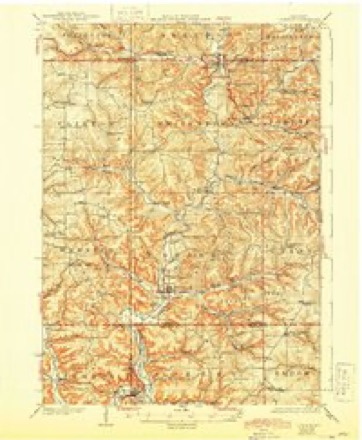
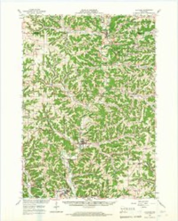
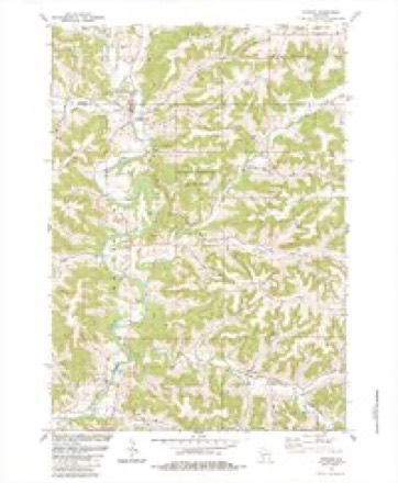
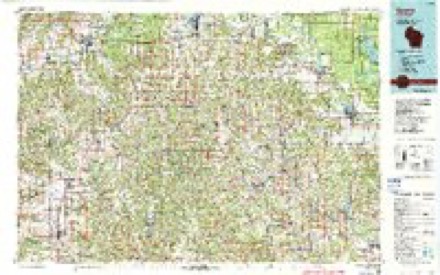
8 surveys from 12 printed sheetsMatched by testing this settlement's coordinate against the published boundary of every sheet in the United States Geological Survey's historical collection. Each opens the scanned sheet at the Survey.
- 1926 USGS La Farge quadrangle1:62500, 3 printings
- 1958 USGS La Crosse quadrangle1:250000, 2 printings
- 1961 USGS La Crosse quadrangle1:250000
- 1965 USGS La Crosse quadrangle1:250000
- 1965 USGS La Farge quadrangle1:62500
- 1976 USGS La Crosse quadrangle1:250000
- 1983 USGS Ontario quadrangle1:24000
- 1985 USGS Sparta quadrangle1:100000, 2 printings




In the county-history sources
2,274 words on this townshipHistory of Vernon County, Wisconsin .., published 1884 names this settlement in its chapter on Ontario Village. These are the passages that mention it, exactly as the scans read.
The village of Ontario was laid out and platted, in 1857, by Giles White. It was named Ontario, at the request of O. H. Millard, after his native county, in the State of New York. Giles White erected the first frame house, in 1856. George Prentice opened the first store, in 1856. Giles Wliite erected the first saw mill, in 1855. The first blacksmith was H. I. Bushnell. The first shoemaker was Sidney Mills. The first physician in the village was Dr. W. R. Hart, who settled in 1857 The first school building was erected in 1859. The present school is a graded one, and the building was erected in 1870. The first flouring mill was erected by George Prentice, in 1859. The first hotel was erected, in 1862, by S. D. Cottrell. The first wagon-maker was Hiram Timerman, who settled in the village in 1864. The first surgical operation in the town was performed by Giles White, which came about in the following laughable manner: Mrs. Hiram Bushnell, who was one of the pioneer women, had been afflicted for some time with an in-growing toe nail, and one day she was about the mill, where Mr. White was at work, when she was complaining of her toe, and remarked to him, that she wished some one would cut her toe off. Mr. White, in fun, said "I will cut it off, if you say so." Mrs. Bushnell told him to do it; so he told her to go to his bench and get a big firmer chisel and he would do it. He had no idea she was in earnest, but she got his chisel and placed her foot on a solid block and told him to go ahead. Mr. White took one look at the toe, which had become badly swollen, and with the nerve of an expert army surgeon he took his mallet, and, with one blow, severed the toe and bound it up in good shape.
Passage source: History of Vernon County, Wisconsin .., published 1884.
Now, in the days of railway postal cards running their ceaseless race from ocean to ocean, one can scarcely conceive of the inconvenience endured by the early pioneers in securing their mail. Prior to 1857 the settlers had to depend upon passers by, going to and from Madison, for their mail. The nearest postoffice was then at Readsburg, a distance of over fifty miles, then it was shortened up . to Coon Prairie (Cashton) and in 1875 it was brought from the Chicago & Northwestern railway, at Norwalk. But in 1884 the facilities were much improved. At this date mail was received at Ontario from Norwalk daily, from Viroqua twice a week and from Viola three times a week.
Passage source: History of Vernon County, Wisconsin .., published 1884.
Millard was fully vindicated in this matter and the blame will ever rest where it should - on the man who thus became guilty of forging names to a petition for his removal. Mr. Millard was succeeded by George Prentice. T. L. De Lap is the present incumbent. In 1882 the money order office was created, and the first order was issued to William Sandon, August T, and sent to O. I. Newton, Sparta, Wis. The first order paid was issued at Mistic Ridge, Conn., and paid to Mrs. Mary Raferty. The annual amount of business done at the Ontario office aggregates about $8,000.
Passage source: History of Vernon County, Wisconsin .., published 1884.
Machine-read from a century-old scan, so expect the errors a machine makes: misspelled names, dropped words, stray characters.
Read the whole chapter on Ontario Village - it names this place 5 more 5 times.
Fires near this place
2 since 2018Regional context, not property-specific evidence. The federal wildfire occurrence database lists 2 fires within 5 miles of Ontario in 2018, burning about 2 acres in total. None started naturally. None was recorded as arson. Distance is straight-line from the map coordinates, so a fire counted here may appear on a neighbouring settlement's page as well.
| Reported cause | Fires |
|---|---|
| Missing data/not specified/undetermined | 2 |
The most recent of them, most recent first, with the day each was reported and the service that recorded it.
| Date | Cause | Size | Reported by | Name on the report |
|---|---|---|---|---|
| 30 April 2018 | Missing data/not specified/undetermined | under an acre | Wisconsin Department of Natural Resources | 12 |
| 29 March 2018 | Missing data/not specified/undetermined | 2.0 acres | Wisconsin Department of Natural Resources | 1810 |
Mines and quarries near this place
2 within 5 milesRegional context, not property-specific evidence. The federal mineral resources record lists 2 workings within 5 miles of Ontario: 2 producers. All of them still produce. What was taken out: Stone, Crushed/Broken. Distance is straight-line from the map coordinates, so a quarry counted here may appear on a neighbouring settlement's page as well.
| Where | Site | Commodity | Status | Recorded |
|---|---|---|---|---|
| Erdman Quarry | Stone, Crushed/Broken | Producer | ||
| Sheldon Township Quarry | Stone, Crushed/Broken | Producer |
Storms near this place
30 since 1994Regional context, not property-specific evidence. The National Weather Service names Ontario in 30 storm reports between 1994 and 2022: 15 flood, 9 thunderstorm wind, 4 hail, 1 flash flood. No death or injury is recorded in these reports. Each account below is quoted exactly as the forecast office filed it, from the NOAA Storm Events Database, and each date opens the federal record of that event.
| When | Event | Place named | Harm | What the report says |
|---|---|---|---|---|
| June 2008 | Flood | Ontario | $750,000 | The Kickapoo River at Ontario crested at a record level of 21.96 feet about 9:45 p.m. CDT on June 8. The previous record crest of 18.85 feet occurred on March 14, 2007. Flood stage is 18.0 feet. The river levels actually dipped just below flood stage around 7:00 a.m. CDT on June 8th before rising very quickly back up. Unoffically Ontario picked up 9.84 inches of rain over the weekend. Water swamped the intersection of Highways 33 and 131 and backed up into town. The village's baseball field and nearby parks were submerged along with nearly 3 feet of water into some businesses. |
| July 1997 | Thunderstorm Wind | Ontario | $15,000 | no account filed |
| July 1997 | Thunderstorm Wind | Ontario | $7,000 | no account filed |
| December 2021 | Thunderstorm Wind | Ontario | $5,000 | Trees and large branches were blown down in Ontario. |
| September 2019 | Flash Flood | Ontario | $5,000 | Thunderstorms dropped 2 to 4 inches of rain across northeast Vernon County. With this rain falling on already saturated ground, flash flooding occurred along the Kickapoo River near Ontario. Water covered some roads prompting officials to close them to travel. |
| June 2005 | Thunderstorm Wind | Ontario | $2,500 | no account filed |
| July 2022 | Thunderstorm Wind | Ontario | $2,000 | Several large trees were blown down in Ontario. |
| June 2020 | Thunderstorm Wind | Ontario | $2,000 | Trees were blown down near Ontario. |
| July 1999 | Thunderstorm Wind | Ontario | $1,000 | no account filed |
| June 2005 | Thunderstorm Wind | Ontario | $300 | no account filed |
| May 2021 | Hail | Ontario | - | Hail ranging in size from quarters to ping pong balls was reported in Ontario. |
| August 2021 | Flood | Ontario | - | Runoff from heavy rains pushed the Kickapoo River out of its banks in Ontario. The river crested over two feet above the flood stage at 18.13 feet. |
| March 2019 | Flood | Ontario | - | Runoff from rain and melting snow pushed the Kickapoo River out of its banks in Ontario. The river crested almost four feet above the flood stage at 19.68 feet on March 14th. |
| July 2019 | Flood | Ontario | - | Runoff from heavy rain pushed the Kickapoo River out of its banks in Ontario. The river crested over two and a half feet above the flood stage at 18.69 feet on the 3rd. |
| July 2019 | Flood | Ontario | - | Runoff from heavy rain pushed the Kickapoo River out of its banks in Ontario. The river crested over four feet above the flood stage at 20.32 feet. |
| September 2019 | Heavy Rain | Ontario | - | East of Ontario, 3.74 inches of rain fell. |
| September 2019 | Flood | Ontario | - | Runoff from heavy rain pushed the Kickapoo River out of its banks in Ontario. The river crested almost three and a half feet above the flood stage at 19.4 feet. |
| September 2018 | Flood | Ontario | - | Runoff from heavy rains pushed the Kickapoo River out of its banks in Ontario. The river crested over four feet above the flood stage at 20.72 feet on September 5th. |
| August 2018 | Flood | Ontario | - | Runoff from heavy rain created historic flooding along the Kickapoo River in Ontario. The river established a new crest of record that was estimated to be 28.5 feet, which was over 12 feet above the flood stage. |
| July 2017 | Flood | Ontario | - | Runoff from heavy rains pushed the Kickapoo River out of its banks in Ontario. The river crested over five feet above the flood stage at 23.17 feet. This was a crest of record for this site. |
| September 2016 | Flood | Ontario | - | Runoff from heavy rain pushed the Kickapoo River out of its banks in Ontario. The river crested over three feet above the flood stage at 19.37 feet. |
| December 2015 | Flood | Ontario | - | Runoff from heavy rain pushed the Kickapoo River out of its banks in Ontario. The river crested at 18.61 feet, which was around 2.5 feet over the flood stage. |
| March 2014 | Flood | Ontario | - | Runoff from rain and snow melt pushed the Kickapoo River out of its banks in Ontario. The river crested just over a foot above flood stage at 17.15 feet. |
| August 2010 | Flood | Ontario | - | Locally heavy rains pushed the Kickapoo River out of its banks in Ontario on August 13th. The river exceeded the flood stage by a half foot, cresting at 18.52 feet. |
| September 2010 | Flood | Ontario | - | Brush Creek was out of its banks and flooding nearby fields and lowlands. |
| September 2010 | Flood | Ontario | - | Locally heavy rains across west central Wisconsin pushed the Kickapoo River at Ontario briefly out of its banks on September 23rd. The river exceeded the flood stage by just over one foot, cresting at 19.3 feet. |
| August 2021 | Hail | Ontario | - | no account filed |
| June 2001 | Hail | Ontario | - | no account filed |
| May 1998 | Hail | Ontario | - | no account filed |
| July 1994 | Thunderstorm Wind | Ontario | - | no account filed |
Nearest settlements
The eight closest, with where each one stands in the county. Distances are straight-line, computed from the Geographic Names Information System coordinates.
| Map | Place | Distance | Sheets |
|---|---|---|---|
| Rockton | 5.9 miles | 12 | |
| Valley | 6.4 miles | 12 | |
| Mount Tabor | 7.5 miles | 11 | |
| Dilly | 9.9 miles | 11 | |
| Trippville | 10.0 miles | 11 | |
| White City | 10.4 miles | 11 | |
| La Farge | 10.7 miles | 12 | |
| Bloomingdale | 11.4 miles | 14 |
Elsewhere
Matched on this settlement's Geographic Names Information System number rather than its name, so it cannot be a different place of the same name in another state.
| Wikipedia article on Ontario | An encyclopaedic summary. Its text is share-alike, so it is linked here rather than copied. |
| Wikidata item Q2400855 | The structured record the population and elevation above come from. Public domain (CC0). |
Provenance
This settlement is recorded in the Geographic Names Information System as feature 1570841. The sheet list is computed by point-in-boundary test against the United States Geological Survey's historical topographic inventory. Both are works of the United States government and carry no copyright under 17 U.S.C. 105.
Wildfire. Short, Karen C. 2022. Spatial wildfire occurrence data for the United States, 1992-2020 [FPA_FOD_20221014]. 6th Edition. Fort Collins, CO: Forest Service Research Data Archive. https://doi.org/10.2737/RDS-2013-0009.6 Collected with United States Government funding and usable without additional permissions or fees.
Mines and quarries. USGS Mineral Resources Data System (MRDS) https://mrdata.usgs.gov/mrds/ A work of the United States government, no copyright under 17 U.S.C. 105.
Storms. NOAA National Centers for Environmental Information, Storm Events Database https://www.ncei.noaa.gov/stormevents/ A work of the United States government, no copyright under 17 U.S.C. 105. Narratives are quoted verbatim from the National Weather Service report and are not edited or summarised.