 Block
Sturtevant, Wisconsin
16 topographic sheets cover this place, the earliest surveyed in 1892 and the latest in 1980. It stands in Mount Pleasant Village. It lies in ZIP code area 53177. The Survey maps it on the Sturtevant quadrangle. 6,919 people lived here at the 2020 count. It stands 702 feet above sea level.
Population over time
2 figuresSturtevant fell from 6,970 to 6,919 between 2010 and 2020. These are the recorded population figures Wikidata holds for this place, reached through the Geographic Names Information System number this page is keyed on rather than by name, so they belong to this place and not to another of the same name. Most are census counts, but not all are: an early figure may be a founding or settlement estimate, and an estimate published within five years of a census is left out. The change column is computed, and is left blank where more than 20 years separate a figure from the one before it, because a gap that long is not a change between two counts.
| Year | People | Change |
|---|---|---|
| 2010 | 6,970 | |
| 2020 | 6,919 | -51 (-1%) |
Topographic sheets covering this place
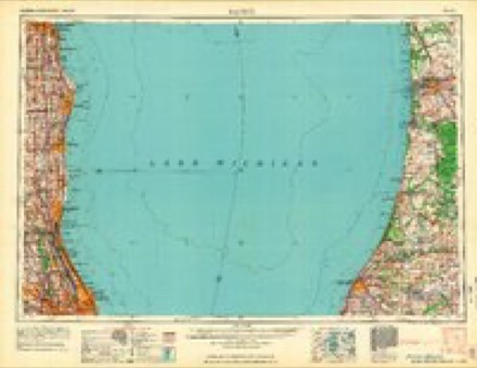
7 surveys from 16 printed sheetsMatched by testing this settlement's coordinate against the published boundary of every sheet in the United States Geological Survey's historical collection. Each opens the scanned sheet at the Survey.
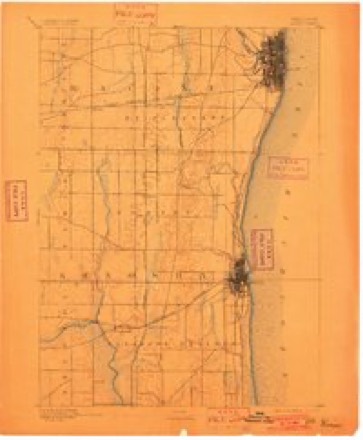
- 1892 USGS Racine quadrangle1:62500, 2 printings
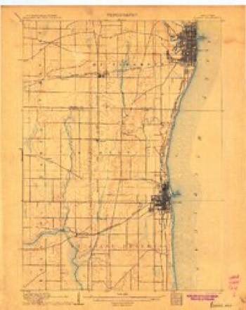
- 1905 USGS Racine quadrangle1:62500, 3 printings
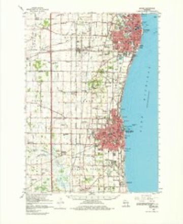
- 1958 USGS Racine quadrangle1:250000, 3 printings
- 1959 USGS Racine quadrangle1:62500, 2 printings
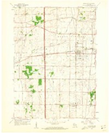
- 1959 USGS Sturtevant quadrangle1:24000, 4 printings
- 1962 USGS Racine quadrangle1:250000
- 1980 USGS Racine quadrangle1:100000


In the county-history sources
9,624 words on this townshipThe History of Racine and Kenosha Counties, Wisconsin .., published 1879 has no passage naming this settlement, which was common for smaller places. Its township is covered in full.
The chapter on Mount Pleasant Village covers the township.
Read the chapter on Mount Pleasant Village - 9,624 words.
Fires near this place
30 since 2018Regional context, not property-specific evidence. The federal wildfire occurrence database lists 30 fires within 5 miles of Sturtevant between 2018 and 2020, burning about 32 acres in total. None started naturally. 1 was recorded as arson. Distance is straight-line from the map coordinates, so a fire counted here may appear on a neighbouring settlement's page as well.
| Reported cause | Fires |
|---|---|
| Missing data/not specified/undetermined | 25 |
| Smoking | 2 |
| Debris and open burning | 2 |
| Arson/incendiarism | 1 |
The most recent of them, most recent first, with the day each was reported and the service that recorded it.
| Date | Cause | Size | Reported by | Name on the report |
|---|---|---|---|---|
| 4 September 2020 | Missing data/not specified/undetermined | under an acre | Wisconsin Department of Natural Resources | 203640 |
| 23 September 2018 | Missing data/not specified/undetermined | under an acre | Wisconsin Department of Natural Resources | 184317 |
| 15 September 2018 | Missing data/not specified/undetermined | under an acre | Wisconsin Department of Natural Resources | 184175 |
| 7 August 2018 | Missing data/not specified/undetermined | under an acre | Wisconsin Department of Natural Resources | 183671 |
| 5 July 2018 | Missing data/not specified/undetermined | under an acre | Wisconsin Department of Natural Resources | 182533 |
| 10 July 2018 | Arson/incendiarism | 1.0 acres | Wisconsin Department of Natural Resources | 1806005 |
| 10 July 2018 | Missing data/not specified/undetermined | under an acre | Wisconsin Department of Natural Resources | 482 |
| 9 June 2020 | Missing data/not specified/undetermined | 1.0 acres | Wisconsin Department of Natural Resources | 20317 |
Settlements close enough to share some of these fires:
Storms near this place
31 since 1997Regional context, not property-specific evidence. The National Weather Service names Sturtevant in 31 storm reports between 1997 and 2026: 7 funnel cloud, 7 thunderstorm wind, 5 hail, 4 flash flood. The reports record 5 injuries. Each account below is quoted exactly as the forecast office filed it, from the NOAA Storm Events Database, and each date opens the federal record of that event.
| When | Event | Place named | Harm | What the report says |
|---|---|---|---|---|
| October 2010 | Tornado (EF1) | Sturtevant | 2 hurt, $1,000,000 | An EF1 tornado that developed in far northern Kenosha County, northeast of Somers, entered Racine County near the intersection of County Highway KR (County Line Road) and 90th Street. After a path length of about 0.43 mile in Kenosha County, it crossed into Racine County where CTH EA (72nd Ave) intersects County Line Rd. The tornado moved northeast and dissipating in the northeast section of Graceland Cemetery on the west side of the City of Racine, about 500 feet west of Osborne Boulevard. In Racine County, the tornado blew a weakly anchored barn (built in the 1920s) off its foundation and damaged an industrial building south of STH 11. Later on, it tore off a 100'x200' roof section of the Case/New Holland building, damaged several HVAC units on the roof, and tore off some of the building's garage doors. The Case/New Holland plant was closed until Monday, November 1st while the roof was being repaired. Two workers in this plant were injured by the tornadoes effects. Additionally, a tractor and it's semi-trailer on the Case/New Holland site were blown over and damaged. wo other businesses on STH 11 reported roof damage. At least 3 homes sustained damage. State Highway 11 was closed for a time in eastern Racine County due to debris and fallen power lines, closing or disrupting business at stores along Highway 11, especially in the 7000 and 7100 blocks. At a church 2 miles northeast of the intersection of STH 11 and Oakes Rd., damage was inflicted to its roof, siding windows and a brick sign. Numerous trees and a few power lines were blown down or broken along the path of the tornado. At one point, about 2700 customers lost electrical power. There were reports of a couple vehicle accidents as drivers tried to avoid the tornado. The tornado path averaged 50 yards in width, with a maximum width of 100 yards. The EF-rating was based on DI 23 DOD 4 EXP103 with estimated wind speeds up to 105 mph. The exact start location in Racine County is Lat 42.66901 Lon -87.89515. The exact end location is Lat 42.72845 Lon -87.82596. The path of the tornado was not a straight line, rather, a rough curved line with an actual path length of 5.92 miles within Racine County. After crossing STH 11 about 1/10 of a mile east of North Branch Pike River, the tornado path bearing changed from NNE to NE. Property damage values are estimated. |
| June 2011 | Thunderstorm Wind | Sturtevant | 2 hurt | A 5-mile wide swath of thunderstorm wind damage occurred from the Interstate-94 area west of Racine to the city of Racine. Semi-tractor trailers were blown over on Interstate-94 at STH 11 and CTH K, resulting in in the injury of two drivers. A 33-foot long sailboat, that was still on land and located on the shore of the Root River near downtown Racine, was blown over and damaged. Otherwise a couple dozen large trees were uprooted in the swath and there were reports of many large broken tree branches. |
| June 2010 | Tornado (EF1) | Sturtevant | 1 hurt, $75,000 | A tornado spun up just northwest of the village of Sturtevant just northwest of the intersection of STH 11 and Wisconsin St., and moved east-southeast through the northern part of the village before dissipating in the Elmwood Park area near the intersection of Taylor Ave and Meachem Rd. It damaged two doors of the Sturtevant Fire Department, damaged the roofs and windows of two homes, uprooted a tree that crashed through another home, and knocked over another tree that damage a truck. One person was injured when the tornado winds rushed into her home and pushed her three feet against a banister. Numerous vehicles in a WalMart parking lot had broken windows from airborne debris. It overturned, moved, and slightly damaged two trailers about 50 yards at a local business where it also snapped 3 light poles. At least two to three dozen trees were uprooted or had broken limbs. The beginning and ending lat/lon pairs of numbers were: 42.70306/-87.91533 and 42.68797/-8782715. The EF-rating was based on DI 27 (FR12), DOD3 EXP, which suggests maximum wind speeds about 95 to 100 mph.||Elsewhere, rear flank downdraft winds from the storm produced scattered minor damage over the extreme southeast corner of Racine County and northeast Kenosha County. The thunderstorm may also have produced a waterspout as it moved out over Lake Michigan about 1 mile north-northeast of the intersection of State Highway 32 and County Highway KR. However, there was no confirmation. |
| July 2003 | Lightning | Sturtevant | $1,000,000 | no account filed |
| August 2002 | Thunderstorm Wind | Sturtevant | $1,000,000 | no account filed |
| June 2007 | Thunderstorm Wind | Sturtevant | $600,000 | A powerful macroburst moved northeast through the eastern half of Racine county and tore up hundreds of trees, blew over several semi-tractor trailers on Interstate-94 between STH 11 and 20, leveled a barn, detroyed another pole shed, riped the roof off a home, and toppled about 30 power-poles and 59 spans of wire. Additionally, there was wind damage to the Ives Grove Golf Course, the County Board chambers, a Sheriff's Department storage building, and a Public Works Department garage. About a half-dozen campers were overturned by the powerful winds. Several homes sustained tree debris damage. At least six other cars were significantly damaged by flying debris or fallen trees. Monetary damage to the power-poles and power-lines was on the order of $90,000 alone. Newspaper reports mentioned that the damaged swath looked like a war-zone. The width of the damage swath was on the order of 3 to 5 miles. Based on the structural damage it is that estimated peak wind gusts were probably on the order of 87 knots (100 mph). Eyewitness accounts indicated that visibility was less than 10 yards due to the winds and rains. |
| August 2007 | Flash Flood | Sturtevant | $100,000 | Several rounds of thunderstorms with heavy rains on top of a saturated ground resulted in flash flooding from the Sturtevant area into the city of Racine. Fast-flowing water reached depths of 6 inches to 2 feet on several roads. The following roads were closed: Intersection of CTH X and Southwood Drive, Intersection of STH 11 and STH 32, and intersection of CTH H and CTH KR. At least a couple dozen homes had water damage to basement contents, or sewage backups. Some soil erosion and minor crop damage were noted in the area.||August, 2007, rainfall totals include: 11.47 in Burlington, 11.58 in Racine, 11.04 at the Racine Airport, 12.41 in Union Grove, and 13.75 in Waterford. |
| September 2006 | Flash Flood | Sturtevant | $100,000 | no account filed |
| May 2004 | Flash Flood | Sturtevant | $100,000 | no account filed |
| March 2026 | Flash Flood | Sturtevant | $50,000 | Five vehicles reported stranded in floodwaters in Racine from the Racine Police Department. 30 service calls taken by the Racine PD related to the flooding, including flooded roadways, underpasses, and uncovered manholes. Many yards and basements flooded. Flooding impacts also affected communities just to the west of Racine. |
| July 2022 | Thunderstorm Wind | Sturtevant | $20,000 | A swath of numerous power lines and tree branches down, and some roof damage. The width of damage was around 3 blocks. |
| July 2006 | Lightning | Sturtevant | $10,000 | Lightning struck a home in the 3200 block of 90th St., resulting in a roof fire. |
| June 2002 | Heavy Rain | Sturtevant | $10,000 | no account filed |
| June 2000 | Flood | Sturtevant | $5,000 | no account filed |
| June 2007 | Lightning | Sturtevant | $3,000 | Lightning struck an electrical power transformer, resulting in the loss of service to 700 customers and several stop lights in the area from Caladonia to Sturtevant. |
| May 2014 | Thunderstorm Wind | Sturtevant | $1,000 | A boat was overturned from a thunderstorm wind gust. |
| June 2010 | Thunderstorm Wind | Sturtevant | - | HAM radio operator estimated 52 knot (60 mph) thunderstorm wind gusts in Sturtevant. |
| April 2017 | Hail | Sturtevant | - | no account filed |
| May 2014 | Hail | Sturtevant | - | no account filed |
| January 2008 | Funnel Cloud | Sturtevant | - | no account filed |
| January 2008 | Funnel Cloud | Sturtevant | - | no account filed |
| January 2008 | Funnel Cloud | Sturtevant | - | no account filed |
| January 2008 | Funnel Cloud | Sturtevant | - | no account filed |
| June 2008 | Funnel Cloud | Sturtevant | - | no account filed |
| June 2008 | Funnel Cloud | Sturtevant | - | no account filed |
| March 2007 | Hail | Sturtevant | - | no account filed |
| July 2006 | Hail | Sturtevant | - | no account filed |
| May 2004 | Thunderstorm Wind | Sturtevant | - | no account filed |
| June 2002 | Funnel Cloud | Sturtevant | - | no account filed |
| May 2000 | Flood | Sturtevant | - | no account filed |
| May 1997 | Hail | Sturtevant | - | no account filed |
Nearest settlements
The eight closest, with where each one stands in the county. Distances are straight-line, computed from the Geographic Names Information System coordinates.
| Map | Place | Distance | Sheets |
|---|---|---|---|
| Waxdale | 0.9 miles | 16 | |
| Mount Pleasant | 2.1 miles | 15 | |
| Sylvania | 3.4 miles | 16 | |
| Oakdale Estates | 3.6 miles | 16 | |
| Elmwood Park | 3.8 miles | 15 | |
| Ives Grove | 4.4 miles | 16 | |
| Franksville | 4.4 miles | 17 | |
| Harvest View Estates | 5.4 miles | 16 |
Elsewhere
Matched on this settlement's Geographic Names Information System number rather than its name, so it cannot be a different place of the same name in another state.
| Wikipedia article on Sturtevant | An encyclopaedic summary. Its text is share-alike, so it is linked here rather than copied. |
| Wikidata item Q1972771 | The structured record the population and elevation above come from. Public domain (CC0). |
Provenance
This settlement is recorded in the Geographic Names Information System as feature 1575001. The sheet list is computed by point-in-boundary test against the United States Geological Survey's historical topographic inventory. Both are works of the United States government and carry no copyright under 17 U.S.C. 105.
Wildfire. Short, Karen C. 2022. Spatial wildfire occurrence data for the United States, 1992-2020 [FPA_FOD_20221014]. 6th Edition. Fort Collins, CO: Forest Service Research Data Archive. https://doi.org/10.2737/RDS-2013-0009.6 Collected with United States Government funding and usable without additional permissions or fees.
Storms. NOAA National Centers for Environmental Information, Storm Events Database https://www.ncei.noaa.gov/stormevents/ A work of the United States government, no copyright under 17 U.S.C. 105. Narratives are quoted verbatim from the National Weather Service report and are not edited or summarised.