 Block
From the record
One of 55 National Register listings published here for Columbia County · listed in 2014 · category: District.
Sources: the National Register database, National Park Service
Listed on the National Register of Historic Places in 2014.
One of 55 National Register listings published here for Columbia County · listed in 2014 · category: District.
Sources: the National Register database, National Park Service
Regional context, not property-specific evidence. The federal wildfire occurrence database lists 120 fires within 5 miles of Lodi Downtown Historic District between 1992 and 2020, burning about 198 acres in total. 1 started naturally. 2 were recorded as arson. Distance is straight-line from the map coordinates, so a fire counted here may appear on a neighbouring settlement's page as well.
| Reported cause | Fires |
|---|---|
| Debris and open burning | 54 |
| Equipment and vehicle use | 27 |
| Missing data/not specified/undetermined | 18 |
| Recreation and ceremony | 7 |
| Other causes | 3 |
| Smoking | 3 |
| Misuse of fire by a minor | 3 |
| Arson/incendiarism | 2 |
| Railroad operations and maintenance | 1 |
| Power generation/transmission/distribution | 1 |
| Natural | 1 |
The most recent of them, most recent first, with the day each was reported and the service that recorded it.
| Date | Cause | Size | Reported by | Name on the report |
|---|---|---|---|---|
| 27 September 1997 | Missing data/not specified/undetermined | under an acre | Wisconsin Department of Natural Resources | not named |
| 17 September 1999 | Equipment and vehicle use | under an acre | Wisconsin Department of Natural Resources | not named |
| 4 August 2015 | Equipment and vehicle use | under an acre | Wisconsin Department of Natural Resources | KOLTES PASTURE |
| 30 August 1992 | Missing data/not specified/undetermined | 1.5 acres | Wisconsin Department of Natural Resources | not named |
| 29 August 2014 | Debris and open burning | under an acre | Wisconsin Department of Natural Resources | BABYDOLL FIRE |
| 21 August 2004 | Missing data/not specified/undetermined | under an acre | Wisconsin Department of Natural Resources | not named |
| 20 August 2004 | Equipment and vehicle use | under an acre | Wisconsin Department of Natural Resources | not named |
| 19 August 2002 | Missing data/not specified/undetermined | under an acre | Wisconsin Department of Natural Resources | not named |
Regional context, not property-specific evidence. The federal mineral resources record lists 4 workings within 5 miles of Lodi Downtown Historic District: 3 past producers, 1 occurrence. None of them still produces. What was taken out: Stone, Crushed/Broken, Sand and Gravel, Construction. Distance is straight-line from the map coordinates, so a quarry counted here may appear on a neighbouring settlement's page as well.
| Where | Site | Commodity | Status | Recorded |
|---|---|---|---|---|
| Quam Pit | Sand and Gravel, Construction | Past Producer | ||
| John Smith Sandstone Quarry | Stone, Crushed/Broken | Occurrence | ||
| Stevenson Quarry | Stone, Crushed/Broken | Past Producer | ||
| Thistle Sandstone Quarry | Stone, Crushed/Broken | Past Producer |
Regional context, not property-specific evidence. The National Weather Service names Lodi, the town this property stands in, in 22 storm reports between 1997 and 2026: 10 thunderstorm wind, 4 flood, 4 hail, 1 tornado. No death or injury is recorded in these reports. Each account below is quoted exactly as the forecast office filed it, from the NOAA Storm Events Database, and each date opens the federal record of that event.
| When | Event | Place named | Harm | What the report says |
|---|---|---|---|---|
| July 2010 | Flash Flood | Lodi | $60,000 | The Columbia County Emergency Manager reported gravel shoulder wash-outs on several roads and one to two feet of water on low-lying roads from heavy rains as strong to severe thunderstorms crossed the region. Minor crop damage was also noted. |
| April 2026 | Thunderstorm Wind | Lodi | $35,000 | Dozens of trees snapped, uprooted, or downed in Lodi. Powerlines down as well. A small portion of a roof collapsed at a nursing home. |
| March 2022 | Heavy Rain | Lodi | $10,000 | Heavy rainfall on a frozen ground lead to high runoff and some basement flooding. A basement wall of a home collapsed in Lodi. |
| April 1997 | Thunderstorm Wind | Lodi | $8,000 | no account filed |
| May 2016 | Thunderstorm Wind | Lodi | $5,000 | Fallen branches downing power lines. |
| September 2005 | Thunderstorm Wind | Lodi | $2,000 | Large trees and road signs down. |
| June 1997 | Thunderstorm Wind | Lodi | $2,000 | no account filed |
| October 2019 | Flood | Lodi | $1,000 | Spring Creek at Lodi reached moderate flood stage, cresting at 7.3 feet the morning of October 2nd. Floodwaters affect Goeres Park including the pool, and Habermann Park including the baseball diamond. Floodwaters approach the Public Works garage. |
| February 2018 | Flood | Lodi | $1,000 | Spring Creek in Lodi reached major flood stage, cresting at 7.90 ft. There was widespread flooding in Goeres Park and Habermann Park, including the baseball diamond. |
| August 2018 | Lightning | Lodi | $1,000 | A few trees and a powerline down due to a lightning strike. |
| August 1997 | Thunderstorm Wind | Lodi | $1,000 | no account filed |
| October 2020 | Flood | Lodi | $500 | Spring Creek at Lodi reached major flood stage, cresting around 7.6 feet the morning of October 23rd. Floodwaters affect Goeres Park including the pool, and water approaches the Public Works garage, and Habermann park including the baseball diamond. |
| May 2013 | Thunderstorm Wind | Lodi | - | A mesonet site located at Lodi Middle School recorded a 60 mph (52 knot) thunderstorm wind gust. |
| August 2010 | Thunderstorm Wind | Lodi | - | Sheriff deputies reported sporadic damage to large trees from damaging thunderstorm wind gusts estimated at 65 knots (75 mph). |
| June 2005 | Thunderstorm Wind | Lodi | - | Measured at Lodi Middle School. |
| August 2005 | Tornado (F0) | Lodi | - | A brief tornado spun up and dissipated at 1710CST about 4.5 miles north-northeast of Lodi, or about 1 mile south of the intersection of CTH CS and Smith Rd., just west of Smith Rd. Only minor vegetative damage was noted by a severe weather spotter in the area at the time. This tornado was rated as F0 with estimated wind speeds of 35-63 knots (40-72 mph). |
| September 2022 | Hail | Lodi | - | no account filed |
| May 2015 | Hail | Lodi | - | no account filed |
| September 2001 | Thunderstorm Wind | Lodi | - | no account filed |
| June 2000 | Hail | Lodi | - | no account filed |
| February 1999 | Hail | Lodi | - | no account filed |
| August 1997 | Flood | Lodi | - | no account filed |
No historic map-sheet match is published for this property yet. That does not mean no map exists. This record needs a coordinate-quality review before it can be joined to a sheet boundary. Browse the county's mapped places while that work is pending.
Other National Register properties close enough to walk or drive between, ordered by distance from this one. Both positions come from the same geocoding pass that matched these properties to their map sheets.
| Photograph | Property | Distance | Listed |
|---|---|---|---|
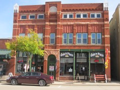 | Job Mills Block | under 500 feet | 2008 |
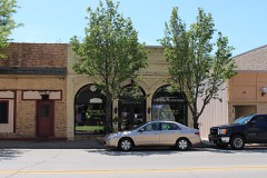 | Joel M. Pruyn Block | under 500 feet | 2008 |
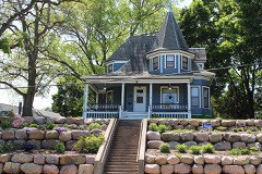 | Portage Street Historic District | 0.1 miles | 2000 |
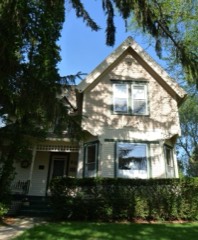 | Clara F. Bacon House | 0.1 miles | 2009 |
 | Lodi Street-Prairie Street Historic District | 0.1 miles | 2000 |
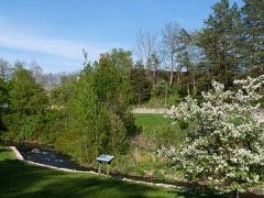 | Lodi School Hillside Improvement Site | 0.2 miles | 2009 |
| National Archives record | The nomination case file for reference 08000980 in Record Group 79. |
| Columbia County | All 55 listed properties in this county. |