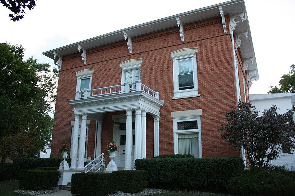
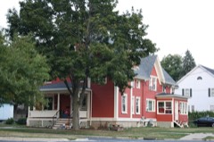
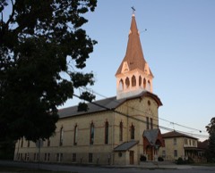
Built in 1858 (Italianate architecture). Listed on the National Register of Historic Places in 2009.
From the record
“The George Griswold House is located in Columbus, Wisconsin, United States. It was added to the National Register of Historic Places in 2009.”
Wikipedia article George Griswold House, CC BY-SA 4.0.
One of 55 National Register listings published here for Columbia County · listed in 2009 · category: Building · built in 1858, Italianate architecture.
National Register reference number.09000487- the number the National Park Service assigned this property when it was listed, and the key its nomination file is catalogued under at the National Archives.
In 1863, Isaac Seymour, N. A. Cowdrey, Horace Galpen, David H. Hughes, William Gould, Frederick P. James and George Smith, all of New York, and Asahel Finch and William H. White, both of Milwaukee, associated themselves under articles of agreement, dated May 5, of that year, as the Milwaukee & St. Paul Railway Company. They had purchased, at mortgage sale, the Western Division of the La Crosse & Milwaukee Railroad, being that portion of the lines between Poi'tage and La Crosse, and in their articles of agreement stipulated that they might purchase the Milwaukee & Western Railroad, commonly called the Watertown road, running from Milwaukee to Columbus, with a branch to Sun Prairie ; the Milwaukee & Horicon road, running from Horicon to Berlin, and the Eastern Division of the La Crosse & Milw^^iikee road, when practicable ; and these purchases were subsequently perfected. Other persons afterward became associated with them, and the company operated, under orders of the United States Court, the Eastern Division of the La Crosse & Milwaukee road, accounting to the court for its use. The lines owned by the company, under the purchases made by them, were as follows : From Milwaukee to Columbus, via Watertown, 78 miles ; from Portage to La Crosse, 98 miles ; from Watertown to Sun Prairie, 26 miles ; from Horicon to Berlin, 49 miles ; from Ripon to Omro, 10 miles. In order to own a through line from Milwaukee to La Crosse, the company constructed 28 miles of track, from Columbus to Portage, which was completed in September, 1864, when the through line was open to travel. All through trains previous to that time had I'un over the Eastern Division of the La Crosse road. The cost of the lines of road and entire property purchased by the company, of which they entered into the possession June 13, 1863, was $8,144,138, for 261 miles of road, or $31,203 per mile.
Chicago tf- North western. - A stretch of about seven and a half miles of this road passes through Columbia County. In 1870, the Baraboo Air Line Railroad Company was incorporated with authority to build a railroad from Columbus, AVatertown, Madison, or any point intermediate, via the village of Lodi, Baraboo, Abelman's Mills and Reedsburg, to Tomah, La Crosse, or any point on the Mississippi River above La Crosse. In 1871, the Baraboo Air Line Company was consolidated with the Beloit and Madison Company, and both were then consolidated with the Northwestern Company, and the construction of the road northwest of Madison, or the Madison Extension, as it was called, was rapidly pushed forward toward AVinona Junction, a distance of 129 miles. Aid was voted to the Air Line road previous to the consolidation, and was paid to aid its construction as follows: City of Madison, $25,000 cash ; Lodi, $25,000 bonds and $15,000 cash;
Regional context, not property-specific
evidence. The
federal wildfire occurrence database
lists 59 fires within 5 miles of George Griswold House
between 1992 and 2020, burning about 87 acres in total. None started naturally. None was recorded as arson.
Distance is straight-line from the map coordinates, so a fire counted
here may appear on a neighbouring settlement's page as well.
Reported cause
Fires
Debris and open burning
27
Equipment and vehicle use
18
Missing data/not specified/undetermined
8
Smoking
2
Misuse of fire by a minor
2
Railroad operations and maintenance
2
The most recent of
them, most recent first, with the day each was reported and the service
that recorded it.
Regional context, not property-specific
evidence. The federal mineral resources record lists
4 workings within 5 miles of George Griswold House: 2 unknowns, 1 producer, 1 past producer.
1 still produces. What was taken out: Stone, Crushed/Broken, Sand and Gravel, Construction, Stone. Distance is straight-line from the
map coordinates, so a quarry counted here may appear on a neighbouring
settlement's page as well.
Regional context, not property-specific
evidence. The National Weather Service names
Columbus, the town this property stands in, in 27 storm reports between 1996 and 2026: 19 thunderstorm wind, 3 hail, 2 flood, 2 funnel cloud.
No death or injury is recorded in these reports. Each account below is quoted exactly as the forecast office
filed it, from the NOAA Storm Events Database, and each date
opens the federal record of that event.
Widespread tree damage in the city of Columbus with many of the roads blocked by debris. A State of Emergency was declared in the city. Numerous large tree branches and trunks snapped. Some large trees uprooted. A few trees downed on homes. Some power poles knocked down or leaning. The Red Cross opened a shelter at Columbus Middle School for those without power in order to seek relief from the heat and humidity.
Two large trees blown down and a pine tree snapped at 80 feet high in a neighborhood. Additional trees and tree limbs down in the neighborhood and across Columbus. One tree felled on a home causing roof damage.
The flooding of the Crawfish River resulted in portions of River Rd. and Campbell St. flooding near the highway 16/60 bridge. The high river stage was impacting the bottom portion of the bridge. Neighborhood yards flooded in the vicinity of the river.
Law enforcement officials reported trees two feet in diameter blown down by thunderstorm wind gusts estimated at 65 mph (56 knots) along a path from 2 miles south of Columbus to Fall River.
Powerful thunderstorms winds knocked down large trees southwest of Columbus. A school mesonet site (Madison TV-15) 1 mile south-southwest of Columbus had a measured gust of 84.3 mph (73 knots).
No historic map-sheet match is published
for this property yet. That does not mean no map exists. This record needs
a coordinate-quality review before it can be joined to a sheet boundary.
Browse the county's mapped places while that work is
pending.
Listed places nearby
6 within 8 miles
Other National Register properties close
enough to walk or drive between, ordered by distance from this one. Both
positions come from the same geocoding pass that matched these properties
to their map sheets.
Listing record. National Park Service National Register of Historic Places, listed-properties dataset, current to 2026-05-22.
Map join. Address geocoded through the United States Census geocoder, then tested against the published boundary of every sheet in the USGS Historical Topographic Map Collection.
How this page is made. Listing fields come from federal records; map-sheet coverage is a labelled coordinate-to-boundary calculation, not a source-field claim.
Wildfire. Short, Karen C. 2022. Spatial wildfire occurrence data for the United States, 1992-2020 [FPA_FOD_20221014]. 6th Edition. Fort Collins, CO: Forest Service Research Data Archive. https://doi.org/10.2737/RDS-2013-0009.6 Collected with United States Government funding and usable without additional permissions or fees.
Mines and quarries. USGS Mineral Resources Data System (MRDS) https://mrdata.usgs.gov/mrds/ A work of the United States government, no copyright under 17 U.S.C. 105.
Storms. NOAA National Centers for Environmental Information, Storm Events Database https://www.ncei.noaa.gov/stormevents/ A work of the United States government, no copyright under 17 U.S.C. 105. Narratives are quoted verbatim from the National Weather Service report and are not edited or summarised.
 Block