 Block
From the record
One of 153 National Register listings published here for Waukesha County · listed in 2017 · category: District.
Sources: the National Register database, National Park Service
Listed on the National Register of Historic Places in 2017.
One of 153 National Register listings published here for Waukesha County · listed in 2017 · category: District.
Sources: the National Register database, National Park Service
The chapter on Waukesha City in The History of Waukesha County, Wisconsin. Containing an Account of Its Settlement, Growth, Development and Resources; an Extensive and Minute Sketch of Its Cities, Towns and Villages--their Improvements, Industries, Manufactories, Churches, Schools and Societies; Its War Record, Biographical Sketches, Portraits of Prominent Men and Early Settlers; the Whole Preceded by a History of Wisconsin, Statistics of the State, and an Abstract of Its Laws and Constitution and of the Constitution of the United States, published 1880 names Delafield. This is what it says, exactly as the scans read.
In 1840, the first death occurred in the town, that of Martin Moulster, who died in January of that year. About this time, or not long after, two young men were drowned in Lake Keesus, while making maple sugar. The first birth was that of Emma Skinner, daughter of George W. and Lucinda Skinner, November 18, 1839. The first one who preached in the town is said to have been Elder Griffin. Elder Wheelock came here as early as 1842, and held meetings ; also Rev. Baker, who held his first meeting in 1842 in the house of Henry Cheney. The first schoolhouse is said to have been erected in 1843 on Section 26, and either Mr. Taylor or Mrs. Stephen Warren (nee Nicholson) was the first teacher. A schoolhouse was built at Stone Bank in 1843, also, perhaps as soon as the other. George W. Skinner was Territorial Justice of the Peace in 1839 or 1840. The first marriage was that of Stephen Warren to Miss Mary Nicholson. The ceremony was performed by George W. Skinner, Justice of the Peace, May 7, 1840. The first store, if it could be called a store, was opened by Michael Shell, at Monches, about 1844. This embraced shoe-shop, saloon and general merchandise. The Swedish settlers also had a little shop, kept by the wife of Capt. Von Schneideau, in a very early day. The first cemetery was surveyed in 1841. The first town meeting in Warren, now Merton, was held April 4, 1843, at the house of William Le Roy, on Section 26. The voters of the town went to Delafield in the morning, in sleighs, to vote. After the meeting had been called to order, it was moved by Sylvanus Warren, that they divide the town, and that those who belonged in Merton (then Warren) should repair to Mr. Le Roy's house at 1 P. M. of that day. The motion was carried, and in the afternoon thirty-nine voters assembled as agreed. Moses Smith was elected Chairman of the Board of Supervisors, and Charles G. Williams and Jacob Snyder, Side Supervisors ; Town Clerk, L. H. Taylor ; Road Commissioners, Hiram Warren, George McKerly and Earl Wright; School Commissioners, L. M. Moore, Sybrant Hall, Dewey K. Warren and Reuben Perry ; Assessors, Henry Cheney and John M. Hall ; Treasurer, Sylvanus Warren ; Constable,
In early days, the postoffice was at Delafield, and the neighbors would club together and get it by turns about once in two or three weeks. In 1851, Samuel Breck became the first Postmaster, and, in 1855, George Sterzbach succeeded him. In 1859, Anthony Houser succeeded Mr. Sterzbach, and has been Postmaster ever since.
Machine-read from a century-old scan, so expect the errors a machine makes: misspelled names, dropped words, stray characters.
Read the whole chapter on Waukesha City - 86,288 words on its settlement, mills, schools and churches.
Regional context, not property-specific evidence. The federal wildfire occurrence database lists 22 fires within 5 miles of Nashotah House Theological Seminary between 2018 and 2020, burning about 10 acres in total. None started naturally. None was recorded as arson. Distance is straight-line from the map coordinates, so a fire counted here may appear on a neighbouring settlement's page as well.
| Reported cause | Fires |
|---|---|
| Missing data/not specified/undetermined | 14 |
| Debris and open burning | 7 |
| Power generation/transmission/distribution | 1 |
The most recent of them, most recent first, with the day each was reported and the service that recorded it.
| Date | Cause | Size | Reported by | Name on the report |
|---|---|---|---|---|
| 16 September 2018 | Debris and open burning | under an acre | Wisconsin Department of Natural Resources | 381 |
| 10 September 2018 | Debris and open burning | under an acre | Wisconsin Department of Natural Resources | 367 |
| 1 July 2020 | Debris and open burning | under an acre | Wisconsin Department of Natural Resources | 222 |
| 1 July 2018 | Power generation/transmission/distribution | 1.0 acres | Wisconsin Department of Natural Resources | 242 |
| 7 May 2020 | Missing data/not specified/undetermined | under an acre | Wisconsin Department of Natural Resources | 129 |
| 4 May 2018 | Missing data/not specified/undetermined | under an acre | Wisconsin Department of Natural Resources | 1800812 |
| 21 May 2020 | Missing data/not specified/undetermined | under an acre | Wisconsin Department of Natural Resources | 205 |
| 18 May 2018 | Missing data/not specified/undetermined | under an acre | Wisconsin Department of Natural Resources | 456 |
Regional context, not property-specific evidence. The federal mineral resources record lists 6 workings within 5 miles of Nashotah House Theological Seminary: 4 producers, 2 unknowns. 4 still produce. What was taken out: Sand and Gravel, Construction, Stone, Crushed/Broken, Stone. Distance is straight-line from the map coordinates, so a quarry counted here may appear on a neighbouring settlement's page as well.
| Where | Site | Commodity | Status | Recorded |
|---|---|---|---|---|
| Own Crews | Stone | Unknown | ||
| Main Quarry and Mill | Stone, Crushed/Broken | Producer | ||
| Waukesha Lime and Stone Co Quarry | Stone, Crushed/Broken | Producer | ||
| James Pit | Sand and Gravel, Construction | Producer | ||
| Springdale Pit | Sand and Gravel, Construction | Unknown | ||
| Wcti Pit | Sand and Gravel, Construction | Producer |
Regional context, not property-specific evidence. The National Weather Service names Delafield, the town this property stands in, in 23 storm reports between 1994 and 2025: 11 thunderstorm wind, 7 hail, 4 lightning, 1 funnel cloud. No death or injury is recorded in these reports. Each account below is quoted exactly as the forecast office filed it, from the NOAA Storm Events Database, and each date opens the federal record of that event.
| When | Event | Place named | Harm | What the report says |
|---|---|---|---|---|
| July 2012 | Thunderstorm Wind | Delafield | $25,000 | A local newspaper reported trees and power lines were downed and a few homes damaged by severe thunderstorm wind gusts estimated at 70 mph (61 knots). |
| May 1998 | Lightning | Delafield | $20,000 | no account filed |
| May 2006 | Thunderstorm Wind | Delafield | $10,000 | no account filed |
| May 1998 | Lightning | Delafield | $10,000 | no account filed |
| May 2000 | Hail | Delafield | $5,000 | no account filed |
| July 2018 | Thunderstorm Wind | Delafield | $4,000 | Several trees damaged in Delafield. |
| May 1998 | Lightning | Delafield | $4,000 | no account filed |
| September 2025 | Thunderstorm Wind | Delafield | $3,000 | Several trees and wires down in and near Delafield. |
| August 2002 | Lightning | Delafield | $3,000 | no account filed |
| August 2025 | Thunderstorm Wind | Delafield | $2,000 | About a half a dozen large branches and tops of trees broken off along with two downed and split trees. |
| August 2024 | Thunderstorm Wind | Delafield | $1,000 | A large tree down. |
| May 2000 | Thunderstorm Wind | Delafield | $1,000 | no account filed |
| May 2000 | Thunderstorm Wind | Delafield | $1,000 | no account filed |
| September 2009 | Thunderstorm Wind | Delafield | - | Powerful thunderstorm wind gusts toppled a few large trees and sheared off a couple pine trees. |
| June 2006 | Thunderstorm Wind | Delafield | - | Trees were reported down with the damaging winds. Penny sized hail was also noted for 5 minutes within the swath of wind damage. |
| May 2023 | Hail | Delafield | - | no account filed |
| August 2013 | Hail | Delafield | - | no account filed |
| September 2006 | Hail | Delafield | - | no account filed |
| May 2004 | Funnel Cloud | Delafield | - | no account filed |
| May 2004 | Hail | Delafield | - | no account filed |
| July 2004 | Hail | Delafield | - | no account filed |
| July 2000 | Hail | Delafield | - | no account filed |
| July 1994 | Thunderstorm Wind | Delafield | - | no account filed |
No historic map-sheet match is published for this property yet. That does not mean no map exists. This record needs a coordinate-quality review before it can be joined to a sheet boundary. Browse the county's mapped places while that work is pending.
Other National Register properties close enough to walk or drive between, ordered by distance from this one. Both positions come from the same geocoding pass that matched these properties to their map sheets.
| Photograph | Property | Distance | Listed |
|---|---|---|---|
| Theodore I. and Margaret Morey House | 1.3 miles | 2024 | |
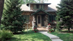 | Morey-Lewis House | 1.4 miles | 1995 |
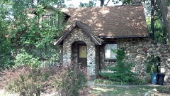 | Morey-Seidens House | 1.4 miles | 1995 |
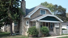 | Morey-Andrews House | 1.7 miles | 1995 |
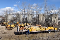 | Hadfield Company Lime Kilns | 2.1 miles | 1982 |
| Grand View Health Resort | 2.1 miles | 1984 |
| National Archives record | The nomination case file for reference 100000523 in Record Group 79. |
| Waukesha County | All 153 listed properties in this county. |