 Block
From the record
One of 33 National Register listings published here for Marathon County · listed in 2015 · category: Building · built in 1923.
Sources: the National Register database, National Park Service

Built in 1923. Listed on the National Register of Historic Places in 2015.
One of 33 National Register listings published here for Marathon County · listed in 2015 · category: Building · built in 1923.
Sources: the National Register database, National Park Service
Regional context, not property-specific evidence. The federal wildfire occurrence database lists 84 fires within 5 miles of Schofield School between 1992 and 2020, burning about 80 acres in total. 1 started naturally. 6 were recorded as arson. Distance is straight-line from the map coordinates, so a fire counted here may appear on a neighbouring settlement's page as well.
| Reported cause | Fires |
|---|---|
| Equipment and vehicle use | 25 |
| Missing data/not specified/undetermined | 21 |
| Debris and open burning | 20 |
| Arson/incendiarism | 6 |
| Smoking | 5 |
| Recreation and ceremony | 2 |
| Misuse of fire by a minor | 2 |
| Fireworks | 1 |
| Other causes | 1 |
| Natural | 1 |
The most recent of them, most recent first, with the day each was reported and the service that recorded it.
| Date | Cause | Size | Reported by | Name on the report |
|---|---|---|---|---|
| 13 September 2018 | Equipment and vehicle use | under an acre | Wisconsin Department of Natural Resources | 678 |
| 24 July 2000 | Equipment and vehicle use | under an acre | Wisconsin Department of Natural Resources | not named |
| 22 July 2005 | Missing data/not specified/undetermined | under an acre | Wisconsin Department of Natural Resources | not named |
| 19 July 2000 | Equipment and vehicle use | under an acre | Wisconsin Department of Natural Resources | not named |
| 17 July 2018 | Missing data/not specified/undetermined | under an acre | Wisconsin Department of Natural Resources | 11260 |
| 13 July 2006 | Equipment and vehicle use | under an acre | Wisconsin Department of Natural Resources | not named |
| 12 July 2006 | Equipment and vehicle use | under an acre | Wisconsin Department of Natural Resources | not named |
| 10 July 2012 | Equipment and vehicle use | under an acre | Wisconsin Department of Natural Resources | TRAILER TIRE |
Regional context, not property-specific evidence. The federal mineral resources record lists 13 workings within 5 miles of Schofield School: 4 past producers, 4 unknowns, 3 occurrences, 2 producers. 2 still produce. What was taken out: Sand and Gravel, Construction, Stone, Crushed/Broken, Stone. Distance is straight-line from the map coordinates, so a quarry counted here may appear on a neighbouring settlement's page as well.
| Where | Site | Commodity | Status | Recorded |
|---|---|---|---|---|
| Own Crews | Stone | Unknown | ||
| Sunburst Quarry | Stone | Unknown | ||
| Wimmer Quarry | Stone | Unknown | ||
| Beilke Quarry | Stone, Crushed/Broken | Past Producer | ||
| Rib Mountain Quarry | Stone, Crushed/Broken | Past Producer | ||
| Thurber Granite Pit | Stone, Crushed/Broken | Producer | ||
| Wimmer Pit | Stone, Crushed/Broken | Producer | ||
| Cedar Creek Gravel Deposit | Sand and Gravel, Construction | Occurrence | ||
| County Pit | Sand and Gravel, Construction | Unknown | ||
| Kelly Gravel Pit | Sand and Gravel, Construction | Past Producer |
Regional context, not property-specific evidence. The National Weather Service names Schofield, the town this property stands in, in 24 storm reports between 1995 and 2026: 12 hail, 7 thunderstorm wind, 2 lightning, 1 heavy rain. No death or injury is recorded in these reports. Each account below is quoted exactly as the forecast office filed it, from the NOAA Storm Events Database, and each date opens the federal record of that event.
| When | Event | Place named | Harm | What the report says |
|---|---|---|---|---|
| October 2007 | Lightning | Schofield | $8,300,000 | Lightning struck a 321 megawatt power plant in the Wausau area, causing damage severe enough to keep it off-line until late 2007 or early 2008. In addition to the cost of repairs to the plant, the utility company will have to pay at least an addition $30 million to purchase power to replace the amount that would have been generated by the plant while repairs are made. The plant was equipted with a state-of-the-art lightning suppression system that was operational at the time of the strike. |
| April 2026 | Tornado (EF3) | Schofield | $8,200,000 | A tornado developed about 3 miles west-southwest of Ringle, east of Kronenwetter near Martin and Creek Road, at about 4:46 PM CDT. The tornado moved northeast, crossing highway 29 and downing hundreds of trees. It then moved through neighborhoods along and near River Road from Shady Lane to north of Clubhouse Road. In this area, dozens of homes suffered significant roof damage, with failures of attached garages common. At least three homes in this area had complete removal of their roofs with failure of all external walls and several interior walls, consistent with EF-3 damage. Hundreds more trees were downed in this area, with many snapped near the base. Multiple sheds and outbuildings were destroyed. The tornado continued northeast, closely following the Eau Claire River, and dissipated between Gold Dust Road and County Road Z, 5 miles southwest of Hogarty, at about 5:03 PM CDT. The tornado destroyed 13 homes, produced major damage to 25 homes, with 101 homes reporting minor damage or affected by the tornado. An estimated $8.2 million worth of damage was reported from the tornado. Total path length is estimated to be 13.53 miles long, with a width of 600 yards. Peak wind estimated to be around 145 mph. |
| August 2008 | Lightning | Schofield | $8,000,000 | A lightning strike at 2:29 am CDT on August 23 generated a fire at the Gordon Aluminum Industries in Schofield. The fire destroyed a row of offices and generated enough heat to incapacitate nearby machinery. In addition to the fire damage at the plant, $300 million worth of unfinished aluminum had varying degrees of corrosion as a result of the smoke, ash, and water used to douse the flames.||The lightning strike rattled residences in the area. A blown gas main valve near the apparent source of the fire served to fuel the blaze. |
| June 1995 | Thunderstorm Wind | Schofield | $25,000 | Isolated severe storms developed powerful winds which resulted mostly in large trees and powerlines being blown down. Scattered locations in Price and St. Croix Counties had powerful winds which blew down large trees. In the Caroline (Shawano County) area the severe winds blew down several trees and the top of a high school scoreboard, and "pushed" a farmer's chopper wagon 700 feet across a field, the last 200 feet uphill. Intense downburst winds downed approximately 50 trees, and did $25,000 in damage to several houses and vehicles in the Schofield (Marathon County) area. Large trees were also toppled west of Fifield by a severe storms powerful winds. |
| September 2012 | Thunderstorm Wind | Schofield | $15,000 | Thunderstorm winds blew off part of a roof of a metal building system near Rothschild. |
| July 2011 | Thunderstorm Wind | Schofield | $15,000 | Thunderstorm winds knocked down numerous trees and power lines in the town of Schofield. One tree fell on a house. |
| September 2012 | Thunderstorm Wind | Schofield | $1,000 | Thunderstorm winds downed a large tree that fell onto and damaged a deck. |
| September 2012 | Thunderstorm Wind | Schofield | $500 | A thunderstorm wind gust, estimated at 80 mph, bent a highway sign to the ground. The sign, at the STH 29 and U.S. Highway 51 interchange, was on steel posts that bent at the base. |
| May 2025 | Hail | Schofield | - | Quarter size hail fell near Evergreen. |
| May 2025 | Hail | Schofield | - | Half dollar size hail fell near Evergreen. |
| August 2024 | Flash Flood | Schofield | - | Heavy rain caused flash flooding in Schofield and Rothschild in central Marathon County. Many roads were closed due to standing and flowing water. |
| May 2022 | Hail | Schofield | - | Quarter size hail fell in Schofield. |
| June 2021 | Thunderstorm Wind | Schofield | - | Thunderstorm winds downed trees and power lines in Rothschild. The time of this report is an estimate based on radar data. |
| October 2012 | Hail | Schofield | - | Quarter size hail fell in Schofield. |
| May 2011 | Hail | Schofield | - | Thunderstorms dropped penny to quarter size hail in Rothschild. |
| May 2011 | Hail | Schofield | - | Thunderstorms dropped quarter size hail in Schofield. |
| May 2011 | Hail | Schofield | - | Quarter size hail fell in Rothschild. |
| July 2011 | Thunderstorm Wind | Schofield | - | Thunderstorm winds downed trees in the town of Schofield. |
| August 2011 | Heavy Rain | Schofield | - | More than an inch and a half of rain, 1.55 inches, fell in Rothschild in 30 minutes. |
| July 2010 | Hail | Schofield | - | Quarter size hail fell at Rothschild. |
| May 2006 | Hail | Schofield | - | no account filed |
| May 2006 | Hail | Schofield | - | no account filed |
| May 2006 | Hail | Schofield | - | no account filed |
| July 2006 | Hail | Schofield | - | no account filed |
No historic map-sheet match is published for this property yet. That does not mean no map exists. This record needs a coordinate-quality review before it can be joined to a sheet boundary. Browse the county's mapped places while that work is pending.
Other National Register properties close enough to walk or drive between, ordered by distance from this one. Both positions come from the same geocoding pass that matched these properties to their map sheets.
| Photograph | Property | Distance | Listed |
|---|---|---|---|
 | Rothschild Pavilion | 1.0 miles | 2002 |
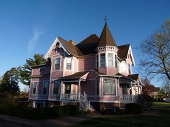 | Henry Miller House | 2.2 miles | 1982 |
 | Duey and Julia Wright House | 2.6 miles | 1999 |
| Hotel Wausau | 3.4 miles | 2021 | |
 | Granville D. Jones House | 3.4 miles | 1977 |
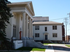 | Wausau Club | 3.4 miles | 1989 |
| National Archives record | The nomination case file for reference 15000108 in Record Group 79. |
| Marathon County | All 33 listed properties in this county. |