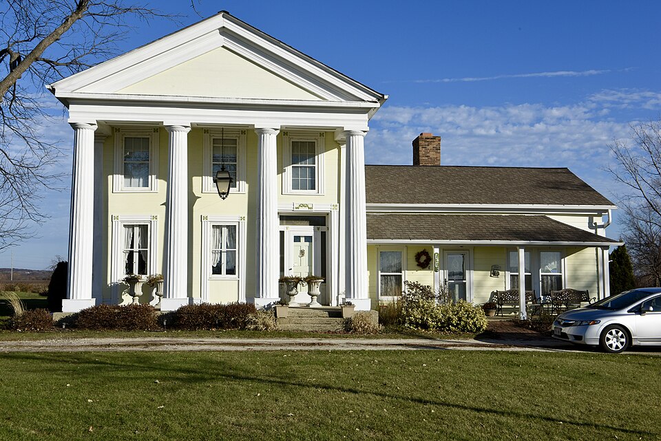
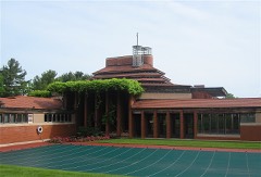
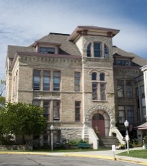
Built in 1853 (Greek Revival architecture). Listed on the National Register of Historic Places in 1974.
From the record
One of 57 National Register listings published here for Racine County · listed in 1974 · category: Building · built in 1853, Greek Revival architecture.
National Register reference number.74000119- the number the National Park Service assigned this property when it was listed, and the key its nomination file is catalogued under at the National Archives.
I have the word of Mr. Elam Beardsley, for saying, that he was the first actual white settler in Caledonia. It has been said that John Davis preceded him, but though Mr. Davis may have first asserted a claim in the town, I think that Mr. Beardsley established the first actual settlement, and that Mrs. Beardsley was the first white woman who came into the county for a permanent home. He came from Michigan, bringing with him his family, and on the third night after lie set out on his perilous journey, he and his household jewels slept in a shanty on his claim in Caledonia.
On the fifteenth day of February, they made their claim. They staked out as they supposed, enough land for four ; but when the survey was made, it was found that they had only secured a sufficient quantity of land for two claims. They then visited the Rapids, and found there, Mr, See, who was building his mill. Upon returning to their claim, they built a log shanty without a window in it. They soon returned to Michigan and removed to Chicago where the family lived two years. Meanwhile, Lucius S. Blake and his brother, A. H. Blake, came back to the claim and resided in their cabin two seasons. They ploughed a portion of the land, made some fencing, and held the claim by actual occupancy until Mr. Levi Blake removed to it with his family in the fall of 1837. Capt. Blake's capacious log house, which he built on his premises, was a land mark in the country. It was always open to the settlers, and the hospitality of its proprietor gave it the appropriate name of " Our House." The farm now owned by James Wilson, constituted part of the Blake claim. Early in 1835, Edward Bradley and his brother made claims in Caledonia, and during the summer of 1835 and spring of '36, other settlers arrived with their families ; among them were Simeon Butler, Isaac Butler, Thomas Butler, Joseph Adams, and Shintafer, whom Mr. Blake describes as a daring specimen of a borderer. I think at about the same time Ezra Beardsley, the father of Elam Beardsley, and Ira Hurlbut, also, settled in the town. Ezra Beardsley was known as a sturdy pioneer of great heart and noble hospitality.
Regional context, not property-specific
evidence. The
federal wildfire occurrence database
lists 23 fires within 5 miles of John Collins House
between 2018 and 2020, burning about 8 acres in total. None started naturally. 1 was recorded as arson.
Distance is straight-line from the map coordinates, so a fire counted
here may appear on a neighbouring settlement's page as well.
Reported cause
Fires
Missing data/not specified/undetermined
14
Debris and open burning
6
Smoking
2
Arson/incendiarism
1
The most recent of
them, most recent first, with the day each was reported and the service
that recorded it.
Regional context, not property-specific
evidence. The federal mineral resources record lists
1 working within 5 miles of John Collins House: 1 unknown.
None of them still produces. What was taken out: Stone. Distance is straight-line from the
map coordinates, so a quarry counted here may appear on a neighbouring
settlement's page as well.
Regional context, not property-specific
evidence. The National Weather Service names
Caledonia, the town this property stands in, in 14 storm reports between 1994 and 2023: 8 thunderstorm wind, 4 hail, 1 lightning, 1 heavy rain.
The reports record 1 death. Each account below is quoted exactly as the forecast office
filed it, from the NOAA Storm Events Database, and each date
opens the federal record of that event.
No historic map-sheet match is published
for this property yet. That does not mean no map exists. This record needs
a coordinate-quality review before it can be joined to a sheet boundary.
Browse the county's mapped places while that work is
pending.
Listed places nearby
6 within 8 miles
Other National Register properties close
enough to walk or drive between, ordered by distance from this one. Both
positions come from the same geocoding pass that matched these properties
to their map sheets.
Listing record. National Park Service National Register of Historic Places, listed-properties dataset, current to 2026-05-22.
Map join. Address geocoded through the United States Census geocoder, then tested against the published boundary of every sheet in the USGS Historical Topographic Map Collection.
How this page is made. Listing fields come from federal records; map-sheet coverage is a labelled coordinate-to-boundary calculation, not a source-field claim.
Wildfire. Short, Karen C. 2022. Spatial wildfire occurrence data for the United States, 1992-2020 [FPA_FOD_20221014]. 6th Edition. Fort Collins, CO: Forest Service Research Data Archive. https://doi.org/10.2737/RDS-2013-0009.6 Collected with United States Government funding and usable without additional permissions or fees.
Mines and quarries. USGS Mineral Resources Data System (MRDS) https://mrdata.usgs.gov/mrds/ A work of the United States government, no copyright under 17 U.S.C. 105.
Storms. NOAA National Centers for Environmental Information, Storm Events Database https://www.ncei.noaa.gov/stormevents/ A work of the United States government, no copyright under 17 U.S.C. 105. Narratives are quoted verbatim from the National Weather Service report and are not edited or summarised.
 Block