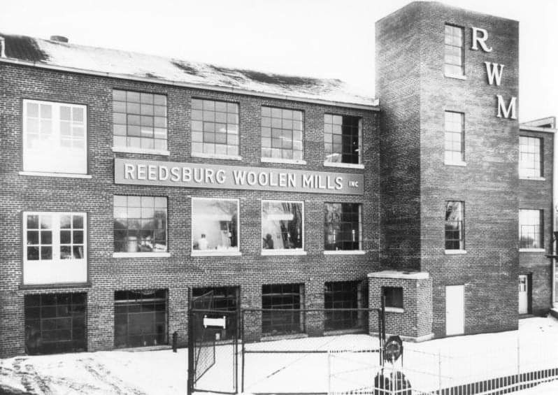
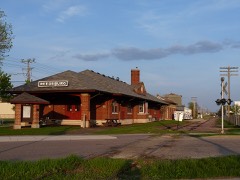
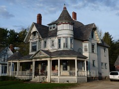
Built in 1891. Listed on the National Register of Historic Places in 1984.
From the record
“The Reedsburg Woolen Mill was a historic woolen mill along the Baraboo River in Reedsburg, Wisconsin. The woolen mill was the largest employer in Reedsburg for much of its life, employing over 200 people.”
Wikipedia article Reedsburg Woolen Mill, CC BY-SA 4.0.
One of 58 National Register listings published here for Sauk County · listed in 1984 · category: Building · built in 1891.
National Register reference number.84000664- the number the National Park Service assigned this property when it was listed, and the key its nomination file is catalogued under at the National Archives.
What happened here
An account from the chapter on Reedsburg city. The inset identifies its exact
source book and publication year.
From this "list, we find that Reedsburg lost a larger number than any one supposed, being about one-foimh of all who enlisted. Of these, eight were killed, six died of wounds, and eighteen of disease. The 19th, Regiment took more from this town than any other, and consequently lost more.
At the regular election of this year David C. Beed, Lewis BuSteriield and John Kork were .elected supervisors, O. 11. Perrv. Clerk. At the town meeting in April, 1850, Samuel JSTorthip was elected chairman ot the board of supervisors. The other officials were reelected. JLTJw name of Baraboo for the town became objectionable as there was a" village by this name upon the rapids of the river, laid out prior to the organization of this town. The shear town of the count}" was laid out adjoining the village of Baraboo and called Adams by the county commissioners in April, 1847. The postoffiee was called Baraboo at the county seat, although located in the village of Adams. The only postoffice in the town of Baraboo was called Reedsburg. Several names became confounded with that of Baraboo in different localities, hence the town of Reedsburg was organized to extricate themselves from this medley.
Upon petition of J. H. Rork and others, while this gentleman was acting as chairman of the board of supervisors of this town, a new town was created out of the towns of Baraboo and Eagle. It comprised the present towns of Winiield, La Valle, Woodland, the north half of Ironton and Reedsburg. This act was taken December 11th. 1850. It was named Reedsburg in honor of the first settler of the village of Reedsburg, David C Reed, who caused to be erected the first saw and grist mill here.
Regional context, not property-specific
evidence. The
federal wildfire occurrence database
lists 105 fires within 5 miles of Reedsburg Woolen Mill Office
between 1992 and 2020, burning about 158 acres in total. 3 started naturally. 5 were recorded as arson.
Distance is straight-line from the map coordinates, so a fire counted
here may appear on a neighbouring settlement's page as well.
Reported cause
Fires
Debris and open burning
42
Equipment and vehicle use
24
Missing data/not specified/undetermined
19
Arson/incendiarism
5
Smoking
3
Natural
3
Recreation and ceremony
3
Misuse of fire by a minor
2
Power generation/transmission/distribution
2
Other causes
1
Fireworks
1
The most recent of
them, most recent first, with the day each was reported and the service
that recorded it.
Regional context, not property-specific
evidence. The federal mineral resources record lists
1 working within 5 miles of Reedsburg Woolen Mill Office: 1 producer.
All of them still produce. What was taken out: Stone, Crushed/Broken. Distance is straight-line from the
map coordinates, so a quarry counted here may appear on a neighbouring
settlement's page as well.
Regional context, not property-specific
evidence. The National Weather Service names
Reedsburg, the town this property stands in, in 52 storm reports between 1994 and 2022: 25 thunderstorm wind, 15 hail, 6 flood, 3 lightning.
The reports record 1 injury. Each account below is quoted exactly as the forecast office
filed it, from the NOAA Storm Events Database, and each date
opens the federal record of that event.
A hailstorm dumped hail stones with diameters from 1.00 to 1.75 inch from Reedsburg to Baraboo, with most of the activity in the Reedsburg area. Hundreds of vehicles were damaged by the hail stones. Three insurance companies reported 375 claims totaling about $900,000.
Law enforcement officials reported trees downed by powerful thunderstorm winds that gusted to an estimated 65 mph (56 knots) along a path from Reedsburg to 3 miles wesdt of Lake Delton.
The Baraboo River peaked around 16.9 feet the early morning of September 24th in Reedsburg. Floodwaters affected West Second Street, Granite Ave., South Webb Ave. Water touched the lowest part of the concrete deck of the Webb Avenue bridge. Water is close to the overhead doors at the Public Works Building. Floodwaters are 3 to 3.5 feet deep in the Public Works Yard. South Park next to the Wastewater Plant is underwater. Floodwaters are into the swimming pool control room in Webb Park. Floodwaters are into Webb Park and Smith Conservancy. There was water is many basements on the west side of Reedsburg.
Powerful thunderstorm downburst winds gusting to an estimated 56 knots (65 mph) toppled several large trees. Tree branch debris knocked down some power lines.
The Baraboo River at Reedsburg crested at 16 ft. which is moderate flood stage. There is widespread inundation of lowland in the Reedsburg area at this level. Floodwaters affect West Second Street, Granite Avenue and South Webb Avenue along the river. Water affects the concrete deck of the South Webb Avenue bridge. Floodwaters are into Webb Park and Smith Conservancy. The Public Works Yard is under 2 to 2.5 feet of water.
The Baraboo River at Reedsburg reached minor flood stage and peaked at 15.80 feet. Floodwaters affected Granite Ave. and South Webb Ave. along the river and touched the concrete deck of the South Webb Ave. bridge. There is widespread inundation of lowland including Webb Park and Smith Conservancy.
The Baraboo River at Reedsburg reached minor flood stage, cresting at 15.45 feet the early afternoon of March 15th. Floodwaters affect Granite Ave. and South Webb Ave. along the river. There is general inundation of lowland in the Reedsburg area. The walking path in Webb Park and Smith Conservancy is covered with water. The Public Works yard is under 18-24 inches of water.
The Baraboo River reached minor flood stage in Reedsburg, cresting around 15 ft. |Floodwaters affect Granite Avenue and South Webb Avenue along the river. There is general inundation of lowland in the Reedsburg area. The walking path in Webb Park and Smith Conservancy is covered with water. The Public Works Yard is under 12-18 inches of water.
No historic map-sheet match is published
for this property yet. That does not mean no map exists. This record needs
a coordinate-quality review before it can be joined to a sheet boundary.
Browse the county's mapped places while that work is
pending.
Listed places nearby
6 within 8 miles
Other National Register properties close
enough to walk or drive between, ordered by distance from this one. Both
positions come from the same geocoding pass that matched these properties
to their map sheets.
Listing record. National Park Service National Register of Historic Places, listed-properties dataset, current to 2026-05-22.
Map join. Address geocoded through the United States Census geocoder, then tested against the published boundary of every sheet in the USGS Historical Topographic Map Collection.
How this page is made. Listing fields come from federal records; map-sheet coverage is a labelled coordinate-to-boundary calculation, not a source-field claim.
Wildfire. Short, Karen C. 2022. Spatial wildfire occurrence data for the United States, 1992-2020 [FPA_FOD_20221014]. 6th Edition. Fort Collins, CO: Forest Service Research Data Archive. https://doi.org/10.2737/RDS-2013-0009.6 Collected with United States Government funding and usable without additional permissions or fees.
Mines and quarries. USGS Mineral Resources Data System (MRDS) https://mrdata.usgs.gov/mrds/ A work of the United States government, no copyright under 17 U.S.C. 105.
Storms. NOAA National Centers for Environmental Information, Storm Events Database https://www.ncei.noaa.gov/stormevents/ A work of the United States government, no copyright under 17 U.S.C. 105. Narratives are quoted verbatim from the National Weather Service report and are not edited or summarised.
 Block