 Block
From the record
One of 153 National Register listings published here for Waukesha County · listed in 1988 · category: District.
Sources: the case file at the National Archives · the National Register database, National Park Service
Listed on the National Register of Historic Places in 1988.
One of 153 National Register listings published here for Waukesha County · listed in 1988 · category: District.
Sources: the case file at the National Archives · the National Register database, National Park Service
Regional context, not property-specific evidence. The federal wildfire occurrence database lists 20 fires within 5 miles of Davis, Cyrus-Davis Brothers Farmhouse between 2010 and 2020, burning about 9 acres in total. 2 started naturally. None was recorded as arson. Distance is straight-line from the map coordinates, so a fire counted here may appear on a neighbouring settlement's page as well.
| Reported cause | Fires |
|---|---|
| Missing data/not specified/undetermined | 13 |
| Natural | 2 |
| Debris and open burning | 2 |
| Equipment and vehicle use | 2 |
| Recreation and ceremony | 1 |
The most recent of them, most recent first, with the day each was reported and the service that recorded it.
| Date | Cause | Size | Reported by | Name on the report |
|---|---|---|---|---|
| 31 August 2012 | Natural | 1.0 acres | Wisconsin Department of Natural Resources | not named |
| 9 July 2018 | Missing data/not specified/undetermined | 1.0 acres | Wisconsin Department of Natural Resources | 1802082 |
| 14 July 2020 | Missing data/not specified/undetermined | under an acre | Wisconsin Department of Natural Resources | 2002444 |
| 20 June 2020 | Debris and open burning | under an acre | Wisconsin Department of Natural Resources | 2002129 |
| 5 May 2020 | Missing data/not specified/undetermined | under an acre | Wisconsin Department of Natural Resources | 2000661 |
| 4 May 2019 | Missing data/not specified/undetermined | under an acre | Wisconsin Department of Natural Resources | 19560 |
| 29 May 2018 | Missing data/not specified/undetermined | 1.0 acres | Wisconsin Department of Natural Resources | 1800799 |
| 15 May 2018 | Equipment and vehicle use | under an acre | Wisconsin Department of Natural Resources | 1800727 |
Regional context, not property-specific evidence. The federal mineral resources record lists 27 workings within 5 miles of Davis, Cyrus-Davis Brothers Farmhouse: 16 producers, 9 past producers, 2 unknowns. 16 still produce. What was taken out: Limestone, Dimension, Sand and Gravel, Construction, Stone, Crushed/Broken, Stone. Distance is straight-line from the map coordinates, so a quarry counted here may appear on a neighbouring settlement's page as well.
| Where | Site | Commodity | Status | Recorded |
|---|---|---|---|---|
| Four Halquist Quarries | Stone | Unknown | ||
| Genessee & Lannon Quarries | Stone | Unknown | ||
| Fonda Limestone Quarry | Stone, Crushed/Broken | Producer | ||
| Lannon Quarry | Stone, Crushed/Broken | Producer | ||
| Main Quarry and Mill | Stone, Crushed/Broken | Producer | ||
| Vulcan Materials Co Sussex Quarry | Stone, Crushed/Broken | Producer | ||
| Colgate Pit | Sand and Gravel, Construction | Past Producer | ||
| Colgate Pit Yard 1 | Sand and Gravel, Construction | Producer | ||
| J J Pit | Sand and Gravel, Construction | Producer | ||
| K and N Sand and Gravel Pit | Sand and Gravel, Construction | Producer |
Regional context, not property-specific evidence. The National Weather Service names Menomonee Falls, the town this property stands in, in 24 storm reports between 1996 and 2026: 9 hail, 7 thunderstorm wind, 4 flash flood, 2 flood. The reports record 1 injury. Each account below is quoted exactly as the forecast office filed it, from the NOAA Storm Events Database, and each date opens the federal record of that event.
| When | Event | Place named | Harm | What the report says |
|---|---|---|---|---|
| August 2025 | Flash Flood | Menomonee Falls | 1 hurt, $89,000,000 | Widespread flash flooding of streets, creeks, rivers, and low lying neighborhoods and homes occurred especially in New Berlin, Brookfield, Butler, Menomonee Falls, Elm Grove, and Muskego. Some of the more notable creeks or rivers that flooded were the Fox and Menomonee Rivers and their tributaries. The Butler Ditch, Jewel Creek, Root River, and other unnamed creeks also flash flooded. For all of Waukesha County, 3 homes were classified as destroyed, 310 homes and businesses sustained major damage, 221 with minor damage and 119 with affected damage. These damages were from a variety of 1st floor flooding, basement flooding, and foundation collapse. Residential sewage backups, and raw sewage released into rivers by many municipalities were common. A small number of complete road washouts and swift water rescues occurred, in addition to dozens of people stranded in their vehicles in deep, still water in low lying areas. More specifically, a partial road washout occurred on Lily Road in Menomonee Falls due to the flash flooding of a tributary of the Menomonee River. The large collapse of a Y-shaped intersection at Campbell Dr. and Campbell Ct. in Menomonee Falls also occurred due to the flash flooding of Butler Ditch. A car was swept away at this intersection but the occupant escaped with minor injuries. 130 St. in New Berlin was partially washed out from the flash flooding of a tributary of the Root River. A swift water rescue occurred on Beres Rd. in New Berlin when a car was swept off the road by floodwaters. Dozens of people were evacuated or relocated from their flooded homes and neighborhoods. Very brief rise into moderate flood stage along the Menomonee River at Menomonee Falls between 1-1:15 AM local time August 10. |
| August 2025 | Flash Flood | Menomonee Falls | $9,000,000 | Widespread flash flooding of streets, creeks, rivers, and low lying neighborhoods and homes occurred especially in New Berlin, Brookfield, Menomonee Falls, Waukesha, Pewaukee, Merton, and Muskego. Some of the more notable creeks or rivers that flooded were the Fox River, Jewel Creek, and their tributaries, as well as some lake flooding. Some flood damage occurred to homes especially near Linnie Lac Lake toward Little Muskego Lake. These damages were from a variety of 1st floor flooding, basement flooding, and foundation collapse. Residential sewage backups, and raw sewage released into rivers by many municipalities were common. A small number of complete road washouts and swift water rescues occurred, in addition to dozens of people stranded in their vehicles in deep, still water in low lying areas. More specifically, one lane of Gold Dr. washed out due to the flash flooding of Jewel Creek in Muskego. Large sections of Barker Road in Brookfield and other nearby roads were closed due to the flash flooding of the Fox River, including the Fox River overtopping the Barker Rd. bridge. Dozens of people were evacuated or relocated from their flooded homes and neighborhoods, which included the Deer Path Subdivision near Minooka Park. A sidewall of the Merton Millpond Dam was damaged but quickly repaired. Many other dams in eastern Waukesha County were at or exceeding their maximum flow capacity, but no dam failures occurred. |
| June 1997 | Flash Flood | Menomonee Falls | $5,380,000 | no account filed |
| April 2006 | Hail | Menomonee Falls | $4,440,000 | Hail sized ranged from 1.00 to 2.75 inches in diameter. |
| July 2010 | Flash Flood | Menomonee Falls | $2,900,000 | Thunderstorms training over the region produced 4 to 7 inches of rain over Waukesha County. While many sections of the county experienced flash flooding, the north and northeast sections were hardest hit, with numerous roads flooded and basements flooded in Brookfield, Menomonee Falls and Sussex. A trained spotter reported 4 inches of rain in one hour in Menomonee Falls where the heavy rains caused a sink hole to form on Campbell Drive. Rushing water flooded roads in Delafield near U.S. Highway 18, closed STH 59 at STH 164 south of Waukesha, and covered sections of CTH Z, west of Eagle in western Waukesha County. Flooded roads were also reported in Muskego, New Berlin and Oconomowoc. |
| August 2025 | Flood | Menomonee Falls | $1,000,000 | Widespread flooding of streets, creeks, rivers, and low lying neighborhoods and homes continued over the eastern half of the county and was aggravated by additional showers and storms. The greatest concentration of flooding was in New Berlin, Brookfield, Butler, Menomonee Falls, Waukesha, Pewaukee, Merton, and Muskego. Some of the more notable creeks or rivers that flooded were the Fox River, Menomonee River, Jewel Creek, Butler Ditch, Root River, and their tributaries, as well as some lake flooding. Some flood damage occurred to homes especially near Linnie Lac toward Little Muskego Lake. These damages were from a variety of 1st floor flooding, basement flooding, and foundation collapse. Residential sewage backups, and raw sewage released into rivers by many municipalities were common. A small number of complete road washouts and swift water rescues occurred, in addition to dozens of people stranded in their vehicles in deep, still water in low lying areas. More specifically, one lane of Gold Dr. washed out due to the flash flooding of Jewel Creek in Muskego. Large sections of Barker Road in Brookfield and other nearby roads were closed due to the flash flooding of the Fox River, including the Fox River overtopping the Barker Rd. bridge. A partial road washout occurred on Lily Road in Menomonee Falls due to the flash flooding of a tributary of the Menomonee River. The large collapse of a Y-shaped intersection at Campbell Dr. and Campbell Ct. in Menomonee Falls also occurred due to the flash flooding of Butler Ditch. 130 St. in New Berlin was partially washed out from the flash flooding of a tributary of the Root River. Dozens of people were evacuated or relocated from their flooded homes and neighborhoods, which included the Deer Path Subdivision near Minooka Park and homes near Linnie Lac. A sidewall of the Merton Millpond Dam was damaged but quickly repaired. Many other dams in eastern Waukesha County were at or exceeding their maximum flow capacity, but no dam failures occurred. River flooding along the Lower Fox River in Waukesha peaks during the evening of August 11, with a 8.62 foot crest in moderate flood stage occurring at 5:15 PM local time. Moderate river flooding continues along Lower Fox River in Waukesha through the morning hours of August 13. In moderate flood stage, water from the Lower Fox River approaches the base of the Bastow St and Bank St Bridges in downtown Waukesha, in addition to some homes in the Bethesda Court area about one half mile south of downtown Waukesha. Water also inundates the Frame Park area, with waters at least 3 feet deep on land near the shoreline of the Lower Fox River. Water approaches Corrina Blvd and Union St to the south of downtown Waukesha. |
| May 2016 | Thunderstorm Wind | Menomonee Falls | $51,000 | Three apartment buildings suffered shingle and gutter damage. A tree was snapped. |
| August 1996 | Lightning | Menomonee Falls | $25,000 | no account filed |
| June 2019 | Thunderstorm Wind | Menomonee Falls | $7,000 | Scattered trees and power lines down across the area. |
| May 2024 | Thunderstorm Wind | Menomonee Falls | $6,000 | Several reports of trees, limbs and power lines down. |
| June 2007 | Thunderstorm Wind | Menomonee Falls | $2,000 | Powerful thunderstorm winds toppled large trees. Estimated wind gusts were on the order of 52 knots (60 mph). |
| July 2018 | Thunderstorm Wind | Menomonee Falls | $1,000 | Large tree down. |
| July 2018 | Thunderstorm Wind | Menomonee Falls | $1,000 | Branches onto power lines. |
| June 2014 | Thunderstorm Wind | Menomonee Falls | $1,000 | Sixteen inch diameter tree knocked down onto highway 145. |
| April 2026 | Hail | Menomonee Falls | - | Trained spotter reports 2 inch diameter hail northeast of Menomonee Falls. |
| April 2026 | Hail | Menomonee Falls | - | Public report of 1.25 inch diameter hail near Menomonee Falls. |
| April 2026 | Hail | Menomonee Falls | - | Public report of 1 inch diameter hail northeast of Menomonee Falls. |
| February 2024 | Hail | Menomonee Falls | - | no account filed |
| September 2021 | Hail | Menomonee Falls | - | no account filed |
| March 2007 | Hail | Menomonee Falls | - | no account filed |
| May 2004 | Funnel Cloud | Menomonee Falls | - | no account filed |
| May 2004 | Hail | Menomonee Falls | - | no account filed |
| June 2002 | Flood | Menomonee Falls | - | no account filed |
| May 2000 | Hail | Menomonee Falls | - | no account filed |
No historic map-sheet match is published for this property yet. That does not mean no map exists. This record needs a coordinate-quality review before it can be joined to a sheet boundary. Browse the county's mapped places while that work is pending.
Other National Register properties close enough to walk or drive between, ordered by distance from this one. Both positions come from the same geocoding pass that matched these properties to their map sheets.
| Photograph | Property | Distance | Listed |
|---|---|---|---|
| Cyrus Davis Farmstead | 0.1 miles | 1989 | |
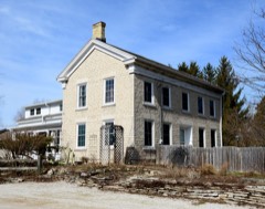 | Thomas Camp Farmhouse | 0.4 miles | 1988 |
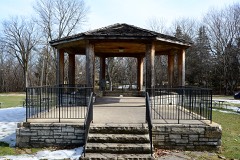 | Village Park Bandstand | 2.5 miles | 1988 |
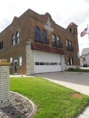 | Menomonee Falls City Hall | 2.6 miles | 1988 |
| Andrew Barnes House | 2.6 miles | 1988 | |
| Frank Koehler House and Office | 2.7 miles | 1988 |
| National Archives record | The nomination case file for reference 88001672 in Record Group 79. |
| Waukesha County | All 153 listed properties in this county. |