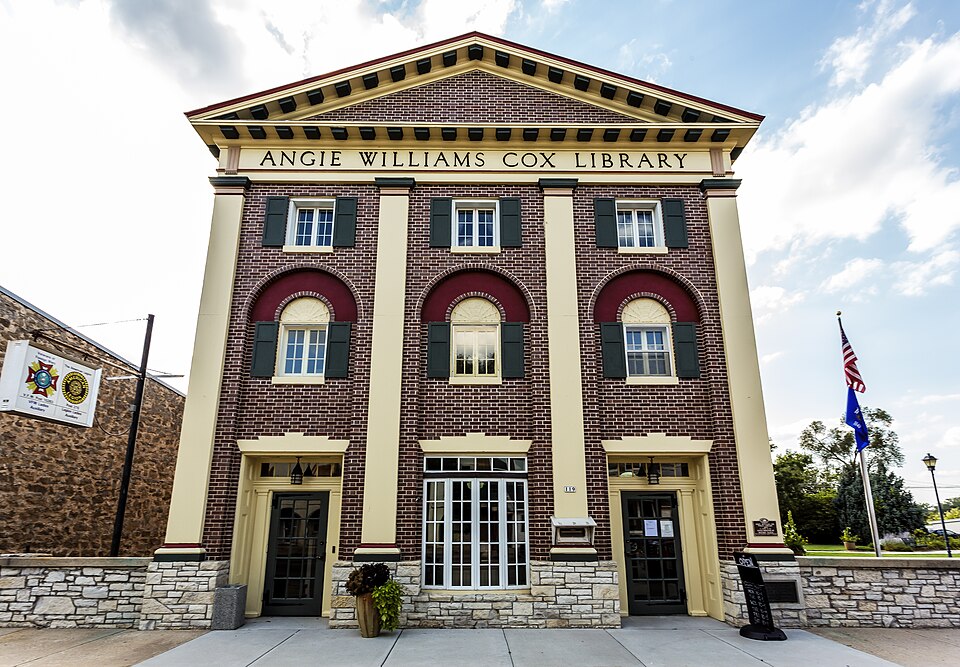
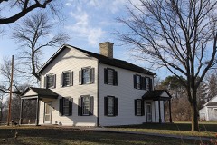
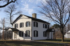
Built in 1900 (Colonial Revival architecture). Listed on the National Register of Historic Places in 1990.
From the record
“The Angie Williams Cox Public Library is located in Pardeeville, Wisconsin. It was added to the National Register of Historic Places in 1990.”
Wikipedia article Angie Williams Cox Library, CC BY-SA 4.0.
One of 55 National Register listings published here for Columbia County · listed in 1990 · category: Building · built in 1900, Colonial Revival architecture.
National Register reference number.90001703- the number the National Park Service assigned this property when it was listed, and the key its nomination file is catalogued under at the National Archives.
In the fall of 1848, John S. Pardee, then merchandising in Milwaukee, sent out Mr. Reuben Stedman to build a store in this neighborhood, and in December following, Yates Ashley came out with goods and commenced trading for Mr. Pardee, and getting out timber to build mills. In 1849, the saw and grist mills were built and commenced operations. This was the beginning of Pardeeville.
J. S. Pardee commenced the erection of the large grist-mill, in 1849 ; in the same year he transferred his interest in Pardeeville to Joseph Utley, who, about the year 1853, turned the whole property over to John Pardee, father of the original proprietor, who took possession of the property (the mill being unfinished), and completed the mill in the latter part of 1856.
Regional context, not property-specific
evidence. The
federal wildfire occurrence database
lists 177 fires within 5 miles of Angie Williams Cox Library
between 1992 and 2020, burning about 324 acres in total. 3 started naturally. 10 were recorded as arson.
Distance is straight-line from the map coordinates, so a fire counted
here may appear on a neighbouring settlement's page as well.
Reported cause
Fires
Debris and open burning
67
Equipment and vehicle use
38
Missing data/not specified/undetermined
23
Railroad operations and maintenance
15
Arson/incendiarism
10
Smoking
6
Fireworks
5
Recreation and ceremony
5
Power generation/transmission/distribution
4
Natural
3
Misuse of fire by a minor
1
The most recent of
them, most recent first, with the day each was reported and the service
that recorded it.
Regional context, not property-specific
evidence. The federal mineral resources record lists
5 workings within 5 miles of Angie Williams Cox Library: 4 past producers, 1 producer.
1 still produces. What was taken out: Sand and Gravel, Construction. Distance is straight-line from the
map coordinates, so a quarry counted here may appear on a neighbouring
settlement's page as well.
Regional context, not property-specific
evidence. The National Weather Service names
Pardeeville, the town this property stands in, in 43 storm reports between 1997 and 2025: 26 thunderstorm wind, 13 hail, 1 lightning, 1 tornado.
The reports record 6 injuries. Each account below is quoted exactly as the forecast office
filed it, from the NOAA Storm Events Database, and each date
opens the federal record of that event.
This tornado was extremely wide since the thunderstorm cloud base was very low and the meso-cyclone that is usually aloft was well-formed all the way to the ground. Within a broad 1 to 2 mile wide area of EF0 to EF1 damage, there were several small swaths of EF2 damage due to multiple votices. The accompanying graphic shows this effect. With respect to residential homes this tornado resulted in very minor damage to 150, minor damage to 30, major damage to 10, and 2 were destroyed (total residential damage of $2 million). With respect to agricultural buildings ($500K in total damage), this tornado resulted in minor damage to 20, and major damage to 2 buildings (inlcuding silos). Tens of thousands of trees were uprooted or chewed-up, and many power-lines and power-poles were either toppled or damaged. About 4000 to 6000 trees on a tree farm were destroyed at a location about 3 miles east-southeast of Pardeeville. This tree-farm loss was treated as a crop loss. Additionally, some corn and soybean crops were damaged. This tornado started just southeast of the intersection of CTH P and Pardeeville Road, and moved southeastward for about 4 miles and then traveled east-southeast to end just northeast of the western intersection of STH 146 and CTH A. The specific starting point and ending point lat/long numbers were 43.53333/-89.26306 and 43.49556/-89.09878, respectively. Additional mid-point pairs of number include: 43.51603/-8922394, 43.50728/-89.20151, and 43.50208/-89.17679. DI#24 (ELT), DOD4. The wind speeds were estimated at about 120 mph. Average path length was about 1760 yards (1 mile).
Numerous large trees and branches snapped on the golf course and surrounding neighborhood adjacent to Swan Lake. A large porch roof and overhang of a large and new lake home was ripped off and deposited on the other side of the house.
Several large trees uprooted or snapped. Large branches also down. Structural damage to several homes from trees landing on them. Two pontoon boats that were resting on boat lifts were overturned into the lake.
Thunderstorm wind gusts toppled several large trees down near STH 44 and STH 33 in the area northeast of Pardeeville. Roof damage to a home was noted near intersection of Vaughn and Atkinson roads. Nearby, a barn roof was torn off.
Street flooding in many communities. Reports of driveways flooded up to the garages in Fall River. Some shoulder washouts on rural roads. Rainfall totals of 4-6 inches.
No historic map-sheet match is published
for this property yet. That does not mean no map exists. This record needs
a coordinate-quality review before it can be joined to a sheet boundary.
Browse the county's mapped places while that work is
pending.
Listed places nearby
6 within 8 miles
Other National Register properties close
enough to walk or drive between, ordered by distance from this one. Both
positions come from the same geocoding pass that matched these properties
to their map sheets.
Listing record. National Park Service National Register of Historic Places, listed-properties dataset, current to 2026-05-22.
Map join. Address geocoded through the United States Census geocoder, then tested against the published boundary of every sheet in the USGS Historical Topographic Map Collection.
How this page is made. Listing fields come from federal records; map-sheet coverage is a labelled coordinate-to-boundary calculation, not a source-field claim.
Wildfire. Short, Karen C. 2022. Spatial wildfire occurrence data for the United States, 1992-2020 [FPA_FOD_20221014]. 6th Edition. Fort Collins, CO: Forest Service Research Data Archive. https://doi.org/10.2737/RDS-2013-0009.6 Collected with United States Government funding and usable without additional permissions or fees.
Mines and quarries. USGS Mineral Resources Data System (MRDS) https://mrdata.usgs.gov/mrds/ A work of the United States government, no copyright under 17 U.S.C. 105.
Storms. NOAA National Centers for Environmental Information, Storm Events Database https://www.ncei.noaa.gov/stormevents/ A work of the United States government, no copyright under 17 U.S.C. 105. Narratives are quoted verbatim from the National Weather Service report and are not edited or summarised.
 Block