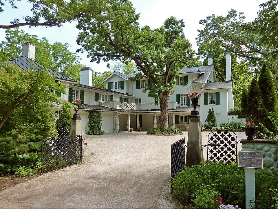
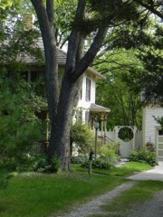
A National Historic Landmark. Built in 1915. Listed on the National Register of Historic Places in 1998.
From the record
“Ten Chimneys was the summer home and gentleman's farm of Broadway actors Lynn Fontanne and Alfred Lunt, and a social center for American theater. The property is located in Genesee Depot in the Town of Genesee in Waukesha County, Wisconsin, United States.”
Wikipedia article Ten Chimneys, CC BY-SA 4.0.
One of 153 National Register listings published here for Waukesha County · listed in 1998 · category: Building · built in 1915 · a National Historic Landmark.
National Register reference number.98000076- the number the National Park Service assigned this property when it was listed, and the key its nomination file is catalogued under at the National Archives.
What happened here
An account from the chapter on Genesee town. The inset identifies its exact
source book and publication year.
WILiIilAM ADDENBROORE, farmer. Sec. 9; P. 0. North Prairie; born 1832, in Staffordshire, Eng. ; is a son of Hy. and Harriett (Johnson) Addenbrook, who are now residents of Liverpool, Eng. ; Mr. A. studied in the schools of his native land, taking a medical course at the Birmingham Hospital; he practiced medicine on the ocean packet-ships, and in the American and English seaports, until 1852, when he came to Wisconsin and bought his present farm of 120 acres; was for nine years in the grain and mercantile business at North Prairie, selling his store and elevator, in 1875 ; has since devoted himself to his farm and apiary ; his first swarm was captured in the woods about twenty years ago ; was for a time in partnership with George Grimm, whose father, Adam G., of Jefferson, Wis., was the most successful apiarian on the continent, and first introduced the Italian bees ; the partnership was dissolved in 1879, Mr.
C. V. BKOWNEIili, farmer. See. 8; P. 0. Brookfield Center; was born in Darien, Genesee Co., N. Y., in 1816; he came to Wisconsin in 1837, lived in Milwaukee a short time, then went to Wauwatosa, there remaining until 1846, when he moved to Brookfield, Waukesha Co., which has been his home since; Oct. 9, 1842, he married in Brookfield, Adeline Phillips, a native of Erie Co., N. Y., born in 1823 ; their surviving children are Emma, William, Cbauncey, Campbell, Edgar and Adeline ; the oldest, Emma, is the wife of Alansen Pease, Andover, 111.; he was a soldier in the Union army in the war of the Rebellion ; William, the secon'd oldest, served in Co. A, 35th W. V. I., three years and three months ; was in active service ; he married Annie Robinson ; they live in Buffalo Co., Wis.; Chauncey married Ellen Grogan; they reside iu this town (Brookfield); Adeline is the wife of Andrew Fortner ; they live in Canada; Campbell and Edgar are at home. Mr. Brownell owns 120 acres of land; is a Republican in politics.
WIIililAM HIIiL, deceased; born 1805, in Cheshire, England; married Miss Rachel Bradley, who was born Oct. 9, 1810, in Yorkshire ; they came to America with four children, in 1840 ; reaching Waukesha, they were unable to find other shelter than a stable, where Mrs. Hill lay sick, while her husband searched out a home, her children suifering for the bread she was unable to get them ; Mr. Hill bought 80 acres on Sec. 17, living in a log house ; Mr. Hill did good work with his ax and breaking plow, building up a good home, and a good and honorable name. He died Feb. 6, 1870, leaving six children - Jacob, David, Jane, Anne, Mary and Elizabeth ; James Hill died before his father ; Mary and her husband William Shultis are with the widow. Mr. and Mrs. H. were among the founders of the Genesee Congregational Church. «
Regional context, not property-specific
evidence. The
federal wildfire occurrence database
lists 12 fires within 5 miles of Ten Chimneys
between 2008 and 2020, burning about 42 acres in total. None started naturally. 3 were recorded as arson.
Distance is straight-line from the map coordinates, so a fire counted
here may appear on a neighbouring settlement's page as well.
Reported cause
Fires
Missing data/not specified/undetermined
8
Arson/incendiarism
3
Debris and open burning
1
The most recent of
them, most recent first, with the day each was reported and the service
that recorded it.
Regional context, not property-specific
evidence. The federal mineral resources record lists
8 workings within 5 miles of Ten Chimneys: 4 producers, 3 past producers, 1 unknown.
4 still produce. What was taken out: Sand and Gravel, Construction, Stone, Stone, Dimension. Distance is straight-line from the
map coordinates, so a quarry counted here may appear on a neighbouring
settlement's page as well.
Regional context, not property-specific
evidence. The National Weather Service names
Genesee, the town this property stands in, in 3 storm reports between 2000 and 2008: 2 thunderstorm wind, 1 lightning.
No death or injury is recorded in these reports. Each account below is quoted exactly as the forecast office
filed it, from the NOAA Storm Events Database, and each date
opens the federal record of that event.
Lightning struck a nearly 100-year-old church in/near Genessee on State Highway 83, and the resultant fire destroyed the structure. The time of this event andn damage amount are broad estimates.
No historic map-sheet match is published
for this property yet. That does not mean no map exists. This record needs
a coordinate-quality review before it can be joined to a sheet boundary.
Browse the county's mapped places while that work is
pending.
Listed places nearby
6 within 8 miles
Other National Register properties close
enough to walk or drive between, ordered by distance from this one. Both
positions come from the same geocoding pass that matched these properties
to their map sheets.
Listing record. National Park Service National Register of Historic Places, listed-properties dataset, current to 2026-05-22.
Map join. Address geocoded through the United States Census geocoder, then tested against the published boundary of every sheet in the USGS Historical Topographic Map Collection.
How this page is made. Listing fields come from federal records; map-sheet coverage is a labelled coordinate-to-boundary calculation, not a source-field claim.
Wildfire. Short, Karen C. 2022. Spatial wildfire occurrence data for the United States, 1992-2020 [FPA_FOD_20221014]. 6th Edition. Fort Collins, CO: Forest Service Research Data Archive. https://doi.org/10.2737/RDS-2013-0009.6 Collected with United States Government funding and usable without additional permissions or fees.
Mines and quarries. USGS Mineral Resources Data System (MRDS) https://mrdata.usgs.gov/mrds/ A work of the United States government, no copyright under 17 U.S.C. 105.
Storms. NOAA National Centers for Environmental Information, Storm Events Database https://www.ncei.noaa.gov/stormevents/ A work of the United States government, no copyright under 17 U.S.C. 105. Narratives are quoted verbatim from the National Weather Service report and are not edited or summarised.
 Block