 Block
From the record
10 National Register listings published here.
Sources: the National Register database, National Park Service
77 topographic sheets cover 22 settlements here, and 10 properties are on the National Register of Historic Places.
10 National Register listings published here.
Sources: the National Register database, National Park Service
Every property in this county listed on the National Register of Historic Places, with the year it was listed and the federal nomination document.
| Photograph | Property | Type | Listed | Reference |
|---|---|---|---|---|
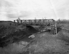 | DXN Bridge over Missouri River | structure | 1985 | 85000419 |
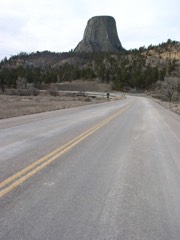 | Entrance Road-Devils Tower National Monument | structure | 2000 | 00000854 |
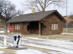 | Entrance Station-Devils Tower National Monument | building | 2000 | 00000853 |
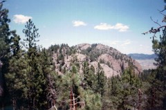 | Inyan Kara Mountain | district | 1973 | 73001929 |
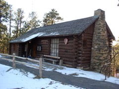 | Old Headquarters Area Historic District | district | 2000 | 00000852 |
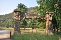 | Ranch A | district | 1997 | 97000227 |
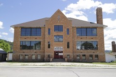 | Sundance School | building | 1985 | 85003099 |
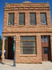 | Sundance State Bank | building | 1984 | 84003660 |
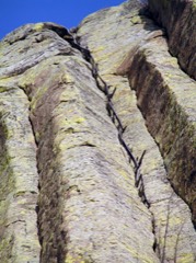 | Tower Ladder-Devils Tower National Monument | structure | 2000 | 00000855 |
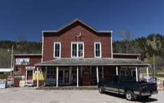 | Wyoming Mercantile | building | 1991 | 91000435 |
Every wildfire the federal occurrence database records inside this county: 734 of them, burning about 64,356 acres. 439 started naturally and 5 were recorded as arson. Each settlement page carries the fires within five miles of it.
| Reported cause | Fires |
|---|---|
| Natural | 439 |
| Missing data/not specified/undetermined | 179 |
| Debris and open burning | 34 |
| Recreation and ceremony | 33 |
| Equipment and vehicle use | 31 |
| Arson/incendiarism | 5 |
| Fireworks | 5 |
| Railroad operations and maintenance | 3 |
| Power generation/transmission/distribution | 3 |
| Misuse of fire by a minor | 1 |
| Smoking | 1 |
The five largest, by the area the report gives. None of them was recorded as arson.
| Date | Cause | Size | Reported by | Name on the report |
|---|---|---|---|---|
| 13 July 2006 | Natural | 14,886 acres | New Castle Field Office | THORN DIVIDE COMPLEX |
| 24 June 2016 | Natural | 12,347 acres | New Castle Field Office | KARA CREEK |
| 11 August 2000 | Natural | 6,089 acres | Casper Field Office | WOOD DRAW |
| 31 August 2004 | Missing data/not specified/undetermined | 4,700 acres | Crook County | BASIN DRAW |
| 23 July 2005 | Natural | 3,025 acres | Black Hills National Forest | CEMENT |
| 21 June 2016 | Natural | 2,345 acres | New Castle Field Office | DOUGLAS |
| 18 August 2000 | Natural | 2,000 acres | Casper Field Office | A HAGERMAN |
| 2 September 2000 | Missing data/not specified/undetermined | 2,000 acres | Devils Tower National Monument | WEEHINKLE |
Every settlement page carries the fires within five miles of it - see the settlement index below.
The NOAA Storm Events Database holds 839 reports for this county, causing no deaths, 10 injuries and about $5,308,820 in recorded property damage. Each settlement page carries the reports that name it.
| Kind of event | Reports |
|---|---|
| Hail | 504 |
| Thunderstorm Wind | 263 |
| Tornado | 38 |
| Flood | 13 |
| Flash Flood | 8 |
| Lightning | 4 |
| Funnel Cloud | 4 |
| Wildfire | 3 |
| Heavy Rain | 2 |
The most serious of them, by death, then injury, then recorded damage. The accounts are quoted exactly as the forecast office filed them.
| When | Event | Place named | Harm | What the report says |
|---|---|---|---|---|
| July 2001 | Hail | Devils Tower | 4 hurt, $10,000 | no account filed |
| July 2009 | Tornado (EF2) | Alva | 2 hurt, $300,000 | A large tornado touched down west of Cook Lake and tracked east-southeastward across the Bear Lodge Mountains, dissipating west of Wyoming Highway 111. The tornado downed about 4000 acres of Ponderosa pine trees, destroyed two metal shop buildings and a large barn at a ranch, and severely damaged a house and mobile home. Two people in the residences received very minor injuries. |
| July 2001 | Lightning | Devils Tower | 2 hurt | no account filed |
| June 2014 | Tornado (EF2) | Hulett | 1 hurt, $100,000 | A tornado tracked across the Bear Lodge Mountains of northeastern Wyoming. It snapped and uprooted large Ponderosa Pine and cottonwood trees along its path. It destroyed a mobile home northeast of Alva; one person inside it was slightly injured. Several sheds had sheet metal torn off walls and doors blown in; one shed had part of its roof collapsed. Horse and other small trailers were rolled. Evidence of inflow winds of 80 to 110 mph were noted south of the tornado track. |
| August 2024 | Thunderstorm Wind | Devils Tower | 1 hurt | Numerous reports of broken windows, building damage, extensive camper and vehicle damage, and extensive tree damage throughout the Devils Tower area. There was one injury when a person suffered an elbow contusion from flying debris at a campground and had to receive medical attention. |
| July 2010 | Hail | Moorcroft | $800,000 | Wind-driven large hail broke windows and damaged siding and roofs of houses in Moorcroft. The hail also broke windshields and dented vehicles. |
| June 2012 | Hail | Moorcroft | $600,000 | Large hail caused automobile and building damage in Moorcroft. |
| July 2009 | Hail | Hulett | $400,000 | Baseball sized hail caused extensive damage to homes and automobiles throughout town. |
| May 2014 | Hail | Hulett | $300,000 | Hail to tennis ball size damaged buildings and automobiles. |
| July 2001 | Lightning | Moorcroft | $250,000 | no account filed |
| July 1965 | Tornado (F3) | not stated | $250,000 | no account filed |
| June 2010 | Thunderstorm Wind | Moorcroft | $200,000 | Strong winds downed branches, trees, and a few power poles; heavily damaged or destroyed small structures; and ripped the roof off a mobile home. |
| July 2009 | Hail | New Haven | $200,000 | Softball sized hail damaged automobiles and buildings. |
| May 2014 | Hail | Hulett | $200,000 | no account filed |
| May 2013 | Hail | Devils Tower | $200,000 | no account filed |
| June 2014 | Hail | Moorcroft | $150,000 | Some minor property damage occurred in town. |
| July 2013 | Hail | Sundance | $150,000 | no account filed |
| June 2013 | Flood | New Haven | $100,000 | Several creeks and streams experienced flooding. The Belle Fourche River near Alva reached a stage of 7.5 feet, which is three feet above flood stage. |
| June 2008 | Flood | Colony | $100,000 | The Belle Fourche River, Oak Creek, Hay Creek, and other small streams flooded roads north of Aladdin. |
| July 2011 | Hail | Moorcroft | $100,000 | no account filed |
| May 2013 | Flood | New Haven | $60,000 | Several creeks and streams across Crook County flooded. The Belle Fourche River near Alva reached a stage of 7.5 feet, which is three feet above flood stage. |
| May 2014 | Thunderstorm Wind | Hulett | $50,000 | Thunderstorm winds blew over an outbuilding, blew a 20-by-30 foot barn off its foundation, and damaged roofs southwest of Hulett along WY Highway 24. |
| July 2011 | Thunderstorm Wind | Sundance | $50,000 | Striong winds blew down large trees and fences in Sundance. |
| June 2010 | Thunderstorm Wind | Pine Haven | $50,000 | Wind gusts between 70 and 80 mph blew down sheds, blew apart fences, and tore off shingles throughout Pine Haven. |
| June 2007 | Hail | Colony | $50,000 | Hail damaged automobiles. |
| July 2013 | Hail | Hulett | $50,000 | no account filed |
| August 2012 | Hail | Sundance | $50,000 | no account filed |
| March 2004 | Thunderstorm Wind | Moorcroft | $50,000 | no account filed |
| July 2009 | Hail | Hulett | $25,000 | Softball sized hail broke windows and damaged roofs and automobiles. |
| June 2011 | Hail | Devils Tower | $25,000 | no account filed |
| July 1986 | Tornado (F1) | not stated | $25,000 | no account filed |
| May 1984 | Tornado (F2) | not stated | $25,000 | no account filed |
| July 1976 | Tornado (F1) | not stated | $25,000 | no account filed |
| June 1975 | Tornado (F3) | not stated | $25,000 | no account filed |
| May 1961 | Tornado (F2) | not stated | $25,000 | no account filed |
| June 1959 | Tornado (F2) | not stated | $25,000 | no account filed |
| August 1999 | Hail | Moorcroft | $20,000 | Eighty houses had hail damage--mostly broken windows and damaged siding. Two police vehicles had moderate hail damage and another was totaled by hail. |
| June 1998 | Tornado (F1) | Sundance | $20,000 | Damage was sustained to a three car garage, several bam roofs, several campers, and a home satellite dish. |
| June 2012 | Hail | Moorcroft | $20,000 | no account filed |
| May 2009 | Hail | Moorcroft | $20,000 | no account filed |
| August 2000 | Thunderstorm Wind | Beulah | $15,000 | no account filed |
| June 2015 | Thunderstorm Wind | Colony | $10,000 | The combination of strong wind and large hail caused minor damage. |
| June 2015 | Hail | Lightning Flat | $10,000 | Several windows were broken and siding was damaged on a house. |
| June 2014 | Tornado (EF1) | Devils Tower | $10,000 | A tornado touched down at a ranch east of Devils Tower, where it destroyed an old house and barn, and snapped and uprooted large Ponderosa pine trees along its track. |
| July 2013 | Thunderstorm Wind | Alva | $10,000 | The combination of hail and wind caused minor damage at Cook Lake. |
| July 2007 | Thunderstorm Wind | Hulett | $10,000 | Numerous large tree limbs and several small trees were blown down. |
| July 2000 | Hail | New Haven | $10,000 | Several windows were broken. Also several cattle and antelope were killed. |
| July 2013 | Hail | Hulett | $10,000 | no account filed |
| August 2012 | Hail | Sundance | $10,000 | no account filed |
| August 2000 | Thunderstorm Wind | Aladdin | $10,000 | no account filed |
| May 1996 | Tornado (F1) | Hulett | $10,000 | no account filed |
| July 2009 | Hail | Hulett | $7,000 | no account filed |
| June 2015 | Thunderstorm Wind | Lightning Flat | $5,000 | The strong winds uprooted about 30 trees and blew over heavy farm equipment. |
| June 2015 | Flash Flood | Moorcroft | $5,000 | Two to three feet of water was reported over Wind Creek Road. The road was washed out in eight places. |
| June 2013 | Thunderstorm Wind | Keyhole Reservoir | $5,000 | Strong winds lifted the roof off a barn. |
| July 2013 | Hail | Moorcroft | $5,000 | Hail accumulated four to six inches deep and damaged house siding and a camper. |
| July 2013 | Thunderstorm Wind | Lightning Flat | $5,000 | Strong winds tore part of the roof off a shop, leaving just the rafters. |
| July 2011 | Hail | Keyhole Reservoir | $5,000 | Hail from 1.0 to 2.5 inches in diameter fell for 30 minutes and broke windows on a house. |
| August 2010 | Thunderstorm Wind | New Haven | $5,000 | Wind-driven hail punched holes in the siding and broke windows of a mobile home. |
| April 2007 | Thunderstorm Wind | Moorcroft | $5,000 | Strong winds blew the roof off a garage. Winds were estimated around 60 mph. |
The Survey's mineral resources record lists 194 workings inside this county. 23 still produce and 171 are closed or unrecorded. Each settlement page carries the workings within five miles of it.
| Commodity | Workings |
|---|---|
| Uranium | 109 |
| Bentonite | 38 |
| Fluorine-Fluorite | 14 |
| Clay | 8 |
| Gypsum-Anhydrite | 5 |
| Gold | 4 |
| Manganese | 2 |
| Sand and Gravel, Construction | 2 |
| Tin | 2 |
| Stone, Crushed/Broken | 2 |
| Gold, Tin, Tungsten, Garnet | 1 |
| Gold, REE, Niobium (Columbium) | 1 |
| Copper, Silver, Thorium | 1 |
| Thorium | 1 |
The least common of them first, because a county's hundredth gravel pit says nothing its first ten did not.
| Where | Site | Commodity | Status | Recorded |
|---|---|---|---|---|
| Anna No 2 Fraction | Tin, Niobium (Columbium) | Prospect | ||
| Bear Lodge Mountains area | Gold, REE, Niobium (Columbium), Copper, Silver, Thorium, Uranium | Prospect | ||
| Black Butte Deposit | Lead, Silver | Past Producer | ||
| Carbonate Claims | Lead, Zinc | Prospect | ||
| Copper Prince Mine | Copper | Unknown | ||
| Home Guard Nos. 1, 2, and 3 claims | Iron | Occurrence | ||
| Negro Hill placers | Gold, Tin, Tungsten, Garnet | Occurrence | Cassiterite, Gold, Wolframite | |
| Summit Materials Quarry | Limestone, Dimension | Producer | ||
| Unknown | Thorium | Prospect | ||
| Unknown | Calcium | Occurrence | ||
| Bear Gulch Placer | Tin | Past Producer | ||
| Bull Hill | Stone, Crushed/Broken | Occurrence | ||
| Bull Hill Prospect | Manganese | Occurrence | ||
| Driskell Pit | Sand and Gravel, Construction | Producer | ||
| Sand Creek | Tin | Occurrence | Cassiterite | |
| Simmons Stockpile | Sand and Gravel, Construction | Producer | ||
| Unidentified Gold Occurrence | Gold, Manganese | Occurrence | Gold | |
| Watson Pit Quarry | Stone, Crushed/Broken | Producer | ||
| Hutchins Consolidated Gold Mining | Gold | Prospect | ||
| Warren Peaks | Gold | Unknown | ||
| Warren Peaks Occurrence | Gold | Occurrence | Gold | |
| Beaver Creek | Gypsum-Anhydrite | Unknown | ||
| Belle Fourche River No 2 | Gypsum-Anhydrite | Unknown | ||
| Government Valley | Gypsum-Anhydrite | Unknown | ||
| Hulett | Gypsum-Anhydrite | Unknown | ||
| Unknown | Gypsum-Anhydrite | Unknown | ||
| American Colloid Pits | Clay | Past Producer | ||
| Cedar Creek No 2 | Clay | Unknown | ||
| Colony Mine | Clay | Producer | ||
| Gumbo Creek | Clay | Unknown | ||
| Middle Creek #1 | Clay | Producer | ||
| Missouri Mine | Clay | Producer | ||
| Oak Creek 2 | Clay | Unknown | ||
| Unknown | Clay | Unknown | ||
| Cole Canyon Prospect | Fluorine-Fluorite | Unknown | ||
| Corral Spring Prospect | Fluorine-Fluorite | Occurrence | ||
| Jim Wayne Canyon | Fluorine-Fluorite | Unknown | ||
| Lytle Creek Prospect | Fluorine-Fluorite | Prospect | ||
| Peterson Claims, Bear Lodge Mtns | Fluorine-Fluorite | Occurrence | Fluorite | |
| Peterson Deposits | Fluorine-Fluorite | Prospect | ||
| Redwater Claims | Fluorine-Fluorite | Prospect | ||
| Redwater Claims | Fluorine-Fluorite | Prospect | ||
| Royal Purple #1 & 2 | Fluorine-Fluorite | Unknown | ||
| Royal Purple N0s. 1&2 | Fluorine-Fluorite | Occurrence | ||
| Unknown | Fluorine-Fluorite | Prospect | ||
| Unknown | Fluorine-Fluorite | Occurrence | ||
| Unknown | Fluorine-Fluorite | Prospect | ||
| Unknown | Fluorine-Fluorite | Occurrence | ||
| Baroid Colony Mill | Bentonite | Producer | ||
| Baroid Colony Mine | Bentonite | Producer | ||
| Bear Gulch Area | Bentonite | Unknown | ||
| Belle Fourche River No 1 | Bentonite | Unknown | ||
| Belle Fourche River No 3 | Bentonite | Unknown | ||
| Bentonite Spur | Bentonite | Producer | ||
| Cedar Creek No 1 | Bentonite | Producer | ||
| Crow Creek | Bentonite | Producer | ||
| Elkhorn Creek | Bentonite | Unknown | ||
| Federal Colony Mill | Bentonite | Producer | ||
| International Colony Mill | Bentonite | Producer | ||
| Middle Creek #2 | Bentonite | Producer | ||
| Montana Creek | Bentonite | Unknown | ||
| Pine Ridge 2 | Bentonite | Unknown | ||
| Sage Area | Bentonite | Producer | ||
| South of Colony | Bentonite | Producer | ||
| Unknown | Bentonite | Producer | ||
| Unknown | Bentonite | Occurrence | ||
| Unknown | Bentonite | Occurrence | ||
| Unknown | Bentonite | Occurrence | ||
| Unknown | Bentonite | Occurrence | ||
| Unknown | Bentonite | Past Producer | ||
| Unknown | Bentonite | Occurrence | ||
| Unknown | Bentonite | Occurrence | ||
| Unknown | Bentonite | Prospect | ||
| Unknown | Bentonite | Occurrence | ||
| Unknown | Bentonite | Occurrence | ||
| Unknown | Bentonite | Occurrence | ||
| Unknown | Bentonite | Occurrence | ||
| Unknown | Bentonite | Occurrence | ||
| Unknown | Bentonite | Occurrence | ||
| Unknown | Bentonite | Occurrence | ||
| Unknown | Bentonite | Occurrence | ||
| Unknown | Bentonite | Unknown | ||
| Unknown | Bentonite | Occurrence | ||
| Unknown | Bentonite | Occurrence | ||
| Unknown | Bentonite | Unknown | ||
| Wimco Mine | Bentonite | Producer | ||
| A. H. Claim | Uranium | Occurrence | ||
| A.A.Johnson Property | Uranium | Unknown | ||
| Ackerman | Uranium | Past Producer | ||
| Aladdin | Uranium | Producer | Stratabound | |
| Apex | Uranium | Occurrence | Vein | |
| Barnard Canyon | Uranium | Occurrence | ||
| Bear Creek Mountains | Uranium | Occurrence | ||
| Black Vein 7 | Uranium | Occurrence | ||
| Busfield Mine | Uranium | Past Producer | 1956 | |
| C. Cockran | Uranium | Occurrence | ||
| Cabin Creek 4 and 7 | Uranium | Occurrence | Stratabound | |
| Cabin Creek No. 6 | Uranium | Unknown | ||
| Campstool 9 and 11 | Uranium | Occurrence | ||
| Carlile Mine | Uranium | Past Producer | 1952, 1953, 1955 | |
| Claim #1 | Uranium | Prospect | ||
| Claim #2 | Uranium | Occurrence | ||
| Claims #3 and #4 | Uranium | Occurrence | ||
| Claims #5 and #11 | Uranium | Occurrence | ||
| Climax 10 | Uranium | Prospect | ||
| Cochrun | Uranium | Occurrence | Stratabound | |
| Davidson Property | Uranium | Occurrence | ||
| Dennis | Uranium | Past Producer | ||
| Elkhorn Properties (Elkhorn Project) | Uranium | Prospect | ||
| Gose Ranch Property | Uranium | Prospect | ||
| Graves 1 | Uranium | Prospect | ||
| Griffith | Uranium | Past Producer | ||
| Hauber Mine | Uranium | Past Producer | Stratabound | |
| Hauber Project properties (Elkhorn Project) | Uranium | Prospect | ||
| Helmer | Uranium | Unknown | ||
| Helmer (Sec. 19) | Uranium | Occurrence | Stratabound | |
| Holmes Lease | Uranium | Past Producer | ||
| Homes Fire Lode 43 | Uranium | Prospect | ||
| Homestake Lode 1 | Uranium | Past Producer | ||
| Homestake Property | Uranium | Prospect | ||
| Inum 1 Claim | Uranium | Prospect | ||
| Inum Group | Uranium | Occurrence | ||
| J. C. Vieragutz Property | Uranium | Occurrence | ||
| Jones, Bury, & Murdock Property #1 | Uranium | Occurrence | ||
| Jones, Bury, & Murdock Property #1 | Uranium | Occurrence | ||
| Jubilee Mine | Uranium | Unknown | Stratabound | |
| Laymon Lease | Uranium | Past Producer | Uraninite | |
| Lewis Dennis | Uranium | Unknown | ||
| Locality #17 | Uranium | Occurrence | ||
| Lytle 3 Claim | Uranium | Prospect | ||
| Lytle 5 Claim | Uranium | Prospect | ||
| Manke Lease | Uranium | Past Producer | ||
| Melani 2 Claim ? | Uranium | Occurrence | ||
| Nelson | Uranium | Unknown | ||
| Nelson Property | Uranium | Occurrence | Stratabound | |
| New Haven | Uranium | Occurrence | Stratabound | |
| New Haven 28 | Uranium | Occurrence | Stratabound | |
| New Haven Homestake | Uranium | Occurrence | ||
| Nubeth Joint Venture | Uranium | Producer | ||
| Oak Creek | Uranium | Occurrence | ||
| Oldman Mining Co Prop | Uranium | Occurrence | ||
| Paul Myers | Uranium | Prospect | ||
| Pearson Bros. Property | Uranium | Occurrence | ||
| Pine Ridge | Uranium | Past Producer | ||
| Poison Creek | Uranium | Occurrence | Stratabound | |
| Potluck 1 & 2 | Uranium | Occurrence | ||
| Red Rock 1 | Uranium | Occurrence | ||
| Red Rock 2 | Uranium | Occurrence | ||
| Richards Property | Uranium | Occurrence | Stratabound | |
| Saddle Group | Uranium | Prospect | Stratabound | |
| Sand Lode 4 | Uranium | Prospect | ||
| Sisson | Uranium | Unknown | ||
| Sodak Mine | Uranium | Unknown | ||
| State Lease 22090 | Uranium | Past Producer | ||
| Storm | Uranium | Past Producer | ||
| Sunrise Lode | Uranium | Prospect | ||
| Thorn Divide | Uranium | Occurrence | Stratabound | |
| Thorn Ridge Mine | Uranium | Occurrence | Stratabound | |
| Tony 1 | Uranium | Past Producer | ||
| Unknown | Uranium | Occurrence | ||
| Unknown | Uranium | Occurrence | Stratabound | |
| Unknown | Uranium | Occurrence | Stratabound | |
| Unknown | Uranium | Occurrence | Stratabound | |
| Unknown | Uranium | Occurrence | Stratabound | |
| Unknown | Uranium | Producer | Stratabound | |
| Unknown | Uranium | Occurrence | Stratabound | |
| Unknown | Uranium | Producer | Stratabound | |
| Unknown | Uranium | Past Producer | ||
| Unknown | Uranium | Past Producer | ||
| Unknown | Uranium | Occurrence | ||
| Unknown | Uranium | Past Producer | ||
| Unknown | Uranium | Past Producer | ||
| Unknown | Uranium | Occurrence | ||
| Unknown | Uranium | Past Producer | ||
| Unknown | Uranium | Past Producer | ||
| Unknown | Uranium | Unknown | ||
| Unknown | Uranium | Past Producer | ||
| Unknown | Uranium | Past Producer | ||
| Unknown | Uranium | Occurrence | ||
| Unknown | Uranium | Unknown | ||
| Unknown | Uranium | Past Producer | ||
| Unknown | Uranium | Occurrence | ||
| Unknown | Uranium | Occurrence | ||
| Unknown | Uranium | Prospect | ||
| Unknown | Uranium | Occurrence | ||
| Unknown | Uranium | Past Producer | ||
| Unknown | Uranium | Occurrence | ||
| Vickers Mine (Kay) | Uranium | Past Producer | 1957 | |
| Victory Lode | Uranium | Prospect | ||
| Viergutz 1 | Uranium | Prospect | ||
| Viergutz 2 & 3 | Uranium | Prospect | ||
| Viergutz Prospects | Uranium | Occurrence | Stratabound | |
| Viertgutz Property | Uranium | Prospect | ||
| Virgina 16 | Uranium | Past Producer | Stratabound |
Named settlements recorded in the Geographic Names Information System, each with the topographic sheets covering it. Villages, hamlets and abandoned places alike. Each is shown with the nearest named watercourse or landform and the survey quadrangle it falls on.
Hulett census division · 82710 · Near Table Mountain Draw · Aladdin quadrangle
15 sheets, 1901 to 1984
Sundance census division · 82712 · On South Redwater Creek · Beulah quadrangle
16 sheets, 1901 to 1984
Moorcroft census division · 82721 · On Thorn Creek · Carlile quadrangle
15 sheets, 1918 to 1984
Sundance census division · 82729 · Near Castle Rocks · Devils Tower quadrangle
13 sheets, 1905 to 1984
Moorcroft census division · 82714 · Near Campstool Draw · Devils Tower quadrangle
13 sheets, 1905 to 1984
Sundance census division · 82729 · On Spring Creek · Sugarloaf Mountain quadrangle
12 sheets, 1901 to 1984
Hulett census division · 82720 · On Blacktail Creek · Hulett quadrangle
12 sheets, 1905 to 1984
Hulett census division · Near Signal Hill · Rockypoint quadrangle
8 sheets, 1954 to 1975
No longer a settlement
Moorcroft census division · 82730 · On Little Houston Creek · Linden quadrangle
13 sheets, 1918 to 1984
Hulett census division · 82720 · On Music Creek · New Haven quadrangle
12 sheets, 1905 to 1984
Moorcroft census division · 82721 · Near Sidner Draw · Oshoto quadrangle
12 sheets, 1905 to 1984
Moorcroft census division · 82721 · Near Lower Pine Ridge · Grasshopper Butte quadrangle
14 sheets, 1918 to 1984
Sundance census division · Near Green Hill · Tinton quadrangle
18 sheets, 1898 to 1984
Sundance census division · 82729 · On North Fork Sundance Creek · Sundance West quadrangle
16 sheets, 1898 to 1984
Sundance census division · 82729 · Near Wagon Canyon · Moskee quadrangle
17 sheets, 1898 to 1984
The vanished settlements of Crook County: the places named above that are no longer on the map.