 Block
From the record
20 National Register listings published here, 1 of them a National Historic Landmark.
Sources: the National Register database, National Park Service
62 topographic sheets cover 18 settlements here, and 20 properties are on the National Register of Historic Places.
20 National Register listings published here, 1 of them a National Historic Landmark.
Sources: the National Register database, National Park Service
Every property in this county listed on the National Register of Historic Places, with the year it was listed and the federal nomination document.
| Photograph | Property | Type | Listed | Reference |
|---|---|---|---|---|
| Big Sandy Lodge | district | 2023 | 100009516 | |
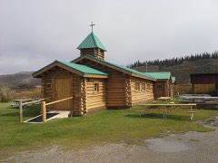 | Church of St. Hubert the Hunter and Library | building | 2002 | 01001525 |
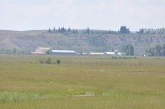 | Circle Ranch | district | 1987 | 87000778 |
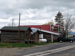 | Cora Townsite | district | 2017 | 100000925 |
| Craig Cabin | district | 2016 | 16000648 | |
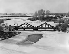 | DDZ Bridge over New Fork River | structure | 1985 | 85000437 |
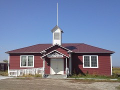 | Daniel School | district | 1990 | 90001387 |
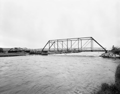 | ENP Bridge over Green River | structure | 1985 | 85000438 |
| Emerson School | building | 2025 | 100012057 | |
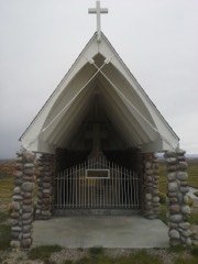 | Father DeSmet's Prairie Mass Site | site | 1970 | 70000676 |
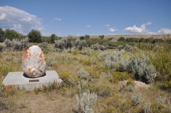 | Fort Bonneville | site | 1970 | 70000677 |
| Green River Drift Trail Traditional Cultural Property | district | 2013 | 12001224 | |
| Jensen Ranch | district | 1988 | 88000552 | |
| Lander Road-New Fork River Crossing | site | 2017 | 100000525 | |
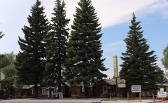 | Log Cabin Motel | district | 1993 | 93000230 |
| New Fork | district | 1987 | 87000773 | |
| Redick Lodge | district | 1983 | 83003364 | |
| Sommers Ranch Headquarters Historic District | district | 2009 | 09000454 | |
| Steele Homestead | building | 1985 | 85000870 | |
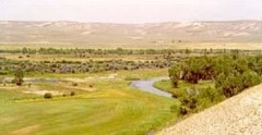 | Upper Green River Rendezvous Site | site | 1966 | 66000763 |
Every wildfire the federal occurrence database records inside this county: 670 of them, burning about 153,154 acres. 354 started naturally and 4 were recorded as arson. Each settlement page carries the fires within five miles of it.
| Reported cause | Fires |
|---|---|
| Natural | 354 |
| Recreation and ceremony | 122 |
| Missing data/not specified/undetermined | 95 |
| Debris and open burning | 49 |
| Equipment and vehicle use | 16 |
| Smoking | 13 |
| Power generation/transmission/distribution | 8 |
| Fireworks | 5 |
| Arson/incendiarism | 4 |
| Firearms and explosives use | 2 |
| Misuse of fire by a minor | 2 |
The five largest, by the area the report gives. None of them was recorded as arson.
| Date | Cause | Size | Reported by | Name on the report |
|---|---|---|---|---|
| 15 September 2018 | Recreation and ceremony | 61,522 acres | Bridger-Teton National Forest | ROOSEVELT |
| 17 July 2016 | Natural | 34,313 acres | Bridger-Teton National Forest | CLIFF CREEK |
| 29 July 2008 | Recreation and ceremony | 15,089 acres | Bridger-Teton National Forest | NEW FORK |
| 21 June 2007 | Missing data/not specified/undetermined | 8,590 acres | Bridger-Teton National Forest | HORSE CREEK |
| 6 October 1996 | Debris and open burning | 4,500 acres | Bridger-Teton National Forest | FAYETTE |
| 2 July 2006 | Natural | 3,895 acres | Bridger-Teton National Forest | JIM CREEK WFU |
| 11 July 2002 | Natural | 3,400 acres | Bridger-Teton National Forest | MULE FIRE |
| 6 August 2002 | Natural | 2,620 acres | Bridger-Teton National Forest | DIVIDE |
Every settlement page carries the fires within five miles of it - see the settlement index below.
The NOAA Storm Events Database holds 95 reports for this county, causing 1 death, 5 injuries and about $610,230 in recorded property damage. Each settlement page carries the reports that name it.
| Kind of event | Reports |
|---|---|
| Thunderstorm Wind | 48 |
| Hail | 18 |
| Tornado | 7 |
| Funnel Cloud | 7 |
| Flash Flood | 5 |
| Flood | 5 |
| Lightning | 4 |
| Wildfire | 1 |
The most serious of them, by death, then injury, then recorded damage. The accounts are quoted exactly as the forecast office filed them.
| When | Event | Place named | Harm | What the report says |
|---|---|---|---|---|
| June 2003 | Lightning | Pinedale | 1 killed, 1 hurt | no account filed |
| June 2001 | Lightning | Pinedale | 4 hurt | Oil field workers. |
| July 1998 | Thunderstorm Wind | Big Piney | $400,000 | no account filed |
| August 1999 | Thunderstorm Wind | (Bpi)Big Piney Arpt | $63,000 | no account filed |
| July 2011 | Flood | Daniel | $50,000 | Horse Creek and other small tributaries of the Green River near Daniel overflowed their banks quickly flooding lowlands and nearly impacting several roads. The flood waters caused several homes north and east of Daniel to be sandbagged around their perimeter. |
| June 2005 | Thunderstorm Wind | Pinedale | $40,200 | no account filed |
| April 2019 | Tornado (EF0) | Marbleton | $20,000 | A landspout tornado touched down in Marbleton. Please see event summary for details. |
| July 2023 | Thunderstorm Wind | (Bpi)Big Piney Arpt | $10,000 | A 61 mph wind gust was reported at the Big Piney Airport. Tree damage was reported near Big Piney. A roof was peeled off a commercial warehouse in Marbleton. |
| August 2007 | Flash Flood | Bondurant | $10,000 | no account filed |
| July 2022 | Thunderstorm Wind | Pinedale | $5,000 | Several trees were blown over, knocking out power to around 350 customers in Daniel and Pinedale. Shingles were blown off of the Museum Of The Mountain Man. |
| July 2021 | Thunderstorm Wind | (Bpi)Big Piney Arpt | $5,000 | The ASOS at the Big Piney-Marbleton Airport registered a 61 mph wind gust. |
| June 2009 | Lightning | (Bpi)Big Piney Arpt | $3,000 | A lightning strike destroyed a water tank in the Jonah Field in southern Sublette County. |
| March 2007 | Thunderstorm Wind | Pinedale | $2,000 | Trees downed in Pinedale. Roof damage of some buildings at Ralph Wenz Field southeast of Pinedale. |
| August 2024 | Thunderstorm Wind | Marbleton | $1,000 | Wind damaged a large semi-permanent tent structure at the Sublette County Fairgrounds. |
| September 2016 | Tornado (EF1) | Warren Bridge | $1,000 | A tornado touched down in open country north of Merna, Wyoming, and caused tree damage along its approximately 2.4 mile path. At its widest, the tornado produced sporadic tree damage approximately 300 yards across. The trees fell on some fence lines, but otherwise caused no property damage. |
| July 1975 | Tornado (F1) | not stated | $30 | no account filed |
| April 2026 | Thunderstorm Wind | Daniel | - | A 59 mph wind gust occurred in the Lee of the Absarokas at the Cottonwood Merna mesonet site. |
| June 2025 | Thunderstorm Wind | Daniel | - | A maximum 71 mph wind gust was reported at the Cottonwood Merna weather station to the west of Daniel. |
| June 2025 | Thunderstorm Wind | Pinedale Wenz Arpt | - | A 62 mph wind gust was reported at the Pinedale airport. |
| July 2025 | Thunderstorm Wind | Daniel | - | A 65 mph wind gust was reported to the west of Daniel. |
| July 2025 | Thunderstorm Wind | (Bpi)Big Piney Arpt | - | A 62 mph wind gust was reported at the Big Piney / Marbleton airport. |
| July 2025 | Hail | Cora | - | A trained spotter reported golf ball size hail to the north of Cora. |
| June 2025 | Thunderstorm Wind | Pinedale | - | A 64 mph wind gust was reported at Half Moon Lake to the northeast of Pinedale. |
| August 2024 | Thunderstorm Wind | (Bpi)Big Piney Arpt | - | Winds gusted as high as 68 mph at the Big Piney / Marbleton airport. |
| July 2024 | Thunderstorm Wind | Daniel | - | A 59 mph wind gust occurred at the Cottonwood Merna mesonet site to the west of Daniel. |
| September 2024 | Tornado (EF0) | New Fork | - | The Sublette County emergency manager reported a landspout east of Marbleton. The landspout remained over open country and caused no known damage. |
| July 2023 | Thunderstorm Wind | Pinedale | - | Trees were reported downed at the Boyd Skinner Park. |
| July 2023 | Thunderstorm Wind | (Bpi)Big Piney Arpt | - | A 58 mph wind gust was reported at the Big Piney Airport. |
| July 2023 | Thunderstorm Wind | Pinedale | - | A 58 mph wind gust was reported near Pinedale. |
| May 2022 | Thunderstorm Wind | (Bpi)Big Piney Arpt | - | A 59 mph wind gust was reported at the Big Piney airport. |
| August 2022 | Thunderstorm Wind | (Bpi)Big Piney Arpt | - | The Sublette County Emergency Manager reported 4 powerline poles and 2 trees were downed by the strong wind gusts. Minor flooding also occurred in the area. |
| July 2021 | Thunderstorm Wind | (Bpi)Big Piney Arpt | - | The ASOS at the Big Piney-Marbleton Airport recorded a 60 mph wind gust. |
| August 2021 | Thunderstorm Wind | (Bpi)Big Piney Arpt | - | The ASOS at Big Piney-Marbleton Airport recorded a wind gust of 64 mph. |
| October 2019 | Thunderstorm Wind | (Bpi)Big Piney Arpt | - | A 62 mph wind gust was reported at the Big Piney airport. |
| July 2018 | Hail | Boulder | - | A trained spotter reported nickel size hail to the east of Boulder. |
| July 2018 | Flash Flood | Calpet | - | The Sublette County emergency manager reported 14 inches of water flowing across Highway 189 6 miles north of Labarge. The flooding receded after a clogged culvert was cleared. |
| July 2018 | Thunderstorm Wind | (Bpi)Big Piney Arpt | - | The ASOS at the Big Piney airport reported a 66 mph wind gust from a collapsing shower. |
| June 2018 | Funnel Cloud | (Bpi)Big Piney Arpt | - | The Sublette County Emergency Manager reported a funnel cloud near the Big Piney airport. The funnel cloud reached about two thirds of the way to the ground but never touched down. |
| March 2017 | Flood | Calpet | - | Sublette County Emergency Management reported flooding along portions of Highway 372 between Mile Markers 40 and 48. That portion of the road was closed for over 24 hours before the waters receded. |
| March 2017 | Flash Flood | Calpet | - | The Sublette County Emergency Manager reported a couple of houses had water in the basements along the Green River above the Fontenelle Reservoir. |
| June 2017 | Thunderstorm Wind | (Bpi)Big Piney Arpt | - | The ASOS at the Big Piney airport reported a wind gust of 64 mph. |
| June 2017 | Flood | Calpet | - | The Sublette County emergency manager reported widespread low land flooding around Labarge along the Green River. Hardest hit were areas around Whalen Road, where up to three feet of water was running across the road at certain times in early and mid June. Many other BLM and USFS roads were completely washed out. |
| June 2017 | Flood | Marbleton | - | The Sublette County Emergency Manager reported several BLM and USFS roads were washed out by flooding near the New Fork River. |
| September 2016 | Hail | Warren Bridge | - | Hail the size of ping pong balls fell near the Rim in association with a tornadic thunderstorm. |
| September 2016 | Funnel Cloud | Merna | - | A funnel cloud north of Merna heading north toward The Rim was photographed by several people over the course of 15 minutes. |
| August 2014 | Funnel Cloud | (Bpi)Big Piney Arpt | - | A sheriff's deputy observed and photographed a funnel cloud west of Marbleton around 1600MST. |
| May 2014 | Thunderstorm Wind | (Bpi)Big Piney Arpt | - | The ASOS at the Big Piney Airport clocked a peak wind gust of 60 mph shortly before 1900MST. |
| May 2014 | Tornado (EF0) | Green River Lakes | - | A tornado touched down briefly on Dollar Lake. The tornado sucked up water from the lake before lifting. No damage was reported. |
| May 2014 | Funnel Cloud | Green River Lakes | - | An off-duty US Forest Service employee photographed a funnel cloud northwest of Green River Lakes. |
| July 2014 | Hail | Green River Lakes | - | A backcountry traveler observed penny sized hail that accumulated to a depth of several inches near Union Peak. |
| July 2013 | Thunderstorm Wind | (Bpi)Big Piney Arpt | - | The ASOS at Big Piney-Marbleton Airport recorded an outflow thunderstorm wind gust from the northwest that measured 59 mph. |
| September 2013 | Hail | Warren Bridge | - | A trained spotter 8 miles north of Daniel reported half-dollar sized hail. |
| September 2012 | Thunderstorm Wind | Pinedale Wenz Arpt | - | A strong thunderstorm brought a severe wind gust of 58 mph to the Pinedale Airport. |
| July 2011 | Flood | New Fork | - | The New Fork River was flooded in sections around State Highway 351 and upstream near the confluence of Boulder Creek. |
| July 2011 | Funnel Cloud | Pinedale | - | Several reports were received of a funnel cloud just east of Pinedale. The funnel was clearly visible from town. |
| July 2011 | Thunderstorm Wind | Pinedale Wenz Arpt | - | A strong thunderstorm produced a 58 mph wind gust at Ralph Wenz Field south of Pinedale. |
| May 2010 | Lightning | Cora | - | Lightning ignited a fire in a haystack near Cora around 1700MST. The fire smoldered into the early morning hours of the following day and scorched approximately 350 tons of hay. The stack was three bales high across an area 300 feet by 200 feet in size. |
| September 2010 | Thunderstorm Wind | (Bpi)Big Piney Arpt | - | A thunderstorm moved across the Upper Green River Basin, producing a 64 mph wind gust at Miley Memorial Field airport north of Marbleton. |
| September 2010 | Thunderstorm Wind | Pinedale Wenz Arpt | - | A wind gust to 59 mph was recorded at Ralph Wenz Field southeast of Pinedale. |
| May 2008 | Thunderstorm Wind | (Bpi)Big Piney Arpt | - | Thunderstorm wind gusts of 50 to near 70 mph occurred from near Marbleton to east of Pinedale. |
The Survey's mineral resources record lists 150 workings inside this county. 23 still produce and 127 are closed or unrecorded. Each settlement page carries the workings within five miles of it.
| Commodity | Workings |
|---|---|
| Sand and Gravel, Construction | 98 |
| Uranium | 19 |
| Phosphorus-Phosphates | 16 |
| Molybdenum | 5 |
| Bentonite | 5 |
| Iron | 3 |
| Uranium, Phosphorus-Phosphates | 2 |
| Titanium, Metal | 1 |
| Zirconium, Thorium, Iron | 1 |
| Marble, Dimension | 1 |
| Sodium Sulfate, Sodium Carbonate | 1 |
| Geothermal | 1 |
| Gold, Silver | 1 |
| Gold | 1 |
The least common of them first, because a county's hundredth gravel pit says nothing its first ten did not.
| Where | Site | Commodity | Status | Recorded |
|---|---|---|---|---|
| Big Fall Creek | Marble, Dimension | Occurrence | ||
| Cliff Creek Deposit | Titanium, Metal, Zirconium, Thorium, Iron | Occurrence | Titaniferous Black Sandstone Paleoplacer Deposit | |
| Horse Creek | Gold, Silver | Prospect | Gold, Pyrite | |
| Rim Draw (Placer?) | Gold, Sand and Gravel, Construction | Occurrence | ||
| TKC Claims Adit | Silver, Gold | Occurrence | Underground | |
| Unknown | Sodium Sulfate, Sodium Carbonate | Occurrence | ||
| Unnamed Springs | Geothermal | Unknown | ||
| East Shoal Creek and Dell Creek Prospect | Uranium, Phosphorus-Phosphates | Occurrence | ||
| Tosi Creek | Uranium, Phosphorus-Phosphates | Occurrence | ||
| Tosi Creek Basin | Iron | Occurrence | 1966 | |
| Unidentified Iron Occurrence | Iron | Occurrence | ||
| Union Pass Magnetite Taconite | Iron | Occurrence | Magnetite | |
| Schiestler Peak molybdenum prospect | Molybdenum | Occurrence | Molybdenite, Chalcopyrite, Pyrite | |
| Temple Peak Deposit | Molybdenum | Occurrence | Molybdenite | |
| Unidentified Occurence | Molybdenum | Prospect | Molybdenite | |
| Unidentified Occurrence | Bentonite | Occurrence | Bentonite | |
| Unidentified Occurrence | Bentonite | Occurrence | Bentonite | |
| Unidentified Occurrence | Bentonite | Occurrence | Clay | |
| Unidentified occurrence | Molybdenum | Occurrence | Molybdenite | |
| Unknown | Bentonite | Occurrence | ||
| Unknown | Bentonite | Occurrence | ||
| Unknown (occurrence of molydenum in float) | Molybdenum | Occurrence | ||
| Bartlett Creek | Phosphorus-Phosphates | Prospect | ||
| Gros Ventre Range Combined | Phosphorus-Phosphates, Uranium | Prospect | Surface, Underground | |
| Lime Creek | Phosphorus-Phosphates | Occurrence | ||
| Middle Piney Lake Occurrence | Phosphorus-Phosphates, Uranium | Occurrence | ||
| Rock Creek | Phosphorus-Phosphates | Occurrence | ||
| Section 102, General Petroleum Corp. Lakeridge No. 43-19-G | Phosphorus-Phosphates | Occurrence | ||
| Section 103, Trench II | Phosphorus-Phosphates | Occurrence | ||
| Section 105, Trench GGL | Phosphorus-Phosphates | Occurrence | ||
| Section 106, Trench HH | Phosphorus-Phosphates | Occurrence | ||
| Section 81, unnamed | Phosphorus-Phosphates | Occurrence | ||
| Sheep Mountain and Gypsum Creek Prospects | Phosphorus-Phosphates | Occurrence | ||
| South Fork Gypsum Creek Prospect | Phosphorus-Phosphates, Uranium | Occurrence | ||
| South Fork North Piney Creek Occurrence | Phosphorus-Phosphates | Occurrence | ||
| Tosi Creek/Bartlett Creek area | Phosphorus-Phosphates, Uranium | Occurrence | 1950 | |
| Unidentified Occurrence (unverified) | Phosphorus-Phosphates | Occurrence | ||
| White Rock Prospect | Phosphorus-Phosphates | Occurrence | ||
| Fremont Butte | Uranium | Unknown | ||
| Fremont Ridge | Uranium | Unknown | ||
| Jack Creek Area | Uranium | Unknown | ||
| John Paul No. 5 | Uranium | Occurrence | ||
| Juel Creek | Uranium | Past Producer | ||
| Long Shot No 4 | Uranium | Prospect | vein-type uranium | |
| Longshot Claim | Uranium | Prospect | Uranophane | |
| Prospect Mountains | Uranium | Past Producer | ||
| Rainbow | Uranium | Occurrence | ||
| Sandy Cal No. 2 | Uranium | Unknown | ||
| Unknown | Uranium | Occurrence | ||
| Unknown | Uranium | Occurrence | ||
| Unknown | Uranium | Unknown | ||
| Unknown | Uranium | Occurrence | ||
| Unknown | Uranium | Occurrence | ||
| Airport Pit | Sand and Gravel, Construction | Unknown | ||
| Alexander Pit | Sand and Gravel, Construction | Unknown | ||
| Apex Pit | Sand and Gravel, Construction | Unknown | ||
| Archer | Sand and Gravel, Construction | Producer | ||
| Bar Cross Pit | Sand and Gravel, Construction | Unknown | ||
| Bondurant Pit | Sand and Gravel, Construction | Past Producer | ||
| Bootjack Pit | Sand and Gravel, Construction | Producer | ||
| Boulder No. 1 | Sand and Gravel, Construction | Producer | ||
| Bousman | Sand and Gravel, Construction | Producer | ||
| Bud's Pit | Sand and Gravel, Construction | Unknown | ||
| Cora Pit | Sand and Gravel, Construction | Unknown | ||
| County Line Pit | Sand and Gravel, Construction | Unknown | ||
| Daylite Pit | Sand and Gravel, Construction | Unknown | ||
| Dry Basin | Sand and Gravel, Construction | Prospect | ||
| Dry Piney Pit | Sand and Gravel, Construction | Unknown | ||
| Dump Pit | Sand and Gravel, Construction | Unknown | ||
| Eleven Seventy Pit | Sand and Gravel, Construction | Unknown | ||
| F Bar Cross Seventy Six | Sand and Gravel, Construction | Unknown | ||
| Fear | Sand and Gravel, Construction | Producer | ||
| Fear Pit | Sand and Gravel, Construction | Producer | ||
| Feltner | Sand and Gravel, Construction | Past Producer | ||
| Fisherman Pit | Sand and Gravel, Construction | Past Producer | ||
| Five Eighty Two Pit #2 | Sand and Gravel, Construction | Unknown | ||
| Five Thirty Two Pit #1 | Sand and Gravel, Construction | Unknown | ||
| Forty Rod North | Sand and Gravel, Construction | Unknown | ||
| Forty Rod Pit | Sand and Gravel, Construction | Past Producer | ||
| Franz Pit | Sand and Gravel, Construction | Unknown | ||
| Fred's Hill Pit Resample | Sand and Gravel, Construction | Unknown | ||
| Government | Sand and Gravel, Construction | Unknown | ||
| Graveyard Pit | Sand and Gravel, Construction | Unknown | ||
| Guio North Piney | Sand and Gravel, Construction | Producer | ||
| Hagenstein | Sand and Gravel, Construction | Prospect | ||
| Hecox Pit | Sand and Gravel, Construction | Unknown | ||
| JTWRS | Sand and Gravel, Construction | Producer | ||
| Jake's Pit | Sand and Gravel, Construction | Unknown | ||
| James Ranch | Sand and Gravel, Construction | Producer | ||
| Johnson Pit | Sand and Gravel, Construction | Unknown | ||
| Jones | Sand and Gravel, Construction | Producer | ||
| L L Pit | Sand and Gravel, Construction | Unknown | ||
| Long Draw Pit | Sand and Gravel, Construction | Unknown | ||
| Lot Two Pit | Sand and Gravel, Construction | Unknown | ||
| Marsh Creek Pit | Sand and Gravel, Construction | Unknown | ||
| Mesa Road | Sand and Gravel, Construction | Producer | ||
| Miner Pit | Sand and Gravel, Construction | Unknown | ||
| New Five Mile Pit | Sand and Gravel, Construction | Unknown | ||
| New Fork Pit | Sand and Gravel, Construction | Producer | ||
| New Fork Pit | Sand and Gravel, Construction | Producer | ||
| Noble | Sand and Gravel, Construction | Producer | ||
| Noble Pit | Sand and Gravel, Construction | Unknown | ||
| North Pape Pit | Sand and Gravel, Construction | Unknown | ||
| Olson | Sand and Gravel, Construction | Producer | ||
| Pan Am Pit | Sand and Gravel, Construction | Past Producer | ||
| Pape Pit | Sand and Gravel, Construction | Unknown | ||
| Pocket Pit | Sand and Gravel, Construction | Unknown | ||
| Quarter Corner Pit | Sand and Gravel, Construction | Unknown | ||
| Que Pit | Sand and Gravel, Construction | Unknown | ||
| Reed Construction | Sand and Gravel, Construction | Producer | ||
| Rex's Pit | Sand and Gravel, Construction | Unknown | ||
| Shaffer | Sand and Gravel, Construction | Past Producer | ||
| Shriver Sand & Gravel Pit | Sand and Gravel, Construction | Producer | ||
| Sink Hole Pit | Sand and Gravel, Construction | Past Producer | ||
| Speedway Pit | Sand and Gravel, Construction | Unknown | ||
| Ten Trees Pit | Sand and Gravel, Construction | Unknown | ||
| Thirteen Twenty Six Pit | Sand and Gravel, Construction | Unknown | ||
| Unknown Borrow Pit | Sand and Gravel, Construction | Unknown | ||
| Unknown Borrow Pit | Sand and Gravel, Construction | Unknown | ||
| Unknown Gravel Pit | Sand and Gravel, Construction | Unknown | ||
| Unknown Gravel Pit | Sand and Gravel, Construction | Unknown | ||
| Unknown Gravel Pit | Sand and Gravel, Construction | Unknown | ||
| Unknown Gravel Pit | Sand and Gravel, Construction | Unknown | ||
| Unknown Gravel Pit | Sand and Gravel, Construction | Unknown | ||
| Unknown Gravel Pit | Sand and Gravel, Construction | Unknown | ||
| Unknown Gravel Pit | Sand and Gravel, Construction | Unknown | ||
| Unknown Gravel Pit | Sand and Gravel, Construction | Unknown | ||
| Unknown Gravel Pit | Sand and Gravel, Construction | Unknown | ||
| Unknown Gravel Pit | Sand and Gravel, Construction | Unknown | ||
| Unknown Gravel Pit | Sand and Gravel, Construction | Unknown | ||
| Unknown Gravel Pit | Sand and Gravel, Construction | Unknown | ||
| Unknown Gravel Pit | Sand and Gravel, Construction | Producer | ||
| Unknown Gravel Pit | Sand and Gravel, Construction | Unknown | ||
| Unknown Gravel Pit | Sand and Gravel, Construction | Unknown | ||
| Unknown Gravel Pit | Sand and Gravel, Construction | Unknown | ||
| Unknown Gravel Pit | Sand and Gravel, Construction | Unknown | ||
| Unknown Gravel Pits | Sand and Gravel, Construction | Unknown | ||
| Unknown Gravel Pits | Sand and Gravel, Construction | Unknown | ||
| Unknown Sand and Gravel pit | Sand and Gravel, Construction | Producer | ||
| Unknown Sand and Gravel pit | Sand and Gravel, Construction | Producer | ||
| Unknown Sand and Gravel pit | Sand and Gravel, Construction | Producer | ||
| Unknown Sand and Gravel pit | Sand and Gravel, Construction | Producer | ||
| Unknown Sand and Gravel pit | Sand and Gravel, Construction | Producer | ||
| Unknown Sand and Gravel pit | Sand and Gravel, Construction | Past Producer | ||
| Unknown Sand and Gravel pit | Sand and Gravel, Construction | Past Producer | ||
| Unknown Sand and Gravel pit | Sand and Gravel, Construction | Past Producer | ||
| Unknown Sand and Gravel pit | Sand and Gravel, Construction | Prospect | ||
| Wardell Pit | Sand and Gravel, Construction | Unknown | ||
| Wimple Pit | Sand and Gravel, Construction | Unknown | ||
| Wye Pit | Sand and Gravel, Construction | Unknown |
Named settlements recorded in the Geographic Names Information System, each with the topographic sheets covering it. Villages, hamlets and abandoned places alike. Each is shown with the nearest named watercourse or landform and the survey quadrangle it falls on.
Big Piney census division · 83113 · On West Meadow Canyon Creek · Big Piney East quadrangle
11 sheets, 1939 to 1982
Pinedale census division · 82922 · Near Wertz Draw · Bondurant quadrangle
13 sheets, 1907 to 1981
Boulder census division · 82923 · On Boulder Creek · Boulder quadrangle
10 sheets, 1955 to 1981
Pinedale census division · 83115 · On Beaver Creek · Daniel Junction quadrangle
10 sheets, 1939 to 1982
Big Piney census division · 83113 · On South Fork Birch Creek · The Hogsback quadrangle
10 sheets, 1955 to 1982
Pinedale census division · 83115 · On Prairie Creek · Daniel quadrangle
10 sheets, 1939 to 1982
Pinedale census division · 82941 · Daniel Junction quadrangle
10 sheets, 1939 to 1982
Boulder census division · 82923 · Prospect Mountains quadrangle
9 sheets, 1955 to 1986
Boulder census division · 82923 · On Sagebrush Creek · Leckie quadrangle
11 sheets, 1955 to 1981
Big Piney census division · 83113 · On West Meadow Canyon Creek · Big Piney East quadrangle
11 sheets, 1939 to 1982
Boulder census division · 82923 · On East Fork River · Boulder quadrangle
10 sheets, 1955 to 1981
Pinedale census division · 82941 · Near Hay Gulch · Pinedale quadrangle
11 sheets, 1955 to 1981
Pinedale census division · 82941 · Near Kelly Park · Fremont Lake South quadrangle
11 sheets, 1955 to 1981
Boulder census division · 82923 · On South Temple Creek · Big Sandy Opening quadrangle
12 sheets, 1955 to 1981