 Block
From the record
6 National Register listings published here.
Sources: the National Register database, National Park Service
56 topographic sheets cover 19 settlements here, and 6 properties are on the National Register of Historic Places.
6 National Register listings published here.
Sources: the National Register database, National Park Service
Every property in this county listed on the National Register of Historic Places, with the year it was listed and the federal nomination document.
| Photograph | Property | Type | Listed | Reference |
|---|---|---|---|---|
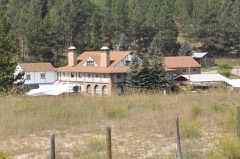 | Cambria Casino | building | 1980 | 80004058 |
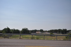 | Jenney Stockade Site | site | 1969 | 69000198 |
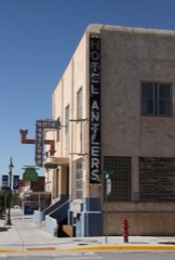 | Newcastle Commercial District | district | 2009 | 08001061 |
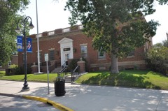 | US Post Office-Newcastle Main | building | 1987 | 87000791 |
 | Weston County Courthouse | building | 2001 | 01000930 |
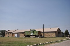 | Wyoming Army National Guard Cavalry Stable | building | 1994 | 94000680 |
Every wildfire the federal occurrence database records inside this county: 618 of them, burning about 128,469 acres. 244 started naturally and 1 was recorded as arson. Each settlement page carries the fires within five miles of it.
| Reported cause | Fires |
|---|---|
| Natural | 244 |
| Missing data/not specified/undetermined | 238 |
| Equipment and vehicle use | 36 |
| Debris and open burning | 33 |
| Power generation/transmission/distribution | 25 |
| Railroad operations and maintenance | 24 |
| Fireworks | 9 |
| Recreation and ceremony | 6 |
| Smoking | 2 |
| Arson/incendiarism | 1 |
The five largest, by the area the report gives. None of them was recorded as arson.
| Date | Cause | Size | Reported by | Name on the report |
|---|---|---|---|---|
| 29 June 2012 | Power generation/transmission/distribution | 61,416 acres | New Castle Field Office | OIL CREEK |
| 30 July 2001 | Natural | 14,990 acres | Black Hills National Forest | ELK MOUNTAIN #2 |
| 18 July 2011 | Natural | 7,462 acres | New Castle Field Office | WHOOPUP ASSIST |
| 16 August 1994 | Natural | 7,150 acres | Medicine Bow-Routt National Forests, Thunder Basin National Grassland | PETERSON-ELLIOTT |
| 27 August 2010 | Missing data/not specified/undetermined | 4,907 acres | Medicine Bow-Routt National Forests, Thunder Basin National Grassland | 35 MILE MARKER |
| 31 August 1997 | Railroad operations and maintenance | 4,415 acres | Casper Field Office | DEWEY 2 |
| 12 July 2006 | Natural | 4,242 acres | Medicine Bow-Routt National Forests, Thunder Basin National Grassland | CUMMINGS |
| 7 July 2007 | Natural | 2,445 acres | Medicine Bow-Routt National Forests, Thunder Basin National Grassland | WADE HILL |
Every settlement page carries the fires within five miles of it - see the settlement index below.
The NOAA Storm Events Database holds 524 reports for this county, causing no deaths, 3 injuries and about $2,939,410 in recorded property damage. Each settlement page carries the reports that name it.
| Kind of event | Reports |
|---|---|
| Hail | 301 |
| Thunderstorm Wind | 169 |
| Tornado | 28 |
| Flash Flood | 14 |
| Flood | 6 |
| Funnel Cloud | 3 |
| Wildfire | 1 |
| Lightning | 1 |
| Heavy Rain | 1 |
The most serious of them, by death, then injury, then recorded damage. The accounts are quoted exactly as the forecast office filed them.
| When | Event | Place named | Harm | What the report says |
|---|---|---|---|---|
| June 2001 | Tornado (F0) | Newcastle | 2 hurt | no account filed |
| June 1989 | Thunderstorm Wind | not stated | 1 hurt | no account filed |
| July 2010 | Hail | Upton | $700,000 | Large hail punctured vinyl siding, broke windows, and damaged automobiles. |
| May 2013 | Hail | Newcastle | $500,000 | no account filed |
| October 2011 | Thunderstorm Wind | Newcastle | $250,000 | Trees, power lines, fences, and signs were blown down throughout Newcastle. Roof and window damage was reported to buildings and homes. |
| July 2011 | Hail | Upton | $250,000 | Hail damaged homes and automobiles in Upton. |
| May 1991 | Tornado (F1) | not stated | $250,000 | no account filed |
| May 2011 | Flash Flood | Osage | $163,000 | At least four inches of rain fell over eastern Weston County in less than two hours, causing flash flooding in Newcastle. Widespread street flooding damaged cars and left debris throughout the town. Numerous culverts were damaged, sewers were clogged, and basements were flooded. |
| July 2013 | Flash Flood | Rochelle | $100,000 | A flash flood collapsed a house foundation, washed away two pole barns, and swept away the contents of a shop building on a ranch. Lion Creek overtopped Lynch Road, damaging the culvert and downstream side of the road. |
| June 2010 | Thunderstorm Wind | Osage | $100,000 | Thunderstorm winds blew over a metal shed and snapped and overturned trees. |
| August 2005 | Flash Flood | Newcastle | $100,000 | Heavy rains fell across Newcastle during the early evening hours. Two to four inches of rain fell in about an hour, causing flooding of streets and residences north and west of downtown. Previous rains earlier in the week saturated the soil and may have contributed to more severe flooding. Loose debris and wood clogged culverts, worsening flooding near and along the railroad tracks northwest of downtown Newcastle. Some minor damage was noted as water entered some homes. A beauty shop in downtown Newcastle also reported some minor damage from flooding. |
| July 2010 | Thunderstorm Wind | Newcastle | $75,000 | Wind gusts estimated at 70 mph caused minor damage in Newcastle, including trees and branches blown down. |
| May 2011 | Flash Flood | Upton | $50,000 | Heavy rain caused flash flooding in Upton. Over six inches of water flowed down Division Street and water covered sidewalks along Highway 16. |
| June 2015 | Flash Flood | Rochelle | $30,000 | Runoff from heavy rain flooded and washed out several roads. Hay Creek flooded Dewey Road between Highway 85 and the South Dakota border. Lynch Road near the AU7 Ranch was washed out. Spring Creek washed out a section of Spring Creek Road. |
| August 2019 | Flash Flood | Newcastle Arpt | $25,000 | Numerous roads around Newcastle were flooded. Morrisey Road at Highway 16 was damaged from a culvert washout. |
| June 2013 | Flash Flood | Four Corners | $25,000 | West Plum Creek, which is normally dry, quickly rose to eight feet deep and thirty feet wide. Plum Creek Road, Big Plum Road, and Oil Creek Road were damaged when water and debris flowed over them. |
| September 2002 | Thunderstorm Wind | Clareton | $25,000 | no account filed |
| July 1964 | Tornado (F2) | not stated | $25,000 | no account filed |
| June 1958 | Tornado (F2) | not stated | $25,000 | no account filed |
| July 2015 | Thunderstorm Wind | Upton | $20,000 | Considerable wind damage occurred to trees and roofs. Some power lines were blown down. |
| June 2012 | Hail | Upton | $20,000 | no account filed |
| July 2010 | Hail | Osage | $20,000 | no account filed |
| July 2009 | Thunderstorm Wind | Osage | $15,000 | Numerous trees were blown down by strong wind gusts, including a 30 inch diameter tree blown onto a garage. Wind-driven hail broke a skylight and skirting on a mobile home and windows. |
| August 2002 | Thunderstorm Wind | Upton | $15,000 | no account filed |
| August 2002 | Thunderstorm Wind | Upton | $15,000 | no account filed |
| July 2019 | Flood | Newcastle | $10,000 | Dewey Road was inundated with water in several locations. A culvert on Dewey Road near Hay Creek was washed out. |
| July 2015 | Thunderstorm Wind | Upton | $10,000 | Two trailer houses and a stock tank were blown away, hay bales rolled from fields onto a county road, large limbs broke off trees, and shingles were blown off sheds. |
| July 2015 | Thunderstorm Wind | Newcastle | $10,000 | Ten empty coal train cars were derailed by strong wind gusts. |
| August 2013 | Flash Flood | Osage | $10,000 | Heavy rain caused flooding along Skull Creek Road, Oil Creek Road, Green Mountain Road, and Purvis Road. One and a half inches of rain fell in 20 minutes north of Four Corners. Water covered the westbound lane of U.S. Highway 16 near the intersection with Highway 450. |
| October 2011 | Thunderstorm Wind | Osage | $10,000 | Strong winds damaged a house roof and tree limbs, broke a 500 gallon fiberglass tank into three pieces, and blew the pieces a mile away. |
| July 2010 | Thunderstorm Wind | Upton | $10,000 | The combination of large hail and wind broke windows, damaged automobiles, and brought down three to four inch tree branches. |
| August 2001 | Thunderstorm Wind | Upton | $10,000 | Part of a roof was blown off a house and into a neighbor's garage. |
| August 2013 | Hail | Four Corners | $10,000 | no account filed |
| August 2019 | Hail | Clareton | $5,000 | Wind driven hail broke windows in a house. |
| August 2015 | Thunderstorm Wind | Newcastle | $5,000 | Wind -riven small hail broke windows, damaged siding, and snapped trees. |
| June 2010 | Thunderstorm Wind | Osage | $5,000 | A metal shop building was flattened by strong wind gusts. |
| June 2006 | Thunderstorm Wind | Newcastle | $5,000 | A business had a plate glass window blown out and part of its roof torn off. |
| July 2014 | Hail | Osage | $5,000 | no account filed |
| July 2013 | Hail | Four Corners | $5,000 | no account filed |
| July 2012 | Flash Flood | Osage | $5,000 | no account filed |
| July 2001 | Thunderstorm Wind | Osage | $5,000 | no account filed |
| July 2009 | Thunderstorm Wind | Newcastle | $4,000 | A storage shed was destroyed, large tree branches were blown down, and shingles were torn off a house. |
| July 1963 | Tornado (F1) | not stated | $2,500 | no account filed |
| June 1962 | Tornado | not stated | $2,500 | no account filed |
| May 1953 | Tornado (F2) | not stated | $2,500 | no account filed |
| July 2014 | Hail | Newcastle | $2,000 | Large hail ripped bark off trees, dented cars, and smashed a rain gauge. |
| August 2002 | Thunderstorm Wind | Upton | $2,000 | A ten inch diameter tree was snapped and landed on a car. |
| July 2013 | Hail | Four Corners | $2,000 | no account filed |
| August 2015 | Thunderstorm Wind | Newcastle | $1,000 | A warning siren pole fell on a power line. |
| May 2007 | Thunderstorm Wind | Newcastle | $1,000 | A railroad crossing arm was broken off its post at the Main Street crossing. |
| October 2011 | Thunderstorm Wind | Upton | $500 | Minor roof damage was reported. |
| July 2009 | Hail | Clareton | $500 | A garage window was broken by the hail. |
| June 1996 | Hail | Clareton | $500 | no account filed |
| August 1966 | Tornado | not stated | $250 | no account filed |
| May 2007 | Thunderstorm Wind | Four Corners | $100 | Wind caused minor damage to an outbuilding. |
| July 1958 | Tornado (F1) | not stated | $30 | no account filed |
| June 1950 | Tornado (F1) | not stated | $30 | no account filed |
| July 2025 | Thunderstorm Wind | Newcastle | - | Mesonet recorded wind gust. |
| July 2025 | Thunderstorm Wind | Rochelle | - | Mesonet recorded wind gust. |
| September 2025 | Thunderstorm Wind | Osage | - | WY Mesonet Site measured wind gust. |
The Survey's mineral resources record lists 118 workings inside this county. 5 still produce and 113 are closed or unrecorded. Each settlement page carries the workings within five miles of it.
| Commodity | Workings |
|---|---|
| Sand and Gravel, Construction | 30 |
| Bentonite | 28 |
| Uranium | 23 |
| Gypsum-Anhydrite | 13 |
| Limestone, General | 7 |
| Stone, Crushed/Broken | 6 |
| Fire Clay (Refractory) | 2 |
| Salt | 2 |
| Lead, Silver | 1 |
| Zeolites | 1 |
| Clay | 1 |
| Barium-Barite | 1 |
| Flagstone | 1 |
| Copper, Gold | 1 |
The least common of them first, because a county's hundredth gravel pit says nothing its first ten did not.
| Where | Site | Commodity | Status | Recorded |
|---|---|---|---|---|
| Near Pedro | Zeolites | Occurrence | ||
| Newcastle #2 | Clay | Occurrence | ||
| Unknown | Lead, Silver | Past Producer | ||
| Unknown | Barium-Barite | Occurrence | ||
| Unknown | Flagstone | Producer | ||
| Unknown | Copper, Gold | Occurrence | ||
| Unknown | Manganese | Occurrence | ||
| Unknown | Clay, Fire Clay (Refractory) | Prospect | ||
| Cambria Area | Fire Clay (Refractory) | Occurrence | ||
| Newcastle #1 | Fire Clay (Refractory) | Occurrence | ||
| Salt Creek | Salt | Prospect | ||
| Unknown | Salt | Prospect | ||
| Government Limestone Quarry | Stone, Crushed/Broken | Past Producer | ||
| Lak Reservoir Area #2 | Stone, Crushed/Broken | Occurrence | ||
| Lak Reservoir Area #3 | Stone, Crushed/Broken | Occurrence | ||
| Rawhauser Quarry | Stone, Crushed/Broken | Past Producer | ||
| Stockade Beaver Creek #2 | Stone, Crushed/Broken | Occurrence | ||
| Unknown | Stone, Crushed/Broken | Occurrence | ||
| Unknown | Limestone, General | Occurrence | ||
| Unknown | Limestone, General | Prospect | ||
| Unknown | Limestone, General | Prospect | ||
| Unknown | Limestone, General | Prospect | ||
| Unknown | Limestone, General | Prospect | ||
| Unknown | Limestone, General | Producer | ||
| Unnamed | Limestone, General | Prospect | ||
| Beaver Creek | Bentonite, Gypsum-Anhydrite | Occurrence | ||
| Cedar Ridge | Gypsum-Anhydrite | Occurrence | ||
| Lak Reservoir Area #1 | Gypsum-Anhydrite | Occurrence | ||
| North of Newcastle | Gypsum-Anhydrite | Occurrence | ||
| Oil Creek | Gypsum-Anhydrite | Occurrence | ||
| Red Creek Area | Gypsum-Anhydrite | Occurrence | ||
| Sheldon Canyon | Gypsum-Anhydrite | Occurrence | ||
| Stockade Beaver Creek #1 | Gypsum-Anhydrite | Occurrence | ||
| Strawberry Mountain Area | Gypsum-Anhydrite | Occurrence | ||
| Unknown | Gypsum-Anhydrite | Prospect | ||
| Unknown | Gypsum-Anhydrite | Occurrence | ||
| Unknown | Gypsum-Anhydrite | Prospect | ||
| Unknown | Gypsum-Anhydrite | Prospect | ||
| Alray Uranium Mine | Uranium | Occurrence | Stratabound | |
| Elk Mountain (uranium) | Uranium | Past Producer | ||
| Farclin ? | Uranium | Prospect | ||
| Farley No.1 | Uranium | Prospect | ||
| Farley No.2 | Uranium | Prospect | ||
| Farley No.3 | Uranium | Prospect | ||
| Foster | Uranium | Past Producer | ||
| Goodson Prop No 1 | Uranium | Occurrence | ||
| Goodson Prop No 2 | Uranium | Occurrence | ||
| Heetland | Uranium | Unknown | ||
| Homestake 2 | Uranium | Unknown | ||
| Homestake Pit No. 1 | Uranium | Unknown | ||
| Homestake Pit No. 2 | Uranium | Unknown | ||
| Homestake Pit No. 3 | Uranium | Unknown | ||
| Homestake Pit No. 4 | Uranium | Unknown | ||
| Homestake Pit No. 5 | Uranium | Unknown | ||
| L. Shuck Property | Uranium | Occurrence | ||
| Myers | Uranium | Unknown | ||
| Rushmore Clareton U. Prop. | Uranium | Occurrence | ||
| Sunny Divide | Uranium | Unknown | ||
| Unknown | Uranium | Occurrence | ||
| Unknown | Uranium | Occurrence | ||
| Wicker-Baldwin Prospect | Uranium | Past Producer | Metatyuyamunite | |
| American Uptton Mill | Bentonite | Producer | ||
| Federal Upton Mill | Bentonite | Producer | ||
| Jerome Area | Bentonite | Unknown | ||
| Lucky Strike Bentonite Mine | Bentonite | Unknown | ||
| Osage | Bentonite | Occurrence | ||
| Osage,Clay Spur Quarries | Bentonite | Producer | ||
| Owens Draw | Bentonite | Occurrence | ||
| Pedro Area #1 | Bentonite | Occurrence | ||
| Pedro Area #2 | Bentonite | Unknown | ||
| Pedro Area #3 | Bentonite | Unknown | ||
| Pine Ridge | Bentonite | Unknown | ||
| Sheep Creek | Bentonite | Occurrence | ||
| Thornton Dome | Bentonite | Occurrence | ||
| Turner Creek | Bentonite | Occurrence | ||
| Unknown | Bentonite | Prospect | ||
| Unknown | Bentonite | Occurrence | ||
| Unknown | Bentonite | Unknown | ||
| Unknown | Bentonite | Occurrence | ||
| Unknown | Bentonite | Occurrence | ||
| Unknown | Bentonite | Occurrence | ||
| Unknown | Bentonite | Occurrence | ||
| Unknown | Bentonite | Past Producer | ||
| Unknown | Bentonite | Prospect | ||
| Unnamed | Bentonite | Occurrence | ||
| Upton #1 | Bentonite | Unknown | ||
| Upton #2 | Bentonite | Unknown | ||
| Upton Bentonite Mine | Bentonite | Occurrence | ||
| Airport Shale Pit | Sand and Gravel, Construction | Past Producer | ||
| Carl Shale | Sand and Gravel, Construction | Past Producer | ||
| Dry Creek Pit | Sand and Gravel, Construction | Past Producer | ||
| Elliot | Sand and Gravel, Construction | Past Producer | ||
| F - One Eleven | Sand and Gravel, Construction | Past Producer | ||
| Frontier Homes Pit | Sand and Gravel, Construction | Past Producer | ||
| Gerald Barrow #2 | Sand and Gravel, Construction | Past Producer | ||
| Gerald Darrow #1 | Sand and Gravel, Construction | Past Producer | ||
| Gerald Darrow #3 | Sand and Gravel, Construction | Past Producer | ||
| Harriet Peterson #1 | Sand and Gravel, Construction | Past Producer | ||
| Harriet Peterson #2 | Sand and Gravel, Construction | Past Producer | ||
| High School Pit | Sand and Gravel, Construction | Past Producer | ||
| Joe Fordyce Pit | Sand and Gravel, Construction | Past Producer | ||
| Last Chance Filler Pit | Sand and Gravel, Construction | Past Producer | ||
| Miller Quarry | Sand and Gravel, Construction | Past Producer | ||
| Morrison Pit | Sand and Gravel, Construction | Past Producer | ||
| O'Neil Pit | Sand and Gravel, Construction | Past Producer | ||
| Raby Pit | Sand and Gravel, Construction | Past Producer | ||
| Raby Pit | Sand and Gravel, Construction | Past Producer | ||
| Rawhauser Sand Pit | Sand and Gravel, Construction | Past Producer | ||
| Roundhouse | Sand and Gravel, Construction | Past Producer | ||
| Sod House Pit | Sand and Gravel, Construction | Past Producer | ||
| State Land Quarry | Sand and Gravel, Construction | Past Producer | ||
| State Land Sand Pit | Sand and Gravel, Construction | Past Producer | ||
| Sweet Gravel Pit | Sand and Gravel, Construction | Past Producer | ||
| Tavegia Pit | Sand and Gravel, Construction | Past Producer | ||
| Usfs #1 | Sand and Gravel, Construction | Past Producer | ||
| Usfs #2 | Sand and Gravel, Construction | Past Producer | ||
| Usfs #3 | Sand and Gravel, Construction | Past Producer | ||
| Voss | Sand and Gravel, Construction | Past Producer |
Named settlements recorded in the Geographic Names Information System, each with the topographic sheets covering it. Villages, hamlets and abandoned places alike. Each is shown with the nearest named watercourse or landform and the survey quadrangle it falls on.
Newcastle census division · 82701 · Near Jumbo Table · Cambria quadrangle
11 sheets, 1899 to 1984
No longer a settlement
Newcastle census division · 82701 · Clareton quadrangle
5 sheets, 1955 to 1982
No longer a settlement
Newcastle census division · 82730 · On East Iron Creek · Clay Spur quadrangle
16 sheets, 1898 to 1984
Newcastle census division · 82701 · In Clifton Canyon · Clifton quadrangle
12 sheets, 1899 to 1979
Newcastle census division · 82701 · Near Canyon Springs Prairie · Four Corners quadrangle
15 sheets, 1898 to 1984
No longer a settlement
Newcastle census division · 82701 · Near Johnson Draw · Newcastle quadrangle
13 sheets, 1899 to 1979
Upton census division · 82730 · On Jerome Creek · Upton East quadrangle
12 sheets, 1918 to 1984
Newcastle census division · 82701 · Near Whitney Draw · Morrisey quadrangle
9 sheets, 1899 to 1982
Newcastle census division · 82701 · Near Cave Spring Canyon · Newcastle quadrangle
13 sheets, 1899 to 1979
Newcastle census division · 82723 · On West Fork Skull Creek · Skull Creek quadrangle
16 sheets, 1898 to 1984
Upton census division · 82730 · Near Dry Draw · Thornton quadrangle
12 sheets, 1918 to 1984
The vanished settlements of Weston County: the places named above that are no longer on the map.