 Block
From the record
15 National Register listings published here, 1 of them a National Historic Landmark.
Sources: the National Register database, National Park Service
217 topographic sheets cover 90 settlements here, and 15 properties are on the National Register of Historic Places.
15 National Register listings published here, 1 of them a National Historic Landmark.
Sources: the National Register database, National Park Service
Every property in this county listed on the National Register of Historic Places, with the year it was listed and the federal nomination document.
| Photograph | Property | Type | Listed | Reference |
|---|---|---|---|---|
| Jacob Berger House | building | 1977 | 77000219 | |
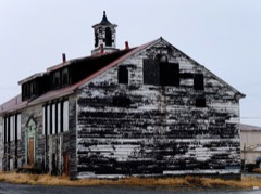 | Bureau of Indian Affairs Unalakleet School | building | 2002 | 02000536 |
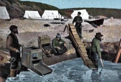 | Cape Nome Mining District Discovery Sites | district | 1978 | 78000535 |
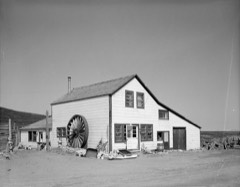 | Cape Nome Roadhouse | building | 1976 | 76000361 |
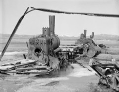 | Council City and Solomon River Railroad | district | 2001 | 01000109 |
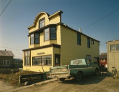 | Discovery Saloon | building | 1980 | 80000759 |
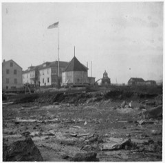 | Fort St. Michael | building | 1977 | 77000221 |
| Erik Lindblom Placer Claim | site | 1976 | 76000362 | |
| Norge Storage Site | building | 1974 | 74000441 | |
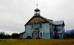 | Pilgrim Hot Springs | building | 1977 | 77000223 |
| Snow Creek Placer Claim No. 1 | site | 1976 | 76000363 | |
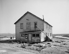 | Solomon Roadhouse | building | 1980 | 80000760 |
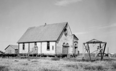 | St. Joseph's Catholic Church, Old | building | 2000 | 00000149 |
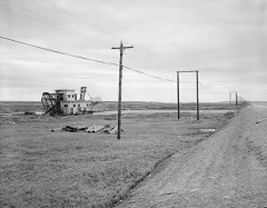 | Swanberg Dredge | structure | 2001 | 01000232 |
| Teller Mission Orphanage | building | 2001 | 01001117 |
Every wildfire the federal occurrence database records inside this county: 212 of them, burning about 452,081 acres. 179 started naturally and none was recorded as arson. Each settlement page carries the fires within five miles of it.
| Reported cause | Fires |
|---|---|
| Natural | 179 |
| Missing data/not specified/undetermined | 13 |
| Debris and open burning | 8 |
| Equipment and vehicle use | 5 |
| Recreation and ceremony | 4 |
| Smoking | 2 |
| Misuse of fire by a minor | 1 |
The five largest, by the area the report gives. None of them was recorded as arson.
| Date | Cause | Size | Reported by | Name on the report |
|---|---|---|---|---|
| 10 June 2019 | Natural | 111,898 acres | Alaska State Office | NORTH RIVER |
| 22 July 1997 | Natural | 76,300 acres | Alaska Fire Service | 732621 GAR |
| 20 June 2015 | Natural | 49,182 acres | Alaska Fire Service | OLD WOMAN |
| 22 June 2015 | Natural | 23,272 acres | Alaska Fire Service | KOYUK |
| 19 July 2015 | Natural | 21,698 acres | Alaska Fire Service | MINGVK |
| 4 August 2002 | Equipment and vehicle use | 21,575 acres | Alaska Fire Service | MP 85 |
| 20 June 2015 | Natural | 20,049 acres | Alaska Fire Service | SISTERS |
| 6 June 2017 | Natural | 16,003 acres | Alaska Fire Service | TOIK HILL |
Every settlement page carries the fires within five miles of it - see the settlement index below.
The NOAA Storm Events Database holds 5 reports for this county, causing no deaths, no injuries and about $11,000 in recorded property damage. Each settlement page carries the reports that name it.
| Kind of event | Reports |
|---|---|
| Flood | 5 |
The most serious of them, by death, then injury, then recorded damage. The accounts are quoted exactly as the forecast office filed them.
| When | Event | Place named | Harm | What the report says |
|---|---|---|---|---|
| May 2009 | Flood | Brevig Mission | $3,000 | no account filed |
| May 2009 | Flood | Nome | $3,000 | no account filed |
| May 2009 | Flood | Pilgrim Hot Springs | $3,000 | no account filed |
| May 2009 | Flood | Nome | $2,000 | no account filed |
| April 2014 | Flood | Brevig Mission | - | no account filed |
Named settlements recorded in the Geographic Names Information System, each with the topographic sheets covering it. Villages, hamlets and abandoned places alike. Each is shown with the nearest named watercourse or landform and the survey quadrangle it falls on.
Nome census subarea · Solomon B-3 NW quadrangle
14 sheets, 1950 to 1951
No longer a settlement
Nome census subarea · Near Sledge Island · Nome C-3 OE S NE quadrangle
8 sheets, 1950 to 1957
No longer a settlement
Nome census subarea · Near Sledge Island · Nome C-3 OE S NE quadrangle
8 sheets, 1950 to 1957
No longer a settlement
Nome census subarea · On Nunavulnuk River · Saint Michael B-1 NW quadrangle
8 sheets, 1951 to 1964
No longer a settlement
Nome census subarea · On Bering Creek · Teller A-3 NW quadrangle
15 sheets, 1950 to 1958
No longer a settlement
Nome census subarea · 99762 · Near Quincy Gulch · Nome C-1 SE quadrangle
12 sheets, 1950 to 1957
Nome census subarea · 99785 · On Shelman Creek · Teller B-3 SW quadrangle
16 sheets, 1950 to 1958
Nome census subarea · 99762 · Near Homestake Gulch · Solomon D-5 SW quadrangle
13 sheets, 1907 to 1951
Nome census subarea · On Kenwood Creek · Candle A-5 SE quadrangle
13 sheets, 1950 to 1964
Nome census subarea · 99762 · Near Little Diomede Island · Teller D-8 SW quadrangle
12 sheets, 1950 to 1958
Nome census subarea · 99762 · On Wonder Creek · Nome C-1 SW quadrangle
12 sheets, 1950 to 1957
No longer a settlement
Nome census subarea · On Vinegar Creek · Solomon C-5 NW quadrangle
13 sheets, 1907 to 1951
Nome census subarea · 99684 · On Egavik Creek · Norton Bay A-4 SW quadrangle
11 sheets, 1948 to 1955
Nome census subarea · 99762 · On Cheenik Creek · Solomon C-3 SE quadrangle
11 sheets, 1950 to 1951
Nome census subarea · 99762 · On Nugget Creek · Nome B-1 NE quadrangle
11 sheets, 1950 to 1957
No longer a settlement
Nome census subarea · Solomon B-3 NE quadrangle
11 sheets, 1950 to 1951
No longer a settlement
Nome census subarea · 99762 · Solomon B-6 NW quadrangle
11 sheets, 1950 to 1951
No longer a settlement
Nome census subarea · 99762 · On Iron Creek · Solomon D-6 NE quadrangle
11 sheets, 1950 to 1951
Nome census subarea · Teller B-4 SW quadrangle
14 sheets, 1950 to 1958
No longer a settlement
Nome census subarea · Teller A-4 SE quadrangle
24 sheets, 1950 to 1958
No longer a settlement
Nome census subarea · Saint Lawrence C-6 SW quadrangle
10 sheets, 1948 to 1964
No longer a settlement
Nome census subarea · On Pilgrim River · Teller A-1 NW quadrangle
14 sheets, 1950 to 1958
No longer a settlement
Nome census subarea · Teller A-2 NE quadrangle
17 sheets, 1950 to 1958
No longer a settlement
Nome census subarea · On Klikitarik River · Unalakleet B-5 NW quadrangle
12 sheets, 1951 to 1964
Nome census subarea · Saint Lawrence D-3 SW quadrangle
10 sheets, 1948 to 1964
No longer a settlement
Nome census subarea · On McKinley Creek · Teller B-3 SE quadrangle
16 sheets, 1950 to 1958
No longer a settlement
Nome census subarea · 99753 · On Koyuk River · Norton Bay D-5 NE quadrangle
11 sheets, 1948 to 1955
Nome census subarea · 99739 · Solomon C-1 SE quadrangle
12 sheets, 1950 to 1951
No longer a settlement
Nome census subarea · On Kwik River · Norton Bay D-6 SE quadrangle
10 sheets, 1948 to 1955
No longer a settlement
Nome census subarea · 99739 · On Kwiniuk River · Solomon C-1 NE quadrangle
12 sheets, 1950 to 1951
Nome census subarea · 99739 · On Kwiniuk River · Solomon C-1 NE quadrangle
12 sheets, 1950 to 1951
Nome census subarea · 99772 · On Ocean Creek · Teller C-6 SW quadrangle
15 sheets, 1950 to 1958
No longer a settlement
Nome census subarea · 99762 · On Moonlight Creek · Nome C-1 SW quadrangle
12 sheets, 1950 to 1957
Nome census subarea · On Paystreak Creek · Bendeleben A-6 SW quadrangle
12 sheets, 1950 to 1964
Nome census subarea · On Quartz Creek · Solomon C-5 NW quadrangle
13 sheets, 1907 to 1951
Nome census subarea · 99659 · Near Channel Island · Saint Michael B-1 NE quadrangle
8 sheets, 1951 to 1964
Nome census subarea · 99769 · On Sawoonhak Creek · Saint Lawrence D-3 SW quadrangle
10 sheets, 1948 to 1964
Nome census subarea · 99772 · Bendeleben D-6 SE quadrangle
12 sheets, 1950 to 1964
Nome census subarea · On Little Ptarmigan Creek · Bendeleben A-6 NW quadrangle
12 sheets, 1950 to 1964
No longer a settlement
Nome census subarea · Teller A-3 NE quadrangle
15 sheets, 1950 to 1958
No longer a settlement
Nome census subarea · On Sinuk · Nome C-3 SW quadrangle
11 sheets, 1950 to 1975
No longer a settlement
Nome census subarea · 99762 · On Negsue Creek · Nome C-2 SE quadrangle
11 sheets, 1950 to 1957
No longer a settlement
Nome census subarea · Bendeleben B-5 NE quadrangle
12 sheets, 1950 to 1964
No longer a settlement
Nome census subarea · On McDame Creek · Teller A-3 SE quadrangle
15 sheets, 1950 to 1958
No longer a settlement
Nome census subarea · On Alder Creek · Teller A-3 SE quadrangle
15 sheets, 1950 to 1958
Nome census subarea · 99762 · Near Grass Gulch · Nome C-1 SW quadrangle
12 sheets, 1950 to 1957
Nome census subarea · Nome C-3 SE quadrangle
11 sheets, 1950 to 1975
No longer a settlement
Nome census subarea · Teller D-6 SE quadrangle
15 sheets, 1950 to 1958
No longer a settlement
Nome census subarea · 99783 · On Village Creek · Teller C-7 SE quadrangle
15 sheets, 1950 to 1958
No longer a settlement
Nome census subarea · 99659 · Near Beulah Island · Saint Michael B-1 NE quadrangle
8 sheets, 1951 to 1964
No longer a settlement
Nome census subarea · On Shorty Creek · Unalakleet C-5 SE quadrangle
13 sheets, 1951 to 1964
No longer a settlement
Nome census subarea · 99772 · On Cape Creek · Teller C-6 SW quadrangle
15 sheets, 1950 to 1958
Nome census subarea · On Junction Creek · Norton Bay A-4 NW quadrangle
11 sheets, 1948 to 1955
No longer a settlement
Nome census subarea · Norton Bay B-4 SW quadrangle
11 sheets, 1948 to 1955
No longer a settlement
Nome census subarea · On Surprise Creek · Solomon C-4 SW quadrangle
11 sheets, 1950 to 1951
No longer a settlement
Nome census subarea · Near Bald Head · Norton Bay C-6 NE quadrangle
12 sheets, 1948 to 1955
No longer a settlement
Nome census subarea · On Tuksuk Channel · Teller A-3 NE quadrangle
15 sheets, 1950 to 1958
No longer a settlement
Nome census subarea · On Ponluktule Creek · Unalakleet C-5 SE quadrangle
15 sheets, 1951 to 1964
No longer a settlement
Nome census subarea · 99762 · On Nome River · Nome B-1 NW quadrangle
11 sheets, 1950 to 1957
No longer a settlement
Nome census subarea · Solomon B-3 NE quadrangle
15 sheets, 1950 to 1951
No longer a settlement
Nome census subarea · 99684 · Unalakleet D-3 NW quadrangle
13 sheets, 1950 to 1964
No longer a settlement
Nome census subarea · 99684 · On Trail Creek · Unalakleet D-4 SW quadrangle
12 sheets, 1950 to 1964
Nome census subarea · Norton Bay C-4 SW quadrangle
10 sheets, 1948 to 1955
No longer a settlement
Nome census subarea · 99783 · On Village Creek · Teller C-7 SE quadrangle
15 sheets, 1950 to 1958
Nome census subarea · 99739 · On Walla Walla Creek · Solomon C-1 SW quadrangle
12 sheets, 1950 to 1951
Nome census subarea · 99772 · On Anikovik River · Teller B-6 NE quadrangle
14 sheets, 1950 to 1958
The vanished settlements of Nome Census Area: the places named above that are no longer on the map.