 Block
From the record
6 National Register listings published here, 1 of them a National Historic Landmark.
Sources: the National Register database, National Park Service
198 topographic sheets cover 38 settlements here, and 6 properties are on the National Register of Historic Places.
6 National Register listings published here, 1 of them a National Historic Landmark.
Sources: the National Register database, National Park Service
Every property in this county listed on the National Register of Historic Places, with the year it was listed and the federal nomination document.
| Photograph | Property | Type | Listed | Reference |
|---|---|---|---|---|
| Aluakpak | site | 1980 | 80004555 | |
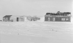 | Leffingwell Camp Site | site | 1971 | 71001093 |
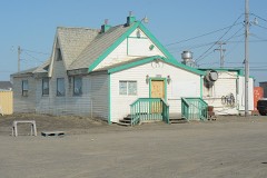 | Point Barrow Refuge Station | building | 1980 | 80004563 |
| Prudhoe Bay Oil Field Discovery Well Site | site | 2000 | 00000264 | |
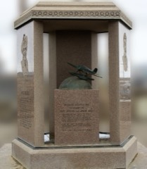 | Rogers-Post Site | site | 1980 | 80004564 |
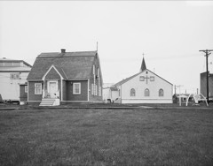 | Utkeagvik Church Manse | building | 1983 | 83003447 |
Every wildfire the federal occurrence database records inside this county: 62 of them, burning about 415,011 acres. 56 started naturally and none was recorded as arson. Each settlement page carries the fires within five miles of it.
| Reported cause | Fires |
|---|---|
| Natural | 56 |
| Missing data/not specified/undetermined | 3 |
| Debris and open burning | 1 |
| Equipment and vehicle use | 1 |
| Fireworks | 1 |
The five largest, by the area the report gives. None of them was recorded as arson.
| Date | Cause | Size | Reported by | Name on the report |
|---|---|---|---|---|
| 16 July 2007 | Natural | 256,734 acres | Alaska Fire Service | ANAKTUVUK RIVER |
| 22 July 1993 | Natural | 82,370 acres | Alaska Fire Service | DCKN190 |
| 18 June 2012 | Natural | 18,850 acres | Alaska Fire Service | KUCHER CREEK |
| 3 July 1993 | Natural | 16,740 acres | Alaska Fire Service | DCKN 178 |
| 4 June 2018 | Natural | 14,548 acres | Alaska Fire Service | TUSIKPAK LAKE |
| 18 June 2012 | Natural | 3,619 acres | Alaska Fire Service | KNIFEBLADE RIDGE |
| 28 June 2017 | Natural | 2,870 acres | Alaska Fire Service | KETIK RIVER |
| 19 June 2012 | Natural | 2,311 acres | Alaska Fire Service | ITKILLIK RIVER |
Every settlement page carries the fires within five miles of it - see the settlement index below.
The NOAA Storm Events Database holds 8 reports for this county, causing no deaths, no injuries and about $15,504,500 in recorded property damage. Each settlement page carries the reports that name it.
| Kind of event | Reports |
|---|---|
| Flood | 8 |
The most serious of them, by death, then injury, then recorded damage. The accounts are quoted exactly as the forecast office filed them.
| When | Event | Place named | Harm | What the report says |
|---|---|---|---|---|
| May 2015 | Flood | Deadhorse | $15,500,000 | no account filed |
| June 2014 | Flood | Kuparuk | $2,000 | no account filed |
| May 2009 | Flood | Nuiqsut | $1,500 | no account filed |
| June 2013 | Flood | Nuiqsut | $1,000 | no account filed |
| June 2025 | Flood | Anaktuvuk Pass | - | AKDOT reported water overtopping roads and bridges throughout the area. As meltwater volume increased, major impacts followed including a significant washout at MP 315 on June 14th forced a four-day closure of the highway. |
| June 2025 | Flood | Sagwon | - | AKDOT reported extensive bank erosion and flooding from the Sag River along multiple stretches of the Dalton highway, with water overtopping roads and bridges throughout the area. As a result the Dalton highway was closed from Milepost 314-355. |
| June 2024 | Flood | Deadhorse | - | On June 7th at 1500 AKDT, a USGS hydro technician observed an ice jam downstream of Spine road. The Kupurak Roads and Pads Foreman reported that the causeway approaches to bridges were flooded and that water went over the road on Sunday June 9th and rose Sunday night with an estimated 0.5 feet of water on the road. Water levels at the KUPA2 (Kuparuk River near Deadhorse) gage hit minor flood stage of 35.5 feet on Sunday June 9th at 0500 AKDT and rose steadily until early afternoon. There was a steep rise from mid-afternoon through 1900 AKDT to a relatively flat plateau around 36.7 feet. The Kuparuk Roads and Pads Foreman reported water was 0.7 feet deep over the road and that vehicles were being escorted across. On June 11th at 1200 AKDT the sate at KUPA2 was around 36.3 feet. Water levels remained above minor flood stage until late morning on June 12 when recession steepened, and fell below action state by the morning of June 13th. |
| June 2023 | Flood | Deadhorse | - | The main flow of the Sagavanirktok (Sag) River was diverted to the farthest west channel of the river due to aurfeis blocking the channel. The Sag River was pushed up against the Dalton Highway and began to erode the road near Milepost 403.5. On June 7th the road was closed at Milepost 403.5 due to the Sag River eroding the highway to the centerline with the threat of a total washout. This closure shut off the only road access to the oil fields on the North Slope of Alaska. The AK Department of Transportation immediately began hauling rock from a quarry 150 miles away in order to secure the road. The road reopened to one lane traffic on June 8th, although the threat of erosion continued for another week. Runoff from heavy rain and snowmelt in the headwaters of the Sag River reached Milepost 403.5 of the Dalton Highway on June 14th. |
Named settlements recorded in the Geographic Names Information System, each with the topographic sheets covering it. Villages, hamlets and abandoned places alike. Each is shown with the nearest named watercourse or landform and the survey quadrangle it falls on.
North Slope census subarea · 99721 · On Contact Creek · Chandler Lake A-3 NW quadrangle
13 sheets, 1951 to 1971
North Slope census subarea · On Angun River · Demarcation Point D-3 NE quadrangle
15 sheets, 1951 to 1964
North Slope census subarea · On Kapaloak Creek · Point Hope C-3 NE quadrangle
7 sheets, 1952 to 1965
No longer a settlement
North Slope census subarea · On Mitik Creek · Point Hope A-2 SE quadrangle
9 sheets, 1952 to 1965
North Slope census subarea · Near Seahorse Islands · Meade River D-5 NE quadrangle
6 sheets, 1951 to 1962
No longer a settlement
North Slope census subarea · 99734 · Beechey Point A-3 NW quadrangle
15 sheets, 1951 to 1970
North Slope census subarea · Barter Island A-5 NW quadrangle
12 sheets, 1951 to 1964
No longer a settlement
North Slope census subarea · On Kukruk Creek · Point Hope D-1 SE quadrangle
7 sheets, 1952 to 1965
No longer a settlement
North Slope census subarea · 99766 · On Isuk Creek · Point Hope A-2 NW quadrangle
9 sheets, 1952 to 1965
No longer a settlement
North Slope census subarea · Howard Pass A-1 NW quadrangle
7 sheets, 1951 to 1984
No longer a settlement
North Slope census subarea · 99747 · Barter Island A-5 NE quadrangle
12 sheets, 1951 to 1964
North Slope census subarea · On Kigalik River · Ikpikpuk River B-3 SW quadrangle
8 sheets, 1951 to 1985
No longer a settlement
North Slope census subarea · Wainwright B-3 NE quadrangle
7 sheets, 1951 to 1964
No longer a settlement
North Slope census subarea · On Kuk River · Wainwright C-2 SW quadrangle
8 sheets, 1951 to 1964
No longer a settlement
North Slope census subarea · On Kukpowruk River · Point Lay C-2 SW quadrangle
7 sheets, 1951 to 1965
No longer a settlement
North Slope census subarea · Wainwright B-3 NW quadrangle
7 sheets, 1951 to 1964
No longer a settlement
North Slope census subarea · Point Lay B-2 NW quadrangle
9 sheets, 1951 to 1965
No longer a settlement
North Slope census subarea · Point Lay D-2 NE quadrangle
7 sheets, 1951 to 1965
No longer a settlement
North Slope census subarea · Chandler Lake B-5 SE quadrangle
13 sheets, 1951 to 1987
No longer a settlement
North Slope census subarea · Wainwright D-1 NE quadrangle
9 sheets, 1951 to 1964
No longer a settlement
North Slope census subarea · 99734 · Beechey Point B-3 SE quadrangle
14 sheets, 1951 to 1970
North Slope census subarea · Wainwright C-2 NE quadrangle
10 sheets, 1951 to 1964
No longer a settlement
North Slope census subarea · On Utukok River · Wainwright A-6 SW quadrangle
7 sheets, 1951 to 1964
No longer a settlement
North Slope census subarea · Killik River D-5 NW quadrangle
15 sheets, 1951 to 1984
No longer a settlement
North Slope census subarea · On Selin Creek · Point Hope D-2 SW quadrangle
6 sheets, 1952 to 1965
The vanished settlements of North Slope Borough: the places named above that are no longer on the map.