 Block
From the record
5 National Register listings published here.
Sources: the National Register database, National Park Service
28 topographic sheets cover 6 settlements here, and 5 properties are on the National Register of Historic Places.
5 National Register listings published here.
Sources: the National Register database, National Park Service
Every property in this county listed on the National Register of Historic Places, with the year it was listed and the federal nomination document.
| Photograph | Property | Type | Listed | Reference |
|---|---|---|---|---|
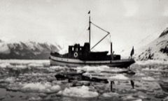 | CHUGACH (Ranger Boat) | structure | 1992 | 91001937 |
| F/V CHARLES W (Schooner) | structure | 2006 | 05000285 | |
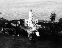 | Five Finger Light Station | district | 2004 | 04000416 |
| Five Finger Lighthouse | structure | 2004 | 04000416 |
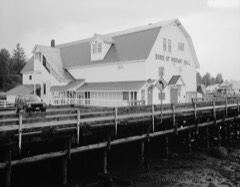 | Sons of Norway Hall | building | 1979 | 79003765 |
Every wildfire the federal occurrence database records inside this county: 39 of them, burning about 15 acres. 4 started naturally and none was recorded as arson. Each settlement page carries the fires within five miles of it.
| Reported cause | Fires |
|---|---|
| Recreation and ceremony | 26 |
| Natural | 4 |
| Debris and open burning | 4 |
| Missing data/not specified/undetermined | 2 |
| Fireworks | 1 |
| Other causes | 1 |
| Equipment and vehicle use | 1 |
The five largest, by the area the report gives. None of them was recorded as arson.
| Date | Cause | Size | Reported by | Name on the report |
|---|---|---|---|---|
| 9 May 2003 | Equipment and vehicle use | 4.5 acres | Tongass National Forest | FOURLEAF 37 |
| 6 August 1999 | Natural | 1.0 acres | Tongass National Forest | CEDAR |
| 5 May 2002 | Recreation and ceremony | 1.0 acres | Tongass National Forest | KEENE CHANNEL |
| 5 April 2003 | Recreation and ceremony | 1.0 acres | Tongass National Forest | PETERSBURG CREEK |
| 2 May 1998 | Debris and open burning | 1.0 acres | Tongass National Forest | FARRAGUT BAY |
| 13 June 2006 | Other causes | under an acre | Tongass National Forest | BACK BAY |
| 25 July 2004 | Recreation and ceremony | under an acre | Tongass National Forest | CHRISTMAS TREE |
| 14 September 1993 | Recreation and ceremony | under an acre | Tongass National Forest | not named |
Every settlement page carries the fires within five miles of it - see the settlement index below.
The NOAA Storm Events Database holds 1 report for this county, causing no deaths, no injuries and no recorded property damage. Each settlement page carries the reports that name it.
| Kind of event | Reports |
|---|---|
| Flood | 1 |
The most serious of them, by death, then injury, then recorded damage. The accounts are quoted exactly as the forecast office filed them.
| When | Event | Place named | Harm | What the report says |
|---|---|---|---|---|
| December 2020 | Flood | Petersburg | - | As the atmospheric river moved over the the central inner channels near Petersburg in the early morning hours of December 1st through the early morning of December 2nd it produced significant amount of precipitation. Through that time frame 3 to 6 of precipitation fell with the highest rain rates of .5 per hour in the morning hours of December 1st with another burst of heavy rainfall in the evening. Falls Creek along Mitkof highway in Petersburg rose quickly from the heavy precipitation along with added runoff from snowmelt at higher elevations. The creek went above minor flood stage in the late morning of December 1st and continued to climb above moderate flood stage of 24 feet in the afternoon. The creek crested at 24.38 feet for a 5 foot rise and produced some impacts to the highway. AKDOT had to close the road at times the night of December 1st due to about 8 to 10 inches of water running over the road along with debris that had to clear off the road. |
Named settlements recorded in the Geographic Names Information System, each with the topographic sheets covering it. Villages, hamlets and abandoned places alike. Each is shown with the nearest named watercourse or landform and the survey quadrangle it falls on.
Petersburg census subarea · 99833 · On Petersburg Creek · Petersburg D-3 SW quadrangle
13 sheets, 1952 to 1995
Petersburg census subarea · 99833 · Near Sasby Island · Petersburg D-3 SW quadrangle
13 sheets, 1952 to 1995
Petersburg census subarea · 99833 · On Twin Creek · Petersburg C-3 NW quadrangle
12 sheets, 1948 to 1992
No longer a settlement
The vanished settlements of Petersburg Borough: the places named above that are no longer on the map.