 Block
From the record
4 National Register listings published here.
Sources: the National Register database, National Park Service
38 topographic sheets cover 5 settlements here, and 4 properties are on the National Register of Historic Places.
4 National Register listings published here.
Sources: the National Register database, National Park Service
Every property in this county listed on the National Register of Historic Places, with the year it was listed and the federal nomination document.
| Photograph | Property | Type | Listed | Reference |
|---|---|---|---|---|
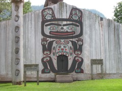 | Chief Shakes Historic Site | building | 1970 | 70000918 |
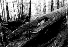 | ETOLIN CANOE | site | 1989 | 88001061 |
| JUDITH ANN (Riverboat) | structure | 2004 | 04000658 | |
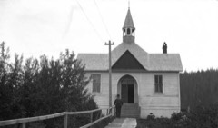 | Saint Philip's Episcopal Church | building | 1987 | 87000654 |
Every wildfire the federal occurrence database records inside this county: 39 of them, burning about 26 acres. 11 started naturally and 1 was recorded as arson. Each settlement page carries the fires within five miles of it.
| Reported cause | Fires |
|---|---|
| Recreation and ceremony | 19 |
| Natural | 11 |
| Debris and open burning | 3 |
| Smoking | 2 |
| Equipment and vehicle use | 2 |
| Missing data/not specified/undetermined | 1 |
| Arson/incendiarism | 1 |
The five largest, by the area the report gives. One of them was set deliberately.
| Date | Cause | Size | Reported by | Name on the report |
|---|---|---|---|---|
| 15 August 2004 | Natural | 6.0 acres | Tongass National Forest | RAINBOW FALLS |
| 6 May 2002 | Debris and open burning | 4.0 acres | Tongass National Forest | UNION BAY |
| 27 June 2019 | Natural | 3.0 acres | Tongass National Forest | SOUTHEAST COVE |
| 3 May 2003 | Recreation and ceremony | 2.0 acres | Tongass National Forest | HIGHLINE |
| 18 July 1999 | Arson/incendiarism | 2.0 acres | Tongass National Forest | KETILI |
| 14 July 1993 | Natural | 1.0 acres | Tongass National Forest | not named |
| 22 June 2004 | Recreation and ceremony | 1.0 acres | Tongass National Forest | WHISKEY COVE |
| 3 August 2009 | Equipment and vehicle use | 1.0 acres | Tongass National Forest | HIGHBUSH |
Every settlement page carries the fires within five miles of it - see the settlement index below.
The NOAA Storm Events Database holds 3 reports for this county, causing 6 deaths, 1 injury and about $1,620,000 in recorded property damage. Each settlement page carries the reports that name it.
| Kind of event | Reports |
|---|---|
| Flood | 2 |
| Debris Flow | 1 |
The most serious of them, by death, then injury, then recorded damage. The accounts are quoted exactly as the forecast office filed them.
| When | Event | Place named | Harm | What the report says |
|---|---|---|---|---|
| November 2023 | Debris Flow | Wrangell | 6 killed, 1 hurt, $1,600,000 | By the early evening as the front was moving eastward a landslide was reported near mile post 11 south of Wrangell along the Zimovia Highway, which blocked the road and cut power to residents on the other side of the slide. The landslide resulted in 6 people perishing and 3 homes being destroyed, one person survived as they were saved by search and rescue personnel. The area around the slide was evacuated and homes to the south of the slide were without power for multiple days. Supplies were brought to the cutoff homes via boat. ||Rain amounts around Wrangell were around 3 inches for 24 hours but half of that amount fell within 6 hours preceding the landslide being reported along with high wind gusts at a 900 foot weather station just west of Wrangell on Zarembo Island. There was another large landslide that came down on the next ridge to the east along the Middle Ridge forest service road. This blocked the road and a person had to spend the night in his car as the road was blocked in both directions. |
| January 2014 | Flood | Klawock | $10,000 | It rained seventeen point thirty four inches over a thirty seven day period on Prince of Wales Island. There was just two days over that period of time that no rain fell for an average of just under one half of an inch of rain per day. The strong weather front that moved over the area on January 14 produced two point forty two inches and broke the daily rainfall record, the previous record was one point forty seven inches from 2007. All of the record rainfall that day transferred into runoff and produced a record stream flow stage along the Staney Creek of seventeen point fifty five feet which broke the previous record of seventeen point twenty from 1993. There was moderate flooding from the rainfall along local streams and rivers with some impacts to homes. The very moist antecedent soil conditions, high rain rates along with strong winds gusts of fifty mph triggered land/mudslides near steep terrain and logging areas. These slides knocked down power lines and blocked roads. One big mud slide in particular blocked the main highway between Hollis and Craig for a period of time. |
| September 2011 | Flood | Wrangell | $10,000 | The Stikine River continued to rise for most of a week from high water flowing from swollen streams and rivers in Canada. There was well above normal precipitation that fell over the western portions of British Columbia. Water levels along the Stikine River reached near record levels with significant flood of cabins. |
Named settlements recorded in the Geographic Names Information System, each with the topographic sheets covering it. Villages, hamlets and abandoned places alike. Each is shown with the nearest named watercourse or landform and the survey quadrangle it falls on.
Wrangell census subarea · 99929 · Petersburg C-1 NE quadrangle
13 sheets, 1948 to 1995
No longer a settlement
Wrangell census subarea · 99903 · Near Meyers Island · Craig C-1 NW quadrangle
9 sheets, 1950 to 1957
Wrangell census subarea · Near Southerly Island · Petersburg B-3 NW quadrangle
14 sheets, 1948 to 1995
Wrangell census subarea · 99929 · Near Dewey Hill · Petersburg B-2 NE quadrangle
14 sheets, 1948 to 1995
The vanished settlements of Wrangell City and Borough: the places named above that are no longer on the map.