 Block
Circle, Alaska
16 topographic sheets cover this place, the earliest surveyed in 1951 and the latest in 1964. It stands in Yukon Flats census subarea. It lies in ZIP code area 99738. The Survey maps it on the Circle D-1 SE quadrangle. 91 people lived here at the 2020 count. It stands 1,050 feet above sea level.
On record in Circle
Buildings and businesses the archive holds for this place. Each opens its own page, with the source record it came from.
On the National Register 1 record
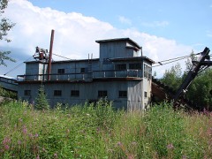 Coal Creek Historic Mining Districtlisted 1995
Population over time
3 figuresCircle fell from 100 to 91 between 2000 and 2020. These are the recorded population figures Wikidata holds for this place, reached through the Geographic Names Information System number this page is keyed on rather than by name, so they belong to this place and not to another of the same name. Most are census counts, but not all are: an early figure may be a founding or settlement estimate, and an estimate published within five years of a census is left out. The change column is computed, and is left blank where more than 20 years separate a figure from the one before it, because a gap that long is not a change between two counts.
| Year | People | Change |
|---|---|---|
| 2000 | 100 | |
| 2010 | 104 | +4 (+4%) |
| 2020 | 91 | -13 (-12%) |
Topographic sheets covering this place
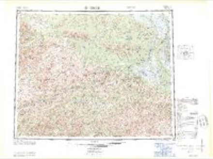
4 surveys from 16 printed sheetsMatched by testing this settlement's coordinate against the published boundary of every sheet in the United States Geological Survey's historical collection. Each opens the scanned sheet at the Survey.
- 1951 USGS Circle quadrangle1:250000, 4 printings
- 1955 USGS Circle quadrangle1:250000, 8 printings
- 1955 USGS Circle D-1 quadrangle1:63360, 3 printings
- 1964 USGS Circle quadrangle1:250000
Fires near this place
8 since 1993Regional context, not property-specific evidence. The federal wildfire occurrence database lists 8 fires within 5 miles of Circle between 1993 and 2004, burning about 1,386 acres in total. 6 started naturally. None was recorded as arson. Distance is straight-line from the map coordinates, so a fire counted here may appear on a neighbouring settlement's page as well.
| Reported cause | Fires |
|---|---|
| Natural | 6 |
| Missing data/not specified/undetermined | 1 |
| Debris and open burning | 1 |
The most recent of them, most recent first, with the day each was reported and the service that recorded it.
| Date | Cause | Size | Reported by | Name on the report |
|---|---|---|---|---|
| 5 July 1993 | Natural | under an acre | Alaska Fire Service | CEMN 24 |
| 3 July 1997 | Natural | under an acre | Alaska Fire Service | CIRCLE CIT |
| 26 June 1999 | Missing data/not specified/undetermined | under an acre | Alaska Fire Service | CIRCLE CIT |
| 2 June 1994 | Natural | under an acre | Alaska Fire Service | FYU SE 54 |
| 14 June 2004 | Natural | 4.0 acres | Alaska Fire Service | CIRCLE |
| 14 June 1994 | Natural | 1.0 acres | Alaska Fire Service | FYU SE 58 |
| 13 June 2000 | Natural | 1,377 acres | Alaska Fire Service | TORGNY |
| 23 May 1999 | Debris and open burning | 2.5 acres | Alaska Fire Service | SIX MILE |
Settlements close enough to share some of these fires:
Storms near this place
7 since 2009Regional context, not property-specific evidence. The National Weather Service names Circle in 7 storm reports between 2009 and 2023: 6 flood, 1 heavy rain. No death or injury is recorded in these reports. Each account below is quoted exactly as the forecast office filed it, from the NOAA Storm Events Database, and each date opens the federal record of that event.
| When | Event | Place named | Harm | What the report says |
|---|---|---|---|---|
| May 2013 | Flood | Circle | $1,500,000 | no account filed |
| May 2009 | Flood | Circle | $1,400,000 | no account filed |
| May 2014 | Flood | Circle | $1,000 | no account filed |
| June 2023 | Flood | Circle | - | Heavy rain and snowmelt in the Birch Creek headwaters caused Birch Creek to flow overbank and flood portions of the Steese Highway between milepost 145 to 147. The flooding caused the highway to be closed for a period of time due to dangerous driving conditions. Birch Creek fell back within bank on June 2nd. |
| May 2023 | Flood | Circle | - | Record flooding occurred on the evening of May 13th at Circle. The Riverwatch team flew between Eagle and Circle on the afternoon of May 13th. During the day on May 13th, an observer 28 miles upriver of Circle reported the highest water hed ever seen. The Riverwatch team observed widespread flooding (trees inundated, islands covered in ice, river well out of bank) upriver from Circle. Ice had degraded during the day in warm conditions and the Riverwatch team saw ice start to move while they were in Circle at 5 pm May 13th. Prior to landing, the Riverwatch team observed a roughly 90-mile-long run of ice behind the breakup front. For context, that is the longest run of ice that this Riverwatch team could remember ever seeing. The Riverwatch team circled above several times after takeoff and observed ice moving, and progressive disintegration of larger ice sheets (indicating weakness and that given the momentum of the river ice jams were unlikely). The flooding came on quickly; the water rose extremely fast and major flooding was first reported at around 8 pm. There was extensive damage, with flood waters estimated to be higher than the previous flood of record, 1945. The store had water up to the ceiling of the first floor. Ice moved into town and damaged homes with stranded ice throughout the community. Most structures in the town flooded and also flooded the airport apron and taxiway. The Riverwatch team flew over the next day and did not observe evidence of ice jamming but believe that the river simply slowed at the S-curves (where the Yukon becomes more braided) and compounded with historically high water levels. By the next morning, floodwaters had receded and had dropped below the airport access road by 3 pm May 14th. |
| May 2022 | Flood | Circle | - | An ice jam formed the evening of May 9th in that Yukon River which caused flooding in the village of Circle. This flooding caused the road to the airport to the airport to become impassable. The Steese Highway was flooded with 12 inches of water. The high water levels caused the community well to flood requiring the well to be disinfected before it could be used again. One home had water enter the bottom floor. |
| June 2011 | Heavy Rain | Circle | - | no account filed |
Nearest settlements
The eight closest, with where each one stands in the county. Distances are straight-line, computed from the Geographic Names Information System coordinates.
| Map | Place | Distance | Sheets |
|---|---|---|---|
| Circle Hot Springs | 38.5 miles | 17 | |
| Circle Hot Springs Station | 41.4 miles | 17 | |
| Central | 43.1 miles | 16 | |
| Woodchopper Creek | 50.3 miles | 13 | |
| Chalkyitsik | 59.9 miles | 14 | |
| Coal Creek | 60.0 miles | 13 | |
| Miller House | 64.7 miles | 17 | |
| Fort Yukon | 82.1 miles | 12 |
Elsewhere
Matched on this settlement's Geographic Names Information System number rather than its name, so it cannot be a different place of the same name in another state.
| Wikipedia article on Circle | An encyclopaedic summary. Its text is share-alike, so it is linked here rather than copied. |
| Wikidata item Q974350 | The structured record the population and elevation above come from. Public domain (CC0). |
Provenance
This settlement is recorded in the Geographic Names Information System as feature 1400404. The sheet list is computed by point-in-boundary test against the United States Geological Survey's historical topographic inventory. Both are works of the United States government and carry no copyright under 17 U.S.C. 105.
Wildfire. Short, Karen C. 2022. Spatial wildfire occurrence data for the United States, 1992-2020 [FPA_FOD_20221014]. 6th Edition. Fort Collins, CO: Forest Service Research Data Archive. https://doi.org/10.2737/RDS-2013-0009.6 Collected with United States Government funding and usable without additional permissions or fees.
Storms. NOAA National Centers for Environmental Information, Storm Events Database https://www.ncei.noaa.gov/stormevents/ A work of the United States government, no copyright under 17 U.S.C. 105. Narratives are quoted verbatim from the National Weather Service report and are not edited or summarised.