 Block
From the record
17 National Register listings published here.
Sources: the National Register database, National Park Service
518 topographic sheets cover 130 settlements here, and 17 properties are on the National Register of Historic Places.
17 National Register listings published here.
Sources: the National Register database, National Park Service
Every property in this county listed on the National Register of Historic Places, with the year it was listed and the federal nomination document.
| Photograph | Property | Type | Listed | Reference |
|---|---|---|---|---|
| Alaska Road Commission Shelter Cabin-Fritz's | building | 2021 | 100006832 | |
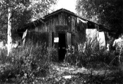 | Ed Beiderman Fish Camp | building | 1987 | 87001204 |
| Bettles Lodge | building | 1997 | 97000401 | |
| Central House | building | 1978 | 78003431 | |
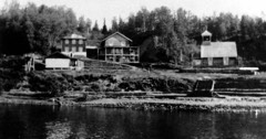 | Christ Church Mission | building | 1980 | 80004572 |
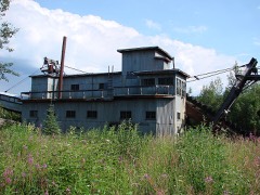 | Coal Creek Historic Mining District | district | 1995 | 95000573 |
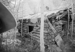 | George McGregor Cabin | building | 1987 | 87001199 |
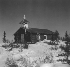 | Mission Church | building | 1977 | 77001578 |
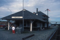 | Nenana Depot | building | 1977 | 77000229 |
| Old Mission House | building | 1978 | 78000539 | |
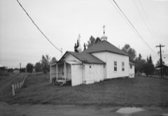 | Presentation of Our Lord Chapel | building | 1980 | 80004584 |
| Ruby Roadhouse | building | 1982 | 82004898 | |
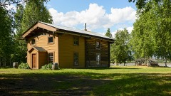 | Frank Slaven Roadhouse | building | 1987 | 87001202 |
| Sourdough Inn | building | 1997 | 97001585 | |
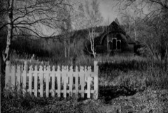 | Tanana Mission | district | 1977 | 77000230 |
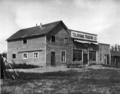 | Tolovana Roadhouse | building | 1988 | 88000402 |
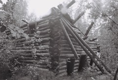 | Woodchopper Roadhouse | structure | 1987 | 87001201 |
Every wildfire the federal occurrence database records inside this county: 3,011 of them, burning about 25,475,709 acres. 2,592 started naturally and 17 were recorded as arson. Each settlement page carries the fires within five miles of it.
| Reported cause | Fires |
|---|---|
| Natural | 2592 |
| Missing data/not specified/undetermined | 145 |
| Recreation and ceremony | 129 |
| Debris and open burning | 63 |
| Equipment and vehicle use | 30 |
| Arson/incendiarism | 17 |
| Misuse of fire by a minor | 12 |
| Smoking | 9 |
| Other causes | 8 |
| Power generation/transmission/distribution | 3 |
| Fireworks | 2 |
| Firearms and explosives use | 1 |
The five largest, by the area the report gives. None of them was recorded as arson.
| Date | Cause | Size | Reported by | Name on the report |
|---|---|---|---|---|
| 21 June 2009 | Natural | 517,078 acres | Alaska Fire Service | MINTO FLATS SOUTH |
| 6 July 2004 | Natural | 483,280 acres | Alaska Fire Service | DALL CITY |
| 12 June 2004 | Natural | 419,884 acres | Alaska Fire Service | NORTH DAG |
| 15 June 2004 | Natural | 403,993 acres | Alaska Fire Service | PINGO |
| 7 June 1997 | Natural | 365,871 acres | Alaska Fire Service | SIMELS 732 |
| 20 June 2009 | Natural | 349,450 acres | Alaska Fire Service | LITTLE BLACK ONE |
| 15 June 2004 | Natural | 344,833 acres | Alaska Fire Service | WINTER TRAILL |
| 22 June 2015 | Natural | 312,918 acres | Nowitna National Wildlife Refuge | 15533 BIG CREEK 2 |
Every settlement page carries the fires within five miles of it - see the settlement index below.
The NOAA Storm Events Database holds 52 reports for this county, causing no deaths, no injuries and about $37,519,500 in recorded property damage. Each settlement page carries the reports that name it.
| Kind of event | Reports |
|---|---|
| Flood | 43 |
| Thunderstorm Wind | 3 |
| Flash Flood | 2 |
| Dust Devil | 2 |
| Hail | 1 |
| Heavy Rain | 1 |
The most serious of them, by death, then injury, then recorded damage. The accounts are quoted exactly as the forecast office filed them.
| When | Event | Place named | Harm | What the report says |
|---|---|---|---|---|
| May 2013 | Flood | Galena | $15,000,000 | no account filed |
| May 2009 | Flood | Stevens Village | $7,200,000 | no account filed |
| May 2009 | Flood | Tanana | $5,900,000 | no account filed |
| July 2008 | Flood | Nenana | $2,670,000 | no account filed |
| May 2009 | Flood | Ft Yukon | $1,900,000 | no account filed |
| May 2013 | Flood | Circle | $1,500,000 | no account filed |
| May 2009 | Flood | Circle | $1,400,000 | no account filed |
| May 2009 | Flood | Chalkyitsik | $715,000 | no account filed |
| May 2022 | Flood | Mcgrath | $301,000 | An ice jam formed at Sand Island, adjacent to McGrath, at 5pm on May 10th . Before the ice jam, waterleaves were near bankfull, and the ice jam caused the river to rise 4.5 feet in 6 hours from 19.2 at 5 PMto 23.7 and 11PM. The ice jam held for 26 hours, releasing at 6pm on 5/11, with the water dropping rapidly. The flooding caused damage to Chinana Avenue, the main road in town as well as the road to the dump. The flood damaged the sewage lagoon and the dump. Water entered basements and crawlspaces of around 15 homes. |
| May 2013 | Flood | Ft Yukon | $300,000 | no account filed |
| May 2022 | Flood | Manley Hot Springs | $282,000 | Water levels rose to bankfull in Manley Hot Springs the evening of May 6th and by the morning of May 7th major flooding was observed in the community. NWS staff on a Civil Air Patrol reconnaissance flight observed a large ice jam on the Tanana River 12 miles downriver which dammed the river and backed up water into the community. The river crested around 9 am May 8th with a preliminary estimated stage of 19.50 feet, which is 6.0 feet above flood stage. This was the highest water level observed at Manley Hot Springs since the record flood of 1956 (the 1956 flood is estimated approximately 2.5 feet higher). The ice jam held for 36 hrs, releasing on the morning of May 8th and water levels began to recede through the day. Standing water remained in low lying areas of the community through the following week. Impacts to the community included many homes and structures either flooded or surrounded by water, many roads inundated with some parts of town appearing cut off and only accessible by boat, Only 6 of freeboard under the Manley Hot Springs Slough bridge, approximately 500 feet of the Elliot Highway approaching town was inundated with several feet of water, power was shut down in the community as a precaution due to the lines being buried, cellular, phone, and internet networks are down. In addition significant areas of fuel sheen on the water surface due to overturned heating fuel tanks and other sources. |
| May 2013 | Flood | Hughes | $250,000 | no account filed |
| May 2009 | Flood | Mcgrath | $60,000 | no account filed |
| May 2010 | Flood | Ruby | $25,000 | no account filed |
| May 2011 | Thunderstorm Wind | Galena | $5,000 | no account filed |
| June 2010 | Thunderstorm Wind | Tanana | $5,000 | no account filed |
| May 2009 | Flood | Grayling | $2,000 | no account filed |
| July 2008 | Flash Flood | Central | $2,000 | no account filed |
| June 2015 | Dust Devil | Venetie | $1,000 | no account filed |
| May 2014 | Flood | Circle | $1,000 | no account filed |
| May 2015 | Flood | Ft Yukon | $300 | no account filed |
| July 2015 | Dust Devil | Nenana | $200 | no account filed |
| August 2025 | Flood | Allakaket | - | Emergency management personnel with the Tanana Chiefs Conference and local officials from Allakaket reported a prolonged moderate to major flood that surrounded most of the lower community, Old Town, and the old runway. Several roads including the airport access road and Main Street washed out. The river officially crested at 64.54 feet on August 31st. |
| August 2025 | Flood | Prospect Creek | - | Water over the Dalton Highway caused the road to wash out between mile markers 142 and 144 just north of Prospect Creek. The Alaska DOT was forced to completely close the roadway between mile markers 112 and 156. All traffic was stopped at the Jim River DOT Camp. |
| August 2025 | Flood | Wiseman | - | Public reports and photos delivered to the NWS River Forecast Center in Alaska indicated that the road to Wiseman was completely covered, thus preventing any travel into or out of Wiseman by automobile. It was estimated that the Middle Fork of the Koyukuk rose high enough to cover the road with water 18 inches deep. |
| May 2024 | Flood | Ft Yukon | - | High water on the Porcupine River reached Fort Yukon on May 24th and caused the Sucker River to back up into low-lying areas on the east side of town and has flooded some roads east of Fort Yukon. A river observer reported at 1 pm Friday May 24th flooding of sloughs, low area, and some low-lying roads east of Fort Yukon. The observer reported that water was rising rapidly and was 6 inches to 1 foot below the low section of the runway in Fort Yukon. At 12 pm on May 27th a river observer reported that water levels had receded approximately one foot since Saturday May 25th with only a few inches of water remaining over the roadway near Liquor Store Lake. Sloughs near the airport remained just above bankfull. On May 28th at 3:07 pm, a river observer reported that water levels on the main stem Yukon River were up 1 to 2 feet from Monday May 27th with the Porcupine flow still dominating. A few inches of water remained over the roadway near Liquor Store lake. Sloughs near the airport remained just above bankfull. Water began receding on May 29th and the Flood Warning was cancelled. A Flood Watch was issued on May 20th and upgraded to a Flood Warning on May 24th. The Flood Warning was cancelled on May 29th. |
| August 2024 | Flood | Allakaket | - | Heavy rainfall over the northern Interior caused rapid rises on the Alatna and Kuyokuk Rivers. The water came up 4 to 6 feet in three days on the Alatna River and the Koyukuk was very high with debris and flooding. In Allakaket, water flooding the boat launch, as well as fish camps along the river. |
| June 2023 | Flood | Circle | - | Heavy rain and snowmelt in the Birch Creek headwaters caused Birch Creek to flow overbank and flood portions of the Steese Highway between milepost 145 to 147. The flooding caused the highway to be closed for a period of time due to dangerous driving conditions. Birch Creek fell back within bank on June 2nd. |
| May 2023 | Flood | Tanana | - | An ice jam on the Yukon River approx 100 miles downriver from Tanana caused minor flooding in the community. |
| June 2023 | Flood | Wiseman | - | Water levels rose rapidly on the Middle Fork of the Koyukuk River on Friday June 9th and went overbank and caused minor flooding by Saturday morning June 10th. At Wiseman, residents reported approximately 3 inches of water over the lower part of the access road into Wiseman. The high water caused bank erosion and some erosion on the Wiseman Road surface. High groundwater levels also caused flooding of the crawl space in at least one home in Wiseman along Wiseman Creek. |
| June 2023 | Flood | Central | - | Heavy rain on snow caused Crooked Creek in Central to rise overbank and flood portions of the community. The public reported flood waters up to the doors of the Central Museum, into the parking lot of the local store, and up to 6 inches deep over the Steese Highway in Central. Residents put sandbags around the Central Museum but water still seeped in through the back door and got the carpet and floor wet. Floodwaters crested Thursday afternoon May 31st and flooding ended by Friday morning Jun 1st. |
| May 2023 | Flood | Central | - | Heavy rain on snow caused Crooked Creek in Central to rise overbank and flood portions of the community. The public reported flood waters up to the doors of the Central Museum, into the parking lot of the local store, and up to 6 inches deep over the Steese Highway in Central. Residents put sandbags around the Central Museum but water still seeped in through the back door and got the carpet and floor wet. Floodwaters crested Thursday afternoon May 31st and flooding ended by Friday morning Jun 1st. |
| July 2023 | Thunderstorm Wind | Chalkyitsik | - | A thunderstorm went through the village Chalkyitsik knocking down numerous trees. The falling trees caused minor damage to a building. |
| May 2023 | Flood | Circle | - | Record flooding occurred on the evening of May 13th at Circle. The Riverwatch team flew between Eagle and Circle on the afternoon of May 13th. During the day on May 13th, an observer 28 miles upriver of Circle reported the highest water hed ever seen. The Riverwatch team observed widespread flooding (trees inundated, islands covered in ice, river well out of bank) upriver from Circle. Ice had degraded during the day in warm conditions and the Riverwatch team saw ice start to move while they were in Circle at 5 pm May 13th. Prior to landing, the Riverwatch team observed a roughly 90-mile-long run of ice behind the breakup front. For context, that is the longest run of ice that this Riverwatch team could remember ever seeing. The Riverwatch team circled above several times after takeoff and observed ice moving, and progressive disintegration of larger ice sheets (indicating weakness and that given the momentum of the river ice jams were unlikely). The flooding came on quickly; the water rose extremely fast and major flooding was first reported at around 8 pm. There was extensive damage, with flood waters estimated to be higher than the previous flood of record, 1945. The store had water up to the ceiling of the first floor. Ice moved into town and damaged homes with stranded ice throughout the community. Most structures in the town flooded and also flooded the airport apron and taxiway. The Riverwatch team flew over the next day and did not observe evidence of ice jamming but believe that the river simply slowed at the S-curves (where the Yukon becomes more braided) and compounded with historically high water levels. By the next morning, floodwaters had receded and had dropped below the airport access road by 3 pm May 14th. |
| May 2023 | Flood | Ft Yukon | - | The breakup front progressed towards Fort Yukon on May 14th, finally stopping (jamming) just below Fort Yukon by late afternoon/evening. Water levels rose rapidly over bank and resulted in moderate flooding of the community. The river crested the night of the 14th. Several homes/structures were inundated with water. The tribal hall was flooded with water just up to the floor level with likely damage to the floor. The road to the east of the Tribal Hall was breached to help reduce water levels with water flowing through the breach and back towards the Yukon River. The levee held well and prevented more significant damages. A local observer reported that water levels came to within one foot of overtopping the low spots along the levee, and estimated that the water level was similar to 1981. Water started receding early in the morning of May 15th when the ice jam released. The water took several days to fully drop back within bank. |
| June 2023 | Flood | Allakaket | - | Water levels on the Koyukuk River at Allakaket rose overbank in low-lying areas of the community near the river on June 10th. Minor flooding was reported when the water crested early Monday morning June 12th. Water inundated the old runway by the river and overtopped Stanley Slough Road near the boat launch. A local observer reported that the high water and debris was initially coming from the Alatna River on June 10th but then coming down the Koyukuk River by June 11th. It is estimated water levels would need to rise approximately 1 additional foot to go over roads in the lower part of the village and have more significant impacts. |
| May 2022 | Flood | Shageluk | - | Water levels on the Innoko River began rising to bankfull on Friday May 20th as floodwaters from an ice jam on the Yukon River started flowing into the Innoko River upstream of Shageluk. Water levels rose overbank in Shageluk on Saturday the 21st as the surge of water moved down the Innoko River, eventually cresting on Tuesday May 24th. Water levels in Shageluk remained above flood stage through May 30th with bankfull conditions persisting into the first week of June. Residents reported water over some roads near the river, including the road to the airport which was impassable and caused the airport to only be accessible by boat. The high water also caused significant erosion of some riverbanks. |
| May 2022 | Flood | Circle | - | An ice jam formed the evening of May 9th in that Yukon River which caused flooding in the village of Circle. This flooding caused the road to the airport to the airport to become impassable. The Steese Highway was flooded with 12 inches of water. The high water levels caused the community well to flood requiring the well to be disinfected before it could be used again. One home had water enter the bottom floor. |
| May 2019 | Flood | Allakaket | - | In the village of Allakaket, several roads were inundated including First and Second Avenue. Water also flowed over the road adjacent to the store. Several outbuildings were flooded and/or moved to higher ground. The local observer estimates water levels would need to rise 2 feet to flood the lowest elevation house. There were no known permanent structures impacted. |
| August 2019 | Flood | Bettles Field | - | The Alaska DOT estimated that a three day storm peaked with around 4 inches of rain in 24 hours ending on Aug 3rd in the vicinity of the Jim River between Dalton Highway Mileposts 142 to 145. Water overtopped the Highway at two locations between Jim River #3 and Douglas Cr. Water was estimated to be around 2 feet deep across the highway. The road was impassable to some vehicles. The flowing water also caused damage to the Highway. |
| July 2014 | Flood | Wiseman | - | no account filed |
| April 2012 | Flood | Manley Hot Springs | - | no account filed |
| May 2012 | Flood | Nulato | - | no account filed |
| May 2012 | Flood | Central | - | no account filed |
| September 2012 | Flood | Nenana | - | no account filed |
| June 2011 | Heavy Rain | Circle | - | no account filed |
| May 2010 | Hail | Manley Hot Springs | - | no account filed |
| June 2010 | Flash Flood | Livengood | - | no account filed |
| May 2009 | Flood | Grayling | - | no account filed |
| May 2009 | Flood | Nulato | - | no account filed |
| May 2008 | Flood | Manley Hot Springs | - | no account filed |
| August 2008 | Flood | Nenana | - | no account filed |
Named settlements recorded in the Geographic Names Information System, each with the topographic sheets covering it. Villages, hamlets and abandoned places alike. Each is shown with the nearest named watercourse or landform and the survey quadrangle it falls on.
Koyukuk-Middle Yukon census subarea · 99720 · On Unatlotly Creek · Bettles C-6 SE quadrangle
12 sheets, 1951 to 1970
Koyukuk-Middle Yukon census subarea · 99720 · On Unatlotly Creek · Bettles C-6 SE quadrangle
12 sheets, 1951 to 1970
Yukon Flats census subarea · 99740 · Fort Yukon D-3 SW quadrangle
11 sheets, 1951 to 1956
Koyukuk-Middle Yukon census subarea · On Alinement Creek · Wiseman D-1 NW quadrangle
17 sheets, 1951 to 1971
No longer a settlement
Koyukuk-Middle Yukon census subarea · 99720 · On Alatna River · Bettles C-6 SE quadrangle
12 sheets, 1951 to 1970
McGrath-Holy Cross census subarea · 99558 · Holy Cross C-3 NE quadrangle
10 sheets, 1951 to 1952
Koyukuk-Middle Yukon census subarea · On Kanuti River · Hughes B-1 NE quadrangle
23 sheets, 1951 to 1986
No longer a settlement
Yukon Flats census subarea · 99722 · Arctic A-3 NW quadrangle
11 sheets, 1951 to 1972
Koyukuk-Middle Yukon census subarea · 99756 · On Baker Creek · Kantishna River D-1 NW quadrangle
14 sheets, 1948 to 1964
Koyukuk-Middle Yukon census subarea · On Bergman Creek · Bettles B-6 NW quadrangle
14 sheets, 1951 to 1970
No longer a settlement
Koyukuk-Middle Yukon census subarea · 99726 · Bettles D-4 NE quadrangle
13 sheets, 1951 to 1970
Koyukuk-Middle Yukon census subarea · On Lake Creek · Chandalar C-5 SW quadrangle
12 sheets, 1951 to 1971
Yukon Flats census subarea · 99730 · Fort Yukon B-4 SW quadrangle
10 sheets, 1951 to 1956
Koyukuk-Middle Yukon census subarea · 99768 · On Montana Creek · Melozitna A-2 NE quadrangle
10 sheets, 1951 to 1956
Yukon Flats census subarea · Coleen A-4 SE quadrangle
17 sheets, 1951 to 1956
No longer a settlement
Yukon Flats census subarea · On Flat Creek · Chandalar A-3 NE quadrangle
11 sheets, 1951 to 1990
Yukon Flats census subarea · 99788 · On Fishhook Creek · Black River C-6 NE quadrangle
14 sheets, 1951 to 1964
Yukon Flats census subarea · On Rosalie Creek · Chandalar C-3 SW quadrangle
11 sheets, 1951 to 1990
Yukon Flats census subarea · 99730 · On Hot Springs Creek · Circle B-2 NE quadrangle
17 sheets, 1951 to 1964
Yukon Flats census subarea · 99730 · Circle B-2 NE quadrangle
17 sheets, 1951 to 1964
McGrath-Holy Cross census subarea · 99602 · Holy Cross A-2 NW quadrangle
11 sheets, 1951 to 1952
No longer a settlement
Yukon Flats census subarea · 99738 · On Beaton Pup · Charley River B-5 SE quadrangle
13 sheets, 1951 to 1956
Koyukuk-Middle Yukon census subarea · 99701 · On Slate Creek · Wiseman B-1 SE quadrangle
16 sheets, 1951 to 1971
Koyukuk-Middle Yukon census subarea · On Cosna Slough · Kantishna River D-3 SW quadrangle
13 sheets, 1948 to 1964
McGrath-Holy Cross census subarea · Iditarod B-1 NE quadrangle
9 sheets, 1951 to 1956
McGrath-Holy Cross census subarea · On Iditarod River · Ophir A-6 SW quadrangle
6 sheets, 1951 to 1954
No longer a settlement
McGrath-Holy Cross census subarea · On Black Creek · Iditarod B-4 NW quadrangle
9 sheets, 1951 to 1956
McGrath-Holy Cross census subarea · Ophir C-3 NW quadrangle
5 sheets, 1951 to 1954
No longer a settlement
Koyukuk-Middle Yukon census subarea · 99756 · On Pioneer Creek · Tanana A-1 NE quadrangle
14 sheets, 1951 to 1960
Koyukuk-Middle Yukon census subarea · 99726 · Bettles D-4 NE quadrangle
13 sheets, 1951 to 1970
McGrath-Holy Cross census subarea · On Flat Creek · Iditarod B-5 NE quadrangle
10 sheets, 1951 to 1956
Yukon Flats census subarea · 99740 · On Yllota Slough · Fort Yukon C-3 SW quadrangle
12 sheets, 1951 to 1956
Koyukuk-Middle Yukon census subarea · 99741 · On Kala Slough · Nulato C-2 NW quadrangle
13 sheets, 1945 to 1964
McGrath-Holy Cross census subarea · On Ganes Creek · Ophir A-1 SW quadrangle
6 sheets, 1951 to 1954
McGrath-Holy Cross census subarea · 99602 · Holy Cross A-2 NW quadrangle
11 sheets, 1951 to 1952
Koyukuk-Middle Yukon census subarea · On Grant Creek · Tanana A-6 NW quadrangle
14 sheets, 1951 to 1960
McGrath-Holy Cross census subarea · 99590 · On Grayling Creek · Holy Cross D-3 NE quadrangle
10 sheets, 1951 to 1952
McGrath-Holy Cross census subarea · 99602 · Holy Cross A-2 NW quadrangle
11 sheets, 1951 to 1952
Koyukuk-Middle Yukon census subarea · 99745 · On Hughes Creek · Hughes A-3 SW quadrangle
13 sheets, 1951 to 1965
Koyukuk-Middle Yukon census subarea · On Huslia River · Kateel River C-2 NE quadrangle
9 sheets, 1951 to 1955
No longer a settlement
McGrath-Holy Cross census subarea · 99602 · Holy Cross A-2 NW quadrangle
11 sheets, 1951 to 1952
No longer a settlement
McGrath-Holy Cross census subarea · Russian Mission D-4 NW quadrangle
7 sheets, 1947 to 1980
No longer a settlement
McGrath-Holy Cross census subarea · Russian Mission D-5 NE quadrangle
8 sheets, 1947 to 1980
No longer a settlement
McGrath-Holy Cross census subarea · Holy Cross D-2 SE quadrangle
12 sheets, 1951 to 1952
No longer a settlement
McGrath-Holy Cross census subarea · Holy Cross D-2 SE quadrangle
12 sheets, 1951 to 1952
No longer a settlement
Koyukuk-Middle Yukon census subarea · On Nulato River · Nulato C-5 NE quadrangle
12 sheets, 1945 to 1964
No longer a settlement
Koyukuk-Middle Yukon census subarea · On Illinois Creek · Melozitna A-1 NE quadrangle
9 sheets, 1951 to 1956
Koyukuk-Middle Yukon census subarea · 99748 · On Kaltag River · Nulato B-6 SE quadrangle
11 sheets, 1945 to 1964
McGrath-Holy Cross census subarea · Iditarod C-5 SE quadrangle
10 sheets, 1951 to 1956
No longer a settlement
Koyukuk-Middle Yukon census subarea · 99768 · Ruby D-4 NE quadrangle
14 sheets, 1951 to 1964
Koyukuk-Middle Yukon census subarea · On Mentanontli River · Hughes B-1 SE quadrangle
23 sheets, 1951 to 1986
No longer a settlement
McGrath-Holy Cross census subarea · Iditarod B-4 NE quadrangle
9 sheets, 1951 to 1956
No longer a settlement
McGrath-Holy Cross census subarea · On Innoko River · Holy Cross A-2 NE quadrangle
11 sheets, 1951 to 1952
No longer a settlement
McGrath-Holy Cross census subarea · 99757 · On Deep Creek · Denali D-5 NW quadrangle
11 sheets, 1952 to 1969
Koyukuk-Middle Yukon census subarea · 99790 · On Ruth Creek · Livengood C-4 SE quadrangle
21 sheets, 1945 to 1964
Koyukuk-Middle Yukon census subarea · Near Bear Gulch · Ruby B-5 NW quadrangle
13 sheets, 1951 to 1964
Koyukuk-Middle Yukon census subarea · 99756 · On Ohio Creek · Tanana A-2 SE quadrangle
15 sheets, 1951 to 1960
McGrath-Holy Cross census subarea · 99627 · On Takotna River · McGrath D-6 NE quadrangle
9 sheets, 1949 to 1958
McGrath-Holy Cross census subarea · 99627 · On Scow Harry Creek · Medfra A-4 SE quadrangle
7 sheets, 1950 to 1959
Yukon Flats census subarea · 99730 · On Miller Creek · Circle C-3 SE quadrangle
17 sheets, 1951 to 1964
Koyukuk-Middle Yukon census subarea · 99758 · On Uncle Sam Creek · Livengood A-5 NW quadrangle
21 sheets, 1945 to 1964
McGrath-Holy Cross census subarea · On Willow Creek · Iditarod C-3 SE quadrangle
8 sheets, 1951 to 1956
Koyukuk-Middle Yukon census subarea · 99760 · On Nenana River · Fairbanks C-5 SE quadrangle
21 sheets, 1950 to 1964
Koyukuk-Middle Yukon census subarea · 99720 · Bettles C-6 SE quadrangle
12 sheets, 1951 to 1970
Koyukuk-Middle Yukon census subarea · 99701 · On Acme Creek · Wiseman B-1 NE quadrangle
16 sheets, 1951 to 1971
Koyukuk-Middle Yukon census subarea · 99760 · On Little Nenana River · Fairbanks C-5 SE quadrangle
21 sheets, 1950 to 1964
Koyukuk-Middle Yukon census subarea · 99765 · On Mukluk Creek · Nulato C-5 NE quadrangle
12 sheets, 1945 to 1964
Koyukuk-Middle Yukon census subarea · Bettles D-4 NE quadrangle
13 sheets, 1951 to 1970
No longer a settlement
McGrath-Holy Cross census subarea · 99627 · On Takotna River · McGrath D-6 NE quadrangle
9 sheets, 1949 to 1958
Yukon Flats census subarea · On Salmon Trout River · Coleen A-2 NE quadrangle
16 sheets, 1951 to 1956
Yukon Flats census subarea · Near Vacahanyande Mountain · Black River C-4 SE quadrangle
13 sheets, 1951 to 1964
McGrath-Holy Cross census subarea · On Ophir Creek · Ophir A-2 NE quadrangle
7 sheets, 1951 to 1954
McGrath-Holy Cross census subarea · On Dishna River · Ophir C-3 SW quadrangle
5 sheets, 1951 to 1954
No longer a settlement
Koyukuk-Middle Yukon census subarea · On Tenderfoot Creek · Ruby A-6 SE quadrangle
13 sheets, 1951 to 1964
Koyukuk-Middle Yukon census subarea · 99767 · On Rampart Creek · Tanana C-1 SE quadrangle
14 sheets, 1951 to 1960
Koyukuk-Middle Yukon census subarea · 99768 · On Ruby Creek · Ruby C-5 NW quadrangle
15 sheets, 1951 to 1964
McGrath-Holy Cross census subarea · 99665 · Holy Cross C-2 NE quadrangle
10 sheets, 1951 to 1952
McGrath-Holy Cross census subarea · Ophir C-3 SE quadrangle
5 sheets, 1951 to 1954
No longer a settlement
Koyukuk-Middle Yukon census subarea · 99726 · Bettles C-3 NW quadrangle
12 sheets, 1951 to 1970
No longer a settlement
Koyukuk-Middle Yukon census subarea · 99768 · Ruby D-4 NE quadrangle
14 sheets, 1951 to 1964
No longer a settlement
Koyukuk-Middle Yukon census subarea · 99774 · Beaver A-5 SE quadrangle
11 sheets, 1951 to 1964
Koyukuk-Middle Yukon census subarea · On Spangle Creek · Ruby A-5 NW quadrangle
14 sheets, 1951 to 1964
Koyukuk-Middle Yukon census subarea · Nulato B-3 NE quadrangle
11 sheets, 1945 to 1964
No longer a settlement
McGrath-Holy Cross census subarea · 99675 · Iditarod D-1 NE quadrangle
10 sheets, 1951 to 1956
McGrath-Holy Cross census subarea · On Steamboat Slough · Unalakleet D-1 SE quadrangle
12 sheets, 1951 to 1964
No longer a settlement
Koyukuk-Middle Yukon census subarea · 99777 · On NC Creek · Tanana A-5 NE quadrangle
14 sheets, 1951 to 1960
Koyukuk-Middle Yukon census subarea · On Pilot Mountain Slough · Nulato D-3 SW quadrangle
11 sheets, 1945 to 1964
No longer a settlement
Koyukuk-Middle Yukon census subarea · On Negotsena Creek · Nulato D-4 SW quadrangle
12 sheets, 1945 to 1964
No longer a settlement
McGrath-Holy Cross census subarea · On Iditarod River · Ophir A-6 SW quadrangle
6 sheets, 1951 to 1954
No longer a settlement
Koyukuk-Middle Yukon census subarea · On Patsy Slough · Nulato C-4 NW quadrangle
20 sheets, 1945 to 1964
No longer a settlement
Koyukuk-Middle Yukon census subarea · 99756 · Near Harter Gulch · Tanana A-2 SW quadrangle
15 sheets, 1951 to 1960
Koyukuk-Middle Yukon census subarea · 99768 · Ruby D-3 NW quadrangle
13 sheets, 1951 to 1964
No longer a settlement
Koyukuk-Middle Yukon census subarea · Near Koyukuk Island · Nulato D-4 NE quadrangle
12 sheets, 1945 to 1964
No longer a settlement
Koyukuk-Middle Yukon census subarea · 99760 · On Toklat River · Kantishna River B-1 NW quadrangle
13 sheets, 1948 to 1964
Koyukuk-Middle Yukon census subarea · 99756 · On Tolovana River · Fairbanks D-6 SW quadrangle
18 sheets, 1950 to 1964
McGrath-Holy Cross census subarea · On Mastodon Creek · Ophir B-3 SE quadrangle
7 sheets, 1951 to 1954
No longer a settlement
Koyukuk-Middle Yukon census subarea · 99760 · On Nenana River · Fairbanks C-5 SE quadrangle
21 sheets, 1950 to 1964
No longer a settlement
Koyukuk-Middle Yukon census subarea · On Steamboat Slough · Tanana A-5 NW quadrangle
14 sheets, 1951 to 1960
No longer a settlement
McGrath-Holy Cross census subarea · Unalakleet C-1 SW quadrangle
14 sheets, 1951 to 1964
No longer a settlement
Koyukuk-Middle Yukon census subarea · 99760 · On Kantishna River · Fairbanks C-6 NW quadrangle
21 sheets, 1950 to 1964
No longer a settlement
Koyukuk-Middle Yukon census subarea · 99726 · On South Fork Koyukuk River · Bettles C-4 SW quadrangle
13 sheets, 1951 to 1970
No longer a settlement
McGrath-Holy Cross census subarea · Holy Cross A-2 NE quadrangle
11 sheets, 1951 to 1952
No longer a settlement
Yukon Flats census subarea · 99781 · On Teedriinjik River · Fort Yukon C-4 SW quadrangle
10 sheets, 1951 to 1956
McGrath-Holy Cross census subarea · 99627 · McGrath C-6 NE quadrangle
7 sheets, 1949 to 1958
Koyukuk-Middle Yukon census subarea · 99701 · On Wiseman Creek · Wiseman B-1 NE quadrangle
16 sheets, 1951 to 1971
Koyukuk-Middle Yukon census subarea · On Ninemile River · Nulato C-5 NW quadrangle
12 sheets, 1945 to 1964
Koyukuk-Middle Yukon census subarea · 99760 · Fairbanks C-4 SE quadrangle
20 sheets, 1950 to 1964
No longer a settlement
Koyukuk-Middle Yukon census subarea · 99760 · On Little Nenana River · Fairbanks C-5 SE quadrangle
21 sheets, 1950 to 1964
Koyukuk-Middle Yukon census subarea · 99756 · On Deep Creek · Tanana A-3 SE quadrangle
14 sheets, 1951 to 1960
No longer a settlement
Yukon Flats census subarea · 99738 · On Iron Creek · Charley River B-5 SW quadrangle
13 sheets, 1951 to 1956
Koyukuk-Middle Yukon census subarea · Near Bishop Rock · Nulato D-3 SW quadrangle
11 sheets, 1945 to 1964
Koyukuk-Middle Yukon census subarea · Kateel River B-4 NE quadrangle
10 sheets, 1951 to 1955
No longer a settlement
Koyukuk-Middle Yukon census subarea · Kateel River B-4 SE quadrangle
10 sheets, 1951 to 1955
No longer a settlement
The vanished settlements of Yukon-Koyukuk Census Area: the places named above that are no longer on the map.