 Block
From the record
One of 29 National Register listings published here for Kenai Peninsula Borough · listed in 2022 · category: District.
Sources: the National Register database, National Park Service
Listed on the National Register of Historic Places in 2022.
One of 29 National Register listings published here for Kenai Peninsula Borough · listed in 2022 · category: District.
Sources: the National Register database, National Park Service
Regional context, not property-specific evidence. The federal wildfire occurrence database lists 4 fires within 5 miles of Fort McGilvray Historic Archaeological District between 1999 and 2007, burning about 3 acres in total. None started naturally. None was recorded as arson. Distance is straight-line from the map coordinates, so a fire counted here may appear on a neighbouring settlement's page as well.
| Reported cause | Fires |
|---|---|
| Recreation and ceremony | 2 |
| Smoking | 1 |
| Debris and open burning | 1 |
The most recent of them, most recent first, with the day each was reported and the service that recorded it.
| Date | Cause | Size | Reported by | Name on the report |
|---|---|---|---|---|
| 26 August 2000 | Smoking | under an acre | Chugach National Forest | FOX ISLAND |
| 14 May 1999 | Debris and open burning | under an acre | Chugach National Forest | TONSINA CREEK |
| 12 May 2007 | Recreation and ceremony | under an acre | Chugach National Forest | TONSINA POINT |
| 28 April 2005 | Recreation and ceremony | 2.3 acres | Chugach National Forest | TONSINA CREEK |
Regional context, not property-specific evidence. The National Weather Service names Seward, the town this property stands in, in 13 storm reports between 2006 and 2024: 12 flood, 1 funnel cloud. No death or injury is recorded in these reports. Each account below is quoted exactly as the forecast office filed it, from the NOAA Storm Events Database, and each date opens the federal record of that event.
| When | Event | Place named | Harm | What the report says |
|---|---|---|---|---|
| September 2012 | Flood | Seward | $3,310,000 | no account filed |
| October 2006 | Flood | Seward | $500,000 | no account filed |
| September 2020 | Flood | Seward | $250,000 | Eight to ten inches of rain fell between September 26th and October 3rd The most intense rain was on Wednesday, September 30th with 2.5 inches in 24 hours, followed by 3 days of 1-2 inches/day. This event caused flooding and gravel aggregation in many of the roadways. Specific impacts include: Heavy equipment operating in all the gravel creeks of the Seward and Bear Creek areas throughout the weekend, Kenai Peninsula Borough (KPB) activated their Emergency Operations Center (EOC), Kenai Peninsula Borough put residents of Bruno Road into a Ready Status - preparing them for evacuation in case the levy breached, runway flooded and closed for 4 days while flooding subsided and DOT could remove debris from runway, Landslide on Lowell Point Road and numerous gravel removal efforts at the outlet of Lowell Creek Tunnel. |
| October 2013 | Flood | Seward | $225,000 | The airport at Seward measured 4.47 inches of rainfall between October 27-28, 2013. This caused the Lowell Creek diversion tunnel outlet stream to become filled with gravel from the creek that washed down from the mountainside in the heavy rainfall. The result was damage to the bridge over the road as flood waters topped the bridge. |
| July 2018 | Flood | Seward | $50,000 | The dike eroded along Sawmill Creek causing flooding on 2 properties in the Clyde King Subdivision to flood; 1 house has 1.5 ft of water. |
| July 2009 | Flood | Seward | $50,000 | River gages in Seward exceeded flood stage. |
| September 2016 | Flood | Seward | $15,000 | About 3.5 inches of rain fell in the Seward area, with 1.72 inches falling in a 6 hour period. The Resurrection River, adjacent to the Seward airport, rose 5 ft in 24 hours, resulting in water and debris impacting the runway and causing a 2 day closure of the airport. |
| August 2024 | Funnel Cloud | Seward | - | A mariner reported that a waterspout developed between Cheval Island and Pony Cove starting around 10:45 AM AKST that moved from west to east after developing and lasted for about 5 minutes. Photo evidence provided by this mariner showed a clear funnel cloud and surface circulation kicking up sea spray. While this waterspout developed close to several islands, there was no clear evidence this feature ever reached land before it dissipated. |
| October 2020 | Flood | Seward | - | Eight to ten inches of rain fell between September 26th and October 3rd The most intense rain was on Wednesday, September 30th with 2.5 inches in 24 hours, followed by 3 days of 1-2 inches/day. This event caused flooding and gravel aggregation in many of the roadways. Specific impacts include: Heavy equipment operating in all the gravel creeks of the Seward and Bear Creek areas throughout the weekend, Kenai Peninsula Borough (KPB) activated their Emergency Operations Center (EOC), Kenai Peninsula Borough put residents of Bruno Road into a Ready Status - preparing them for evacuation in case the levy breached, runway flooded and closed for 4 days while flooding subsided and DOT could remove debris from runway, Landslide on Lowell Point Road and numerous gravel removal efforts at the outlet of Lowell Creek Tunnel. |
| September 2013 | Flood | Seward | - | The Resurrection River in Seward reached minor flood stage and covered part of the runway at the airport. Several roads were closed as water covering them made them impassible. |
| October 2010 | Flood | Seward | - | Heavy rainfall along the Eastern Kenai Mountains caused the Resurrection River near Seward, Alaska to reach flood stage. It was over flood stage from Oct 2 at 7 AM ADT through 4 PM ADT Oct 2nd. The crest was at 18.17 ft, which is .67 ft over flood stage.|In addition, the Seward Emergency Manager reported a mudslide on mile 19 with only one lane open. Water was up to the road at Salmon Creek road and Nash road. There was also an unconfirmed report of water over the bridge near the prison. |
| September 2012 | Flood | Seward | - | no account filed |
| October 2012 | Flood | Seward | - | no account filed |
No historic map-sheet match is published for this property yet. That does not mean no map exists. This record needs a coordinate-quality review before it can be joined to a sheet boundary. Browse the county's mapped places while that work is pending.
Other National Register properties close enough to walk or drive between, ordered by distance from this one. Both positions come from the same geocoding pass that matched these properties to their map sheets.
| Photograph | Property | Distance | Listed |
|---|---|---|---|
 | Hoben Park | 7.2 miles | 2006 |
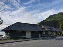 | Seward Depot | 7.2 miles | 1987 |
 | Van Gilder Hotel | 7.5 miles | 1980 |
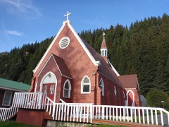 | St. Peter's Episcopal Church | 7.8 miles | 1979 |
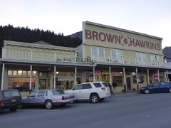 | Brown & Hawkins Store | 7.8 miles | 1988 |
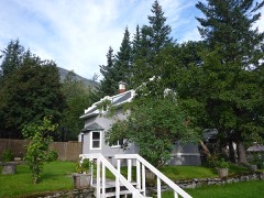 | Swetman House | 7.9 miles | 1978 |
| National Archives record | The nomination case file for reference 100007802 in Record Group 79. |
| Kenai Peninsula Borough | All 29 listed properties in this county. |