Block
From the record
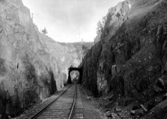
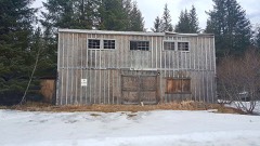
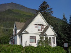
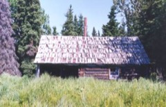
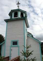
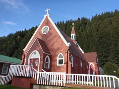
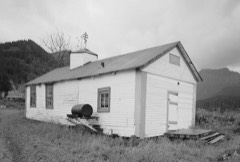
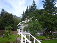
29 National Register listings published here, 1 of them a National Historic Landmark.
Sources: the National Register database, National Park Service
256 topographic sheets cover 73 settlements here, and 29 properties are on the National Register of Historic Places.
29 National Register listings published here, 1 of them a National Historic Landmark.
Sources: the National Register database, National Park Service
Every property in this county listed on the National Register of Historic Places, with the year it was listed and the federal nomination document.
Every wildfire the federal occurrence database records inside this county: 1,818 of them, burning about 534,274 acres. 77 started naturally and 24 were recorded as arson. Each settlement page carries the fires within five miles of it.
| Reported cause | Fires |
|---|---|
| Missing data/not specified/undetermined | 484 |
| Recreation and ceremony | 416 |
| Debris and open burning | 386 |
| Misuse of fire by a minor | 128 |
| Other causes | 77 |
| Equipment and vehicle use | 77 |
| Natural | 77 |
| Power generation/transmission/distribution | 68 |
| Smoking | 52 |
| Arson/incendiarism | 24 |
| Fireworks | 23 |
| Railroad operations and maintenance | 3 |
| Firearms and explosives use | 3 |
The five largest, by the area the report gives. None of them was recorded as arson.
| Date | Cause | Size | Reported by | Name on the report |
|---|---|---|---|---|
| 19 May 2014 | Missing data/not specified/undetermined | 196,722 acres | Kenai National Wildlife Refuge | 140 FUNNY RIVER |
| 5 June 2019 | Natural | 167,183 acres | Alaska State Office | SWAN LAKE |
| 19 June 2007 | Missing data/not specified/undetermined | 56,254 acres | Alaska Fire Service | CARIBOU HILLS |
| 11 July 2005 | Natural | 26,300 acres | Kenai National Wildlife Refuge | 450 FOX CREEK WFU |
| 6 June 1996 | Debris and open burning | 17,510 acres | Alaska Fire Service | 603411 |
| 30 June 2009 | Natural | 13,221 acres | Kenai National Wildlife Refuge | 348 SHANTA CREEK |
| 26 June 2005 | Natural | 10,131 acres | Alaska Fire Service | KING COUNT |
| 15 June 2015 | Missing data/not specified/undetermined | 8,876 acres | Alaska Fire Service | CARD STREET |
Every settlement page carries the fires within five miles of it - see the settlement index below.
The NOAA Storm Events Database holds 42 reports for this county, causing no deaths, no injuries and about $22,030,000 in recorded property damage. Each settlement page carries the reports that name it.
| Kind of event | Reports |
|---|---|
| Flood | 34 |
| Hail | 6 |
| Funnel Cloud | 2 |
The most serious of them, by death, then injury, then recorded damage. The accounts are quoted exactly as the forecast office filed them.
| When | Event | Place named | Harm | What the report says |
|---|---|---|---|---|
| April 2021 | Flood | Homer | $5,000,000 | An ice jam formed on the lower Anchor River on April 19, 2021. Originally the ice jam formed above the stream gage on the Old Sterling Highway and over the next few days the ice jam slowly moved downstream until it broke on April 24th. The area around the Old Sterling Highway flooded - notably the DOT supply and equipment staging site for the bridge replacement this summer as well as the campgrounds along the Anchor River Road and Anchor River Road itself. |
| September 2017 | Flood | Soldotna | $5,000,000 | Flooding in many yards and at least one cabin along Snug Harbor Road. The lake edge is normally about another 30 feet off the deck. NWS survey crews found flooded boat launches at both Cooper Landing Boat Launch and Quartz Creek Campground Boat Launch. The public also reported flooding of various parking lots around the Cooper Landing area via Social Media. |
| September 2012 | Flood | Seward | $3,310,000 | no account filed |
| February 2007 | Flood | Soldotna | $1,600,000 | no account filed |
| January 2007 | Flood | Soldotna | $1,600,000 | no account filed |
| September 2012 | Flood | Soldotna | $1,380,000 | The Kenai River at Skilak crested at 15.56ft on 9/26/12 at 15:15 AKDT; the Kenai River at Soldotna crested at 12.53ft on 9/26/12 at 13:15 AKDT. |
| December 2019 | Flood | Homer | $1,000,000 | Primary impact of this episode was flooding of the Anchor Point River. North Fork Road at mile 15.5 was impassable, water was over the Sterling Highway in several locations between mile 161 and 163, flooding across East End Road at Bear Creek Drive and a mudslide on East End Road at Kachemak Bay Drive. Water also flooded the Anchor River State Recreation area and surrounded multiple recreation cabins in the area. |
| September 2017 | Flood | Moose Pass | $1,000,000 | NWS Survey team as well as photos and reports from residents along Primrose Spur road on south end of Kenai Lake confirm several days of flooded yards and road closed by state Dept. of Transportation. Resident reported flooding on the high end of normal for this biennial flooding event. |
| October 2006 | Flood | Seward | $500,000 | no account filed |
| August 2019 | Flood | Soldotna | $350,000 | Aerial monitoring of the Snow Glacier Dammed Lake, combined with a rise in the water level on the river gauge indicated the lake had released. The forecast river stage was based on the estimated amount of water in the lake. Primrose Campground and Cooper Lake Campground were flooded, closing the campgrounds. The Alaska Railroad experienced high levels of erosion along the route due to shifting of the river channel, in addition to the high volume of water. The railroad had to close the route for a week during peak tourist season. |
| August 2019 | Flood | Moose Pass | $350,000 | Aerial monitoring of the Snow Glacier Dammed Lake, combined with a rise in the water level on the river gauge indicated the lake had released. The forecast river stage was based on the estimated amount of water in the lake. Primrose Campground and Cooper Lake Campground were flooded, closing the campgrounds. The Alaska Railroad experienced high levels of erosion along the route due to shifting of the river channel, in addition to the high volume of water. The railroad had to close the route for a week during peak tourist season. |
| October 2018 | Flood | Soldotna | $300,000 | Two heavy waves of precipitation between October 12th and 16th each dropped roughly 6 of rain on the precipitation gage at the headwaters of the Resurrection River, and 6.86 of precipitation at the Seward airport during the second event. The Resurrection River reached moderate flood stage on Oct 13th and again on the 16th. Numerous creeks in the Seward area went overbank; closing and washing out roads to critical infrastructure. The airport runway flooded, and there were mud and rock slides throughout the area. |
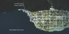
| September 2020 | Flood | Seward | $250,000 | Eight to ten inches of rain fell between September 26th and October 3rd The most intense rain was on Wednesday, September 30th with 2.5 inches in 24 hours, followed by 3 days of 1-2 inches/day. This event caused flooding and gravel aggregation in many of the roadways. Specific impacts include: Heavy equipment operating in all the gravel creeks of the Seward and Bear Creek areas throughout the weekend, Kenai Peninsula Borough (KPB) activated their Emergency Operations Center (EOC), Kenai Peninsula Borough put residents of Bruno Road into a Ready Status - preparing them for evacuation in case the levy breached, runway flooded and closed for 4 days while flooding subsided and DOT could remove debris from runway, Landslide on Lowell Point Road and numerous gravel removal efforts at the outlet of Lowell Creek Tunnel. |
| October 2013 | Flood | Seward | $225,000 | The airport at Seward measured 4.47 inches of rainfall between October 27-28, 2013. This caused the Lowell Creek diversion tunnel outlet stream to become filled with gravel from the creek that washed down from the mountainside in the heavy rainfall. The result was damage to the bridge over the road as flood waters topped the bridge. |
| January 2020 | Flood | Soldotna | $50,000 | Big Eddy Ice Jam on the Kenai River on January 9th, an ice jam formed on the Kenai River at Big Eddy, sending water over roads and into residences in the area. Flooding was mostly on the Riverside Drive/Eddy Lane subdivision. Water levels stabilized after the ice jam. After the overbank water froze, the borough graded the road to allow resident access. No changes are expected until breakup. |
| July 2018 | Flood | Seward | $50,000 | The dike eroded along Sawmill Creek causing flooding on 2 properties in the Clyde King Subdivision to flood; 1 house has 1.5 ft of water. |
| July 2009 | Flood | Seward | $50,000 | River gages in Seward exceeded flood stage. |
| September 2016 | Flood | Seward | $15,000 | About 3.5 inches of rain fell in the Seward area, with 1.72 inches falling in a 6 hour period. The Resurrection River, adjacent to the Seward airport, rose 5 ft in 24 hours, resulting in water and debris impacting the runway and causing a 2 day closure of the airport. |
| January 2025 | Flood | Homer | - | Warm weather caused the breakup of ice on the Anchor River near Anchor Point. Initially river rises were reported on the portion of the Anchor River between the Sterling Highway Bridge and the Old Sterling Highway bridge, as ice moved downstream. Ice eventually became entrenched below the old Sterling Highway bridge, flooding the Anchor Point road and compromising residents ability to reach their homes. Additional widespread flooding was reported in the Anchor River Campground. |
| January 2025 | Flood | Homer | - | Heavy rain in the Anchor River basin brought river levels up quickly and flooded many areas along the river between Anchor Point and Homer. The Blackwater Bend area reported water over the Sterling Highway. Additional severe flooding was reported on Anchor Point Road near the Old Sterling Highway as water reactivated ice in the Anchor River, causing an ice jam. Over a foot of water spread over Anchor Point Road, which closed access to homes along the road. The entire Anchor River Campground was flooded as well. |
| August 2024 | Funnel Cloud | Seward | - | A mariner reported that a waterspout developed between Cheval Island and Pony Cove starting around 10:45 AM AKST that moved from west to east after developing and lasted for about 5 minutes. Photo evidence provided by this mariner showed a clear funnel cloud and surface circulation kicking up sea spray. While this waterspout developed close to several islands, there was no clear evidence this feature ever reached land before it dissipated. |
| August 2024 | Flood | Soldotna | - | Heavy rain caused widespread lowland flooding and large amounts of riverine erosion across Seward, AK and the surrounding areas. Several streams in the region were moving large amounts of sediment and Seward officials were in an ongoing flood flight to keep area culverts clear of debris to mitigate more severe flooding. Flooding along Japanese Creek flooded Dieckgraeff Road after a berm washed out flooding the area. |
| December 2024 | Flood | Homer | - | Warm temperatures caused snowmelt to raise river levels and dislodged ice cover on the Anchor River, from the Old Sterling Highway downstream to near Anchor Point. Ice jammed at several locations along the river and caused flooding of parklands along the Anchor River and flooded areas of Anchor Point Road. Road closures were monitored by DOT. |
| December 2024 | Flood | Homer | - | Warm temperatures caused snowmelt to raise river levels and dislodged ice cover on the Anchor River, from the Old Sterling Highway downstream to near Anchor Point. Ice jammed at several locations along the river and caused flooding of parklands along the Anchor River and flooded areas of Anchor Point Road. Road closures were monitored by DOT. |
| September 2023 | Flood | Soldotna | - | Observations of Snow Glacier indicated that a Glacial Dammed Lake (GDL) released on or around the 9/7/23 to 9/8/23. The Snow and Kenai Rivers rose rapidly in response, routing flood waters through the system from the GDL. The Snow River reached action stage, however as the flood propagated downstream it combined with high river baseflows to crest in minor flood at 13.48 feet at 3:15pm AKDT on 9/10/23 at the Cooper Landing river gauge. |
| September 2023 | Flood | Soldotna | - | Skilak Glacier Dammed Lake released, combining with flow coming through Skilak Lake, impacting the region below Skilak Lake and Soldotna. Widespread flooding was reported at Kenai Keys and along the Kenai River, especially below Skilak Lake where flood levels reached moderate severity. Verification was made using inundation maps matched with ground truth photos, emergency manager reports and social media. |
| August 2022 | Flood | Soldotna | - | River gage on the Kenai River remained in action stage for over a week due to the persistent rainfall from day to day. Low lying areas of a campground nearby reported higher than usual water levels during the timeframe of the 18th-27th but only minor flooding reported. |
| September 2022 | Flood | Soldotna | - | Snow Glacial Dam releases caused minor flooding along the Snow and Kenai Rivers from near Seward to Skilak Lake. Water levels reached minor flood levels with reports of high water closing down boat access, reaching into yards, and encroaching on garages along the rivers. |
| September 2022 | Flood | Moose Pass | - | Snow Glacial Dam releases caused minor flooding along the Kenai River from near Seward to Skilak Lake. Water levels reached minor flood levels, with reports of high water closing down boat access, reaching into yards, and encroaching garages that were along the river. |
| October 2020 | Flood | Seward | - | Eight to ten inches of rain fell between September 26th and October 3rd The most intense rain was on Wednesday, September 30th with 2.5 inches in 24 hours, followed by 3 days of 1-2 inches/day. This event caused flooding and gravel aggregation in many of the roadways. Specific impacts include: Heavy equipment operating in all the gravel creeks of the Seward and Bear Creek areas throughout the weekend, Kenai Peninsula Borough (KPB) activated their Emergency Operations Center (EOC), Kenai Peninsula Borough put residents of Bruno Road into a Ready Status - preparing them for evacuation in case the levy breached, runway flooded and closed for 4 days while flooding subsided and DOT could remove debris from runway, Landslide on Lowell Point Road and numerous gravel removal efforts at the outlet of Lowell Creek Tunnel. |
| July 2014 | Funnel Cloud | Anchorage | - | The water spout was photographed by a person living on the Anchorage Hillside. |
| September 2013 | Flood | Seward | - | The Resurrection River in Seward reached minor flood stage and covered part of the runway at the airport. Several roads were closed as water covering them made them impassible. |
| October 2010 | Flood | Seward | - | Heavy rainfall along the Eastern Kenai Mountains caused the Resurrection River near Seward, Alaska to reach flood stage. It was over flood stage from Oct 2 at 7 AM ADT through 4 PM ADT Oct 2nd. The crest was at 18.17 ft, which is .67 ft over flood stage.|In addition, the Seward Emergency Manager reported a mudslide on mile 19 with only one lane open. Water was up to the road at Salmon Creek road and Nash road. There was also an unconfirmed report of water over the bridge near the prison. |
| August 2009 | Flood | Soldotna | - | Reconnaissance of the Skilak Lake by the Kenai Peninsula Borough revealed the glacial dam release. |
| September 2012 | Flood | Seward | - | no account filed |
| October 2012 | Flood | Seward | - | no account filed |
| June 2007 | Hail | Soldotna | - | no account filed |
| June 2007 | Hail | Moose Pass | - | no account filed |
| July 2005 | Hail | Soldotna | - | no account filed |
| July 2005 | Hail | Soldotna | - | no account filed |
| July 2005 | Hail | Soldotna | - | no account filed |
| July 2005 | Hail | Soldotna | - | no account filed |
Named settlements recorded in the Geographic Names Information System, each with the topographic sheets covering it. Villages, hamlets and abandoned places alike. Each is shown with the nearest named watercourse or landform and the survey quadrangle it falls on.
Kenai-Cook Inlet census subarea · 99556 · On North Fork Anchor River · Seldovia D-5 SW quadrangle
18 sheets, 1946 to 1987
Kenai-Cook Inlet census subarea · 99603 · Seldovia C-3 NW quadrangle
21 sheets, 1951 to 1987
No longer a settlement
Seward-Hope census subarea · 99664 · On Lost Creek · Seward A-7 NE quadrangle
27 sheets, 1950 to 1997
Kenai-Cook Inlet census subarea · Iliamna A-4 NE quadrangle
13 sheets, 1951 to 1957
No longer a settlement
Kenai-Cook Inlet census subarea · 99611 · On Kenai River · Kenai C-4 SE quadrangle
19 sheets, 1944 to 1986
No longer a settlement
Kenai-Cook Inlet census subarea · 99568 · In Clam Gulch · Kenai A-4 NW quadrangle
18 sheets, 1944 to 1987
Kenai-Cook Inlet census subarea · 99610 · On Kasilof River · Kenai B-4 SE quadrangle
18 sheets, 1944 to 1986
Seward-Hope census subarea · 99572 · On Bean Creek · Seward B-8 NW quadrangle
25 sheets, 1951 to 1994
Seward-Hope census subarea · 99664 · On Falls Creek · Seward B-7 NE quadrangle
25 sheets, 1951 to 1994
Seward-Hope census subarea · 99631 · On Fresno Creek · Seward C-7 NW quadrangle
23 sheets, 1951 to 1994
Kenai-Cook Inlet census subarea · 99603 · Seldovia C-5 NE quadrangle
20 sheets, 1946 to 1987
Kenai-Cook Inlet census subarea · On Rust Slough · Kenai C-6 SW quadrangle
14 sheets, 1944 to 1958
Seward-Hope census subarea · 99664 · On Trail Creek · Seward B-7 NE quadrangle
25 sheets, 1951 to 1994
Kenai-Cook Inlet census subarea · 99603 · Seldovia D-3 SW quadrangle
18 sheets, 1951 to 1987
Kenai-Cook Inlet census subarea · 99603 · Seldovia C-4 NE quadrangle
20 sheets, 1948 to 1987
Kenai-Cook Inlet census subarea · 99669 · Kenai C-3 SE quadrangle
20 sheets, 1944 to 1992
Seward-Hope census subarea · 99631 · On Slate Creek · Seward C-7 SW quadrangle
23 sheets, 1951 to 1994
Kenai-Cook Inlet census subarea · 99603 · Near Ismailof Island · Seldovia C-4 SE quadrangle
20 sheets, 1948 to 1987
Kenai-Cook Inlet census subarea · 99639 · On Happy Creek · Seldovia D-5 NW quadrangle
18 sheets, 1946 to 1987
Kenai-Cook Inlet census subarea · 99603 · Near Woodard Canyon · Seldovia C-5 NE quadrangle
20 sheets, 1946 to 1987
Seward-Hope census subarea · 99605 · On Cripple Creek · Seward D-8 NE quadrangle
25 sheets, 1951 to 1995
Kenai-Cook Inlet census subarea · On Twist Creek · Iliamna C-1 NW quadrangle
15 sheets, 1949 to 1958
Kenai-Cook Inlet census subarea · 99663 · On Jakolof Creek · Seldovia B-5 NE quadrangle
18 sheets, 1951 to 1987
Kenai-Cook Inlet census subarea · 99603 · Near Bear Canyon · Seldovia C-4 NW quadrangle
20 sheets, 1948 to 1987
Kenai-Cook Inlet census subarea · 99603 · On Fox Creek · Seldovia D-3 SW quadrangle
18 sheets, 1951 to 1987
Kenai-Cook Inlet census subarea · 99610 · Kenai B-4 NE quadrangle
18 sheets, 1944 to 1986
Kenai-Cook Inlet census subarea · 99610 · On Crooked Creek · Kenai B-4 SE quadrangle
18 sheets, 1944 to 1986
Kenai-Cook Inlet census subarea · 99611 · On Kenai River · Kenai C-4 SE quadrangle
19 sheets, 1944 to 1986
Kenai-Cook Inlet census subarea · 99556 · Seldovia D-5 SE quadrangle
18 sheets, 1946 to 1987
Kenai-Cook Inlet census subarea · 99556 · Seldovia D-5 SE quadrangle
18 sheets, 1946 to 1987
Seward-Hope census subarea · 99664 · On Victor Creek · Seward B-7 SE quadrangle
25 sheets, 1951 to 1994
Seward-Hope census subarea · 99664 · On Ptarmigan Creek · Seward B-7 NE quadrangle
25 sheets, 1951 to 1994
Seward-Hope census subarea · 99664 · On Spruce Creek · Seward A-7 SW quadrangle
26 sheets, 1950 to 1997
Kenai-Cook Inlet census subarea · 99603 · Seldovia C-4 NW quadrangle
20 sheets, 1948 to 1987
Seward-Hope census subarea · 99664 · On Ptarmigan Creek · Seward B-7 NE quadrangle
25 sheets, 1951 to 1994
Kenai-Cook Inlet census subarea · 99556 · Seldovia D-5 SE quadrangle
18 sheets, 1946 to 1987
Kenai-Cook Inlet census subarea · 99556 · Seldovia D-5 SE quadrangle
18 sheets, 1946 to 1987
Kenai-Cook Inlet census subarea · 99603 · On English Bay River · Seldovia B-6 SE quadrangle
19 sheets, 1951 to 1987
Kenai-Cook Inlet census subarea · 99611 · Kenai D-4 SE quadrangle
18 sheets, 1944 to 1986
No longer a settlement
Kenai-Cook Inlet census subarea · 99556 · Seldovia D-5 SE quadrangle
18 sheets, 1946 to 1987
Kenai-Cook Inlet census subarea · 99639 · On Ninilchik River · Kenai A-5 SE quadrangle
18 sheets, 1944 to 1987
Kenai-Cook Inlet census subarea · 99635 · On Old Tyonek Creek · Tyonek A-4 SE quadrangle
13 sheets, 1949 to 1965
No longer a settlement
Kenai-Cook Inlet census subarea · Seldovia C-5 SE quadrangle
27 sheets, 1946 to 1987
No longer a settlement
Kenai-Cook Inlet census subarea · 99611 · Kenai D-4 SE quadrangle
18 sheets, 1944 to 1986
Kenai-Cook Inlet census subarea · 99603 · Seldovia B-5 SW quadrangle
18 sheets, 1951 to 1987
Kenai-Cook Inlet census subarea · 99611 · Kenai C-4 NW quadrangle
19 sheets, 1944 to 1986
Kenai-Cook Inlet census subarea · 99611 · Tyonek A-2 SE quadrangle
16 sheets, 1949 to 1986
Kenai-Cook Inlet census subarea · 99611 · On Salamatof Creek · Kenai C-4 SW quadrangle
19 sheets, 1944 to 1986
Kenai-Cook Inlet census subarea · 99663 · By Red Bluff · Seldovia B-5 NW quadrangle
18 sheets, 1951 to 1987
Kenai-Cook Inlet census subarea · 99663 · On Barabara Creek · Seldovia B-5 NE quadrangle
18 sheets, 1951 to 1987
Seward-Hope census subarea · 99664 · On Lowell Creek · Seward A-7 SW quadrangle
26 sheets, 1950 to 1997
Kenai-Cook Inlet census subarea · 99635 · Tyonek A-4 SW quadrangle
13 sheets, 1949 to 1965
Kenai-Cook Inlet census subarea · 99669 · On Slikok Creek · Kenai B-4 NE quadrangle
18 sheets, 1944 to 1986
No longer a settlement
Seward-Hope census subarea · 99605 · On Silvertip Creek · Seward D-7 SE quadrangle
24 sheets, 1951 to 1994
Kenai-Cook Inlet census subarea · 99568 · Kenai A-1 SW quadrangle
17 sheets, 1944 to 1958
No longer a settlement
Kenai-Cook Inlet census subarea · 99611 · On Kenai River · Kenai C-4 SE quadrangle
19 sheets, 1944 to 1986
No longer a settlement
Seward-Hope census subarea · 99572 · On Shackleford Creek · Seward B-8 NE quadrangle
25 sheets, 1951 to 1994
Kenai-Cook Inlet census subarea · 99669 · On Soldotna Creek · Kenai B-3 NW quadrangle
18 sheets, 1944 to 1986
Kenai-Cook Inlet census subarea · 99672 · On Moose River · Kenai C-3 SE quadrangle
20 sheets, 1944 to 1992
Seward-Hope census subarea · 99605 · On Falls Creek · Seward D-7 NE quadrangle
25 sheets, 1951 to 1994
Kenai-Cook Inlet census subarea · 99682 · On Tyonek Creek · Tyonek A-4 SE quadrangle
13 sheets, 1949 to 1965
No longer a settlement
Kenai-Cook Inlet census subarea · On McArthur River · Kenai D-5 NW quadrangle
15 sheets, 1944 to 1958
No longer a settlement
Kenai-Cook Inlet census subarea · 99682 · On Indian Creek · Tyonek A-4 SE quadrangle
13 sheets, 1949 to 1965
Seward-Hope census subarea · 99631 · On Frenchy Creek · Seward C-7 NW quadrangle
23 sheets, 1951 to 1994
Seward-Hope census subarea · 99664 · On Bear Creek · Seward A-7 NE quadrangle
27 sheets, 1950 to 1997
Seward-Hope census subarea · 99664 · Seldovia B-2 NW quadrangle
18 sheets, 1951 to 1963
No longer a settlement
The vanished settlements of Kenai Peninsula Borough: the places named above that are no longer on the map.