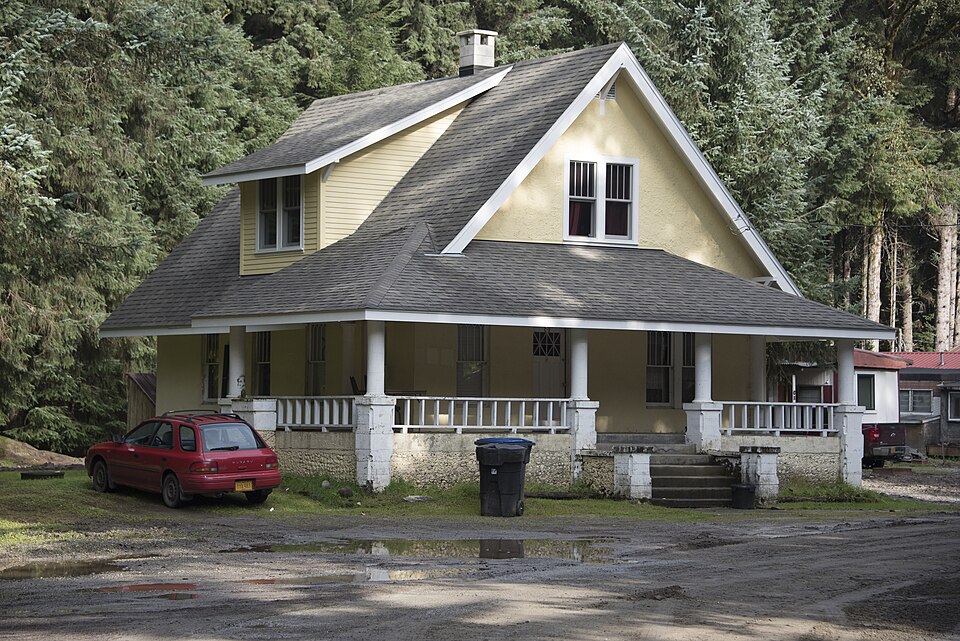
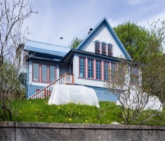
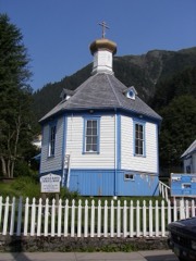
Built in 1915 (American Craftsman). Listed on the National Register of Historic Places in 2015.
From the record
“The Rudy-Kodzoff House is a historic house at 2865 Mendenhall Loop Road in Juneau, Alaska. It is a concrete structure with Craftsman/Bungalow styling, built in 1915 for Charles Rudy, one of the first settlers of the Mendenhall Valley.”
Wikipedia article Rudy-Kodzoff House, CC BY-SA 4.0.
One of 23 National Register listings published here for Juneau City and Borough · listed in 2015 · category: Building · built in 1915, American Craftsman.
National Register reference number. 15000070 - assigned by the National Park Service when the property was listed.
Fires near this property
61 since 1993
Regional context, not property-specific
evidence. The
federal wildfire occurrence database
lists 61 fires within 5 miles of Rudy-Kodzoff House
between 1993 and 2020, burning about 16 acres in total. None started naturally. 6 were recorded as arson.
Distance is straight-line from the map coordinates, so a fire counted
here may appear on a neighbouring settlement's page as well.
Reported cause
Fires
Recreation and ceremony
26
Missing data/not specified/undetermined
14
Arson/incendiarism
6
Debris and open burning
4
Misuse of fire by a minor
4
Smoking
3
Fireworks
3
Equipment and vehicle use
1
The most recent of
them, most recent first, with the day each was reported and the service
that recorded it.
Regional context, not property-specific
evidence. The federal mineral resources record lists
37 workings within 5 miles of Rudy-Kodzoff House: 20 past producers, 10 prospects, 6 occurrences, 1 producer.
1 still produces. What was taken out: Gold, Sand and Gravel, Construction, Lead, Stone. Distance is straight-line from the
map coordinates, so a quarry counted here may appear on a neighbouring
settlement's page as well.
Regional context, not property-specific
evidence. The National Weather Service names
Juneau, the town this property stands in, in 2 storm reports between 2014 and 2021: 2 flood.
No death or injury is recorded in these reports. Each account below is quoted exactly as the forecast office
filed it, from the NOAA Storm Events Database, and each date
opens the federal record of that event.
The Taku River water levels were at record daily stream flows hovering just below minor flooding stage of 43 feet by the end on July from well above normal snowpack, delayed snowmelt from a cool spring and then rapid snowmelt from impacts of an atmospheric river and then record high temperatures. One the morning of June 29th the public reported that the glacier dammed lake, Lake No Lake, on the Tulsequah Glacier just over the Canadian boarder was starting to release water into Tulsequah River which is a tributary to the Taku River. The Taku River started to rise steadily for the next 36 hours as the Lake No Lake totally drained. There was about 50,000 cubic feet per second of water added to the Taku River from Lake No Lake and combined with record daily stream flows already occurring on the Taku River it produced record flooding going above the previous record of 45.07 feet from 2004. A number of homes were affected from the moderate to major flooding with water in homes and some foundations being compromised.
A weather front moved across the north central inner channels on July 14 and produced about one half to three quarters of an inch of rainfall. The Taku River began to rise from the rain runoff but instead of dropping off once the rain let up the river rose significantly. At the same time the water temperature started to drop significantly. All of these variables pointed towards a release from Lake No Lake glacier dammed lake along the Tulsequah Glacier. For the next thirty hours the Taku River rose significantly as the water from Lake No Lake drained into the river system. The Taku River crested at forty-four point zero two feet which was just above moderate flood stage at 1:30pm on July 16. At this stage there will be water at the door jam of the house near the USGS gauge along with water inundating other cabins along the river.
No historic map-sheet match is published
for this property yet. That does not mean no map exists. This record needs
a coordinate-quality review before it can be joined to a sheet boundary.
Browse the county's mapped places while that work is
pending.
Listed places nearby
6 within 8 miles
Other National Register properties close
enough to walk or drive between, ordered by distance from this one. Both
positions come from the same geocoding pass that matched these properties
to their map sheets.
Listing record. National Park Service National Register of Historic Places, listed-properties dataset, current to 2026-05-22.
Map join. Address geocoded through the United States Census geocoder, then tested against the published boundary of every sheet in the USGS Historical Topographic Map Collection.
How this page is made. Listing fields come from federal records; map-sheet coverage is a labelled coordinate-to-boundary calculation, not a source-field claim.
Wildfire. Short, Karen C. 2022. Spatial wildfire occurrence data for the United States, 1992-2020 [FPA_FOD_20221014]. 6th Edition. Fort Collins, CO: Forest Service Research Data Archive. https://doi.org/10.2737/RDS-2013-0009.6 Collected with United States Government funding and usable without additional permissions or fees.
Mines and quarries. USGS Mineral Resources Data System (MRDS) https://mrdata.usgs.gov/mrds/ A work of the United States government, no copyright under 17 U.S.C. 105.
Storms. NOAA National Centers for Environmental Information, Storm Events Database https://www.ncei.noaa.gov/stormevents/ A work of the United States government, no copyright under 17 U.S.C. 105. Narratives are quoted verbatim from the National Weather Service report and are not edited or summarised.
 Block