 Block
From the record
23 National Register listings published here.
Sources: the National Register database, National Park Service
50 topographic sheets cover 23 settlements here, and 23 properties are on the National Register of Historic Places.
23 National Register listings published here.
Sources: the National Register database, National Park Service
Every property in this county listed on the National Register of Historic Places, with the year it was listed and the federal nomination document.
| Photograph | Property | Type | Listed | Reference |
|---|---|---|---|---|
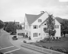 | Alaska Governor's Mansion | building | 1976 | 76000359 |
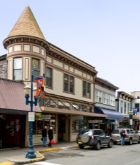 | Alaska Steam Laundry | building | 1978 | 78000527 |
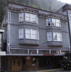 | Alaskan Hotel | building | 1978 | 78000526 |
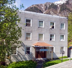 | Bergmann Hotel | building | 1977 | 77000217 |
| Chicken Ridge Historic District | district | 1995 | 95000420 | |
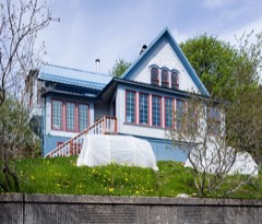 | J. M. Davis House | building | 1982 | 82002073 |
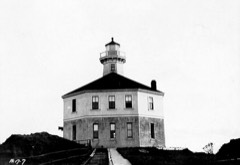 | Eldred Rock Lighthouse | structure | 1975 | 75000332 |
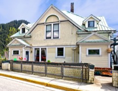 | Frances House | building | 1985 | 85001187 |
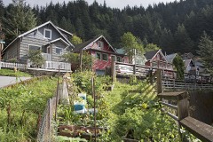 | Fries Miners' Cabins | district | 1988 | 88001347 |
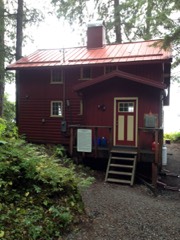 | Ernest Gruening Cabin | building | 1992 | 92000633 |
| Hasselborg Cabin | building | 1995 | 95001291 | |
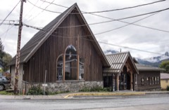 | Holy Trinity Church | building | 1978 | 78000528 |
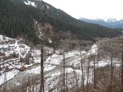 | Jualpa Mining Camp | district | 1993 | 93000733 |
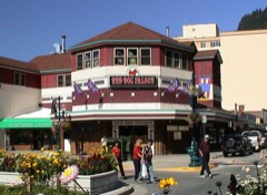 | Juneau Downtown Historic District | district | 1994 | 94000603 |
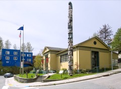 | Juneau Memorial Library | building | 2006 | 06000463 |
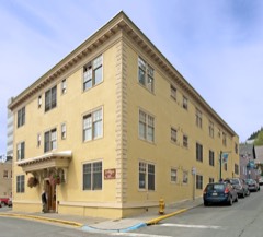 | MacKinnon Apartments | building | 2000 | 00000144 |
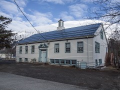 | Mayflower School | building | 1988 | 88002534 |
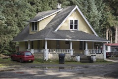 | Rudy-Kodzoff House | building | 2015 | 15000070 |
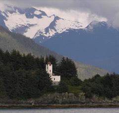 | Sentinel Island Light Station | district | 2002 | 02001407 |
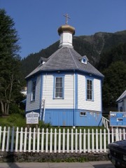 | St. Nicholas Russian Orthodox Church | building | 1973 | 73000377 |
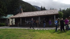 | Twin Glacier Camp | district | 1988 | 88000556 |
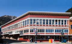 | Valentine Building | building | 1985 | 85001275 |
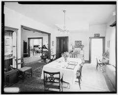 | Wickersham House | building | 1976 | 76000360 |
Every wildfire the federal occurrence database records inside this county: 226 of them, burning about 139 acres. 1 started naturally and 11 were recorded as arson. Each settlement page carries the fires within five miles of it.
| Reported cause | Fires |
|---|---|
| Recreation and ceremony | 146 |
| Missing data/not specified/undetermined | 32 |
| Debris and open burning | 17 |
| Arson/incendiarism | 11 |
| Smoking | 6 |
| Misuse of fire by a minor | 6 |
| Fireworks | 5 |
| Equipment and vehicle use | 2 |
| Natural | 1 |
The five largest, by the area the report gives. None of them was recorded as arson.
| Date | Cause | Size | Reported by | Name on the report |
|---|---|---|---|---|
| 31 May 2018 | Recreation and ceremony | 56 acres | Tongass National Forest | ANTLER |
| 26 May 1997 | Recreation and ceremony | 20 acres | Tongass National Forest | BERNER'S BAY |
| 9 May 2020 | Misuse of fire by a minor | 16 acres | Tongass National Forest | CROW POINT |
| 5 May 2003 | Recreation and ceremony | 4.0 acres | Tongass National Forest | LENA POINT |
| 20 May 2005 | Debris and open burning | 2.5 acres | Tongass National Forest | REFUGE WETLANDS |
| 4 May 2003 | Recreation and ceremony | 2.0 acres | Tongass National Forest | MIDDLE POINT |
| 11 May 2000 | Recreation and ceremony | 2.0 acres | Tongass National Forest | LITTLE SHEEP CREEK |
| 8 May 2002 | Smoking | 2.0 acres | Tongass National Forest | MOOSE LAKE |
Every settlement page carries the fires within five miles of it - see the settlement index below.
The NOAA Storm Events Database holds 30 reports for this county, causing no deaths, no injuries and about $28,832,740 in recorded property damage. Each settlement page carries the reports that name it.
| Kind of event | Reports |
|---|---|
| Flood | 25 |
| Debris Flow | 4 |
| Thunderstorm Wind | 1 |
The most serious of them, by death, then injury, then recorded damage. The accounts are quoted exactly as the forecast office filed them.
| When | Event | Place named | Harm | What the report says |
|---|---|---|---|---|
| December 2020 | Flood | Douglas | $8,100,000 | As the atmospheric river moved over the north central inner channels of Southeast Alaska it produced significant amount of precipitation from December 1-2. Heavy to moderate rainfall persisted over 36 hours with the highest amounts coming during the overnight hours going into December 2nd. By mid morning on December 1st, 2 to 3 inches of precipitation fell which is a 5 to 10 year event at the Juneau forecast office and the downtown Juneau LARC. Some of that precipitation did fall as snow, from 9 to 20 inches at elevations above 1000 feet. The snow level rose rapidly through the afternoon of December 1st to be above the mountain tops by the evening hours. This warming at elevation melted the fresh snow that fell with most gains lost by the morning of December 2nd. By the end of December 1st the Juneau airport reported a 24 hour precipitation amount of 4.93 which was a 100 year event and broke the all time daily precipitation record from 1946. Precipitation amounts for December 1st ranged from 3 to 5 inches with a number of daily precipitation records broken. Over the 2 days precipitation amounts were from 5 to 7. The Juneau airport 48hr total of 6.39 remained around the 100 year event. Other areas that did report heavy precipitation did not seem to get the intensity the airport reported. The Juneau forecast office 48hr total of 5.10 was near a 5 year event with the 24hr amount of 4.09 on December 1st was 5 to 10 year event. There was significant runoff from the intense precipitation and from the snowmelt in the mountains. Most of the small streams in the Juneau area began to rise rapidly through the morning hours of December 1st with Jordan Creek going over minor flood stage by the afternoon. As the heavy rain persisted into the evening and overnight hours going into December 2nd the soils continued to be super saturated to produce extreme runoff across the area. This produced record flooding along Jordan Creek in the early morning of December 2nd before it crested around 8am AKST at 11.20 feet for a total rise of 4.5 feet over 36 hours. Multiple homes around Jordan Creek and business in Jordan Square were flooded. Roads near the creek from Jordan Ave, Cascade St, Trout St and the main road of Glacier Highway all were significantly flooded with 1 to 3 feet of water. Due to the intense long duration heavy precipitation, additional snowmelt runoff, and high soil saturation there were multiple debris flows reported across the Juneau area near steep terrain which damaged homes, blocked a number of roads and overwhelmed culverts that damaged roads from erosion. Renninger Street, at the base of Heintzleman Ridge, accesses a city water reservoir along with a middle schools was washed out from erosion on both sides of the road. Residences along Mary Ellen Way on Vanderbilt Hill had multiple debris flows that damaged homes and deposited debris into yard that blocked drainages to divert water into homes. Multiple large debris flows occurred along the lower and upper Salmon Creek Rd and damaged the penstock that brings water from the reservoir to the ALE&P power plant and CBJ water treatment facility. This is the only water supply for DIPAC hatchery that supplies fish stock to all of Southeast Alaska. Without the water DIPAC 2021 stock will die impacting sport and commercial fisheries. A big debris flow was reported along Wire St which damages homes and blocked the Glacier Hwy. Another big debris flow was reported near the AWARE shelter along Glacier Hwy which deposited lots of mud around the shelter and surrounding homes. A home was damaged by a debris flow on Cohen Dr near Tee Harbor as the debris smashed into the side of the home removing a significant portion of the structural support. This was one of the most impactful flooding and debris flow events in recent memory and the data backups extreme impacts. The city of Juneau declared a disaster for this event. |
| August 2023 | Flood | Douglas | $7,000,000 | The level of Mendenhall Lake was near normal levels of 5.5 feet before this event started, late Thursday August 3rd, and by Saturday morning water levels were over moderate flood stage of 10 feet. By this time areas near Skaters Cabin Rd, View Dr, and the Mendenhall Glacier Visitor Center were experiencing moderate flooding impacts with the Mendenhall Lake campground being evacuated. By midday on Saturday, the water levels exceeded the previous record from 2016 of 11.99 feet and impacts were increasing along the Mendenhall River. Homes along View Dr were cut off due to the significant amount of flooding over the road along with flood waters from 1 to 3 feet deep. Areas below the Mendenhall Back Loop Road bridge started to see flooding of yards and increasing bank erosion in the afternoon of August 5th.| |The river continued to rise at a fast pace through the day into the evening hours and the City of Juneau then set up their Emergency Operations Center. In the evening hours, many areas (roads and homes) below Mendenhall Back Loop Road bridge along the Mendenhall River were experiencing moderate flooding along with significant bank erosion of 50 to 200 feet. From that bank erosion one home fell into the river with another large 3 story condominium building was evacuated as it became compromised and could also fall into the river. Going into the late evening hours a portion of another house fell into the river with many other homes along the river being undermined and at risk of falling into the river. Homes and roads around Meander Way, Marion Dr, River Court and Killewich Rd flooded with moderate impacts in the late evening and the local electric company cut power to those residences due to flood waters being 2 to 4 feet deep. ||The river crested near 14.97 feet (preliminary crest from the USGS) around 11:30 PM AKDT on August 5th. At the peak of the event there was 3 to 7 feet of water in and around homes along View Dr. The Mendenhall Lake and River were back below minor flood stage of 9.0 feet by 9:45 AM AKDT on Sunday, August 6th.||While other locations in the Mendenhall Valley, above Mendenhall Back Loop Road bridge, have experienced flooding impacts from these types of events in the past, they saw major damage this time around. This event was 3 feet higher than the previous record from 2016 and the Mendenhall Lake and River rose approximately 9.42 feet.||In the end there were about 48 homes affected with 13 destroyed, 8 with major damage and 7 with minor. This historic event saw the largest amount of water released from Suicide Basin in a single event and approximately 14 billion gallons of water came out of the basin and into the Mendenhall Lake and River system. |
| August 2024 | Flood | Mendenhall Valley | $6,660,000 | The level of Mendenhall Lake was slightly below normal levels of 5.0 feet before this event started in the early morning hours of Sunday August 4th. Twenty four hours into the flooding event, by noon on Monday, water levels had risen 5 feet and were over the moderate flood stage of 10 feet. By this time, areas near Skaters Cabin Rd and the Mendenhall Glacier Visitor Center were experiencing moderate flooding impacts with the USFS Mendenhall Lake Campground being evacuated. As water levels continued to rise, homes along View Drive were cut off with flood waters from 1 to 3 feet deep. Areas below the Mendenhall Back Loop Road bridge started to see flooding of yards between 12 and 13 feet but other locations that saw flooding during last years major event when the river level was near 13 to 13.5 feet did not see flooding at that level due to storm sewer one way values the City and Bough of Juneau installed prior to this event. Also the bank stabilization and armoring that residents installed on the right and left side of the river below the Mendenhall Back Loop Road bridge after last years event remained in tact and protected those residences from flooding/erosion impacts. ||From Monday morning to the crest early Tuesday morning, the rate of rise on the river was around 0.4 FT per hour. The rate of rise was faster this year than last year, which could be due to a more efficient subglacial conduit drainage system, primed by a previous atmospheric river. The river continued to rise on this fast pace through the Monday evening hours and reached major flood stage of 14 feet at 2015AKST, when most of the flooding of homes and roads below the Mendenhall Back Loop bridge started to take place. By 2245AKST on August 5th the Mendenhall River went over the previous record stage set last year of 14.97 feet. The river would rise for another 3 and a half hours and crested at a new record crest of 15.99 feet (preliminary crest from the USGS) at 0315AKST on August 6th. The Mendenhall Lake and River were back below minor flood stage of 9.0 feet by noon on Tuesday, August 6th. The river system was above flood stage for 28 hours.||Through an extensive storm survey, it was determined that water came over the banks of the Mendenhall River along Marion Dr, Riverside Dr, Killewich Rd and Meander Way and produced major flooding to homes west of Riverside Drive and made roads impassable during the peak of the event. The local electric company cut power to those residences due to the flood waters. The amount of water that flowed over Killewich Drive was much higher than last year, causing water to move like a strong river down Riverside Drive and Killewich Dr into Emily Way, Sharon Street, Gee Street, Long Run, and Northland St - areas that had not seen such flooding before. Residents in those areas saw water not just coming from the river to the west, but also from the north, as water made its way through the community from the breach at Killewich Dr. These flood waters produced major impacts, with 1 to 4 FT of water in homes, causing significant damage. There were some areas that reported as much as 6 feet of water in their homes. As the floodwaters moved through homes west of Riverside Drive, the water flowed down Rivercourt Way and returned to the Mendenhall River. After the Mendenhall River breached the banks around Marion Drive, Riverside Drive, Killewich Drive, and Meander Way, water entered the storm sewer drains but could not flow into the Mendenhall River due to the high velocity and pressure from the flood flow. This caused water pressure to build up in the storm sewer system, leading to flooding in areas around the Mendenhall Valley Library and other nearby locations as water emerged from manhole covers. This also occurred near the back of the Safeway by the Mendenhall River at Brotherhood Bridge.||There were changes to the sections of the river above the Back Loop Bridge along View Drive after last years record event which was able to hold more water within its banks. This area did not see moderate flooding impacts until the Mendenhall Lake gauge read above 11.5 feet. This was due to large amounts of river scouring from last year's event. Even through there was major flooding along View Dr, the events high water marks along the south side of View Drive were about 6 inches lower than last year (which saved one house from flood damage). Meanwhile, residents on the north side of View Drive experienced more water flowing across their property, causing increased road and home damage with reports of 4 to 7 feet of water in homes and other erosion issues. ||In the end, there were about 300 homes majorly affected from this significant flood. This was another historic event as it was the second year in a row there was major flooding impacts to an area that historically has not seen any flooding. The area affected this year expanded from last year due and increase of water released from Suicide Basin in a single event. This year, there was approximately 16 billion gallons of water that came out of the basin and into the Mendenhall Lake and River system which was 2 billion more than last year. |
| August 2025 | Flood | Mendenhall Valley | $5,890,000 | The level of Mendenhall Lake was already above the minor flood stage of 9 feet due to an atmospheric river and heavy rain in the days leading up to the event when the outburst flood started on the morning of Tuesday August 12th. By 1200 AKST the water levels had risen 1 foot to be over the moderate flood stage of 10 feet. By this time, areas near Skaters Cabin Rd and the Mendenhall Glacier Visitor Center were experiencing moderate flooding impacts with the USFS Mendenhall Lake Campground being evacuated. As water levels continued to rise, homes along View Drive were cut off with flood waters from 1 to 3 feet deep. The rate of rise continued to increase through the evening hours with Mendenhall Lake going over the major flood stage of 14 feet at 2325 AKST. The rate of rise was higher than last year and the highest observed with an over 3000 CFS increase per hour. For context, the average flow for this time of year for the Mendenhall Lake is around 3500 CFS. The river continued to rise and went over the previous flood stage record of 16 feet around 0420 AKST on August 13th and crested at a new record of 16.65 feet (preliminary crest from the USGS) at 0615 AKST (1515 UTC). The Mendenhall Lake gauge was back below minor flood stage of 9.0 feet at 1440 AKST on Wednesday August 13th. The river system was above flood stage for approximately 38 hours.||According to the City and Borough of Juneau (CBJ), this major flooding event produced significant impacts upstream of the Back Loop Road Bridge, along with minor impacts downstream along the Mendenhall River. These impacts below back loop bridge are different from last years impacts and not as severe due to flood protection. Based on FEMA damage definitions, CBJ identified 35 homes as affected, including 11 with minor damage and 6 with major damage. The most severe flooding occurred in the View Drive area, where CBJ reported 5 homes sustained major damage after 45 FT of water entered living spaces. Additional homes along Meander Way (15 total) were also impacted, including 2 with minor damage and 1 with major damage caused by water seeping under or through HESCO barriers (flood protection measures). Homes near River Road were also affected, and storm drains near the Safeway parking lot at Brotherhood Bridge backed up, contributing to localized flooding. CBJ also documented severe erosion along the left bank (river left) near the Back Loop Road Bridge at the event peak. This erosion damaged the bridge approach, which was already closed, causing part of the sidewalk to fall into the river and severed telecommunication and power lines. The loss of a utility pole into the river cut power and internet connectivity to nearby homes and businesses. |
| October 2019 | Debris Flow | Douglas | $637,000 | Most of the damage from the erosion when culverts were overwhelmed or blocked and debris flows that blocked roadways in Douglas were reported by trained weather spotters or emergency management right after midnight on October 6th. There was multiple calls from the public located on St. Anns Ave about minor street flooding in Douglas along with a debris flow on David and John Street washing out portions of the street. Police started to evacuate people out of harms way with the Red Cross helping people displaced from the damage. Just before sunrise more reports came in that Thane Road was blocked by a debris flow just before Mt.Roberts street. There was also other reports in the morning of the 6th that there was a debris flows in Cope Park in downtown Juneau along with major damage to the Alaska Electric Light and Power's flume system as a debris took out a section of the flume. One report came in that a person's oil tank became dislodged from erosion and was spilling heating fuel into the ground and street. |
| July 2014 | Flood | Douglas | $311,000 | The annual glacier lake outburst flood that takes place on the Mendenhall Lake and River was a record event this year. Once the twelve billion gallons, that accumulated throughout the spring and early summer, in the basin began to drain on Thursday July 9 the lake rose significantly for next forty-two hours. There was a lot of publicity leading up to the event so this record event did not come by a surprise. The new record crest was eleven point eight feet on July 11 which was almost two feet above the moderate flood stage of 10.0 feet and broke the old record from 1994 of eleven point eighteen. The Mendenhall River crested at thirteen point fifty-two feet just under the record crest from 1995 of thirteen point seventy-five feet. After cresting both the Mendenhall Lake and River receded fast and was back at base-flow levels in 12 hours. ||The record flows and stages from Mendenhall Lake and River damaged homes, campgrounds and roads. There was at least three feet of water that flooded the West Glacier spur road which borders the west side of Mendenhall Lake. The USDA Forecast Service closed the West Glacier Road and trail, Nugget Falls trail, Photo Point trail and restricted watercraft on the lake 24 hours before the flooding took place. They also closed the Mendenhall Lake Campground and evacuated 23 of the 70 sites that were occupied. Some campers moved to another campground while other moved to a designated area for them. There was significant flooding within the campground with 3-4 feet of water in places and 150 feet of road within the campground was damaged. The power was also cut by the City of Juneau to the campground.||The View Drive subdivision was cutoff with a one home sustaining significant damage. The City of Juneau told residents of View Drive, along the Mendenhall River, to shelter in place and they also cut their power once water was across the road and the subdivision was cutoff. The home that sustained significant damage was along the Mendenhall River and it had 43 inches in their garage and about 10 inches inside the house. ||The City of Juneau closed the Brotherhood Bridge Trail which follows along the river. They also restricted access to all roads leading into Meander Way, from Rivercourt Drive to Killewich Ave along Riverside Drive but the closure was voluntary. The city was worried that the roads maybe impassible due to flooding from the River or water through the storm drain system.||There was a major bridge construction going on at near the mouth of the River. The construction company was pulling logs out of the river so it would not damage any of their work but logs were getting lodged and acting like a dam diverting water to the banks. This cause significant bank erosion but the bridge structure was not damaged by the trees and debris floating down the river. |
| October 2017 | Flood | Douglas | $180,000 | As moderate rain fell through the day on the 26th, Jordan Creek began to slowly rise from about one inch of rainfall in 12 hours. The creek's rate of rise started to sharpen overnight on the 26th as the snow pack in the headwaters became primed to produce more runoff to go along with the runoff from the rainfall. Jordan Creek went above minor flood stage in the early morning hours of the 27th as the rain increased to be heavy. Within 3 hours around 9 am AKDT the water levels rose above the old record stage for that site of 10.07 feet and above moderate flood stage of 10.50 feet. Jordan Creek crested at 10.97 feet, a new record, in the afternoon of the 27th and began to recede through the early evening as the rain rates began to tapper off. ||There was significant flooding in the Jordan Creek area with multiple home's and business's' flooded, with some water in their crawl space and/or homes . Roads around the area were flooded but still passable. Parking lots were also flooded with some owners moving their car but some did not and were flooded with a few feet of water. Estimated flood damage costs were around 100k.||The heavy rain also produced a debris flow along the Gold Creek flume and cause damage which cost about 80k to fix. |
| July 2016 | Flood | Douglas | $20,000 | In the afternoon of June 29th the Mendenhall Lake and River began to slowly rise as the glacier dammed lake in Suicide Basin about 2 miles from the terminus started to drain. Mendenhall Lake and River continue to rise for the next two days as the dammed lake emptied. The water levels reach minor flood stage of nine feet in the morning of July 1 and by the late evening around 8pm Mendenhall Lake crested at eleven point ninety nine feet. This crest broke the old record stage of eleven point eighty nine feet from 2014. After the lake and river crested the water level receded very quickly and was below minor flood stage by the mid morning on July 2. There was significant flooding around Mendenhall Lake and the upper portions of the river above Back Loop Road. The Mendenhall campground was evacuated due flooding of up to three feet at the entrance and within the campground. The West Glacier spur road and the area around Skaters Cabin was flooded with three feet water. View Drive was flooded with two feet of water and the road cut off. There was minor flood damage to some homes that border the river along the road. There was also more flooding along the dredge lakes trail area and and few other trails around the Mendenhall Glacier Vistitor Center run by the USDA Forest Service. |
| September 2022 | Debris Flow | Douglas | $18,800 | AKDOT respond to a small shallow landslide around mile marker 31 along Glacier Highway which closed the highway for a period of time. The slide was reported around 1700AKST which was was the front went through the area and there was very high rain rates of over 0.50 in 3 hours after more than 2 in the previous 24 hours. The heavy rain persisted overnight and another small slide came down very close to the location of the first one the previous day. AKDOT was able to clear the material in a few hours to have the road back open. |
| June 2025 | Thunderstorm Wind | Douglas | $8,200 | A sudden wind shift to the south from a strengthening squall line measured a peak gust of 73mph at the top of the Mt. Roberts Tram at 304pm and a peak gust of 60mph at the top of the Federal Building at 310pm AKDT. The NOS Juneau Tide Gauge at the USCG dock measured a peak gust of 47mph at 306pm AKDT and the Juneau Airport center runway measured a peak gust of 47mph at 321pm. ||When the squall line reached the Port of Juneau shortly after 3pm, a cruise ship at the AJ Dock was pushed away from the shore causing the lines to snap and the ship to drift well out into Gastineau Channel. The public reported loose debris picked up by the wind shattered a windshield in Douglas and several reported quarter inch hail or smaller between 3 to 330pm AKDT. The public reported a truck canopy along the road in the Twin Lakes area and another report of trees down in the Lemon Creek area, including a photo of a large pine tree trunk snapped, both around 340pm. Two video accounts showed a gustnado spun up and crossed over Egan Drive and the Airport parking lot. No damage was noted from the gustnado. At approximately 350pm AKDT a report from out the road noted a burst of strong wind followed by small hail for about 10 minutes.||Not including the snapped mooring lines, repair costs at the dock were estimated at $8,200 and the dock was able to be used again that same day. |
| July 2011 | Flood | Douglas | $5,000 | The two river gauges (Mendenhall Lake, Mendenhall River) on the system both reach the second highest stage in history and went above moderate flood stage. The Mendenhall Lake and River stages continue to rise for a few days when it was clear and dry. The look of the hydrograph indicated a glacier dam release but there no documented large dammed lake. After some investigating it was known that the source was from Suicide Basin 1 mile from the terminus. Near Mendenhall Lake and along the River some homes flooded, campgrounds evacuated, power cut in flooded subdivision with road cut off. |
| September 2025 | Debris Flow | Mendenhall Valley | $2,000 | The City & Borough of Juneau Parks and Recreation teams closed the Auke Lake Trail on Saturday after two landslides were observed. The first landslide was reported via social media at approximately 130pm AKDT on the 20th between the two docks at Auke Lake. The second reported landslide via social media occurred at approximately 235pm AKDT. Rainfall amounts in the 12 hours leading up to the slides were 1-2 inches in vicinity of Auke Bay. Jordan Creek and Montana Creek areas also saw minor flooding during this time. The trail along the lake remained closed for the next two months. |
| August 2021 | Flood | Douglas | $740 | The Mendenhall Lake rose sharply through early morning on August 13th and went above minor flood stage of 9.0 feet by 545AKDT. The precipitation intensity continued to increased through the late morning of August 13th and combined with the high magnitude of warm air associated with the atmospheric river the amount of runoff from glacier/snow melt elevated the rate of rise on Mendenhall Lake significantly. The lake rose rapidly through the morning to go over moderate flood stage of 10.0 feet by 945AKDT from. As the heavy rain taper off in the afternoon of the 13th the lake continue to rise but not at a steep rate from all the runoff in the mountains and water funneling through the Mendenhall Glacier and surrounding Juneau Icefield. The lake did not peak until the early morning hours around 545AKDT on August 14th at 11.55 feet and was not was not below flood stage until 1815AKDT. ||The Mendenhall Lake campground was evacuated from significant flooding along with road closures of View drive and Skaters Cabin road. It should also be known that some locations along the Mendenhall River below the back loop bridge had significant amount of water in their yards. |
| January 2024 | Flood | Douglas | - | Rain and rising freezing levels moved over the Juneau area through the evening hours of January 28th. The rain continued to increase in intensity and with the rising freezing level, a significant amount of runoff was going into local rivers and streams. Jordan Creek started to rise significantly in the early morning of January 29th and went over minor flood stage of 9.7 feet in the late morning. As the second low pressure system moved over the area rain rates increased again over the area, to be greater than 0.25 inches per hour at times. The amount of runoff from the overland flow into Jordan Creek rose water levels to go over the moderate flood stage of 10.5 feet at 415pm and the creek crested at 10.78 feet in the early evening of January 29th. Rain rates decreased as the cold front moved east of the area in the late evening hours and stream levels on Jordan Creek started to recede through the overnight hours. The creek was below minor flood stage by mid morning of January 30th. There was some damage to a few homes and business along the creek and roadways near Jordan Creek were impassable at times. |
| October 2024 | Flood | Mendenhall Valley | - | The Mendenhall Lake Gauge rose above the moderate flood stage of 10 feet at 715pm AKST on Sunday October 20th, crested at 10.8 feet at 1130pm, and fell below moderate flood stage at 1am AKDT on the 21st. There were reports of trees and debris floating down the river and water into some yards on View Drive. Skaters Cabin Road was closed and impassable along with some damage to the USFS Mendenhall Campground. |
| September 2023 | Flood | Douglas | - | Heavy rain moved into the Juneau area in the late afternoon of September 20th and continued to increase through the overnight hours with 1.5 to 2 inches of rainfall by 0700AKDT. Jordan Creek near the Juneau airport start to respond to this heavy rain with a sharp rise upward and went over minor flood stage of 9.7 feet in the early morning hours of September 21st. As the heavy rain continued, Jordan Creek rose to be just under moderate flood stage of 10.5 feet by the afternoon. A second pulse of heavy rain moved over the area in the evening and overnight hours of the 21st and this additional 1 to 1.5 inches of rain pushed Jordan Creek above moderate flood stage. The creek crested at 10.77 feet in the early morning hours of Friday September 22nd. As the heavy rain diminished with the AR pushing east into Canada, Jordan Creek fell below moderate flood stage by mid morning and then below minor flood stage in the afternoon. ||There was moderate flooding around Jordan Creek which impacted roads, business and a few homes. The severity of the impacts was water getting into a few homes and crawlspaces, over driveways and around entrances to businesses. Meanwhile, shortly after 12AM on the 22nd, water coming down the hillside in downtown Juneau resulted in a few homes being evacuated. |
| September 2022 | Debris Flow | Douglas | - | Around 1700AKST on September 26th there was a strong wind shift to the west after hours of strong southeast winds and heavy rain with 3 hour amounts of over 0.50 leading up to the event. The ground was saturated and the wind shift triggered a large tree to fall from steep terrain in downtown Juneau to produce a shallow landslide. The material hit 3 homes with one resting on the one below it. There was no one was injured but there was significant damage to the 3 homes that were impacted. The impact area was isolated with other residences in the area evacuated until the area was declared safe. |
| August 2022 | Flood | Douglas | - | Showers were moving across the Juneau area with most of them being light to moderate. A very strong shower moved over the Juneau airport around 1500AKST and persisted for the next 2 hours. This produced 1.03 of rainfall which is a 50 year return period rainfall intensity. Jordan Creek, located very close to the airport, was already near bankfull stage of 9.2 feet from the previous showers moving over the area through the day. The creek began to rise rapidly from the heavy rain and went over minor flood stage of 9.7 feet around 1700AKST and crest at 10.73 feet above moderate flood stage of 10.50 feet by 2100AKST. There was flooding of roads, yards along with some water getting into homes near Jordan Creek. |
| September 2022 | Flood | Douglas | - | Jordan Creek in Juneau started to rise in response to the heavy rain through September 26th with it going over minor flood stage of 9.7 feet in the late evening hours. Water levels continued to rise at a fast pace from 12 hour rain of amounts of over 1.50 inches. The runoff from the heavy rain pushed Jordan Creek just above moderate flood stage and crested at 10.58 feet before receding below flood stage by the morning hours of September 27th. There was significant flooding of roads and parking lots around the Jordan Creek area and along Jordan Avenue. Some homes did put up sandbags to stop flood waters from coming into their homes with some water getting right up to other residences. |
| October 2022 | Flood | Douglas | - | The USGS Mendenhall Lake gauge started to rise from moderate rainfall through the afternoon of October 25th. The lake continue to rise from heavy rain of 1 to 2 inches with more in the mountains. Mendenhall Lake water level rate of rise changed and it started to rise at a steeper and more constant rate. This is an indicator that a glacier lake outburst flooding event happening from Suicide Basin. Another indicator was old images from the basin which showed significant amount of water in the basin. Mendenhall Lake continue to rise for the next 2 days as water continue to drain from Suicide Basin and the lake crested in the afternoon hours of October 27th 10.33 feet above moderate flood stage of 10.0 feet. Skaters Cabin road was flooded along with areas within the USFS Mendenhall Lake campground. The camp ground was closed for the season but there were some roads flooded with possible erosion damage. |
| October 2022 | Flood | Douglas | - | Moderate precipitation fell over the the Jordan Creek area in Juneau from the afternoon of September 29th to day break on September 30th. This precipitation of 1 to 1.5 inches of rain in 12 to 18 hours rose Jordan Creek to be just below bankful. Heavy rain associated with a strong atmospheric river moved into the area through the afternoon and evening hours of September 30th. Jordan Creek started to rise rapidly in response to the runoff from to the heavy rain through the night of September 30th with it going over moderate flood stage of 10.5 feet in the morning hours of October 1st from 1.5 to 2 inches in 12 hours. Jordan Creek crested at 10.98 feet in the late morning which was the the second highest crest on record from the 2 to 3 inches of rain that fell over the previous 24 hours. As the rain tapered off water levels dropped below minor flood stage by the late afternoon. There was significant flooding of roads, yards, parking lots around the Jordan Creek area and along Jordan Avenue. Some homes and business did get water into their buildings and caused some damage. |
| June 2021 | Flood | Juneau | - | The Taku River water levels were at record daily stream flows hovering just below minor flooding stage of 43 feet by the end on July from well above normal snowpack, delayed snowmelt from a cool spring and then rapid snowmelt from impacts of an atmospheric river and then record high temperatures. One the morning of June 29th the public reported that the glacier dammed lake, Lake No Lake, on the Tulsequah Glacier just over the Canadian boarder was starting to release water into Tulsequah River which is a tributary to the Taku River. The Taku River started to rise steadily for the next 36 hours as the Lake No Lake totally drained. There was about 50,000 cubic feet per second of water added to the Taku River from Lake No Lake and combined with record daily stream flows already occurring on the Taku River it produced record flooding going above the previous record of 45.07 feet from 2004. A number of homes were affected from the moderate to major flooding with water in homes and some foundations being compromised. |
| July 2020 | Flood | Douglas | - | This event spanned the months of July and August. In the morning hours of July 30th the Mendenhall Lake and River began to slowly rise, the lake had been on a slow up tick as water from Suicide Basin was over topping the ice dam of the Mendenhall Glacier. Air reconnaissance during the afternoon hours of July 30th over Suicide Basin, which is about 2 miles from the terminus, in the afternoon of July 30th indicated that water had begun to drain from the basin subglacially. Mendenhall Lake and River continue to rise for the next day and a half as the glacier dammed lake emptied. The water levels reach minor flood stage of nine feet by the afternoon of July 31st morning and by 245am AKDT on August 1st Mendenhall Lake crested at eleven point fifty-five, one and half feet above moderate flood stage of ten feet. This was the third highest peak crest on record for this site to date. After the lake and river crested the water level receded slowly which is atypical for these types of events. Water levels went below minor flood stage of nine feet around 445pm AKDT on August 1st. There was minor to moderate flooding around Mendenhall Lake and the upper portions of the river above Back Loop Road. The Mendenhall campground was evacuated due to flooding of up to three feet at the entrance and within the campground with some minor damage done to the road system. The West Glacier Spur Road and the area around Skaters Cabin was flooded with three feet water. View Drive was flooded with two feet of water and the road cut off. There was also more flooding along the Dredge Lakes trail area and and few other trails around the Mendenhall Glacier Visitor Center run by the USDA Forest Service. |
| August 2020 | Flood | Douglas | - | This event spanned the months of July and August. In the morning hours of July 30th the Mendenhall Lake and River began to slowly rise, the lake had been on a slow up tick as water from Suicide Basin was over topping the ice dam of the Mendenhall Glacier. Air reconnaissance during the afternoon hours of July 30th over Suicide Basin, which is about 2 miles from the terminus, in the afternoon of July 30th indicated that water had begun to drain from the basin subglacially. Mendenhall Lake and River continue to rise for the next day and a half as the glacier dammed lake emptied. The water levels reach minor flood stage of nine feet by the afternoon of July 31st morning and by 245am AKDT on August 1st Mendenhall Lake crested at eleven point fifty-five, one and half feet above moderate flood stage of ten feet. This was the third highest peak crest on record for this site to date. After the lake and river crested the water level receded slowly which is atypical for these types of events. Water levels went below minor flood stage of nine feet around 445pm AKDT on August 1st. There was minor to moderate flooding around Mendenhall Lake and the upper portions of the river above Back Loop Road. The Mendenhall campground was evacuated due to flooding of up to three feet at the entrance and within the campground with some minor damage done to the road system. The West Glacier Spur Road and the area around Skaters Cabin was flooded with three feet water. View Drive was flooded with two feet of water and the road cut off. There was also more flooding along the Dredge Lakes trail area and and few other trails around the Mendenhall Glacier Visitor Center run by the USDA Forest Service. |
| August 2020 | Flood | Douglas | - | July and the beginning of August was very wet and the soils were primed. As moderate to heavy rains moved over the area on the morning of August 9th Mendenhall Lake continued to rise from the previous rains but at a steeper rate. There was a short break in the rain amounts and the rate of rise on the lake was not as steep. As the stronger portion of the weather front moved over the northern half of the panhandle high rain rates increased again and Mendenhall Lake began to rise at a steep rate during the evening hours on the 9th. Rainfall totals from this time frame ranged from one to three inches near sea level with higher amounts in the headwaters at higher elevations. The very warm temperatures created very high freezing levels that increase runoff from glacier ice melt. Mendenhall Lake rose to minor flood stage of nine feet in the early morning hours of August 10th and continued to rise at steep rate into the early afternoon hours and crested at ten point two feet around 245pm AKDT. This was above moderate flood stage of ten feet. The lake did not go back below flood stage until the early morning hours on August 11th.||There was minor to moderate flooding around Mendenhall Lake and the upper portions of the river above Back Loop Road. The Mendenhall campground was evacuated due the potential of moderate flooding the night before impacts took place. There was up to two feet of water at the entrance and within the campground. The West Glacier Spur Road and the area around Skaters Cabin was also flooded. View Drive was flooded with less than one foot of water. There was also flooding along the dredge lakes trail area and few other trails around the Mendenhall Glacier Visitor Center run by the USDA Forest Service. |
| August 2018 | Flood | Douglas | - | After a very dry period for the northern inner channels of Southeast Alaska moderate to heavy rains moved over the area on August 7th. The high rain rates continued for the next forty-eight to seventy-two hours. Rainfall totals from this time frame ranged from two to three inches near sea level with four to five inches at higher elevations. The very warm temperatures created very high freezing levels that increase runoff from snow or ice melt. There was also a release of water from the glacier dammed lake in Suicide Basin that added runoff into the Mendenhall River system, but less water than the first release earlier in the summer. The Mendenhall Lake started to rise slowly through August 7th, by the morning of August 8th the rate of rise on the lake and along the river increased as the heavy rain moved over the area. The Mendenhall Lake went above minor flood stage of nine feet in the afternoon and continued on the steady rise through the overnight hours and went over moderate flood stage of nine feet. The Mendenhall Lake crested at ten point forty-two feet by the afternoon on August 9th. As the heavy rain started to diminish the water levels began to recede and the lake and river went below minor flood stage in the early morning hours of August 10th. There was minor to moderate flooding around Mendenhall Lake and the upper portions of the river above Back Loop Road. The Mendenhall campground was evacuated due flooding of up to two feet at the entrance and within the campground, also the Skaters Cabin Road was flooded. View Drive was flooded with one foot of water and the road cut off. There was more flooding along the dredge lakes trail area and a few other trails around the Mendenhall Glacier Visitor Center run by the USDA Forest Service. |
| July 2018 | Flood | Douglas | - | In the early morning hours of July 18th the Mendenhall Lake and River began to slowly rise as the glacier dammed lake in Suicide Basin about 2 miles from the terminus started to drain. Mendenhall Lake and River continue to rise for the next day and a half as the dammed lake emptied. The water levels reach minor flood stage of nine feet by the morning of July 19th and by the mid-afternoon around 5pm Mendenhall Lake crested at ten point ninety two feet. After the lake and river crested the water level receded very quickly and was below minor flood stage just before midnight on the 19th. There was minor to moderate flooding around Mendenhall Lake and the upper portions of the river above Back Loop Road. The Mendenhall campground was evacuated due flooding of up to three feet at the entrance and within the campground with some damage done to the road system. The West Glacier spur road and the area around Skaters Cabin was flooded with three feet water. View Drive was flooded with two feet of water and the road cut off. There was minor flood damage to some homes that border the river along the road. There was also more flooding along the dredge lakes trail area and and few other trails around the Mendenhall Glacier Visitor Center run by the USDA Forest Service. |
| July 2014 | Flood | Juneau | - | A weather front moved across the north central inner channels on July 14 and produced about one half to three quarters of an inch of rainfall. The Taku River began to rise from the rain runoff but instead of dropping off once the rain let up the river rose significantly. At the same time the water temperature started to drop significantly. All of these variables pointed towards a release from Lake No Lake glacier dammed lake along the Tulsequah Glacier. For the next thirty hours the Taku River rose significantly as the water from Lake No Lake drained into the river system. The Taku River crested at forty-four point zero two feet which was just above moderate flood stage at 1:30pm on July 16. At this stage there will be water at the door jam of the house near the USGS gauge along with water inundating other cabins along the river. |
| August 2014 | Flood | Douglas | - | This event was very difficult to identify due to the heavy rain masking the the much bigger event going on, the second release of the glacier dammed lake in Suicide Basin. It was about one month to the date when the first outburst flood from Suicide Basin took place. There were two days leading up to this event that had record rainfall values. The Juneau forecast office, near the headwaters but at lower elevation, had record rainfall on August 9th and 10th of one point thirty-nine and two point thirty-three respectively. The Juneau airport also reported record rainfall for those days but not as much as in the Mendenhall Valley. It is possible that the mountains and ice field that drains into the Mendenhall system had as much as double the rain amounts at the forecast office. All of the rainfall rose the Mendenhall Lake four feet to just below minor flood stage by July 11 and then it rose above minor flood stage after a burst of heavy rain in the amounts of one half to three quarters of an inch in the early morning of Tuesday July 12. The Mendenhall Lake continue to rise on a constant slope after the rain stopped. It can to light that there was a second release from Suicide basin on going. The Mendenhall Lake and River rose above moderate flood stage in the afternoon and crested at ten point eighty-eight and twelve point eight respectively. This is was the fifth highest record stage level on Mendenhall lake. After the crest both the Mendenhall River and Lake receded very quickly and were below minor flood stage by midnight on July 13.||This event flooded the Mendenhall Lake campground with about 2 feet of water at the entrance along with flooded out many campsites. There were fourteen occupied campsites out of sixty-nine site which were evacuated by the Tuesday afternoon. There was about 3 feet of water across west glacier spur road along Mendenhall Lake. A few hikers had to get rescued on the west glacier trail due to their van getting stuck because of the flooded road. There was significant flooding along the Mendenhall River near View Drive with one house getting twenty three inches of water in their garage. They also had water in their crawl space. This area was getting repair from damaged done from the previous outburst flooding event a month earlier. |
| August 2011 | Flood | Douglas | - | Lake and River levels on the Mendenhall system rose throughout the day on August 22 2011 from heavy rain fall that produced high rain rates from tropical moisture as an atmospheric river moved over the Juneau area. The river and lake stages reached moderate flood stage and produce flooding along view driveMendenhall campground and the spur road to Mendenhall Lake. The high rain rates diminished late in the event but the water levels continue to rise at high rate. The hydrograph was taking on a look like a glacier dam release took place and later it was verified that glacier dammed lake in Suicide Basin drained for a second time that summer. |
Named settlements recorded in the Geographic Names Information System, each with the topographic sheets covering it. Villages, hamlets and abandoned places alike. Each is shown with the nearest named watercourse or landform and the survey quadrangle it falls on.
Juneau census subarea · 99801 · Juneau C-3 NE quadrangle
17 sheets, 1951 to 1996
No longer a settlement
Juneau census subarea · On Auke Mountain · Juneau B-3 NE quadrangle
19 sheets, 1947 to 1996
No longer a settlement
Juneau census subarea · 99801 · On Waydelich Creek · Juneau B-2 NW quadrangle
20 sheets, 1947 to 1986
Juneau census subarea · 99801 · On Peterson Creek · Juneau B-3 NE quadrangle
18 sheets, 1947 to 1996
Juneau census subarea · 99801 · On Bear Creek · Juneau B-2 SE quadrangle
20 sheets, 1947 to 1986
Juneau census subarea · 99801 · Near Indian Island · Juneau B-3 NE quadrangle
18 sheets, 1947 to 1996
Juneau census subarea · 99801 · On Fish Creek · Juneau B-2 SW quadrangle
20 sheets, 1947 to 1986
No longer a settlement
Juneau census subarea · 99801 · On Gold Creek · Juneau B-2 SE quadrangle
20 sheets, 1947 to 1986
Juneau census subarea · 99801 · On Switzer Creek · Juneau B-2 SE quadrangle
20 sheets, 1947 to 1986
Juneau census subarea · 99801 · On Lena Creek · Juneau B-3 NE quadrangle
18 sheets, 1947 to 1996
Juneau census subarea · 99801 · On Arastra Creek · Juneau B-2 NW quadrangle
20 sheets, 1947 to 1986
Juneau census subarea · 99801 · On Arastra Creek · Juneau B-2 NW quadrangle
20 sheets, 1947 to 1986
Juneau census subarea · 99801 · On Grant Creek · Juneau B-2 SE quadrangle
20 sheets, 1947 to 1986
No longer a settlement
Juneau census subarea · 99801 · On Shrine Creek · Juneau B-3 NE quadrangle
18 sheets, 1947 to 1996
Juneau census subarea · 99801 · On Grindstone Creek · Juneau A-1 NW quadrangle
16 sheets, 1951 to 1996
No longer a settlement
Juneau census subarea · 99801 · On Starr Hill · Juneau B-2 SE quadrangle
20 sheets, 1947 to 1986
Juneau census subarea · 99801 · Near Steeple Peak · Juneau A-1 SE quadrangle
15 sheets, 1951 to 1996
Juneau census subarea · 99801 · On Tee Creek · Juneau B-3 NE quadrangle
18 sheets, 1947 to 1996
Juneau census subarea · 99801 · Near Timber Gulch · Juneau B-1 SW quadrangle
18 sheets, 1948 to 1997
Juneau census subarea · 99801 · On Paris Creek · Juneau B-2 SE quadrangle
20 sheets, 1947 to 1986
No longer a settlement
Juneau census subarea · 99801 · Near Starr Hill · Juneau B-2 SE quadrangle
20 sheets, 1947 to 1986
No longer a settlement
Juneau census subarea · 99801 · On Lemon Creek · Juneau B-2 SE quadrangle
20 sheets, 1947 to 1986
Juneau census subarea · 99801 · On Kowee Creek · Juneau B-2 SE quadrangle
20 sheets, 1947 to 1986
The vanished settlements of Juneau City and Borough: the places named above that are no longer on the map.