
BlockBefore
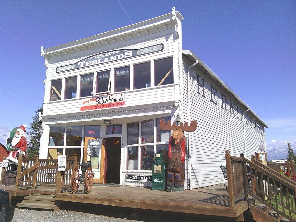
Photograph of Teeland's Country Store
Photograph by Trwhite98, CC BY-SA 3.0. Via Wikimedia Commons.

Teeland's Country Store

Listed on the National Register of Historic Places in 1978.

From the record

“Teeland's Country Store, also known as Herning's Place and Knik Trading Company, is a historic retail establishment located at the corner of East Herning Avenue and North Boundary Street in Wasilla, Alaska. The oldest portion of this wood-frame building is a log structure at the back whose construction dates to 1905.”

Wikipedia article Teeland's Country Store, CC BY-SA 4.0.

One of 29 National Register listings published here for Matanuska-Susitna Borough · listed in 1978 · category: Building.

Sources: the Wikipedia article · the case file at the National Archives · the National Register database, National Park Service · the Wikipedia article
The listing

  • What is counted as historic. The nomination lists 1 building as contributing to the listing.
  • Address. Mile 42 George Parks Hwy. and Knik Rd., Wasilla, 99654
  • When was it listed? November 1978
  • Category. building
  • Census subarea. Matanuska-Susitna census subarea
  • National Register reference number. 78000533 - the number the National Park Service assigned this property when it was listed, and the key its nomination file is catalogued under at the National Archives.

Fires near this property

581 since 1992

Regional context, not property-specific evidence. The federal wildfire occurrence database lists 581 fires within 5 miles of Teeland's Country Store between 1992 and 2020, burning about 631 acres in total. None started naturally. 7 were recorded as arson. Distance is straight-line from the map coordinates, so a fire counted here may appear on a neighbouring settlement's page as well.

Reported cause Fires
Debris and open burning275
Missing data/not specified/undetermined128
Misuse of fire by a minor50
Power generation/transmission/distribution33
Recreation and ceremony29
Equipment and vehicle use22
Smoking16
Fireworks11
Other causes10
Arson/incendiarism7

The most recent of them, most recent first, with the day each was reported and the service that recorded it.

DateCause SizeReported by Name on the report
8 September 1998Debris and open burningunder an acreMat-Su AreaDIAMOND WAY
5 September 1998Debris and open burningunder an acreMat-Su AreaBARBI
5 September 1994Debris and open burningunder an acreMat-Su AreaLIMBERLST2
25 September 2010Power generation/transmission/distributionunder an acreMat-Su AreaMULCHATNA
25 September 1996Debris and open burningunder an acreMat-Su AreaCRESTWOOD
17 September 1996Recreation and ceremonyunder an acreMat-Su AreaGREYBARK
14 September 2007Power generation/transmission/distributionunder an acreMat-Su Areanot named
12 September 1996Debris and open burningunder an acreMat-Su AreaDEFOREST

Every fire recorded in Matanuska-Susitna Borough

Mines and quarries near this property

8 within 5 miles

Regional context, not property-specific evidence. The federal mineral resources record lists 8 workings within 5 miles of Teeland's Country Store: 5 past producers, 1 occurrence, 1 producer, 1 prospect. 1 still produces. What was taken out: Sand and Gravel, Construction, Calcium. Distance is straight-line from the map coordinates, so a quarry counted here may appear on a neighbouring settlement's page as well.

Where SiteCommodity StatusRecorded
Lucille LakeCalciumOccurrence
Wasilla LakeCalciumProspect
Central Rock and SandSand and Gravel, ConstructionPast Producer
ConsteelSand and Gravel, ConstructionPast Producer
Fairview Loop Road PitSand and Gravel, ConstructionPast Producer
Parks Highway PitSand and Gravel, ConstructionPast Producer
Wasilla Aggregate Pit & PlantSand and Gravel, ConstructionProducer
Wasilla PitSand and Gravel, ConstructionPast Producer

Storms near this property

8 since 2005

Regional context, not property-specific evidence. The National Weather Service names Wasilla, the town this property stands in, in 8 storm reports between 2005 and 2023: 5 flood, 2 hail, 1 lightning. No death or injury is recorded in these reports. Each account below is quoted exactly as the forecast office filed it, from the NOAA Storm Events Database, and each date opens the federal record of that event.

WhenEvent Place namedHarm What the report says
January 2020FloodWasilla$200,000Late on December 21, an ice jam on Willow Creek near the Deneki Bridge (61.77N, -149.956W) caused water to back up and flow through numerous residences. Deneki Road and access to the Deneki Bridge was closed for multiple weeks between December 21 and January 8, 2020. At least thirteen households evacuated on December 21-22 due to flooding or anticipation of road closures. Six homes were damaged by flood water; there was a report of knee-deep water in one home, as well as deep flowing water around the house, It formed a river in my yard . Numerous, (>10), cars were flooded and frozen in place. Also some cars had to be abandoned after owners tried to drive across the flood waters and became stuck. ||Examining the hydrographs, the most likely cause of the ice jam flooding was an ice dam which collapsed in the canyon, causing a mini breakup which was constricted and stopped at the Deneki Bridge. ||The MatSu Borough worked with private contractors to divert the water and allow access to the Deneki Bridge and the subdivision of homes and farms to which it provides the single point of access. Using heavy equipment, they mechanically removed the ice jam, which allowed the water flow to return to the channel, preventing it from flowing through the neighborhoods overland.
December 2019FloodWasilla$200,000Late on December 21, an ice jam on Willow Creek near the Deneki Bridge (61.77N, -149.956W) caused water to back up and flow through numerous residences. Deneki Road and access to the Deneki Bridge was closed for multiple weeks between December 21 and January 8, 2020. At least thirteen households evacuated on December 21-22 due to flooding or anticipation of road closures. Six homes were damaged by flood water; there was a report of knee-deep water in one home, as well as deep flowing water around the house, It formed a river in my yard . Numerous, (>10), cars were flooded and frozen in place. Also some cars had to be abandoned after owners tried to drive across the flood waters and became stuck. ||Examining the hydrographs, the most likely cause of the ice jam flooding was an ice dam which collapsed in the canyon, causing a mini breakup which was constricted and stopped at the Deneki Bridge. ||The MatSu Borough worked with private contractors to divert the water and allow access to the Deneki Bridge and the subdivision of homes and farms to which it provides the single point of access. Using heavy equipment, they mechanically removed the ice jam, which allowed the water flow to return to the channel, preventing it from flowing through the neighborhoods overland.
April 2015LightningWasilla$2,000A lightning strike near Houston, AK knocked out power for more than 28,000 people. |The lightning strike at 5:42 p.m. affected the Intertie between Anchorage and Fairbanks, knocking out power from Willow to as far as North Pole and Salcha. According to Golden Valley Electric Association, strike knocked out 11 substations. |Power was restored to most people by 6:08 p.m., except some in the Cantwell area because of breaker problems in the Healy substation. Power was restored in Cantwell by 11:00 PM.
September 2023FloodWasilla-Heavy rains in the Matanuska Valley, specifically around Hatcher's Pass and the Enchanted Forest Subdivision in Houston, AK, reported minor flooding from 1-2 inches of rainfall that fell over the course of the 24 hour period September 1, 2023.
August 2022FloodWasilla-Flooding was verified by Alaska State Troopers in Wasilla. The Regional Operations Center and the State Emergency Operations Center reported on August 8th, 2022 at approximately 22:09 hours, Alaska State Troopers (AST) began receiving multiple 911 calls reporting flooding in the area of Schrock Road and Sitze Road in Wasilla. AST responded to the area discovering the road has been washed out and is impassible just past the Little Susitna River Bridge due to a culvert failing. Matsu Borough along with DOT is on scene working to repair the culvert and roadway. Its also been advised there is a bridge farther down Sitze Road that may be compromised and is being assessed. At this time, residence past this washout are un accessible. Additional patrols of the area also discovered North Sushana Drive is impassible due to the Little Susitna River flooding the road. These neighborhoods are also un accessible at this time. There were pictured posted on social media from the Alaska State Department of Transportation. SEOC also forwarded maps & pics of flooding in Houston. A news article with pictures can be seen here: https://www.adn.com/alaska-news/mat-su/2022/08/09/mat-su-flooding-closes-roads-threatens-homes-after-deluge-soaks-talkeetna-mountains/.
August 2022FloodWasilla-Numerous roads and low lying properties were reported to be flooded Monday night and Tuesday downstream from the Parks Highway Bridge and were impacted by flood waters for about 24-36 hours.
August 2015HailWasilla-Largest hail reports were estimated from social media to be around 1.0 inch. An NWS employee reported 1.0 inch drifts of pea-sized hail.
July 2005HailWasilla-no account filed

Every storm recorded in Matanuska-Susitna Borough

Map coverage status

No historic map-sheet match is published for this property yet. That does not mean no map exists. This record needs a coordinate-quality review before it can be joined to a sheet boundary. Browse the county's mapped places while that work is pending.

Listed places nearby

5 within 8 miles

Other National Register properties close enough to walk or drive between, ordered by distance from this one. Both positions come from the same geocoding pass that matched these properties to their map sheets.

Photograph PropertyDistance Listed
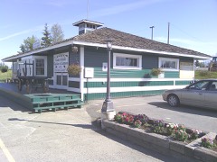
Wasilla Depotunder 500 feet1977
Wasilla Elementary Schoolunder 500 feet1980
Blanche and Oscar Tryck House0.1 miles2004
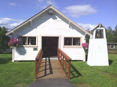
Wasilla Community Hall0.4 miles1982
Whitney Section House3.4 miles2004

Sources for this property

National Archives recordThe nomination case file for reference 78000533 in Record Group 79.
Wikipedia articleCommunity-written account of this property, licensed CC BY-SA.
Matanuska-Susitna BoroughAll 29 listed properties in this county.

Provenance

  • Listing record. National Park Service National Register of Historic Places, listed-properties dataset, current to 2026-05-22.
  • Map join. Address geocoded through the United States Census geocoder, then tested against the published boundary of every sheet in the USGS Historical Topographic Map Collection.
  • How this page is made. Listing fields come from federal records; map-sheet coverage is a labelled coordinate-to-boundary calculation, not a source-field claim.
  • Wildfire. Short, Karen C. 2022. Spatial wildfire occurrence data for the United States, 1992-2020 [FPA_FOD_20221014]. 6th Edition. Fort Collins, CO: Forest Service Research Data Archive. https://doi.org/10.2737/RDS-2013-0009.6 Collected with United States Government funding and usable without additional permissions or fees.
  • Mines and quarries. USGS Mineral Resources Data System (MRDS) https://mrdata.usgs.gov/mrds/ A work of the United States government, no copyright under 17 U.S.C. 105.
  • Storms. NOAA National Centers for Environmental Information, Storm Events Database https://www.ncei.noaa.gov/stormevents/ A work of the United States government, no copyright under 17 U.S.C. 105. Narratives are quoted verbatim from the National Weather Service report and are not edited or summarised.