 Block
From the record
29 National Register listings published here.
Sources: the National Register database, National Park Service
236 topographic sheets cover 51 settlements here, and 29 properties are on the National Register of Historic Places.
29 National Register listings published here.
Sources: the National Register database, National Park Service
Every property in this county listed on the National Register of Historic Places, with the year it was listed and the federal nomination document.
| Photograph | Property | Type | Listed | Reference |
|---|---|---|---|---|
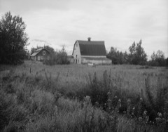 | Bailey Colony Farm | district | 1991 | 91000775 |
| Berry House | building | 1991 | 91000779 | |
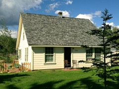 | Campbell House | building | 2013 | 13000129 |
| Cunningham-Hall Pt-6,Nc-692W | object | 1978 | 78000531 | |
| Curry Lookout | building | 1992 | 92000424 | |
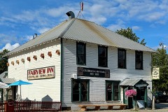 | Fairview Inn | building | 1982 | 82004905 |
| Herried House | building | 1991 | 91000778 | |
| High Ridge | building | 2021 | 100006829 | |
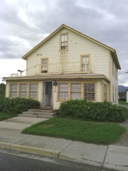 | Hyland Hotel | building | 1991 | 91000774 |
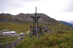 | Independence Mines | site | 1974 | 74000440 |
| Kirsch's Place | building | 1998 | 97001631 | |
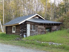 | Knik Site | building | 1973 | 73000379 |
| Matanuska Colony Community Center | district | 1991 | 91000773 | |
| Old Willow Community Center | building | 2017 | 100001695 | |
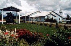 | Palmer Depot | building | 1978 | 78000530 |
| Patten Colony Farm | district | 1991 | 91000776 | |
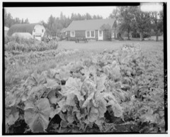 | Puhl House | building | 1991 | 91000777 |
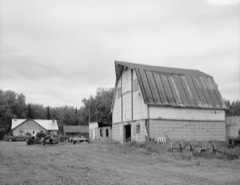 | Raymond Rebarchek Colony Farm | building | 1978 | 78000532 |
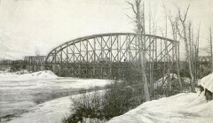 | Susitna River Bridge | structure | 1977 | 77000227 |
| Sutton Community Hall | building | 2013 | 13000617 | |
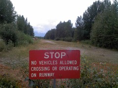 | Talkeetna Airstrip | structure | 2002 | 02000814 |
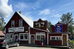 | Talkeetna Historic District | district | 1993 | 93000321 |
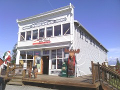 | Teeland's Country Store | building | 1978 | 78000533 |
| Blanche and Oscar Tryck House | building | 2004 | 04000968 | |
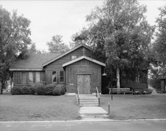 | United Protestant Church | building | 1980 | 80000757 |
| Wasilla Community Hall | building | 1982 | 82002072 | |
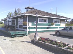 | Wasilla Depot | building | 1977 | 77000218 |
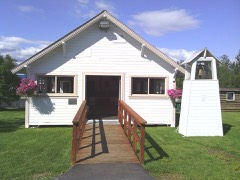 | Wasilla Elementary School | building | 1980 | 80000758 |
| Whitney Section House | building | 2004 | 04001106 |
Every wildfire the federal occurrence database records inside this county: 2,802 of them, burning about 68,122 acres. 117 started naturally and 35 were recorded as arson. Each settlement page carries the fires within five miles of it.
| Reported cause | Fires |
|---|---|
| Debris and open burning | 1012 |
| Missing data/not specified/undetermined | 690 |
| Recreation and ceremony | 268 |
| Misuse of fire by a minor | 168 |
| Other causes | 142 |
| Equipment and vehicle use | 120 |
| Power generation/transmission/distribution | 118 |
| Natural | 117 |
| Fireworks | 81 |
| Smoking | 48 |
| Arson/incendiarism | 35 |
| Firearms and explosives use | 2 |
| Railroad operations and maintenance | 1 |
The five largest, by the area the report gives. None of them was recorded as arson.
| Date | Cause | Size | Reported by | Name on the report |
|---|---|---|---|---|
| 2 June 1996 | Fireworks | 37,336 acres | Alaska Fire Service | 601351MILL |
| 20 June 2007 | Natural | 8,494 acres | Mat-Su Area | SU RIVER |
| 14 June 2015 | Missing data/not specified/undetermined | 7,265 acres | Alaska Fire Service | SOCKEYE |
| 17 August 2019 | Power generation/transmission/distribution | 3,289 acres | Alaska State Office | MCKINLEY |
| 16 July 2002 | Natural | 1,701 acres | Mat-Su Area | THURSDAY CREEK |
| 31 July 2013 | Natural | 1,489 acres | Valdez-Copper River Area | TABERT LAKE |
| 17 August 2019 | Missing data/not specified/undetermined | 1,314 acres | Mat-Su Area | DESHKA LANDING |
| 6 June 2017 | Natural | 980 acres | Mat-Su Area | TALKEETNA RIVER |
Every settlement page carries the fires within five miles of it - see the settlement index below.
The NOAA Storm Events Database holds 43 reports for this county, causing 1 death, no injuries and about $29,122,000 in recorded property damage. Each settlement page carries the reports that name it.
| Kind of event | Reports |
|---|---|
| Flood | 33 |
| Hail | 8 |
| Lightning | 1 |
| Heavy Rain | 1 |
The most serious of them, by death, then injury, then recorded damage. The accounts are quoted exactly as the forecast office filed them.
| When | Event | Place named | Harm | What the report says |
|---|---|---|---|---|
| September 2012 | Flood | Nancy Lake | 1 killed, $10,370,000 | The Susitna River at Sunshine crested at 27.66ft on 9/21/12 at 23:00 AKDT. Damages in the Susitna Valley were extensive, with several railroad bridges and smaller roads flooded and washed out. Most of the homes destroyed and damaged were in the Susitna Valley. on 9/24/12 a 51 year old man died while attempting to cross a swollen creek in a remote hunting area. |
| September 2012 | Flood | Palmer | $4,780,000 | no account filed |
| July 2019 | Flood | Skwentna | $3,000,000 | Above normal temperatures combined with above normal high elevation snowpack caused this flooding event. A local lodge reported 6-7 inches of water in one of their guest cabins. The Yentna River at Lake Creek (YLKA2) crested at 21.82 feet on 7/1/2019. Moderate flood stage is 22 ft, minor flood stage is 20.5 ft. |
| June 2019 | Flood | Skwentna | $3,000,000 | Above normal temperatures combined with above normal high elevation snowpack caused this flooding event. The Yentna River at Lake Creek (YLKA2) crested at 21.82 feet on 7/1/2019. Moderate flood stage is 22 ft, minor flood stage is 20.5 ft. Many lodges were surrounded by water and one reported 6-7 inches of water in one of their guest cabins. |
| October 2006 | Flood | Willow | $2,900,000 | no account filed |
| May 2018 | Flood | Talkeetna | $2,750,000 | Workers with the Alaska Railroad Corporation discovered a 5 mile section of track flooded and covered with chunks of ice after an ice jam caused a 8-10 ft vertical water level rise between Talkeetna and Curry, on the Susitna River. Significant sections of track were damaged and moved horizontally by as much as 25 ft. At the same time, significant areas of erosion/damage to the railroad bed itself also occurred which had to be rebuilt. Rail service was disrupted for several days. |
| June 2025 | Flood | Sutton | $1,000,000 | After a cool start to the month of June, Palmer quickly warmed up June 10 through 21, 2025. In this timeframe, the Palmer airport reported six days of 70 or above temperatures with a high of 75 on June 19th. This reflects a warm and dry pattern that set up region-wide and enhanced snowmelt in the headwaters of the Matanuska River. Further, only .02 inches of rain fell at Palmer from June 10-21. Warm temperatures and bank erosion led to high water breaking through the banks of the Matanuska River (noted at the Matanuska River Bridge (MATA2) gage) between the Old Glenn Highway and the River in the Maud Road area due to flooding caused by snowmelt and a river channel shift. ||Reports indicate that due to this flooding, five homes and two businesses were damaged, and $1 million plus in road damage was noted. This led to a local disaster declaration. ||News articles:|https://www.alaskasnewssource.com/2025/06/23/matanuska-river-flooding-crew-works-emergency-protective-measures/. |https://www.alaskasnewssource.com/2025/06/25/matanuska-river-flooding-leaves-river-running-through-properties/. |
| May 2009 | Flood | Talkeetna | $400,000 | Ice Jam Flooding occurred near Talkeetna. Flooding damaged the Alaska Railroad tracks in the area. |
| July 2018 | Flood | Skwentna | $250,000 | The Yentna and Skwentna rivers, already high due to snowmelt, were expected to reach near bankfull during the second week of July as the weather pattern turned wetter. On July 10th, a local lodge near the confluence of the Yentna River and Lake Creek reported flooding in cabins and outbuildings resulting in 18 inches of water getting inside. The Flood Advisory was issued as a result of this report. Later that same day, an update from Lake Creek was received saying that the river had risen to 2-3 feet above the bank and that most of the property, including numerous water front lodges, were flooded. |
| January 2020 | Flood | Wasilla | $200,000 | Late on December 21, an ice jam on Willow Creek near the Deneki Bridge (61.77N, -149.956W) caused water to back up and flow through numerous residences. Deneki Road and access to the Deneki Bridge was closed for multiple weeks between December 21 and January 8, 2020. At least thirteen households evacuated on December 21-22 due to flooding or anticipation of road closures. Six homes were damaged by flood water; there was a report of knee-deep water in one home, as well as deep flowing water around the house, It formed a river in my yard . Numerous, (>10), cars were flooded and frozen in place. Also some cars had to be abandoned after owners tried to drive across the flood waters and became stuck. ||Examining the hydrographs, the most likely cause of the ice jam flooding was an ice dam which collapsed in the canyon, causing a mini breakup which was constricted and stopped at the Deneki Bridge. ||The MatSu Borough worked with private contractors to divert the water and allow access to the Deneki Bridge and the subdivision of homes and farms to which it provides the single point of access. Using heavy equipment, they mechanically removed the ice jam, which allowed the water flow to return to the channel, preventing it from flowing through the neighborhoods overland. |
| December 2019 | Flood | Wasilla | $200,000 | Late on December 21, an ice jam on Willow Creek near the Deneki Bridge (61.77N, -149.956W) caused water to back up and flow through numerous residences. Deneki Road and access to the Deneki Bridge was closed for multiple weeks between December 21 and January 8, 2020. At least thirteen households evacuated on December 21-22 due to flooding or anticipation of road closures. Six homes were damaged by flood water; there was a report of knee-deep water in one home, as well as deep flowing water around the house, It formed a river in my yard . Numerous, (>10), cars were flooded and frozen in place. Also some cars had to be abandoned after owners tried to drive across the flood waters and became stuck. ||Examining the hydrographs, the most likely cause of the ice jam flooding was an ice dam which collapsed in the canyon, causing a mini breakup which was constricted and stopped at the Deneki Bridge. ||The MatSu Borough worked with private contractors to divert the water and allow access to the Deneki Bridge and the subdivision of homes and farms to which it provides the single point of access. Using heavy equipment, they mechanically removed the ice jam, which allowed the water flow to return to the channel, preventing it from flowing through the neighborhoods overland. |
| August 2025 | Flood | Skwentna | $100,000 | The Yentna River at Lake Creek entered flood stage on the afternoon of August 28th, then rose to a record crest around 22.56 feet in moderate flood stage by August 29th. River levels remained near the record crest through the morning of August 31st, then began dropping back below flood stage by the evening of August 31st. Observers along the river between Skwentna and Lake Creek reported that numerous cabins in the area were flooded during this time, with many cabins also left without power due to their generators flooding. |
| August 2025 | Flood | Talkeetna | $50,000 | The flood gauge near Talkeetna at the confluence of the Talkeetna River and Susitna River rose into flood stage around 12 PM AKST August 29th, crested just below major flood stage at 14.93 ft around 11 PM AKST August 29th, then receded back to below minor flood stage by 12 PM AKST August 30th. This was the third highest crest on record for the gauge, and highest water level recorded since 2012. Pictures from Talkeetna by an NWS employee on 8/30 showed overbank flooding at the end of Main Street. Low lying areas of Talkeetna, particularly the lower west side of town, experienced flood waters from high water on the Susitna. Worst impacts were to the Alaska Dream Cabins that are located at the west end of Main Street / B Street and by the water. The Alaska River Forecast Center found high water marks of 1-2 ft on several buildings. Despite some raising of buildings, Water reached the lowest few inches to foot of many of the buildings. The Talkeetna River Park and campground experienced flooding as well as the low-lying areas between the campground and revetment. |
| August 2018 | Flood | Skwentna | $50,000 | The river gauge on the Yentna River at Lake Creek went into minor flood stage for a brief period on August 14th. McDougall's Lodge Cabins were evacuated due to flooding water. |
| August 2025 | Flood | Talkeetna | $40,000 | On August 31st, a resident of Petersville reported that the road along Cache Creek had been totally washed out in several places due to flooding along the creek itself, and the washouts had cut off residents from the main road network for several days. The resident also mentioned debris including large logs had washed into the road crossings and that the flood waters had overturned a few unoccupied vehicles. The creek that caused the flood damage was not gauged, so timing of the flood damage was estimated by comparing to timing of the highest water levels observed on the nearby Moose Creek during the same timeframe at the end of August. |
| September 2015 | Flood | Willow | $30,000 | Heavy rain overnight caused minor flooding of the streams and rivers in the central Susitna valley. A cooperative observer at Amber Lake recorded 1.55 inches of rainfall in 24 hours on Sept 27th. Willow Creek reached one foot above minor flood stage and Montana Creek reached 1.5 feet above minor flood stage. Ten homes were impacted by the water, with water surrounding them but not flooding the homes. One road was washed out. |
| April 2015 | Lightning | Wasilla | $2,000 | A lightning strike near Houston, AK knocked out power for more than 28,000 people. |The lightning strike at 5:42 p.m. affected the Intertie between Anchorage and Fairbanks, knocking out power from Willow to as far as North Pole and Salcha. According to Golden Valley Electric Association, strike knocked out 11 substations. |Power was restored to most people by 6:08 p.m., except some in the Cantwell area because of breaker problems in the Healy substation. Power was restored in Cantwell by 11:00 PM. |
| January 2025 | Flood | Palmer | - | An avalanche slid into the Little Susitna River blocking the river flow and flooding roads near the river; including the Government Peak Campground. River flow would eventually erode the blockage and restore flow to the river. |
| August 2024 | Flood | Skwentna | - | Heavy rain from an atmospheric river led to rapid rises on the Yentna and Skwenta Rivers in the western portion of the Susitna Borough. Rivers inundated cabins all along the rivers with water widespread flooding of the campgrounds, airstrips and access to structures. |
| August 2023 | Flood | Skwentna | - | Flood waters encroached on cabins along the Yentna and Skwentna Rivers. 2-4 inches of rain fell within the basin causing river levels to swell, and inundating land areas alongside cabins on the river's edge of the Yentna and Skwentna Rivers. |
| August 2023 | Flood | Nancy Lake | - | Heavy rains of 2-4 inches in the Little Susitna Basin, along with much higher rainfall amounts along the mountain headwaters, caused rapid river rises along the Little Susitna River and its tributaries. High water impacted areas around the Enchanted Forest area of Houston and at campgrounds in Hatcher's Pass. |
| August 2023 | Flood | Talkeetna | - | Heavy rain across the Talkeetna Mountains caused rapid rises along the Talkeetna River. 1-3 inches of rainfall in the basin, with much higher rainfall amounts in the mountains and headwaters, kept rivers consistently high over a long period of time; this contributed to widespread flooding and areas of bank erosion in Talkeeta. |
| August 2023 | Flood | Talkeetna | - | One to three inches of heavy rainfall flooded low lying areas of the Susitna Valley, including the main road that crossed Kroto and Moose Creeks. This road closure limited resident access to their homes. |
| September 2023 | Flood | Talkeetna | - | Heavy rains of 1-2 inches in 24 hours caused widespread minor flooding across the Talkeetna and Little Susitna Basins. Minor flooding was recorded at several river gauges and long periods of elevated river levels, exacerbated river bank erosion in the areas around Talkeetna. |
| September 2023 | Flood | Wasilla | - | Heavy rains in the Matanuska Valley, specifically around Hatcher's Pass and the Enchanted Forest Subdivision in Houston, AK, reported minor flooding from 1-2 inches of rainfall that fell over the course of the 24 hour period September 1, 2023. |
| August 2022 | Flood | Wasilla | - | Flooding was verified by Alaska State Troopers in Wasilla. The Regional Operations Center and the State Emergency Operations Center reported on August 8th, 2022 at approximately 22:09 hours, Alaska State Troopers (AST) began receiving multiple 911 calls reporting flooding in the area of Schrock Road and Sitze Road in Wasilla. AST responded to the area discovering the road has been washed out and is impassible just past the Little Susitna River Bridge due to a culvert failing. Matsu Borough along with DOT is on scene working to repair the culvert and roadway. Its also been advised there is a bridge farther down Sitze Road that may be compromised and is being assessed. At this time, residence past this washout are un accessible. Additional patrols of the area also discovered North Sushana Drive is impassible due to the Little Susitna River flooding the road. These neighborhoods are also un accessible at this time. There were pictured posted on social media from the Alaska State Department of Transportation. SEOC also forwarded maps & pics of flooding in Houston. A news article with pictures can be seen here: https://www.adn.com/alaska-news/mat-su/2022/08/09/mat-su-flooding-closes-roads-threatens-homes-after-deluge-soaks-talkeetna-mountains/. |
| August 2022 | Flood | Nancy Lake | - | Anchorage Daily News published a story about the flooding in Houston from heavy rain that fell over the Talkeetna Mountains August 8. Numerous roads were closed in the Houston, AK township and up to 20 properties were affected. Flooding in the town of Houston and surrounding roads was widespread. https://www.adn.com/alaska-news/mat-su/2022/08/09/mat-su-flooding-closes-roads-threatens-homes-after-deluge-soaks-talkeetna-mountains/ Flooding on the Little Susitna River at Houston reached a crest of 12.52 ft on August 10, 2022 at 5PM AKDT which was moderate flood stage. |
| August 2022 | Flood | Nancy Lake | - | Numerous roads and low lying properties were reported to be flooded Monday night and Tuesday downstream from the Parks Highway Bridge and were impacted by flood waters for about 24-36 hours. |
| August 2022 | Flood | Wasilla | - | Numerous roads and low lying properties were reported to be flooded Monday night and Tuesday downstream from the Parks Highway Bridge and were impacted by flood waters for about 24-36 hours. |
| July 2022 | Flood | Palmer | - | Little Susitna River below Hatcher Pass Bridge peaked in action stage and was close to minor flood stage, as seen in hydrograph and data table. Data from this station's hydrograph were used to populate the verifying & peak times for this event.|Matanuska River at Old Glenn Hwy approached action stage, as seen in hydrograph and data table.|One of the emergency managers at Mat-SU EM had video of a flooded driveway but noted no other impacts had been observed. |
| July 2022 | Flood | Willow | - | Hydrographs ands tabular data for Willow Creek showed action stage was exceeded by |July 19 at 4pm, minor flood stage was exceeded by July 19 at 9pm, crest occurred on July 20 at 5am.|Other creeks in 145 that exceeded action stage: Little Susitna River, Willow Creek near Willow, Susitna River at Gold Creek & Parks Hwy Bridge, Talkeetna River near Railroad Bridge. |
| June 2019 | Heavy Rain | Palmer | - | Palmer ASOS reported 0.44 of precipitation between 5:32 p.m. and 6:00 p.m. This caused localized flooding of parking lots in the Palmer area. Quarter inch hail was also reported at this time. |
| August 2015 | Hail | Wasilla | - | Largest hail reports were estimated from social media to be around 1.0 inch. An NWS employee reported 1.0 inch drifts of pea-sized hail. |
| July 2008 | Flood | Skwentna | - | The river gage along the Yentna River at Lake Creek was .4 ft below flood stage. Reports from residents along the river were of water in their yards without any damage. |
| June 2007 | Hail | Paxson | - | The hail size for this storm is estimated based upon storms within the same complex that had hail up to 1 inch in diameter. |
| June 2004 | Hail | Talkeetna | - | These severe thunderstorm warnings were issued for uninhabited areas. Verification for this event is solely based upon examination of satellite and radar data that indicated hail near .75 inches in diameter. |
| September 2012 | Flood | Hayes River | - | no account filed |
| August 2010 | Flood | Hayes River | - | no account filed |
| July 2005 | Hail | Nancy Lake | - | no account filed |
| July 2005 | Hail | Wasilla | - | no account filed |
| July 2005 | Hail | Willow | - | no account filed |
| June 2005 | Hail | Talkeetna | - | no account filed |
| June 2005 | Hail | Chulitna River Lodge | - | no account filed |
Named settlements recorded in the Geographic Names Information System, each with the topographic sheets covering it. Villages, hamlets and abandoned places alike. Each is shown with the nearest named watercourse or landform and the survey quadrangle it falls on.
Matanuska-Susitna census subarea · 99667 · On Alexander Creek · Tyonek B-2 NW quadrangle
13 sheets, 1949 to 1965
Matanuska-Susitna census subarea · 99667 · On Alexander Creek · Tyonek B-2 NW quadrangle
13 sheets, 1949 to 1965
Matanuska-Susitna census subarea · 99652 · Anchorage C-8 SW quadrangle
22 sheets, 1950 to 1994
Matanuska-Susitna census subarea · 99729 · On Tsaani Creek · Healy A-5 NW quadrangle
15 sheets, 1950 to 1956
No longer a settlement
Matanuska-Susitna census subarea · 99645 · Near Bodenburg Butte · Anchorage C-6 SE quadrangle
22 sheets, 1951 to 1994
Matanuska-Susitna census subarea · 99688 · Talkeetna Mountains A-6 SW quadrangle
17 sheets, 1950 to 1966
Matanuska-Susitna census subarea · 99676 · Talkeetna B-1 NE quadrangle
17 sheets, 1950 to 1994
Matanuska-Susitna census subarea · 99667 · Talkeetna B-3 NW quadrangle
13 sheets, 1950 to 1965
Matanuska-Susitna census subarea · 99674 · On California Creek · Anchorage D-4 SW quadrangle
18 sheets, 1948 to 1994
Matanuska-Susitna census subarea · 99676 · On Salmon Creek · Talkeetna Mountains D-6 NE quadrangle
18 sheets, 1949 to 1966
Matanuska-Susitna census subarea · 99623 · Anchorage C-7 SW quadrangle
19 sheets, 1950 to 1994
Matanuska-Susitna census subarea · 99676 · On Deadhorse Creek · Talkeetna C-1 SE quadrangle
17 sheets, 1950 to 1987
Matanuska-Susitna census subarea · On Willow Creek · Healy A-1 NW quadrangle
14 sheets, 1949 to 1956
Matanuska-Susitna census subarea · 99674 · On Knob Creek · Anchorage C-6 NE quadrangle
22 sheets, 1951 to 1994
Matanuska-Susitna census subarea · 99588 · Anchorage D-1 NE quadrangle
19 sheets, 1948 to 1993
Matanuska-Susitna census subarea · 99676 · On Birch Creek · Talkeetna A-1 NE quadrangle
19 sheets, 1950 to 1994
Matanuska-Susitna census subarea · 99645 · Anchorage C-6 SW quadrangle
22 sheets, 1951 to 1994
Matanuska-Susitna census subarea · 99676 · On Gold Creek · Talkeetna Mountains D-6 SE quadrangle
18 sheets, 1949 to 1966
Matanuska-Susitna census subarea · 99694 · On Teddy Creek · Anchorage C-8 NW quadrangle
19 sheets, 1950 to 1994
Matanuska-Susitna census subarea · 99623 · Anchorage B-8 NW quadrangle
18 sheets, 1951 to 1994
Matanuska-Susitna census subarea · 99674 · Near Wishbone Hill · Anchorage C-6 NE quadrangle
22 sheets, 1951 to 1994
Matanuska-Susitna census subarea · 99688 · On Tl'et' Qelchentnu · Tyonek C-1 NW quadrangle
15 sheets, 1949 to 1993
No longer a settlement
Matanuska-Susitna census subarea · 99588 · Gulkana B-6 SE quadrangle
16 sheets, 1950 to 1965
Matanuska-Susitna census subarea · 99645 · On Lazy Mountain · Anchorage C-6 NE quadrangle
22 sheets, 1951 to 1994
Matanuska-Susitna census subarea · 99688 · On Homestake Creek · Anchorage D-7 SE quadrangle
18 sheets, 1949 to 1994
Matanuska-Susitna census subarea · 99645 · Anchorage C-6 SW quadrangle
22 sheets, 1951 to 1994
Matanuska-Susitna census subarea · 99688 · Tyonek D-3 NE quadrangle
14 sheets, 1949 to 1993
No longer a settlement
Matanuska-Susitna census subarea · 99623 · Anchorage C-7 SW quadrangle
19 sheets, 1950 to 1994
Matanuska-Susitna census subarea · 99688 · Talkeetna A-1 SE quadrangle
18 sheets, 1950 to 1994
Matanuska-Susitna census subarea · 99688 · Talkeetna A-1 SE quadrangle
18 sheets, 1950 to 1994
Matanuska-Susitna census subarea · On Crooked Creek · Talkeetna Mountains A-1 SE quadrangle
17 sheets, 1949 to 1966
No longer a settlement
Matanuska-Susitna census subarea · 99645 · Anchorage C-6 SW quadrangle
22 sheets, 1951 to 1994
Matanuska-Susitna census subarea · 99683 · Talkeetna B-2 NW quadrangle
13 sheets, 1950 to 1994
Matanuska-Susitna census subarea · 99623 · Anchorage B-8 SW quadrangle
18 sheets, 1951 to 1994
Matanuska-Susitna census subarea · 99667 · Near Bourbon Mist Island · Tyonek D-4 NW quadrangle
13 sheets, 1949 to 1993
Matanuska-Susitna census subarea · 99674 · Anchorage D-1 NW quadrangle
19 sheets, 1948 to 1993
No longer a settlement
Matanuska-Susitna census subarea · 99676 · On Question Creek · Talkeetna A-1 NE quadrangle
19 sheets, 1950 to 1994
Matanuska-Susitna census subarea · On Ha Betnu · Tyonek C-2 SE quadrangle
14 sheets, 1949 to 1993
Matanuska-Susitna census subarea · 99674 · On Eska Creek · Anchorage C-6 NE quadrangle
22 sheets, 1951 to 1994
Matanuska-Susitna census subarea · 99676 · On Talkeetna River · Talkeetna B-1 SE quadrangle
18 sheets, 1950 to 1994
Matanuska-Susitna census subarea · 99654 · Anchorage C-7 NE quadrangle
19 sheets, 1950 to 1994
Matanuska-Susitna census subarea · 99688 · Near Beq'estsiq' Tuyu'uh · Tyonek C-1 SW quadrangle
15 sheets, 1949 to 1993
No longer a settlement
Matanuska-Susitna census subarea · 99667 · Talkeetna A-3 SW quadrangle
12 sheets, 1950 to 1965
No longer a settlement
Matanuska-Susitna census subarea · 99683 · Talkeetna B-1 SE quadrangle
18 sheets, 1950 to 1994
Matanuska-Susitna census subarea · 99667 · On Alexander Creek · Tyonek B-2 NW quadrangle
13 sheets, 1949 to 1965
No longer a settlement
Matanuska-Susitna census subarea · 99588 · Gulkana C-6 SE quadrangle
17 sheets, 1951 to 1965
Matanuska-Susitna census subarea · 99654 · Anchorage C-7 SW quadrangle
19 sheets, 1950 to 1994
Matanuska-Susitna census subarea · 99688 · Near Radar Hill · Tyonek C-1 NE quadrangle
17 sheets, 1949 to 1993
Matanuska-Susitna census subarea · 99688 · Near Radar Hill · Tyonek C-1 NE quadrangle
17 sheets, 1949 to 1993
The vanished settlements of Matanuska-Susitna Borough: the places named above that are no longer on the map.