
BlockBefore
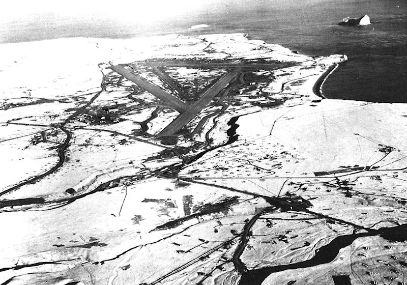
Photograph of Cape Field at Fort Glenn
Photograph by United States Army Air Forces, Public domain. Via Wikimedia Commons.

Cape Field at Fort Glenn (Umnak Island)

A National Historic Landmark. Listed on the National Register of Historic Places in 1987.

From the record

“Cape Field at Fort Glenn was a military site significant for its role in World War II. It consists of Fort Glenn, an airfield of the United States Army Air Corps later renamed Cape Air Force Base, and the adjacent Naval Air Facility Otter Point, both located on Umnak Island in the Aleutian Islands of southwestern Alaska.”

Wikipedia article Cape Field at Fort Glenn, CC BY-SA 4.0.

One of 10 National Register listings published here for Aleutians West Census Area · listed in 1987 · category: District · a National Historic Landmark.

Sources: the Wikipedia article · the case file at the National Archives · the National Register database, National Park Service

The listing

  • Address. NE section of Umnak Island, Fort Glenn
  • When was it listed? May 1987
  • Category. district
  • Census subarea. Aleutians West census subarea
  • National Register reference number. 87001301 - the number the National Park Service assigned this property when it was listed, and the key its nomination file is catalogued under at the National Archives.

Map coverage status

No historic map-sheet match is published for this property yet. That does not mean no map exists. This record needs a coordinate-quality review before it can be joined to a sheet boundary. Browse the county's mapped places while that work is pending.

Sources for this property

National Archives recordThe nomination case file for reference 87001301 in Record Group 79.
Wikipedia articleCommunity-written account of this property, licensed CC BY-SA.
Aleutians West Census AreaAll 10 listed properties in this county.

Provenance

  • Listing record. National Park Service National Register of Historic Places, listed-properties dataset, current to 2026-05-22.
  • Map join. Address geocoded through the United States Census geocoder, then tested against the published boundary of every sheet in the USGS Historical Topographic Map Collection.
  • How this page is made. Listing fields come from federal records; map-sheet coverage is a labelled coordinate-to-boundary calculation, not a source-field claim.