 Block
From the record
10 National Register listings published here, 7 of them National Historic Landmarks.
Sources: the National Register database, National Park Service
77 topographic sheets cover 42 settlements here, and 10 properties are on the National Register of Historic Places.
10 National Register listings published here, 7 of them National Historic Landmarks.
Sources: the National Register database, National Park Service
Every property in this county listed on the National Register of Historic Places, with the year it was listed and the federal nomination document.
| Photograph | Property | Type | Listed | Reference |
|---|---|---|---|---|
| Adak Army Base and Adak Naval Operating Station | district | 1987 | 87000841 | |
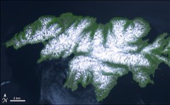 | Attu Battlefield and U.S. Army and Navy Airfields on Attu | site | 1985 | 85002729 |
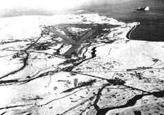 | Cape Field at Fort Glenn (Umnak Island) | district | 1987 | 87001301 |
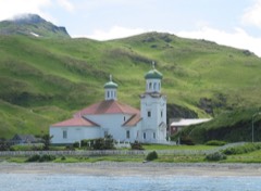 | Church of the Holy Ascension | building | 1970 | 70000112 |
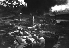 | Dutch Harbor Naval Operating Base and Fort Mears, U.S. Army | district | 1985 | 85002733 |
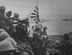 | Japanese Occupation Site, Kiska Island | site | 1985 | 85002732 |
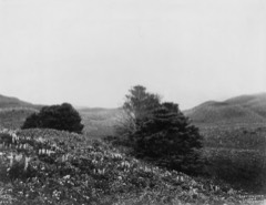 | Sitka Spruce Plantation | site | 1978 | 78000513 |
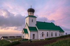 | St. George the Great Martyr Orthodox Church | building | 1980 | 80000743 |
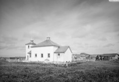 | St. Nicholas Church | building | 1980 | 80000740 |
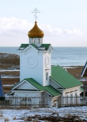 | Sts. Peter and Paul Church | building | 1980 | 80000744 |
Every wildfire the federal occurrence database records inside this county: 4 of them, burning about 990 acres. None started naturally and none was recorded as arson. Each settlement page carries the fires within five miles of it.
| Reported cause | Fires |
|---|---|
| Debris and open burning | 3 |
| Missing data/not specified/undetermined | 1 |
The five largest, by the area the report gives. None of them was recorded as arson.
| Date | Cause | Size | Reported by | Name on the report |
|---|---|---|---|---|
| 27 May 2001 | Debris and open burning | 800 acres | Alaska Fire Service | KAVALGA |
| 17 June 2017 | Missing data/not specified/undetermined | 100 acres | Alaska Fire Service | VOLCANO BAY |
| 8 April 2013 | Debris and open burning | 80 acres | Alaska Fire Service | NIKOLSKI |
| 27 May 2001 | Debris and open burning | 10 acres | Alaska Fire Service | AMLIA |
Every settlement page carries the fires within five miles of it - see the settlement index below.
The NOAA Storm Events Database holds 2 reports for this county, causing no deaths, no injuries and no recorded property damage. Each settlement page carries the reports that name it.
| Kind of event | Reports |
|---|---|
| Flood | 1 |
| Heavy Rain | 1 |
The most serious of them, by death, then injury, then recorded damage. The accounts are quoted exactly as the forecast office filed them.
| When | Event | Place named | Harm | What the report says |
|---|---|---|---|---|
| March 2024 | Heavy Rain | Unalaska | - | Unalaska Roads Department reported heavy rain in Unalaska washed out several gravel roadways in the surrounding area. Blocked culverts caused additional street flooding and also washed large crevasses up to 4 ft deep in some of the roadways. |
| December 2022 | Flood | Dutch Harbor | - | Unalaska experienced multiple mudslides and flooding over non-primary roadways, including Ballyhoo Road where road access was restricted. Mudslides along roadways did require fire department response. |
Named settlements recorded in the Geographic Names Information System, each with the topographic sheets covering it. Villages, hamlets and abandoned places alike. Each is shown with the nearest named watercourse or landform and the survey quadrangle it falls on.
Aleutians West census subarea · 99546 · Near Red Bluff · Adak C-2 NW quadrangle
8 sheets, 1951 to 1983
Aleutians West census subarea · Gareloi Island B-1 NE quadrangle
7 sheets, 1951 to 1954
No longer a settlement
Aleutians West census subarea · Near Fumarole Valley · Rat Islands B-4 SE quadrangle
7 sheets, 1951
Aleutians West census subarea · Atka C-1 NE quadrangle
3 sheets, 1952 to 1959
No longer a settlement
Aleutians West census subarea · 99547 · Near Higidgim Ungluu · Atka C-1 NW quadrangle
3 sheets, 1952 to 1959
Aleutians West census subarea · On McKenzie Creek · Attu C-3 NE quadrangle
9 sheets, 1952 to 1953
Aleutians West census subarea · Unalaska C-1 NW quadrangle
11 sheets, 1951 to 1989
No longer a settlement
Aleutians West census subarea · Unalaska D-3 SE quadrangle
11 sheets, 1951 to 1989
No longer a settlement
Aleutians West census subarea · 99685 · Near Fish Rock · Unalaska C-2 NW quadrangle
12 sheets, 1951 to 1990
Aleutians West census subarea · On Crater Creek · Unalaska B-6 SW quadrangle
19 sheets, 1951 to 1958
Aleutians West census subarea · Near Agattu Island · Attu A-2 NE quadrangle
9 sheets, 1952 to 1953
No longer a settlement
Aleutians West census subarea · 99546 · Near Happy Valley · Adak C-2 SW quadrangle
8 sheets, 1951 to 1983
Aleutians West census subarea · Adak C-4 SE quadrangle
8 sheets, 1951 to 1983
No longer a settlement
Aleutians West census subarea · Adak C-6 SE quadrangle
8 sheets, 1951 to 1983
No longer a settlement
Aleutians West census subarea · Near Imachalux · Atka C-1 SE quadrangle
3 sheets, 1952 to 1959
No longer a settlement
Aleutians West census subarea · 99685 · Near Split Top Mountain · Unalaska C-2 NE quadrangle
12 sheets, 1951 to 1990
No longer a settlement
Aleutians West census subarea · By Achiitxax · Atka D-2 SE quadrangle
3 sheets, 1952 to 1959
No longer a settlement
Aleutians West census subarea · Near Priest Rock · Unalaska C-3 SW quadrangle
11 sheets, 1951 to 1989
Aleutians West census subarea · 99660 · Near North Hill · Pribilof Islands D-4 SW quadrangle
9 sheets, 1948 to 2001
No longer a settlement
Aleutians West census subarea · 99638 · Near Agusux · Samalga Island D-3 NW quadrangle
5 sheets, 1951 to 1958
Aleutians West census subarea · 99591 · Pribilof Islands A-2 NW quadrangle
9 sheets, 1948 to 2001
Aleutians West census subarea · 99660 · By Black Bluffs · Pribilof Islands C-4 NW quadrangle
9 sheets, 1948 to 2001
Aleutians West census subarea · Unalaska A-4 NW quadrangle
11 sheets, 1951 to 1989
No longer a settlement
Aleutians West census subarea · Near Agattu Island · Attu A-2 NE quadrangle
9 sheets, 1952 to 1953
No longer a settlement
Aleutians West census subarea · Unalaska D-2 SW quadrangle
11 sheets, 1951 to 1989
No longer a settlement
Aleutians West census subarea · Near Agattu Island · Attu A-2 NE quadrangle
9 sheets, 1952 to 1953
No longer a settlement
Aleutians West census subarea · Unalaska B-3 NE quadrangle
11 sheets, 1951 to 1989
No longer a settlement
Aleutians West census subarea · Near Saahmlam Tanangis · Atka C-1 SW quadrangle
3 sheets, 1952 to 1959
No longer a settlement
Aleutians West census subarea · Unalaska B-3 SW quadrangle
11 sheets, 1951 to 1989
No longer a settlement
Aleutians West census subarea · On Missouri Creek · Unalaska A-6 SW quadrangle
19 sheets, 1951 to 1958
No longer a settlement
Aleutians West census subarea · Near Agattu Island · Attu A-2 NE quadrangle
9 sheets, 1952 to 1953
No longer a settlement
Aleutians West census subarea · Near Agattu Island · Attu A-2 NE quadrangle
9 sheets, 1952 to 1953
No longer a settlement
Aleutians West census subarea · Near Agattu Island · Attu A-2 NE quadrangle
9 sheets, 1952 to 1953
No longer a settlement
Aleutians West census subarea · Near Agattu Island · Attu A-2 NE quadrangle
9 sheets, 1952 to 1953
No longer a settlement
Aleutians West census subarea · Near Hog Island · Unalaska C-2 NW quadrangle
12 sheets, 1951 to 1990
No longer a settlement
Aleutians West census subarea · 99685 · Near Goblers Knob · Unalaska C-2 SW quadrangle
12 sheets, 1951 to 1990
Aleutians West census subarea · On Unguchiing Achidan Tanangis · Atka C-4 SE quadrangle
3 sheets, 1952 to 1959
No longer a settlement
The vanished settlements of Aleutians West Census Area: the places named above that are no longer on the map.