 Block
Albertville, Alabama
24 topographic sheets cover this place, the earliest surveyed in 1885 and the latest in 1984. It stands in the Albertville-Boaz census division. It lies in ZIP code area 35950. The Survey maps it on the Albertville quadrangle. 22,386 people lived here at the 2020 count. It stands 1,089 feet above sea level.
On record in Albertville
Buildings and businesses the archive holds for this place. Each opens its own page, with the source record it came from.
On the National Register 2 records
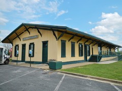 Albertville Depotlisted 1975
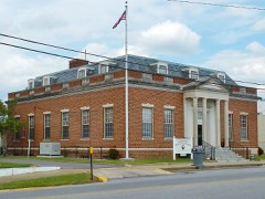 U.S. Post Officelisted 1983
Population over time
2 figuresAlbertville grew from 21,160 to 22,386 between 2010 and 2020. These are the recorded population figures Wikidata holds for this place, reached through the Geographic Names Information System number this page is keyed on rather than by name, so they belong to this place and not to another of the same name. Most are census counts, but not all are: an early figure may be a founding or settlement estimate, and an estimate published within five years of a census is left out. The change column is computed, and is left blank where more than 20 years separate a figure from the one before it, because a gap that long is not a change between two counts.
| Year | People | Change |
|---|---|---|
| 2010 | 21,160 | |
| 2020 | 22,386 | +1,226 (+6%) |
Topographic sheets covering this place
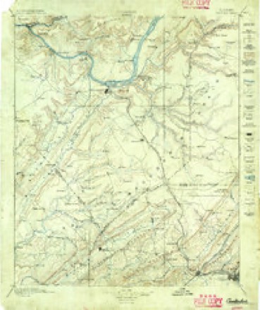
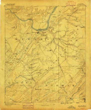
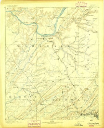
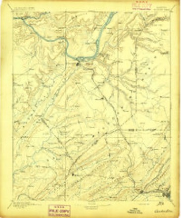
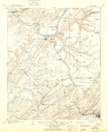
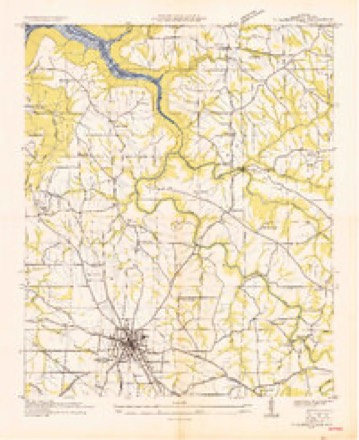
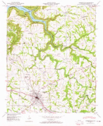
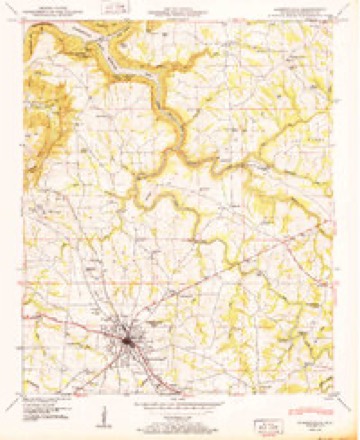
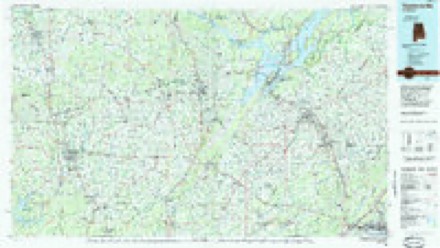
13 surveys from 24 printed sheetsMatched by testing this settlement's coordinate against the published boundary of every sheet in the United States Geological Survey's historical collection. Each opens the scanned sheet at the Survey.
- 1885 USGS Gadsden quadrangle1:125000
- 1888 USGS Gadsden quadrangle1:125000
- 1892 USGS Gadsden quadrangle1:125000
- 1895 USGS Gadsden quadrangle1:125000
- 1903 USGS Gadsden quadrangle1:125000, 4 printings
- 1936 USGS Albertville quadrangle1:24000
- 1947 USGS Albertville quadrangle1:24000, 4 printings
- 1950 USGS Albertville quadrangle1:24000, 2 printings
- 1956 USGS Gadsden quadrangle1:250000, 3 printings
- 1958 USGS Gadsden quadrangle1:250000
- 1960 USGS Gadsden quadrangle1:250000, 2 printings
- 1963 USGS Gadsden quadrangle1:250000
- 1984 USGS Guntersville quadrangle1:100000, 2 printings




Fires near this place
41 since 1994Regional context, not property-specific evidence. The federal wildfire occurrence database lists 41 fires within 5 miles of Albertville between 1994 and 2016, burning about 233 acres in total. 1 started naturally. 3 were recorded as arson. Distance is straight-line from the map coordinates, so a fire counted here may appear on a neighbouring settlement's page as well.
| Reported cause | Fires |
|---|---|
| Debris and open burning | 19 |
| Missing data/not specified/undetermined | 9 |
| Equipment and vehicle use | 3 |
| Recreation and ceremony | 3 |
| Arson/incendiarism | 3 |
| Railroad operations and maintenance | 2 |
| Natural | 1 |
| Other causes | 1 |
The most recent of them, most recent first, with the day each was reported and the service that recorded it.
| Date | Cause | Size | Reported by | Name on the report |
|---|---|---|---|---|
| 5 September 1998 | Arson/incendiarism | 2.0 acres | Alabama Forestry Commission | not named |
| 30 September 2007 | Debris and open burning | under an acre | Alabama Forestry Commission | not named |
| 5 August 2015 | Other causes | 2.0 acres | Alabama Forestry Commission | NOR-20150805-001 |
| 23 August 2011 | Arson/incendiarism | 11 acres | Alabama Forestry Commission | 3106 CR 205, AL |
| 19 August 2000 | Debris and open burning | 2.0 acres | Alabama Forestry Commission | not named |
| 6 July 2007 | Debris and open burning | under an acre | Alabama Forestry Commission | not named |
| 19 July 2000 | Debris and open burning | 1.0 acres | Alabama Forestry Commission | not named |
| 3 June 2011 | Railroad operations and maintenance | 15 acres | Alabama Forestry Commission | 514 SWITCH LANE RD, AL |
Settlements close enough to share some of these fires:
Storms near this place
60 of 75 shownRegional context, not property-specific evidence. The National Weather Service names Albertville in 75 storm reports between 1995 and 2025: 30 hail, 28 thunderstorm wind, 7 flash flood, 5 lightning. The reports record 1 death and 2 injuries. Each account below is quoted exactly as the forecast office filed it, from the NOAA Storm Events Database, and each date opens the federal record of that event.
| When | Event | Place named | Harm | What the report says |
|---|---|---|---|---|
| June 1999 | Heavy Rain | Albertville | 1 killed, 1 hurt | Heavy rainfall earlier in the day caused many local creeks and streams to rise significantly. According to newspaper reports, a 3 year old boy drowned and an 8 year old boy sustained minor injuries while canoeing on a rain swollen creek after heavy rains had ended. The incident occurred on Drum Creek at US 431 in Albertvile. |
| August 2013 | Lightning | Albertville | 1 hurt | Scattered thunderstorms resulted in a lightning strike that caused a minor injury to person on Weaver road, in Albertville, Alabama. |
| May 2025 | Lightning | Albertville | $100,000 | Lightning struck a home on Honeysuckle Lane in the Albertville area. Severe damage to the roof and interior of the home resulted from the lightning strike. The home was damaged enough for the residents of that home to be temporarily displaced. |
| September 2006 | Tornado (F1) | Albertville | $90,000 | The tornado initially touched down in the southwest side of Albertville between Whitesville Road and South Broad Street. At this stage, the tornado was 40 yards wide producing F0 intensity winds up to 60 mph for along a one quarter mile path. Then the tornado increased to F1 intensity with winds up to 100 mph along a path width of 500 yards. Several trees were snapped and uprooted in its path. Several homes sustained minor roof, awning, and gutter damage. The tornado continued its path north-northeast into western Albertville before dissipating. |
| March 2013 | Thunderstorm Wind | Albertville | $25,000 | Thunderstorm winds damaged three structures on Highway 431 and Rose Road. |
| June 1995 | Thunderstorm Wind | Albertville | $25,000 | Thunderstorm wind blew down trees and power lines and damaged several buildings in and around Albertville. A mobile home used as a retail fireworks shop was flipped over. Heaviest concentration of damage appeared to be on the north side of Albertville. |
| June 2011 | Thunderstorm Wind | Albertville | $20,000 | A seventy five mph gust was estimated. Several trees were blown down in the area. One house was reported damaged. |
| June 2011 | Thunderstorm Wind | Albertville | $20,000 | Several trees were blown down in this area. Damage also occurred to a house in the area. |
| October 2010 | Thunderstorm Wind | Albertville | $20,000 | Unspecified damage was reported near the intersection of 431 and highway 75 and along highway 75 to the intersection of Huntsville Road. Also, the KMART at 431 and highway 75 sustained roof damage. |
| July 2006 | Thunderstorm Wind | Albertville | $20,000 | A microburst tore a large portion of a roof off of a county government building. |
| April 1998 | Hail | Albertville | $20,000 | Up to golf ball size hail was reported northeast of Albertville by amateur radio storm spotters. |
| August 2013 | Lightning | Albertville | $15,000 | An isolated thunderstorm produced a lightning strike that produced minor fire damage to a residence in Albertville, Alabama. |
| September 2011 | Flash Flood | Albertville | $15,000 | Heavy rain associated with the remnants of Tropical Storm Lee produced flash flooding with several inches of water over several area roads in Albertville and Boaz. Several trees were downed in Boaz due to the saturated ground associated with the heavy rainfall. |
| June 1997 | Flash Flood | Albertville | $12,000 | Several inches of rain fell in a short period of time and caused an earthen dam to partially break, several roads to flood and a mobile home to almost wash away. There was a foot of water in many locations. |
| July 1998 | Thunderstorm Wind | Albertville | $10,000 | There were several trees down and several chicken houses were damaged. |
| March 1997 | Thunderstorm Wind | Albertville | $10,000 | no account filed |
| May 1997 | Thunderstorm Wind | Albertville | $9,000 | Wind knocked down several trees onto power lines, causing power outages for up to three hours in many locations across the city. |
| January 1997 | Hail | Albertville | $7,000 | no account filed |
| June 1998 | Thunderstorm Wind | Albertville | $5,000 | Trees and power lines were down in Albertville. |
| June 1998 | Thunderstorm Wind | Albertville | $5,000 | Trees and power lines were down in the Asbury community. |
| April 1997 | Hail | Albertville | $3,000 | Three-quarter inch hail was reported in Hustleville, in the eastern part of the county, by a ham spotter. |
| May 2024 | Thunderstorm Wind | Albertville | $2,000 | Metal roofing was blown onto power lines on Carroll Street. A trampoline was also toppled to near the street from an adjacent residence. Time estimated by radar. |
| April 2006 | Lightning | Albertville | $2,000 | Lightning struck a home, producing minor damage as a fire was started by the lightning strike. |
| June 1999 | Thunderstorm Wind | Albertville | $2,000 | Several trees were reported down in Albertville. Additional scattered reports were received of tree limbs down and several short power outages. A funnel cloud was reported over Guntersville Lake. |
| June 2014 | Thunderstorm Wind | Albertville | $1,000 | A tree was downed by thunderstorm winds. |
| April 2011 | Lightning | Albertville | $1,000 | Lightning struck a power pole in Albertville. |
| August 2023 | Thunderstorm Wind | Albertville | $500 | A tree was knocked down on the road at Martling Road at Wright Road. Time estimated by radar. |
| April 2025 | Hail | Albertville | - | One and one quarter of an inch in diameter hail was reported off of Section Line Road at this location. Time was estimated by radar. |
| April 2025 | Hail | Albertville | - | Two and one quarter inch in diameter hail was reported at this location via MPING observation. |
| April 2025 | Hail | Albertville | - | One and one quarter of an inch in diameter hail was reported at this location west of S Edmonson Street. |
| May 2025 | Hail | Albertville | - | Golf ball size hail was reported in the Albertville community. Time was estimated from radar. |
| May 2024 | Flash Flood | Albertville | - | Marshall County EMA reported water over roadways with several cars stranded in Albertville. |
| May 2024 | Flash Flood | Albertville | - | Marshall County EMA reported barricaded toads in Albertville due to culverts washed out. Depth of water unknown. |
| June 2019 | Hail | Albertville | - | The public reported quarter sized hail in Albertville. |
| September 2018 | Flash Flood | Albertville | - | An SUV was swept away on Glover Street at Avenue B after attempting to drive through flood waters. A mother and two children were rescued by the fire department. |
| June 2017 | Flood | Albertville | - | Flooding on Kilpatrick Road in Albertville. Depth of water unknown. Video/report relayed via Social Media. |
| June 2017 | Flood | Albertville | - | Albertville Police Dept reports that numerous streets have minor flooding. Water depth is 3 inches or less and more of a nuisance than anything else. Report relayed via Social Media. |
| June 2017 | Flood | Albertville | - | Albertville Police Dept is now barracading George Wallace Drive. Water depth is 3 to 4 inches and due to poor drainage. Nuisance flooding reported elsewhere in Albertville. Report relayed via Social Media. |
| April 2017 | Thunderstorm Wind | Albertville | - | Thunderstorm winds knocked a tree down. |
| April 2017 | Thunderstorm Wind | Albertville | - | Thunderstorm winds knocked a tree down. |
| January 2015 | Thunderstorm Wind | Albertville | - | Thunderstorm winds downed several trees, bent a local restaurant sign over to a 30 degree angle and a roof was partially blown off of an apartment building. |
| March 2015 | Hail | Albertville | - | Nickel sized hail was reported in the Laddywood community in Marshall county. |
| April 2015 | Thunderstorm Wind | Albertville | - | Two trees were downed due to thunderstorm winds. |
| October 2014 | Hail | Albertville | - | Quarter sized hail was reported. |
| March 2013 | Thunderstorm Wind | Albertville | - | A severe thunderstorm produced extensive wind damage in the city of Albertville. A brick building sustained significant roof damage at the intersection of U.S. Highway 431 and Mathis Mill Road. A large section of the roof was lifted and peeled off. Wooden power poles were snapped in this location and a gas station sign was destroyed. Debris was strewn well into Highway 431. On the north side of the road at the intersection of Highland Avenue, a barbeque restaurant sustained major damage. An additional building had roof damage and a sign was heavily damaged. The damage in this area was consistent with winds of 90 to 100 mph. A newspaper reported that up to 1500 customers lost power during the storm. |
| March 2011 | Hail | Albertville | - | Three quarter inch diameter hail was reported. |
| August 2010 | Flash Flood | Albertville | - | Numerous roads were covered with water in the city of Albertville. A few roads were covered in water so deep that barricades had to be put in place. |
| April 2009 | Hail | Albertville | - | Nickel size hail was reported near downtown Albertville. |
| April 2009 | Hail | Albertville | - | Nickel size hail was reported on Meadowbrook Drive. |
| March 2008 | Hail | Albertville | - | Nickel sized hail was reported in Albertville. |
| February 2008 | Flash Flood | Albertville | - | Flash flooding was reported on several streets in Albertville including Highway 205 and Rose Road. |
| May 2007 | Hail | Albertville | - | Penny size hail was reported. |
| April 2006 | Hail | Albertville | - | Quarter size hail was reported and covering the ground. |
| April 2006 | Hail | Albertville | - | Nickel size hail was reported. |
| April 2006 | Hail | Albertville | - | Quarter size hail was reported. |
| July 2006 | Thunderstorm Wind | Albertville | - | Light roof shingle damage occurred due to strong winds. |
| July 2006 | Thunderstorm Wind | Albertville | - | Large tree limbs were broken off due to thunderstorm winds. |
| February 2005 | Hail | Albertville | - | Nickel size hail reported. |
| August 2005 | Thunderstorm Wind | Albertville | - | A tree was blown down. |
| December 2004 | Thunderstorm Wind | Albertville | - | A few trees and power lines were blown down by thunderstorm winds. |
Nearest settlements
The eight closest, with where each one stands in the county. Distances are straight-line, computed from the Geographic Names Information System coordinates.
| Map | Place | Distance | Sheets |
|---|---|---|---|
| Saratoga | 1.3 miles | 24 | |
| Corbinville | 1.6 miles | 24 | |
| White Oak | 2.7 miles | 23 | |
| Rabbit Town | 2.8 miles | 22 | |
| Minorville (historical) | 3.3 miles | 24 | |
| Hustleville | 3.8 miles | 24 | |
| Marshall | 3.8 miles | 23 | |
| Lane | 3.9 miles | 24 |
Elsewhere
Matched on this settlement's Geographic Names Information System number rather than its name, so it cannot be a different place of the same name in another state.
| Wikipedia article on Albertville | An encyclopaedic summary. Its text is share-alike, so it is linked here rather than copied. |
| Wikidata item Q79675 | The structured record the population and elevation above come from. Public domain (CC0). |
Provenance
This settlement is recorded in the Geographic Names Information System as feature 112970. The sheet list is computed by point-in-boundary test against the United States Geological Survey's historical topographic inventory. Both are works of the United States government and carry no copyright under 17 U.S.C. 105.
Wildfire. Short, Karen C. 2022. Spatial wildfire occurrence data for the United States, 1992-2020 [FPA_FOD_20221014]. 6th Edition. Fort Collins, CO: Forest Service Research Data Archive. https://doi.org/10.2737/RDS-2013-0009.6 Collected with United States Government funding and usable without additional permissions or fees.
Storms. NOAA National Centers for Environmental Information, Storm Events Database https://www.ncei.noaa.gov/stormevents/ A work of the United States government, no copyright under 17 U.S.C. 105. Narratives are quoted verbatim from the National Weather Service report and are not edited or summarised.